International Falls MN
Friday August 21
The sound of the calling loons is a clear indication that we are back up north in the land of woods and waters. We have left behind the primary agricultural use of the land and are now in the logging, fishing, and tourist activities. Two of our stops on the way to international Falls were at Minnesota State Parks.

Road tripping in northern MN, On our way to Zippel Bay State Park, we came across this unique deer hunting stand
Friday morning we left Roseau Minnesota, driving again through Warroad on our friendly two lane roads. Our first stop was to be at Zippel Bay State Park. This park looks out onto Lake of the Woods, in that area of Minnesota that sticks out like a sore thumb at the top of the US border with Canada. Zippel Bay is primarily used for fishing, although camping is also possible. On this part of the lake, there is a sandy shoreline.

Lighthouse at Zippel Bay State Park
We hiked along the shoreline out towards the lighthouse sticking into the waters. The sun is starting to peek through the clouds, where it will remain out for just a brief portion of the day. At this park, as we have been doing previously, and as we will be doing for the remaining days of this trip, we keep looking for moose. Moose are declining in Minnesota although the reasons are not fully known. We keep hoping to see several, even just one, but our hopes are not to be fulfilled.

VFW fishing lunch for disabled vets at Zippel Bay State Park, MN

The fishing docks are busy as boaters arrive for the lunch hour. The local VFW post is sponsoring a luncheon. Numerous boat owners are taking disabled veterans out to fish for the day, with lunch provided here at the docks. These boats are much larger than most of the ones seen previously on the other lakes so far in Minnesota. It seems as if everyone knows each other as they yell back and forth as the boats come in. The food smells great.

Zippel Bay State Park, lake shore view
This lake is large, the 100th largest in the world, stretches into Canada, and produces heavy wave action.The fishing is evidently quite good here, according to the head ranger who was here visiting with the anglers. He provided us with a luncheon suggestion in Baudette Minnesota, the next town on our way to International Falls.
In the town of Baudette, we came across a pharmaceutical manufacturing company, ANI Pharmaceutical, that employs 100 people. Amazing the variety of small businesses located in these smaller communities. Why we seem unable to get some of these small business locations on to the Indian reservations is beyond my knowing.

Willie Walleye in Baudette MN
Baudette also had its local motto and mascot. “Walleye Capital of the World” and Chris took a picture of the statue of “Willie Walleye”. Every town wants to have some motto or claim to fame. How about “We are just normal”?
International Falls is our home for the next two nights. One of the three main entry points to Voyageurs National Park is located here. As is our custom, we stopped at the park today to check out the area prior to our boat ride tomorrow. Outside of the office is a park volunteer, tending the garden and talking to people like us.
This gentleman has been doing volunteer work here and at other parks for nine years. He lives out of his RV. On this trip, we also met a couple who sold their home and have been living out of an RV for 18 years. A third couple have been living out of an RV for three years. Makes our periodic vacation rambles minor in comparison. The three-year couple were from the Harrisburg, PA area and we knew several people in common.
We asked the Voyageurs volunteer, and have asked several other travelers, their impressions of Big Bend National Park in Texas. All of them have been universally in acclaim for the beauty of Big Bend, if you avoid the hot months. Chris has been resisting traveling there. It really is a long distance from anything else. Now however, it looks like she has agreed to add this to our list.

Looking north into Canada from the Rainy River at Franz Jevne State Park
Voyageurs National Park is another water based park. The Minnesota border with Ontario from Lake Superior over to Lake of the Woods is a series of lakes and rivers nestled among land masses. Parks are located on both sides of the border. Due to the vagaries of land, water and international borders, you can view Canada from the Kettle Falls area of Voyageurs by looking south-, yes, south.

Looking SOUTH into Canada from Kettle Falls in Yoyageurs National Park, MN
Lake of the Woods is primarily water, much of the land is privately owned. Voyageurs National Park has 218,000 acres which combine lakes, rivers, and land which is usually only accessible from water. The Boundary Waters Canoe Area is further to the east, and is a 1,000,000 acre wilderness within the Superior National Forest. There is a mosaic of green park land and blue water from International Falls to Grand Portage, MN/Thunder Bay, Ontario, a distance of about 200 miles.

Boating on Rainy Lake, Voyageurs National Park
As a national park, Voyageurs allows motor boats. Boundary Waters does not. We watched a constant parade of motorboats traveling along the lakes. Voyageurs National Park has four primary lakes; Rainy Lake, Namakan Lake, Sand Point Lake, and Kabetogoma Lake. Houseboats can be rented here and we saw numerous boats going in and out of port as well as along the various landing points allotted to them. The waters here flow primarily northwestward through International Falls, along Rainy River, to Lake Winnipeg and then out to Hudson Bay.
We are staying for two nights at the Thunderbird Lodge across the road from the Kabetogoma Lake visitor center. We had a great dinner at the lodge Friday night and at Saturday morning breakfast we met two other couples that were going with us on the 6 1/2 hour boat ride to Kettle Falls Hotel.
Saturday, August 22

Our boat for the trip to Kettle Falls Hotel at Voyageurs National Park
This boat ride was much smoother and more comfortable than the ride to Isle Royale back in June. A park ranger accompanied us and provided information about the park and the history of this area. If you have read this blog previously, you may recall the history of the French-Canadian voyageurs. This park is named after them. The French-Canadian voyageurs were active in the 1700s and 1800s; collecting beaver and other animal furs and sending them back to Montreal to be shipped to Europe. Europe was in the midst of a beaver hat frenzy. The voyageurs brought European made products to trade with the Native Americans who hunted beaver and other animals. The route they followed also became part of the border between Canada and the U.S.

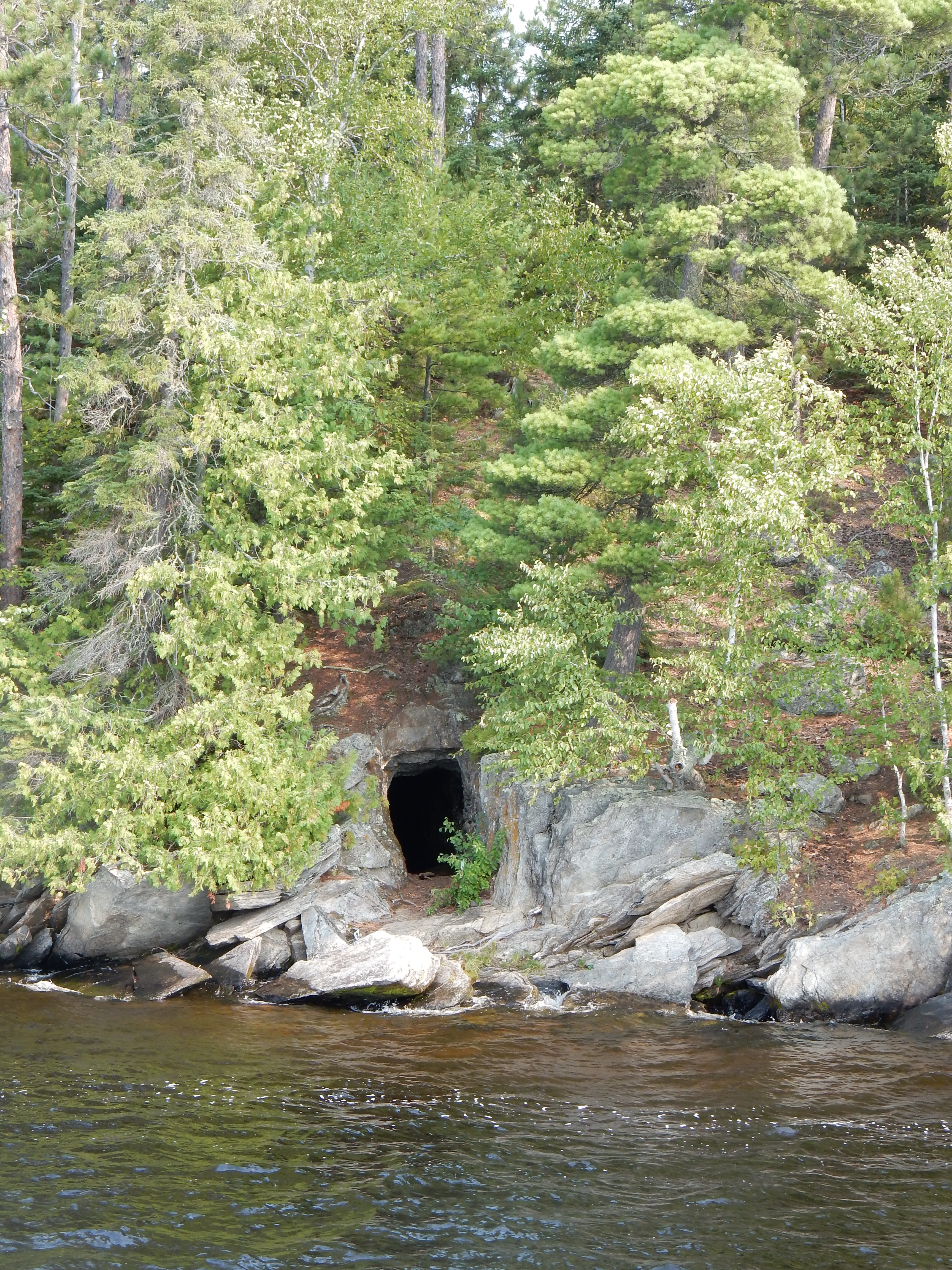
Mine shaft dug for gold rush in 1893 in Voyageurs
The Voyagers were not settlers, however. Settlement by European immigrants came late to this area. There was a brief gold rush in 1893 which did not last long. The Klondike gold rush started in 1896 and attracted most of the miners who came to this area with a greater promise of wealth.
Logging was the next economic driver for the area. The red and white pine would be cut down and sent along the lakes and rivers to International Falls where the hydropower drove saw mills and paper making plants. Some of that industry continues to this day. We were told that the paper plant in Fort Frances, the city across the Rainy River in Ontario, had shut down, while the plant in International Falls was operating, but on a reduced basis.

Kettle Falls Hotel in Voyageurs National Park
Commercial fishing was the third business in the area but was prohibited beginning in the 1930s. Tourism took over along with recreational fishing. The lumber industry wanted to build more dams but this was denied and in the 1970s, Voyageurs National Park was created as the 36th US National Park. Our boat ride mainly went through Rainy Lake to Kettle Falls Hotel. The hotel was begun in 1913 and continues to this day. Overnight lodging is still available here during the summer months. We had looked at that option but decided to pass on it. Instead the boat ride and lunch at the hotel took up our Saturday.

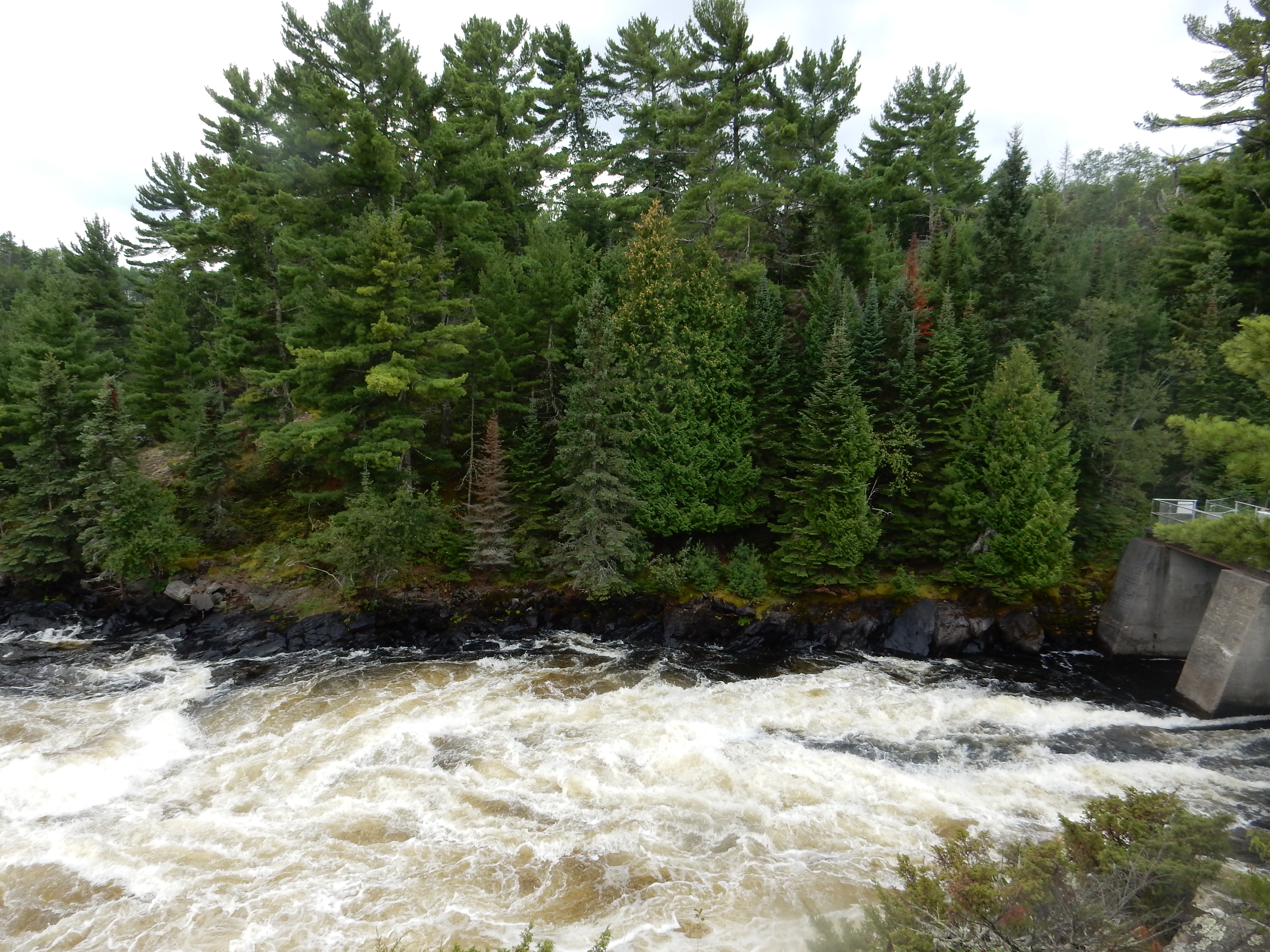
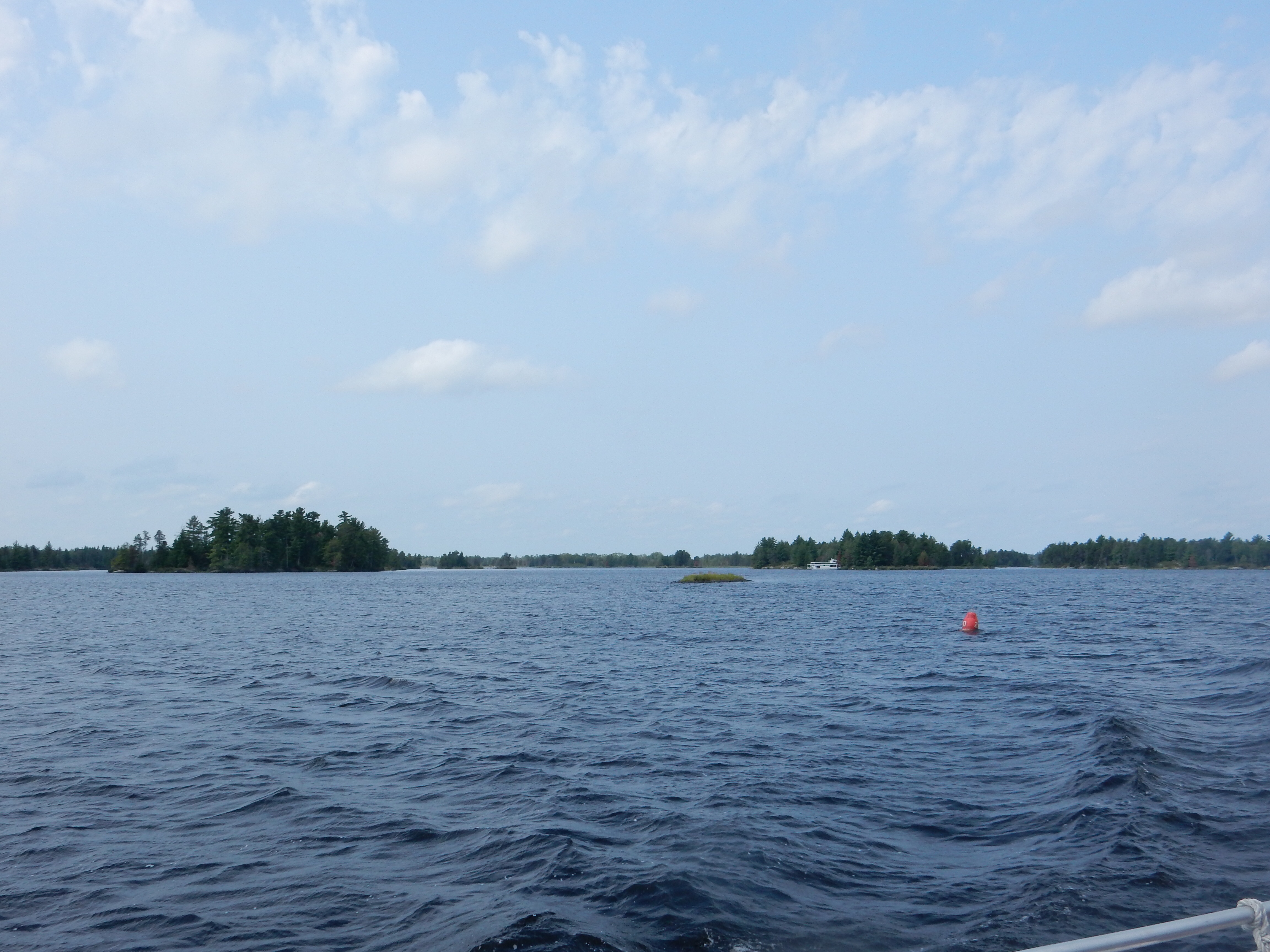
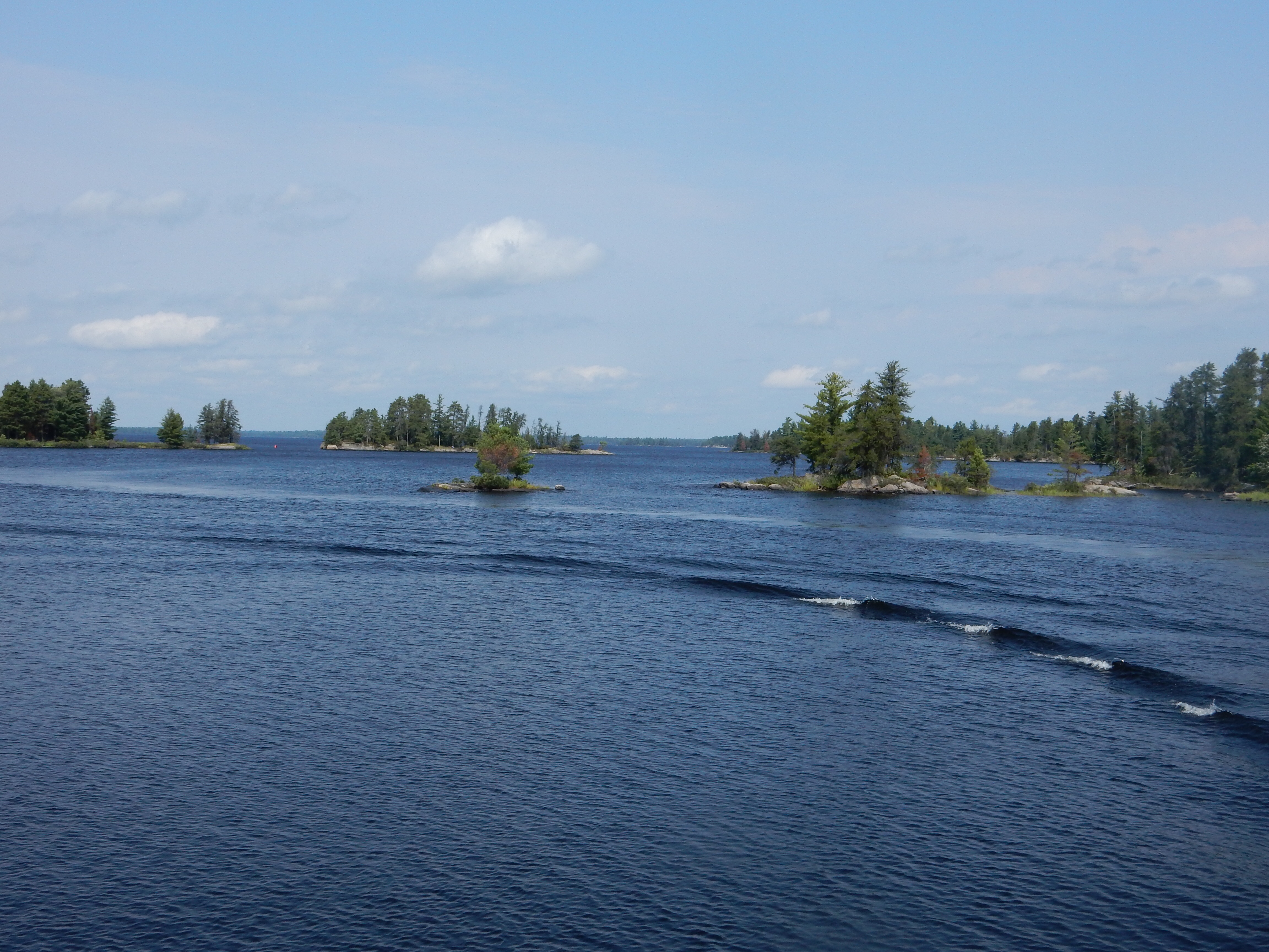
Rainy Lake

While Rainy Lake is large, we were normally in view of islands or the Kabetogoma peninsula. So land was normally a reassuring visage. People were out fishing and the houseboats here are tied up to trees or iron rods driven into the ground. None of that hole digging for anchors that we had to do at Lake Powell. The morning ride was generally with sunny skies. By the time of our afternoon return journey, the skies were dark, some rain came down, and the wind and waves had picked up, but still at a tolerable level.

Starting to get stormy in Voyageurs National park

Houseboat heading out into stormy weather
Sunday August 23

Driving the Edge of the Wilderness Scenic Byway, MN
International Falls is 300 miles from Saint Paul so our Sunday journey was able to allow us a few stops along the way. Chris wanted to stop at Scenic State Park. On the way there, we drove a scenic byway that was one of the first 20 created in the country. It is called the Edge of the Wilderness Scenic Byway. To be honest, we had driven this 47 mile route once before and while it is a pleasant drive, it is not spectacular.

Local history displayed at Bigfork MN
It is well-marked and has story boards in several of the small towns along the route. Of course, the mosquito statue in Effie MN is always worth a look and a few comments. Again, lumbering and modest agriculture rules the area. Railroads used to come through here to transport the lumber, but they are long gone. Much of the road goes through the Chippewa National Forest and there are a plenitude of lakes on either side of the road, normally hidden by the forest of trees.

Scenic State Park shelter constructed by the CCC in the 1930s

Scenic State Park is located just a few miles east of the road. It was created in 1921 after local residents asked the state to preserve the remaining pine and birch trees. The Civilian Conservation Corps created beautiful wood structures here in the 1930s which are still standing and in great shape. Our hike here was not long, Sunday was continuing the overcast, windy, and rainy conditions of Saturday afternoon. We had stopped at the park office and in talking to the ranger, learned that the clothing merchandise offered for sale was primarily created by a local guy who goes around to numerous local parks and businesses and creates unique designs for them. It was refreshing to hear that local business was involved; we were impressed with the designs available. However, there were no T-shirts with pockets being offered.
A late lunch in Grand Rapids, home of Judy Garland and Blandin Paper Mills, and then St. Paul by 6 PM. A pleasant visit to parts of our state we had not visited previously. We were able to obtain several more park stamps to add to our collection to eventually complete the Minnesota Department of Natural Resources State Parks Passport Club.
Ed and Chris
Saint Paul, Monday 10 pm


Recent Comments