

Lakeview OR, Sept. 15
Fire in United States National Parks. Wednesday and Thursday we visited two national parks in California that were heavily, heavily impacted by wildfire. It was quite an eye-opening experience.

Wednesday morning started with having breakfast with our hosts at the bed and breakfast in Arcata California. Not only was the food delicious, the conversation was politically interesting and pleasant. We left around 10 AM and drove over the Coast Mountains once more. The cooling ocean breezes were left behind, and we greeted the hot, hot temperatures of interior California. Road construction and smoke from the Smith River Complex fires were our companions.
Whiskeytown was an area of California populated by Native Americans, the Wintu. Gold fever brought immigrants who through guns and germs decimated the local Indians. The small amount of gold present was mined and removed. With gold gone, most of the people left also. Eventually, only a small town remained, and that was moved and covered up by the Whiskeytown dam.
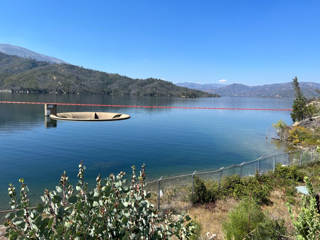
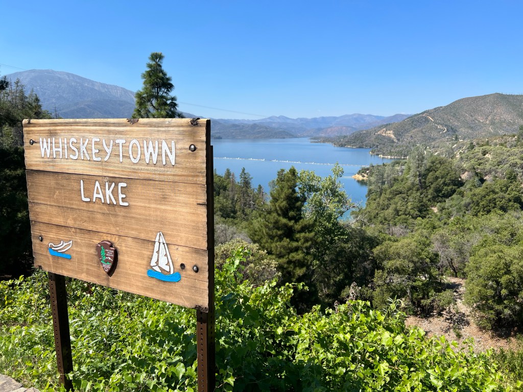
Starting with the construction of the Shasta Dam and Lake in the 1940s, part of the Trinity River water system was diverted to central California via the Sacramento River, rather than its normal endpoint of the Pacific Ocean. Whiskeytown Lake and Dam were a 1960s addition to that water movement system. The final result was hydroelectric power, a dependable water supply for central California, a flood control system, and opportunities for recreation. Whiskeytown’s official name is Whiskeytown-Shasta-Trinity National Recreation Area. Only the Whiskeytown unit is managed by the National Park Service, the Shasta and Trinity units are part of the US Forest Service.


As we drove east from the Pacific Ocean, we came across dramatic evidence of the July 2018 Carr Fire. Over 97% of the park had fire damage, much of it severe. Prescribed burns have been done in this park for three decades, and that was able to mitigate the damage in a number of areas. But in the Carr Fire, three firefighters and four civilians died. At times while fighting the fire, temperatures reached 113°. Over 1000 homes were destroyed. Part of the park has been reopened, numerous sections are still closed, however. Leaving Whiskeytown, we had a greater appreciation for the damage fire can cause.
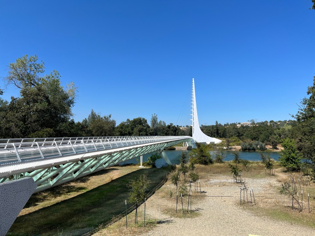
Next stop, Redding, California where we are to spend the evening. We stopped at the Sundial Bridge. This is a 2004 constructed pedestrian bridge over the Sacramento River that connects to parts of a park, museum, and botanical garden. We only looked at the bridge, walking over it and taking pictures of the river down below.
We went onto our Home 2 Suites lodging and chose not to do a blog post for this day, thinking that we would combine Wednesday and Thursday into one post. Little did we know that for the next 36 hours, we would have practically no Internet and no cell service due to the terrain we were driving through, walking through, and staying at.
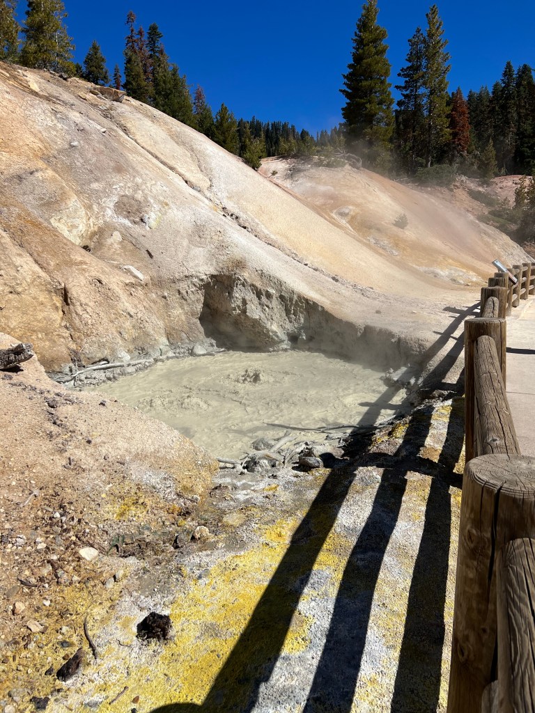
Thursday was to be spent at Lassen Volcanic National Park, one of the few places in the world where all four types of volcanoes are present: plugged dome volcanoes, cinder cone volcanoes, composite volcanoes, and shield volcanoes. Lassen Peak is one of the largest plugged dome volcanoes in the world. Its last eruptions were between 1914 and 1921.


Miles before we reached the park, we could see cinder cone volcanoes and lava rocks throughout the rolling plains, leading up to the park itself.
As one enters the park, it becomes more mountainous and more forested. Then you come across burnt areas. Yes, Lassen was also subject to a tremendous California wildfire.
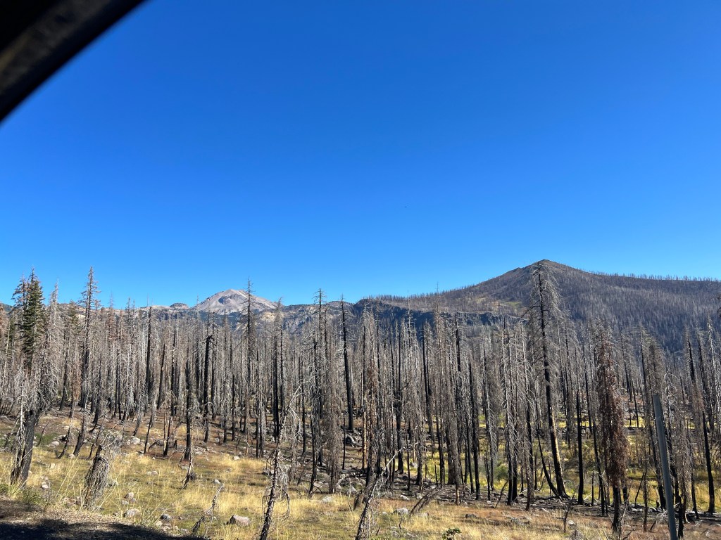

The 2021 Dixie fire, started on July 13, became the largest single fire in California history. Despite spending 30 years on fuel reduction, the park still suffered traumatic loss. Recovery efforts will continue throughout 2023. We hiked over 4 miles here even though Lassen Park has a high elevation and mountainous terrain. We did not walk to the top of Lassen Peak, 10,463 feet. There’s a limit.
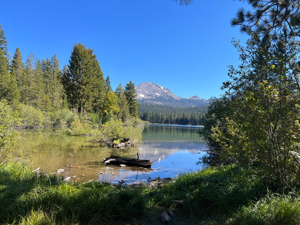

Lassen does not have glaciers, but there is still snow at some locations year around. There are meadows, lakes, creeks, forests, and of course, lots of rocks and mountainsides. The park road reaches a high elevation of 8500 feet and is part of 500 mile Volcanic Legacy Scenic Byway, connecting Lassen and Crater Lake National Parks. It is only one of 42 designated All American roads. We will end up driving a good portion of this scenic byway as we go to Lava Beds National Monument on Friday.
We spent the evening in a mom and pop hotel in the small town of Burney California, population 3000. We had a 20 minute delay getting into town due to road construction. Road construction blocked off access to many restaurants so we walked next-door to a small Chinese place. Neither the Chinese restaurant or the hotel were fantastic but they did in a pinch. Internet service was so slow it might as well not been offered. Cell coverage was nonexistent in the park and elsewhere while it too was practically nonexistent in the town. No blog post this night either.
Ed and Chris, Lakeview Sept 15


Recent Comments