
Kemmerer, WY Saturday June 12
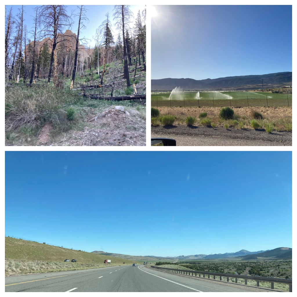
No blog on Saturday, we spent most of the day driving. Usually at 80 mph (the posted speed limit), a nice steady speed. The Best Western at Brian Head was a good find and a great summer price. Sleeping at 9600 feet was a challenge and it felt good to quickly reach a lower elevation upon leaving Brian Head. The drive down took us through forests that had been impacted by fire. In contrast, the drive along I-15 alternated between mountains and valleys, with patches of green in valleys that had irrigation.
About halfway between Salt Lake City and Provo Utah, in the Wasatch Mountain Range, is Timpanogos Cave. Due to COVID-19, the cave tours are limited in numbers. We decided not to try to get tickets, having seen other NPS caves as Jewel Cave, Wind Cave, and Mammoth Cave. In addition, to reach the cave entrance one must hike 1.5 miles up to the cave entrance, a path that goes up 1,092 feet in elevation, and then walk back down 1.5 miles. The estimate for the entire experience (up, down, and cave tour) is 3-4 hours.
Instead, we walked the nature trail along the American Fork River, marveling at the mountain sides which went up another 6,000 feet to the top of Mt. Timpanogos from our elevation of 5,638. That view of mountain sides must have been a precursor for the mountains we experienced along I-80 east of Salt Lake City to the Wyoming border.

I-80 had steep sections that put the road in Southern Colorado we discussed a few days ago to shame. Here the trucks had one or even two truck lanes and the auto traffic was still backed up trying to pass the trucks. The first section out of Salt Lake City to Park City was familiar, we drove it back in 2013. I did enjoy the drive as you sweep up the hills and around the curves. I think Chris held her breath a few times to see whether cars would be able to pass trucks before being cut off.

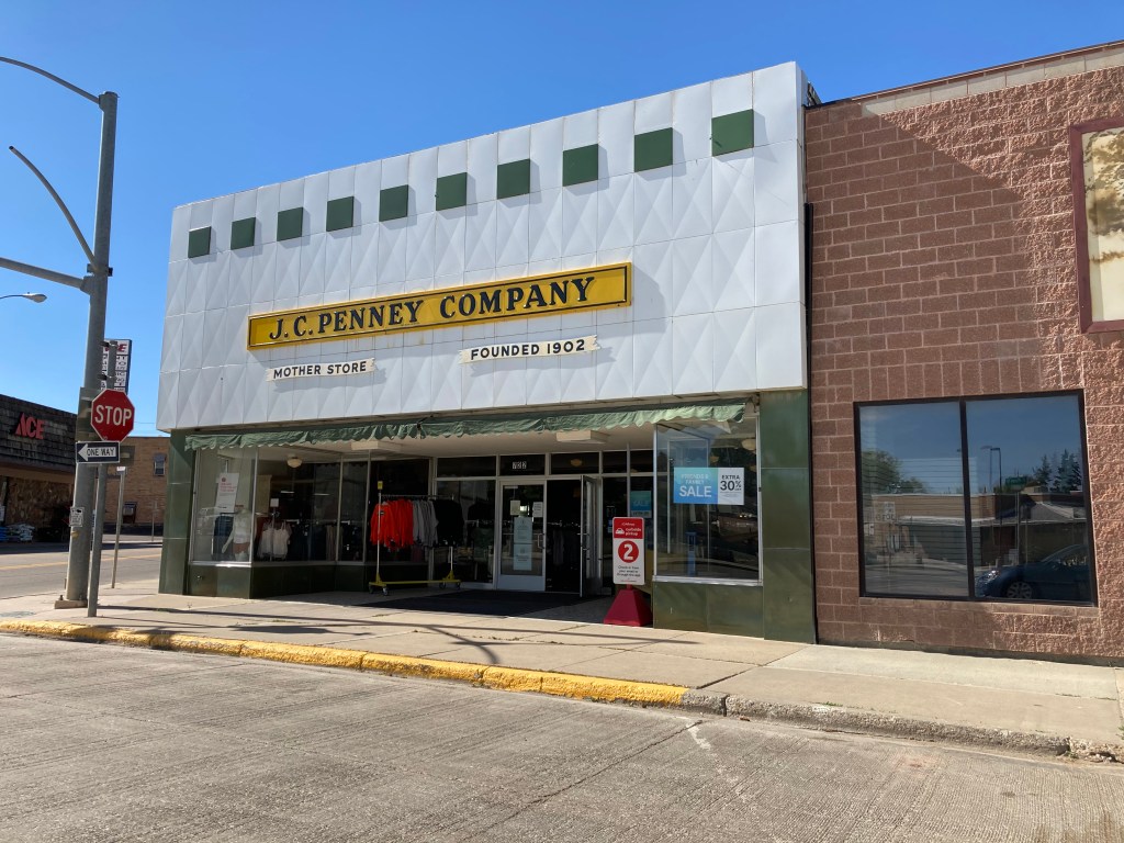
Kemmerer Wyoming was the locale for our evening’s lodging. There is a new Best Western in this town of 2600 people, the only chain type lodging among the older roadside motels. Kemmerer has a history, partly being due to the town being the birthplace of the J.C. Penney stores. The “mother store” is still open in town.
Kemmerer owes its existence to coal. Coal was discovered here in 1843 but really got underway in 1881 when the Union Pacific Railroad began mining coal for its train engines to stop being ripped off by the local Wyoming coal mines. Coal is still mined just south of town and fed directly to a coal power plant. Wyoming still relies on coal for 90% of its electricity. One of three generators at the power plant recenlty shut down. The power company has plans to shutter the other two units but the state is fighting the change. Wyoming has been the number one coal mining state since 1986 and the state fears losing the jobs and revenue it produces. A recent effort by a Bill Gates owned company has proposed a new type of nuclear plant that might be located at the Kemmerer power plant site.

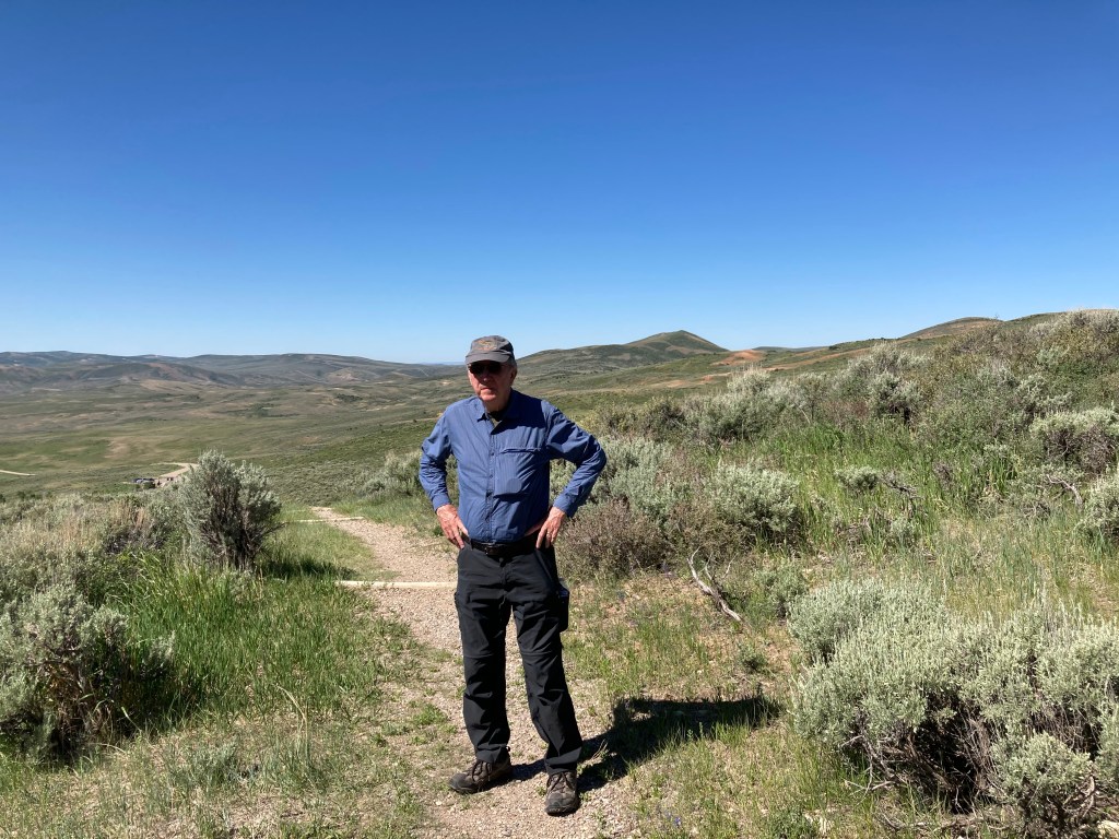
But we were not here to look at coal. Something old like coal though. Fossils. Sunday we would visit Fossil Butte National Monument.
Sunday June 13, Kemmerer WY
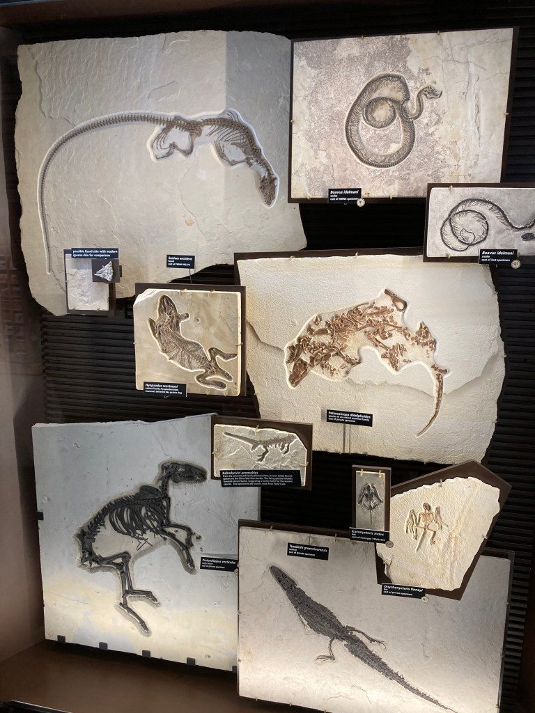
Fossil Butte National Monument lies 13 miles west of Kemmerer. It was named as a national monument in 1972 but extensive fossil collecting here dates back to the late 1800s. Private collectors and scientists collected fossils here and sold/gave them to museums all across the U.S. The monument protects only a small area in which fossils can be found. The NPS site is strong on research, other sites outside of the monument’s boundaries allow fossil hunting by state permit.
Fifty two million years ago this area was part of ancient Fossil Lake. Fossil Lake and two other large lakes covered large parts of present day Utah, Wyoming, and Colorado. Fossil Lake was the smallest at 60 miles long and 40 miles wide. It was shallow, primarily fresh water with a salt water spring at the deepest part. I’ll skip the details, you can check the website, but the number, diversity, and striking completeness of the fossils are unique and amazing. For example, in the display case was a turtle with two crocodile bite marks in its shell. Another amazing example is a fossilized fish in the process of eating another fish. Scientists have determined that the climate 52,000,000 years ago was similar to today’s Florida Gulf Coast.
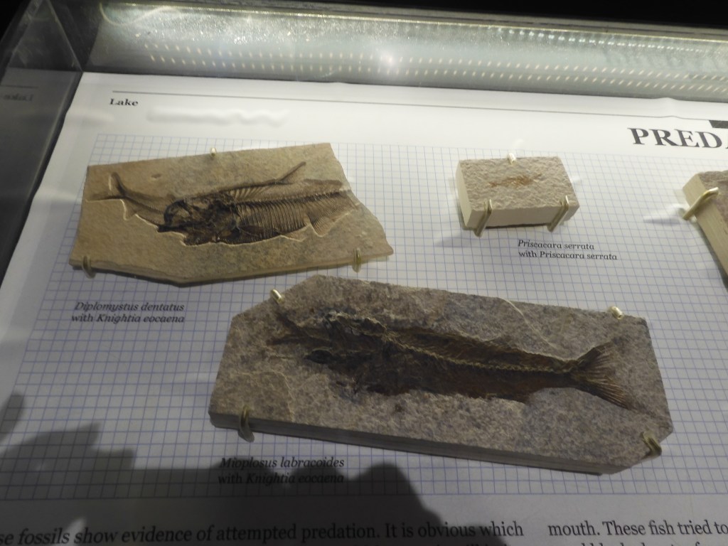
Luckily for us, the monument’s exhibit center was open. Besides the exhibits, we took in two videos and a ranger talk. While we did not make it to the small quarry on site, we did take a 45 minute hike on the nature trail and drove to the top of a ridge looking down onto what would have been part of the ancient lake bed. On the nature trail, delicate wildflowers were visible with pink, blue, yellow, and white flowers. After three hours here, it was off to our next stop, Seedskadee National Wildlife Refuge.
Driving through this terrain, we had to wonder how we could possibly find a wildlife refuge at this high elevation among the sage brush dry landscape. As we got closer to Seedskadee, the terrain only produced a few mule deer and signs indicating the land belonged to Exxon/Mobil. The national wildlife refuge was created in 1965 to compensate for the habitat destroyed by the creation of the Flaming Gorge and Fontenelle Dams. The refuge has a gravel auto tour route which we took.
Seedskadee is derived from the Shoshone language meaning “River of the Prairie Hen”. Fur trappers butchered the pronunciation, leading to its current spelling. We now call the river the Green River, a major tributary of the Colorado River. (If interested, look up the renaming of the Colorado River in 1921.) One of the challenges facing the refuge staff is the impact of the Fontenelle Dam which stifles the natural actions of the river. Normal flooding no longer occurs and there is a loss of silt action. Reminiscent of the Mississippi River near St. Paul, cottonwood trees are not being replaced through natural means.

In the early 1960s, there was an experimental project here that tried to establish small family farms. Irrigation and electrical lines were brought in, sheep and cattle purchased, etc. The effort failed. The land was just not suited for small farms and the farming impacted on the mining of soda ash. Soda ash is widely used in applications like glass making, water treatment, production of paper and detergents, in animal feed, etc. We passed a mine for trona (from which comes soda ash or sodium (bi)carbonate.
The refuge has a visitor center with 24 hour clean restrooms. The picnic tables we first saw were in the hot sun but Chris explored and found more in the shade looking at the river. Our lunch of bagels and fruit cups from the hotel breakfast supply was much more enjoyable when eaten in the shade.
Our destination for the evening was Vernal, UT. To get there, we traversed flat plains, mountains, valleys, and gorgeous rock formations. There were sightings of phosphate mining, multiple rail sidings with engines and rail cars stored, cattle and sheep grazing, sage brush and rock canyons of multiple colors including red. One does not need to visit Zion National Park to enjoy fantastic views of canyons and red rocks, those views have been frequent for the past several days.

In particular, today’s ending journey took us through Flaming Gorge National Recreation Area. This area is managed by the US Forest Service and includes both sides of the Green RIver gorge “discovered” by J. Wesley Powell. Today’s river has become a reservoir with water depths ranging from 275 to 500 feet deep. The gorge at one of the observation points is 1,360 feet from top of gorge to surface of water. Flaming Gorge is deeper than Royal Gorge back in Colorado, Horseshoe Bend south of Page AZ, and Gooseneck in southern Utah.

We drove the west side of the gorge today. When we leave Vernal Utah tomorrow for Thermopolis Wyoming, we will drive the east side of the gorge and view the dam.

Ed Heimel, Chris Klejbuk Vernal UT Sunday June 13.

Recent Comments