Posts Tagged With: road trip

2022 Trip Searching for our 300th National Park Site: April 14-15

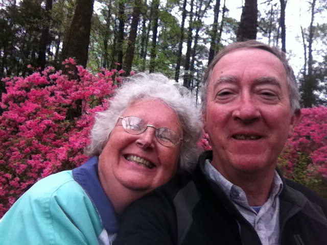
Dahlgren, VA Friday April 15

The last two days have not been horrendous but they were certainly not great days. Nothing terrible, just numerous minor disappointments. Thursday the 14th we walked to the Mary McLeod Bethune Council House National Historic Site. This townhouse was the headquarters of the National Council of Negro Women and the last home of Mary McLeod Bethune.

Mary McLeod Bethune was the founder of what is now Bethune-Cookman University. The University is home to 2600 students and is located in Daytona Beach FL. Bethune served as an advisor to Presidents Coolidge, Hoover, Roosevelt, and Truman. She founded the National Council of Negro Women which currently reaches out to four million women through affiliate organizations.

She probably did other things too. I only know the above from doing Internet research. We were unable to gain access to this NPS site. All of the apps, etc. indicated this site should be open Thursday beginning at 9 AM. At 9:30 AM, the outside entry door was open but the inside door was locked. That door had a note telling one to ring the buzzer/entry speaker to gain access. No one answered any of the three rings. No one responded to the knocks on the door. (Lights appeared to be on inside.) Phone calls to the operator went unanswered and the voice mail box was full. Not only that, but the voice mail message mentioned how this site was one of 390 National Park Service sites. Since there are currently 424 NPS sites, this group has some serious organizational issues. We decided to add this site to our list of visitations. We were here at an appropriate time, not our fault they screwed up.

Now we had a hole in our schedule. Rain was forecast for the afternoon so we did not want to go walking great distances. We found the Chinese American museum on 16th St, not far from the Bethune Council House. It was open and greeted visitors warmly. The first floor had a movie about the experience of Chinese immigrants to the U.S. The message I walked away with was that after decades of being ignored and actively discriminated against (think the Chinese Exclusion Act of 1882 which banned the immigration into this country of all Chinese; the act was not repealed until 1943.), things are looking up. As one example, history is finally acknowledging the over whelming role of Chinese labor in building the Transcontinental Railroad. On the third floor was an exhibit about textiles, needlework, and embroidery. The fourth floor had visual art interpretations of the theme ”East meets West”.

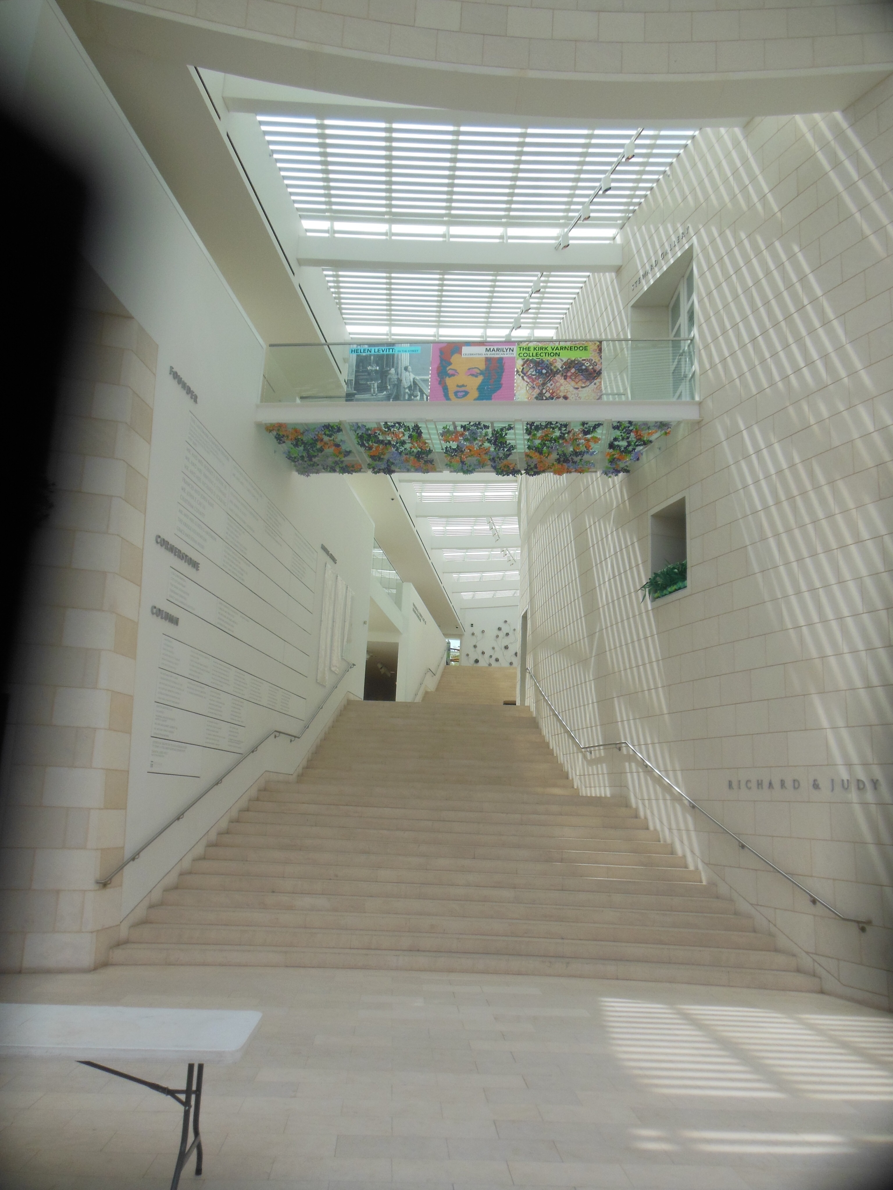
Walking back to the hotel, Chris spotted the D.C. public school museum and archives. Named after Charles Sumner, a Massachusetts abolitionist, the museum occupies portions of four floors of the old Charles Sumner School. Built in 1872, it was one of the first public elementary school buildings for African Americans in Washington DC. It was rescued from demolition in the late 1970s, lovingly renovated, and repurposed as the official museum, archives, and repository for artifacts for DC schools. It was pleasant but there is no need for you to add it to your top list of things to see in DC.

The rain held off until we returned to the hotel. In the evening I had another St. Paul related Zoom meeting.

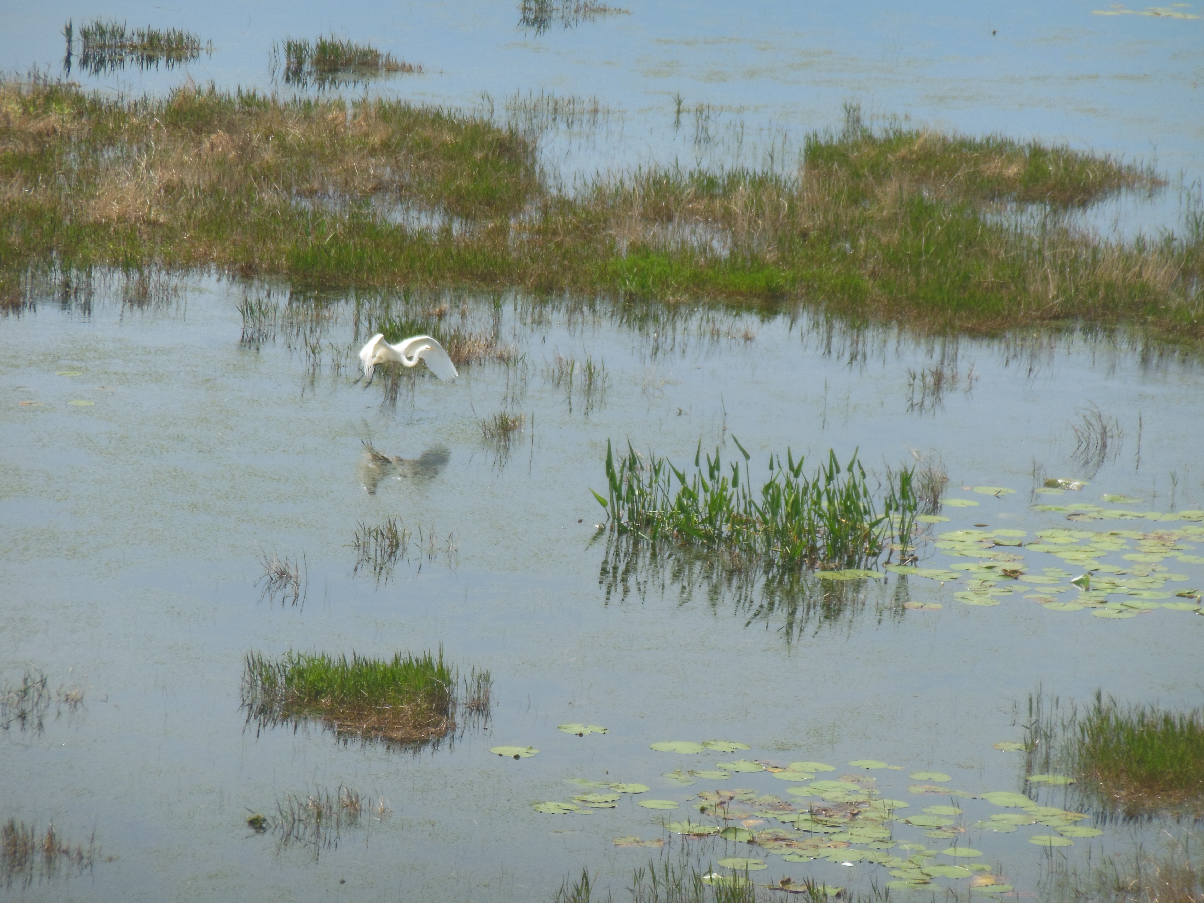
Friday we were off early for visits to two national wildlife refuges and one NPS site, all three well south of DC. Wisely, we chose the George Washington Memorial Parkway as our route. It was relaxing, scenic, and not crowded. As we passed Mount Vernon, we saw over 15 tour buses lined up and a long line waiting to enter Mount Vernon. We continued on to Elizabeth Hartwell Mason Neck National Wildlife Refuge. Mason Neck was established in 1969 and was the first wildlife refuge established specifically for the protection of the bald eagle. Mason Neck is the name for the peninsula and Elizabeth Hartwell’s name was added due to her activism to protect this area from development.

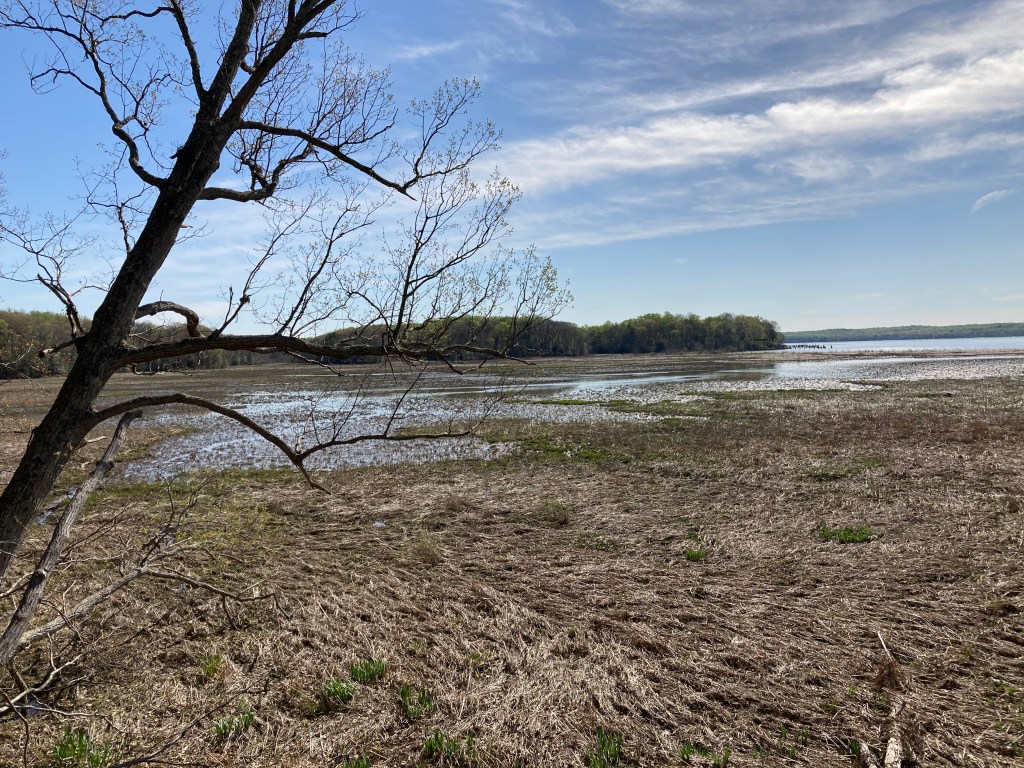
We hiked the Woodmarsh Trail out to an overlook with tidal marshes facing the Potomac River. We did not see any bald eagles, but that was not a problem. It just seemed appropriate to visit a place that has been a part of the resurgence of the bald eagle in the United States.

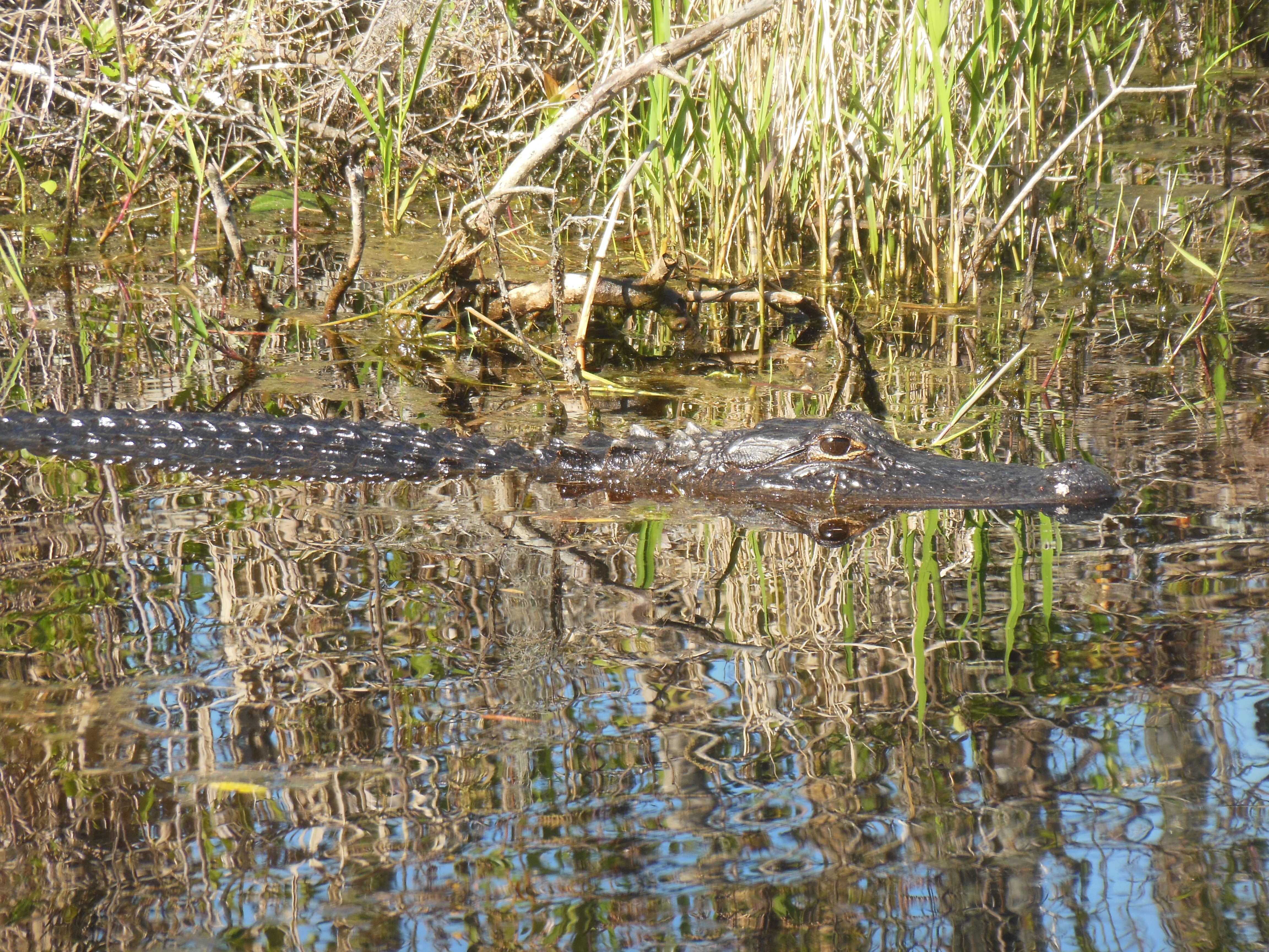
Twenty miles from Mason Neck is Occoquan Bay National Wildlife Refuge. Only a quarter as large as Mason Neck, we chose this one primarily because it has an auto drive. Our hope was we might spot migratory birds without consuming a large chunk of our time. No luck. Either we did not look closely or the migratory birds have moved on. In any event it was a bust.

On to stop three for the day. George Washington Birthplace National Monument. Before we could get there, we checked Google Maps for the best route. Surprise, there was a crash on I-95 southbound. Our shortest route to stop three was to go back north to Washington, then south through the parts of Maryland we drove Wednesday to reach Thomas Stone NHS, cross over the Potomac on a major but backlogged bridge under construction to Virginia, and then on to George Washington Birthplace National Monument. Two and a half hours.

George Washington Birthplace National Monument is located on Pope’s Creek just as it joins the Potomac River with a grand looking building and a Washington Monument replica.

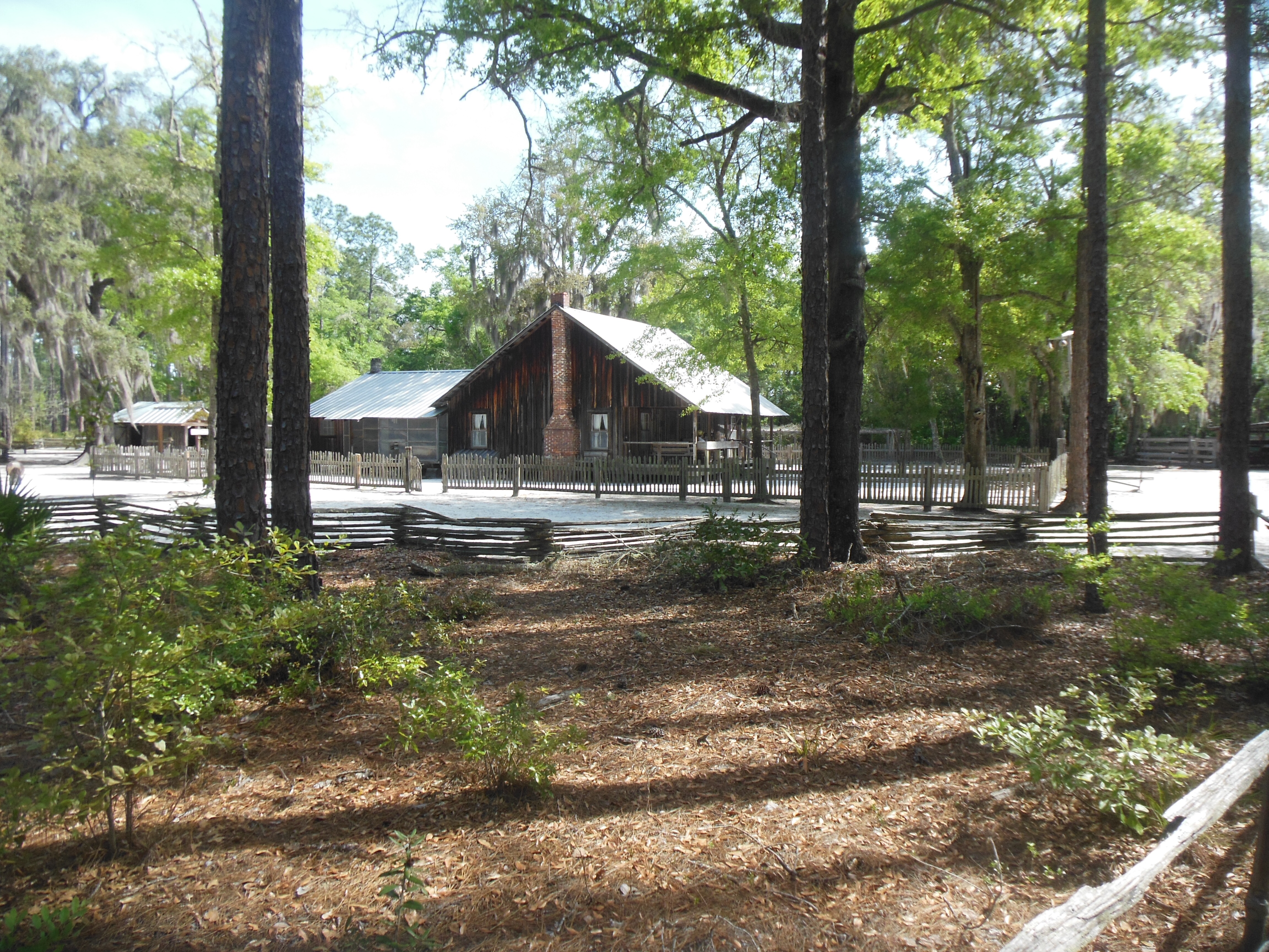
We made it in time to talk to two rangers, view the video, and enjoy a half hour tour. Major surprising item learnt: The building on the site was not the home where George Washington was born. His actual birth home burned in the late 1700s. We had assumed too much by the name of the NPS site This is the family plantation where he was born-his father actually had three plantations. The exact location of the birth home on this family plantation is not known. The building erected here is typical of the times and the tour focuses heavily on the characteristics of life of a colonial plantation farmer and on Washington family history.

The exact location of the home may not be known but efforts are continuing to pinpoint it. Twice In the past, a brick foundation had been uncovered, examined, and then recovered without definitive answers. Another effort is now underway. Modern underground imaging techniques are working alongside humans with shovels. At first, the monument was placed where the house is now located but as part of the deal to give the property to the Park Service, the monument was moved and the home built in its place.

The Washingtons had been living in this area for over seventy years before George was born. While the Washingtons did well, family fortunes were aided frequently by marriages to daughters of wealthy men. George too was helped in that regard. Also, as the third son of his father, his two older brothers would have inherited the bulk of the family wealth. George was aided by the mentoring, training, and business and social connections provided by an older brother, Lawrence. It was Lawrence who deeded the future Mount Vernon to George after Lawrence, and then his wife, died.

We are staying at a Hampton Inn in Dahlgren, just south of the bridge over the Potomac. We chose it due to its proximity to George Washington’s birthplace and thinking we would be getting here late after our long drive. Now I wish we had planned to push a little farther for tonight’s lodging. Tomorrow, we drive to Dover DE, another two and a half hour drive.

Ed and Chris, Dahlgren VA Saturday April 16

Categories: travel | Tags: , , , , , , , | Leave a comment

2019 Trip 5: Alaska: August 29

Alaska

Girdwood, AK. Thursday August 29

A most interesting day. You will get your fill of animal and scenery pictures. Thursday was dedicated to one activity, a five hour boat cruise out of Whittier in Prince William Sound. But first, we had to get there. As noted yesterday, Whittier was not inviting as a lodging option. We are staying in Girdwood, about 45 minutes west of Whittier. The challenge in reaching Whittier is that if you are coming by car, you have to use the Whittier Tunnel. There is no other option.

The tunnel was constructed during WWII for railroad traffic and only much later converted to combined rail and auto traffic. And I mean combined. It is one lane wide with trains and autos using the same path. To enter Whittier from the west, you line up and wait for the tunnel to allow east bound traffic at 30 minutes after the hour. To leave Whittier, you line up and wait to enter the tunnel at the hour. If you miss your time, you wait an hour.

It should take 45 minutes to reach the tunnel from Girdwood. We allowed an hour. But, experienced travelers that we are, we missed the turn-off! We were zipping along when suddenly the road signs just seemed wrong. No cell service to check on Google maps. We decided we had to re-trace our steps. Going speeds I have not reached since the wide open spaces of west Texas, we reached the line at 10:35. Luckily at that time there were enough cars that the line was long and the tunnel was still open. Close call.

Logistics of the day: Boat, Lunch (plus a kale salad not in the photo), Seats (Top deck, front row, right by window) Chris at the far right front

Our cruise was with Phillips Cruises for a five hour journey on a new boat. They assign seats and since we had booked back in March, we had prime seats in front, by ourselves, looking forward, right next to windows in front and to our right. For the next five hours we took in magnificent scenery and a long list of sea animals. Once out on the Sound, the smoky haze was minimal. Whittier and this area of Alaska receive huge amounts of rain and snow but today was clear. Temps were in the high 50s, we did not need the extra gear we brought to stay warm on the water.

Glaciers

A U.S. Forest Service Ranger from the Chugach National Forest was on board providing narration. The Chugach is our second largest U.S. forest and includes huge swaths of water surface within its boundaries. He discussed glacier formation, the weather, the impact of climate change and the dramatic shrinking of the glaciers.

Glacier calving: Breaking off top, splashing bottom

Waterfalls

Alaska water falls that seemed so puny before were dramatic in height as water from melting snow and glacial ice poured down tall mountain sides.

Stellar seal lions

I could discuss the habits of Stellar sea lions and the other animals; we picked up fact sheets on all of them. But I won’t except for a few brief comments here and there.

Sea otters at play

Sea otters in Prince William Sound

Sea otters were almost hunted to extinction. Their pelts are amazing in their ability to resist water and keep warmth. If you want to be disgusted, read a history of how they were hunted and natives here treated.

Dall’s porpoises

The porpoises were the highlight. They buzzed the ship. They dived and splashed. They went out and “played” with the humpbacks whales. There must have been at least ten of them. Porpoises are fast. It was hard to take a photo; by the time they jumped out of the water, they were gone again.

Harbor seals in Prince William Sound

Humpback whales

This is not the season for orcas, so humpbacks were the “only” whales we saw today.

We did not bother taking pictures of bald eagles. Kind of ho-hum for a couple from Minnesota.

This was the Alaska of our imagination. A great cruise. A lucky day weather wise. A wealth of wildlife to observe and glaciers to marvel at.

Oh, we have canceled our first night in Cooper Landing due to fire issues. Our river rafting excursion has been canceled also. Still debating the next two nights in Cooper Landing and our three days in Homer. A Homer cancellation will hurt; we had splurged on an air trip over Cook Inlet to Lake Clark or Katmai National Park. They are remote and only reached by air or boat.

Alaska

Ed and Chris August 30. 3:30 AM

Categories: road trip, travel | Tags: , , , , , , , , , , , , , | 1 Comment

2017 Trip Two: Tour of Texas, March 1

March 1, 2017

On the Road Again.

Well, we are off on our longest journey yet. This trip is projected to be 61 days, arriving back in St. Paul on April 30. We actually deleted a few days at the end that we were going to spend in Oklahoma City and Tulsa, OK. Upon reflection, we decided that we would probably be in a mood just to zip home by the end of April. Our previous longest trips were 54 days driving around Florida in 2015 and 50 days in 2013 going to western Canada and parts of northwest U.S.

The schedule and dates were driven by several goals: A. to visit Big Bend National Park along the Rio Grande in southwestern Texas; B. to visit Kearney NE to try to observe the sandhill cranes in their northern migration; C. to spend a week at our timeshare in Miami Beach; D.to see the bluebonnets and other flowers in bloom in Texas; and E. to see previously unexplored areas of Texas. As usual, getting lodging inside a national park (this time Big Bend) meant having to pick a day months ahead of time before the rooms were all booked up. The Miami Beach timeshare also books up months ahead of time. After Big Bend and Miami Beach were locked in, we had to make the rest of the journey work. Some decisions may not provide for visiting at the optimal time. The sandhill cranes make their own timetable, usually the birds are most numerous in mid-March but we will be there in early March. While early April is normally a good time for bluebonnets, the weather has been warmer earlier than usual so blooms will pick their own dates as when to blossom. Since we will be in Texas, we will visit relatives in Houston and San Antonio, cities we have visited previously.

St. Paul MN Wednesday March 1.

St. Paul MN Wednesday March 1.

Today we started out in light snow in St. Paul. Maybe fifty miles into Iowa the snow from today and from last Friday’s storm had disappeared. We had left home a little later than usual in order to have lunch with my niece Shannon and her husband Adam in Iowa. Lunch was really just an excuse to get together and get caught up since we had not visited with them for over a year.

As we made our way through Iowa, we passed one intersection in Ames Iowa that had three large manufacturing facilities on three of the corners. Danfoss is a Danish company that makes pumps, motors, refrigeration equipment, compressors, etc. Amcor is an Australian company that manufactures packaging products. Barilla is an Italian company making pasta and sauces. Such a commentary on our world, three large international companies with a substantial corporate presence in the heartland of the U.S.

Wind Turbines along I-80 in Iowa

Wind Turbines along I-80 in Iowa

As we turned west at Des Moines, the winds picked up. We could have attached a sail to our car and used wind power to get us to Nebraska. Very appropriately as Iowa has jumped to number two in the ranking of states and the amount of wind power generated in that state. Texas is number one. Along both Interstate 35 and Interstate 80, one can observe numerous large wind farms. We recently decided to switch our home energy use to all wind power through Xcel Energy; maybe it will help offset the gasoline we use in our trips around the country.

When one thinks of Iowa, a flat landscape of fertile farm fields comes to mind but it is not all flat and agricultural. We have already mentioned the manufacturing presence in the state. As we drove west on Interstate 80, the flat landscape we had encountered driving south on Interstate 35 transitioned to a series of rolling hills.

Why? Loess. Loess can occur in differing parts of the world but here loess is glacial “flour” or dust (according to Wikipedia) that was laid down as sediment by glacial action and blown into hills and sediments basins as the wet sediment dried. In other parts of the upper Mississippi RIver valley, it forms part of the rich farming soil. Here the wind has shaped it into peaks and saddles of land noticeably different from the flat agricultural land of northern Iowa and parts of Illinois.

We ended the day in Lincoln Nebraska where we will be visiting for the next two days. The land has reverted to the flat lands although we expect to be driving through the Flint Hills of Nebraska and Kansas shortly.

At the top of the blog, we stated this will be a 61 day trip. We have been asked how we decide on our route and what to see along the way. The first step is similar to the description in the paragraph above; to envision an area of the U.S. we have not seen, or relatives to visit, or both. Then we start looking at Google Maps and our National Geographic 12 x 15 bound US map to get an overall sense of a route, focusing more on areas we have not traveled to previously. From there we hit the books, printed books first. Resources like AAA Tour books (particularly their Gems), a map of the 400+ National Park Service units around the country, books by National Geographic like Best Small Towns, Best Scenic Drives, etc., books (these are older but still valuable) by Readers Digest on Off the Beaten Path, the Road Less Traveled, Public Gardens in the U.S, etc. Reading these allows us to highlight locations relatively close to the area we are considering. Most of these books, when writing about a particular destination, also mentioned other interesting places within a reasonable distance. Then we go to the Internet, checking current reviews, hours of operation, how the attraction describes itself, etc. After choosing the most important locations, we sketch out a timetable, using an Excel Spreadsheet to list mileage, attractions to see that day, etc. It allows us to project how many days to spend in any one location and how long to get to the next night’s lodging. Finally, we will go to sources like Roadside America or Atlas Obscura to discover unusual attractions that might be along the way and can fit into our schedule.

The map included in this blog gives a general sense of the route we have plotted out.

2017 Trip Two, Tour of Texas

2017 Trip Two, Tour of Texas

Ed and Chris, March 1, 2017 Lincoln Nebraska

Categories: road trip, travel | Tags: , , , | 3 Comments

2014 Trip Four, May 15-16, The Southwest

Tuesday May 20 Moab Utah for Thursday and Friday May 15-16, Lake Powell and Page AZ

The Great Adventure came to an end. We agreed it was more of an adventure than a vacation. The vistas were great, the hikes enjoyable, Rainbow Bridge a delight, the narrow canyons by powerboat a thrilling adventure, and the food and camaderie could not be beat. But, the nervousness over uncertain tasks to be accomplished, the suspense over the anchoring, and the unexpected hard work removed it from the vacation category. We certainly stretched our personal boundaries, successfully.

Dawn broke early with clear skies foretelling a great day ahead. Smooth sailing was forecast. The early morning was spent cleaning up, packing, and getting ready to unmoor. The powerboat had to be removed from the back of the houseboat and beached before we could take off. The four anchors had to be undug and stowed on the boat. Manning had to be taken for his last walk.

Joyce at the helm

Joyce at the helm

Once the powerboat was beached, Lou pushed up the gangplank on the houseboat and Joyce revved up the houseboat motors and shoved it in to reverse. We were unbeached. Lou had the chore of pushing the powerboat off the beach, hopping on board and then maneuvering it into position behind the houseboat where it was once again tethered and towed behind us. We were heading back to Wahweap Marina.

We left about 10:30 and arrived at 1:30. Maneuvering through the channels was a bit easier for Joyce; she even gave Lou a lesson on driving the houseboat. Wislely we called again for a pilot to come out and bring the boat in for re-fueling and then anchoring at the dock.

Maning with his life jacket

Maning with his life jacket


Our last looks were from an overlook of Lake Powell and the Glen Canyon dam. The dam was constructed over ten years, 1956 to 1966. 17 workers died during construction. The purpose of the dam is to impound water to control downstream flooding, water storage for the southwest and hydroelectric power. It took another 17 years for the water to rise to full levels. At full level, the lake depth is 560 feet at the dam.

Lake Powell is the second largest man-made lake in the U.S. It is 186 miles long with 1,960 miles of shoreline. There are 96 major canyons to explore. The Glen Canyon National Recreation Area encompasses 1.25 million acres, the lake is only 13% of the total.

We had to be off the boat by 3:30 and waiitng for the pilot and re-fueling took a while. We had gotten lazy and enjoyed the ride back so we still had to pack up the food, etc. But we made the deadline and then it was off. Joyce and Lou to the Lake Powell Resort where we spent Thursday night. Ed and Chris first to a drugstore to get medications for a cold and sore throat Ed picked up Wednesday. After four long hot showers we had an excellent dinner with alcohol at the resort restaurant.

Dinner

Dinner

Friday morning was departure day. Ed and Chris made a stop at Urgent Care (got there when they opened) to determine if Ed had strep throat. Ed did not. Then we did laundry and had breakfast.

Given Ed’s cold and sore throat, and Joyce’s not feeling well, we decided to pass up the jeep tour of the Antelope Canyon. This is supposedly one of the most photographed slot canyons in the US. We will have to make it another time.

Our next several days will be a bit more relaxed due to Ed’s cold and sore throat so if the narrative is skimpier than usual you will understand.

Horseshoe Bend

Horseshoe Bend

We did spend a while hiking to Horseshoe Bend, a spot south of Page where the Colorado River makes, what else, a horseshoe bend. Our photo is not perfect. I was not willing to lean over the edge to get a spectacular photo.

Our next three nights will be at Monument Valley, a Navajo Nation Tribal Park. The drive was only a few hours and the hotel is noted for its views of the valley. Monument Valley is named for the numerous stone outcroppings located here. You will see many pictures in the days ahead.

Monument Valley at dusk

Monument Valley at dusk

Ed and Chris Moab May 20 8:45 AM

Categories: travel, Uncategorized | Tags: , , , , | 4 Comments

2014 Trip Four, May 12, The Southwest

Monument Valley, May 17 for Monday, May 12 on Lake Powell

Houseboat viewed from our hike

Houseboat viewed from our hike

Monday was clear, breezy and warmer-but not warm. Joyce was still feeling under the weather so Lou, Chris and Ed went for a two hour hike in the morning. We were beached in an area with rock cliffs not too far away so we decided to explore them. We ended up finding a creek bed also.

Lou and  Chris on  hike

Lou and Chris on hike

The cliffs are sandstone, or so sayeth our resident geologist (Lou has his BA and MA in geology). We found the terrain to be a combination of dry creek bed, hard rock, or soft, deep sand which was deeper and softer than any beach we have been on. The cliffs behind the boat evidenced varying degrees of erosion. There was one location that from the boat looked like a face with large mouth, two eyes, nose, etc. Up close the resemblance was still there but not as dramatic.

prickly pear cactus blooming after rain

prickly pear cactus blooming after rain


More blooming flowers

More blooming flowers


We passed the end of the cliff and started climbing up and discovered a wide area of wildflowers. Prickly pear we could identify, the others seemed to be ones we have seen before but could not identify. We hiked up higher and then discovered a creek bed with running water and green vegetation. A way down was found, not without challenge, but successful. After hiking a ways up the creek bed, we decided we might be biting off too much and headed back. Of course, we had to find our way back up the rock cliff. In the end, we made it safely back to the houseboat in time for lunch.

National Parks Monopoly

National Parks Monopoly

The afternoon we stayed in with Joyce and played National Parks Monopoly- a version that replaces streets with national parks and community chest with historic sites. Okay, yes we snacked also. Joyce, who had limited experience with Monopoly, was the winner.

We only had to replace one anchor site. The runoff from the mountains was continuing, not enough to make an impact on the drought in this area, but enough to make us worry that the water would start to seep into the hole. Most nights we would pick out a marke and see how much higher the water was the following morning.

View from  the hike

View from the hike

Full moon will be Thursday but we have been benefiting from the moon shining on the lake and rocks most nights. My camera does not take good night landscape shots so I can not demonstrate for you. The moon came out around 7-8:30 during this time period and made for dramatic viewing. Some nights the moon came up as the sun was going down. During the night, it was easy to check on the anchors and tethering ropes because the moon was so bright. It lit up the rock cliffs behind us and shined on the lake. A beautiful view. Of course, you know we must have planned this.

Ed and Chris Sat. May 17 at 6 pm for Monday May 12

Categories: road trip, travel | Tags: , , , | Leave a comment

2014 Trip Four, May 10, The Southwest

Monument Valley AZ Friday May 16

Post for Saturday May 10, Lake Powell

Morning dawned and miracle of miracles, the houseboat was still anchored at the location we had beached it. The winds and the waves had made the boat sway during the night but it was still beached. Some slept soundly through the night, others not so much due to concern of being unanchored. Unfortunately Joyce was not feeling well and ear/sinus issues would plague her for most of the trip.

Out powerboating Saturday May 10

Out powerboating Saturday May 10

The five others went for a power boat ride, with Dave doing the driving. We explored Padre Bay and its many coves. The water level is low and so even Dave and Toni were viewing new formations. In warmer weather, these coves are locations where people would park their boat and go swimming. Many of the boats have slides for people to land in the water. Today’s water temperature was not conducive for that.

Padre Bay is large

Padre Bay is large

At one location, we were all amazed by the sight of a rock arch along the water’s edge. As we got closer, we realized the sun’s angle and the colors of the rock had created an optical illusion and there was no arch.

One of the coves off Padre Bay

One of the coves off Padre Bay

With Dave driving, we were comfortable coming closer to the edge of the cliffs and seeing the rock formations from just a few feet away.

exploring Padre Bay

exploring Padre Bay

We stopped and beached the boat once and went for a short hike among the rocks, Since we were unsure how secure the beaching was, we did not stray too far from the boat. All in all, we spent most of the morning out boating.

walking around on Saturday

walking around on Saturday

Lou checking out the rocks

Lou checking out the rocks

The afternoon started getting cloudy and windy and the group stayed on the houseboat. Dinner was spaghetti and meatballs with Joyce’s homemade meatballs.

The clouds start gathering

The clouds start gathering

This night, the wind and rain came and rocked the boat quite a bit. Chris repeated her mantra “out of my comfort zone” quite a few times but the anchors held.

Ed and Chris May 17 at 7 am for May 10 Still getting caught up for after a week of no internet

Categories: travel, Uncategorized | Tags: , , , | 2 Comments

2014 Trip Four, May 5, The Southwest

May 5, Monday, Lincoln NE

Trip Four Has Begun!!!! The exclamation points are deserved. This trip was to begin 6 days ago. Due to the exceptional helpfulness of four different dentists, we are lucky to be underway at all. We had two planned dental appointments scheduled for the 8 days we were between trips three and four. A crown was delayed by an unexpected root canal. The replacement of a temporary to a permanent filling was later supplemented by another unexpected root canal.

One dentist came in on his day off, did prep work for the delayed crown for Chris, squeezed Ed in without an appointment, and took Chris’ crown mold and hand delivered it to the dental lab. Another dentist took Chris in and did her root canal expeditiously. A third dentist was able to fit Ed in due to a cancellation and the fourth, miracle of miracles, just happened to have a root canal cancellation called in the previous afternoon for the time at which dentist three said, oops, Ed you need a root canal.

Chris healed great, Ed was a little slower. His slowness necessitated us to drop Austin TX, the Texas hill country and Big Bend National Park. The difference in the two travel plans are shown in MapQuest maps at the end of the blog. Six less days, 1000 less miles and a different route to Page AZ where the first new adventure will be houseboating on Lake Powell.

site of the first robbery of a moving train

site of the first robbery of a moving train

Today was planned to be a simple travel day but once underway we realized we had missed the allure of the open road. We made two stops in west central Iowa. Our first stop was the site of the first robbery of a moving train! I know, you expected to see a large museum but instead it was a nicely done highway marker just west of Adair IA. The plaque commemorates the date of July 21, 1873 when Jesse James (yes, that one) and his gang robbed a Chicago, Rock Island and Pacific railroad by pulling out the spikes holding the rails and then separating the two rails. This action killed both the engineer and the fireman in the crash.

Jesse had information that $75,000 in gold was to be coming from Cheyenne WY on this train. However, the gold shipment was delayed and they only got $3,000. Justice of a sorts arrived in 1882 when a member of the gang was tempted by reward money on Jesse’s head and killed him in the James home in St. Joseph, MO.

Danish windmill in Elk  Horn IA

Danish windmill in Elk Horn IA

Twenty miles west of Adair is the town of Elk Horn, IA, supposedly the largest rural Danish settlement in the U.S. (exact numbers were not given). In the 1970s, the community raised funds and purchased a windmill made in Denmark in 1848. They had it dismantled, numbering each piece, constructed a working model, and shipped the pieces and the model to Elkhart where volunteer labor re-built the windmill in 12 months.

The windmill still works although it was not turning today. It provides an interesting juxtaposition to the surrounding area where there are at least hundreds if not thousands of wind turbines running. Denmark has one of the largest manufacturers of wind turbines and while we did not climb the turbines to see who the manufacturer was, we will say they were of Danish design.

Elk Horn is just west of Adair which at 1,471 feet above sea level is the highest point in southern IA. The hills and ridges along this section of I-80 appeared to have even more wind turbines than the Buffalo Ridge area along I-90 in southwestern MN.

Danish American museum with two original street lights from Copenhagen out front

Danish American museum with two original street lights from Copenhagen out front

Elk Horn hosts the Danish American Library and Archives, a modern building with interesting exhibits on Denmark, its history, people (Danes spell Christensen with an “e” at the end which I learned years ago from a co-worker in PA), migration, religion, etc. We spent an interesting hour reviewing the exhibits and recalling a brief trip we made to Tyler MN two years ago which was another Danish settlement in America.

A few facts. CA, UT and MN have the largest number of Danes. Utah is high since a number of Danes converted to Mormonism and due to religious persecution (Lutheranism was the state religion at the time), they emigrated to the US and Utah. Some notable modern Danish companies are Maersk shipping, Lego, and Novo Nordisk. Muslims are currently about 4% of the population in Denmark, immigrating in since the 1970s. The archives are undergoing an expansion due to the number of artifacts they own.

Thus, a few tidbits to spice up an otherwise basic travel day.

Ed and Chris 8 pm

2014trip4

Revised Trip 4 of 2014

Revised Trip 4 of 2014

Categories: road trip, travel | Tags: , , , , , , | 1 Comment

2014 Trip Two, April 6-7, Deep South

Sunday April 6 and Monday, April 7
Savannah and Pine Mountain GA

Chris and Ed at Calloway

Chris and Ed at Calloway

Well Sunday was Sunday and rainy. We took it easy. Even full time travelers need some down time. Although on reflection, with Destin and Miami Beach on this trip, we have had more relaxation days than usual.

Interior of St. John the Baptist Cathedral

Interior of St. John the Baptist Cathedral

Sunday we went to the 10 AM Mass at the Cathedral of St. John the Baptist. It is a beautiful church and during our Saturday walks we had a brief tour with a docent who mentioned the 10 AM Mass would have the full choir. The music was very good and the church was crowded. Like a number of other buildings we have seen, paint was used to simulate marble (here on the columns). There is a painted cloth frieze along the top of the walls which looks like a painted mural.

After church we did some exciting stuff. Laundry. The Hampton Inn did not have guest laundry and we found a laundry in the outer portion of town run by a former Marine. Clean and well supervised and it did accept coins-unlike some nowadays where you buy a prepaid card to use which normally means you leave town with money still on the card.

After lunch we went back to the hotel and took the rest of the day off. It was still raining and we figured we had seen enough maritime museums, history museums, coastal fortifications, etc. I also put on several more doses of cortizone cream. Somewhere, probably on Friday at Fort Frederica, I must have run into a batch of no-see-ums; those almost invisible bugs that like to bite. Since I was wearing shorts and Chris pants, she has been spared. Major problem has been sleeping but I think the worst part is over.

View of Earthlodge reconstruction

View of Earthlodge reconstruction

The rain continued today (Monday) and at times was quite strong. We avoided driving during the worst parts by stopping at Ocmulgee National Monument and then having lunch at a local bar b q joint. Thus, the driving was fine but we could see swollen drainage ditches and ponding.

Ocmulgee National Monument is on Ocmulgee River by a ford and the area appears to have been habited as far back as 10,000 BCE. The main item(s) of interest here are mounds used for ceremonial and civic purposes by Indians of the Early Mississippian period. There are other examples of Mississippian mounds in the U.S. (we saw Emerald Mound along the Natchez Trace and there are older burial mounds in St. Paul).

Ocmulgee was made a national monument in 1936. Local efforts were critical in saving the area. The mounds had been reduced by construction of railroads, farming, use of the dirt to construct roads, etc. even though the uniqueness had been identified as early as 1774 by naturalist William Bartram. The earliest archaeological efforts were undertaken during the depression era by CCC/WPA workers supervised by an archaeologist from Harvard. It was the largest archaeological excavation ever in the U.S. up to that time.

The area and mounds were and are considered sacred by the Indians who lived in this area. Even as they were being pushed off their lands by Europeans in the early 1800s, this was the last piece of land the Indians gave up. We do not know the entire history of the area, several different cultures have lived here. The building at the national monument have detailed displays of items recovered and the best estimates of the various cultures that existed here. Since it was raining heavily, we did not go for any of the walks.

Callaway Gardens

Callaway Gardens

Callaway Gardens

Callaway Gardens

We arrived at Callaway Gardens a little after 4 pm. Our room, and many others, were not ready yet for check-in. Some computer/communications problem was the reason cited. We drove over and began our tour of Callaway Gardens. The rain had stopped and trails were wet. We started at the Butterfly House which is indoors.

At Ocmulgee it appeared that our camera had died so at Callaway we took photos only with the iPhone. The butterflies fly a lot and sit a little and I found taking close-ups a little difficult. The pictures are adequate but do not do justice to their diversity and color.

Butterfly at Callaway Gardens

Butterfly at Callaway Gardens


Buttetfly at Callaway

Buttetfly at Callaway

We had just enough time before the garden closed for the day to make one stop to view azaleas. The colors are still vivid and we have hopes that tomorrow will only be cloudy. I will save background data on Callaway for the next posting.

Butterfly

Butterfly

Side comment one: Is it just the South or have we not observed this elsewhere? The soda pop/water glasses are HUGE, like 64 oz size and then people when they leave get a to-go cup and take some more with them.

Side comment two: Now that restaurants seem to be uniformly suggesting tip amounts at 15-17-20% increments (is this a reflection on our lack of math savvy?); why is the percentage based on the food/drink amount PLUS the tax? What does the tax have to do with the quality of service?

Ed and Chris April 7 10:15 pm

Categories: road trip, travel | Tags: , , , , , | 2 Comments

2014, Trip Two, April 5, Deep South

Savannah, GA Saturday April 5

waving girl statue

waving girl statue

The rain has held off but we continued with our plans to visit historic buildings in Savannah. (No interior pictures allowed.) Along the way, we walked along the river front and observed the statue of a young girl who supposedly waved to every outgoing vessel from the harbor.

We went to a series of three buildings owned by one foundation. The Owens-Thomas house was one of the premier historic homes in Savannah, built in 1819. The architect, William Jay, incorporated numerous new ideas from England including indoor plumbing and cast iron. The design is of the Regency style.

Owens Thomas house

Owens Thomas house

This was the in town residence of a wealthy family. Within three years though, due to financial panic and epidemics the house was sold and the wife and two children dead. It passed through several hands until ending up in the Owens family who maintained it until the 1950s.

The house included separate slave quarters. The family had several plantations and got their money off the backs of enslaved people. Sorry, I get tired of hearing about these nice people whose wealth came this way. I asked the guide at the end of the tour if many black Americans tour the property and she indicated that no, but that this historic home saw more blacks due to their honest treatment of the slave issue.

Our next stop was at the Telfair Academy, also designed by William Jay. The Telfair’s were another aristocratic family, originally from Scotland, who had no difficulty owning hundreds of slaves. The group did not produce many progeny and eventually donated the property to create the first art museum in the South. It opened in 1886.

The museum has two recreated rooms from the house and the museum is in the balance of the mansion and an expansion. The art is basically 18th and 19th century American and European art. The basement has several sculptures. All in all, it was pleasant but nothing overwhelming. The only noteworthy item was the original sculpture of “Bird Girl” used on the cover of
the book, “Midnight in the Garden of Good and Evil”.

Interior staircase of Jepson Center

Interior staircase of Jepson Center

Our third stop was the Jepson Center, a new facility dedicated to contemporary art and art education. We had lunch at their cafe which had displays of docent art along the walls leading to the cafe. We met the owner of the cafe who has to make do without the use of an oven. The Jepson Center people were concerned about fire, smell, etc. Lunch was excellent, hope he can make a go of it without the oven.

The art here was so-so; an exhibit on Marilyn Monroe, a small room on digital art, a really boring exhibit of modern art, and a small room dedicated to slave history in Savannah-the best part of the center although it was mainly large boards of written history.

One of the squares in Savannah

One of the squares in Savannah

We left here and went walking for a while. As mentioned yesterday, the historic district is very walkable. The numerous squares have plenty of benches. People are out and about, even late in the evening. Tour trolleys are trundling around, horse drawn carriages are clip-clopping and pedi-cabs are waiting at most parks if you want to have someone take you directly to another location. Most squares have a buskar-musician playing an instrument, hoping passerbys will make a donation.

We stopped at Leopold’s, an ice cream establishment started in 1919. There was a long line, reminiscent of our experience at Stone Harbor on the New Jersey shore when the girls were still in school. We walked by later in the evening and they still had a long line.

Our evening entertainment was one of the functions of the Savannah Music Festival. This is its 25th year and is the largest musical arts event in Georgia. It offers an eclectic array including jazz, dance, chamber/symphonic, pop/rock, and American folk/traditional.

Stringband Spetacular

Stringband Spetacular

Our event was the Acoustic Music Seminar 2014 Finale: Stringband Spectacular. It was held at the Lucas Theater, one of those grand old theaters that had been renovated for $15,000,000 around the year 2000. The event featured 16 young adults aged 16-25 and their mentors playing mandolins, violins/fiddles, banjo, harp, guitar and bass. Many of the songs were composed by the students themselves and the group of players changed from composition to composition. The performance was excellent.

Ed and Chris April 6 12:10 am

Categories: road trip, travel | Tags: , , , , , , | Leave a comment

2014 Trip Two, April 2, Deep South

Wednesday, April 2, Folkston GA

What a glorious day!! Beautiful weather and great explorations.

Our breakfast at The Inn at Folkston was bacon,homemade banana nut waffles and fruit and granola. Plenty of energy for a full day of activities.

Okefenokee National  Wildlife Refuge

Okefenokee National Wildlife Refuge

The Okefenokee Wildlife Refuge was our destination for the day. The refuge protects the Okefenokee Swamp and covers 630 square miles in southeast Georgia. It extends 38 miles north to south and 25 miles east to west. There is no road through it. The terrain includes bogs, swamps, wetlands, lakes, uplands, etc. It is home to a vast array of animals and plant life. Much of the “bottom” is composed of peat; sometimes underwater and sometimes the peat has loosened and floated to the top where it acts like an island.

egret

egret

The refuge was established in 1937, primarily to protect waterfowl and birds. There had been attempts going back to the 1890s to drain the entire swamp to provide agricultural land and to harvest timber. Luckily the swamp was tougher to conquer than the investors had imagined, their funds ran out. Over the years, most of the longleaf pine was cut down and replaced with slash pine, which is harvested quickly for pulpwood. The refuge is trying to replant the longleaf which is more favorable for the diverse plant and animal life here.

image

We started out on the Swamp Drive. At our first stop by a pond we saw our first alligators of the day. At the pond, we met two volunteers, one of whom is doing this full time for five months, then she will be off to a different wildlife refuge to repeat the process. We determined she was at the National Bison Refuge in Montana when we visited it in August of 2013. She also maintains a blog writing about her adventures as a vagabond volunteer.

Chesser homestead

Chesser homestead

The Refuge maintains the original homestead of one of the families that lived in this part of the Okefenokee Swamp. The family moved out in the 1950s. They had 9 children and some of the extended family are employed or volunteer here. The yard was always sand swept very neatly. They kept it swept to reduce the fire hazard and to be able to observe any snakes or snake trails.

raccoon

raccoon

A boardwalk runs out 3/4 mile to an observation tower. Along the boardwalk we saw various birds, a raccoon, a snake, and a slider turtle. The boardwalk was recently rebuilt; in 2011 there were major fires that destroyed the previous boardwalk. Fire is a major component of life in the swamp. Lightning is the historical cause and fire plays an important role in the rejuvenation of the ecosystem-something we have learned at national parks previously visited.

prescribed burn under way

prescribed burn under way

The refuge management is frequently undertaking prescribed burns-although the 2011 fire was not prescribed. When we drove out for a late lunch, the area along the access road was being burned. The smoke and smell are noticeable for some distance even though the area involved was minor.

boat ride vista

boat ride vista

thicket along the boat reide

thicket along the boat ride

swamp iris

swamp iris


swamp prairie

swamp prairie

A four and a quarter hour boat ride on the swamp took up the late afternoon and early evening. Six of us went out on the swamp with a guide for an extended excursion. The guide turned out to be the co-owner of the concessionaire, Okefenokee Adventures. In a drawl that sounded like an backwoods swamper, he educated us for over four hours on a myriad of topics covering politics, ecology, geology, and biology. He identified plant life and birds, including the bittern which evidently is a rare sighting. He related tales of the Okefenokee, the role of fire, threats to the refuge driven by economics, etc. It was a fascinating and educational experience, compounded by the great weather, beautiful sunset, and almost complete lack of biting insects.

sunset on the swamp

sunset on the swamp

Chris and Ed 11:45 pm

Categories: road trip, travel | Tags: , , , , , | 2 Comments

Blog at WordPress.com.