
Quebec City, Friday Sept. 19

Sunrise comes to Quebec City
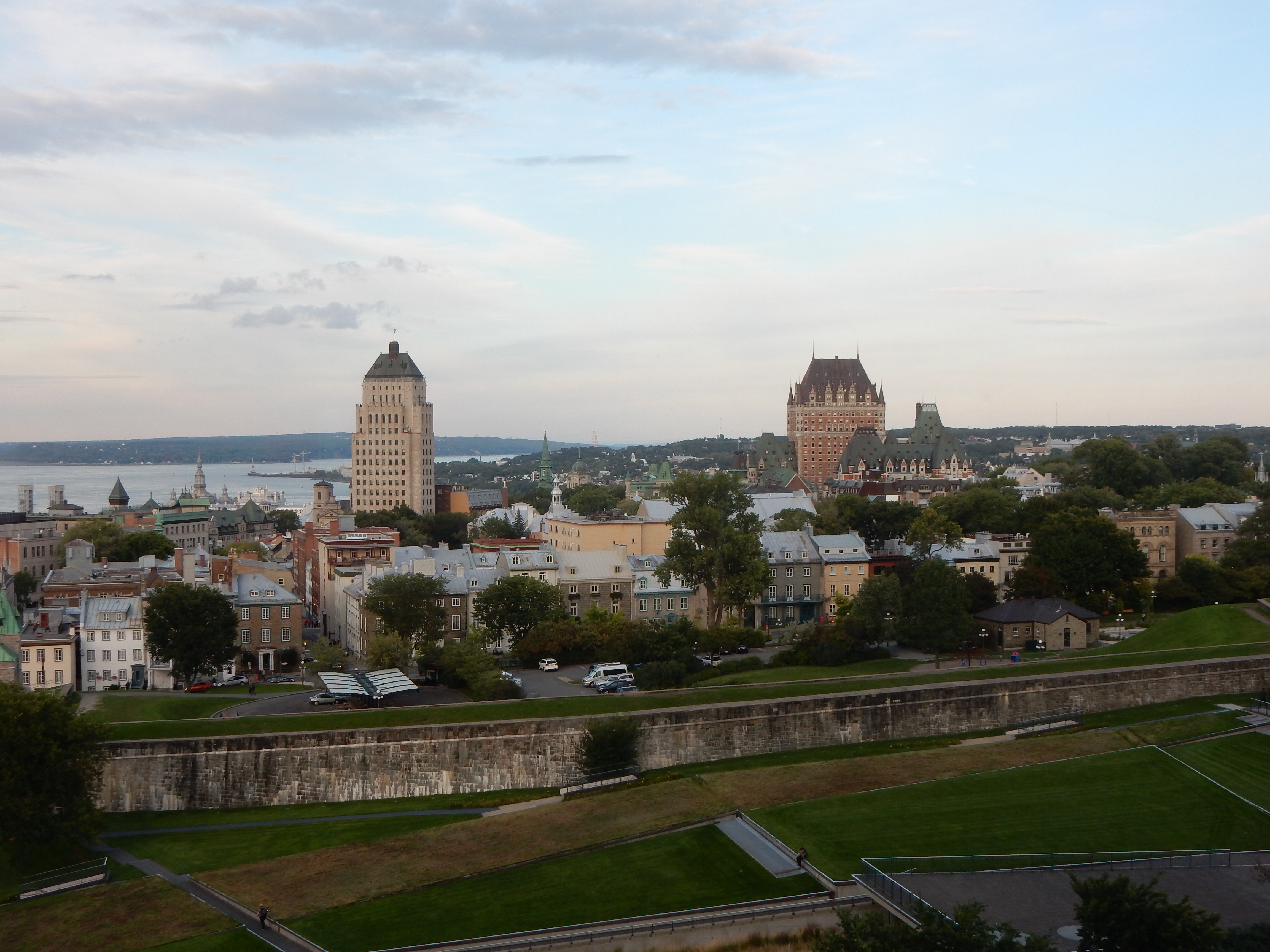
Today’s challenge? Walking.
We spent the day just wandering around Quebec. We chose a day also chosen by two cruise ships and lots of school children. Most of our time was spent in Lowertown, a section of the city by the river where the first landings by Europeans occurred. This is an area between the ramparts of Old (walled) Quebec and the river. It is accessed from our section of the city by either a funicular or one of several long staircases. We chose the staircases.
One of our sites to see was the Quebec Museum of Civilization, only to discover that it experienced a fire Monday before we arrived in the city. If we knew French, we would probably have read about it in the local paper. Mainly smoke and water damage and it should re-open tomorrow.
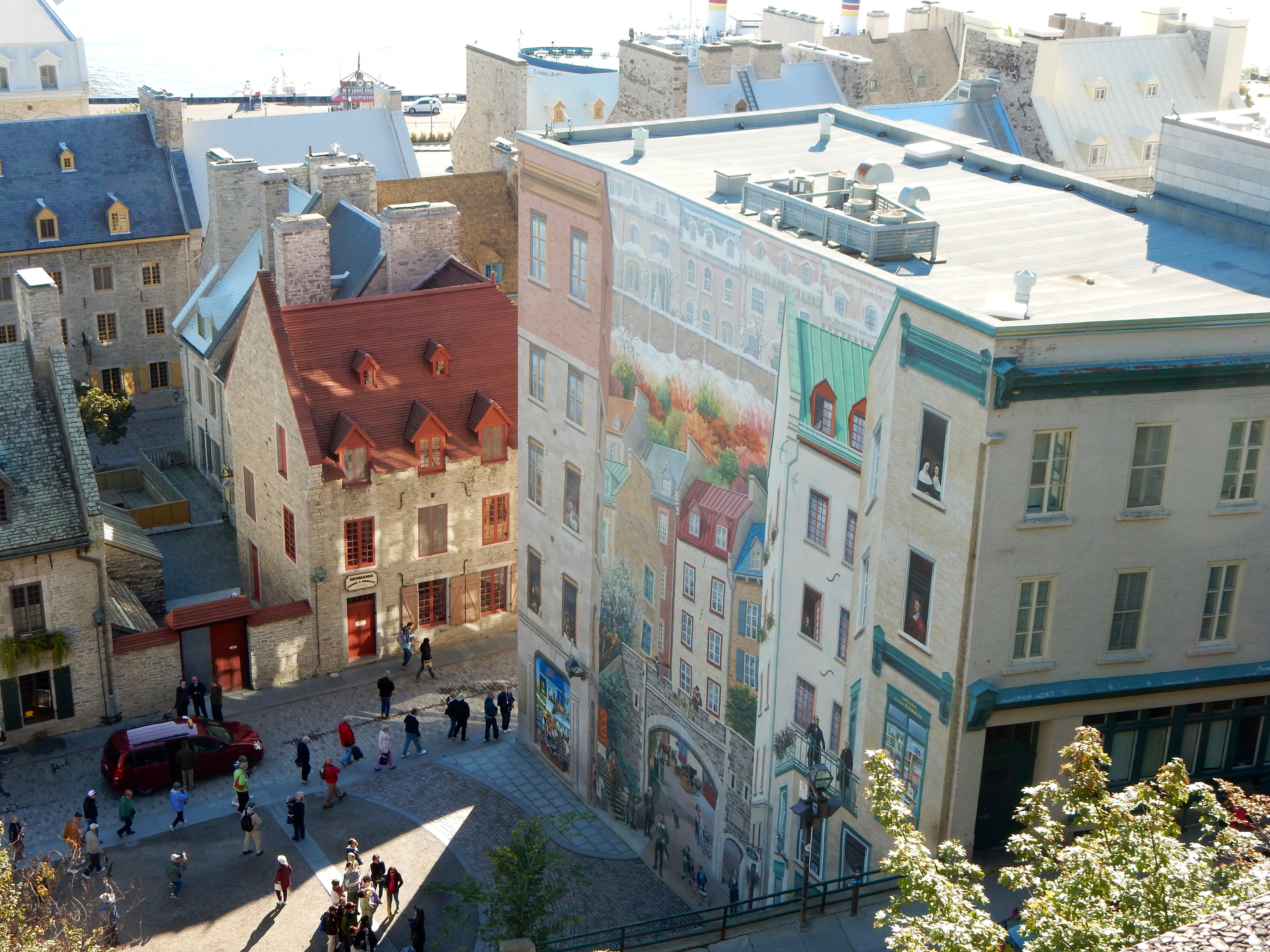
Looking down at Lowertown and mural of 400 years of history
Quebec is a city of statues and commemorative markers. The UN Food and Agriculture Organization was founded in Quebec City in 1945 and it has a statue of a woman holding food from around the world. There is a children’s park with a historical and nautical theme. Two major wall murals are in Lowertown. One depicts 400 years of history and one is dedicated to the shipping experience and its people.
Another Notre Dame church, this one the Eglise Notre-Dame-des-Victoires, was open and we went in. This church is smaller than many of the others we visited. The name comes from the two times the women of the city prayed to Mary to save the city from English invaders. The English were defeated and the previous church title changed. No mention was made of the final British attack which was successful. The church is built on the site of Champlain’s first outpost here in Quebec, Place Royale as it is called now.
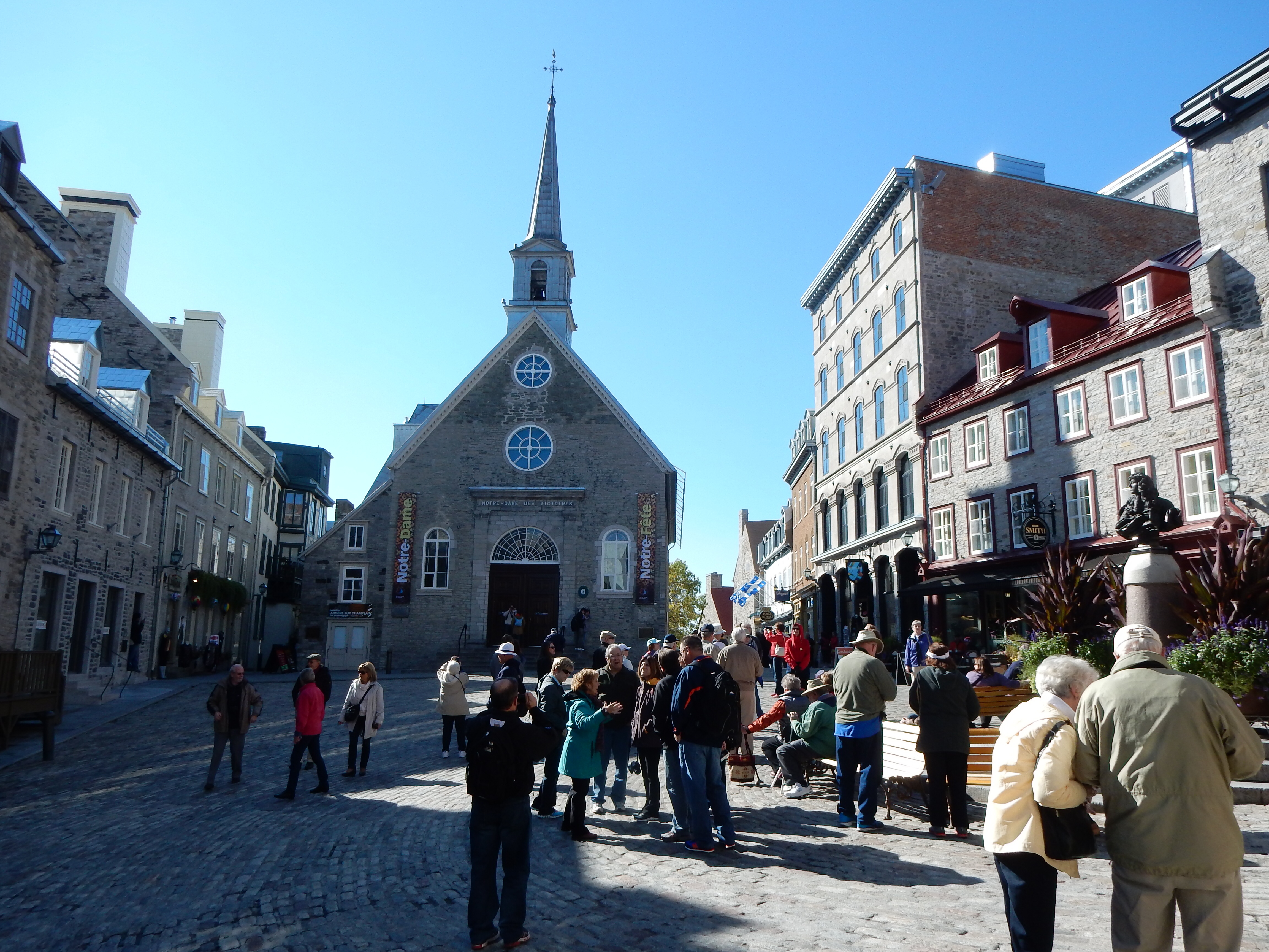
Place Royale-cradle of French civilization in North America
Place Royale leads to numerous other streets, cobblestone usually, with buildings dating back hundreds of years. Some sections are pure tourist with restaurants and souvenir shops alternating store fronts. In other parts, “normal” businesses predominate. The tourist area has more foot traffic but all parts of Lowertown were busy.
Lunch was at Panache, a Quebecoise restaurant that allowed us to eat even though we did not have reservations. It is located in a former 19th century warehouse with beamed ceilings. Like many other restaurants, the meal is 3 course, including appetizer, main course, and dessert. All is done in style with excellent presentation and taste. On the street outside are markers showing the river’s shoreline in past centuries; higher than it is now. I did not note a reason for the change, I presume urban build-up of the area.

Rue du-Petit-Champlain
The Quartier Petit Champlain is a section of Lowertown where the artists and merchants of the area formed a co-op in 1985 to maintain its heritage. Louis Joliet, born in Quebec to European parents, was a well-known explorer and navigator (including portions of the Mississippi River) in the late 1600s whose home is located here. Rue Du-Petit-Champlain is supposedly the oldest street in North America (not sure what happened to Santa Fe or Saint Augustine).
One negative comment. It struck me that the city has a abnormally high amount of graffiti on buildings and almost any facade of any size. It is noticeable and there do not appear to be any major efforts to remove it on a structured basis.
In the evening, we took another walk to observe the city at night. Several of the taller buildings are lit, some in color. It makes the view more romantic and European-like to us.

Tourny Fountain and Parliament at night
Ed and Chris 9/19 10 pm


Recent Comments