Posts Tagged With: NPS

2023 Trip 7: Northwest U.S.: History and Adventure: September 5

Part of Grant Kohrs

Missoula, Montana

Tonight we were supposed to be staying in Butte, MT. Yesterday as we reviewed our upcoming plans, we made a mid course correction. Given the narrowness of the northern section of Idaho, we found it easier to drive back and forth between the two both today and again later in the trip.

The objective for today was to visit Grant-Kohrs Ranch, a NPS National Historic Site in Deer Lodge, Montana. Originally, we had planned to go to Butte to spend the night, just 40 minutes away from Deer Lodge. If we had time, there were one or two other places to visit. Then tomorrow we would drive back to Idaho over the mountains on scenic route US 12. But driving back to Missoula tonight instead would save us 90 minutes of driving time tomorrow before we even started on U.S. 12

The drive on U.S. 12 is supposed to be very scenic, curvy, slow, two lanes, with scenic overlooks, and some Nez Perce historic stops also. It was the drive most difficult to predict how long it would take. Extra time could not hurt. We canceled our Hampton Inn reservation for Butte and made one for Fairfield Inn, Missoula.

Driving to Grant Kohrs

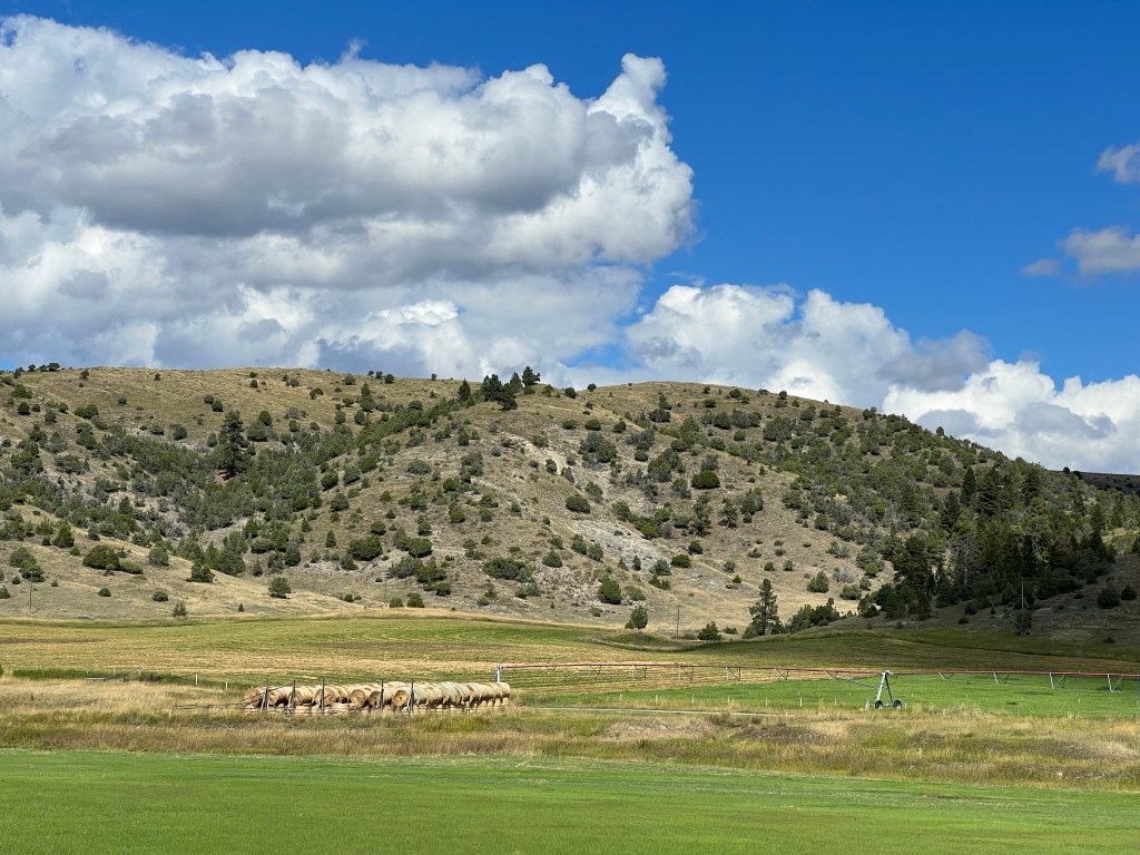
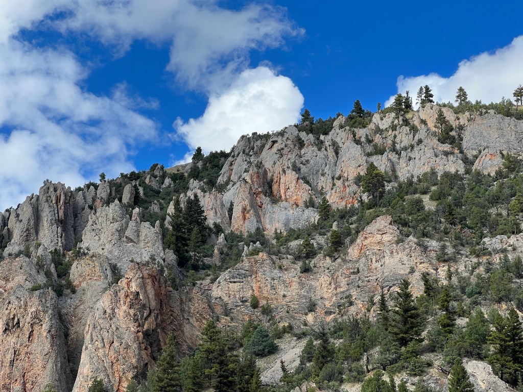
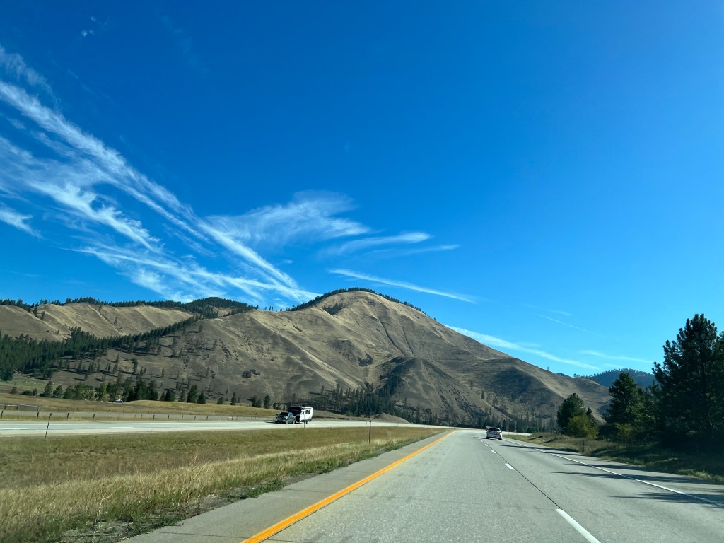
Leaving Kellogg we were driving on I-90 with steep-sided Bitterroot Mountains on either side of us. Low hanging clouds were just slightly above our car. It took about an hour of driving until we were out of the mountains and down into the high plains of Montana. It was another 2 1/2 hours, plus an hours worth of time zone change, until we reached Grant Kohrs.

This national historic site is dedicated to the preservation and memory of the open range time in Montana. From 1860 until about 1900, the open range cattle raising system switched to the new fenced in cattle raising method. A very major factor prompting this change was the terrible winter of 1886–1887. A hard snow, a thaw, followed by another hard snow and freeze left the range covered with ice. The cattle were unable to break the snow and ice in order to reach the grass beneath. Bison, the previous grazers on the open range, did not have difficulty with these types of conditions. However, they had been pretty much exterminated by this time.

A beaverslide haystacker

Ranchers realized they needed a better knowledge of the location of their cattle and greater supplies of hay to feed them in difficult times. In order to do this, fenced in land started to sprout up along the range, reducing the open areas for cattle, and cutting off the cattle trails.

Johnny Grant was of Metis ancestry and knew the area. He realized this valley would provide a luxuriant grassy valley for winter grazing of cattle. He convinced others from a variety of backgrounds to join him and the town of Deer Lodge was begun. As times changed and new people moved in, Grant moved back to Canada.

Grant sold his land and holdings to Conrad Kohrs, a German immigrant. Kohrs, his wife, and brother worked hard, diversified their holdings, and eventually amassed ten million acres of ranch land across three states. They conquered the challenges of the great winter, as well as normal business challenges. They bred horses. They began shipping cattle directly to market in Chicago. Their heirs continued the ranch, eventually selling off the land and dedicating 1600 acres to the National Park Service, along with family furniture and mementos. The ranch is managed actively by the Park Service with cattle, horses, chickens, etc.

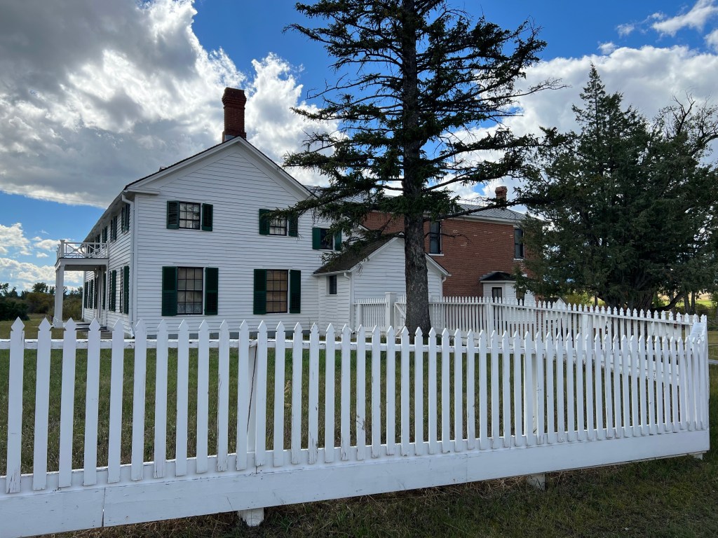
We were lucky enough to have an hour long tour of the home begun by Johnny Grant and expanded by Conrad Kohrs. The park ranger provided background and historical setting for the two families in greater detail than what we have discussed here. I came here, uncertain of what to expect, but walked away with greater knowledge and appreciation for the area than I had before hand.

Ed and Chris, Missoula, Montana Sept. 5

Categories: travel | Tags: , , | 1 Comment

2018 Trip 4: Arizona: May 25

Phoenix, AZ. Friday May 25

Breakfast at the Guest House Inn at Ajo AZ to start the day off right

Ajo is now but a memory, a stronger one when I discovered this morning that a Minnesota designed the town in 1914. Lodging at Guest House Inn was great, Michael was a gracious host. Breakfast was delicious and the bed gave me a great night’s sleep. The B & B had been the location where visiting dignitaries to the copper mine stayed when the mine was still operational. (By the way, RW if you are reading this, I hope you saw our email and responded to Michael.)

As we drove out of town, we stopped at the offices of the Cabeza Prieta National Wildlife Refuge. Cabeza is the third largest refuge in the lower 48 states and is primarily desert and mountain. But as the introductory video states, desert does not equal barren of life.

One needs a wilderness permit to enter the refuge which we obtained but we could have skipped it. Once again, high clearance vehicles are “suggested”. We tried the first mile or so of road but decided once again to be cautious and avoid the potential for damaging the bottom of the rental vehicle. Some time we will have to visit and make sure we have a true high clearance vehicle and go wild on back road trips. We passed another wilderness area, Sonoran Desert National Monument on the way back to Phoenix and just kept driving.

Casa Grande Ruins National Monument, Coolidge AZ

Phoenix was our eventual destination to pick up Deb and Rebecca who will join us for the next eight days. Their flight does not land until late in the evening so we dropped in at Casa Grande Ruins National Monument. This is a NPS unit that Chris and I had disagreed whether we had been here before. I said yes, Chris said no. Once we arrived, we realized Chris was right.

The area around Phoenix was home to people now called the “Ancestral People” who probably arrived around 300 C.E. Over the next thousand years various changes took place, including the change from smaller settlements to larger ones. Casa Grande is the largest known of those large settlements, home to about 2,000 people. Casa Grande is named due to the still-standing four-story Great House.

By the time European explorers arrived in the area, the Ancestral People had dispersed. While not known for certain, best theories believe a combination of weather related conditions caused a societal breakdown and the people dispersed. Six Native American tribes claim ancestry to the Ancestral People.

Map of irrigation canals top; bottom remnant of canal by Casa Grande

We do know that the Ancestral People created a system of canals, close to 220 miles worth, to be able to irrigate crops with water from the Gila River. Without steel implements, this would have been a major task for the community to create. Highly skilled craft remains have been found, indicating the communities had time for more than just work.

Casa Grande up close

Casa Grande was constructed in layers of local building material called caliche, a desert sand high in calcium carbonate mixed with water to form a concrete like substance. The building is oriented north and south with astronomical openings that line up to record the spring and fall equinoxes and the summer solstice.

Casa Grande Ruins was declared the nation’s first archaeological preserve in 1892 and a national monument in 1918. From the picture, you can observe a shelter over the ruins to protect them from the elements. The shelter is called a “Ramada”, or open air shelter, was designed by Frederick Law Olmsted, Jr. and constructed in 1932.

The wispy residue of a dust devil

While walking around the site, we experienced a short but nasty wind storm, with the wind creating the type of dust devil I wrote about a few days ago. This time, we had to close our eyes and turn away from the wind; by the time it died down enough for me to get my camera out, I was only able to snap the few wisps of dirt in the air above us.

The rest of the day was spent driving back to Phoenix, checking in to the hotel and having dinner. We picked up Deb and Rebecca at the airport. As usual for us, we did a test run to the airport and spotting the best location to meet them. Of course, the test run was done flawlessly with few cars or people around. Pick-up time at 9:30 PM was jammed though. But we found them.

Saturday we will head to Flagstaff for the second half of this trip, visiting Lou and Joyce, and taking Deb and Rebecca to the Grand Canyon, Antelope Canyon, etc.

Ed and Chris. May 26

Categories: road trip, travel | Tags: , , , | Leave a comment

2018 Trip 3: April 4-5: KY and TN

Miami Beach, FL April 5

Birds in Biscayne Bay, part of Biscayne National Park

Wednesday we returned to the beach. It was a quiet day, people-watching-wise. Sunny and warm, in the 80s, causing us to rent the umbrella and lounge chairs to make sure I did not turn lobster red in the south Florida sun. The afternoon forecast was for rain around 3 PM; it came at 2:30 PM.

At first we thought we would ride out the rain on the beach. No lightning, it was warm, we would have been wet if we had gone in the ocean, etc. But the rain continued, came down harder, temperature started dropping, wind started blowing the rain under the umbrella, etc. so we packed up and got wet walking back to our time-share. The rain and humidity continued long enough to make us feel justified in leaving the beach. Dinner was left-over chicken from previous nights, nothing fancy.

Thursday we left Miami Beach by 8 AM to drive south to Biscayne National Park. The national park is primarily water, islands and keys, and land underwater. It takes about an hour to reach it, and traffic was reasonably clear. Biscayne National Park’s visitor center is near Homestead Florida, a town that had been heavily destroyed by Hurricane Andrew twenty-five years ago in 1992.

In 1990, Homestead’s population was 27,000. Today it is estimated at 67,000. We saw evidence of the new housing development along with expansive nurseries growing palm trees, etc. for the Miami area market. We even passed two huge landfills, one we were told had grown enormously with construction debris from Hurricane Andrew; the second, smaller one growing now with construction debris from Hurricane Irma when it hit here and at the Keys last fall. Airplanes from the neighboring Homestead Air Force Base were frequently overhead. We passed the Homestead Speedway, a NASCAR racing circuit location.

But eventually we arrived at ocean side, the Biscayne National Park. To learn more about the park, we took a three-hour boat ride with a park ranger out to one of the keys, Boca Chita Key. It takes one hour to reach Boca Chita Key across the bay, you have one hour on the key, and a one hour boat ride back.

Creation of the park has an interesting story; like many NPS sites it was born out of controversy of competing interests. As Florida was developing in the 1950s and 1960s, a group of commercial interests were pushing for a major shipping port and a commercial/residential complex to be located on the shore and the keys in this area. At the same time, environmental groups were recognizing the unique value of Biscayne Bay.

The commercial interests went so far as to bulldoze a “highway” six lanes wide and seven miles long down the middle of one of the keys to limit its natural value. They lost. President Johnson signed legislation creating Biscayne National Monument in 1968. It was upgraded to a national park in 1980. It currently comprises over 170,000 acres, 95% of which is water, stretching from south of Key Biscayne to north of Key Largo.

Red Mangrove trees while hiking on Boca Chita Key, part of Biscayne National Park

First off, you should understand the difference between a “key” and an “island”. An island was created by geological forces; deposits of sand, uplift of the earth’s core, volcanic action, etc. A key was created by the actions of biology, coral reefs. The islands and shoreline are formed by limestone deposits, the bottom of the bay is only six to eight feet below the water level. In some areas the bottom as just a few inches of dirt and soil, while in other areas the dirt on top of the limestone deposits is deep enough to grow saltwater grasses. Both keys and islands exist here and protect the shoreline from wave and storm action by the presence of the rock/coral outcroppings and the mangrove forests located on them. Mangrove forests, of red, black and white mangrove species, also exist on the shore of the mainland.

Our boat ride out was on calm water, clear skies and temperature around 80 degrees F. We only saw one sting ray, no dolphins and plenty of birds. The ranger told us the history of the park and the diversity of plant and fish life here. Two power plants south of here were constructed prior to the National Monument, early operation allowed for direct dumping of their hot “cooling” water and the heated water practically killed life in the Biscayne Bay. The plant operators (willingly or not, I am not sure) switched to an on-land recycling system to cool their water and the bay has since thrived. The plant and fish life here are a feeding grounds for all sorts of larger fish, on up the food chain.

Fake lighthouse on Boca Chita Key, part of Biscayne National Park

Boca Chita Key was the site of a rich man’s toy; Mark Honeywell of the Honeywell thermostat company, was one of many rich people locating a warm second home retreat in Florida, starting back in the late 1880s. His house on Boca Chita Key was built in 1937 and included a fake lighthouse. We climbed up to the top of the lighthouse when we toured the island. He only stayed a few years as his wife died here from a fall.

While I could say more about Biscayne National Park, I will just conclude with the comment that the three-hour trip was fun, educational, and cost-effective. We were pleased to make the trip. Our decision was enhanced as once again the clouds rolled in and rain cleaned our car as we left the park for a late lunch. We were hungry for a burger, not having one for quite a while. A recommendation led us to “Chefs on the Run” in Homestead where we had a delicious burger and fries. We brought back a homemade chocolate cake which we have not tasted yet.

Chefs on the Run in Homestead FL

Tomorrow we leave Florida, driving back north with stops in Georgia, South Carolina, Tennessee and Kentucky.

Ed and Chris. April 5

Epilogue: Snippets on life in America from Chris
Day 21: Unless you are a direct descendant of Native Americans-one of the approximately 562 indigenous groups, then you are a descendant of immigrants to this land. How white does one’s skin need to be an American? What a frightening time we are living in. And the hatred is fueled by our president. Diversity is one of the factors that made this country great.

Categories: road trip, travel | Tags: , , , , | 1 Comment

2018 Trip 3: KY and TN: March 21: Caves and Crafts, Booze and Bluegrass (Music and Horses)

Munfordville, KY March 21

On a two lane road headed to Mammoth Cave

Welcome to Spring. We woke up to 2-3 inches of beautiful, fluffy, yet sticky snow. This allowed the snow to adhere to tree branches causing beautiful landscapes. The temperature was about 33 degrees Fahrenheit, so the snow melted on the roads without getting icy or slippery. By the end of the afternoon, the snow had melted. If all snowstorms were like this one, everyone would be happy to have it snow frequently.

There were six of us at breakfast at the Country Girl at Heart Farm B and B; a couple from KY who visit here frequently; a young couple from Georgia on their way to Chicago and us. Besides the scrambled free range eggs, we had bacon, fresh fruit, biscuits, and home-made danish from a local Amish couple.

Mammoth Cave was our destination for the day. The National Park site was a 45 minute drive from the B and B through a combination of narrow two-lane roads and interstate. The park offers nine different tour options, we had chosen two of them, each two hours long, and ordered our tickets a few weeks ago. Mammoth Cave had suggested ordering tickets in advance for summer tours and for tours during spring break (now). We had to keep re-checking the web site though since they did not replace their winter schedule with the summer schedule until about two weeks ago.

The historic entrance to Mammoth Cave.

The historic tour covers the original entrance and showcases the parts of the cave seen by the earliest cave explorers. Mammoth Cave was “found” by American settlers as far back as the 1780s and even by the Civil War tourists were coming here to explore the cave. The early tourists saw less than 12 miles of cave. Mammoth Cave was established as a National Park in 1941; only 40 miles had been mapped by then. This tour goes over two miles, has 440 stairs, and has elevation gain and loss of 300 feet.

Historic tour at Mammoth Cave National Park

There are over 400 separate caves within this national park and more are privately owned and available to tour outside it. Over time, cave exploration at Mammoth has continued and more miles of cave have been discovered and mapped. One major discovery in the 1970s connected Mammoth Cave to another large cave system, quickly increasing the total length. Today 412 miles with 27 different entrances of interconnected passages have been identified in Mammoth Cave. It is the longest cave system in the world. (To be connected, an opening has to be able to be traversed by a human without artificially widening or expanding openings.)

Descending the 280 stairs at the beginning of the Domes and Dripstones tour

The Domes and Dripstones tour is about one mile long with 280 of the 500 stairs on this tour coming in one quick burst right at the start of the tour. The 280 steps take you down several domes (cylindrical openings) and you slowly work your way back up for the rest of the tour. The big finale is an indoor waterfall with a large collection of stalactites and stalagmites.

Domes and Dripstones tour at Mammoth Cave

Domes and Dripstones tour at Mammoth Cave National Park

In our opinion, the Mammoth Cave System is more impressive than beautiful. Our two tours were not duplicative and we saw less than 1% of the cave miles. Numerous cave passages are extremely wide, one long passageway on the historic tour was forty feet high and probably just as wide. Certainly we had our share of narrow passages and low overhangs-more so for tall people than children. But overall, many passages impressed us by their spaciousness. I have never been satisfied with my ability to effectively show the view of a cave with either of my camera options. I include some photos here, you will have to use your imagination to complete the picture.

The cave system has five different levels caused by different geological periods when the water level of the Green River, the end spot for water flowing through the cave, eroded and lowered its channel. Only the lowest, newest level has water in it periodically. Our tours were all on dry land. Part of that is also caused by the sandstone capstone above the limestone formations in the cave which direct water to flow away rather than down into the cave.

The Park Rangers leading the tours do a nice job of providing historical background and explaining the geology behind the caves. Our Domes and Dripstones guide was able to go into more detail as we only had 26 people on the tour; this tour is frequently run with 100 participants.

We spent the entire day at Mammoth. Besides the two tours, there is a museum with exhibits and video presentations. We talked with Rangers at an informal talk and peppered questions to the Rangers at the information desk. We bought a few souvenirs. We ate a quick lunch after our first tour and had a sit down meal at the lodge in the park after our late afternoon tour. And we sat for a bit waiting for the last tour to begin. We could have gone on walks above ground but the two tours were taxing enough. While the tour description said the tours in total would be about three miles, the walking app on my iPhone said we went over five miles today. I will take the iPhone total. Add on the almost 1000 stairs and the crab walking in low overhead areas, we got plenty of exercise.

One of the barn buildings at our B and B

We were not impressed with the hotel options near Mammoth Cave but this B and B in Munfordville has been quite pleasant. It is 45 minutes away but the drive is part of the experience. The owner moved here from Connecticut, bought the 140 acre farm and added a B and B section to the farmhouse. She has been running it for nine years now. Our room is spacious and while we did not use it, there is a basement with TV, pool table etc. There are goats and chickens. Guests are welcome to join in feeding the animals to make a complete farm experience. We passed on that option.

Ed and Chris March 22

Epilogue: Snippets on life in America from Chris.
Day 6: Where to find beauty. An end of season snowstorm. Two hundred feet below the ground. The setting sun. By saying hello.

Categories: road trip, travel | Tags: , , , , , , | Leave a comment

Blog at WordPress.com.