Posts Tagged With: National Park Service

2023 Trip 2: San Francisco Bay: Feb. 15 to March 6

View from our room, looking north towards Coit Tower and Alcatraz

San Francisco, Feb. 15-16.

We can’t remember when we were last in San Francisco. Our memories include the cable car museum, Wells Fargo museum, Coit Tower, Japanese gardens but have no idea of when that occurred but we don’t plan to revisit those locations (except maybe the Japanese gardens). This trip will be seven days just in downtown and another two weeks traveling around the Bay Area. Luckily, we have about a week before the rains return in earnest so blue sky pictures may predominate for the near future. Of course that statement presumes our legs hold out with all of the walking we are doing.

The flight over the Rockies on Wednesday was clear and the snow capped mountains were amazing to look at. The snow looked to cover everything, civilization was nowhere to be seen. What we saw during the ride on BART from the airport to downtown took care of that illusion. Homes were stacked close together, few trees, freeways, etc.

Impressions do not necessarily equal reality but so far San Francisco is cleaner than expected, amazing architecture, interesting variety of people and street scenes, everyone walking around with a cup of coffee in their hand, and less crowded than one would expect for a town that is a major tourist draw with its own population of over 800,000. (Cousin Judy—you would be disappointed, we can’t find the San Francisco Chronicle on sale anywhere. The front desk staff at the Hilton had no idea where a newspaper copy could be purchased.)

We are staying at the Hilton Financial District and the BART stop on Montgomery gave us an eight block walk through office skyscrapers. We are across from the Transamerica pyramid building. Coit Tower is directly in front of our 22 second floor room. It’s lit dramatically at night and stands out as a predominant site. The green lights shining on the spires of the Saints Peter and Paul church also enhance the evening view. The flashing lighthouse beacon from Alcatraz island is another feature seen outside our window. Golden Gate Bridge is to the but hidden behind a building on Russian Hill. San Francisco Bay is to the right.

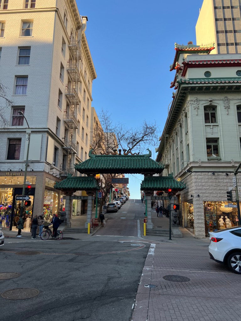
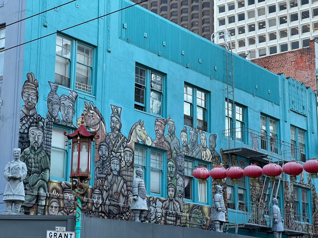
The Hilton is right at the beginning of Chinatown so we are immersed in the Chinatown street scene. There is even a small Chinese Cultural Center on the third floor of the hotel. Portsmouth Square is across the street and people (usually men) are sitting around playing chess and cards with others looking over their shoulders as they play. Early morning brings out the Tai Chi aficionados. Right across the alley was a Chinese restaurant that the hotel staff recommended. We were hungry, CA time is two hours behind MN time but the restaurant did not open until 5 PM so we spent half an hour walking through part of Chinatown. Chris serenaded me with the song ‘Grant Street’ from Flower Drum Song as we walked along the streets. Yes, I know Flower Drum Song portrays stereotypes but this song mentions Grant Street in San Francisco’s Chinatown so just deal with it. Tonight I can also see someone shooting off local fireworks. Initially the sound was nerve-racking; given today’s environment room I thought it was gunshots. The sight of fireworks made for a comforting answer to an initial concern.

[I am trying to control my anger and frustration. After having completed the blog, and having watched the autosave function indicate it was working, I found out that most of the blog, at least 90 minutes of work, was lost. I have this love hate relationship with this blog. I love the ability to look up what we have done from years ago. But the frustration of the time spent, with time lost from the difficulties with the keyboard messing up it or the dictation system screwing up, starts to bring the hate portion very close to the love portion. But so far the love portion is slightly ahead. and so I continue. Of course, what was done before it was lost always strike me as being better than what is dictated the second time around.]

We went to bed early to deal with the time change and the time spent walking. Tomorrow will be the start of another busy day.

This Hilton does not have a continental breakfast but they give us an allowance to use in the restaurant each day. It’s not enough of course but it’s a nice gesture. After breakfast Thursday morning we head up early to Pier 33 to tour Alcatraz. We depart for Pier 33 early of course. For us early means to be extra cautious, making sure we have enough time to walk to the pier and still arrive the 30 to 45 minutes before departure time that the cruise people recommend. We know they recommend this way too early arrival to make sure no one arrives late or to make people use their gift shop. But there is no gift shop today. We are so early we are able to get on an earlier boat and arrive almost an hour ahead of our planned arrival on Alcatraz.

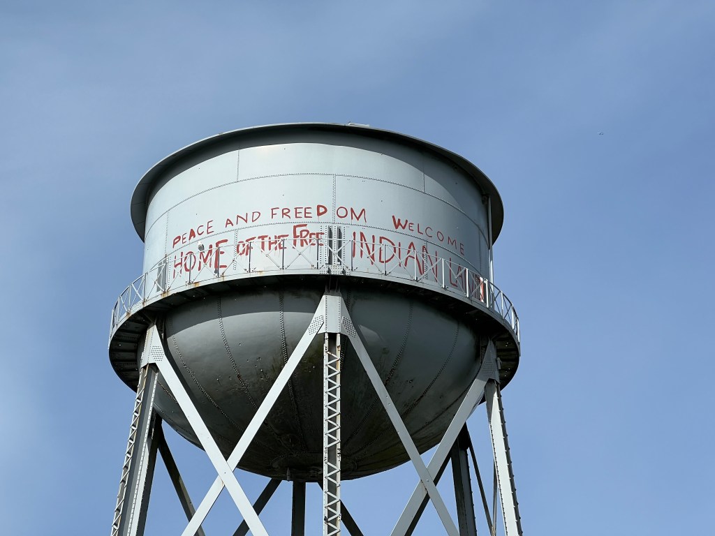
Alcatraz is universally known as the inescapable prison for the federal penitentiaries worst inmates. The staffing level here was dramatically higher than any other federal prison. But before we hear about and enter the prison, we explored several exhibits about the Native American occupation of Alcatraz in 1969. Before the occupation, the prison had been closed in 1963 and was sitting abandoned. The Native American occupation lasted 19 months and surprisingly to us, President Nixon told federal officials to go easy on the occupiers. By 1971 few occupiers were still present and federal officials removed the remaining people. The goals of the Native American occupation were not reached but it raised widespread sensitivity to Native American concerns around the country. I thought the Native American comment about the occupation was indicative of life in America. They stated that Alcatraz was like a reservation because it was so far removed from modern facilities, had a rocky and poor soil where nothing would grow, and wild game was not found.

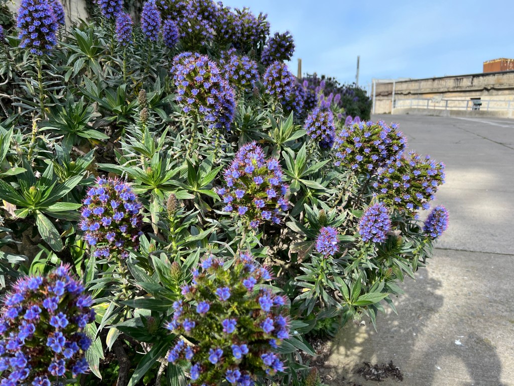
Alcatraz has a surprisingly variety of flowers growing on the island with volunteers who come to pull weeds and showcase the flowers. Many birds enjoy the island and their protected habitat. There is even a nesting pair of peregrine falcons. Of course, our first stop was to get a National Park Service stamp since Alcatraz is part of the Golden Gate National Recreation Area created in 1972. When the park was created, Alcatraz was made a part of it. That park designation stopped the demolition of the abandoned buildings on the island. Without that designation, there would be no Alcatraz as a major tourist attraction in San Francisco. We talked with a park ranger in order to get a junior ranger booklet that I collect to bring back to the park ranger who works on junior ranger booklets for the Mississippi National River And Recreation Area. The Ranger here had a boyfriend from Minnesota so we spent some time chatting about Minnesota.

Eventually we work our way to the inside of the prison and take the audio tour. It’s depressing seeing the tiny cells and limited activities for these dangerous inmates. Of course dangerous is relative; during World War II, a number of conscientious objectors were imprisoned here. Hardly the same level of crime as the killers, robbers, and inmates with various mental problems. The tour takes you through the cell areas, library, dining area, recreation area and talked about several of the escape attempts inmates undertook. No one is known to have successfully escaped from Alcatraz. Several inmates left the island but were never found again. It appears certain that the waters of San Francisco Bay were their final resting place.

After Alcatraz, we went to the Exploratorium. This is a science-based collection of exhibits that make obvious playing can also be learning. The various exhibits showcase interesting facts about science and the children present we’re having a great time. We knew this was more oriented towards children but it had such a positive recommendation that we stopped in anyway. We enjoyed in particular the dry ice exhibit demonstrating the activities of comets. The movement of the dry ice in water, the attraction between dry ice particles, and the water vapor given off made for an interesting and educational display. The young men demonstrating magic trips were pleased and gratified decision to see the amazement expressed on Chris’s face as their tricks were successful.

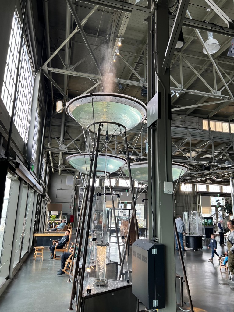
A model geyser at the Exploratorium.

After the Exploratorium, we continued our walk along the Embarcadero to the Ferry building. This had been the major transportation point of the bay area until the Golden Gate and Oakland Bay bridge were built. The Ferry Building fell on hard times but has been revived and rehabilitated. It’s now the front door to several of the ferry cruise lines with numerous food vendors inside. We stopped and had some ice cream to help make the day memorable.

One stall was “Art by Aleisha”, a small area with hand painted maps of towns and campuses. San Fran, the Bay area, Santa Clara, Boston College, Georgetown, etc. But browsing through the stacks I found maps of the University of Minnesota and more amazingly, the University of St. Thomas in St. Paul. Whoa! That seemed unusual for a small stall in San Francisco. Chris went to the web site and it turns out Aleisha is a Minnesota raised, San Francisco based artist who founded her own business. She even painted a mural in Lowertown St. Paul. Interesting coincidence.

We were able to return to the Hilton with just enough time to stop in to the Chinese cultural center which closed at 4 PM. It’s located on the third floor of the Hilton hotel and let’s just say that there was no need for us to rush back to see it.

Dinner was at the Cafe Zoetrope, two blocks from the Hilton. This was the historic Sentinel Building dating from 1907. Its current claim to fame, besides its construction and appearance, is that Francis Ford Coppola located his offices here. Numerous movie scripts were written, edited, or sound mixed in this building. He revived the restaurant and 1999 and many of the recipes are supposedly his creations or adjustments to other recipes. The food was OK. The ambience was nice.

The Sentinel Building, home of Cafe Zoetrope

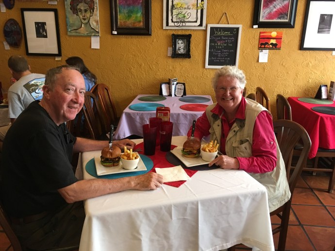
Ed and Chris, Friday morning, September 17 in San Francisco

Categories: travel | Tags: , , , , | 2 Comments

2022 Trip 1: Searching for our 300th National Park site: April 26-28

Pipestem WV April 26

Before we left West Virginia, we made one more visit to the New River. Sandstone Falls on the New River is 30 minutes north of Pipestem Resort State Park. The waterfalls are mentioned frequently and positively in travel literature about West Virginia and in NPS brochures. The falls extend across the New River, punctuated by rock outcroppings. The rock outcroppings have trapped fallen tree trunks on top of the rocks, waiting for the next high water level to push the tree trunks downstream to the next catch point.

The literature indicates the height of the falls ranges from 10-25 feet. Not stunning in height, but the full river width of the falls lends to a greater majesty. The New River is one of the unusual rivers that flows from south to north. Here at Sandstone Falls, the river becomes more narrow, entering a gorge phase. The river drops 750 feet in the next 55 miles.

The day was rainy when we were at the falls, sunshine and reflections in the water would have made for a more impressive photo. Several people were out walking, taking photographs, fishing, etc. We had previously viewed the falls from above, this location places you at river level, at an island in the middle of the river just downstream of the falls. The river seemed shallow but with a fast current. As the signs advise, drownings are a major cause of death along the New River. The current can trap a person, even in very shallow water.

Dinner was back at Pipestem Resort State Park dining room. The menu is limited but the food has been quite good. Even the trashed food must be tasty as we saw raccoons each night who evidently go dumpster diving on a regular basis.

Wednesday morning we were gone by 7 AM; a real sacrifice since the dining room does not open until 7. The day would be longer than usual, over 600 driving miles plus a stop at our last NPS site for this trip. An early, long section of the road was along I-77 and I-64, the West Virginia Turnpike. The road was mountainous and curvy; the tolls on this road were 20% of the tolls we paid for the entire trip. Thankfully EZ Pass eliminates the old stop and pay method of gone by years.

Lincoln’s Boyhood National Memorial in Lincoln City Indiana was well done. It surprised us, not sure what exactly we were expecting. The site is a memorial to Abraham Lincoln’s formative years, from ages 7-21. This is where he matured, reading books, splitting rails, arguing politics, learning how to be a farmer and learning that was not the life he wanted in the future. His mother died after two years here from an illness frequent on the frontier, milk sickness. Cows eat the white snakeroot plant native to this area; it is toxic to them and to humans who drink its milk or eat its meat. Rarely a problem today, this disease claimed Nancy Hanks Lincoln’s life as well as many others in the little community here. The cause of the disease was not known at the time. She was buried on a knoll not far from the Lincoln farm.

In 1943, the state of Indiana constructed the Lincoln Memorial Building to honor Lincoln and his mother. Materials are all native to Indiana. It was transferred to the National Park Service in 1962. The memorial building is a semi-circle with two large auditoriums at either end. One is dedicated to Abraham Lincoln, one to his mother, Nancy Hanks Lincoln. Between the two auditoriums are exhibits about his life in Indiana and his family while he was growing up. On the outside of the building are five sculptured panels of significant periods of his life: Kentucky childhood years, Indiana boyhood days, Illinois political ascendancy, Washington DC presidential years, and the central panel reflecting his place in history.

Besides the memorials for Lincoln and his mother, a living history farm is included on the land where the Lincoln farm was located. Foundation stones have been excavated and marked out while a split log fence and a reconstructed cabin indicate the type of home Lincoln would have experienced. Mary Hanks Lincoln’s actual grave site is not known precisely, but the approximate location is marked and memorialized.

Once again, our visit was enhanced by a friendly and knowledgeable guide, this time a volunteer rather than a park ranger. The rangers were busy getting ready for a huge throng of first graders who would be visiting on Monday. Today’s crowd was about a dozen people while we were there. Enough people to keep the volunteers busy answering questions but light enough to give a visitor personal attention.

We left southern Indiana for the Champaign-Urbana area of central Illinois, a drive of over 200 miles only partly on Interstates. Lodging was our final Hampton Inn of the trip with a Perkins across the parking lot. We managed to force ourselves to have a piece of pie each for dessert.

Thursday-last leg of the trip. 500 miles with rain for the first several hours. Construction continued being frequent but as was normal for the rest of the trip, usually only bridge work. Thus construction areas were short. Our final meal on the road was in the largest Culvers restaurant in Edgerton WI, just south of Madison. As we journeyed north and west, the trees no longer had their leaves and buds visible to us on the road. Probably another week will be necessary for this section to green up. Spring is a little later this year than last, at this time in 2021 the trees were in full leaf.

Last night we reflected on the highs and lows of the trip. The historical units we visited were most frequently the highs. The sites were well done and our knowledge of U.S. history enhanced. Certainly other interesting places could have been visited but our goal of the trip was to reach 300 National Park Service sites. Accomplished.

Ed and Chris, Saint Paul, MN April 30, 2022

Categories: travel | Tags: , , , , , , , | Leave a comment

2022 Trip 1: Searching for our 300th National Park Site, March 30

Framingham, MA March 31

Wednesday started out lousy. Rain, 29 degrees F, driving over central Pennsylvania mountains with their curves and hills—and very aware of the crash on Interstate 81 Monday a little east of here with a 80 car/truck pile up that killed six people. Chris and I are very familiar with that stretch of I-81, we always knew that if fog was around, it could be found in that stretch. In Monday’s situation, though, it was a sudden snow squall. For us, our drive had no problems although we drove a bit slower and left later to try to reach above freezing temps. It was not until we reached Scranton, three hours later, that the temperature was above freezing.

Our one stop of the day was at the Steamtown National Historic Site, a National Park Service (NPS) unit. I had thought we had been here before many years ago but it did not look familiar. Chris was sure she had never been here. In any event, the complex is large and impressive. The major focus of the exhibit is railroading, specifically the Delaware Lackawanna and Western railroad. This railroad was a major connector between New York and the anthracite coal mines of northern Pennsylvania. Like many other railroads, it was the result of the merger of several smaller, local rail lines.

The National Park Service’s role at this site is to interpret the role of railroads in the development of the United States. In particular, Steamtown focuses on the industrial development of the Lehigh Valley around Scranton, the steel factories and coal mines, and the role of immigrants newly arrived in the US who filled jobs in this location. Steamtown has a 18 minute video, and a wonderful series of exhibits surrounding a central Roundhouse. The buildings have been well restored, as have the railroad locomotives on display. During warmer times of the year, train rides are offered.

I found one display of particular interest. There was a Railroad post office car included in the collection of train equipment. These cars were used for sorting mail along the train route, even to the point of dropping off mail at locations without a formal stop by means of a bag tied to a hook. In my talks for the NPS Trails and Rails program on the Amtrak Empire Builder, I try to mention this old time process while speaking in the observation car.

The park ranger we met, a woman originally from Hagerstown Maryland, was gracious and accommodated my request to pick up Junior Ranger booklets. If you are not aware of these, most National Park Service sites have a booklet designed for young visitors to help them explore and learn about the purpose of that specific NPS site. While called Junior Ranger booklets, they can be used by people of any age.

The Ranger responsible for these booklets at my park site, Mississippi National River And Recreation Area in the Twin Cities, will be receiving a packet of Junior Ranger booklets that I will be picking up as we visit 30 or so NPS sites during this trip. Here at Steamtown, the Park Rangers have developed a series of four booklets designed for different ages. One booklet is for ages five and under, one for ages 6 to 8, one for ages 9 to 12, and the last one for people like me, ages 13 to 130. The Steamtown booklets are less fancy, printed with a color printer. In contrast, the Junior Ranger book at Flight 93 National Memorial was printed by a commercial printer on heavy, glossy paper.

Each booklet requires the user to answer questions, draw pictures, and in general interact with the knowledge presented at the NPS site. Completion of the booklet allows the person to be sworn in as a junior ranger and receive a badge. We have found that it can be quite popular with people interested in learning about American history and culture.

The rest of the drive was uneventful. Heavy traffic once we hit New York, then really heavy through the usual traffic jam around Danbury Connecticut. Over the years, most of our visits to Boston from Minnesota have been by air. It was nice to drive old familiar territory, even being surprised by local restaurants that are still in existence from 30 and 40 years ago. When we stopped at the first rest stop in Connecticut, we recollected that this was a dramatic improvement to the trip we used to take from Minnesota and then Pennsylvania to visit Chris’s parents in Connecticut. The rest stop was completed in 1971, a year before we were married. It has an older style than what is now common Interstate rest stops design, but it still was a nostalgic and useful stop. One new addition was a vending machine, see picture, that we have not come across previously. Either it is new or we are just out of touch.

For the next several days we will be in the Boston area. Lodging is a Airbnb, a former garage apparently converted into an attached dwelling unit. I still usually prefer a nice Hampton Inn. There are two people on this trip and cooperation in lodging choices must be made.. The Hampton Inn Monday night in Crawfordsville IN, offered dinner for guests from 5 to 7 pm. We took advantage of it. Over the course of this month, we will be staying at three Airbnb‘s, about a dozen Hampton Inns, a Hilton Grand Vacations Club offering in downtown Washington DC, and three nights at a West Virginia state park resort.

Ed and Chris, Framingham MA March 31.

Categories: travel | Tags: , , , , | Leave a comment

2019 Trip 3: South Florida: April 13-18

Taking the beach walk to the beach

Miami Beach, FL. April 18

Our old haunts awaited us as we returned to Miami Beach. We have been coming here almost every year since 2001-18 years. Some things change, Hurricane Irma closed down one hotel which had a restaurant we used to frequent. A new transit option appeared, free rides in an electric driven small open air van paid for by advertising. Some things are the same, Front Porch restaurant is still open after 25 years and just half a block north of our place as is La Sandwicherie, a famous hole in the wall sandwich shop we frequent.

At the beach: pelicans, cruise ship in background and parasailing, typical beach scene, and moon rising over the ocean.

The people watching continues of course. A better writer than I could keep you spellbound with anecdotes of the various antics one sees on the beach and on the sidewalks. The family whose dad is complaining how the teenage daughters are whining about the experience and how much the parents are paying. We only heard the father’s many whines, few from the daughters. The people trying to open their less expensive store-bought umbrellas that turn inside-out in the strong wind. The woman and child walking down the middle of the street. You will have to use your imagination or your own experiences to expand the number of anecdotes.

Monday was supposed to rain and it was the day for our room to be cleaned so we went walking down to South Pointe, next to the ship channel that is the means for boats, cargo ships, and cruise ships to reach the ocean. We passed two hotels where, when we were working, we used to spend a night or two to extend our vacation. When we stayed at those hotels, we never went to the beach, just stayed at the hotel pool.

Wolfsonian examples of Art Deco inspired furniture: oven, dressing table, hutch,and desk.

The Wolfsonian Museum is a favorite of ours. Usually we go to the Friday night free admission and docent tour. Once we heard James Dyson talk about his revolutionary new vacuum cleaners. That gives you an idea of how long we have been coming here also. Monday we went and actually had to pay the senior admission rate of $8 each. While various exhibits come and go, the heart of the exhibits are items from the Art Deco period.

Wolfsonian: Art Deco in everyday life: mail box, radio, movie ticket taker booth, toaster

Art Deco was highlighted at a 1925 exposition in Paris and took off in the U.S. in the 1930s. Art Deco architecture was the driving style in Miami Beach’s expansion. But Art Deco took over in design for many everyday experiences. There are connections between styles and ornamentation visible on hotels from that period and furnishings and appliances created in the 1930s.

New World Symphony wallcast

The New World Symphony, started by Michael Tilson Thomas, is a post-graduate school training academy for musicians. For Wednesday night’s activity, its outdoor wall is used to simulcast some of their concerts and to host weekly outdoor movies during the winter season. We ambled over last night and watched “Won’t You Be My Neighbor”, the story of Fred Rogers. Besides enjoying the movie tremendously, we saw a new (to us at least) form of outdoor seating. The Porch Couch is a piece of plastic like material, open at one end, and you simply wave it around to fill it with regular air. It provides a couch like seating that held up well for the two groups we saw using it. When the event is over, let out the air and pack it up. Neat.

An unexpected experience wraps up our trip. When walking along the Beach Walk, I came across large tents being erected. Nothing unusual there, Miami Beach is host to many conferences and events. Upon closer perusal, I realized that the tents were for the Longines Global Championship, an international horse jumping competition. It runs Thursday (today) through Saturday on the beach. And attendance was free.

Preparing for the event, Longines Global Championship

Chris and I went to the opening day afternoon competition. Horse and rider teams from the U.S., Great Britain, Qatar, Sri Lanka, Czechoslovakia, Netherlands, Germany and Switzerland were represented. Several different levels of competition were scheduled, we have no clue as to the rules which determine who can enter each round. After two and half hours, our event winner was from the U.S. Listening to the announcers, it was evident that the competitors were top-level. This Global Championship has 20 events in cities like Mexico City, Shanghai, Montreal, Prague, London, Monaco, Stockholm, etc.

During the event.

I was surprised the horses were jumping outside in the heat, 86 degree Fahrenheit at show time. But the views of the ocean and the horses made for great viewing for the spectators. Given the high cost of the horses and of travel, I am sure the horses would not be jumping if it would harm them.

This will be the last post for this trip unless something unexpected happens in the next 24 hours. Friday we fly home.

Ed and Chris April 18 Miami Beach

Categories: road trip, travel | Tags: , , , , , , , , , , , , , | Leave a comment

2018 Trip 4: Arizona: May 25

Phoenix, AZ. Friday May 25

Breakfast at the Guest House Inn at Ajo AZ to start the day off right

Ajo is now but a memory, a stronger one when I discovered this morning that a Minnesota designed the town in 1914. Lodging at Guest House Inn was great, Michael was a gracious host. Breakfast was delicious and the bed gave me a great night’s sleep. The B & B had been the location where visiting dignitaries to the copper mine stayed when the mine was still operational. (By the way, RW if you are reading this, I hope you saw our email and responded to Michael.)

As we drove out of town, we stopped at the offices of the Cabeza Prieta National Wildlife Refuge. Cabeza is the third largest refuge in the lower 48 states and is primarily desert and mountain. But as the introductory video states, desert does not equal barren of life.

One needs a wilderness permit to enter the refuge which we obtained but we could have skipped it. Once again, high clearance vehicles are “suggested”. We tried the first mile or so of road but decided once again to be cautious and avoid the potential for damaging the bottom of the rental vehicle. Some time we will have to visit and make sure we have a true high clearance vehicle and go wild on back road trips. We passed another wilderness area, Sonoran Desert National Monument on the way back to Phoenix and just kept driving.

Casa Grande Ruins National Monument, Coolidge AZ

Phoenix was our eventual destination to pick up Deb and Rebecca who will join us for the next eight days. Their flight does not land until late in the evening so we dropped in at Casa Grande Ruins National Monument. This is a NPS unit that Chris and I had disagreed whether we had been here before. I said yes, Chris said no. Once we arrived, we realized Chris was right.

The area around Phoenix was home to people now called the “Ancestral People” who probably arrived around 300 C.E. Over the next thousand years various changes took place, including the change from smaller settlements to larger ones. Casa Grande is the largest known of those large settlements, home to about 2,000 people. Casa Grande is named due to the still-standing four-story Great House.

By the time European explorers arrived in the area, the Ancestral People had dispersed. While not known for certain, best theories believe a combination of weather related conditions caused a societal breakdown and the people dispersed. Six Native American tribes claim ancestry to the Ancestral People.

Map of irrigation canals top; bottom remnant of canal by Casa Grande

We do know that the Ancestral People created a system of canals, close to 220 miles worth, to be able to irrigate crops with water from the Gila River. Without steel implements, this would have been a major task for the community to create. Highly skilled craft remains have been found, indicating the communities had time for more than just work.

Casa Grande up close

Casa Grande was constructed in layers of local building material called caliche, a desert sand high in calcium carbonate mixed with water to form a concrete like substance. The building is oriented north and south with astronomical openings that line up to record the spring and fall equinoxes and the summer solstice.

Casa Grande Ruins was declared the nation’s first archaeological preserve in 1892 and a national monument in 1918. From the picture, you can observe a shelter over the ruins to protect them from the elements. The shelter is called a “Ramada”, or open air shelter, was designed by Frederick Law Olmsted, Jr. and constructed in 1932.

The wispy residue of a dust devil

While walking around the site, we experienced a short but nasty wind storm, with the wind creating the type of dust devil I wrote about a few days ago. This time, we had to close our eyes and turn away from the wind; by the time it died down enough for me to get my camera out, I was only able to snap the few wisps of dirt in the air above us.

The rest of the day was spent driving back to Phoenix, checking in to the hotel and having dinner. We picked up Deb and Rebecca at the airport. As usual for us, we did a test run to the airport and spotting the best location to meet them. Of course, the test run was done flawlessly with few cars or people around. Pick-up time at 9:30 PM was jammed though. But we found them.

Saturday we will head to Flagstaff for the second half of this trip, visiting Lou and Joyce, and taking Deb and Rebecca to the Grand Canyon, Antelope Canyon, etc.

Ed and Chris. May 26

Categories: road trip, travel | Tags: , , , | Leave a comment

2018 Trip 3: KY and TN: April 8- 9: Caves and Crafts, Booze and Bluegrass (Music and Horses)

Gatlinburg, TN April 9, 2018

Congaree National Park, SC, on the boardwalk with bald cypress kness

Yesterday, Sunday, was primarily spent at a national park, Congaree National Park. Three years ago I am not sure I had heard of Congaree. As we looked over our map of the 417 U.S. National Park Service sites and checked out unvisited sites, this Congaree National Park stuck out. Then we combined that fact with our desire to spend more time in Kentucky and Tennessee, a desire that was on our list prepared in 2012 of U.S. destinations to visit. Congaree is not in KY or TN, but is on a reasonable line from Miami Beach to Tennessee and Kentucky and then on to Minnesota. Finally, we read more about national parks and Congaree was frequently cited as a park with significant environmental resources.

Congaree National Park in South Carolina

So what is Congaree? Congaree is 26,000 acres, 57% of which is wilderness area. Much of the park is bottomland forest, subject to frequent flooding. Congaree is an oasis of old-growth hardwood trees, uncut when much of southeastern U.S. was being de-forested starting in the late 1800s to provide wood for the booming population and economy of the new industrial United States. This area of forest was owned primarily by a lumber company led by a Francis Beidler. The company stopped timbering due to the difficulty of harvesting and transporting the lumber out of this wet and remote area. However by the 1960s, the company was starting to log the area.

Tall trees at Congaree National Park

Congaree, due to being ignored, is believed to be home to the largest contiguous area of 130 to 160 foot tall trees in the eastern United States. The park has 15 champion trees, the largest known of their species. It was protected from further logging in 1976 by designation as the Congaree Swamp National Monument. In 2003, the National monument designation was broadened to that of a national park by an act of Congress.

When a tall tree falls, does anyone in the forest hear it?

Congaree offers canoe excursions which we skipped since they require each person to know how to swim (I can’t). We focused on hiking, taking 3 hours to tramp 9-10 miles through the woods. A portion of the hike was on a 2.5 mile boardwalk that exhibits the relationship between flooding and the specific trees that can grow in those circumstances, bald cypress, water tupleo, American beech, loblolly pine, among others. The bald cypress is an interesting tree, with wood that is resistant to rot and water. The tree has “knees” that protrude from the water. The function of the “knees” is still unknown.

Hiking at Congaree National Park

The rest of the hike was through a variety of woods on paths a bit muddy after it rained here on Saturday. We were fortunate that the weather was dry today and slightly cool. The amount of water and swamp can produce vast numbers of mosquitoes. The “mosquito meter” on the wall at the park remained at a very low level.

Congaree is home to a unique biological feature. Each spring, fireflies congregate here and as part of their mating ritual, they light up on a synchronized basis. Thus, in the evening, you would look out over the swamp area and “boom” all of the fireflies would be glowing and then “boom” all of the fireflies would not be glowing. The timing varies but is currently expected to happen around May 11-22. Obviously, we will miss it. If you plan to come, make sure to get here early and check out the park’s website for timing updates and tips on courteous behavior.

Riverbanks Botanical Garden Columbia South Carolina

After the three-hour hike, we drove to Riverbanks Zoo and Botanical Garden. We were hoping to see a profusion of blooming flowers. The sun had come out and this idea seemed a pleasant way to end the day. Riverbanks is a very nice combined zoo and gardens with rides for kids also. It comes across as a great place to spend the day for families. We devoted our time to the gardens which were colorful but were too small to present an overwhelming presence by themselves.

After an Italian dinner, we spent the evening with our Evergreen hosts. Another amazing couple with a plethora of interesting anecdotes, people they have met, and places they have visited.

Ed and Chris. April 10

Categories: road trip, travel | Tags: , , , | Leave a comment

2018 Trip 3: April 4-5: KY and TN

Miami Beach, FL April 5

Birds in Biscayne Bay, part of Biscayne National Park

Wednesday we returned to the beach. It was a quiet day, people-watching-wise. Sunny and warm, in the 80s, causing us to rent the umbrella and lounge chairs to make sure I did not turn lobster red in the south Florida sun. The afternoon forecast was for rain around 3 PM; it came at 2:30 PM.

At first we thought we would ride out the rain on the beach. No lightning, it was warm, we would have been wet if we had gone in the ocean, etc. But the rain continued, came down harder, temperature started dropping, wind started blowing the rain under the umbrella, etc. so we packed up and got wet walking back to our time-share. The rain and humidity continued long enough to make us feel justified in leaving the beach. Dinner was left-over chicken from previous nights, nothing fancy.

Thursday we left Miami Beach by 8 AM to drive south to Biscayne National Park. The national park is primarily water, islands and keys, and land underwater. It takes about an hour to reach it, and traffic was reasonably clear. Biscayne National Park’s visitor center is near Homestead Florida, a town that had been heavily destroyed by Hurricane Andrew twenty-five years ago in 1992.

In 1990, Homestead’s population was 27,000. Today it is estimated at 67,000. We saw evidence of the new housing development along with expansive nurseries growing palm trees, etc. for the Miami area market. We even passed two huge landfills, one we were told had grown enormously with construction debris from Hurricane Andrew; the second, smaller one growing now with construction debris from Hurricane Irma when it hit here and at the Keys last fall. Airplanes from the neighboring Homestead Air Force Base were frequently overhead. We passed the Homestead Speedway, a NASCAR racing circuit location.

But eventually we arrived at ocean side, the Biscayne National Park. To learn more about the park, we took a three-hour boat ride with a park ranger out to one of the keys, Boca Chita Key. It takes one hour to reach Boca Chita Key across the bay, you have one hour on the key, and a one hour boat ride back.

Creation of the park has an interesting story; like many NPS sites it was born out of controversy of competing interests. As Florida was developing in the 1950s and 1960s, a group of commercial interests were pushing for a major shipping port and a commercial/residential complex to be located on the shore and the keys in this area. At the same time, environmental groups were recognizing the unique value of Biscayne Bay.

The commercial interests went so far as to bulldoze a “highway” six lanes wide and seven miles long down the middle of one of the keys to limit its natural value. They lost. President Johnson signed legislation creating Biscayne National Monument in 1968. It was upgraded to a national park in 1980. It currently comprises over 170,000 acres, 95% of which is water, stretching from south of Key Biscayne to north of Key Largo.

Red Mangrove trees while hiking on Boca Chita Key, part of Biscayne National Park

First off, you should understand the difference between a “key” and an “island”. An island was created by geological forces; deposits of sand, uplift of the earth’s core, volcanic action, etc. A key was created by the actions of biology, coral reefs. The islands and shoreline are formed by limestone deposits, the bottom of the bay is only six to eight feet below the water level. In some areas the bottom as just a few inches of dirt and soil, while in other areas the dirt on top of the limestone deposits is deep enough to grow saltwater grasses. Both keys and islands exist here and protect the shoreline from wave and storm action by the presence of the rock/coral outcroppings and the mangrove forests located on them. Mangrove forests, of red, black and white mangrove species, also exist on the shore of the mainland.

Our boat ride out was on calm water, clear skies and temperature around 80 degrees F. We only saw one sting ray, no dolphins and plenty of birds. The ranger told us the history of the park and the diversity of plant and fish life here. Two power plants south of here were constructed prior to the National Monument, early operation allowed for direct dumping of their hot “cooling” water and the heated water practically killed life in the Biscayne Bay. The plant operators (willingly or not, I am not sure) switched to an on-land recycling system to cool their water and the bay has since thrived. The plant and fish life here are a feeding grounds for all sorts of larger fish, on up the food chain.

Fake lighthouse on Boca Chita Key, part of Biscayne National Park

Boca Chita Key was the site of a rich man’s toy; Mark Honeywell of the Honeywell thermostat company, was one of many rich people locating a warm second home retreat in Florida, starting back in the late 1880s. His house on Boca Chita Key was built in 1937 and included a fake lighthouse. We climbed up to the top of the lighthouse when we toured the island. He only stayed a few years as his wife died here from a fall.

While I could say more about Biscayne National Park, I will just conclude with the comment that the three-hour trip was fun, educational, and cost-effective. We were pleased to make the trip. Our decision was enhanced as once again the clouds rolled in and rain cleaned our car as we left the park for a late lunch. We were hungry for a burger, not having one for quite a while. A recommendation led us to “Chefs on the Run” in Homestead where we had a delicious burger and fries. We brought back a homemade chocolate cake which we have not tasted yet.

Chefs on the Run in Homestead FL

Tomorrow we leave Florida, driving back north with stops in Georgia, South Carolina, Tennessee and Kentucky.

Ed and Chris. April 5

Epilogue: Snippets on life in America from Chris
Day 21: Unless you are a direct descendant of Native Americans-one of the approximately 562 indigenous groups, then you are a descendant of immigrants to this land. How white does one’s skin need to be an American? What a frightening time we are living in. And the hatred is fueled by our president. Diversity is one of the factors that made this country great.

Categories: road trip, travel | Tags: , , , , | 1 Comment

2018 Trip 3: March 29-31: KY and TN

Miami Beach FL. March 31

Cruise ship leaving Miami as seen from our lodging in Miami Beach

As promised, the blog posts are stretching out as we do more relaxing than traveling. The breakfast at Battleview B and B lived up to Chris’ comments about B and B breakfasts; nutritious and wide-ranging in items offered. Our plan was to not rush out the door since Atlanta is but 100 miles away and we hoped to avoid its rush hour traffic. Well, the plan was adhered to but the hope of avoiding traffic was fruitless. We even added on an extra, spontaneous stop hoping it might get us past traffic jams.

Breakfast at Battleview B and B

As we were driving down the road, a sign for Kennesaw Mountain National Battlefield Park appeared. Google Maps was still showing red for heavy Atlanta traffic and we had not visited Kennesaw back in the fall of 2016 when we were last in this area. Who can pass up the chance to obtain one more National Park Service stamp in their NPS “Passport to Your National Parks”? Not us; we are around 220 of 417 and still adding more.

Kennesaw was busy, we had to park in the overflow parking lot a block away. This site is part of the battle for Atlanta as Union General William T. Sherman was pressing Confederate General Joseph E. Johnston for control of the area. Sherman was on his march to the sea plundering and burning supplies, buildings, manufacturing and transportation to destroy the Confederates ability to wage war. Atlanta was a key site. Kennesaw Mountain was the last major mountainous area between Chattanooga and Atlanta and Johnston had fortified the area well.

One view of Kennesaw Mountain

It was May of 1864 and the North was getting tired of war; Lincoln was facing opposition from General McClellan for re-election as President and it seemed only a major victory could provide for his re-election. A series of minor skirmishes and flanking maneuvers were not providing a victory although Sherman was getting closer to Atlanta each time. In late June 1864, a series of full force battles at Kennesaw Mountain forced the Confederates to give up the fortified positions and retreat. By early September, Atlanta was in Union hands and Lincoln had the victory that guaranteed his re-election two months later.

One poignant circumstance was detailed in the video and displays. At the “Dead Angle”, the fighting was fierce and numerous bodies, primarily Union, were left in the middle of the Battlefield with troops on either side of the bodies. After two days of a lull in the battle here, the two sides agreed to a brief cease-fire to bury the rotting bodies of the dead and tend to the wounded. Union and Confederate troops worked together to accomplish this, even going so far as to share food and water and spend some time in games of chance. When the cease-fire ended, they went back to killing and maiming each other.

We resumed our travel and arrived in the Atlanta area around 12:30 PM. The traffic was horrendous, six to eight lanes in either direction, fully clogged and moving slowly. We later discovered two facts: A. Atlanta is ranked number 8 in the world for traffic problems; and B. A couple from Atlanta we met later in the day indicated they had been driving there at the same time and thought the traffic was actually better than usual for that time of day.

Miami Beach Friday evening

Lake City Florida was our overnight stopping point before the final drive to Miami Beach. Miami is another traffic hotspot but we lucked out on Friday and had no major issues arriving at our lodging by 3 PM. Our room was ready and after unloading, we headed up the street to have a late lunch at the Front Porch, one of our usual hangouts. After a restful nap, we walked the boardwalk and enjoyed the almost full moon. This week, there are no major conventions or events going on; just spring breakers and regular tourists so the streets and walkways were quieter than usual. A pleasant way to wrap up the day.

On Saturday, we used the whirlpool and roof top area to relax and enjoy the weather. Saturday evening we headed over to the New World Symphony. New World is a training ground for musicians who aspire to join major orchestras as professional musicians. The students have already received bachelor and master degrees from major colleges around the country. 87 students receive up to three years of paid training; the goal for many is to land a gig prior to the three years being completed. Chris and I have been coming to their performances for years; they used to be housed in an old movie theater on Lincoln Drive. Now they have a Frank Gehry designed campus including a performance venue, practice rooms and living accommodations.

Home of the New World Symphony in Miami Beach FL

Before the concert, two of the musicians gave an informal discussion of the evening’s music, then answering questions about the music and their own background. Tonight’s music was described as relatively new compositions in a minimalist style. We were told the composers were more interested in process and in presenting rhythm and tonality. I hope that you understand that better than I did. Once I heard the music, though, the comments made more sense. Even I could recognize set tones being repeated with varying background changes.

My two favorites were the first piece: A Short Ride on a Fast Machine by John Adams; and the last piece: many loves by Samuel Adams (son of John Adams who was also the conductor for the performance). Fast Ride is well-known and one can hear recordings of it on the Internet-it is only four minutes long.

Ed and Chris April 1. Happy Easter

Epilogue: Snippets on life in America from Chris
Day 16: Sorry family in MN and MA. After two weeks on the road, we have finally arrived to sun and warmth-Miami Beach. We all know that we cannot control Mother Nature. Fortunately, we are driving this trip so we have multiple types of jackets, shoes, and warm headgear.

Categories: road trip, travel | Tags: , , , , | Leave a comment

2018 Trip 3: KY and TN: March 26: Caves and Crafts, Booze and Bluegrass (Music and Horses)

Spencer, TN. March 26

The Hazen Brigade Monument at Stones River National Battlefield. Probably the first Civil War monument erected.

We are a world away from the hustle and bustle of Nashville; its crowds, building cranes, and traffic. Tonight we are staying at Fall Creek Falls State Park, about 40 miles north of Chattanooga but a world away with its presence in forested mountains (1700 feet above sea level). The notable attraction here is the falls, at 256 feet high, one of the highest east of the Mississippi.

However, Fall Creek Falls is the end of our day. Our first stop this morning was at Stones River National Battlefield at Murfreesboro Tennessee. Frankly, Stones River is not a Civil War battle that I recollect ever hearing about. We stopped here since it was roughly on our way and it was a National Park Service site. Visiting here was a good choice.

Stones River is 25 miles southeast of Nashville and was right on the Civil War era tracks of the Nashville and Chattanooga Railroad. Thus, it was a strategic transportation crossroads. The Union army had a primary mission to cut the Confederacy in half. Victory here would be an important piece of that effort.

Lincoln was desperate for a victory. The Emancipation Proclamation was to take effect on January 1, 1863. Yet at the end of 1862, Grant was bogged down at Vicksburg and Burnside’s army had lost a battle at Fredericksburg. Rosecrans was the only hope left and the pressure from Washington was intense. On December 31, 1862 Rosecrans Union Army faced Bragg’s Confederate Army at Stones River. On December 31st, intense day long fighting left the Confederates feeling good but the Union troops still held many of their positions.

The intense fighting forced the two sides to use Jan. 1, 1863 to regroup, bury the dead, and address the wounded. On January 2nd, the battle resumed and while early fighting went the way of the Confederates, the Union Army used 57 cannon to stop and drive back the Confederate advances at great cost to the South. The 3 day battle inflicted grave consequences: for the Union 13,249 casualties; for the Confederacy 10,266 casualties. Bragg had to retreat from the area and Lincoln had the victory he wanted to emphasize the Union’s ability to implement the Emancipation Proclamation.

While visiting the battlefield we talked to some of the staff. We met the Superintendent who is leaving in a few days for a temporary, additional assignment to oversee the redevelopment of the National Park units in the Virgin Islands which had been heavily damaged by Hurricane Irma and Maria. She was familiar with the Mississippi National River and Recreation Area (MNRRA), our home NPS site, due to previously working at Indiana Dunes National Seashore. The superintendent there was previously in change of MNRRA and Chris and I had met him.

One of the volunteers at Stones River was a retired Army soldier and we chatted about the National Park Service. He also emphasized the differences between Western, Middle, and Eastern Tennessee; and reinforced the value of visiting Oak Ridge Manhattan Project NPS site west of Knoxville which is on our schedule when we return home from Great Smoky Mountains National Park.

Stones River has an informative museum and short video. We also drove the scenic loop and walked to various locations that were critical to the battle. When the battle was won, the Union forces established a major supply depot in Murfreesboro that served the Union well on Sherman’s drive to the sea. Another stop was at Hazen Brigade Monument. Colonel William Hazen’s brigade was the only Union troops who did not retreat during the December battle that favored the Confederacy. The fighting was so bad, the area was called “Hell’s Half Acre. In 1863, Hazen’s men had a monument built to honor their fallen comrades. It is the earliest known Civil War Monument. Most Civil War monuments were not built until the late 1880s or 1890s as the veterans wanted memorials built to commemorate battles before the veterans died.

Booze was our second stop. Jack Daniels to be specific. The 42 miles from Murfreesboro to Lynchburg TN took us an hour as we enjoyed the hilly terrain. Jack Daniels offers several types of tours, we did not select one in advance not knowing what time we would arrive. When we were at the ticket counter our choices were a dry tour (no liquor sampling) beginning in twenty minutes or one with liquor beginning in an hour. It was an easy choice for us, soon and sober was our selection.

Finished product at Jack Daniels Distillery, Lynchburg TN

Technically Lynchburg is located in a dry county, meaning no liquor can be sold. Jack Daniel’s nephew (Jack Daniels never married) was heading the business after Prohibition, ran for the Legislature, won and introduced a bill, that passed, allowing them to sell commemorative bottles that happen to have liquor inside and to run educational classes about alcohol that happen to include sampling the product. Or so said our guide.

Jack Daniels statue in front of cave with spring water. Daniels was only 5’2” with a size four shoe

The Jack Daniels story involves several heart warming aspects. First, the founder Jack Daniels built up the business after running away from home as a child, by buying up the land around the spring that provides the water at age 13, and by avoiding extra revenue agents at his distillery by never distilling more than 99 barrels of liquor per day. Mr. Jack began working at the distillery at an early age.

He had two mentors; the first being the owner, Rev. Dan Call, who sold the business to him when his parishioners told the reverend to either preach or make moonshine. Rev. Call chose preaching. The second mentor was a freed slave, Nearest Green, who was effectively the first master distiller here. Green’s heirs still work at the Jack Daniels distillery today. The distillery had to weather Moore County becoming a dry county and Prohibition but Jack Daniels nephew, Lem Motlow, persisted and the company has grown ever since. It is now owned by a conglomerate, Brown-Forman.

The original Jack Daniels office where he kicked the safe

The tour lasted about an hour. You walk through areas involved in all of the steps making the liquor from the wood burned for charcoal filtering to seeing the barrels being stored for aging. At the building housing his original office, we were told how Mr. Jack had arrived early to work one day (not his usual style) and had to open the safe. He did not remember the combination and kicked the safe in frustration. The stubbed toe got infected, multiple amputations occurred, and he eventually died of gangrene. Choose your take-away message: #1. Don’t arrive early to work. #2. Don’t kick a steel safe. Our guide did talk fast and in some noisy areas we did not always hear everything she had to say. BUT, as an added bonus we and three others were able to see a rat scurry along the floor.

Billy Thomas in his Lynchburg Cake and Candy Company

After Jack Daniels, we made a stop at the Lynchburg Cake and Candy Company, another heart warming story. The owner, Billy Thomas, retired as an accountant and mayor of Lynchburg. In 2003 he decided to start a hobby with a goal of making 50 cakes a month from a family recipe. The cake recipe uses one of the Jack Daniels liquors. Well he is still a hometown business operating out of a small building but he now has ten employees. He and the product have been on Nashville Public Television, “The View”, and “Food Network”; his product can be found in regional Cracker Barrel restaurants and in Kroger grocery stores. We met Mr. Thomas and he gave us a detailed explanation of the company grew, how he keeps costs down, and his extremely high sanitation rating. Quite impressive. Of course, we purchased a cake, a package of the whiskey balls, and several bags of whiskey praline pecans, although at the moment all are still unopened.

We drove two hours though Tennessee mountains to Fall Creek Falls State Park. The park is about 70 miles north of Chattanooga on the Cumberland Plateau. Tennessee and Kentucky have numerous parks with resort lodges, this is one of the Tennessee ones. Fall Creek Falls is the largest Tennessee State Park at 26,000 acres. It is known for its gorges and waterfalls. We will be spending two nights here. Our lodging is pleasant with a view overlooking the lake formed by damming Fall Creek, and the restaurant offers buffet meals that were quite tasty. And there is no admission fee to KY or TN state parks.

Ed and Chris. March 27

Epilogue: Snippets on life in America from Chris
Day 11: Many of us feel like we are living in very, very troubling times in our country. A good reminder (which is impossible to do in Minnesota) is to visit a Civil War battlefield site. The horror, the bravery, the carnage. Communities were destroyed and families took sides. The Civil War lasted for four years.

Categories: road trip, travel | Tags: , , , , , , | Leave a comment

2018 Trip 3: KY and TN: March 21: Caves and Crafts, Booze and Bluegrass (Music and Horses)

Munfordville, KY March 21

On a two lane road headed to Mammoth Cave

Welcome to Spring. We woke up to 2-3 inches of beautiful, fluffy, yet sticky snow. This allowed the snow to adhere to tree branches causing beautiful landscapes. The temperature was about 33 degrees Fahrenheit, so the snow melted on the roads without getting icy or slippery. By the end of the afternoon, the snow had melted. If all snowstorms were like this one, everyone would be happy to have it snow frequently.

There were six of us at breakfast at the Country Girl at Heart Farm B and B; a couple from KY who visit here frequently; a young couple from Georgia on their way to Chicago and us. Besides the scrambled free range eggs, we had bacon, fresh fruit, biscuits, and home-made danish from a local Amish couple.

Mammoth Cave was our destination for the day. The National Park site was a 45 minute drive from the B and B through a combination of narrow two-lane roads and interstate. The park offers nine different tour options, we had chosen two of them, each two hours long, and ordered our tickets a few weeks ago. Mammoth Cave had suggested ordering tickets in advance for summer tours and for tours during spring break (now). We had to keep re-checking the web site though since they did not replace their winter schedule with the summer schedule until about two weeks ago.

The historic entrance to Mammoth Cave.

The historic tour covers the original entrance and showcases the parts of the cave seen by the earliest cave explorers. Mammoth Cave was “found” by American settlers as far back as the 1780s and even by the Civil War tourists were coming here to explore the cave. The early tourists saw less than 12 miles of cave. Mammoth Cave was established as a National Park in 1941; only 40 miles had been mapped by then. This tour goes over two miles, has 440 stairs, and has elevation gain and loss of 300 feet.

Historic tour at Mammoth Cave National Park

There are over 400 separate caves within this national park and more are privately owned and available to tour outside it. Over time, cave exploration at Mammoth has continued and more miles of cave have been discovered and mapped. One major discovery in the 1970s connected Mammoth Cave to another large cave system, quickly increasing the total length. Today 412 miles with 27 different entrances of interconnected passages have been identified in Mammoth Cave. It is the longest cave system in the world. (To be connected, an opening has to be able to be traversed by a human without artificially widening or expanding openings.)

Descending the 280 stairs at the beginning of the Domes and Dripstones tour

The Domes and Dripstones tour is about one mile long with 280 of the 500 stairs on this tour coming in one quick burst right at the start of the tour. The 280 steps take you down several domes (cylindrical openings) and you slowly work your way back up for the rest of the tour. The big finale is an indoor waterfall with a large collection of stalactites and stalagmites.

Domes and Dripstones tour at Mammoth Cave

Domes and Dripstones tour at Mammoth Cave National Park

In our opinion, the Mammoth Cave System is more impressive than beautiful. Our two tours were not duplicative and we saw less than 1% of the cave miles. Numerous cave passages are extremely wide, one long passageway on the historic tour was forty feet high and probably just as wide. Certainly we had our share of narrow passages and low overhangs-more so for tall people than children. But overall, many passages impressed us by their spaciousness. I have never been satisfied with my ability to effectively show the view of a cave with either of my camera options. I include some photos here, you will have to use your imagination to complete the picture.

The cave system has five different levels caused by different geological periods when the water level of the Green River, the end spot for water flowing through the cave, eroded and lowered its channel. Only the lowest, newest level has water in it periodically. Our tours were all on dry land. Part of that is also caused by the sandstone capstone above the limestone formations in the cave which direct water to flow away rather than down into the cave.

The Park Rangers leading the tours do a nice job of providing historical background and explaining the geology behind the caves. Our Domes and Dripstones guide was able to go into more detail as we only had 26 people on the tour; this tour is frequently run with 100 participants.

We spent the entire day at Mammoth. Besides the two tours, there is a museum with exhibits and video presentations. We talked with Rangers at an informal talk and peppered questions to the Rangers at the information desk. We bought a few souvenirs. We ate a quick lunch after our first tour and had a sit down meal at the lodge in the park after our late afternoon tour. And we sat for a bit waiting for the last tour to begin. We could have gone on walks above ground but the two tours were taxing enough. While the tour description said the tours in total would be about three miles, the walking app on my iPhone said we went over five miles today. I will take the iPhone total. Add on the almost 1000 stairs and the crab walking in low overhead areas, we got plenty of exercise.

One of the barn buildings at our B and B

We were not impressed with the hotel options near Mammoth Cave but this B and B in Munfordville has been quite pleasant. It is 45 minutes away but the drive is part of the experience. The owner moved here from Connecticut, bought the 140 acre farm and added a B and B section to the farmhouse. She has been running it for nine years now. Our room is spacious and while we did not use it, there is a basement with TV, pool table etc. There are goats and chickens. Guests are welcome to join in feeding the animals to make a complete farm experience. We passed on that option.

Ed and Chris March 22

Epilogue: Snippets on life in America from Chris.
Day 6: Where to find beauty. An end of season snowstorm. Two hundred feet below the ground. The setting sun. By saying hello.

Categories: road trip, travel | Tags: , , , , , , | Leave a comment

Blog at WordPress.com.