

Our going away breakfast at Syringa Lodge B&B in Salmon, Idaho
Mackay, ID, Sept. 27
We will be returning to the flatter, southern portion of Idaho after this last stop in the mountainous portion. Mackay is at 6,000 feet elevation, surrounded by the high mountains in the Lost River Range. Most of Idaho’s peaks over 11,000 feet are around here. For instance, Mount Borah, the highest mountain in Idaho at 12,662 feet is just 25 miles up the road.
To get here, we had two major road options. The quicker route would have retraced some of our previous mileage over those curvy mountainous roads. The longer route would keep us primarily down in valleys between mountain ranges. We opted for the longer route.

Driving down Idaho Highway 28 in the valley between mountains.
Our air bnb host mentioned to us an Amish market less than half an hour south of Salmon. It would be too early for lunch, after all we had our second great breakfast at the Syringa Lodge B and B. A freshly made, large sandwich to go, though, fit the bill for us to pack in our cooler for lunch later on. The route we chose, primarily Idaho 28, is the Sacajawea Scenic Byway. It was a pleasure to drive 65 mph without constant curves. The mountains on either side of us had snow on their peaks, the first time we had seen snow on this trip.
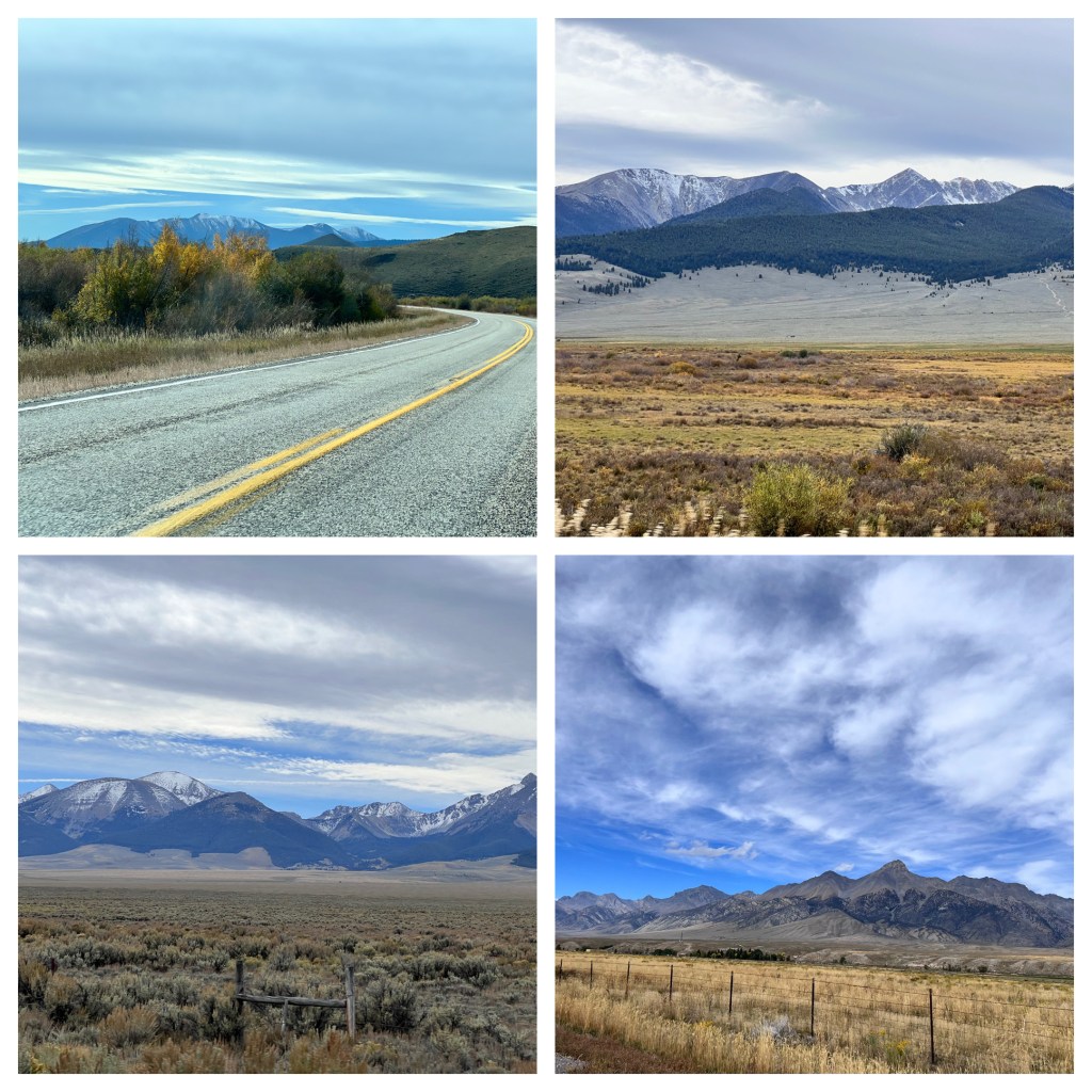
Driving the Sacajawea Scenic Byway
Forest Service ranger stations are frequent in this state; we stopped at two of them to chat and pick up localized information about places to visit. At one of them, the employee had a son living in Fairmont MN and the other person looking for information was originally from Aurora MN. Unlike us, that guy was actually going to fish and camp.
At a park in Arco we had our picnic lunch. Arco’s claim to fame is that on July 17, 1955, the town was the first in the free world to be powered by energy from nuclear power. The Nuclear Reactor Testing Station located in the desert just south of Arco was the source of the power.

Chris had noticed there was supposed to be a mom and pop potato chip company located in Arco. On our first swing through town, which did not take long in a town of under 1,000 people, we could not find it. After lunch, we tried harder and came upon the Atomic Potato Chip Company. Yup, true name. We went in the building and met the owners-and sole employees. Of course, Chris got the back story about previous careers, second marriages, why they are in Arco, etc. The husband had worked in real estate in Pennsylvania, and actually knew of my law firm when I had worked in Harrisburg. Atomic Potato Chip Company had won an Idaho state innovation award and sells their product through stores. Sun Valley Resort is a big client of theirs. We went across the street to the local grocer, bought two bags, and are doing the taste test now.
An Airbnb in Mackey is our lodging. It advertises itself as a vintage style cottage. It has lots of cutesy stuff around, that’s my interpretation. It’s located on the back of a store which sells vintage clothing, housewares, and jewelry. The owner of the store also has the Airbnb. We looked around the store, but there was nothing that really met our needs enough to transport back to Minnesota. Chris, of course, had a delightful visit, chatting with the woman running the store for the owner. The store employee has moved here to be closer to her children, and she was tired of doing nothing so she runs the shop. In her spare time, she paints and makes jewelry, both of which are on sale in the store. The store owner takes bare-bones furniture, redecorating, and makes it available for sale.
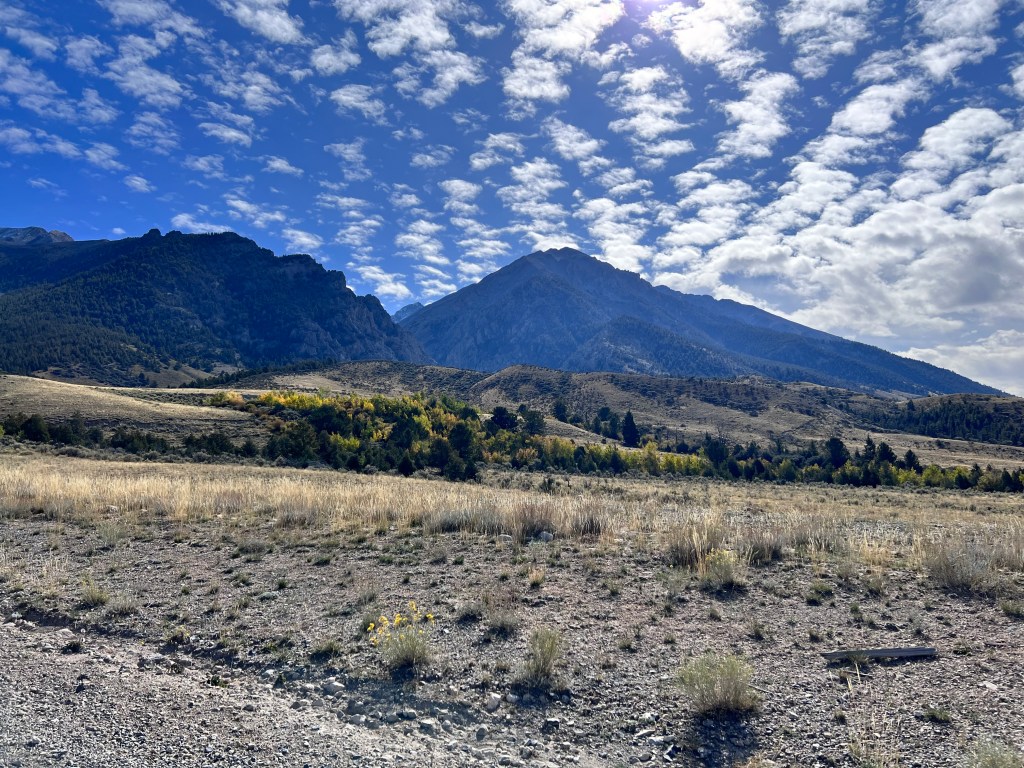
Mount Borah
Today, Thursday, we had Wheaties for breakfast. It was part of our food stash we have taken with us on this trip. After breakfast, we headed up north to get a closer view of Mt. Borah and the site of a 1983 earthquake. Evidently Mount Borah is quite climbable. Many people come to the area to reach the milestone of ascending to the summit of Idaho’s highest peak. On the way there, we passed the Mackay Reservoir. They must be having dry times because this reservoir is way down.
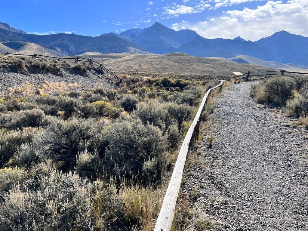
A view of the earthquake scar from 1983
Of even more interest was the October 28, 1983 earthquake that hit this area. The earthquake measured 7.3 on the Richter scale. While the area was sparsely populated, the earthquake still caused over $12 million in damage. An area 21 miles long opened up and separated the mountain peaks from the valley. It is estimated that the mountain peaks increased in height about 1 foot while the valley area dropped over 7 feet. We were able to stand at a portion of this scar and gaze along a line where the height differential is still visible.
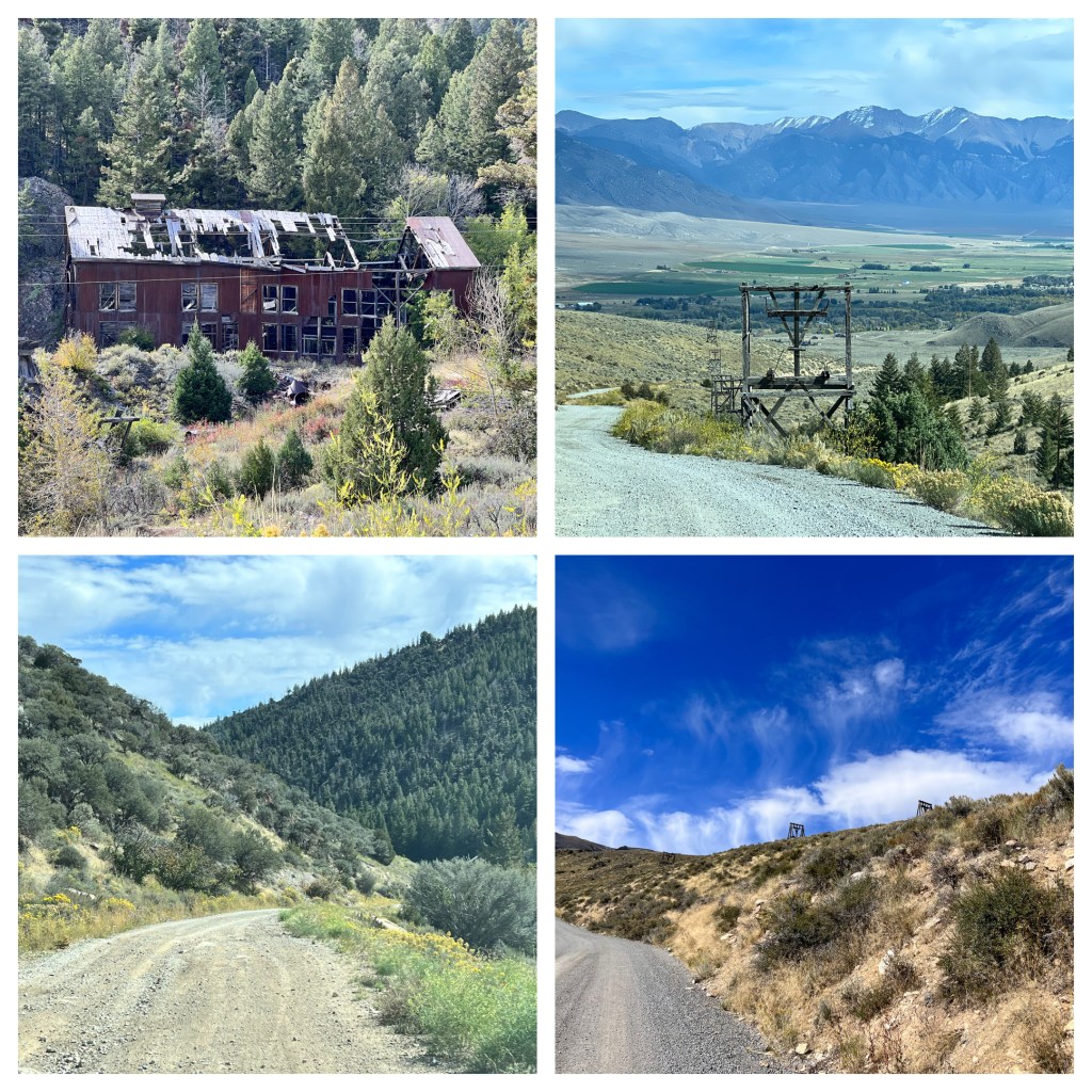
Mackay Mines
Returning to our lodging, we had lunch and then headed out in the afternoon to visit the Mackay Mine Hill. In operation from about 1900 to 1950, the mines in the Mackay area produced gold, silver, lead, zinc, and copper. The Mackay mines produced more copper than anywhere else in Idaho. We saw one of the dilapidated mine buildings and the remaining towers for the aerial tram that transported ore down to the smelters and supplies up to the mines. Visiting the Mackay mines was a challenge for a car, the initial portion of the gravel road not too bad, but then it became more rutted. The mine tour is actually heavily advertised as perfect for an ATV/OHV outing. We did not drive all the way to the end of the road.

Encountering a small cattle drive on the mountain pass

Driving past Mud Lake Canyon over Pass Summit
Instead, we turned around and then drove another gravel road. We were looking for a pleasant hike the Forest Service office had told us about. We never found it. Instead, we went through a ranching area, with both free range cattle and a small cattle drive complete with guys on horseback, through a narrow mountain canyon, to discover on the other side of the mountains a beautiful valley.
We had our fill of gravel roads and decided to simply return to our lodging and pack up for our departure tomorrow to Twin Falls, Idaho and several national park units.
Oh, the Lost River name? It has its name because it begins in the mountain ranges here, goes south towards the Snake River, but before reaching the Snake River goes through a high desert area where the surface of the land is porous. The river water goes underground into the aquifer. The water either travels underground for 100 miles before emerging at Thousand Springs State Parks near Hagerman or is captured by pumps and used for irrigation.

The valley on the other side of Pass Creek Summit after Mud Lake Canyon.
Ed and Chris, Mackay ID Sept. 28

Recent Comments