
Kill Devil Hills, N.C. April 20, Wednesday
People tease us about going on trips so detailed that we need an Excel spreadsheet to list all the information. Yes, we always rejoinder, but we improvise when appropriate. Today and tomorrow will be an example of a reasonable improvisation. Today’s schedule had to be adjusted in order to accommodate tomorrow’s major change. Originally we were going to drive the Outer Banks Scenic Byway on Thursday. This encompasses Cape Hatteras National Seashore. Completing the byway would require two ferry rides, one of over half an hour and one of over 2 1/2 hours.
The weather has been cold and windy and for two days the ferries were completely canceled. While Thursday’s weather appears better, we decided to be cautious and skipped the ferry rides. Instead, we will drive overland to our next stop. It’s not that riding a ferry is worrisome or new. We have ridden very large ferries over Lake Michigan and Vancouver Sound. We have ridden very small ferries, almost extended pontoon boats, across Bull Shoals Lake in Arkansas and the Mississippi River between Missouri and Illinois.
In order to be able to avoid the ferries, we had to add additional activity today to see Cape Hatteras National Seashore. The change would make for a busy day. Our first stop was the Wright Brothers National Memorial in Kill Devil Hills North Carolina. It was an hour and a half drive from the hotel in Norfolk. Upon arrival, we found an NPS site with a line of cars waiting to enter and a full parking lot. It was a surprising change from most of our previous sites which had been lightly attended.
On December 17, 1903, Orville and Wilbur Wright made man’s first heavier than air powered flight. The Wright brothers are from Dayton Ohio, and we have seen the National Park Service site there previously. They came to Kill Devil Hills because of its flat land, frequent steady winds, and tree less spaces. The Wright Brothers put years of study, practice, and research into glider flight, airplane material, studies of birds in flight, and aerodynamics. It was only through all of that work that success was possible. They would return to Dayton in between testing here.

The hill here allowed for the testing of the glider flights. Research with gliders was then incorporated into airplane design. The flat land below was where the first flights occurred.

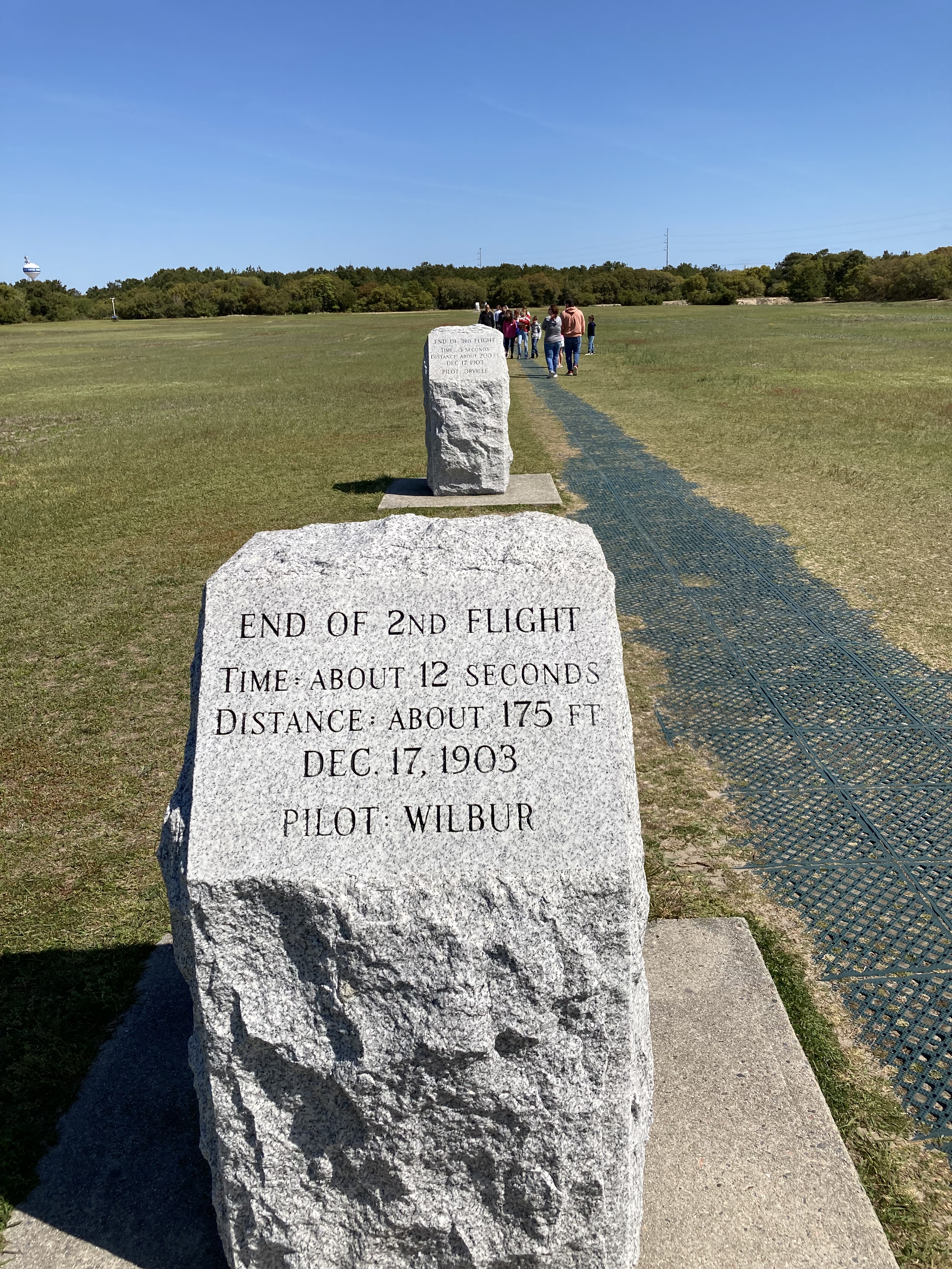

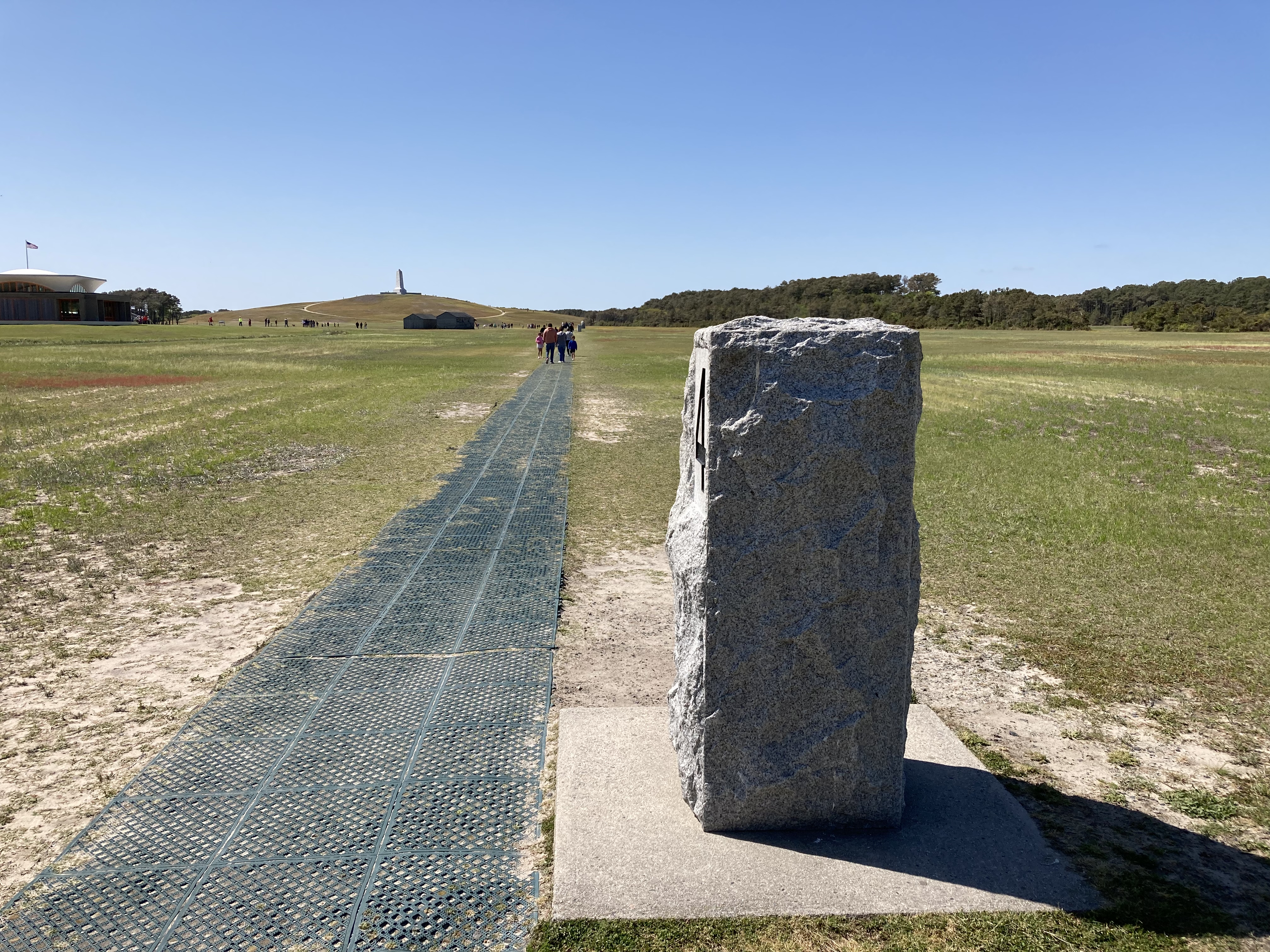

Flights 1, 2, 3, and 4 markers and the boulder marking the take-off point
The first four flights on December 17 were modest. Each brother flew two flights. The first flight lasted 12 seconds and went 120 feet. The second flight lasted 12 seconds and went 175 feet. The third flight lasted 15 seconds and went two hundred feet. The fourth flight went for 59 seconds and 852 feet. There was no fifth flight because the plane crashed after flight number four and would have to be rebuilt. But the effort was successful and they would go on to achieve even greater results.
Leaving flight behind, we went to a site of travel by 16th century sailing ship. The French and the Spanish were active explorers in North America with the Spanish settlement of St. Augustine being the first permanent settlement in North America. The first English attempted settlement was not at Jamestown or Plymouth, but here on Roanoke Island in North Carolina. Now called the ”Lost Colony”, it was funded by Sir Walter Raleigh and in 1587 it was a settlement of over 100 men, women and children.
Why is it called the Lost Colony? Well, a re-supply ship was to return the following year, 1588. Due to the increasing war between England and Spain, no English ships could be spared for a return trip. It was not until the year 1590 that a return ship came back. No settlers were to be found anywhere. Archaeological searches have found no definitive proof of where the 100 settlers went or what happened to them.
Several theories exist, of course. Were the initial English settlers killed by the native American Indians? This theory has credence because while the very first exploratory (non-settlement) visit here by English ships was amicable, serious problems had later arisen. European diseases had already killed 20% of the local population, lack of food due to a drought meant less sharing, and English militaristic efforts killed numerous Indians. Did the settlers try to go west where there were supposed to be a large group of Indians that were friendly? Did they try to go south to Hatteras Island since there was a carving on a tree indicating that?

There is no definitive proof. There is anecdotal evidence and comments passed down from several descendants of American Indian tribes that were in the area at the time. The Lost Colony remains a mystery and continues to fuel a summer stock theater production held here every year. The story of the Lost Colony of Virginia is related through a movie, exhibit, and an excellent presentation by a park ranger. And while this is called the Lost Colony of Virginia, it is in North Carolina. The original colonial charter gave huge swaths of land to Virginia but North and South Carolina developed separately and later amicably set up their own provinces and then states.
Your knowledge of the Lost Colony history probably varies on your part of the country and your teachers. The first English child, Virginia Dare, was born here shortly after the settlement began. We know this because the leader of the colony, her grandfather, was the person who returned to England for supplies. When the return ship arrived three years later and found no one and no evidence, he and the ship went back to England. His written narrative provides much of the detail of the story of the Lost Colony and Virginia Dare. It was not until 1607 that the English attempted another settlement, this one at Jamestown. Thus, Virginia Dare became a symbol taught to white Americans about the difficulties encountered by brave settlers. History books could have emphasized the initial amicable relations between the two countries and how it was destroyed.
Across the street from the Lost Colony was a regional visitor center for national wildlife refuges. It had excellent videos and information detailing the numerous refuges along the North Carolina coast. We discovered that North Carolina has a thriving population of black bears along the coast, particularly in Alligator River NWR just across the sound from Roanoke Island. It was a surprise to us.
By now it was early afternoon and time for a late lunch. We tried Carolina Bar-B-Que in Manteo. Now, after that lunch, we know Carolina barbecue is vinegar based. Not my favorite, I prefer a sweeter version. The restaurant owner told us and all how difficult it is to get help. He was short two people that day and had heavier than normal business. We did not mind waiting, the food was good despite the vinegar base. We have noticed numerous variations for dealing with fewer staff: only open part of the restaurant, only take orders online or from automated kiosks, have take-out only, make the customer wait a long time, etc. We are more tolerant of lapses that might have raised our ire in earlier days. And there do seem to be more lapses everywhere.

We were able to check in early for our airbnb and after unpacking, drove along Cape Hatteras National Seashore and the Outer Banks Scenic Byway. We stopped at Bodie Island Lighthouse. The lighthouse is not open for tours or climbing but there is a very nice boardwalk overlooking the sound. The NPS summer seasonal rangers there were just finishing up their pre-season training and the visitor center was open longer hours than advertised. Lucky for us as we might not have arrived before closing time otherwise.
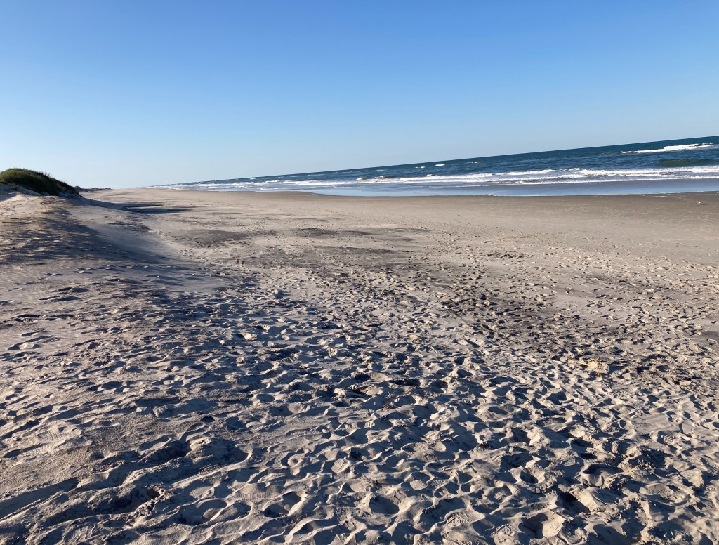
We continued driving south on the Outer Banks Scenic Byway to Pea Island National Wildlife Refuge. Daylight savings time and warmer temperatures made for a pleasant early evening walk along the dunes and a boardwalk going to the sound side of Hatteras Island. We finally saw our first turtles, it had been too cold before this. It was a pleasant walk listening to waves and bird calls.
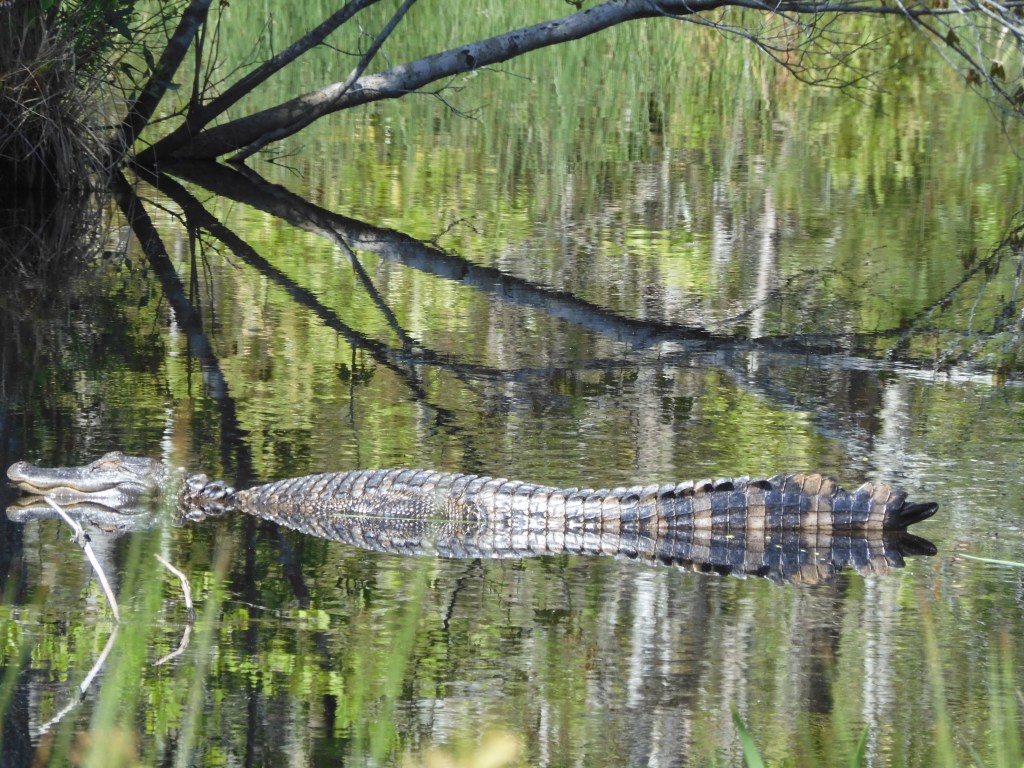
Today, Thursday the 21st, we went looking for bears but found alligators instead. Intellectually I had read that alligators can be found as far north as North Carolina but it had not really sunk in. Even knowing that this wildlife refuge has a name of Alligator River was not ringing any bells. After all, there are many rivers and cities that use the name buffalo but do not have buffalo anywhere nearby. The wildlife refuge docent talked a lot about the black bears and that was what we were hoping to see. Two birders we came across during the wildlife loop drive had seen three that morning.

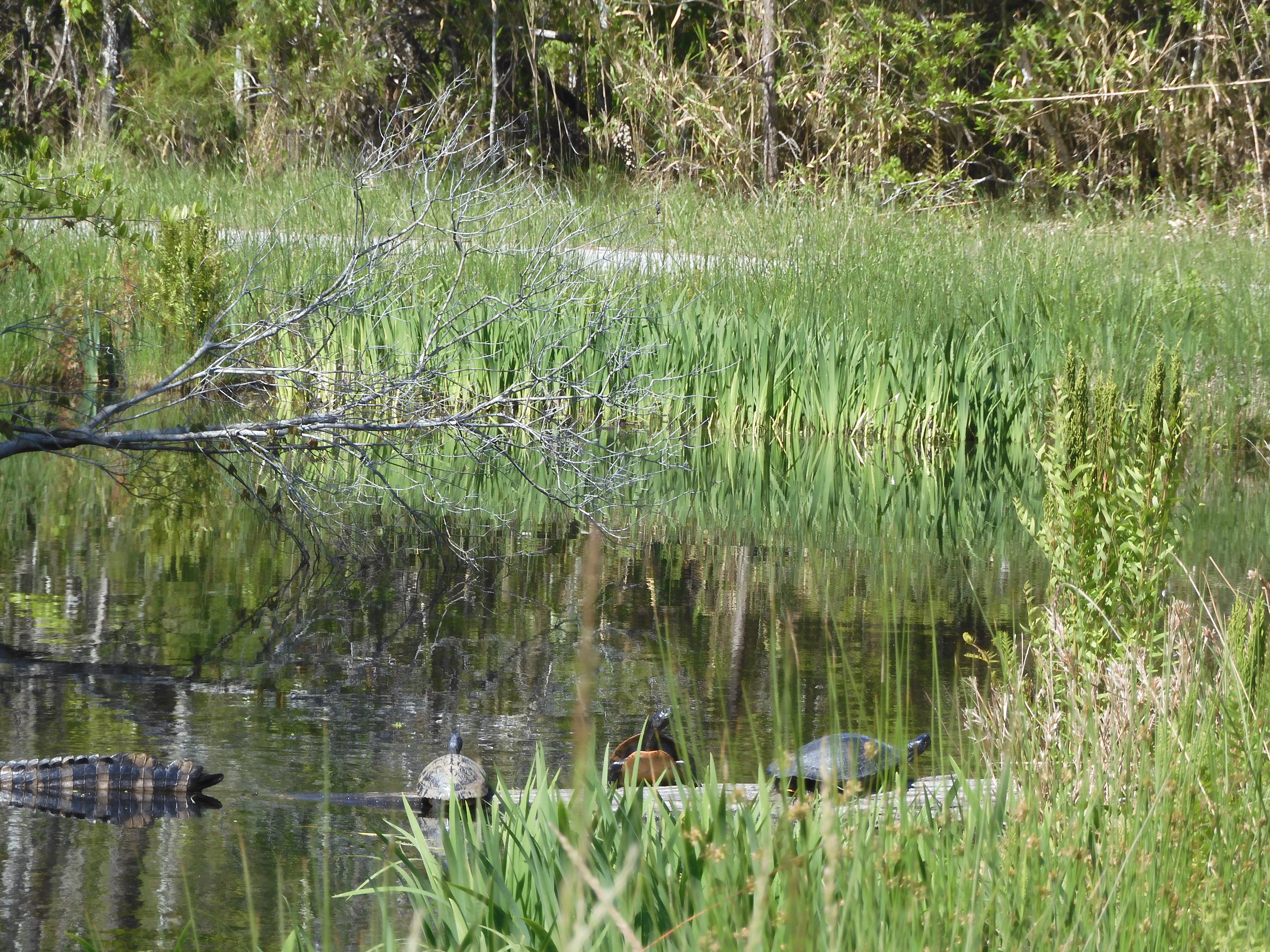
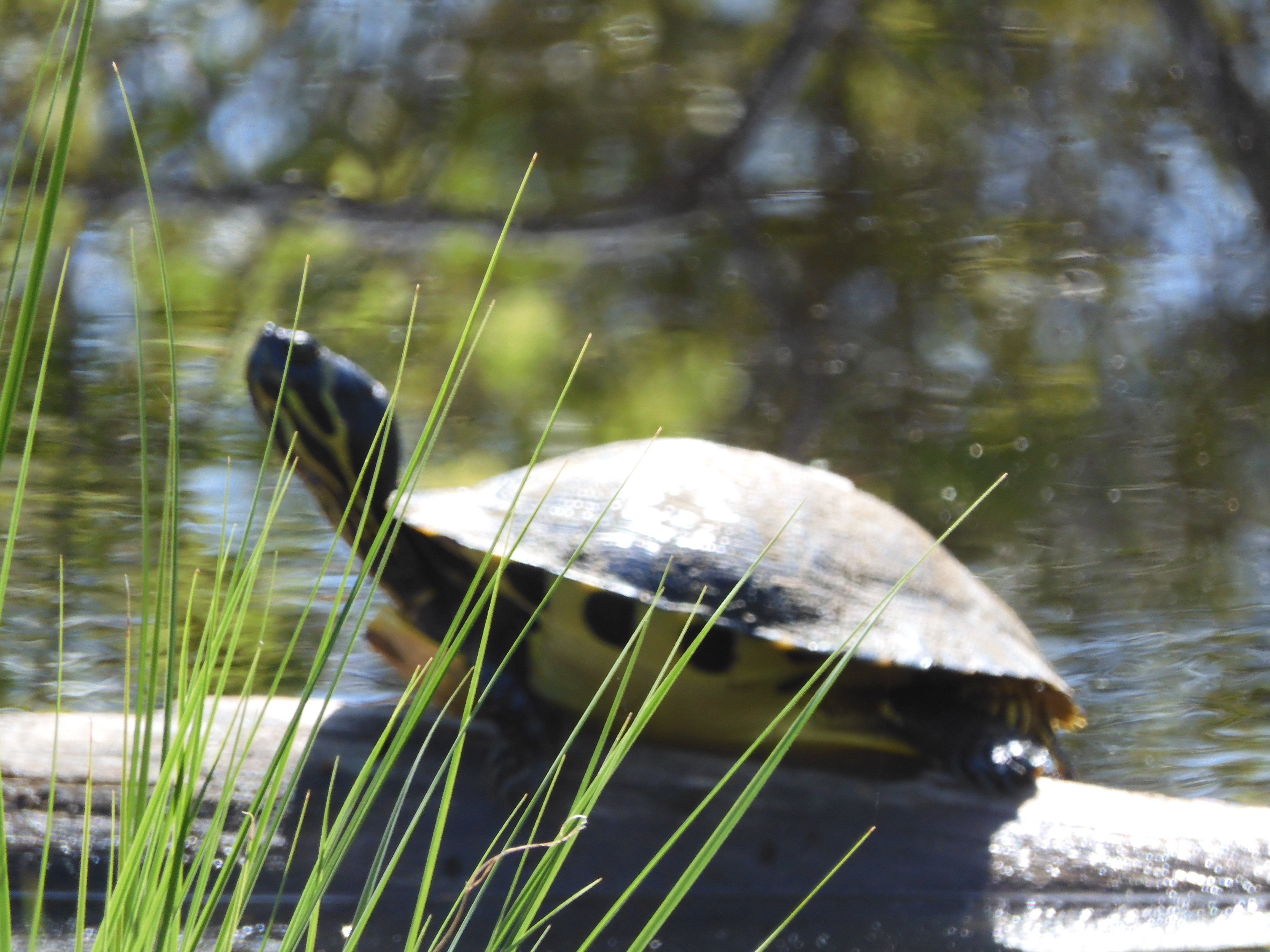

Alligator River NWR is huge at over 150,000 acres. Obviously the bears knew we were visiting and decided to stay away. The alligators surprised us, just laying in the road side ditch. They must not have been hungry because nearby were many turtles sunning themselves.

After two hours in the refuge, we drove 3.5 hours to Harkness Island Visitor Center to Cape Lookout National Seashore. We made a brief stop at Pocosin Lakes National Wildlife Refuge-another well done visitor center and combined with a local tourist office. We had our first outdoor picnic lunch today along the way to Harkness Island. Chris was finally able to remove her fleece jacket.
We made it to the Cape Lookout Visitor Center in time to view their film. Cape Lookout is at the corner point of the seashore which is in the shape of an ”L”. This shape results in differing erosive action from waves and wind upon the dunes which are NE to SW versus the dunes which are NW to SE. There is a lighthouse at the point. While Cape Hatteras area has had over 600 ship wrecks, Cape Lookout has had over 200. More than enough to justify a lighthouse. The Cape Lookout lighthouse stands 163 feet high.
Unlike Cape Hatteras and Assateague Island, there are no bridges to Cape Lookout. One must take a ferry and stay on the island/dunes until a return ferry departs. We were too late to make it out and back today. We decided just to walk the park property on the shore. We have been to lighthouses and seashores before and there was not a unique reason to make a special trip out to the barrier island and dunes.

Indeed, after the walk the weather was still so pleasant we just sat on the rocking chairs outside of the visitor center and watched the waves and the birds. Wrong direction for a sunset but the lighthouse was visible in the distance.
Tonight is another Hampton Inn and dinner at a local Mexican restaurant just across the parking lot.

Ed and Chris, Havelock NC April 21, Thursday
National Park Service sites visited to date: 306

Recent Comments