
Sunday, November 23, Twentynine Palms, CA
Hello from Joshua Tree National Park
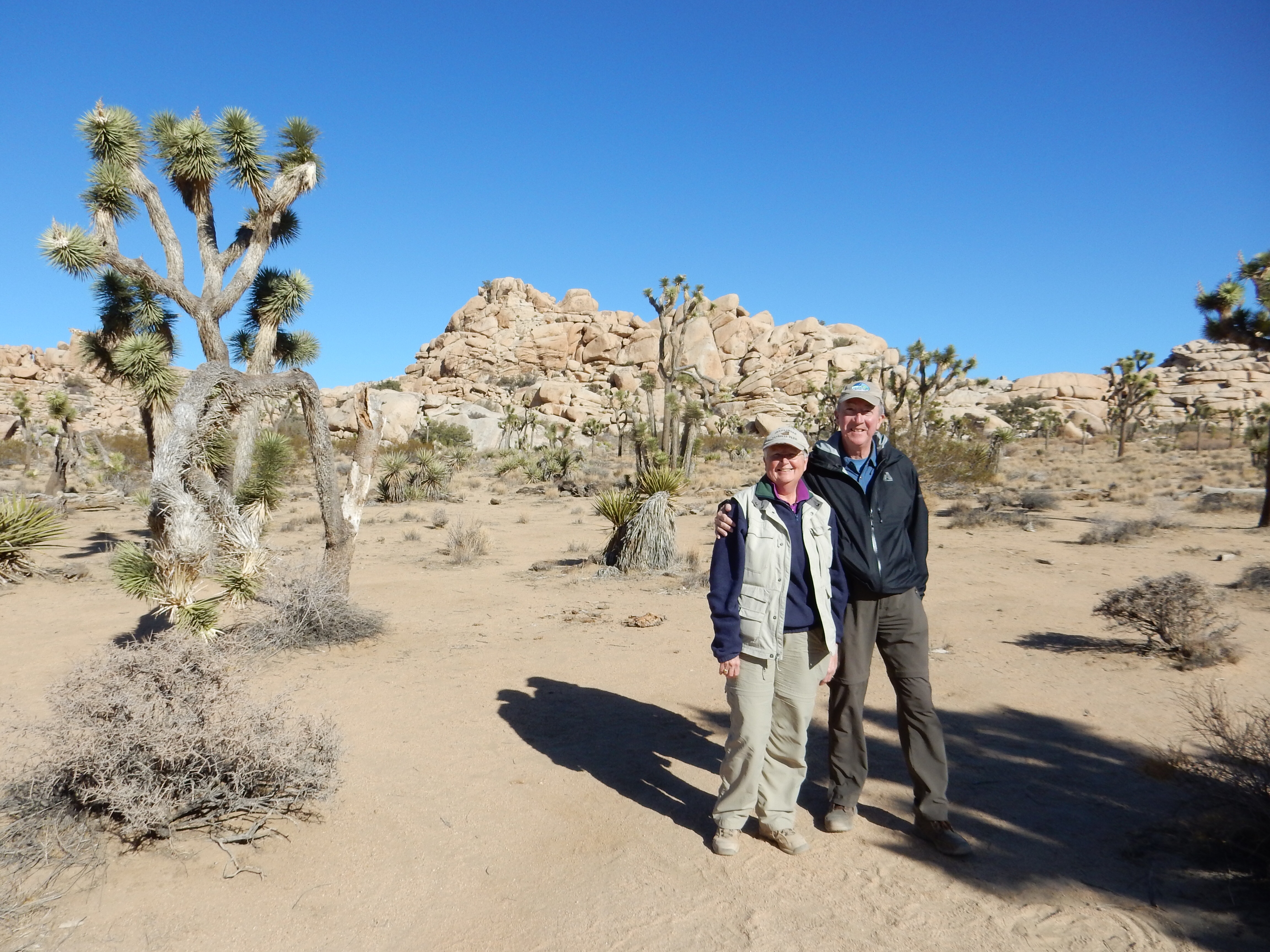
After breakfast and church, we spent the rest of the day hiking in Joshua Tree National Park, ending the day chasing the sunset as we hurried along the last hike to make sure we were out before dark. We did have a flashlight and we made it okay, although Chris stopped to talk to two young women as we were close to the end of the trail. They were just heading out for a quick walk on the second half of the trail and she offered them our flashlight. But they were prepared also; prepared with a flashlight and prepared to good-naturedly accept a mom’s advice to be careful on the trail.

The Oasis of Mara at Joshua Tree National Park
The first hike was a short one; out to see the Oasis of Mara. The oasis was an important stop of The Butterfield Overland Mail route. This route was the first mail by stage from Memphis and St. Louis to San Francisco and began in 1858. (It also passed through the Anza-Borrego desert.) It was longer than a route through Denver and Salt Lake City but was pretty much snow free. The oasis has several fan palm trees; Joshua Tree NP has five such oases for these trees, the only palm trees native to the U.S. (Reality check-population growth in the area has lowered the aquifer at the oasis and the Park Service now pumps in water to keep the oasis thriving.)

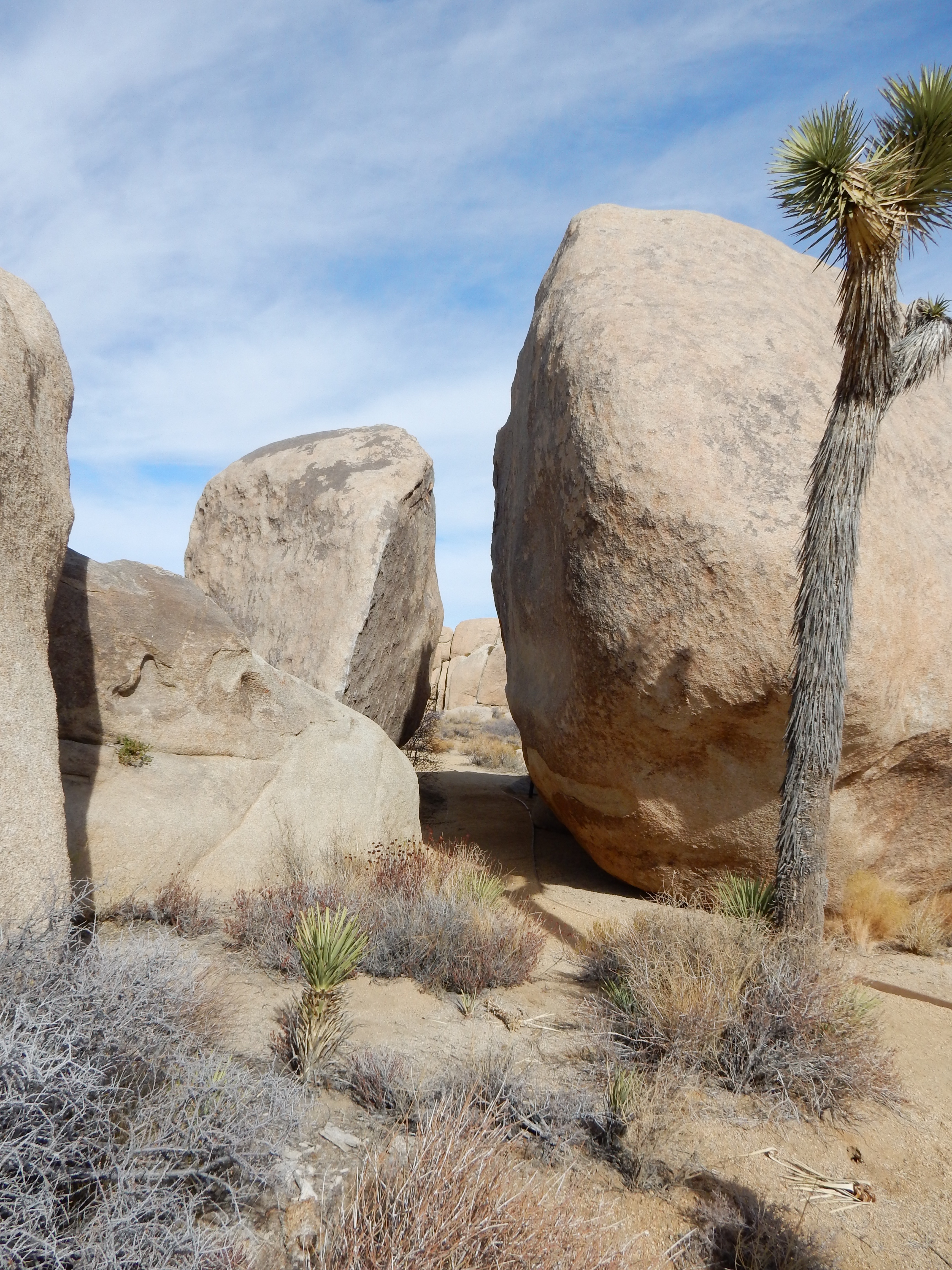
There is a little bit of water behind the Barker Dam

area along the Barker Dam hike
Barker Dam was our second hike. A dam had been constructed here around 1900. We hiked out and there was a little water in the pond; like Lake Mead or Lake Powell, one could observe the rings on the rocks around the pond indicating how high the water had been previously. The trail goes through the rock formations and across open land with yuccas and Joshua trees. Towards the end of the trail are petroglyphs. However, these were painted over by a Disney crew years ago to make them more visible for the film that was shot here. At least I know I am not the only one who has trouble to get petroglyphs to be visible in pictures.

Hidden Valley at Joshua Tree National Park

Hidden Valley
Hidden Valley was next. Hidden Valley was another of those areas supposedly beloved by cattle rustlers. It was evident why it might have been. The valley is not reachable except for one opening and it has a water source. The rock walls are high around the valley and provide natural visual obstruction from prying eyes. Trees and shrubs magically seem to grow in the middle of the rocks, finding some little bit of dirt to bury their roots in.
We headed back to Cap Rock in a vain attempt to find a “shrine”. In preparing yesterday’s post, I came across an item that a “shrine” to Graham Parsons, a singer who died of a drug overdose in 1973 at a motel in the town of Joshua Tree, was located on the north side of Cap Rock. A friend and road manager stole the body and cremated it near Cap Rock in the park. We did not see anything like that on our hike yesterday and on our return visit today, we still did not find it. We even checked out two other nearby rock formations. Nada. Not a problem, I had never heard of Graham Parsons prior to yesterday anyway.

Skull Rock
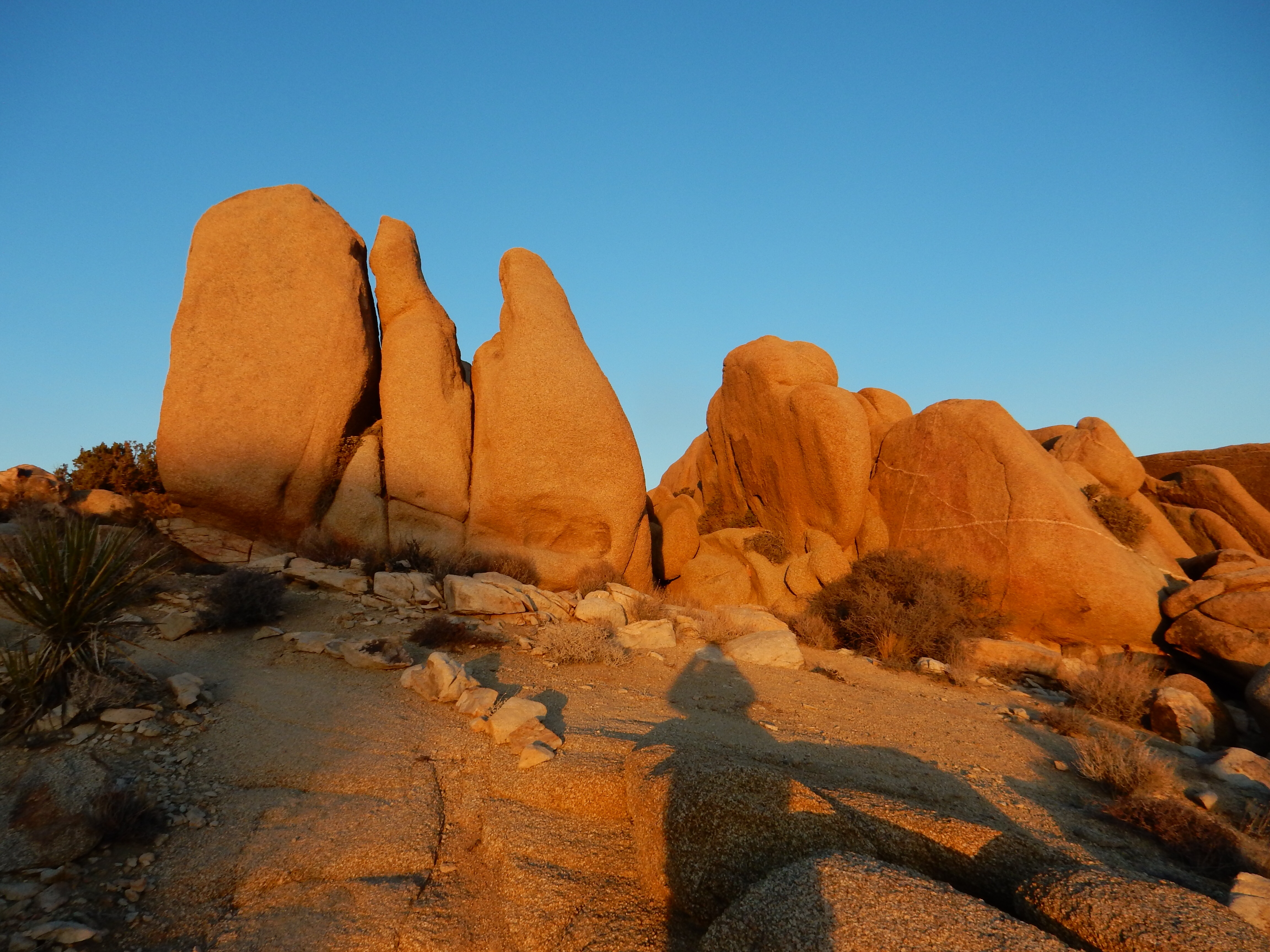
Skull rock hike
Our last hike was Skull Rock. (You need a vivid imagination to consider this rock formation a skull.) We started the hike at 3:30 which should be plenty of time to finish a two-mile hike by sunset. But, rocks and enjoying the vistas took us up to 4:20 to finish the hike. We did wait for the sun to finish setting before we headed back to the motel.
Dinner was at a small mom and pop type restaurant with cheap, comfort food that was quite tasty and met our needs.
Ed and Chris 11/23 9 PM


Recent Comments