
Fort Benton, Montana August 30

A stuffed bison. So what? Read on.
It was pure serendipity. Five minutes after we walked in to the Blaine County Museum in Chinook MT, National Park Service Ranger Austin walked in. We had pretty much decided we were not going to drive down the 19 miles to the Bear Paw Battlefield and stand in an open field in 95° weather. The Blaine County Museum was supposed to have an exhibit about the Bear Paw battlefield. We thought we might settle for that.
The Bear Paw battlefield was the ending location of the Nez Perce trail. This is the 1170 mile trail followed by the Nez Perce (Nee-Me-Poo in their language) tribe. They tried to make their way from the Oregon/Idaho border to Canada and safety from the US Army. It is a long story, but in essence, the Nez Perce treaty of 1855 guaranteed them a 5000 mi.² reservation. Then gold was discovered and the US cut their reservation land by 90%. Some of the Nez Perce refused to move to the new, reduced reservation area within the 30 days mandated by the US Army. This began the 1170 mile journey with constant battles between the Nez Perce and the US Army.
Then we lucked upon Ranger Austin, who gave us a personal interpretation of the battle and the history of the Nez Perce. Combined with a 20 minute excellent video in the museum, we probably got much more from this experience at the Blaine County Museum than we would have by going down to the battlefield.
This journey of the Nez Perce in 1877 is frequently remembered by a famous saying of Chief Joseph, who is not actually the major warrior chief for the group, but who surrendered the group at the end by saying: “From where the sun now stands, I will fight no more forever. “

The Blaine County Museum also had interesting displays on the development of the area into a ranching territory, as well as some of the geological precursors to the terrain that we see now. One interesting factoid was the creation of wheat houses. There are few building materials on these plains. Prepackaged lumber for small tarpaper shacks were sold to prospective homesteaders. The enterprising farmers would create bales of wheat, which they stacked around the shack for insulation and for protection from the wind. We had never heard of this before. Sod houses yes, wheat houses no.
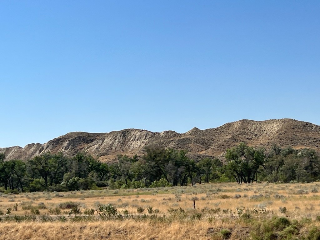
We left Chinook and continued our journey, heading for Fort Benton. Today’s travel surprise was six miles of empty railroad flat cars, the type that piggyback semi-trailers from coastal ports to inland locations. We passed Decision Point, the confluence of the Missouri and Marias Rivers. Lewis and Clark spent ten days here trying to decide which river was the true Missouri. The Marias was as muddy as the Missouri consistently had been. However, Lewis and Clark figured the Missouri must come from the mountains and that water would be cleaner. They chose the correct branch and continued the journey.
Fort Benton is a town of 1,500 and we are spending two nights here. The town proclaims itself as the Birthplace of Montana. Early traders, settlers, and miners came up the Missouri on steamboats. Fort Benton was as far as the river was navigable so they disembarked and took stage coaches, etc. to their final destination. The town continued to prosper until the railroads ended the days of river transportation for rail transportation.
But we are here due to several museums located here, a mini-museum city. We have an Airbnb close to downtown, the museums, and the river. We had sufficient time Tuesday afternoon to visit one museum and we chose The Museum of the Upper Missouri. It’s focus is on the early stages of the town’s development. The museum is right along the river and it was easy to visualize trappers and settlers coming up the Missouri and then taking various trails out to the Pacific Coast, to Canada for furs and liquor, to Helena for mining, or to St. Paul for supplies to sell. The usual tales of bad behavior and vigilante justice were displayed along the walls.
Our Airbnb is a whole house, our host has several properties and the person previously in our scheduled, smaller location wanted to extend a long rental so we got bumped. Can’t complain, this is much nicer. We wandered the downtown where a gift shop owner gave us meal recommendations and we chose the local VFW hall. Busy place and once again we had a tasty meal.
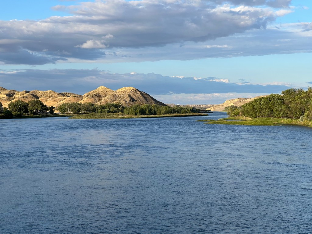
The Missouri River and the Breaks
Wednesday the weather was perfect. Sunny skies and temperatures in the 70s. So of course we spent most of the day inside museums, other than short walks to and from the museums. First off was the Missouri Breaks Interpretive Center of the Upper Missouri River Breaks National Monument operated by the U.S. Bureau of Land Management. Like us, you are probably asking: What are “breaks”? The Breaks are the rugged and remote valleys, badlands, and coulees that surround this section of the Upper Missouri. In 1976, a 149 mile stretch of the Missouri River through north central Montana was designated as wild and scenic. The Upper Missouri River Breaks National Monument was established in 2001 on both sides of the wild and scenic river although there are numerous privately owned parcels within this national monument.
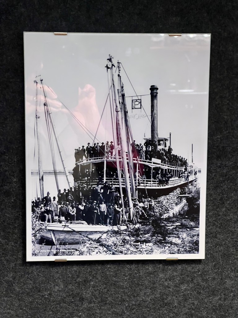
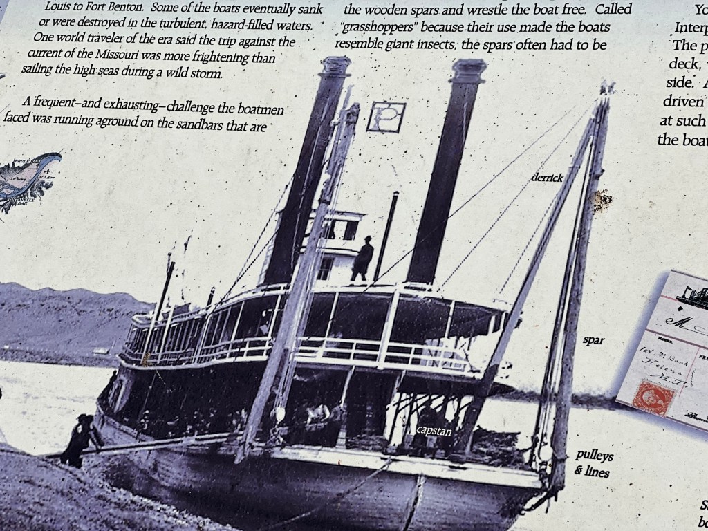

Inside the Interpretive Center, we watched a film, read about local wildlife, and listened to bird songs of the local area. Three particular items stood out. First, the rifle Chief Joseph handed over at Bear Paw Battlefield is on display. Second, the Fort Benton municipal water system was the first in the country to utilize ultraviolet light to disinfect their water supply. Third, we learned about grasshoppers. This was the term used for a series of ropes, pulleys, and tall wood spars on the front of the boat that were repeatedly driven into sandbars while the paddlewheels pushed forward; foot by foot the steamboat moved over the sandbar it had been stuck on.
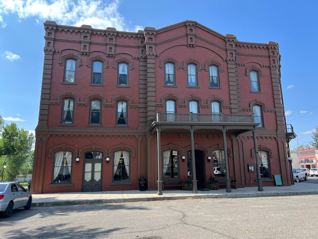
After the Interpretive Center, we had lunch at the Grand Union Hotel. Built in 1882 just prior to the economic collapse of the area due to the railroads, the hotel was a derelict for about 100 years. For the last 20 years it has regained its beauty and prominence.
During the afternoon we visited our last two museums. Old Fort Benton had been constructed for the fur trade era for about 30 years beginning in 1846. Furs for beaver hats were on the decline but buffalo skins were the new cash crop and there were plenty of those for a while. As the head of navigation for the Missouri River, the fort did a brisk business in the shipment of goods. Abandoned by 1877, the fort was purchased and restored.
In the old trading displays we discovered that blankets, like the famous Hudson’s Bay Company blankets, had clearly marked trading prices. 4.5 inch stripes were marked on the blanket with values from one to four. Each stripe was valued at one beaver pelt.


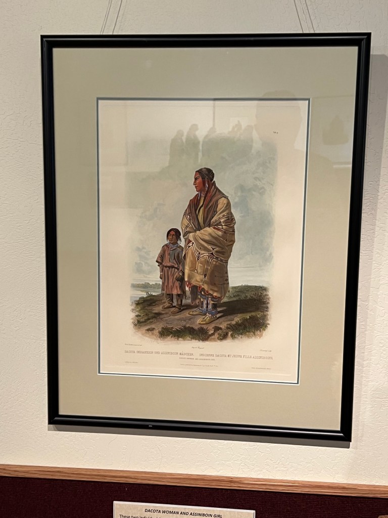
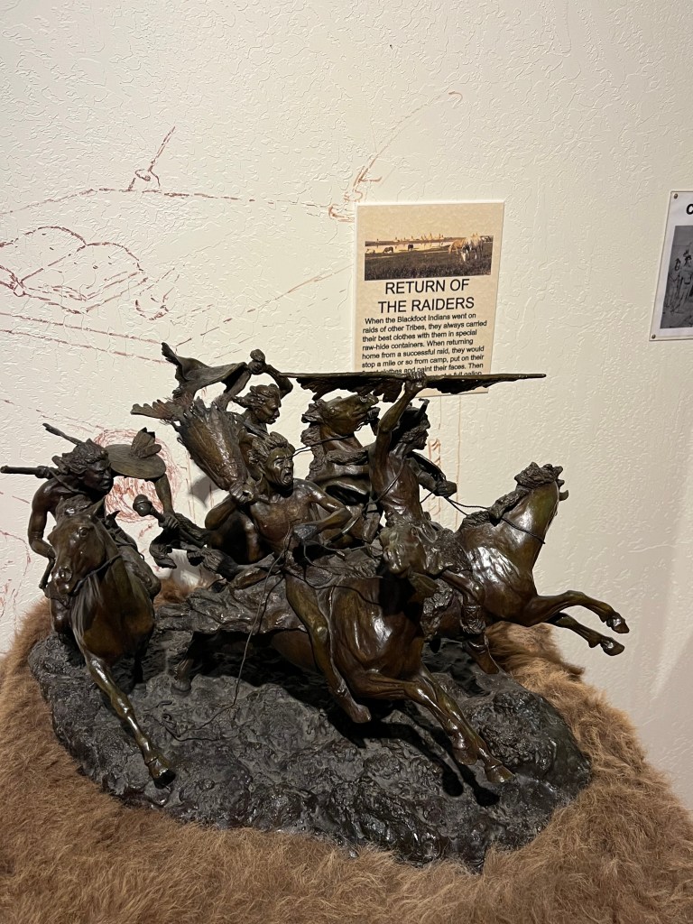
Another building was an art gallery. Remington bronzes and Charles Russell paintings were intermingled in the displays although the focus were bronze sculptures by the Blackfoot artist Robert Macfie Scriver and the paintings of Swiss artist Karl Bodmer.


The final museum was the Museum of the Great Northern Plains. (Other than the Missouri Breaks Center, the three museums are all operated by volunteers without government assistance for operations.) This museum’s focus is to document the last 100 plus years of life on Montana’s plains. Farming, ranching and small town life are on display.
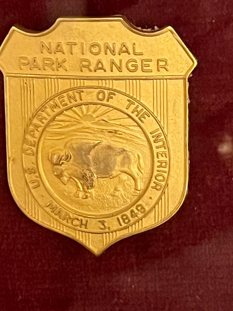
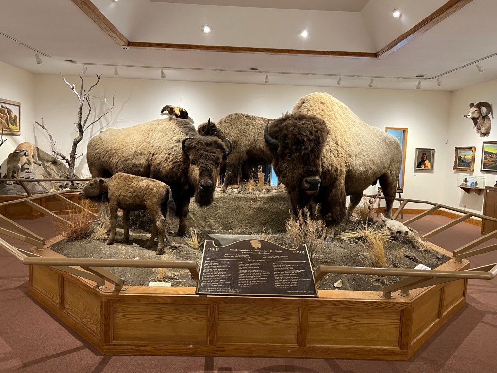
Two items were notable here. First was the Hornaday Bison. This is a group of six bison hunted in 1866 and on display at the Smithsonian for 70 years and then put in storage. They were rediscovered and restored and put on display here in Fort Benton, the last and most successful buffalo robe trading post along the upper Missouri. The bull in the display inspired the Great Seal of the Department of the Interior and the National Park Service badge bears his likeness.
The second item was a display critical of James J Hill, the founder of the Great Northern Railway. The display discussed the grandiose promises made to attract settlers along the path of Hill’s railway. The reality was flat, endless, windswept plains which had hot, dry summers and frigid winters.At its peak in 1912, 3.4 million acres were under cultivation. Less than 10 years later, in 1921, only 1.45 million acres were under cultivation. The land could not produce as the advertisements promised and 100,000 homesteaders had departed.

The day finished on a pleasant note. We walked over the old railroad bridge that is now solely for pedestrian use and got a very nice view of the river and the breaks. Dinner was at the second recommended restaurant and we drove up to a scenic overlook to try to get a view of the Supermoon rising. That effort was partially successful. We were just able to view the moon before it disappeared behind clouds for the night but the wind was so strong, holding the camera steady for an evening shot was challenging. The resulting photos were only so-so.
Ed and Chris, Fort Benton August 31


Recent Comments