
Spokane, WA July 11
We spent most of Thursday at and around the Grand Coulee dam in Washington state. The Grand Coulee dam is larger and produces more electricity than Hoover dam. Construction started in 1933 and took eight years to complete. The original main purpose of the dam was to provide irrigation for farming.

Initial view of Lake Roosevelt behind Grand Coulee Dam.
We left Spokane (without really exploring the city) and on our drive to the dam the agricultural fields were green and prosperous. We noticed this and commented positively on it. It wasn’t until we had the tour that we understood the impact of the dam; that the irrigation creates very fertile fields in what is otherwise a semi-arid, high desert area.

Grand Coulee Dam
This dam on the Columbia River was designed to maximize the amount of water that could be stored without backing water up into Canada. This backup water results in the creation of Lake Roosevelt, a major recreation area. It is 151 miles long. The Columbia River actually has its headwaters in British Columbia, close to where we will be staying in a month or so.
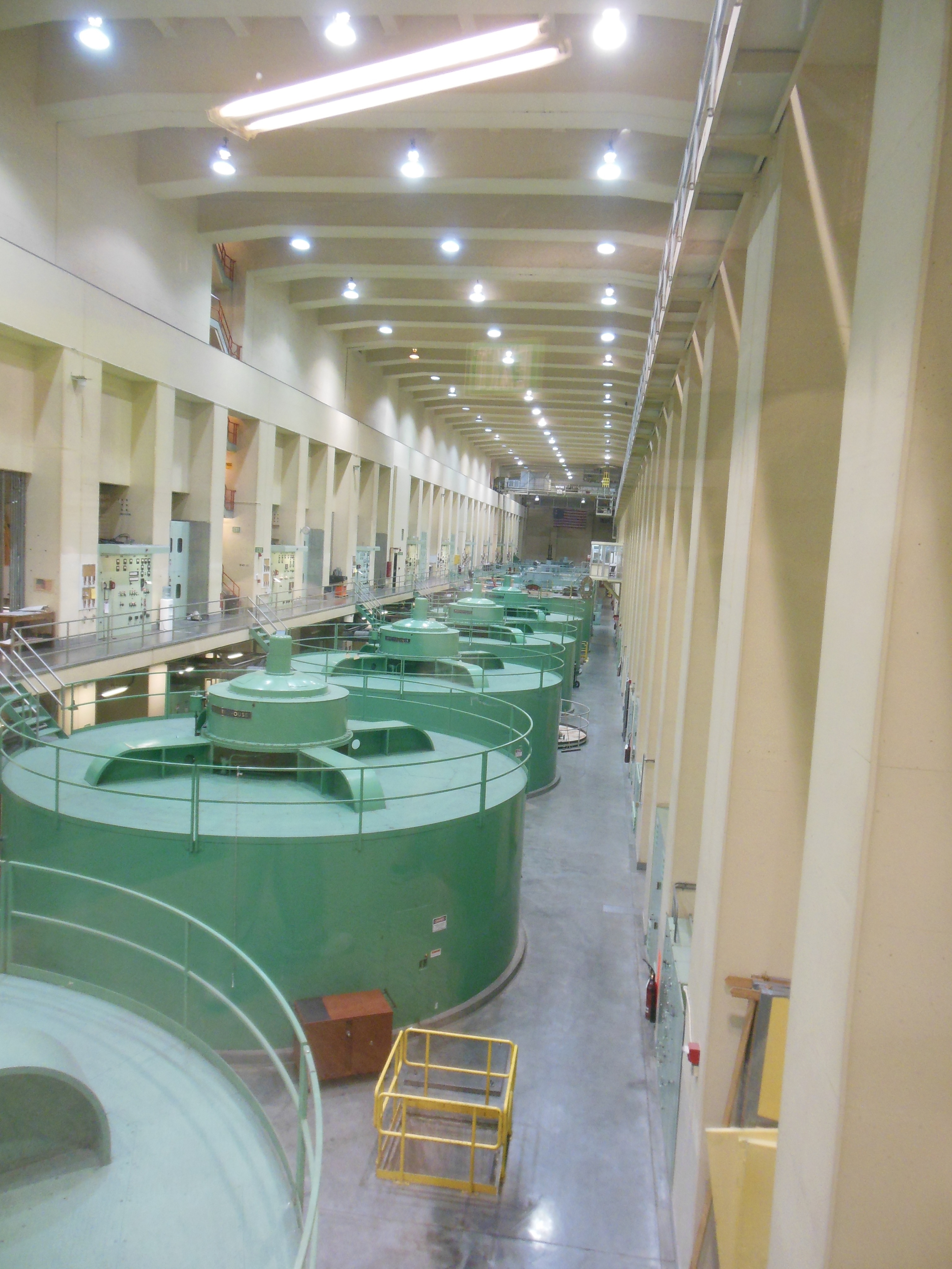
Power generating turbines
From Lake Roosevelt, the Bureau of reclamation pumps water into another lake for irrigation purposes. Banks Lake, as it is called, is another 26 miles long. This is the water that is sent into irrigation canals all over north east Washington state.

Looking down at the water going over the spillway
While the lake created by the dam is named for Franklin Roosevelt, the dam itself is named after a geological feature.
A coulee is a ravine. In this case, the Coulee was created by the multiple breakthroughs of ice from glaciers in Lake Missoula, Montana during the ice age period. The huge flows of water scoured out the Coulee, or ravine. In this case the ravine is quite large.
As always, numerous people were moved out of the 151 mile long area the new lake would create. American Indian tribes were also severely impacted. The tribes do receive some remuneration based on irrigation and power generated but no details as to its sufficiency were made known to us.
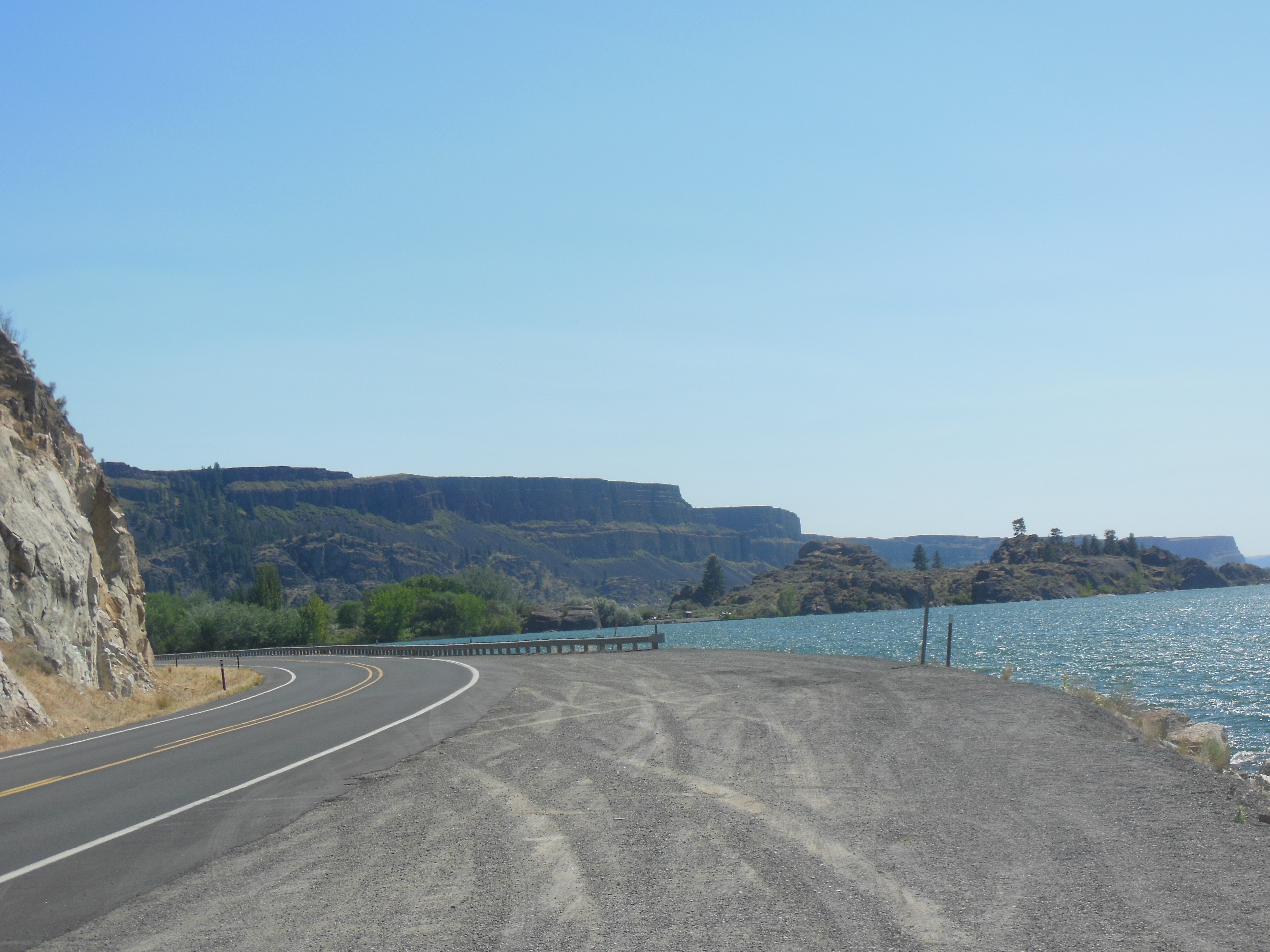
View of Banks Lake and coulee around edge
We were able to take a tour of the dam. 38 people are able to take a tour which is offered every hour on a first come, first served basis. The power produced here is some of the cheapest in the US and goes to areas in eleven western states.
We were able to see water rushing over the top of the spillway. Evidently, this is not common. Due to power generation, pumping for irrigation, snow melt and rainfall, most water is run through the power intake pipes or pumped into Banks Lake.
I am sure a detailed report on the building of the dam would bore you but suffice it to say that it was a massive project that had power struggles for decades before being built. It is an impressive sight.

Dry Falls
After the tour and time spent at the visitor center, we headed for Yakima, WA. On the way there, we also visited the Dry Falls state park. This is another major geological feature. At one time, a gazillion years ago, the falls here were larger than Niagara Falls. The cliffs which were carved by the Ice Age, are 400 feet high and over three miles wide. AND, the concession stand was still open and selling ice cream.
The final stretch of the drive brought us to the Cascade Mountains. The road, now mainly interstates, would rise and fall over 1,000 feet numerous times as we drove up and down the range foothills.
The next two days are in Mt. Ranier and we have been advised cell and internet coverage are normally unavailable.
Ed and Chris July 12 7 AM

Recent Comments