
We are still here. A famous saying now for Native Americans. Appropriate for today’s activities, the trip up to Gila Cliff Dwellings National Monument. Actually a more accurate term, or terms, would be up, down, around, repeat. The elevation at the actual cliff dwellings is not much higher than Silver City New Mexico. It is just that the road to reach the National Monument goes over and around numerous mountain ranges.
I am not sure who is responsible for the signage on the road. I imagine the State of New Mexico since one drives NM 15 to get there. The road had been recently resurfaced and line striping had not yet been completed. But my wonderment goes to two items. First, some times, but not all of the time, maybe not even most of the time, there is a road sign warning you of a very sharp curve or need for a lower speed. How the state determines which very sharp curves deserve a warning sign and others do not is beyond me. Second, there are frequent warning signs that the road is not snow plowed at night or on weekends. Now nights I understand. Dark and dangerous for the snow plow operator. Don’t want them plunging over the cliff. But other than overtime cost, why not weekends? Nobody goes to church here? I mean it is 25 miles with many homes and businesses. Oh well, not my problem.
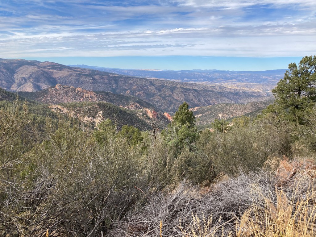
The drive to Gila Cliff is a scenic byway called ”Trail of the Mountain Spirits”. The road goes through the Gila National Forest and Wilderness. Forested hillsides show differing tree species at different elevations. Steep mountain cliffs and steep abysses alternate on either side of your car.

We drive over the Gila River which had more running water than the Rio Grande. Heck, even Cliff Dwellings creek had more water than the Rio Grande.
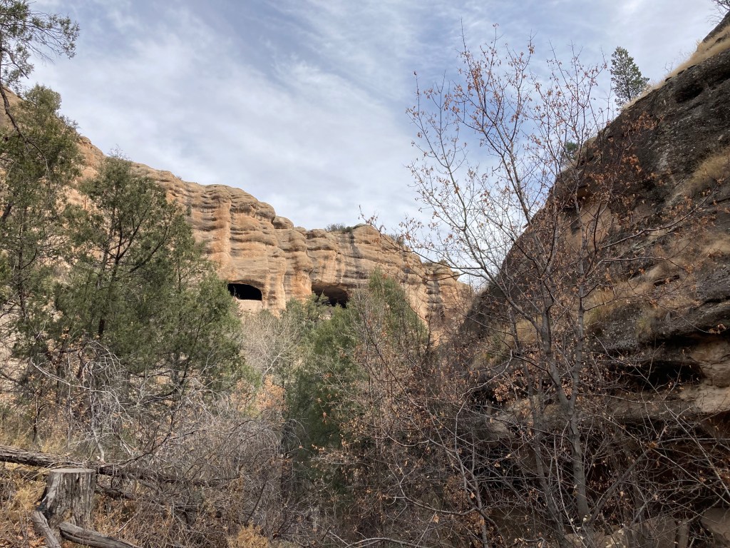
The hike to the actual cliff dwellings is only a mile loop trail. It is rocky with numerous steps, elevation gain of 200 feet. Got a little winded but quite a doable hike. This NPS site was busy for its small size. Half a dozen cars at the visitor center and maybe two dozen at the trailhead.

These cliff dwellings were only occupied for several decades, from about 1276 to about 1300. The year 1276 is carbon dated to the tree limbs used in the construction. This time period also correlates to a long period of drought in the Southwest. The springs, creek and river in the immediate area may have been able to produce enough moisture that this area was a haven for the Mogollon Puebloans who moved here.
The Chiricahua Apache lived in this area at least by the 1500s. Spanish explorers are not known to have reached as far as the cliff dwellings. It was not until prospecting in 1878 that settlers discovered the dwellings and looting of artifacts followed. The Apache were forcibly removed by 1886 and additional settlement occurred at that time in the valleys to the south and southeast of the dwellings. In 1907 the national monument was created to protect the remaining archaeological ruins.
The scenic byway took us back to Silver City by a new route. This route followed the Mimbres River, an area south and southeast of the cliff dwellers. It was occupied by a sub-group of the Mogollon called the Mimbres. They lived along the Mimbres River from 550 to 1140 C.E. predating the cliff dwellers. They are well known by a distinctive black and white pottery style.

One particular location along the Mimbres River has been studied since 1883. Our scenic byway took us to the site. Their museum was closed but visitors are still able to walk the site. Outdoor exhibits allow one to visualize how their villages would have appeared. They seem to have moved from the area by 1140 C.E.

We returned to Bear Mountain Lodge by 4 PM, a seven hour round trip day. Dinner was again at the lodge and was equally tasty as Saturday night.
Ed and Chris, Silver City NM November 21, 2021

Recent Comments