

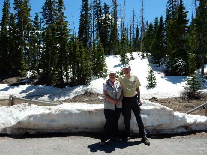
Brian Head UT, Friday June 11, 2011
Flagstaff had been the purpose of our trip, to visit with Lou and Joyce once again after the pandemic had begun to diminish. The trip home will take us eight days as we head north and then east. Our first day mainly retraced portions of the country we had seen before, except for one section in southern Utah. Despite this, we encountered some surprises and long periods of great scenery.
The first surprise came as we approached Page AZ. Horseshoe Bend, a well known bend in the Colorado River south of Page, seemed to have a new entrance facility. Long lines of cars were backed up to visit the site. The river is about 1,000 feet down and it takes a hike of over a mile to reach the observation overlook. My advice, go to Goosenecks State Park in Utah. Shorter walk, deeper canyon, more bends, fewer people.
Second surprise-Lake Powell is at a record low. Glen Canyon dam was finished in 1963 and by 1966 Lake Powell was in operation. Today the water level is at its lowest depth since 1966. The resolution of this issue of decreasing water supply and increasing water usage is beyond me. Come see Lake Powell while you can.

Our trip continued along US 89 through more desert country until we stopped in Kanab Utah for lunch at a local park. The park was very nice with great red rock backgrounds. It was only tonight in our hotel room that we did some research on Kanab. Kanab comes from the Paiute word meaning “place of the willows”. Kanab is very conservative and in the early 2000s faced much backlash from travelers about its stance on marriage and family practices.
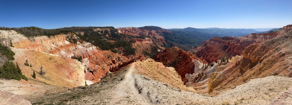
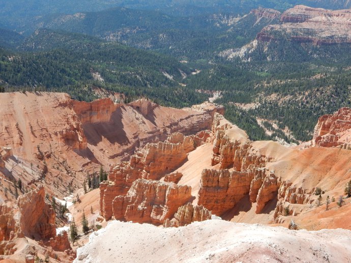
The primary destination for the day was Cedar Breaks National Monument. We were here once before and Chris loved the scenery. We decided to plan our return trip to include it. Cedar Breaks is at an elevation of over 10,000 feet and was constituted as a national monument in 1933. The monument preserves an area created over millions of year from limestone uplifted by a natural fault and eroded by ice, water, and wind. The scenery is spectacular and the monument is not crowded. Wildflowers are just beginning to come out in the prairie and along trails.


Hiking at 10,000 feet above sea level is not a primary activity for us but today we hiked the Alpine Pond trail. The trail is in the shape of a figure eight and due to the elevation (it starts out at 10,460 feet), we only hiked one of the loops. They classify the hike as easy to moderate and it probably is. But, still, with an elevation gain of 200 feet and rocky trails, we were tired when we completed it.

The Alpine Pond is one highlight. The water leaving the pond flows out to the Great Basin many miles to the west. Great Basin is a national park in east central Nevada that we have not visited yet. At Cedar Breaks, the forest is sub-alpine, with predominantly fir and spruce. The spruce trees have faced a major die-off from bark beetles starting back in the mid-1990s. It will take a long time for the forest to regenerate. There are some Bristlecone pines here, one of the longest living life forms on earth.

Not far from Cedar Breaks is Brian Head, the mountain and town. The mountain peak is at 11,300 feet. The town is basically a ski resort but it had the closest lodging to Cedar Breaks that made sense for us. We are staying at a very nice Best Western and ate at its sit down restaurant. There are not too many other eating options in town.
As I mentioned, a number of sites along today’s journey have been visited before. May 12, 2013 our first sighting of Bristlecone pine in CA. May 10-15 of 2014 when we spent a week house boating on Lake Powell. May 31-June 4, 2016 when we visited the North Rim of the Grand Canyon, Antelope Canyon, and Cedar Breaks. (Cedar Breaks still had snow on the ground at that visit.) May 31, 2018 when we stopped at Horseshoe Bend.
Tomorrow we head north and will be visiting more of Utah, Wyoming, Montana and North Dakota.
Ed Heimel, Chris Klejbuk Brian Head UT June 11, 2021
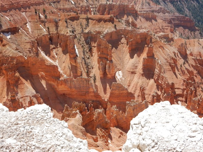 Cedar Breaks National Monument
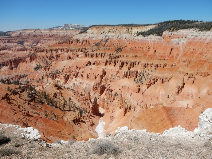

Recent Comments