travel

Our road trips around the U.S.

2016 Trip Eight, The Rockies, Oct. 5-6

Estes Park, CO Thursday, Oct. 6

Sprague Lake, Rocky Mountain National Park

Sprague Lake, Rocky Mountain National Park

A good time was had by all. Our five day sojourn in Estes Park and Rocky Mountain National Park ends as we check out tomorrow morning from Crags Lodge. We were fortunate; Trail Ridge Road has been closed both days so our journey early Tuesday was the best time to make sure we could complete the drive over the top of the mountains.

Towards the start of the Cub Lake Trail,  Rocky Mountain National Park

Towards the start of the Cub Lake Trail, Rocky Mountain National Park

Stellar jay and magpie along Cub Lake Trail

Stellar jay and magpie along Cub Lake Trail

Ed on the Cub Lake Trail at Rocky Mountain National Park

Ed on the Cub Lake Trail at Rocky Mountain National Park

Snow occurred early both Wednesday (high up in the mountains) and today (down here at Estes Park also) and impacted on our choice of activities. Wednesday Chris and I went out for a morning hike along the Cub Lake trail. The trail starts out along meadows and creek as it heads back toward the mountains. We only had two hours to hike so we only completed a portion of the entire trail. It is a popular trail. We encountered a group preparing a video on the meadow and the impact created on the meadow when wolves and other predators were eliminated from the park. We observed more stellar jays and magpies on this trail than we had elsewhere in the park.

Lily Lake at Rocky Mountain National Park

Lily Lake at Rocky Mountain National Park

Jude, Tony, Bernie and Ed at Lily Lake, Rocky Mountain National Park.

Jude, Tony, Bernie and Ed at Lily Lake, Rocky Mountain National Park.

Bernie and Tony went out for breakfast and shopping while Jude took care of some personal needs. We regrouped for lunch and then the five of us hiked around Lily Lake. The wind was slower, the sun was out, and the temperature reasonable. Lily Lake is across from the trailhead for the Twin Sisters peaks that Chris and I had attempted years ago. We agreed there was no way we could attempt that this year.

The Stanley Hotel, Estes Park CO

The Stanley Hotel, Estes Park CO

Late afternoon we toured the Stanley Hotel. The Stanley Hotel dates back to 1905. Twins F.E. Stanley and F.O. Stanley developed an early photographic process that they sold to Eastman Kodak and went on to also create and produce the Stanley Steamer Motor Carriage Company. The hotel grew out of the need for F.O. Stanley to gracefully die from tuberculosis. His doctor had little hope for him and recommended the Colorado air to ease his last days. Well, F.O.survived and many of the family friends and business acquaintances came from out East to visit them. From building a large enough place for them to stay for the summer developed the hotel.

The hotel has gone through rough times but its current owners have spent considerable sums to upgrade it and to allow it to attract clients year round. The tour discusses the history of the hotel and its tie-in to haunting. It is best known as the site for the inspiration for the book “The Shining” by Stephen King. King and his wife stayed here in 1974 during its run-down phase and that night was sufficient to provide the impetus for his novel. Portions of the hotel were also used for the movie “Dumb and Dumber”. The tour guide was happy to mention numerous paranormal experiences hotel guests have mentioned to staff. We finished up with an excellent dinner in the hotel dining room.

Starting our first time around Sprague Lake

Starting our first time around Sprague Lake

Second time around Sprague Lake, Rocky Mountain National Park

Second time around Sprague Lake, Rocky Mountain National Park

Today, Thursday, we woke up to the sound of rain and the sight of snow showers outside. We modified our hiking plans for the day. A morning hike to Sprague Lake seemed reasonable. It was flat, had a water view, and relatively short. We walked it twice, enjoying the falling snow the first time around and the slightly clearing skies the second time around.

After the hike, the adventure continued. This time we expanded our range and drove up to Cheyenne WY. Lunch was at the Albany Cafe. It has been in existence and owned by the same family for almost 75 years. Our waitress has been working there for 16 years. We could understand why it was still in business; the food (and desserts) were quite good.

A fancy saddle at the Nelson Museum of the West in Cheyenne WY

A fancy saddle at the Nelson Museum of the West in Cheyenne WY

Our afternoon exploration was at the Nelson Museum of the West. Founded by a local man, it focuses on numerous areas of western life. Nelson has been a major collector for years and most of the items here are from his collection. There are displays of western lawmen and outlaws, firearms, Native American art, saddles, military uniforms and stuffed animals from around the world. It was a pleasant diversion although not overwhelming.

Our evening was spent at the movies, viewing “Sully”. Crags Lodge was hosting a wedding this evening and festivities were likely to continue until 10 PM. Our rooms are directly underneath the party room so we thought it wise to make ourselves scarce during the main noise-making time.

Ed and Chris

Categories: road trip, travel | Tags: , , , , , , | Leave a comment

2016 Trip Eight, The Rockies, Oct. 4

Estes Park, CO. October 4, Tuesday

View along Trail Ridge Road

View along Trail Ridge Road

Trail Ridge Road (TRR) traverses Rocky Mountain National Park. It is US Highway 34. It is also stupendous. Today it was also windswept and snowy. TRR is only open from about June 1 to about Oct. 15, depending on weather conditions. We wanted to make sure we had an opportunity to drive it during our stay and before it was closed for the year. We knew the day would be windy; Estes Park weather conditions called for 20-25 mph winds and temperatures in the high 40s.

At the Alpine Visitor Center on Trail Ridge Road

At the Alpine Visitor Center on Trail Ridge Road

TRR goes from the city of Estes Park elevation of 7500 feet to 12,183 feet above sea level. Eleven miles of the road are above the tree line. The six of us (including Lacey) rode in the Subaru Legacy which was roomy enough for a journey of a few hours. The beginning of the journey was sunny but breezy. We soon encountered blowing snow and the road surface had a light covering of icy snow. It is always cooler and windier at the top. When we reached the Alpine Visitor Center at 11,796 feet, we do know the temperature was 19 degrees and could only guess that the wind was much stronger than what we experienced at Estes Park.

All six of us at the Alpine Visitor Center on Trail Ridge Road

All six of us at the Alpine Visitor Center on Trail Ridge Road

One view of the tundra environment

One view of the tundra environment

We were dressed for it but chose not to go on the walk at the visitor center which climbed higher still and which was completely exposed to the wind. Lacey enjoyed the snow and wind tremendously; the rest of us bundled up and alternated between enjoying the outside view and shopping at the visitor center. The views at the top were more limited due to the low cloud cover, snow, and blowing snow. The drive up and down offered more views as the clouds separated when we were at lower levels. There are not a lot of parking areas and there are no shoulders along the road. Later we found out that the road was closed at 3 PM today; evidently due to the weather and road conditions. I do not believe the road closing is for the rest of the year, guessing that it will be open again tomorrow.

Horseshoe Park, Rocky Mountain National Park

Horseshoe Park, Rocky Mountain National Park

On the way back down, we stopped at Hidden Valley to have a walk and a picnic lunch. The temperature had risen to 47 degrees and the wind was maybe half as strong as it had been at the top. After lunch we went to Alluvial Fan. This area also had elk herds visible but our reason for visiting was the fact that Alluvial Fan is the area where on July 15, 1982, a dam broke on Lawn Lake. Lawn Lake is a small lake up in the mountains that had been expanded in the early 1900s by a dam to act as a reservoir for the purpose of providing irrigation water to farmers in Loveland CO. Lack of repair and maintenance led to the failure. Three campers lost their lives and million of dollars of damage was done to businesses in Estes Park.

Ed and Chris walking on boulders at Alluvial Fan, Rocky Mountain National Park

Ed and Chris walking on boulders at Alluvial Fan, Rocky Mountain National Park

Alluvial Fan is the area below Lawn Lake where huge boulders settled over acres of land after being carried down the mountain by the flood waters. One can scramble over the boulders along the stream and walk along the wetlands below Alluvial Fan. There are aspen in the meadow area with a great view up into the mountains.

Looking downstream at Alluvial Fan

Looking downstream at Alluvial Fan

After Alluvial Fan we stopped in Estes Park for an afternoon snack of either a malt, pie, hot chocolate, or a smoothie. The owners of “Shakes Alive” are two brothers from the Champaign Illinois area who work dawn to dark for the six months from May 1 to Oct. 31 and then spend the next six months in the Caribbean recuperating. We did not get the story for the “You Need Pie” shop but the apple strawberry pie was excellent.

Relaxation time filled the last two hours of the afternoon before we headed back to Moraine Park Discovery Center for the 6 PM ranger talk on “Elk Echoes”. The ranger gave an excellent presentation (outside-we dressed warmly) about the habits of the elk. She provided interesting tidbits about the rutting season and the various bugle calls and behavior patterns used by bulls and cows. Just a few pointers:
Bigger is better-the bigger the bull elk’s rack of antlers, the more the cows are impressed.
The elk antlers are grown each year, dropping off in April and then growing until the October rutting season.
Elk antlers can grow at a rate of one inch per day.
The bull elk spend the spring and summer in the forest alone eating and resting to focus on growing their antlers.
The cows and calves spend their spring and summer in the meadows in groups that provide protection.

On the way back home, we saw even more elk along the road with cars pulled over in long lines to view them and take pictures. Back at Crags Lodge, the tasty chili Bernie and Tony made in the crock pot was waiting for us.

Ed and Chris

Categories: road trip, travel | Tags: , , , , , , | Leave a comment

2016 Trip Eight, The Rockies, Oct. 3

Estes Park, CO. Oct 3

View of the Rocky Mountains from moraine park area along Big Thompson River

View of the Rocky Mountains from moraine park area along Big Thompson River

Our first day of seeing the park began with a ranger walk at the Moraine Park Discovery Center. Moraine Park is a meadow surrounded by glacial moraines backdropped by the mountains. Big Thompson River runs through the meadow. While this area normally receives 13 inches of rain per year, in 2013 13 inches of rain fell in four days and the river flooded out part of downtown Estes Park. It sure looked a lot quieter today.

View from Moraine Park during ranger walk

View from Moraine Park during ranger walk

The park ranger gave us an hour discussion of Moraine Park, its geology, its wildlife, its weather, and its people. He did an excellent job; but we knew he would, he was from Minnesota. The walking portion of the ranger discussion was shorter than usual due to repair work affecting the trail. During the talk, we could see elk grazing in the meadows below us. After the talk, we drove closer to the elk area.

Just one shot of an elk in Moraine  Park

Just one shot of an elk in Moraine Park

Hopefully you recognize that elk are large and unpredictable. This is also rutting season, when the male elk compete to develop their own harem of cows and so the animals are more active than usual. Unfortunately, not all people are intelligent. We saw numerous people getting way too close to the animals. A theme to be repeated in this blog post.

The day had become quite windy, steady winds of 25 mph and gusts of 35 mph were the forecast. We took our lunch at a trailhead that was meant to be a little bit sheltered and enjoyed our sandwiches until the very end when it began to rain. The mountains create changing weather and we hoped our next hike at Lily Lake would be in a more favorable locale.

Tony, Chris, Bernie and Jude at Lily Lake--top. Lacey's fur blowing in the wind --bottom

Tony, Chris, Bernie and Jude at Lily Lake–top. Lacey’s fur blowing in the wind –bottom

When we pulled in to the parking lot, the wind had even picked up more. Frankly it was fierce. We walked a short way but headed back without doing the hike. This evening at our lodge, Chris ran into a young couple who had gone to Lily Lake and the woman had been pushed into the rock walls by the wind. We were just as happy to head back but we made one more stop.

Bull elk at golf course at Lake Estes

Bull elk at golf course at Lake Estes

Elk are native to this area. The elk herds live in the park and other elk live in the city. The golf course around Lake Estes is one of those places that elk enjoy city living. We drove by the golf course on our way to pick up part of dinner at the Safeway grocery store and, after seeing a large herd of elk, we stopped. There must have been 20 or more females being guarded by one bull elk. As we watched more closely, we observed the bull was laying down. Turns out he must have been hurt in a fight with another male since he was visibly limping. Our guess is that it was recent, that he was still “King of the Hill” but if another challenger came by, he might be dethroned. And of course, hordes of people were trying to get close to get pictures of themselves close to the elk. Even with young children!

I admit it. Some of us might not have been displeased to see the elk charge the people but it did not happen. BUT, back at the lodge, We were talking to three women from Louisiana. Turns out one of them had been charged by a bull elk and had the scars on her back to prove it. It did not sound like that action was going to change her actions in the future.

We had crock pot chicken for dinner in our room. We expect to take most meals here; the staff had some utensils to loan out and a crock pot was one of them. S’mores by the fireplace topped off the evening.

View from our room at Crags Lodge

View from our room at Crags Lodge

Ed and Chris

Categories: road trip, travel | Tags: , , , , | 1 Comment

2016 Trip Eight, The Rockies, Oct. 1-2

Estes Park, CO. Sunday night Oct. 2

Short post today. Yesterday was a drive day with no sightseeing stops of significance. We left Scottsbluff and made it to Denver International Airport in plenty of time to pick up Bernie and Tony. Their flight from St. Paul was on time and even had a few empty seats.

After a late lunch, we checked in and had a slight scare. We arrived at the Longmont Best Western Plus Plaza where I had messed up the reservations. Evidently I never confirmed the booking and we had no reservation. (The “confirmation” sheet we had printed and taken with us had all of our information and price but no confirmation number.) Luckily they did have three rooms available and, while not at the early booking price I thought we had, it was a very reasonable discount to the $200 per night walk-in-the door price. After almost four years and 550 nights on the road, this was our first booking mistake. Just a little humble pie for Ed.

Jude and Lacey arrived around 5:30 and we all had dinner at Pinocchio’s, an Italian restaurant in Longmont. The food was quite good and we had a waitress who had come from Italy about 10 years ago.

One of the outdoor sculptures at Leanin' Tree Museum

One of the outdoor sculptures at Leanin’ Tree Museum

Sunday we were at the Leanin’ Tree Museum of Western Art in Boulder CO as it opened its doors at 10 AM. Leanin’ Tree is a greeting card company started by two WWII veterans on a shoestring. The initial focus was cowboy Christmas cards. Over time, the company grew, one of the founders died, and their remaining founder amassed an amazing collection of western paintings and sculptures. We all found something to do; review the 250 pieces of art and 150 sculpture and/or explore the cards on sale. Celestial Seasonings tea company is located just down the block and we visited their gift store before we went to lunch.

Inside the Leanin' Tree Museum

Inside the Leanin’ Tree Museum

Boulder was a busy town, the University of Colorado is located here and it is well within the orb of the Denver metropolitan area. Lunch was at a restaurant along the Pearl Street Mall, a pedestrian only couple of blocks that was drawing big crowds of walkers, shoppers, pan handlers and buskers.

Estes Park CO is the gateway town to the east side of Rocky Mountain National Park. We will be spending five nights in Estes Park and were warned not to arrive too early. On weekends, the park is jammed and there was an “Elk Fest” running in town this particular weekend. Our drive up (Estes Park is at 7500 feet and Boulder is at 5400 feet above sea level) US 36 was scenic but not overwhelming. We checked in to the “Historic Crags Lodge” which is the third oldest lodge here having started in 1914.

Elk by Crag's Lodge

Elk by Crag’s Lodge

Tomorrow begins the viewing of Rocky Mountain National Park but we got a preview by seeing five elk just hundreds of feet from our lodging.

Ed and Chris

Categories: road trip, travel | Tags: , , , , , | Leave a comment

2016 Trip Eight, The Rockies, Sept. 30

Scottsbluff, NE. Sept 30

Another great day traveling the High Plains where the beauty is a whisper, not a shout. Okay, I stole that line from somewhere but we liked it.

The barracks for the mounted infantry at Fort Laramie

The barracks for the mounted infantry at Fort Laramie

Inside the dorms for the mounted infantry at Fort Laramie

Inside the dorms for the mounted infantry at Fort Laramie

The day started cool and sunny and became cloudy and warm. We drove west for an hour on U.S. 26 to Fort Laramie WY. This portion of the day was continuing our explorations of the settlement of the West through the westward expansion along the Mormon Pioneer Trail, Oregon Trail, and the California Trail. These three trails followed relatively similar paths through Nebraska and much of Wyoming before splitting off to their eventual destinations of Utah, Oregon, and California. Between 1840 and 1870 more than 500,000 pioneers migrated on foot westward, transporting their goods and food via wagons.

The initial westward expansion began as a trickle but soon became a flood, with some pioneers deciding to settle somewhere shorter than their planned destination. The Plains Indians initially aided the settlers but as the flood of settlers eliminated the Indians way of living and as treaty violations eliminated their promised land and payments, warfare broke out.

Fort Laramie, just over the border from Nebraska near the junction of the Laramie and North Platte rivers, originally started out as a camp for fur traders. The camp served as a friendly site for Indians to swap various animal furs for manufactured goods. As emigrant numbers increased, the U.S.established a series of forts along the trails used by the settlers. Fort Laramie became the principal military outpost for about 40 years from the mid-1840s to the mid-1880s.

During those years, Fort Laramie was the scene of negotiations, some successful. Other times the military here were involved in skirmishes against the Plains tribes. In the period of 1866-1868, Red Cloud, a Lakota Chief, bested the U.S.military (including those from Fort Laramie) and forced a new treaty to make settlers abandon the Bozeman trail and to establish the Great Sioux reservation in western South Dakota. By 1874, that treaty was broken when gold was found in the Black Hills. By 1890 though, the Indian wars were over and Fort Laramie’s usefulness was gone.

"Old Bedlam" the unmarried officers quarters at Fort Laramie-the oldest building in WY

“Old Bedlam” the unmarried officers quarters at Fort Laramie-the oldest building in WY

Fort Laramie was made a national monument in 1938. Over time, archeological research has led to the rehabilitation of eleven of the historic buildings. The site today is well-maintained and illustrates the life of a soldier on the frontier. But the impact on us of the fort is less from the soldier’s life as it is on the story of the settlers moving west. One hears again the individual stories of people leaving all behind to follow a dream; a dream that included tremendous difficulties including death.

In a side note, many of us remember the Pony Express, that mix of man and beast that transfixed the nation by delivering news to the west coast in just eight days. What we frequently forget is that the Pony Express only lasted from April 1860 to November 1861. A new invention, the telegraph, was able to string wires across the country and make the Pony Express obsolete.

We left Fort Laramie and drove 90 minutes into Nebraska to Agate Fossil Beds National Monument. We drove back roads through small towns like Van Tassell (population 15) to have lunch in the large town of Harrison (population 251), although there are three bank branches here. Our burger lunch was in the local bar/restaurant and we were the only non-locals in the place. PS, the burgers were great.

The twin hills where the Agate Fossil Beds were found

The twin hills where the Agate Fossil Beds were found

Agate Fossil Beds National Monument is in the middle of ranching country, Verizon cell service is non-existent here. Again, the rangers were very helpful in answering questions. The site is a national monument because in the early 1900s, a vast trove of mammal fossils were found here. There were so many fossils that paleontologists were able to construct full replicas of previously unknown species. The fossils included a full range of specimens by age and sex to indicate that a mass die off occurred here.

Models of the mammals whose fossils were found at Agate Fossil Beds-models cast from actual bones now in possession of universities

Models of the mammals whose fossils were found at Agate Fossil Beds-models cast from actual bones now in possession of universities

Scientists have theorized that this area of the U.S.at the time of these mammals resembled the area we know as the Serengeti Plains of Africa. Volcanic ash had created grass-covered plains with sporadic watering holes. These mammals died during a period of drought when the hordes of animals devoured all vegetation near the watering hole and could no longer find enough food close to the water. They simply laid down to die and various conditions preserved their bones.

Some of the items given to Mr.Cook from Indians. The stone at lower left belonged to Red Cloud and given to Cook by Red Cloud's daughter.

Some of the items given to Mr.Cook from Indians. The stone at lower left belonged to Red Cloud and given to Cook by Red Cloud’s daughter.

The fossil beds were located on the ranch of James and Kate Cook named Agate Springs Ranch. Cook had an interesting background of his own. He was an Army scout,hunter, frontiersman before taking up ranching and was well-respected by the local Indians. Cook was so respected that he received hundreds of gifts from Indians; some of those Indians lived hundreds of miles away. The monument has a special exhibit of many of those gifts.

We had the opportunity to walk to the location of the fossil dig and while it was good exercise (2.5 miles and uphill), what we saw was not particularly illuminating. The displays in the visitors center would have been fine just by themselves.

Pollution in Nebraska and two UP engines waiting for their turn to move out

Pollution in Nebraska and two UP engines waiting for their turn to move out

As we descended the hills going back to Scottsbluff, the high plains area is very quiet and unassumingly scenic. The hills and valleys combine with flat grasslands scattered with cattle grazing and cattle feedlots. But even as you watch trains moving along the tracks (which I enjoy doing), you have to be aware that these are coal trains feeding the hunger of coal-fired power plants. As we drove along the highways, we passed one coal plant where you could see the exhaust plume of dark smoke stretching miles from the plant stacks.

Overall, this chance to catch up on history of our country has been enjoyable and educational. The next few days at Rocky Mountain National Park will be primarily enjoyment before we return to visiting more National Park units in South Dakota.

Ed and Chris

Categories: road trip, travel | Tags: , , , | 2 Comments

2016 Trip Eight, Rocky Mountains, Sept. 28-29

Scottsbluff, NE. Thursday Sept. 29

Sun rise over a back water of the Platte River near the Archway in Kearney NE

Sun rise over a back water of the Platte River near the Archway in Kearney NE

This trip is to spend five nights in Rocky Mountain National Park with my two sisters and a brother-in-law. Of course, we are spending several days to drive to Rocky Mountain National Park and then a week to drive home. Wednesday the 28th we left St. Paul and began the journey by driving to Grand Island, NE. The route went through southern MN, a fertile agricultural area with generally level plains to gently rolling land. The northern and central plains of Iowa are either flat or rolling hills. As you move to the west-central portion of Iowa, the gentle hills are a major source of wind power, with wind turbines as far as the eye can see. I am sure you have all seen them, each blade is 148 feet tall and weighs over 20,000 pounds. We passed, carefully, several oversize truck-trailer combinations on I-80 carrying turbine blades to make another wind turbine somewhere in the area.

Flat land in the center with the start of hills on top and grazing cattle at the bottom

Flat land in the center with the start of hills on top and grazing cattle at the bottom

As we drove into Nebraska, the land became flatter, more like central Illinois. In areas, we saw evidence of oak savannas, prairie like land with sporadic clumps of deciduous trees. We zipped through Omaha and Lincoln. In 2017, we hope to make a winter/spring journey to Kearney/Grand Island, NE; two towns along the Platte River where cranes, particularly sandhill cranes, roost as they begin their spring migration back to the north. Hundreds of thousands of cranes gather here, with their overwhelming raucous cries an experience to be seen and heard as a once in a lifetime occurrence. We expect in 2017 that we will be able to enjoy this region more fully.

Thursday morning we left Grand Island, back on I-80. At Kearney, we did stop to visit “The Archway”, an arch constructed over the freeway and next to the Platte River. Inside are displays about the pioneer experience; recognize that Nebraska’s early history was dominated by the march of Easterners trudging west. The Oregon trail, the California trail, the Mormon trail, the transcontinental railroad, all were formative in the development of the state. Unfortunately we were here at the archway too early to see the displays. Ah, well, the site was worth viewing anyway.

Hillside with ruts from settlers' wagons

Hillside with ruts from settlers’ wagons

Further west, the flat lands start to rise both in sporadic hills and then the plains start to rise as they get closer to the Rocky Mountains. Along the route, we visited a minor site showing an early settler route where ruts created by the settlers’ downhill wagons can still be seen.

Chimney Rock

Chimney Rock

Our first real stop was at Chimney Rock, a combined National Historic site and Nebraska state historic site. As pioneers trudged (yes,most of them walked all the way to their new homes in the West) through Nebraska, Chimney Rock was an unusual promontory that stood out 325 feet above the plains, not far from the North Platte River. From the review of numerous journals kept by settlers, Chimney Rock was the most mentioned landmark. The land consisting of the Rock was donated to the state of Nebraska; the grazing land around the Rock is still privately owned.

Scotts Bluff on right, Mitchell pass at center

Scotts Bluff on right, Mitchell pass at center

Our second stop was at another “westward ho” landmark, Scotts Bluff National Monument. The North Platte River Valley has been an important pathway for Indians, fur traders, and settlers. (Scotts Bluff gets its name from a fur trapper, who became ill, and was left by his companions next to these bluffs to die-which he did.) The river valley was a guiding light and source of water and grass to feed the settlers’ animals. But when they reached this point, the 800 foot bluffs block the path. Ravines and rugged topography blocked the way through the nearby Mitchell Pass and along the river banks. Settlers either forded the river or went miles south of the bluffs.

Scotts Bluff was well documented in writers’ logs and letters back home. It was also the subject of an artist named William Henry Jackson. Jackson was an early photographer of the Hayden explorations of Yellowstone and his pictures proved to a doubtful public that the grandiose comments about Yellowstone were truly accurate. Later in his career, he took up painting, usually the scenes he had observed out West. Scotts Bluff NM has a display of Jackson’s work in their gallery.

We drove to the top of Scotts Bluff, made possible by a road and three tunnels constructed in 1937, which stands at 4,659 feet above sea level. Several trails wind along the top. The view is great, demonstrating the prairies leading to this part of Nebraska, the rocky ridges and difficult terrain through Mitchell Pass, and the North Platte River running through the valley.

Looking west from the top of Scotts Bluff, North Platte River at right edge center

Looking west from the top of Scotts Bluff, North Platte River at right edge center

The river is central to this region as we learned when we visited the Legacy of the Plains museum close to the National Monument. Early settlers had difficulty growing crops due to the deep prairie grass roots and arid climate. Teddy Roosevelt signed legislation establishing the Platte River Project. This project began a series of dams, reservoirs and irrigation channels that allowed a larger and steadier supply of water for irrigation of farmland. Nowadays, the western Nebraska plains are great sources of wheat, millet, soybeans, sugar beets, corn, and potatoes. Farmers here practice both irrigated agriculture and dry farming. Dry farming is a process wrapped around crops and practices that enhance agriculture without overusing water resources.

We had lunch today at Runza’s, a local fast food chain. We hesitated at first becuase one of their signs was promoting a combination of chili and cinnamon buns. We put that aside and had their signature sandwich, a classic Runza that is similar to a pierogie or a pasty from the U.P. Very tasty.

Ed and Chris

Categories: road trip, travel | Tags: , , , , , , | Leave a comment

2016 Trip Seven, The Berkshires, Sept. 22-23

George Rogers Clark Memorial in Vincennes Indiana

George Rogers Clark Memorial in Vincennes Indiana

Madison, WI Friday Sept. 23

I was wrong. Hard to believe I know, but still it happened. However, that is a Friday story and I am starting on Thursday. We left Chillicothe and drove US 50 to Cincinnati through south central Ohio. This is a rural area and on a two lane road we observed a constant stream of Trump signs. Whether this represents the thoughts of most residents in the area or only a most active political sign planting team, I can not say. I only report what we saw.

William Howard Taft house

William Howard Taft house

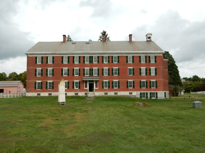
Our destination in Cincinnati was only one locale, not the entire city. We visited the William Howard Taft National Historic Site. Taft was our 27th President from 1909 to 1913 and the only U.S. President to also be the Chief Justice of the U.S. Supreme Court, 1921-1930. Sometimes Taft is best known, unfortunately, for his size, weighing as much as 350 pounds. The Taft family started in Vermont and the father, Alphonse, came to Cincinnati to practice law. Alphonse had his own highly successful political career, serving as US Attorney General and Secretary of War. He was appointed Minister to Austria-Hungary and Imperial Russia. Alphonse and his two wives (Fanny who died and Louisa) began a political dynasty in Ohio, with descendants still prominently active today.

William Howard Taft was born in 1857 and through luck, hard work, good education, family influence, and the ambition he and his wife brought to his life propelled him into successful political endeavors from an early age. He was ethical and of high integrity. He brought about good results in positions as dissimilar as collector of revenue, U.S. Solicitor General, Secretary of War, Head of Panama Canal Commission, and Governor of the Philipines. Taft was not an active candidate for President but was Teddy Roosevelt’s Vice President and when Roosevelt did not seek a third term, Taft was selected.

A "what not" cabinet in the Taft house

A “what not” cabinet in the Taft house

Unfortunately for Taft, he was less successful as President-as he agreed. He had no real power base to work with a fractured Congress. He did not enjoy the give and take of legislation making and was not decisive. Not to say that his four years were worthless; he got the first income tax adopted and was aggressive in challenging monopolies by instituting numerous anti-trust suits and federal oversight of the powerful railroads.

He ran for a second term but a three-way race against Roosevelt and Wilson gave the victory to Woodrow Wilson. His post-Presidential years were active but the highlight was his time as Chief Justice of the U.S. Supreme Court. He relished the law and this position, one that had been a long-held goal. He is recognized for an excellent job as Chief Justice; stream-lining the court, reducing the backlog, obtaining the right for the Court to select which cases it reviewed, and the building of the first, and current, Supreme Court building. He died in 1930.

The NPS site covers Taft but also delves into the other Tafts and the service they performed to Cincinnati and to Ohio. This is the house where Taft grew up and while they moved away, it makes for a good exhibit display area. The furnishings are sparse since the house had been sold and was close to being demolished before being renovated. The Taft family includes two U.S. Senators and one Ohio Governor. One member served on Cincinnati city council. One couple collected art and gave their collection to the city and it is now the Taft Museum of Art. And the list could go on.

As we left, Chris said the family struck her as an early Midwestern equivalent of the Kennedy’s; committed to public service and philanthropy.

Traveling along one of our back roads. No Interstate highway here.

Traveling along one of our back roads. No Interstate highway here.

Our afternoon Thursday was spent driving US 50 again. The early portion was along the Ohio River in Cincinnati’s industrial river heritage area. Barge and rail terminal and facilities were prominent. We crossed into Indiana and drove through small towns without notable features. Agriculture was the predominant industry. We saw road signs to be watchful for Amish buggies but did not see any. Evidently this portion of Indiana had been heavily forested when the first European settlers arrived. They cut down the trees and started planting crops. Unlike portions of northern Minnesota and Wisconsin that has also been forested, the soil under the Indiana forests was excellent for growing crops. We arrived in Vincennes Indiana at dinner time, ready to explore Friday morning.

Inside the George Rogers Clark Memorial

Inside the George Rogers Clark Memorial

So, Friday our first visit was to the National Historical Park of George Rogers Clark. As we entered, the first visitors of the day, the Ranger on duty asked us if we knew anything about Clark. We both nodded yes, of course, he was the guy that went exploring out west, you know, Lewis and Clark. Wrong! George Rogers Clark was the older brother of that other Clark, William Clark. Oops. So why then did this site have a huge memorial to some guy we did not know? I mean, the memorial is 80 feet high and 180 feet across. It has granite from Vermont, Minnesota and Alabama; marble from Italy, France, and Tenessee; limestone from Indiana; and seven murals 16 feet by 28 feet. In short, this guy was responsible for the new United States gaining all of the area north of the Ohio River during the peace settlement of 1883. This Northwest Territory became the states of Ohio, Indiana, Illinois, Michigan, Wisconsin, and the very eastern portion of Minnesota. Whew!

The NPS site had an excellent video supplemented with additional information from a knowledgeable and helpful Ranger. She provided us with background material before the video and answered our numerous questions. Hopefully I can give a concise summary without missing too many nuances.

To set the stage, the year is 1778. The Revolutionary War is underway and the Brisith pretty much hold the western frontier and Canada. American settlers have ignored the British King’s command and have started to settle west of the Appalachian Mountains, primarily into Kentucky (then part of Virginia). The British have few troops though and rely on American Indians to raid and kill Americans in the Kentucky region. The British paid the Indians for scalps brought back. 1777 is a particularly difficult for the settlers, with increasing raids and deaths.

George Rogers Clark was a Kentucky military leader who persuaded the Virginia Governor, Patrick Henry, to allow Clark to recruit volunteers and go on the offensive against the British. A small band of volunteers signed up and Clark lead them down the Ohio. Their eventual objective was Fort Detroit via three settlements/forts at Vincennes IN, and Cahokia and Kaskaskia IL. Through diplomacy, surprise, bluff and assistance from others (remember this is a concise summary), all three settlements land in the hands of Clark and his men. British commander Henry Hamilton heard of Clark’s work, marched down from Fort Detroit with his troops and Indian allies, and was able to recapture Vincennes (Fort Sackville) in late December. It was now winter and Hamilton sent home many of his Indian troops and French militia who had stayed in the New World and went to work for the British.

Clark heard of the reduction in troops at Fort Sackville and began a 180 mile march from Kaskaskia to Vincennes in February 1779. That winter, the land was flooded and rivers were now lakes. Clark and his volunteers made a march through water ranging in height from the tops of their boots to their necks. It took them 2.5 weeks and they went without food for the last several days. They arrived at Vincennes and surprised the fort, ending with its surrender.

While Clark was unable to follow up and attack Fort Detroit, the victory at Fort Sackville led to its inclusion in the United States in the peace negotiations. It took until the War of 1812 to completely consolidate the land under formal U.S.control as the British continued to be involved in the area from their base in Canada.

The memorial was dedicated in 1936 and made a part of the National Park Service in 1966.

After our visit was over, we drove a short ways to the Red Skelton Museum at Vincennes University. I know, younger people are asking: Who is Red Skelton? First off, he was born in Vincennes. Second, he was a famous comedian who started in circus acts in the 1930s. He advanced to having his own radio show, then went into movies during WWII. From 1951 to 1971 he had his own weekly TV comedy show.

In the Red Skelton Museum

In the Red Skelton Museum

It may be hard for younger people to realize the impact and universality Red Skelton had. In the 1930s and 1940s, families were lucky to have one radio. There were not many stations available. A show like Red Skelton’s would bring the whole family together to gather to listen to the show. Thus, basically the whole country listened to him. TV was the same. THere were only three major TV channels and TV shows were heard by everyone. Unlike now, with multiple TV, radio, video, Internet options available, there is no universal experience that draws people together. Red Skelton, and others like him, created a common bond. During the Depression and WWII, a comedy show drew a huge audience and allowed Americans to have a moment of lightness.

That is about the summary of this trip. We drove Friday afternoon to Madison WI and should arrive home by noon on Saturday. However, we are back on the road in a few days as we head out to the Rocky Mountains.

Ed and Chris

Categories: road trip, travel | Tags: , , , , , | 1 Comment

2016 Trip Seven, The Berkshires, Sept. 20-21

Chillicothe, OH Sept. 21

Driving through western Maryland's Sideling Hill

Driving through western Maryland’s Sideling Hill

We left the Berkshire Mountains in Massachusetts Tuesday morning. Our destination Tuesday night was Morgantown, WV. This part of the country was old hat for us; we lived in PA for 30 years and we drove the roads between Carlisle PA and towns in Connecticut and Massachusetts for years, visiting various family. Our biggest decision was which of many optional roads to take. We went with quick, basically driving the New York Thruway, then through northwestern New Jersey to Carlisle and over to Morgantown via I-70 and I-68. Generally scenic, generally busy with cars and trucks until western Maryland and into West Virginia. Fall colors have not really started yet; we had not expected them but timing is always uncertain.

I find town history interesting and would not mind taking more time to discover how specific towns began and evolved. We did not have time to really do that in Morgantown. We were struck by how the mountainous area has shaped the road network and guaranteed heavy traffic. One needs to build roads on the lower levels with a few connector routes that traverse the mountains. This forces everyone to use just several main roads; creating very busy roads in a town of only 30,000 people. The only businesses we noted were the University of West Virgina and medical centers. However, we were talking to a management person at Applebee’s Tuesday night and he mentioned that Morgantown is the home of Mylan Corporation, the maker of Epipen, that has been in the news lately with accusations of price-gouging.

Today, Wednesday we began with a tour of Friendship Hill National Historic Site in Point Marion, PA. This is just over the West Virginia border into Pennsylvania. Friendship Hill was the home of Albert Gallatin. Little known now, Gallatin was important in the post revolutionary time, serving as ambassador to France and England as well as a long time secretary of the treasury. In fact, when Louis and Clark discovered the three rivers that come together to form the Missouri, they named them after George Washington, James Madison, and Albert Gallatin. There are also towns and forests named after him.

Friendship Hill home of Albert Gallatin

Friendship Hill home of Albert Gallatin

Gallatin placed his home high on the bank above the Monongahela River. He had hoped to create a thriving community and industrial powerhouse there. It did not work although coal was mined in the area across the river from his home. However, the home became a pleasant retreat for the family among his many trips to Washington, New York, and Europe. After his death in the 1830s, the house was sold several times and eventually fell into disrepair. In the 1970s, an arsonist almost destroyed the home. Nowadays, it has been preserved and reconstructed.

Gallatin was orphaned early and raised by his grandmother in Geneva Switzerland. He left a fortune in Switzerland to explore liberty and freedom in United States. In the United States, he tried many professions such as surveying, teaching, land speculation, glass factory owner, and others. He got his start in politics in the early structuring of the Pennsylvania constitution and then as a state representative. Here, and in the United States Congress, his specialty was finance. He became a constant opponent of Alexander Hamilton, another early financial specialist in the US government.

The whiskey rebellion in 1794 was an attempt by western Pennsylvania settlers against a tax levied on whiskey that had been promoted by Alexander Hamilton. Gallatin’s diplomatic skills allowed him to defuse the situation and avoid a civil war.

In Congress, Gallatin led the fight for the selection of Jefferson as president over Aaron Burr. He then became the Secretary of the Treasury. He served in this position from 1801 to 1814, helping to reduce the debt accumulated during the Revolutionary War and paying for the Louisiana Purchase. Gallatin also served as American Minister to France for seven years, American ambassador to Great Britain for two years, and then retired to New York City. In New York City he helped found the University of the City of New York, and was an early president of the New York Historical Society. He also began the studies of American Indian languages which brought him the title of the father of American ethnology. We had not remembered any of this prior to our visit.

Our next stop on Wednesday was Hopewell Culture National Historical Park in Chillicothe, Ohio. Today we took primarily back roads. The day was warm and clear and we drove up and down the mountains of West Virginia through Fairmount, Parkersburg, and Clarksburg which had numerous new buildings along the roads. As we entered into Ohio primarily on US 50, the hills started to lessen. We had not driven this stretch of southern Ohio previously. Chillicothe was a larger community than we expected, with paper manufacturing facilities and two correctional facilities.

Chris at one of the mounds at Hopewell Culture

Chris at one of the mounds at Hopewell Culture

Hopewell Culture became a NPS site in 1923 and preserves five separate sites that include numerous mounds and embankments from the Hopewell people who inhabited this area from about 2200 to 1500 years ago. The mounds and people predate the American Indians who were here when European settlers arrived. These mounds predate the mounds further west, at Effigy Mounds in Iowa, Ocmulgee in Georgia, and Cahokia Mounds in Illinois.

Several of the mounds at the Mound Group at Hopewell Culture

Several of the mounds at the Mound Group at Hopewell Culture

The mounds and embankments that encircle them are scattered over tens of miles. There is a symmetry in size between the mounds (circular and square) and placement between them and surrounding embankments. There are connections to solar and astronomical observations. Obviously exact information about this culture is not known. Best estimates are that the people lived in very small villages, one to three houses, and that they came together to construct the mounds. Massive organization would have been necessary for numerous small groups to combine efforts on tasks that involved massive earth moving operations, the construction of ceremonial buildings where the mounds stood, and the similarity of design size and layout across a broad geographic region.

The mounds were initially mapped and explored in 1846. THey were not preserved until the 1920s. By that time, farming and other land development had obliterated or leveled out most of the sites. Current earth imaging technology as well as archeological efforts have been combined with the 1846 survey to better understand the mounds. We walked around the Mound City Group area, which has two dozen mounds within an embankment.

The Greenhouse B & B in Chillicothe, OH

The Greenhouse B & B in Chillicothe, OH

Our lodging was at The Greenhouse Bed and Breakfast, a B & B that will be closing down in the next months. Tom and Dee Shumaker have been running this for 27 years. The home was built in 1894 and they have filled it with an amazing, eclectic assortment of collectibles. Egg measuring scales, toy planes, dishes, enamelware, dolls, pottery, etc. are found here. In the attic, they have 13 artificial Christmas trees and all go up at Christmas.

Some of the collectibles at The Greenhouse

Some of the collectibles at The Greenhouse

Ed and Chris

Categories: road trip, travel | Tags: , , , , , , , , | 2 Comments

2016 Trip Seven, The Berkshires, Sept 18-19

Hancock, MA. Sept. 19

The Big Round Barn at Hancock Shaker Village

The Big Round Barn at Hancock Shaker Village

“Hands to work, hearts to God”. This was one of the more famous sayings of the Shakers, a small religious movement in the 1800s and 1900s. Numbering less than 7000 souls at its peak, the Shakers were more formally titled The United Society of Believers in Christ’s Second Coming and began in England. The Shakers were celibate and believed in pacifism and equality of the sexes. There were about 18 Shaker communities in the United States and were well-known for the quality of their furniture and textiles. Unlike the Amish, the Shakers embraced new technology and methods of production. The Shakers practiced a form of worship that included singing and vibrant dancing, frequently making the floors of the worship room shake; hence the term “Shakers”.

An example of Shaker furniture

An example of Shaker furniture

There is only one active Shaker community in the U.S.now, in Maine. Today, Monday the 19th, we visited a restored 750 acre Shaker Village in Hancock, Massachusetts. This locale did have as many as 300 residents at its peak in the early 1900s. They farmed, grew and sold seeds and farm produce, and manufactured wood furniture. The community closed down in 1960 and the village is maintained by a local non-profit educational organization.

The round stone barn on the property was notable for several reasons. At the time, it was likely the largest barn in New England. The round shape facilitated a unique dairying process, with hay stored in the center (which also provided heat in the winter), a basement level that allowed manure to be easily gathered and removed from the barn, and a second level that allowed hay wagons to drive in and unload (and to store hay on wagons when it was raining outside). The cows were attached to stanchions and easily milked by a person moving onto usually along the circular path. The Shakers believed in straight lines so the construction of a round barn needed special approval from the elders to be built.

Brick house residence for Shakers

Brick house residence for Shakers

The Shakers seemed to embrace their lifestyle. Music was a part of their daily life, with songs for play and for differing forms of work. They were proud of the work they did, it was essential but it was also an opportunity to demonstrate quality and workmanship. Yet, they were humble, not allowing anyone to get a big head, and kept the products basic but well-made.

Yesterday, Sunday, our major touring event was a visit to the Norman Rockwell Museum 30 miles south of Hancock in Stockbridge, MA. Sunday started easy with breakfast at the unit and then the four of us went to church in Pittsfield. We had brunch at the restaurant “Eat on North”, part of the “Hotel on North”. Hotel on North is in an old furniture and retail store in downtown Pittsfield that has been beautifully restored and has been open for about two years. Between the four, we had three different brunch entrees and all were excellent.

Norman Rockwell was an American icon to my generation and those earlier. Born in 1894, he began a career as an illustrator while still in his teens. His first regular job was as the art director for Boy’s Life, the magazine for the Boy Scouts. By age 22, he had sold his first illustrations for the “Saturday Evening Post”. (Brief history may be needed for some. The Saturday Evening Post was a national weekly magazine that for decades was one of three magazines (Life, Look and Post) that set the standards and the news for Americans. Having your art work on the cover of the Saturday Evening Post was big, big stuff. Over his career, Rockwell illustrated 321 covers for the Post.

Rockwell started his career primarily drawing young people, an outgrowth of this work with Boy’s Life. His work usually reflected small-town American life. A perfectionist in his work, Rockwell drew numerous sketches, hired live models, and used photographs of the pose and details he wanted to include in this final illustration. The painting below demonstrates some of his attention to detail. Note some items that indicate the marriage license was being taken out late Friday afternoon: the quantity of discarded cigarette butts, the calendar with today’s page already being torn off in favor of tomorrow-Saturday, and the U.S. flag has been taken down for the day.

The Marriage License by Norman Rockwell

The Marriage License by Norman Rockwell

During WWII, Rockwell did a series of four paintings that portrayed Franklin Roosevelt’s 1940 State of the Union speech listing the four freedoms all citizens of the world should be able to enjoy: the freedom of speech, the freedom of worship, the freedom from fear, and the freedom from want. It took Rockwell two years to get the paintings done the way he wanted them. The U.S. Treasury took the four paintings on tour around the country and they helped raise $130,000,000 in war bonds.

The Four Freedoms by Norman Rockwell

The Four Freedoms by Norman Rockwell

The Post was a controlling organization. For instance, Rockwell and other illustrators were not allowed to show African-Americans in other than service level jobs. In 1963, he left the Post and began putting his illustrations in Look magazine. During his Look period, his work more broadly reflect America and its problems of the day. During his career, he drew illustrations for commercial ventures like Coke and Pepsi, playing cards and calendars for Brown and Bigelow, paintings of famous people like Eisenhower and Kennedy as well as illustrations for books.

The studio where Rockwell did much of his later work

The studio where Rockwell did much of his later work

Rockwell died in 1978, living the last 25 years of his life in Stockbridge. Serous art critics downplayed his work as simplistic but recently his work has been more highly regarded. Whether art critics are listened to or not, the people of America call him one of their own. The museum does an excellent job of showing and describing a selection of his original work. Included on the grounds is the studio where he worked during the latter years of his life.

Chris, Rebecca and Deb and the board game Alhambra

Chris, Rebecca and Deb and the board game Alhambra

The evening finished up with Deb, Rebecca, Chris and Ed playing a board game. Deb won but we continued it Monday morning and ended with everyone winning but Ed.

Ed and Chris

Categories: road trip, travel | Tags: , , , , | Leave a comment

2016 Trip Seven, The Berkshires, Sept. 16-17

Hancock, MA. Sept. 18

Friday dawned clear and warm and Chris and I had a few hours before Deb and Rebecca arrived from Boston. We drove to North Adams. Like many New England towns, North Adams was a manufacturing center, helped by water power. By the 1980s, the last large employer had left town, leaving a major manufacturing site vacant. Through the efforts of many, the Massachusetts Museum of Contemporary Art (MassMOCA) opened on its grounds and is a major attraction. However, we did not go to see it. The museum was hosting a major Blue Grass Festival and our goal was the Western Gateway Heritage State Park.

This park in the city of North Adams was previously a railroad yard. The primary exhibit relates to the building of the Hoosac Tunnel. This 4.75 mile long tunnel was to be Boston’s answer to shipping goods to the Midwest. The Erie Canal was making New York a better port. Boston wanted to build a railroad to Troy NY but the Hoosac Mountains stood in the way. A five-mile barrier, made of hard rock, it took from 1851 to 1875 to complete the tunnel. It was a landmark feat in the use of hard rock tunneling.

One major difficulty was the skill needed to make sure that the two tunnel shafts being built, one on the east and one on the west, met precisely when they joined somewhere in the middle of the tunnel. The engineers set up a series of transits that aligned with scoping towers outside the work area and then lined up those with internal test marks as the work progressed.

Second, the rock was composed of schist and granite quartz that resisted drilling and blasting. A newer version of nitroglycerin and new drilling machines were used, but even those improvements still made for a long, slow slog. The state of Massachusetts provided funding but the project defaulted on the bonds. Owners of a southern Massachusetts railroad succeeded in stopping more funding. Defaulting on the bonds led to the state assuming responsibility for its eventual completion. At one time, this project assumed the majority of all the indebtedness of the state of Massachusetts.

The tunnel was completed successfully and is still in operation today. When first completed, 100 trains per day went through the tunnel. Today less than 15 trains per day go through the Hoosac Tunnel. The construction methods used and advanced here led to improvements used in later tunnel building. Towns in northern Massachusetts experienced growth spurts and the tunnel, by carrying 60% of the goods exported through the port of Boston, enhanced the Boston port’s viability. Unfortunately, the tunnel’s western entrance is deep in the forests and not readily accessible for viewing.

Chris and docent at North Adams Historical Society

Chris and docent at North Adams Historical Society

The North Adams Historical Society has a museum next to the state park and the docent was most helpful. He provided us with a narration about the model railroad he constructed for the historical society. Lunch was at a pub in the old railroad yards and dinner at a local restaurant just down the hill from the Wyndham Bentley Brook. Dessert was strawberry shortcake back in the unit.

Plane crash debris on Rounds Rock Trail on Mount Greylock

Plane crash debris on Rounds Rock Trail on Mount Greylock

Saturday got off to a relaxing start and then the four of us went to Mount Greylock. Mount Greylock is the highest point in Massachusetts at 3,491 feet. After a stop at the visitor center, we hiked Rounds Rock trail. The trail led to two overlooks and one site of a crashed plane. The plane crash occurred in 1948 as a twin-engine Cessna used to deliver late editions of the New York Daily Mirror to Albany. The crash site was in rugged territory and not found for four months.

Panoramic view from Mount Greylock

Panoramic view from Mount Greylock

The summit of Mount Greylock is reachable by car. The monument at the top is currently under construction but we were still able to enjoy the view that the summit provides of the surrounding states. There were probably 30-40 people lounging on the grass and enjoying the weather and the views. Bascom Lodge at the summit provides meals and lodging. We tested out their lunch menu and were satisfied.

The four of us on the Alpine Slide at Jiminy Peak

The four of us on the Alpine Slide at Jiminy Peak

After resting back at Bentley Brook, we spent 2.5 hours at the ski resort, Jiminy Peak. During the summer season, Jiminy Peak offers a summer adventure park with zip lines, elevated rope climbing courses, mountain slides on a rail or a luge type course, etc. Even Chris participated and enjoyed it. All four of us rode the chairlift close to the top of the mountain and rode the sleds down. Since you can set your own speed, Deb was usually the fastest. Chris and Rebecca tended to bring up the rear; I think Chris had a few sledders backed up behind her.

Deb climbing the aerial ropes

Deb climbing the aerial ropes

Deb climbing the aerial ropes

Deb climbing the aerial ropes

The ropes course in the air was a new event for us. Chris volunteered to take photos while the three of us tackled the course-the basic version. We got our harnesses on, had a very brief training session and were set loose. A participant has two carabiners that attach to the safety ropes; I of course took the longest to figure out how to attach them correctly. One time the two eight year olds behind us helped me. Another time I had to have one of the staff climb up and show me how to do it properly. But, by the end, it was working fine. We were glad we took the easiest course and the one closest to the ground for our first time. We only did the one; the alpine slides were more fun and easier to do so they were repeated several times.

Deb and Chris on the Soaring Eagle

Deb and Chris on the Soaring Eagle

Ed on the not-so-tall zip line on basic course

Ed on the not-so-tall zip line on basic course

Ed and Chris

Categories: road trip, travel | Tags: , , , , , | Leave a comment

Blog at WordPress.com.