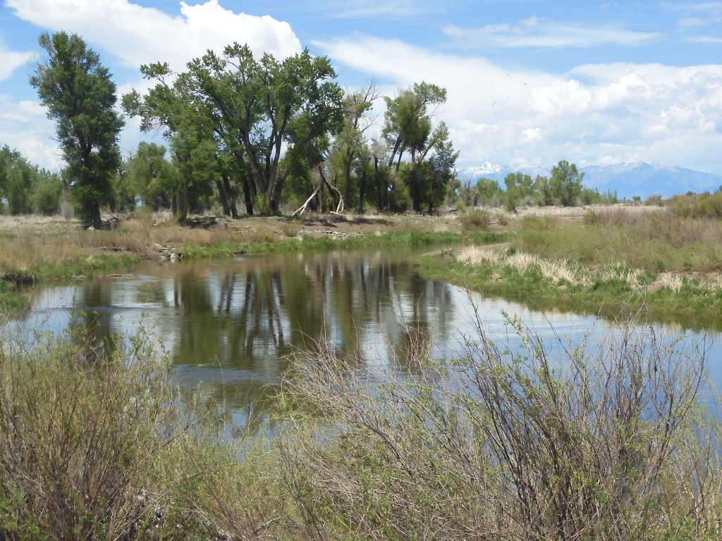
Follow Ed Heimel and Chris Klejbuk as we explore the USA and Canada. Trips began in 2013. See sidebar. Since Jan. 2013, over 220,000 miles traveled and 1100 days on the road. Over 700 blog posts written. 2023-We are closing in on 350th National Park unit. Photo below is Pacific Ocean by Big Sur, CA
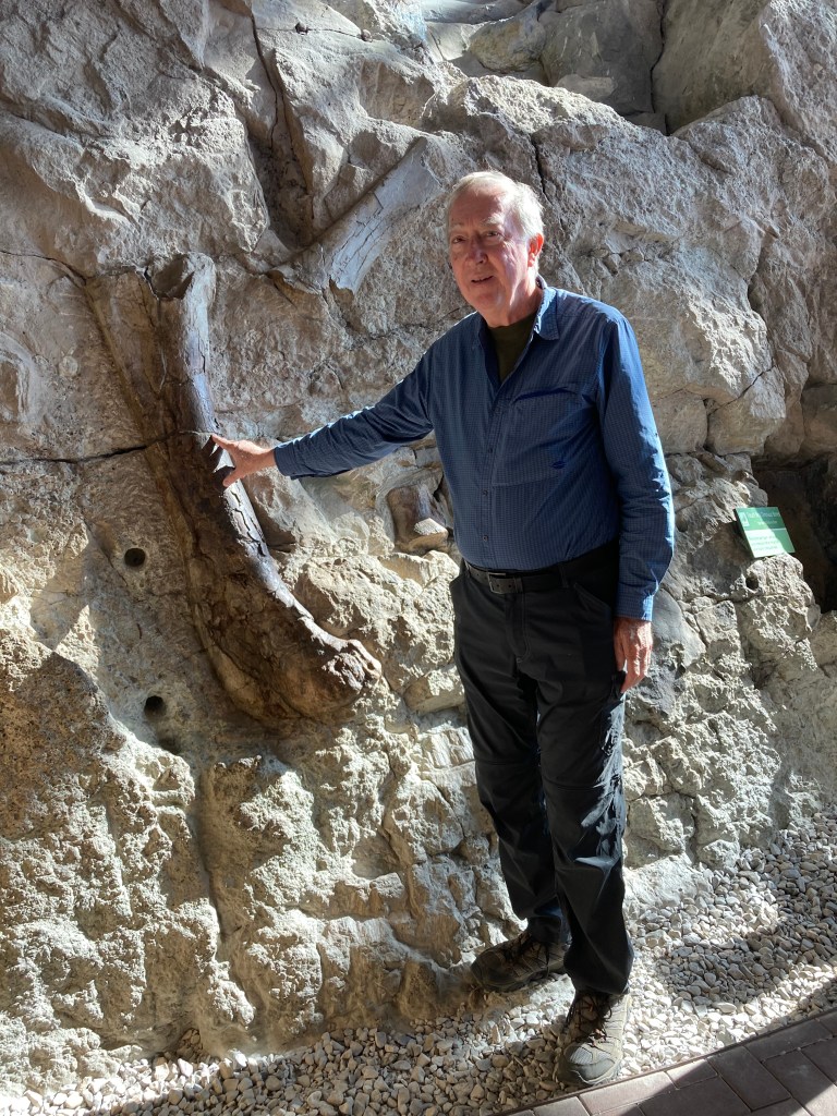
Have you touched a 149 million year dinosaur bone? Today I had the opportunity to do so-and it was legal. Dinosaur National Monument was first made a national monument in 1915 to protect 80 acres around a spectacular site of dinosaur bones from the Jurassic period. Bones from ten different dinosaurs were found in this location, starting in 1909. The eighty acres were designed to protect the site from vandals and preserve the specimens for scientific usage.
In 1938 the monument was expanded and includes areas in Colorado and Utah that represent the geologic history of that time. The monuments expanded size has presented an area rich in recreational opportunities. We, like many others, spent most of our time at the Quarry Exhibit Hall. This hall was proposed by the paleontologist who discovered the first dinosaur bones. Earl Douglas advanced the idea that the quarry site be preserved in situ for normal people to experience the thrill of seeing the bones embedded in the rocks where they have been entombed for 149 million years. Scientists theorize that during a drought, dinosaurs looking for water died near a river’s edge. When it rained, the heavy bones of the dinosaurs washed downriver, collecting in one general area.
Today this quarry site is no longer being actively dug out. Bones in the quarry were sent to museums around the United States. What is left is still awesome and breath-taking. Reservations are required to enter the Hall; one is given a window in time when you can board a tram which takes you from the visitor center to the quarry exhibit hall. Once there, you can take as long as you like to explore the hall and the bones. While dramatic, we did find that it only takes 30-45 minutes to explore the display. A fossil guide is available for a $1 donation that assists in understanding which bones from which dinosaurs you see.
Dinosaur bones at Dinosaur National monument
Rather than taking the tram back to the visitor center, we walked the one mile fossil discovery trail that leads you through rock layers similar to the ones with dinosaur bones entombed. Sharp eyes should be able to observe fossils jutting out of the rock. We did not have sharp eyes. At one location, there were petroglyphs in the rocks. At 10 AM, the temperature was only in the low 80s; later on it hit 103.
Chris pointing at a Petroglyph
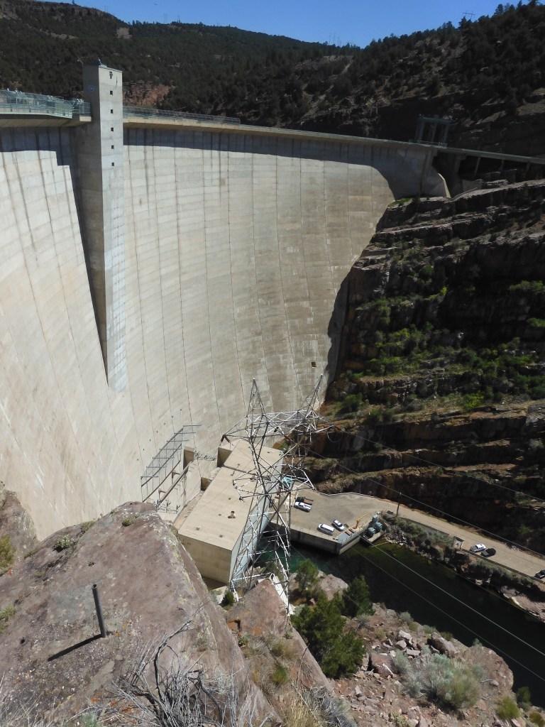
Leaving Dinosaur National Monument, we headed north into Wyoming, this time driving along the east side of Flaming Gorge Reservoir. We stopped at the dam which creates the reservoir. It is part of the Colorado RIver Storage Project; a 1960s era effort to increase irrigation, create hydro electric power, limit flood damage and add recreational opportunities. This occurs through multiple dams and reservoirs; Flaming Gorge being one of the major reservoirs. Flaming Gorge is on the Green River and its spectacular red canyon walls were first publicized by J. Wesley Powell in 1869.
Flaming Gorge Dam
Dam tours are not currently given but we walked where we were allowed and took pictures. Several picnic tables were located under pavilions that produced a shady, cool spot for lunch. The journey to Thermopolis took five hours; again the vistas were alternating between sage desert, mountains, rock cliffs, and finally some natural greenery. The greenery did not last too long.
Scenery like this alternates with the canyons and mountians
Our major stop was in Farson WY (population 143) at the Mercantile store for ice cream. The servings are huge! It took us 20 minutes to finish ours and we had a baby size and a one scoop size. Side Note: We got gas at a Sinclair station in Farson, the logo for Sinclair is a dinosaur.
Ice Cream at Farson Mercantile, WY
In Thermopolis we are staying at an Airbnb located along the Bighorn River. Tomorrow, on to the Beartooth Highway.
Wyoming’s Aquarium in Stone-Fossil Butte National Monument
Kemmerer, WY Saturday June 12
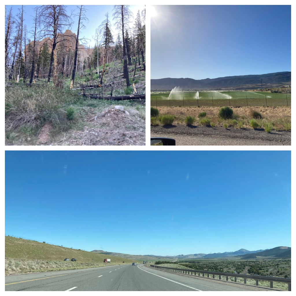
No blog on Saturday, we spent most of the day driving. Usually at 80 mph (the posted speed limit), a nice steady speed. The Best Western at Brian Head was a good find and a great summer price. Sleeping at 9600 feet was a challenge and it felt good to quickly reach a lower elevation upon leaving Brian Head. The drive down took us through forests that had been impacted by fire. In contrast, the drive along I-15 alternated between mountains and valleys, with patches of green in valleys that had irrigation.
Driving from Brian Head to Timpanogos Cave
About halfway between Salt Lake City and Provo Utah, in the Wasatch Mountain Range, is Timpanogos Cave. Due to COVID-19, the cave tours are limited in numbers. We decided not to try to get tickets, having seen other NPS caves as Jewel Cave, Wind Cave, and Mammoth Cave. In addition, to reach the cave entrance one must hike 1.5 miles up to the cave entrance, a path that goes up 1,092 feet in elevation, and then walk back down 1.5 miles. The estimate for the entire experience (up, down, and cave tour) is 3-4 hours.
Instead, we walked the nature trail along the American Fork River, marveling at the mountain sides which went up another 6,000 feet to the top of Mt. Timpanogos from our elevation of 5,638. That view of mountain sides must have been a precursor for the mountains we experienced along I-80 east of Salt Lake City to the Wyoming border.
Chris hiking at Timpanogos Cave nature trail
I-80 had steep sections that put the road in Southern Colorado we discussed a few days ago to shame. Here the trucks had one or even two truck lanes and the auto traffic was still backed up trying to pass the trucks. The first section out of Salt Lake City to Park City was familiar, we drove it back in 2013. I did enjoy the drive as you sweep up the hills and around the curves. I think Chris held her breath a few times to see whether cars would be able to pass trucks before being cut off.
Sheep along I-80
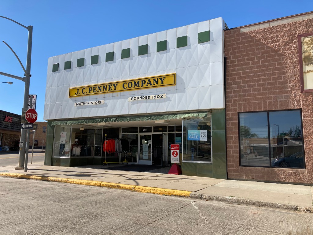
Kemmerer Wyoming was the locale for our evening’s lodging. There is a new Best Western in this town of 2600 people, the only chain type lodging among the older roadside motels. Kemmerer has a history, partly being due to the town being the birthplace of the J.C. Penney stores. The “mother store” is still open in town.
TheJ.C. Penney mother store in Kemmerer,WY
Kemmerer owes its existence to coal. Coal was discovered here in 1843 but really got underway in 1881 when the Union Pacific Railroad began mining coal for its train engines to stop being ripped off by the local Wyoming coal mines. Coal is still mined just south of town and fed directly to a coal power plant. Wyoming still relies on coal for 90% of its electricity. One of three generators at the power plant recenlty shut down. The power company has plans to shutter the other two units but the state is fighting the change. Wyoming has been the number one coal mining state since 1986 and the state fears losing the jobs and revenue it produces. A recent effort by a Bill Gates owned company has proposed a new type of nuclear plant that might be located at the Kemmerer power plant site.
Kemmerer Power Plant withcoal feeder
But we were not here to look at coal. Something old like coal though. Fossils. Sunday we would visit Fossil Butte National Monument.
Sunday June 13, Kemmerer WY
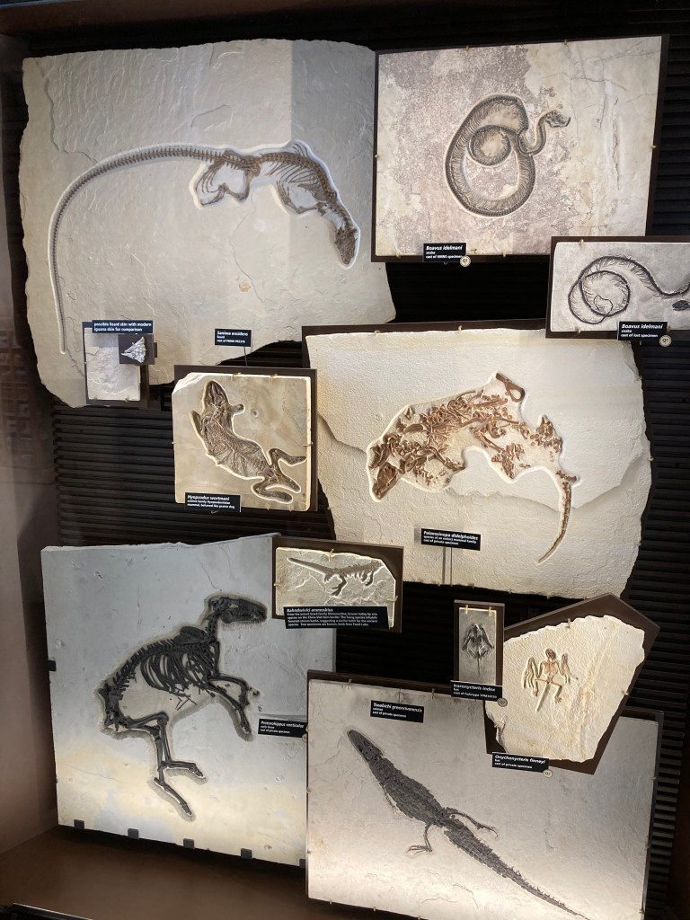
Fossil Butte National Monument lies 13 miles west of Kemmerer. It was named as a national monument in 1972 but extensive fossil collecting here dates back to the late 1800s. Private collectors and scientists collected fossils here and sold/gave them to museums all across the U.S. The monument protects only a small area in which fossils can be found. The NPS site is strong on research, other sites outside of the monument’s boundaries allow fossil hunting by state permit.
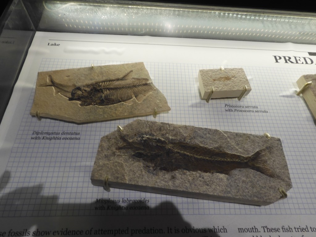
Fifty two million years ago this area was part of ancient Fossil Lake. Fossil Lake and two other large lakes covered large parts of present day Utah, Wyoming, and Colorado. Fossil Lake was the smallest at 60 miles long and 40 miles wide. It was shallow, primarily fresh water with a salt water spring at the deepest part. I’ll skip the details, you can check the website, but the number, diversity, and striking completeness of the fossils are unique and amazing. For example, in the display case was a turtle with two crocodile bite marks in its shell. Another amazing example is a fossilized fish in the process of eating another fish. Scientists have determined that the climate 52,000,000 years ago was similar to today’s Florida Gulf Coast.
Fossils of one fish in the process of eating another fish
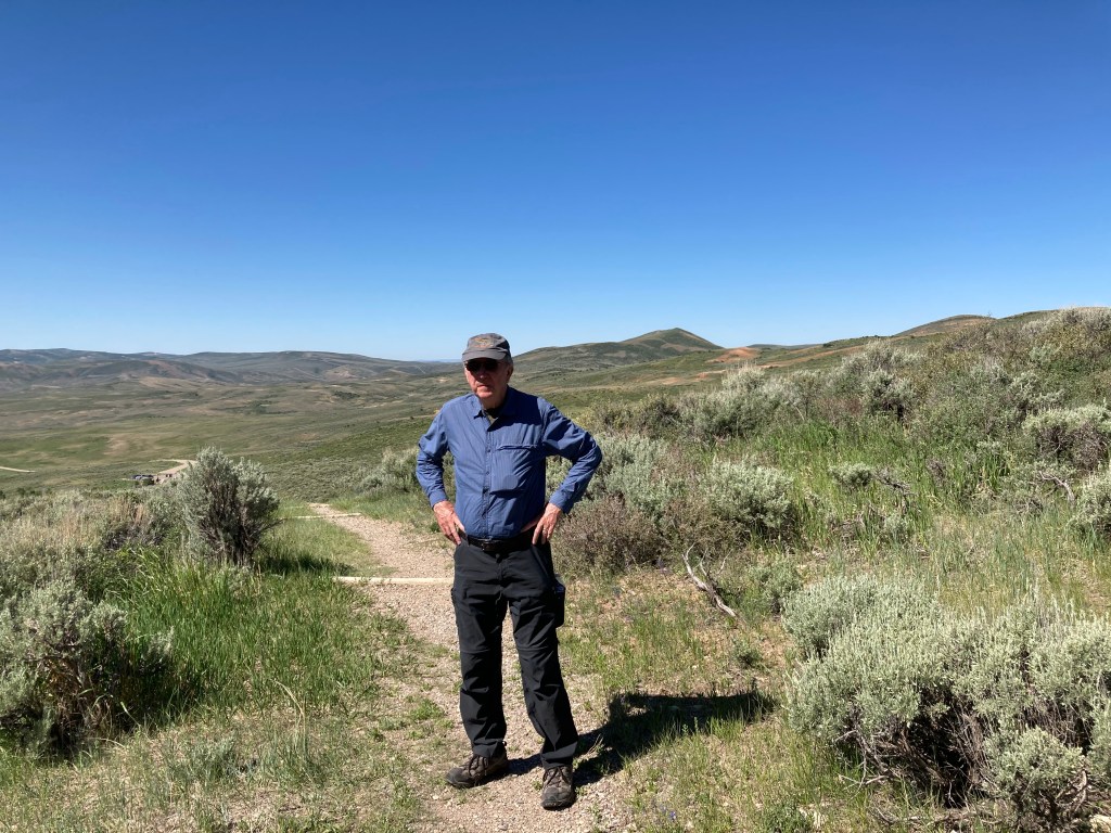
Luckily for us, the monument’s exhibit center was open. Besides the exhibits, we took in two videos and a ranger talk. While we did not make it to the small quarry on site, we did take a 45 minute hike on the nature trail and drove to the top of a ridge looking down onto what would have been part of the ancient lake bed. On the nature trail, delicate wildflowers were visible with pink, blue, yellow, and white flowers. After three hours here, it was off to our next stop, Seedskadee National Wildlife Refuge.
Ed hiking along the nature trail at Fossil Butte
Driving through this terrain, we had to wonder how we could possibly find a wildlife refuge at this high elevation among the sage brush dry landscape. As we got closer to Seedskadee, the terrain only produced a few mule deer and signs indicating the land belonged to Exxon/Mobil. The national wildlife refuge was created in 1965 to compensate for the habitat destroyed by the creation of the Flaming Gorge and Fontenelle Dams. The refuge has a gravel auto tour route which we took.
Seedskadee is derived from the Shoshone language meaning “River of the Prairie Hen”. Fur trappers butchered the pronunciation, leading to its current spelling. We now call the river the Green River, a major tributary of the Colorado River. (If interested, look up the renaming of the Colorado River in 1921.) One of the challenges facing the refuge staff is the impact of the Fontenelle Dam which stifles the natural actions of the river. Normal flooding no longer occurs and there is a loss of silt action. Reminiscent of the Mississippi River near St. Paul, cottonwood trees are not being replaced through natural means.
Part of the wetlands at Seedskadee National Wildlife Refuge
In the early 1960s, there was an experimental project here that tried to establish small family farms. Irrigation and electrical lines were brought in, sheep and cattle purchased, etc. The effort failed. The land was just not suited for small farms and the farming impacted on the mining of soda ash. Soda ash is widely used in applications like glass making, water treatment, production of paper and detergents, in animal feed, etc. We passed a mine for trona (from which comes soda ash or sodium (bi)carbonate.
The refuge has a visitor center with 24 hour clean restrooms. The picnic tables we first saw were in the hot sun but Chris explored and found more in the shade looking at the river. Our lunch of bagels and fruit cups from the hotel breakfast supply was much more enjoyable when eaten in the shade.
Our destination for the evening was Vernal, UT. To get there, we traversed flat plains, mountains, valleys, and gorgeous rock formations. There were sightings of phosphate mining, multiple rail sidings with engines and rail cars stored, cattle and sheep grazing, sage brush and rock canyons of multiple colors including red. One does not need to visit Zion National Park to enjoy fantastic views of canyons and red rocks, those views have been frequent for the past several days.
Driving through Wyoming and Utah
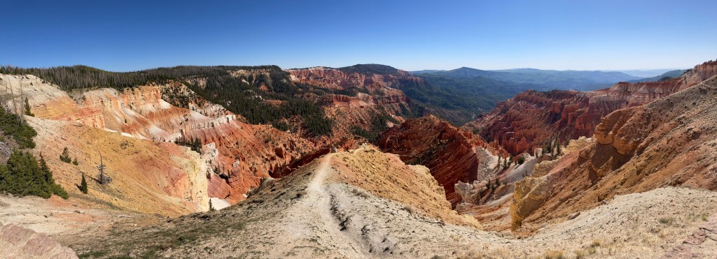
In particular, today’s ending journey took us through Flaming Gorge National Recreation Area. This area is managed by the US Forest Service and includes both sides of the Green RIver gorge “discovered” by J. Wesley Powell. Today’s river has become a reservoir with water depths ranging from 275 to 500 feet deep. The gorge at one of the observation points is 1,360 feet from top of gorge to surface of water. Flaming Gorge is deeper than Royal Gorge back in Colorado, Horseshoe Bend south of Page AZ, and Gooseneck in southern Utah.
Flaming Gorge Recreation Area
We drove the west side of the gorge today. When we leave Vernal Utah tomorrow for Thermopolis Wyoming, we will drive the east side of the gorge and view the dam.
Flaming Gorge National Recreation Area
Ed Heimel, Chris Klejbuk Vernal UT Sunday June 13.
Flagstaff had been the purpose of our trip, to visit with Lou and Joyce once again after the pandemic had begun to diminish. The trip home will take us eight days as we head north and then east. Our first day mainly retraced portions of the country we had seen before, except for one section in southern Utah. Despite this, we encountered some surprises and long periods of great scenery.
The first surprise came as we approached Page AZ. Horseshoe Bend, a well known bend in the Colorado River south of Page, seemed to have a new entrance facility. Long lines of cars were backed up to visit the site. The river is about 1,000 feet down and it takes a hike of over a mile to reach the observation overlook. My advice, go to Goosenecks State Park in Utah. Shorter walk, deeper canyon, more bends, fewer people.
Second surprise-Lake Powell is at a record low. Glen Canyon dam was finished in 1963 and by 1966 Lake Powell was in operation. Today the water level is at its lowest depth since 1966. The resolution of this issue of decreasing water supply and increasing water usage is beyond me. Come see Lake Powell while you can.
Lake Powell and Wahweap marina
Our trip continued along US 89 through more desert country until we stopped in Kanab Utah for lunch at a local park. The park was very nice with great red rock backgrounds. It was only tonight in our hotel room that we did some research on Kanab. Kanab comes from the Paiute word meaning “place of the willows”. Kanab is very conservative and in the early 2000s faced much backlash from travelers about its stance on marriage and family practices.
The primary destination for the day was Cedar Breaks National Monument. We were here once before and Chris loved the scenery. We decided to plan our return trip to include it. Cedar Breaks is at an elevation of over 10,000 feet and was constituted as a national monument in 1933. The monument preserves an area created over millions of year from limestone uplifted by a natural fault and eroded by ice, water, and wind. The scenery is spectacular and the monument is not crowded. Wildflowers are just beginning to come out in the prairie and along trails.
Cedar Breaks National MonumentWildflowers at Cedar Breaks
Hiking at 10,000 feet above sea level is not a primary activity for us but today we hiked the Alpine Pond trail. The trail is in the shape of a figure eight and due to the elevation (it starts out at 10,460 feet), we only hiked one of the loops. They classify the hike as easy to moderate and it probably is. But, still, with an elevation gain of 200 feet and rocky trails, we were tired when we completed it.
Alpine Pond
The Alpine Pond is one highlight. The water leaving the pond flows out to the Great Basin many miles to the west. Great Basin is a national park in east central Nevada that we have not visited yet. At Cedar Breaks, the forest is sub-alpine, with predominantly fir and spruce. The spruce trees have faced a major die-off from bark beetles starting back in the mid-1990s. It will take a long time for the forest to regenerate. There are some Bristlecone pines here, one of the longest living life forms on earth.
Some of the dying trees
Not far from Cedar Breaks is Brian Head, the mountain and town. The mountain peak is at 11,300 feet. The town is basically a ski resort but it had the closest lodging to Cedar Breaks that made sense for us. We are staying at a very nice Best Western and ate at its sit down restaurant. There are not too many other eating options in town.
As I mentioned, a number of sites along today’s journey have been visited before. May 12, 2013 our first sighting of Bristlecone pine in CA. May 10-15 of 2014 when we spent a week house boating on Lake Powell. May 31-June 4, 2016 when we visited the North Rim of the Grand Canyon, Antelope Canyon, and Cedar Breaks. (Cedar Breaks still had snow on the ground at that visit.) May 31, 2018 when we stopped at Horseshoe Bend.
Tomorrow we head north and will be visiting more of Utah, Wyoming, Montana and North Dakota.
Ed Heimel, Chris Klejbuk Brian Head UT June 11, 2021
On Monday afternoon we arrived at Flagstaff, Arizona, the home of Chris’ brother Lucien, his wife Joyce and their Pembroke Welsh Corgi, Manning. This is the first road trip since the pandemic and it was so wonderful to visit family in person. Joyce had retired several years ago and Lou last year. Last year they permanently moved from Scottsdale to Flagstaff. They had purchased property in Flag in 1999 and had the house built in 2010-2011. We have been down here several times and enjoy the area. Flagstaff was named in honor of a ponderosa pine flagpole used to raise the U.S. flag for the national centennial ceremony held July 4, 1876.
Manning
Monday Lou demonstrated the wonders of an Ooni oven with his homemade pizza. The oven heats up to 850-920 degrees F in 30 minutes. The oven was originally designed by a Finnish person who moved to Scotland where Ooni is now home based. The oven is able to be wood fired or gas fired.
Lou making the pizza, putting it in the Ooni, and finished product
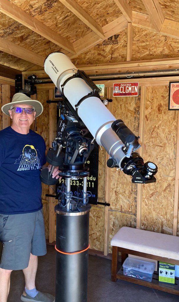
Over the years, Lou has become interested in astronomy. After researching several telescopes, he had an observatory built on their property with a retractable roof; it houses a Astro-Tech refractor telescope with a 6” diameter lens. Monday and Tuesday nights, we spent looking up at the sky and learning about several celestial objects, including open clusters, globular clusters, galaxies and binary stars.
Lou and his telescope
Lucien and Joyce are very involved with the Epiphany Episcopal Church in Flagstaff. In 1912, Epiphany Church moved from temporary quarters to its current rock Mission style church. Wednesday afternoon we got a tour of this church that is on the National Historic Register.
Epiphany Episcopal Church
Thursday we went to the Flagstaff Arboretum; it is included in the largest tract of ponderosa pine forest in the world. We took the trails around the various gardens at the Arboretum, with the ponderosa pines and the San Francisco Peaks always a presence.
Our morning visit there was followed by lunch at a Flagstaff restaurant new to us, the Tourist Home. The Tourist Home was built in the 1920’s by Basque sheep herders who would graze their flocks in the area during the warm summer months. It was a boarding house of sorts and they built the handball court off of the what is now the restaurant patio. The Tourist Home was rebuilt in 2014 to become a restaurant.
Tourist Home restaurant
After lunch we came back to help Lou and Joyce with some yard work and got a surprise visit from some horses and humans who had lost their trail.
Tomorrow morning we head back home via stops in Utah, Wyoming, Montana and North Dakota.
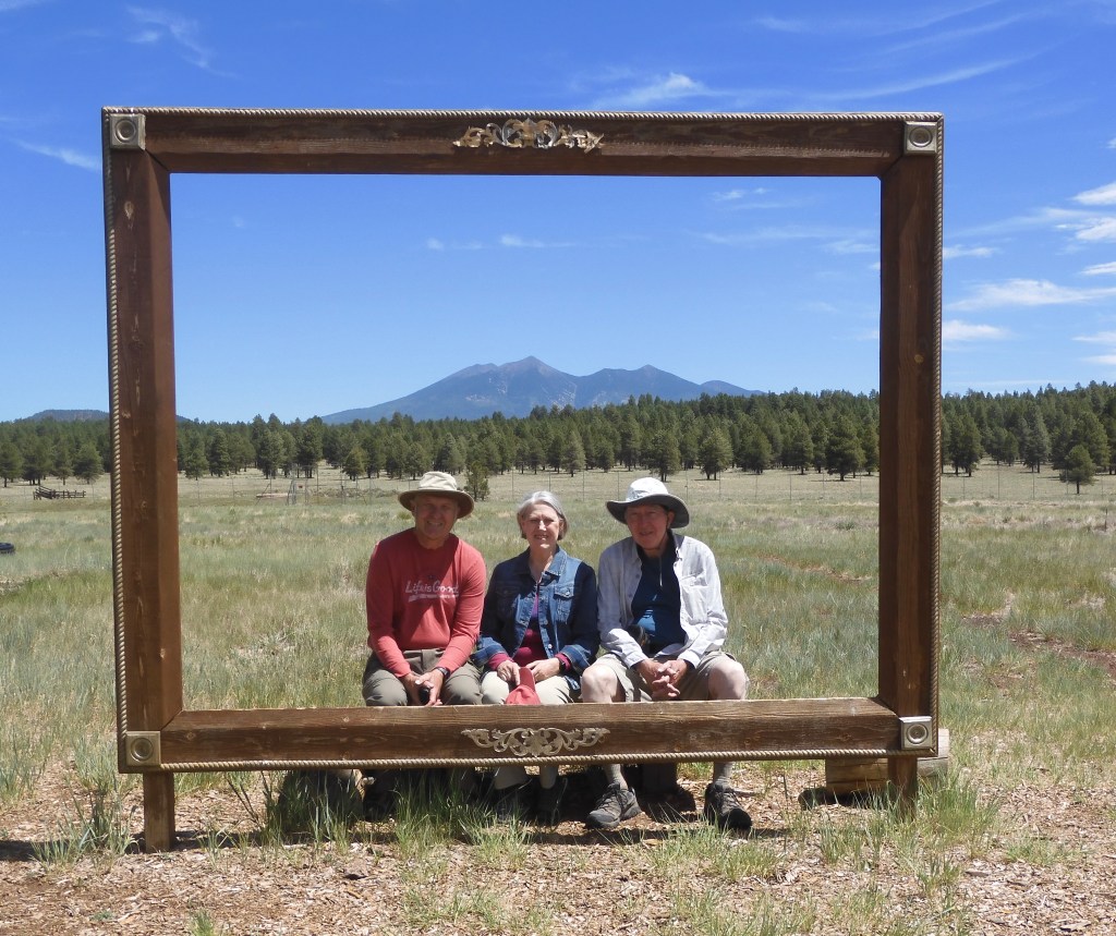
Lucien,Joyce and Ed at Flagstaff arboretum
Chris Klejbuk, Ed Heimel Flagstaff AZ June 10, 2021
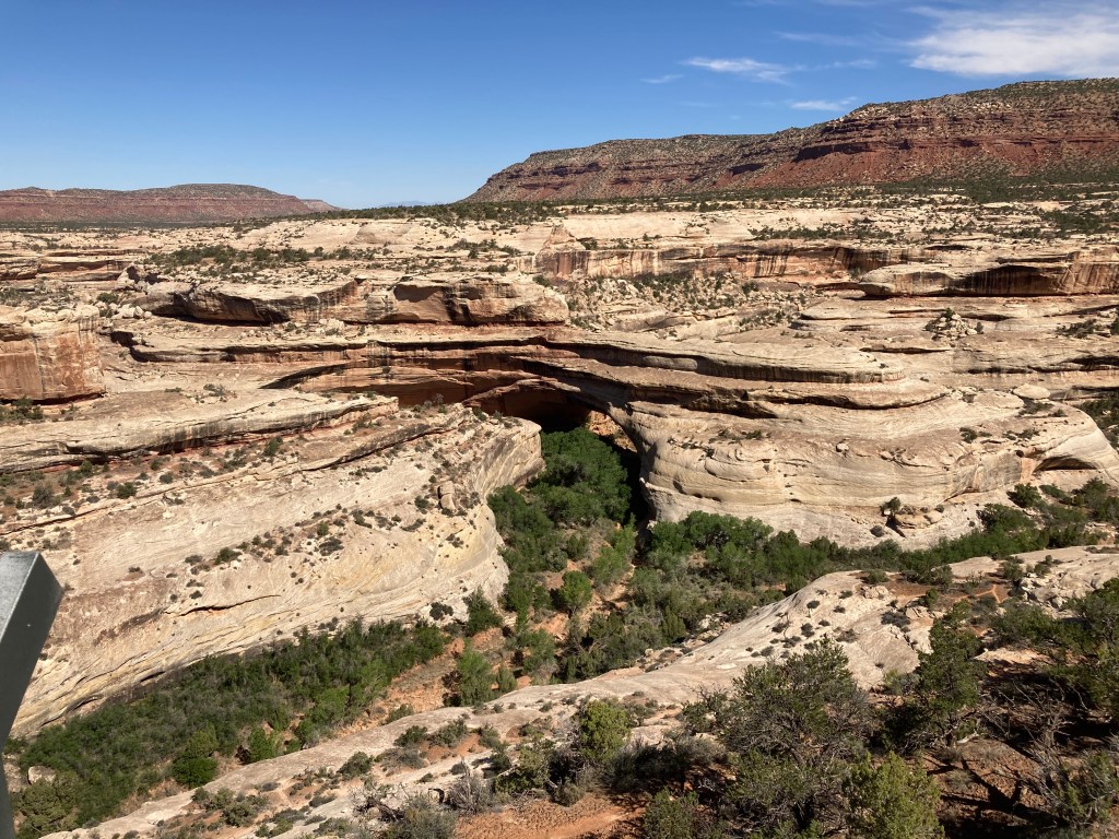
We left our Airbnb in Blanding Utah after discussing some travel options with our host. Natural Bridges National Monument was our primary goal for the day. The road from Blanding is paved although you are warned there are no services and no cell coverage along the route. Unlike other remote sections of Colorado and Utah, we did not observe small houses or farms along the road. Even most of the park staff lives onsite rather than driving in each day.
The monument has three primary natural bridges it protects, although there are other smaller bridges. Natural Bridges had not been high on our previous trip lists due to its remoteness and having seen arches before. While arches and bridges look similar, the causation is different. Bridges are created by erosive action of moving water. Arches are created by other erosionial forces, mainly frost action and seeping moisture. Here the underlying geology is sandstone, a more easily eroded rock.
Having read online about each bridge, overlooks to view them, and trails to reach them, we easily decided on this trip to simply view each natural bridge from an overlook. Each trail to actually reach a bridge is strenuous, elevation changes ranged from 180 to 500 feet, and involves ladders, handrails, slip rock and steep steps cut into the rock. There is a paved, nine mile loop road that connects the overlooks.
Sipapu Bridge comes first and is the second largest natural bridge in the world. Rainbow Bridge in Glen Canyon is bigger, we saw it on our 2014 Lake Powell houseboating trip. Sipapu means gateway in Hopi and refers to a gateway in which souls may pass to the spirit world.
Sipapu Natural Bridge
Kachina Bridge is considered the youngest of the three since its span is still thick and less eroded. In 1992 a rock fall knocked off an estimated 4,000 tons of rock from the bridge. Kachina dancers play a central role in Hopi religious tradition.
Kachina Natural Bridge
Owachomo Bridge means rock mound in Hopi and is named for the rock formation on one end of the bridge. Owachomo is more delicate and may have eroded more quickly than the others. Owachomo no longer has a stream underneath it, evidently centuries of change have either moved the streams or dried them up.
Owachomo Natural Bridge
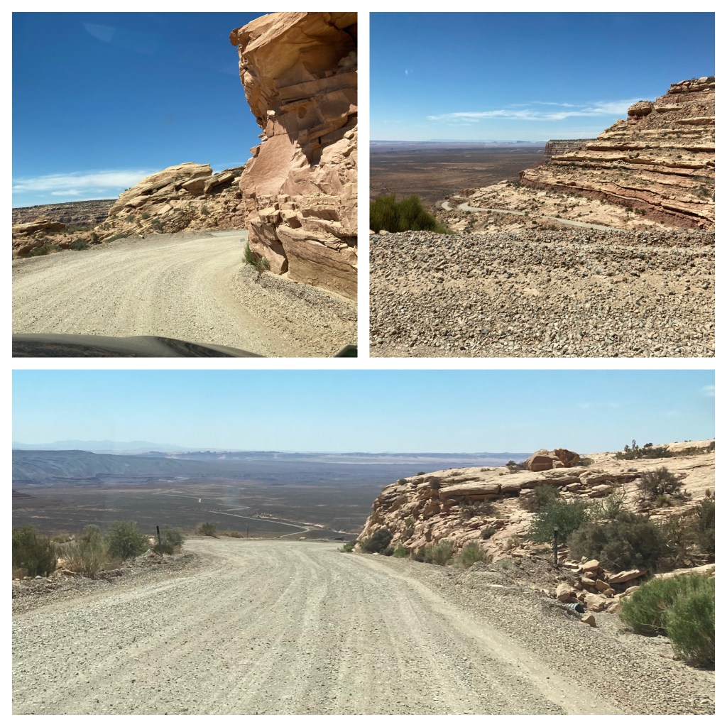
Our Airbnb host had recommended that we not backtrack to Blanding on our way to Flagstaff but take a more local road that provided great scenery. The scenery started as soon as we turned onto the road. Several cattle were grazing along the road. The signs indicated this was an open range territory where cattle are not fenced in. The signs were accurate and viewing the cattle early made sure we kept our eyes open.
The road was paved except for a three mile stretch of gravel road. The gravel portion was on the most scenic section, reasonably wide with switchbacks and steep elevation loss as we descended into the valley below. The views were excellent and the 15 mph speed limit allowed for time to observe-while still keeping an eye on the road and two hands on the steering wheel.
Views from Highway 261 gravel rsection
Almost at the end of this shortcut was Gooseneck State Park. The park is very small, only a parking area with picnic tables and an overlook of the San Juan River. From the park, you can look down 1,100 feet at the river. Even more spectacularly, the river here has carved curves deep into the rock. Horseshoe Bend south of Page AZ gets more visitors and more press but Goosenecks provides a closer view of more bends. Today the water looked more like chocolate milk. Even so, there were people rafting and stand up paddle boarding way down there.
The rest of the journey to Flagstaff was uneventful. Scenery was still great views of buttes, mesas and dirt but we have driven this stretch of road before so it brought back memories instead of making new ones. We did stop for an ice cream shake at Sonic in Kayenta and arrived in Flagstaff around 3:30.
Traveling to Flagstaff. Monument Valley and Mexican Hat on top.
The next three days are more for family time. There will not be daily posts. We resume the travel portion Friday morning June 11.
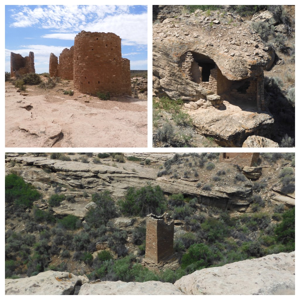
Hovenweep National Monument is probably the last NPS site that we had not visited, until today, that relates to the Ancestral Puebloan people. I thought that the monument would be deserted, located about 45 miles from Cortez CO and equally so from Blanding Utah. The last annual visitation numbers I had read were 40,000 annual visitors in 2017. We left Cortez at 9:30 and reached Hovenweep at 10:30. There were 15 vehicles in the parking lot and an unknown number in the campground. Many more vehicles than I expected.
Hovenweep was named by photographer William Henry Jackson who visited here in 1874. The name comes from the Ute/Paiute word meaning deserted valley. It is deserted today but estimates are the peak period here was from 1100-1300 AD. The ruins indicate a sizable population lived in this area with Hovenweep the center of activity.
Hovenweep has been protected since 1923, to prevent the theft of artifacts. (It may still be occurring. There have been successful federal stings to catch thieves.)There are six areas under protection, located in Utah and Colorado. Most of these require high clearance vehicles to reach them. The Stone Tower group is accessible from the visitor center so we spent our time there. Besides its ties to the Ancestral Puebloans, Hovenweep is known for its amazing and unusual number of towers. Towers, round, D-shaped, and square, were built in the late 1200s and many still stand today. The architectural detailing and stone craftsmanship are outstanding.
Stone Tower Group at hovenweep
The loop trail takes one past several unique dwellings. Hovenweep Castle (named by white Americans, not the Pueblo people) is fashioned by two D-shaped towers on the rim of the canyon. Square Tower is two stories tall and built down in the canyon. Twin Towers had 16 rooms located in one oval tower and one horseshoe shaped. Eroded Boulder House was built under a huge rock which acts as its roof. Chris thought a few of the buildings and ruins resembled hobbit houses.
The tour took us about 1.5 hours to make the 2 mile loop with a descent into and ascent out of the canyon. The park ranger explained various hiking options, noting that it was very hot out and no judgments would be made if people only took a short hike. We started out thinking we would only do a little less than one-half of the total trail but ended up completing the whole trail.
Part of the loop trail at Hovenweep
After a picnic lunch, it was off to Blanding Utah. At Blanding we are spending the night in our first Air Bnb for probably two years. The drive here was again on the Great Sage Plain, with sage brush flat fields alternating with rock outcroppings.
Little surprises still pop up. We were driving in an area without any major concentration of buildings when we came upon a Little Free Library. It was one-third of the way to Hovenweep and placed by the side of the highway. It had a great scenic backdrop. Chris did not find any books of interest. We saw one vineyard and several farms with horses. As we got closer to Hovenweep, the irrigation system seemed to end and we no longer saw lush green fields.
Blanding has no major hotels and few restaurants but the town’s visible infrastructure seems in good shape. Tomorrow’s destination is Natural Bridges National Monument. It is one hour away and Blanding is the nearest community to it.
Side comment. We have driven through portions of Colorado for seven days. It has to be the state with the least use of traffic paint of any state that I can recall. Highways or city streets, it did not matter. Not the end of the earth but just something different to end the blog and our time in Colorado.
On the road to Blanding, Utah
Ed Heimel, Chris Klejbuk Sunday June 6 Blanding Utah
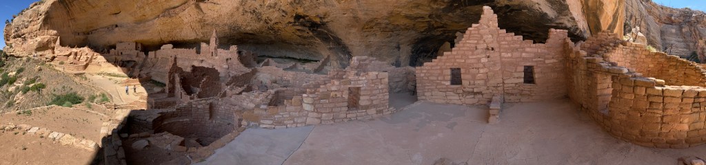
Our tour of Long House was to begin at 10:30 A.M. We left the hotel at 7:30. We had to: drive to Mesa Verde entrance from Cortez, drive the 27 miles to Wetherill Mesa trailhead and parking lot, and then walk .75 miles to the meeting point for the tour. They want you at the tour meeting spot 15 minutes early. NPS recommends 1.5 hours to drive the 27 miles to the trailhead. As you might expect, the road is full of switchbacks, steep ascent and descents, fallen rock areas, and potentially slow drivers. We figured it would be necessary to leave our hotel no later than 8 AM to meet the recommended schedule.
We arrived at the Wetherill parking area at 8:30. The drive did not take as long as the Park Service recommends. They also recommend that you have half a gallon of water per person for the hike. We took more than we would normally take, but less than the recommendation. At the end of the tour, we had a surplus of water. So much for Park Service recommendations.
Evidence of 2000 fire on Wetherill Mesa
Arriving early allowed us to explore the Long House area before the tour started. Our picture of Long House from a distance was only possible because we hiked to an overlook. The trails here are paved and a variety of flowers were evident along the path. Wetherill Mesa suffered a wild fire in 2000 and scorched and burnt trees were still standing.
A ranger was stationed at the meeting point to greet visitors, check your ticket and send you in at the appointed time. Piñon gnats were flying and periodic cicadas were making their unique noise. So far it seems we have avoided any gnat bites, tomorrow may be a better indicator. The tour to Long House involved a 2.25 mile round trip with an elevation gain of 130 feet and climbing two 15-foot ladders. Not horrendous but at 7000 feet and after the pre-tour hiking, we were tired at the conclusion of our visit. The good side is we were able to hike in the early morning temperatures in the 70s versus hiking after the tour when the temperatures were in the high 80s.
Due to COVID-19, instead of one ranger leading a group of 25 and giving a full history of the site, two rangers were stationed at the site and answered questions. For us, this provide a good experience. We have been to numerous similar sites and did not need a recap. Our 10:30 tour time was missing most of its visitors. We were not sure if they were delayed or changed their minds. Their absence made for a sparse gathering but more attention from the two rangers. The 11 o’clock tour had a full cadre and filled up the spaces.
From the NPS.—Long House is nearly equal in size to Cliff Palace with about 150 rooms, 21 kivas, and a row of upper storage rooms. It may have been home 150 to 175 people. Some of the architectural features in Long House suggest it was also a public place where people from all over the Wetherill Mesa gathered to trade or hold community events. The formal plaza in the center of the site is larger than most villages and has some features not often found in other Mesa Verde archeological sites. ….The high number of rooms and kivas in Long House, plus the presence of the formal plaza suggest the community was a particularly significant place for Ancestral Pueblo people, perhaps serving both civic and ceremonial functions.
Tonight was our first sit down and order from a menu dinner. We chose the Loungin Lizard in downtown Cortez and both of us ordered their comfort food meat loaf. We shared a bread pudding with two scoops of cinnamon ice cream. The restaurant was recommended by a couple from Miami. At the Mesa Verde Visitor Center, the woman noticed Chris’ traveling vest and asked where Chris purchased it. One thing led to another and 20 minutes later we wished them well on the rest of their excursion. The exchange brought back pre-COVID travel experiences of chatting with fellow travelers.
Speaking of COVID 19, one just has to be flexible. This Hampton Inn requires face masks at all times indoors. It is serving hot and cold breakfasts but you are served once again by a staff member stationed behind a table. The swimming pool is open. One local grocery store had no sign regarding masks. Another grocery store requested unvaccinated people to wear a mask. The Mesa Verde bookstore required masks and limited attendance to 10 people at a time. Exhibits were closed. The Canyons of the Ancients visitor center had exhibits open and requested face masks if unvaccinated. They also had their movie going.
For us, traveling once again is great and we are more than willing to be flexible.
Comfort food dinner in Cortez, Co
Ed Heimel, Chris Klejbuk Cortez CO Saturday June 5, 2021
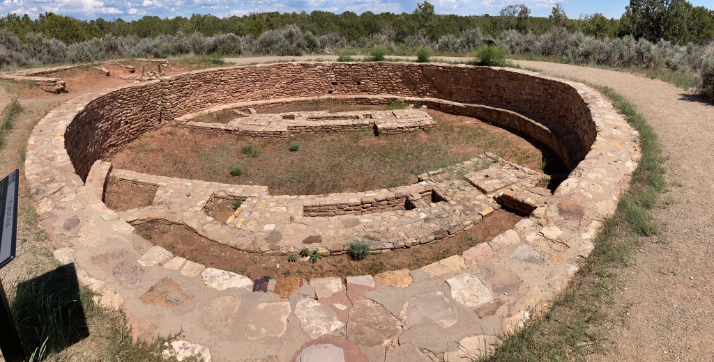
Great Kiva at Lowry Pueblo, Canyons of the Ancients
Cortez, CO June 4, 2021
Tomorrow we will tour Mesa Verde National Park. Due to Covid, tours have been re-structured and limited. Tickets are required and limited. Very limited. Ticketing opens up two weeks before the date you wish to take a tour. Long House and Cliff Palace are the only two options for people like us who do not want to hike in the back country. Our itinerary only allowed Saturday June 5 as an option. Trying for a tour on today, Friday June 4, would have been risky given the travel time and route to get here.
Saturday May 22nd was the first day possible to order tour tickets. Having reviewed the ticketing portal in advance, it seemed that every day sold out the first day ticketing opened up. At 9 AM on Saturday, May 22, when the ticketing portal opened for the day, I tried for the first tour at 9:30 AM. Sold Out. Retried for 10:30 AM. Success!!. Out of curiosity, after I had completed my purchase, I tried to buy tickets for later in the day. The entire day was sold out. Good thing I did not dawdle or sleep in!
Recognize that a visitor can still walk around and take hikes. There is one other cliff dwelling where a visitor does not need tickets but since we came this far, lets get the full experience. Tomorrow’s post will detail the experience. I just wanted to provide a little background and warning for others who might wish to take a tour.
Driving to Cortez
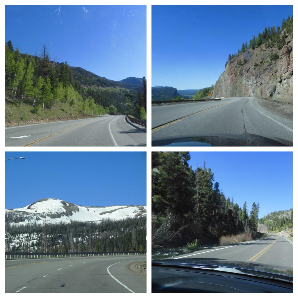
Today’s drive from Alamosa to Cortez was on a US highway. Sometimes it was two lanes, sometimes four. The route includes high mountain valleys, some rushing creeks, forests, rocky mountainsides, and tall mountains. The highest elevation was 10,856 feet above sea level. At Chimney Rock, more later, traffic stopped for construction. We pulled out from a side road and got into traffic behind a semi. I figured we would be stuck behind him for miles. Instead, we worked to keep up with him for over an hour. He led us along the highway no matter how steep the road became. Finally turned onto a different road. Forty years ago as we drove the Pennsylvania Turnpike, whose mountains were nowhere near as high, a car would zip past semis as they labored up hills. Then the semi would reverse the process and zip past the car on the downslope. Today’s trucks are much better engineered and manufactured.
Mesa Verde National Park was created as a national park in 1906 to preserve the archeological heritage of the Ancestral Pueblo people both atop the mesas and in the cliff dwelling below. The park includes over 4,500 archaeological sites, only 600 are cliff dwellings. (NPS brochure) This area of Colorado, and parts of the neighboring states of New Mexico, Utah and Arizona are rich in Native American history. It is said that 24 tribes trace their heritage back to this four corners area.
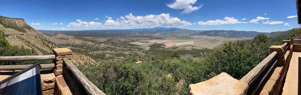
Lunch included this view from Mesa Verde
In the afternoon we explored the visitor center for Canyons of the Ancients. This is a national monument also, one administered by the Bureau of Land Management. The U.S. has 129 national monuments with the overwhelming majority administered by the National Park Service. BLM has 29 and the Forest Service is next with 13. The NPS managed monuments seem to get the most attention and visitors. We have visited several BLM National Monuments before, such as Pompey’s Pillar, Rio Grande del Norte, Kasha Katuwe Tent Rocks, and Grand Staircase Escalante among others.
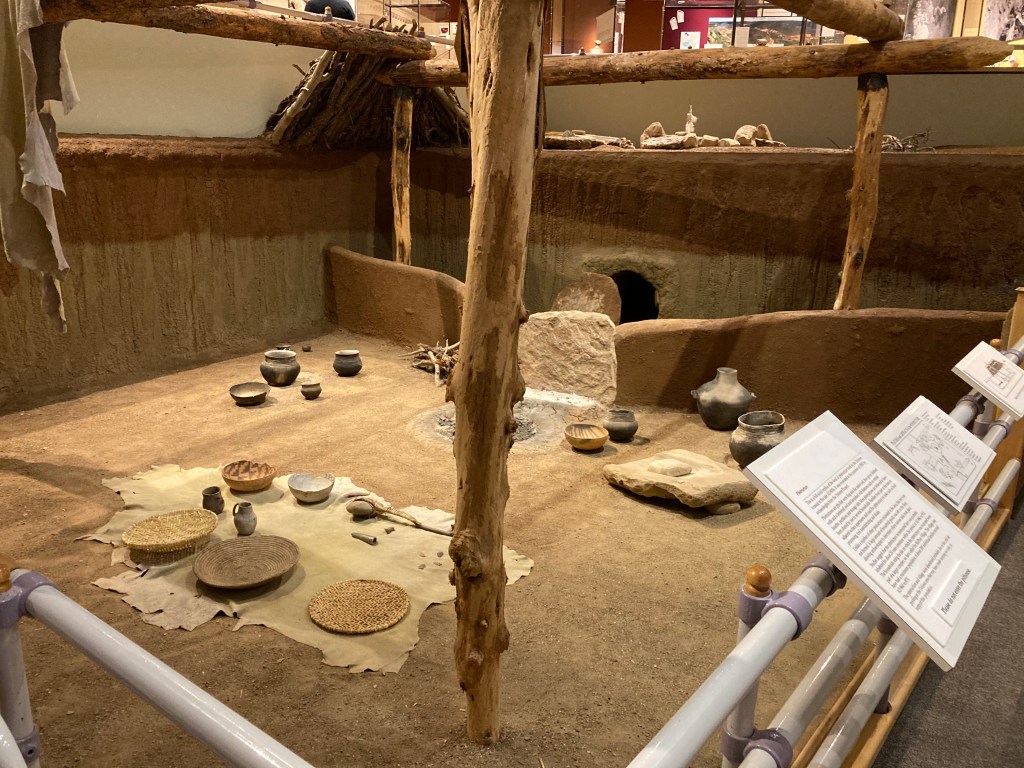
Exhibit at Visitor Center at Canyon of the Ancients
Canyons of the Ancients National Monument is more than three times larger than Mesa Verde National Park. The national monument has thousands of archaeological sites. This high desert area or Great Sage Plains has fertile land and was home to single family farms, villages, kivas, cliff dwellings, reservoirs, etc that supported a densely populated area from AD 500 to 1300. However the national monument only receives 30,000 visitor per year compared to over 500,000 for Mesa Verde. The visitor center is the official repository of items found within the national monument, some of which came from archaeological digs at development sites, such as housing or irrigation projects. The displays are impressive and well laid out. And in these days of COVID-19, it was open.
The McPhee Reservoir dams the Dolores River to provide irrigation water for much of southwest Colorado. It is the fifth largest reservoir in the state and its canal system is extensive. The drought here has brought the reservoir levels extremely low and irriagation water is in short supply.
One of the excavated sites at Canyons of the Ancients is Lowry Pueblo. To get there we drove past some of those irrigation canals and observed the dramatic impact the water has. Irrigated farms have crops that are bright green and newly plowed fields are a deep brown waiting for the magic of water and seed to begin growing. It is a modern example of the impact of water and how the Ancestral Puebloans skillfully managed this scarce resource.
Lowry Pueblo is unusual within Canyons of the Ancients. The Great House and Kiva have been excavated and made available for viewing. Most of the national monument though is undeveloped, to respect and protect the items and the heritage of the Ancestral Puebloans. Between the Pueblo and the irrigated fields, Chris and I realized that life has been going on in this corner of the state for untold years and we rarely understand or respect that.
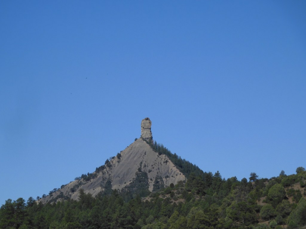
Chimney Rock. Chimney Rock National Monument was a spur of the moment action. We were not aware of this site in our planning. It is managed by the U.S. Forest Service. It too is connected to the Ancestral Puebloan culture and is considered the most remote and isolated community connected to Chaco Canyon. We were on the road west of Pagosa Springs and saw the sign. We were entering into a construction zone and were not sure we could even make the turn off. A car in front of us turned onto the road leading to Chimney Rock so we turned also.
The monument visitor center (Temporary quarters-the new one is currently under construction.) is just ten minutes off the main road. Reaching the rock pinnacle and touring the pueblo area would have required a commitment of two to three hours. We did not believe our schedule allowed it so we noted it for a future trip and headed back to the highway where we picked up the trail of the semi.
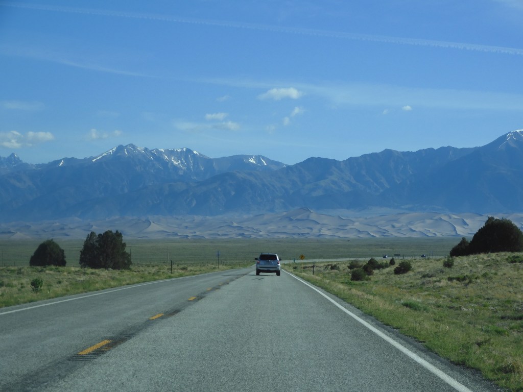
No history lesson today. We spent our time visiting a national park and several wildlife refuges. Nothing high-powered, just an enjoyable day in a different part of the country. Today’s national park, Great Sand Dunes National Park and Preserve, has received a lot of hype lately as an under appreciated and less visited park. It seems many people read those comments and decided to put this park on their to visit list.
We left the Best Western hotel in Alamosa in time to reach the park for the 8:30 AM opening of the visitor center. Unfortunately, we made a mistake, not sure how that happened, since the visitor center opened at 9 AM. We took the brief nature walk by the visitor center and then got in line. The walk put us at number two in line instead of number one.
Now, despite being married for over 48 years and having hundreds of days of travel together, we can still differ on how to prioritize our day. Chris wanted to wait in line for the quick stamping of our National Park passport book. Only five people were going to be allowed in the front vestibule for the quick stamping process. I thought it was wiser to go to the back entrance to gain access to the bookstore and ranger information desk. 12 people were allowed in there but their time inside was likely to be longer.
I should have just gone back there rather than waiting with Chris. Made me grouchy, for a short while, as we waited for 9 AM to arrive and the passport book to be stamped. We did have to wait at the bookstore entrance but only for about five minutes before we entered and bought two postcards. In my defense, I was concerned about parking at the sand dune area. Big signs as we came in told everyone to anticipate Limited Parking and Heavy Traffic Expected.
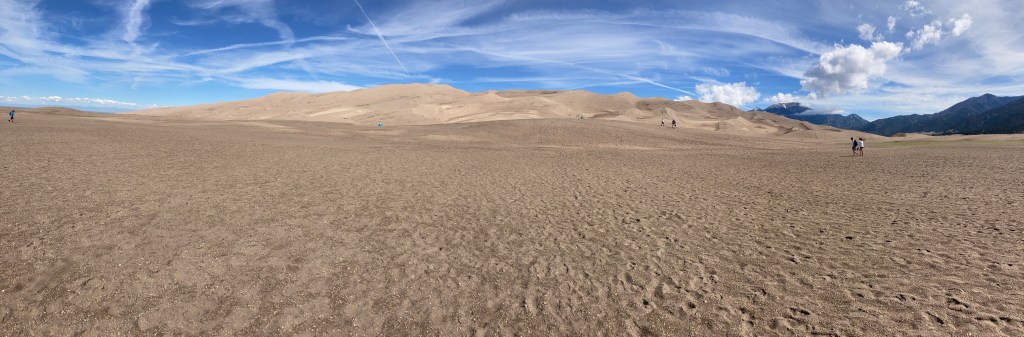
Great Sand Dunes is an anomaly. At the foot of the Sangre De Christo mountains is an area of sand. Sand that one might expect at a nice ocean beach. Acres and acres of sand (30 square miles). High dunes of sand reaching 750 feet. The total park and preserve is over 232 square miles of forest and mountains but most attention is paid to the sand dunes.
Given the unique nature of the park and the heavy hype, I wanted to make sure we were at the dunes area in time for easy parking. Turns out we did fine, got a nice parking spot. My concerns were not unfounded though since from the dunes we later saw long lines of cars coming in and cars being parked way down the road leading to the parking area.
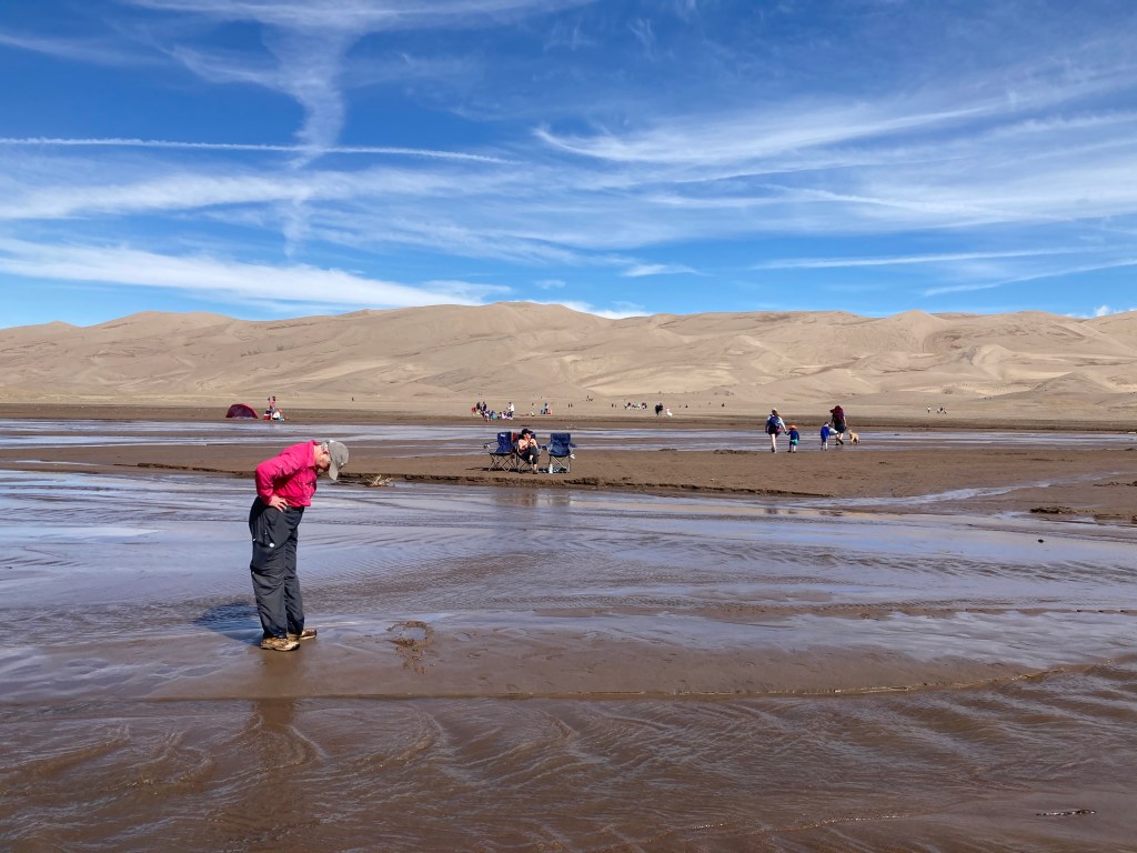
Unlike say, Sleeping Bear Dunes Lakeshore in Michigan, a visitor tromps through Medano Creek before walking through a rocky/sandy area prior to reaching the pure, soft sand of the dunes. As you can probably guess, we did not walk up 750 feet of sand to reach the top of the dunes. Walking in sand is tiring and the elevation here is 7,500 feet above sea level. We put in 45 minutes of climbing up and another 45 minutes climbing down. The weather was perfect, low 70s and practically no wind.
Most visitors were not here to hike to the top of the dunes. Great Sand Dunes replaces a day at the ocean for people in mid-continent America. Sliding down dunes or sitting alongside Medano Creek were the chosen activities. No need to over exert yourself for either of those options. Sure, some younger folks had plans to hike to the top, but they were the exception.
Medano Creek had already reached its peak depth on May 23; today it was 1-4 inches deep. Snow depth in the mountains was lower than usual this year. The creek spreads out, reaching 20-40 feet wide. Eventually the creek starts to dry up unless significant rainfall occurs in the summer.
Why are there sand dunes here? A very brief explanation is wind. Rocks erode and sand and gravel normally wash downstream. Here the mountain ranges create a wind flow that becomes almost circular, keeping the sand in this area and forming dunes.
It was a little early for lunch but we decided to stay and have lunch in a quiet, shaded area away from the dunes. It gave us a chance to continue to enjoy the day without my hyper-ventilating about parking.
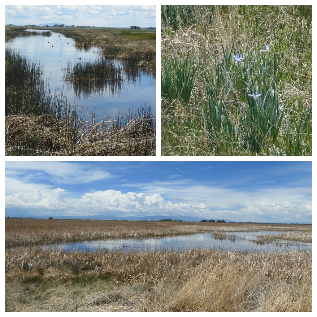
Post lunch we visited Alamosa National Wildlife Refuge and Monte Vista National Wildlife Refuge. Both have auto tour routes. Both were practically deserted. Both had only a few bird types evident. Red-winged blackbirds were abundant. We heard new bird cries unfamiliar to us but the birds did not reveal themselves. During the spring and fall migration periods, sandhill cranes are abundant. The time spent did not make for a majestic time, but it was pleasant.
Before coming here, we paid no attention to the headwaters of the Rio Grande River. Probably a bit provincial for people well aware of the headwaters of the Mississippi River. As we arrived in Alamosa and saw signs at bridges noting that we were crossing the Rio Grande River, we said “the Rio Grande? Here?” Sure enough, the Rio Grande River begins in the forests and mountains 60 miles northwest of Alamosa. In our minds there is almost as much water in the Rio Grande in Alamosa as there was in the Rio Grande in Big Bend National Park when we visited in April of 2018. So much water is drawn off for irrigation and drinking as it flows through low rainfall areas that little is left by the time it reaches the Gulf of Mexico.
Rio Grande River
Friday morning we head to Cortez CO and Mesa Verde National Park. Mesa Verde we expect to be crowded and hot.
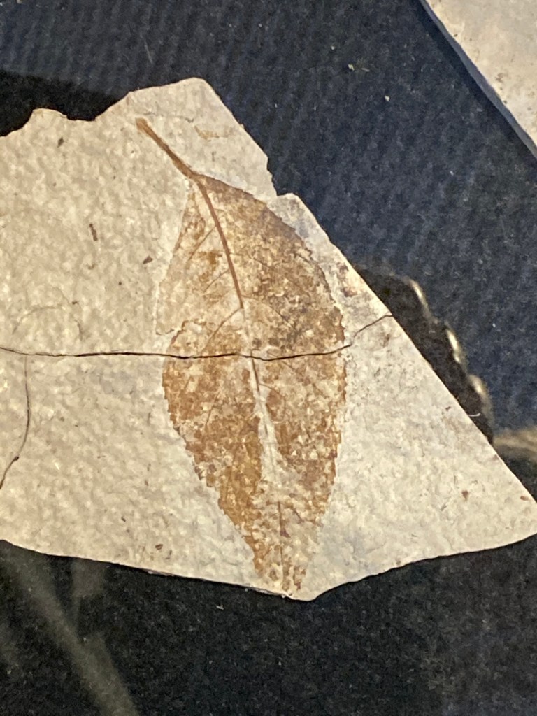
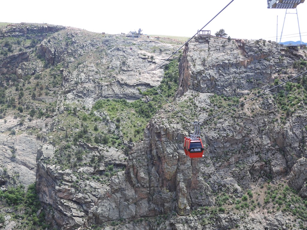
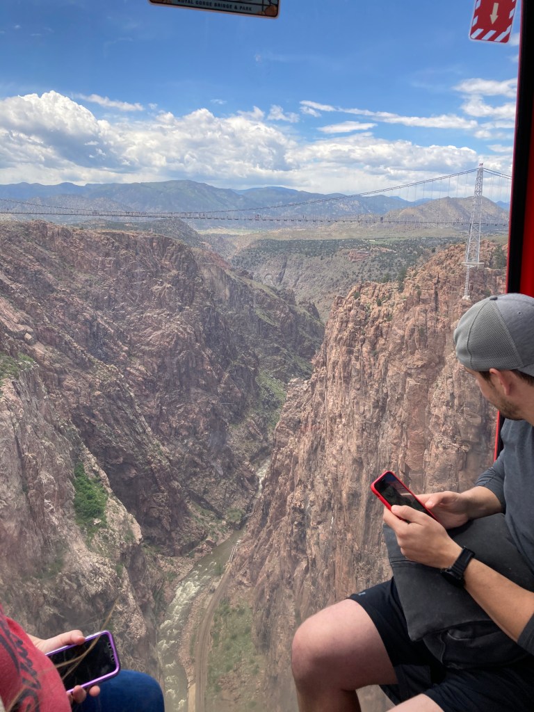
Post script. Yesterday’s blog left out two photo scenes that I had meant to include so the pics are below. The pictures are of the gondola over the Royal Gorge of the Arkansas River and of fossil samples from the Florissant Fossil Beds.
Ed Heimel, Chris Klejbuk Alamosa Thursday June 3, 2021
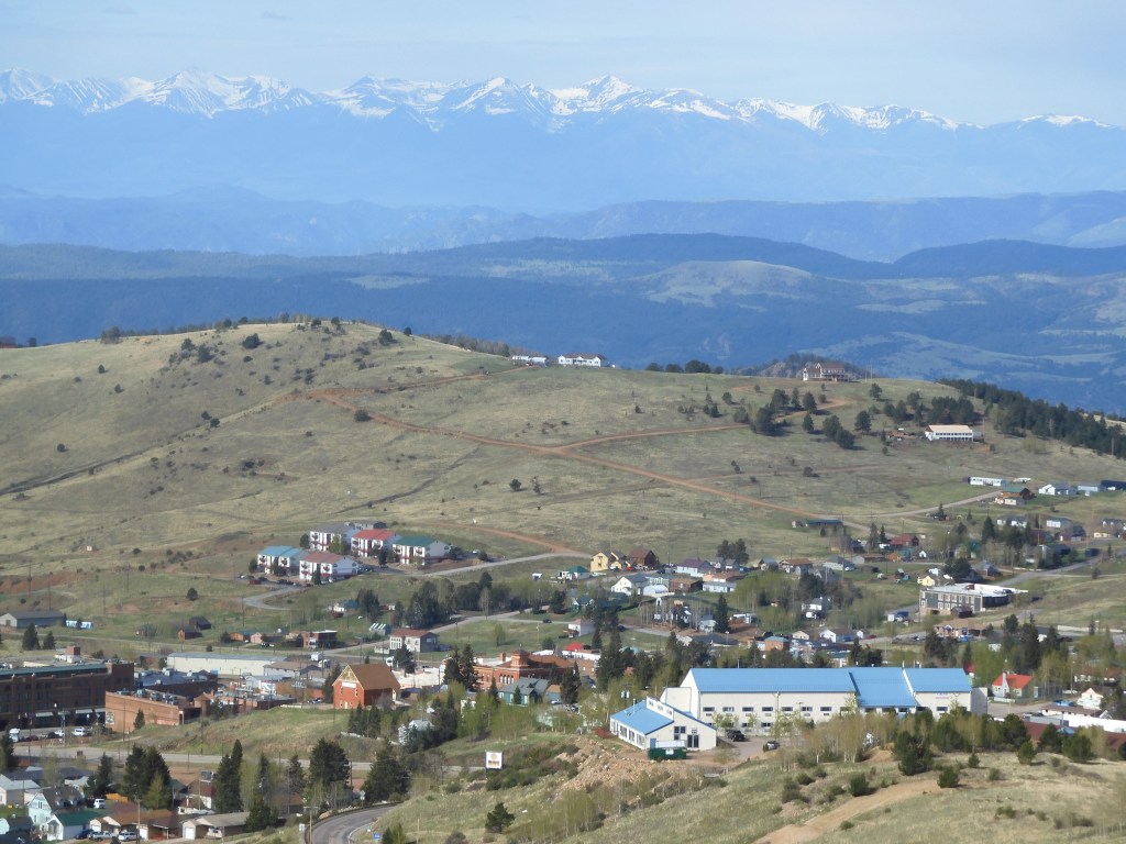
How about starting today’s blog with the story of the Golden Toothache? Our day started at the Heritage Center in Cripple Creek, Colorado. Cripple Creek is best known for its gold mining rush that began in 1890 after Bob Womack, a local prospector, found a major source of gold. Finally, 12 years of prospecting in the Pike’s Peak area ignored by others panned out. One big reason— Bob was staked to his efforts by a local dentist. Bob had a toothache, the dentist fixed it but also listened to Bob’s tale of prospecting. The dentist believed Bob’s one good lead would be successful and it did. Bob’s claim led to other prospectors prospecting in the area and Cripple Creek’s boom time had begun.
The video in the Heritage Center portrayed a series of vignettes highlighting aspects of the boom times in Cripple Creek. Fortunes were made and lost. Mining conditions led to successful union strikes followed later by successful union busting efforts. Railroads came and went. Gold production peaked, bottomed out, and has recovered again. Cripple Creek, like many other boom towns, had culture and education to put a big city to shame. Each of these vignettes, and others, could be a blog post in itself.
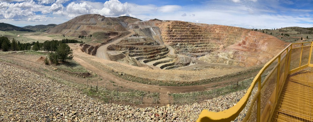
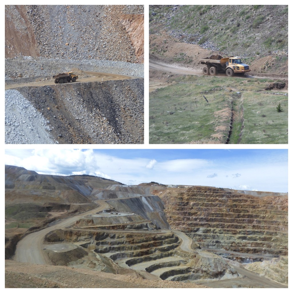
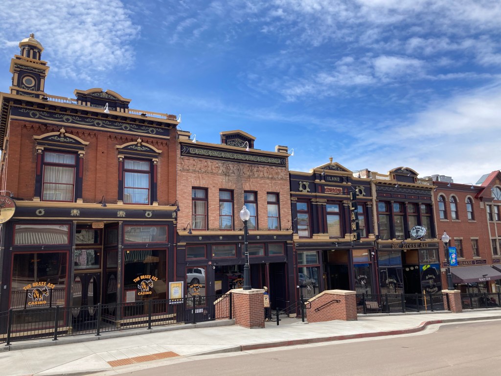
Today Cripple Creek still has an open pit mining operation. Dwarfed by gold mining in Nevada, the open pit mine is still productive. Regulations now require reclamation of the pits, which seems successful to our eyes. More of the Cripple Creek economy seems driven now by tourism and gambling. Gambling has led to renovation of the old brick buildings from Cripple Creek’s boom times.
Part of downtown Cripple Creek
We spent the morning in Cripple Creek, walking the downtown, viewing the mine, exploring the Heritage Center’s numerous exhibits, finishing off with a picnic lunch outdoors. Clear skies with a breeze made for a refreshing trip.
Then it was time to head out. On the outskirts of Cripple Creek was a display outlying the various road and “scenic byways” of the area. Our next destination was the Royal Gorge Bridge west of Canon City. Google Maps, remember our experience at Sand Creek?, outlined three options. The middle one seemed the most direct and quickest. All three would be scenic. The display described one route as “unpaved, rough, winding.” A second route was described as “unpaved, 4-wheel drive recommended, part of route one lane.” The third route was described as “well maintained, no vehicle restrictions.” We chose the third option.
The drive was scenic with mountains and valleys, rock formations, cattle ranches, and dotted with large and small homes in abundance. Blue skies alternated frequently with cloudy skies, brief showers, and black rain clouds which popped up in every direction but missed us.
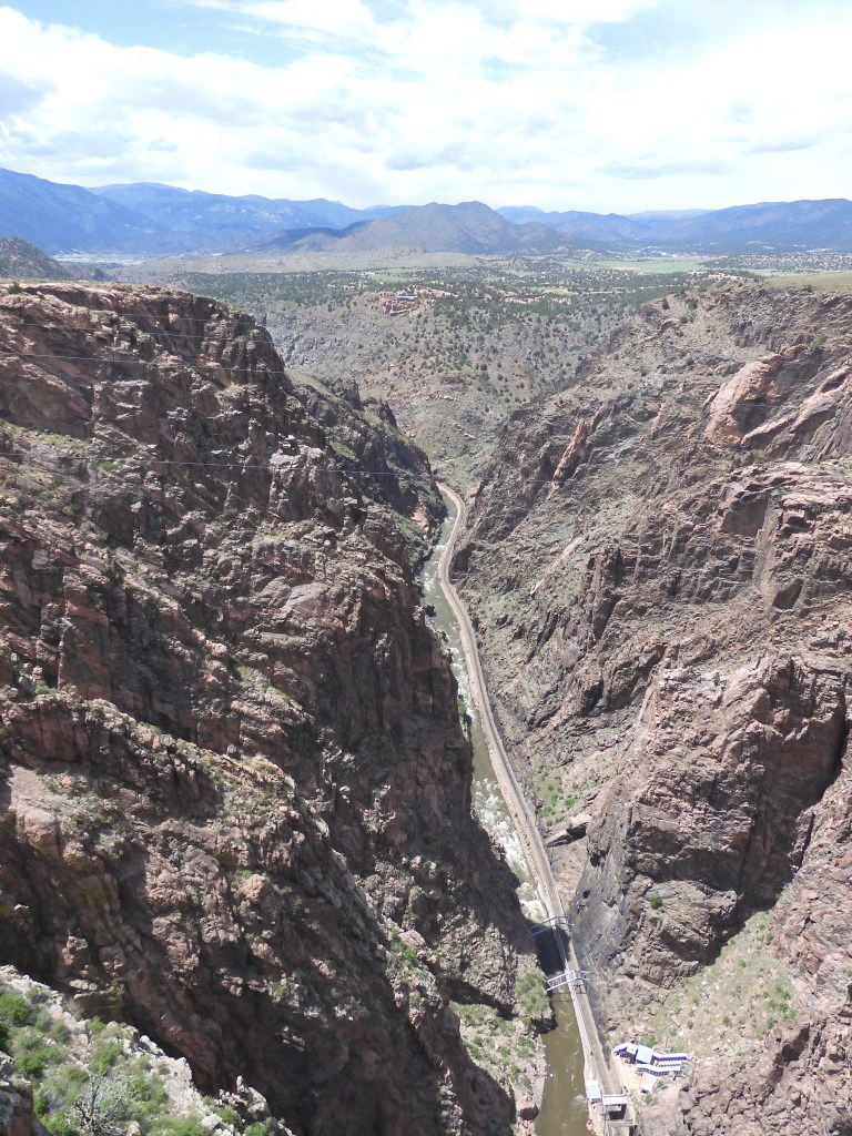
The Royal Gorge Bridge is ranked as the highest bridge in the U.S. and in the top 20 highest bridges in the world. It is 950 feet from the bridge planks to the Arkansas River below. It was built solely as a tourist attraction in 1929 and has remained so today. It is only for walking, no cars allowed. The bridge area has added amusements ranging from play areas for kids to a theater to zip lines over the gorge.
View of Royal Gorge Bridge and Arkansas River from gondola
Chris and I chose the more sedate options of the gondola ride one way and walking back across the gorge. I thought I might get vertigo on the bridge, I have on others. I did not. I attribute that to the fact the Royal Gorge bridge is wide enough with railings ample enough to feel secure. Screams from zip liners and the train whistle of the excursion train along the edge of the river punctuated the air. Down below, rafters were challenging the rocks and rapids.
View from the Royal Gorge Bridge
From the bridge we had another drive to Alamosa Colorado. The road again showcased mountains with the Sawatch in front of us and the Sangre de Cristo on our side. The traffic was much heavier as the new roads were U.S. routes versus state and county roads. Alamosa is the closest town to the Great Sand Dunes National Park and Preserve. It will be our primary destination tomorrow.
Cripple Creek CO at an elevation of 9500 feet above seal level


Recent Comments