travel

2021 Southwestern Thanksgiving, Nov. 15-16

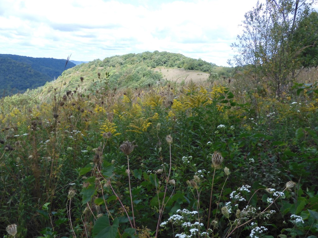
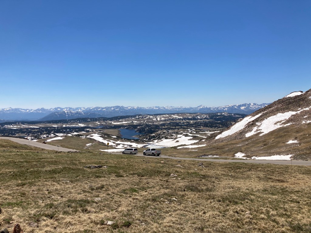
How can one visit southern New Mexico and not stop in Roswell, site of famous UFO and alien encounters? So we stopped there today, Tuesday, but first, we had to get there. We knew Monday would be a long day for us so we left Salina Kansas early on our way to Amarillo Texas. Kansas is relatively flat but we did run across one more “ hilly area” called the smoky hills. For us, we were mainly viewing slight variation of elevations of prairie grass and range land for cattle. I am not knocking it, it has a beauty of its own and I guess when you don’t have much elevation change, any change becomes a hill.

When traveling in an area like this, you appreciate attractive and well laid out farm complexes. Diverse landscapes across our country are a feature that you don’t see or appreciate unless you drive, particularly back roads. Little oddities stick out, sometimes we stop for them, sometimes we don’t. Three examples. First, we saw a concrete early style grain elevator that was unique to our previous experience.

Second, a grain kept appearing in farm fields that looked like miniature corn. Several pictures helped Chris determine that it was sorghum, a crop little grown in Minnesota. Third, we noticed a greater use of the old fashioned windmills to pump drinking water for grazing cattle. Frequently, a windmill provided an artistic picture of its own against the skyline. Sighting the windmills was quite a coincidence because today at the Roswell Art Center, we saw several photographs and drawings by Peter Hurd of windmills with a famous saying of his: ”I am just nuts for windmills.”

The bucolic countryside of central and southern Kansas of morning and mid-day Monday contrasted sharply with the ugly and smelly industrial complexes leading into and out of Amarillo Texas. Petrochemical, agricultural, and meat packing feedlots and processing plants gave off dust, odors, and an unsightly appearance that although the products may be necessary, there appears to be no concern for the environment or the neighbors. No desire to return to this area unless necessary for a quicker drive.

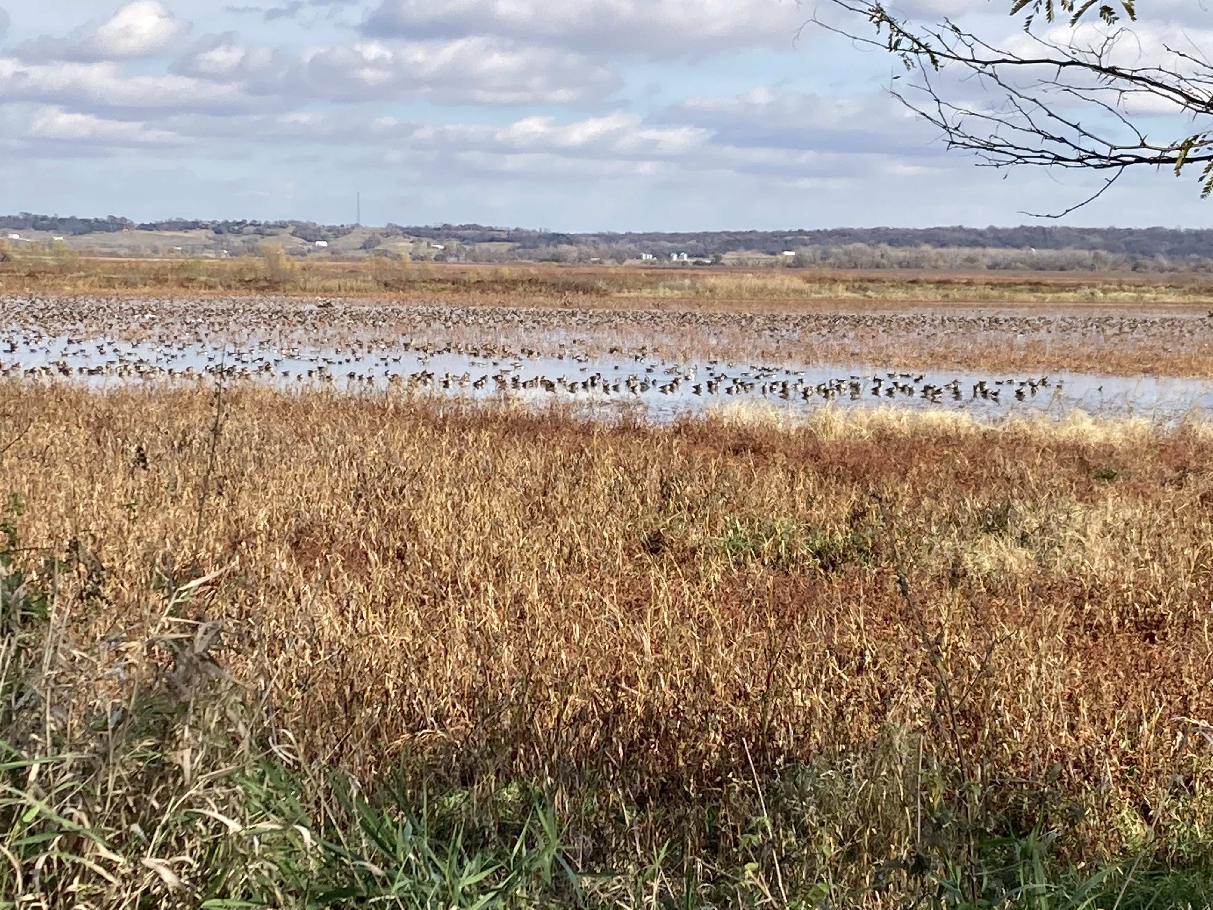
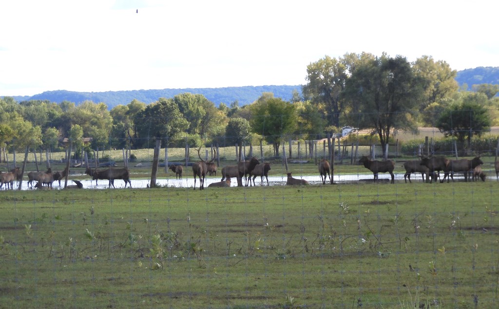
Our first major stop Monday was at Fort Larned National Historic Site. However, we added another national wildlife refuge before visiting the fort. Quivira National Wildlife Refuge seemed to offer an opportunity to see more waterfowl. There had even been sightings of whooping cranes here recently. Waterfowl were few and far between, whether flying or swimming around. No value received for the effort.

Fort Larned lasted for roughly 20 years from 1859 to 1878. Its mission was to protect mail service, keep peace on the plains, and protect overland trails that are the routes to move settlers from the east to New Mexico, Colorado, and points west. The famous Santa Fe Trail came right by the fort. The Trail actually began much earlier than Fort Larned, going back to 1821. Commerce and people on the trail moved both to and from Santa Fe. Supplying demands for products and movement of people, decades of heavy wagon traffic created ruts still visible in locations near to the fort.

The fort exhibits do a great job of explaining relevant portions of U.S. history. Many Americans conveniently forget that Texas, New Mexico, California, etc. were part of Mexico that we took from them. The Plains Indian Wars developed from stolen land, broken treaties and promises, and the eradication of a way of life and culture leading up to the Plains Indian Wars.

Leaving Ford Larned, we drove to Greensburg Kansas. This town was destroyed on May 4, 2007 when a rare and powerful EF5 tornado leveled the community, killing 12 people. There are still vacant blocks around the community although major efforts have been made to rebuild the town. New public facilities have been constructed, including a museum which features the history of the county, its people, and the tornado.

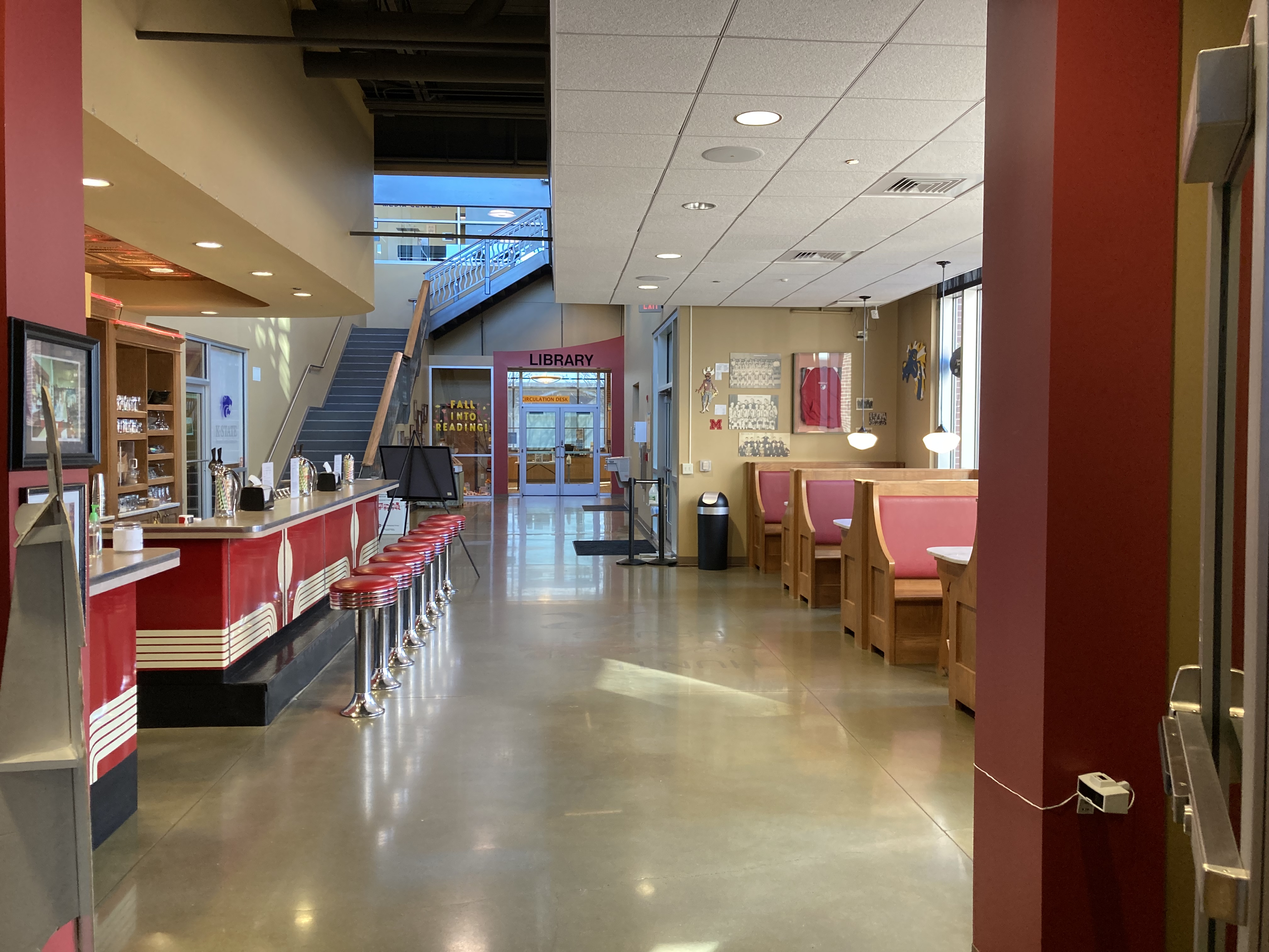
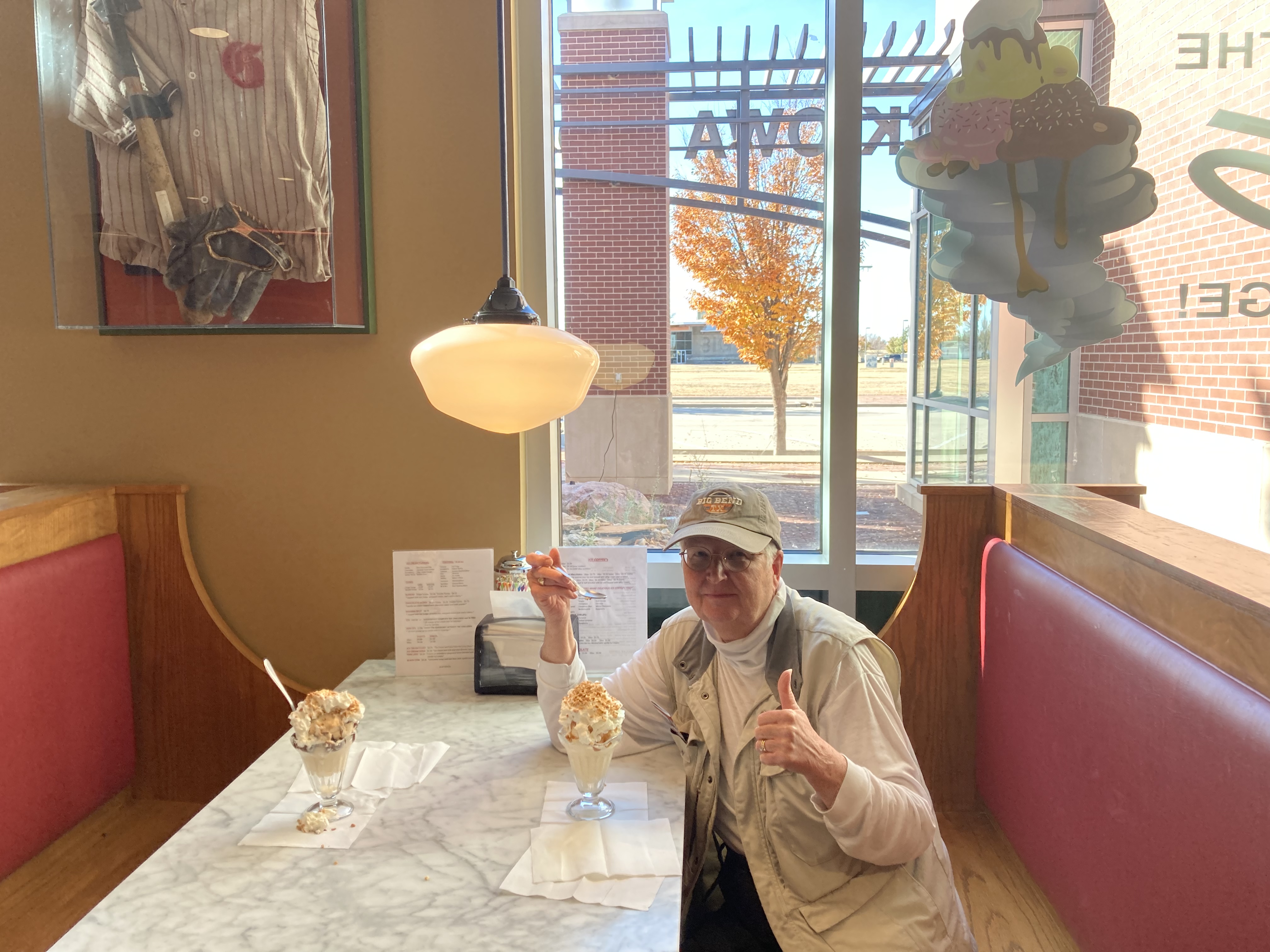
A part of the museum is a living history section, including an old-fashioned soda fountain. We just had to try out the ice cream which was very good. While we were there, a woman, even older than us, came in to get two milkshakes for herself and a friend. The woman had lived through the tornado although the tornado destroyed her family Chevrolet dealership. In her opinion, the town just has not come back to the way it was before.

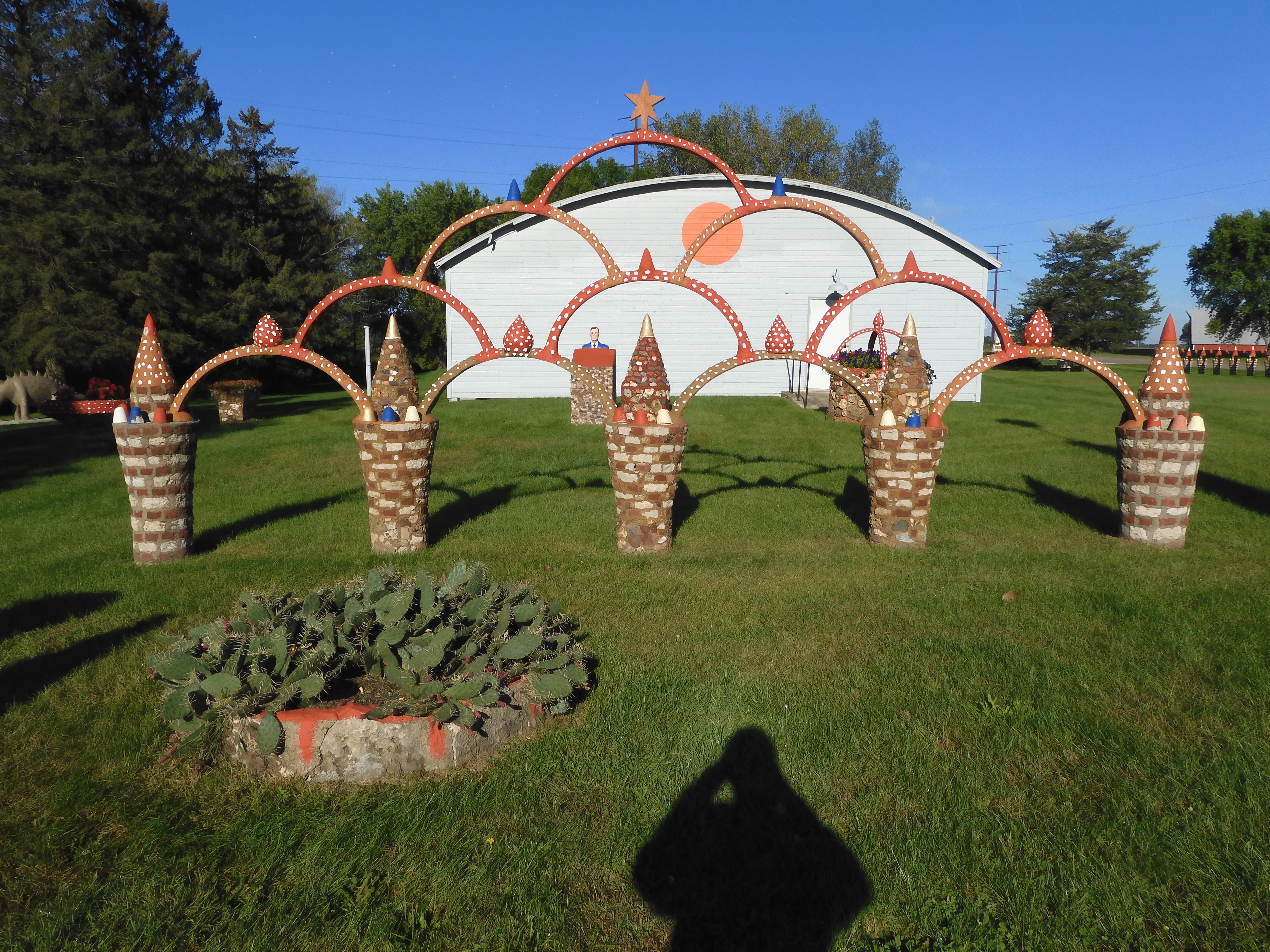
In the town of Mullinville, just a few miles west of Greensboro, was an art museum devoted to the sculptures of M.T. Liggett. Liggett died in 2017 at the age of 83. He was known for creating politically charged metal totems and whirligigs. There is a line of his sculptural pieces stretching along two sides of the museum property. This museum is another effort funded by the Kohler Foundation. You may recall we saw two similar art endeavors in Wisconsin during our trip in early September. The docent at the Liggett Museum had known the artist and while liking much of his work, agreed that he could be abrasive and maybe even obnoxious. He enjoyed creating art that would stir discussion and controversy.

One Liggett story in particular stood out. Liggett was poor growing up. In third or fourth grade, his art teacher assigned the task of drawing a cow. Liggett only had a purple crayon so he drew a purple cow. The art teacher held up his work to the rest of the class and criticized it for its purple color. Liggett said he dropped art for years due to that. Eventually he returned to art and his property is proof of his prolific production.

Monday finished up with our drive to Amarillo, arriving around 8:30 pm with dinner being peanut butter crackers in the hotel room and off to bed. In contrast, Tuesday was set to be a shorter day. Roswell was our destination since there were two places we wanted to visit and hotel prices in Carlsbad, our Wednesday destination, were much higher.

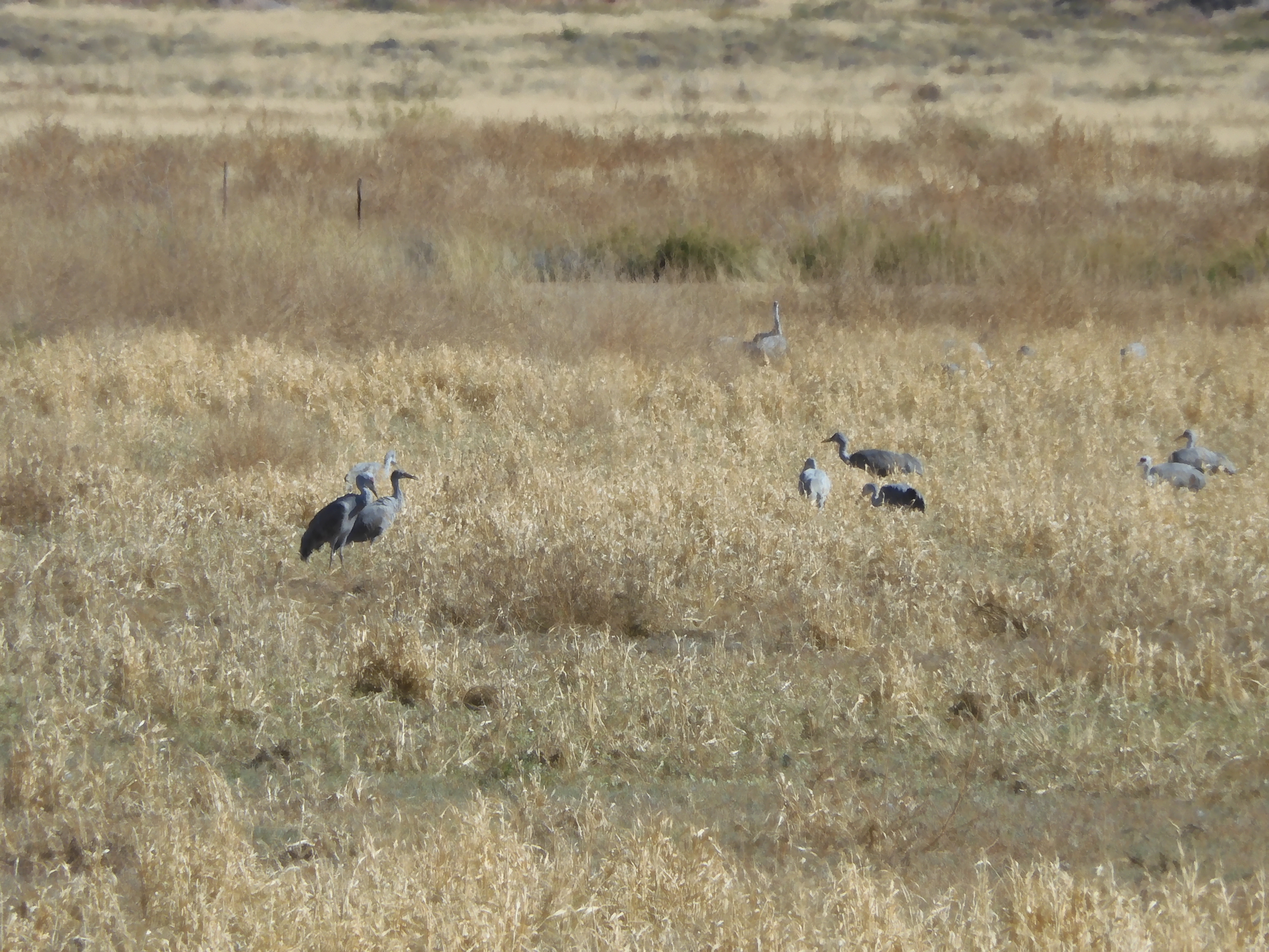
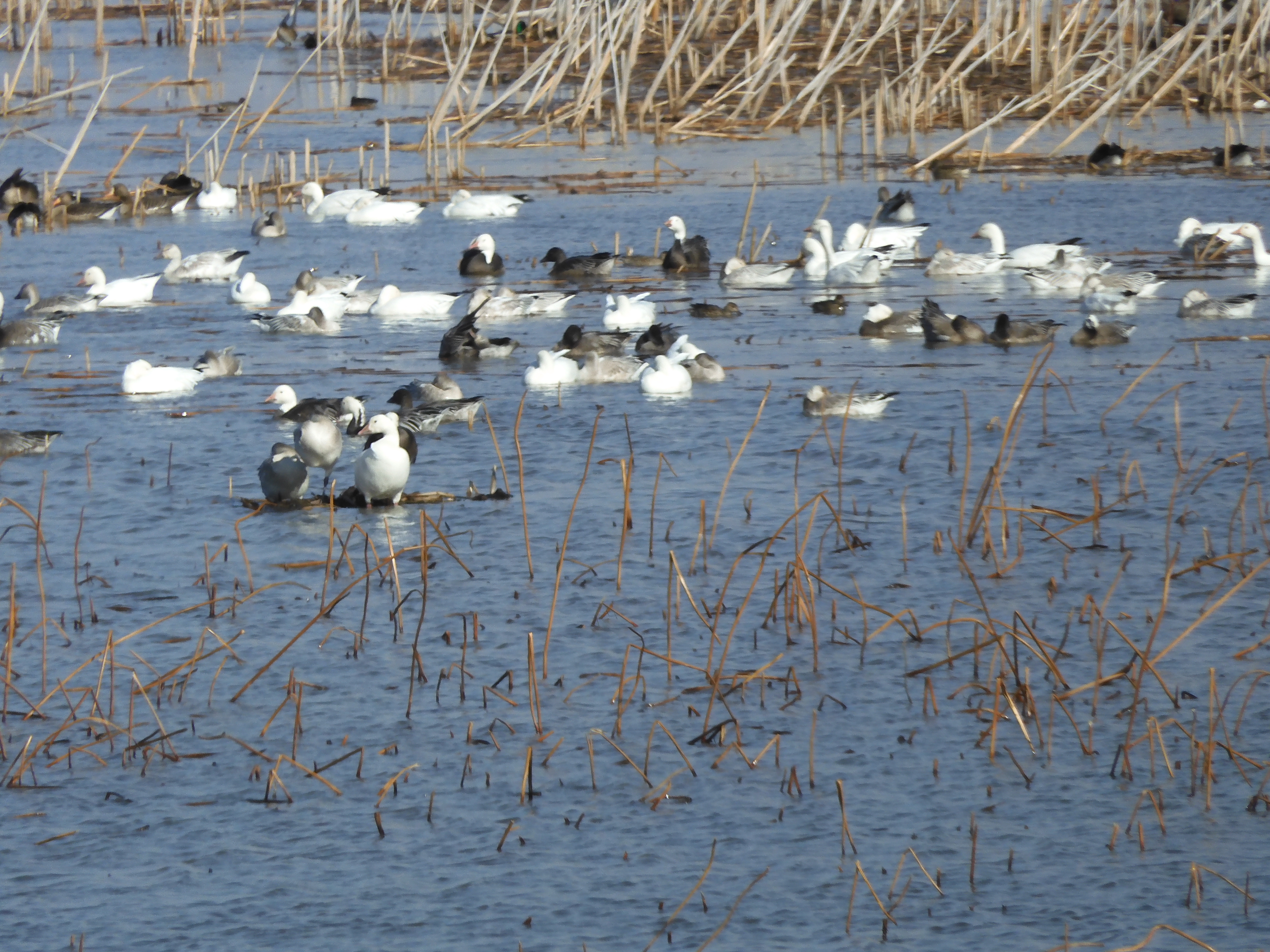
Just outside of Roswell was another national wildlife refuge, Bitter Lake. Sandhill cranes, Ross’s geese, and other waterfowl species were in abundance. We even spotted a hawk perched in a tree, then taking off intent on catching a meal.

Roswell is a town of 50,000 people and the fifth largest city in New Mexico. In popular lore, it is known for UFOs and aliens due to the 1947 reported sighting of a crashed UFO and the death of four aliens. The incident is well-known and heavily debated. The museum here presents the information strongly skewed to the side of it actually occurring with the narrative of a number of participants and witnesses being the strongest evidence. Government explanations appear convoluted and even ridiculous. We aren’t going to take a stand but enjoyed being able to say that we have been here.

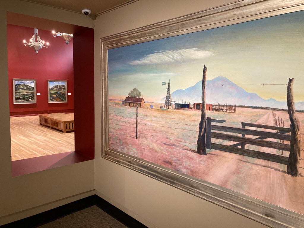
The Roswell Museum and Art Center was our second stop. Portions of the museum are devoted to the Southwest and to New Mexico art and life. Other sections focus on New Mexico artists. A section is devoted to Peter Hurd and Henriette Wyeth. Hurd is a native of Roswell and Wyeth is one of the Brandywine Wyeths. In 1940, the family made this area their home and their future artistic endeavors focused on the area and its people.

Robert Goddard, the rocket scientist, worked on his theories and experimented with rockets in the Roswell area from 1930 to 1941. WWII put a halt to his work and he died in 1945. The exhibit here showcases his research and the efforts of his wife after his death to obtain patents for the work he had conducted.

Roswell has an artist in residence program and art works from numerous participants hang in other galleries. Rogers Aston, a local rancher, oil man, collector and artist (Bronzes), has filled several display cases of southwestern life artifacts. Topics include ranching, spirituality, family life, trade and commerce, etc. The museum surprised us with its beauty and extensive collections on display.

Tomorrow, Carlsbad Caverns.

Ed and Chris, Tuesday November 16, 2021 Roswell New Mexico

Categories: travel | Tags: , , , , , , | Leave a comment

2021 Southwestern Thanksgiving, Nov. 14

Traveling on a Sunday, particularly off-season, is always a challenge when one wants to visit places, not just drive. Today was a perfect example. Two places that might be open before noon, as noted on their websites, turned out that one was not open on weekends and the second was undergoing renovations. For both locations, we had checked several websites and they all indicated no problem in visiting today. Why have a website if you don’t keep it updated?

We pivoted to different options that Chris quickly located between the Rand McNally spiral US map book that we keep with us and Internet checking on the smart phone. We wrote off Omaha Nebraska for another time-maybe.

Our first new stop was the Loess Bluffs National Wildlife Refuge along the Missouri River in the state of Missouri. This required driving south by southeast ( I know, we should be going south by southwest.) along miles of the Loess Hills ( I have seen plenty of these hills by now.) On the way to Loess Bluffs, we stopped at a rest area in Missouri that featured information about the town of Rock Port. This farming community of 1300 people claims to be the first community in the U.S. whose energy is derived solely from wind power. Their wind farm was built in 2008.

The Loess Bluffs NWR is about 30 miles north of St. Joseph Missouri. We knew the visitor center was closed but the auto tour route was open. At the parking lot for the visitor center indoor restrooms, I talked to a gentleman from Missouri who wondered if we were here to look for eagles also. I informed him we were from Minnesota and see eagles all the time. He understood.

We did see a lot of ducks, and a huge flock of snow geese. Muskrat houses dotted the lakes and marshes, providing a perch for birds. But to give you a better idea of the number and types of birds present, we went to the Loess Bluffs eBird Trail Tracker. Here are some of the larger numbers observed in the last 24 hours.Snow goose-2600; Greater white fronted goose-2400; mallards-270; american coot-100; green winged teal-500;ring-necked duck-400; then there was one american white pelican, one downy woodpecker, one black-capped chickadee, one european starling, and one bald eagle plus a bunch of birds with numbers in between the two extremes. We actually saw two bald eagles. I hope the gentleman I met saw them also. Our stop today was just lucky; our visit to DeSoto National Wildlife Refuge on Saturday, while enjoyable, did not have the number of birds observed here.

Our second stop was at a museum (The Pony Express National Museum) open on Sunday in November. The museum is housed in the original Pony Express Stables in St. Joseph Missouri. St. Joseph Missouri was a major ”jumping off point” for Americans headed for the gold fields or new homes on the prairies or west coast in the mid to latter 1800s. It was also the eastern terminus for the Pony Express, that short-lived but famous deliverer of the U.S. mail between the east and the west coast. The Pony Express traveled 1,996 miles in 10 days. That is 8.3 miles per hour.

The Pony Express began on April 3, 1860 and ended when the transcontinental telegraph was completed on October 24, 1861. It was not profitable. The company opened about 160 relay/resting stations about 15 miles apart. Each station had to have stables, bunks, staffing, food and feed. A special mail pouch called a mochila was used which was thrown over very light weight saddles. They purchased 400 horses and hired 200 riders-usually young, wiry men good on horseback. They rode through blizzards, rain and tornadoes. They beat all odds in reducing the time to deliver mail from 25 days on stagecoaches and months on ships to just 10 days. The Pony Express has remained a legend in American folklore.

We thought the museum did a nice job. It is not flashy but has graphics, exhibits of saddles and blacksmithing, videos, recorded messages, etc. covering topics such as the origins of the Pony Express, detailed histories of numerous riders, model stations, large scale maps of the route, etc.

After leaving the museum, we drove 185 miles to our lodging in Salina Kansas. I found it amusing that we began the morning at the Loess Hills of Iowa and finished driving through the Flint Hills of Kansas. (Flint Hills are named for the abundant flint found along the top of the ridges in this area.) During the last hour, our westward journey allowed us to watch the sunset as the colors changed from yellow to orange to a mix of pink, rose, and purple. Scattered cloud cover gave the colors an opportunity to be reflected in a variety of patterns. It was a scenic end to the drive.

Dinner was at Popeyes Louisiana Chicken-our first time at a Popeyes.

Ed and Chris, Salina Kansas Nov. 14,2021

Categories: travel | Tags: , , , | 1 Comment

2021 Southwestern Thanksgiving, Nov.13

Loess Hills of Iowa

Council Bluffs Iowa, November 13, 2021

Today was museum surprise day. But, for the first part of Saturday, we remained in the Sioux City Iowa area. Our first stop was on top of a bluff overlooking the confluence of the Sioux and Missouri rivers. The statue of Chief War Eagle is there, looking down on the rivers and the city of Council Bluffs. Chief War Eagle was born in Minnesota or Wisconsin around 1785 as a member of the Santee or Eastern Dakota Indians. He seems to have moved around the region and ended up along the Missouri River. As a chief in the area he spent most of his life with white settlers and constantly promoted peaceful relations between Native Americans and the European settlers. This monument recognizes those peaceful efforts.

I had mixed feelings regarding the monument. It was constructed by the white Europeans to recognize his efforts but one wonders the tension he must have faced within the Native American tribes given the conflict and difficulties between those tribes and European settlers. As we all know, peaceful efforts, as well as warlike efforts, were unable to save the Native Americans from the settlers greed and spread of diseases. The Missouri River which flows below the bluffs, was transformed from a river teeming with wildlife to a river engineered with dikes and dams to be harnessed for commercial purposes. What would Chief War Eagle think if he looked down on his river today?

Our second stop was a late addition to our schedule. The Dorothy Pecaut Nature Center was just a few miles from the Chief War Eagle statue. I was drawn to it because of its emphasis on the Loess Hills of Iowa. Loess is a geologic term. Loess is a product of “glacial flour”-a term we have encountered previously. Glacial flour is bedrock ground up by the movement of glaciers. The glacial flour gets deposited into rivers by erosion, which sediment moves down river during floods. As the floods recede, the sediment accumulates into mud beds. The mud beds dry out, winds come along, and pick up the dried sediment, and blow it all over the surrounding areas.

This loess and the centuries of growth of prairie grasses and forbs is a major reason for the fertile agricultural fields of Minnesota, Iowa, Illinois, Nebraska, etc. The Loess Hills of Iowa are a region along the Missouri River where wind and water have created hills next to flat plains. The Dorothy Pecault Nature Center had a nice explanation of this phenomena and it was just a short drive from our other planned stops of the day.

We also learned that bur oaks, a staple of the oak savanna and the prairies, have a root system somewhat symmetrical to its tree branches. Chris loved the depiction of the golden pheasant, we normally have only seen ring-neck pheasants.

Next, we visited the Palmer Candy Company of Sioux City. This is a regional candy company whose claim to fame is a popular regional candy called Twin Bing. The candy is a cherry filling with nougat and a chocolate and peanut coating. We purchased a bag of snack sized bars and we each tried one. Very sweet, nice flavor but I still prefer Pearson’s Nut Goodie bars and Salted Nut Rolls.

Our final stop in Sioux City was the Sergeant Charles Floyd monument. This 100 foot tall monument honors Sgt. Floyd, the only member of the Lewis and Clark expedition who died during the two years of the trip. The monument was constructed in 1901 from of sandstone obtained from a quarry along the Kettle River in Minnesota. The Kettle River quarry is now part of a state park which Chris and I have visited numerous times. Floyd’s original grave was subject to erosion and moved twice before finally being placed on this high hill overlooking the Missouri River.

Leaving this second monument, we drove along the Loess Hills Scenic Byway for close to an hour to get better glimpses of the hills ”up close and personal”. Okay, interesting but we do not need to return for a follow up visit.

But the DeSoto National Wildlife Reserve (where nature meets history) was a beaut!!. Only part of the auto drive would be open due to protections for migratory waterfowl, but the visitor center was worth two hours of our time. Two videos of the refuge and the birds that use it were our first treat. Next, and the focal reason of our visit, was the museum section that was devoted to the Steamer Bertrand.

A little background. The Missouri River was nicknamed the Big Muddy since it carried a lot of silt. They used to say its water was too thick to drink and too thin to plow. The Missouri River, like numerous rivers, floods often. This creates sandbars, oxbows (where the river creates a new channel and cuts off a previous river channel, snags (trees felled by eroded riverbanks that float downriver until they get stuck), etc. The Missouri River, at 2340 miles long, travels from St. Louis to the Rocky Mountains in Montana. In the 1800s, the Missouri River was the major transportation route for early settlers and miners. Steamboats brought people and supplies up river.

Stemaboats were extremely profitable. The major impediment to profits were boiler explosions (which killed people and destroyed cargo) and snags which punctured hulls and sank boats. The steamer Bertrand was on its maiden voyage with a veteran pilot, departing St. Louis on March 18, 1865. It was bound for Fort Benton, Montana which it hoped to reach sometime in June. On April 1, it departed from Omaha, traveled about 25 miles, hit a snag which punctured the hull. No lives were lost but the boat flipped over, sunk in the river, and only a small portion of the cargo and equipment was recovered before the river and its silt covered up the boat. Passengers were rebooked on other boats (sounds like airline hassles of today). The veteran steamboat pilot who was on the Bertrand was the pilot that trained Samuel Clemens (Mark Twain). Life went on.

Fast forward to 1968. Over 100 years, the river has created several oxbows. In fact portions of Iowa and Nebraska have flipped which side of the river they are on due to the new river channels. Two archaeologists are exploring for the Bertrand and find it buried 30 feet down in a grassy field east of the river. It takes two years to excavate the wreck but a treasure trove of artifacts are buried in the mud and the muck. Another ten years are required to unearth and clean the artifacts but when completed, the 200,000 artifacts present a miraculous portrayal of ordinary life on the prairie. (Alcohol is one of the materials used to clean these artifacts. The cleaning process took so much alcohol that the conservators (who were from the National Park Service) were required to obtain a liquor license.)

Back to the main story. The visitor center at DeSoto holds those artifacts with a number of them on display. Shovels (many from the Ames Corporation which still makes shovels today), dishes, ammunition, kitchen utensils, etc. are all there to see. Clothing is less frequent as its material is more subject to deterioration under water. It was fascinating to take the time to view various artifacts.

We drove out to the site where the Bertrand was found. Although we did not cross the river, the site was in Nebraska. The bottom hull of the boat was not excavated and is still buried under water and mud in a pond on the refuge property. All in all, a fascinating time at this museum in a national wildlife refuge. Oh, and the displays in the visitor center relating to nature were quite good also.

We had 4 PM timed admission tickets to the Union Pacific Railroad Museum in Council Bluffs Iowa. Council Bluffs was decreed as the eastern terminus of the transcontinental railroad connecting California to the rest of the United States. The Union Pacific was to build track going west while the California Pacific built track going east. Today the Union Pacific still has rail yards in Council Bluffs while their corporate headquarters are in Omaha Nebraska, across the Missouri River. The UP also has their national rail traffic control center in Omaha in an extremely secure building. From here, all UP trains are monitored and controlled across the country.

The museum is funded by UP but only open Friday and Saturday. During our 90 minute visit, we found it a fascinating trove of information. Most of the information is presented on mural boards one must read so it does take a while to make your way around the two floors of exhibits. What did we read about? We will mention just a few.

Before WWII, UP had train coaches for women only to allow single female travelers to feel safe. The coaches were staffed by women with nurse type training and the rest of the train staff (all male of course) needed special permission to enter the coaches.

The railroads were responsible for establishing standard time in the United States. Congress would not end the practice of each town setting its own time based on sunrise, etc as it occurred in their community. This mish mash of parochial stubbornness crated havoc for the operation of trains and a severe potential for accidents. In 1883, railroads in Canada and the U.S. implemented a system of times and time zones. It took Congress until 1918 to pass the Standard Time Act, formalizing that which the railroads started 25 years earlier.

Railroads used to have their own depots so in a city like Council Bluffs that was served by as many as eight railroads at one time, passengers might have to disembark and travel to another depot to catch their next train. Under pressure from cities, railroads finally cooperated in creating ”Union Depots”-one central depot serving all railroads.

Automatic traveling train equipment machines now install concrete ties with better ballast and longer rails than the previous manual process. Employees with remote train controllers hanging on a belt from their waist direct trains around switchyards with no onboard engineer. Passenger trains used to be faster, more frequent, and more luxurious until Americans became enamored of their automobiles.

Not surprising to us as we have traveled is the awareness of the impact railroads created throughout the U.S. Land grants given to them for the building of the transcontinental railroad fueled the immigrants who settled the prairies. This settlement contributed to the taking of Native American land. Prairies were plowed under and while crops were grown, erosion and loss of habitat skyrocketed. As a display indicated back at DeSoto National Wildlife Refuge, progress in building towns and growing food led to ”the other side of the coin’, that is, each positive step had a negative effect.

Towns fought to have rail roads go through their community and to be a hub for servicing passengers and crews. Later those towns would find out that economic benefits might be short-lived as technological changes and economic pressures consolidated and closed facilities. Labor strife over low pay, dangerous working conditions, and long hours resulted in strikes usually won by the railroads. Discriminatory labor practices were prevalent.

If you are in the area, we encouage you to stop in at any of these locatons. We found them interesting and well worth our time. There is more to learn than just what we mentioned today.

The day ended with dinner at McAllister’s Deli before checking in to our Hampton Inn.

Ed and Chris, Nov. 13

Categories: travel | Tags: , , , , , , , , , | Leave a comment

2021 Southwestern Thanksgiving, Nov. 12

What a crappy day! High 20s, but winds gusting over 40 mph. The interstate had semis and cars in the ditch. Not much snow but blustery and cold. It made us drop the state park hike we had planned and to skip the nutcracker exhibit at the Rock County Minnesota Museum in order to make it on a timely basis to Sioux City Iowa. In this corner of the world North Sioux City South Dakota and Sioux City Iowa and South Sioux City Nebraska come together in good old Siouxland at the confluence of the Big Sioux River and the Missouri River.

We have chosen to take this route towards an eventual arrival in Flagstaff Arizona for Thanksgiving. We have not done a lot of exploring along the Missouri River. Over the next two days, we will visit portions of the Missouri River, the Lewis and Clark Trail following the explorers trip through the Louisiana purchase area to the Pacific coast in 1804 through 1806, and the Loess Hills of Iowa.

Our stop today was at the Louis and Clark Interpretive Center and the Betty Strong Encounter Center in Sioux City Iowa. This is a combined complex along the Missouri River. It was not crowded today when we arrive at 3 PM. Understatement. Maybe no one else wanted to go out in this kind of weather. However, the complex was very well done and we enjoyed our time there.

One portion of the complex has murals, animatronics, and written displays about the Lewis and Clark expedition. It clearly explains the critical and positive dependence the explorers had from the Native Americans along the route out to the Pacific and back again. Without that assistance, the expedition would never have been successful. In exchange, Lewis and Clark tried to sow good relations with the Native American tribes. Of course, we all know that while their efforts may have been positive, disease and westward expansion soon killed most of the Native Americans and put the rest on reservations in undesirable locations.

There was a section of the complex devoted to Sergeant Floyd. Sergeant Charles Floyd was the only member of the Lewis and Clark expedition that died during it. Researchers today believe he may have died of appendicitis. The Floyd river is named after him and there are several monuments in the area, one of which we will visit tomorrow.

Two small tidbits. The expedition was delighted and amazed by prairie dog colonies. They had a difficult time trying to capture one but eventually did and ended up sending it to Washington as one of their amazing finds of the expedition. Second, I had not realized they had a big black Newfoundland dog named Seaman accompanying them on the vast majority of the trip.He may have saved their lives by several times barking and warning them of attacks by bison and grizzly bears.

Another section of the museum talks about the history of Sioux City with familiar topics nicely done. Flooding by the Missouri River, the Big Sioux River, and the Floyd River have had a major impact on this region. The work of the Corps of Engineers on the Missouri River has not always been beneficial to protecting the area from floods. That is understandable, but sad. The Corps has to balance conflicting major mission objectives of hydroelectricity, recreation, irrigation, drinking water, river navigation, water quality control and fish and wildlife all while dealing with whatever weather problems that develop.

Along the Missouri, as along the Mississippi, the same issues of trying to maintain a navigable channel for barge traffic to provide an alternative and competing counter to railroad dominance, has resulted in the loss of habitat and greater erosion.

Sioux City Iowa attracted many immigrants to the area due to the meatpacking facilities that developed in the late 1800s and early 1900s. Labor strife between the workers and the companies erupted several times. The companies normally won. Meat packing is still a major employment driver in the area.

The Betty Strong center had an art gallery, a display of the US Navy ship the Sioux City, and photographs of young Native Americans with their career goals highlighted.

Dinner was in our room at the Hampton Inn where we ate the lunch we had packed.

Ed and Chris, Sioux City Iowa, November 12, 2021

Categories: travel | Tags: , , , , | Leave a comment

2021 Sept. 9 The Great River Road

What in the world is this? Answer in the blog

Buffalo City, WI

Today was a time to explore oddities and whimsical items in this section of Wisconsin. Nothing fancy. No major pieces of high art-Unless you consider delicious ice cream made in Madison Wisconsin but sold to us in downtown La Crosse Wisconsin.

The day began early as we walked along the river and snapped a picture of a, maybe, 20 foot tall sculpture of a Viking. It could use a little more paint to refresh it but it ties in with the types of outside art we saw during the course of the day.

Viking in Buffalo City WI

Just 5 miles down the road from our lodging is the Prairie Moon Sculpture Garden. Herman Rusch retired in 1952 at age 67. To kill old age boredom he began puttering around and created a local museum. More importantly, for us at least, after several years of this museum work he started creating huge sculptures.

By the time Rusch reached age 89 he had created almost 40 sculptures. Normally they were made out of freshly mixed concrete but sometimes rocks, embellished with seashells, bits of broken bottles, and shards of crockery and mirrors. Rusch even created a 260 foot arched fence of the same type of material but with precisely aligned conical posts. The posts were made out of alternating bands of chiseled white rocks and pie shaped red bricks. The sculptures include bird houses, a watchtower, a teapot, and a painted self sculpture of him behind a podium gazing at the other sculptures.

Rusch died just after he turned 100 years of age in 1985. The Kohler Foundation purchased the site and began restoration as part of its commitment to the preservation of significant art environments by self-taught artists. Prairie Moon Sculpture Garden was donated to the town of Milton which is nowhere near where the sculpture garden sits. I have no idea why that occurred but the sculpture garden looks well-maintained and is free to the public, dawn to dusk. In 2008 an additional series of sculptures modeled after buildings in Cochrane Wisconsin was added to the park. They were created by a different artist who was from Cochrane, which is just a few miles away.

We continued our back roads explorations. We drove by a local milling complex that creates oat flour and bran for food and animal feed companies. We drove through the driftless area of Wisconsin with its curvy roads and bluffs and valleys. We passed apple orchards, fruit stands, vineyards and wineries as well as small towns and out of the way manufacturing facilities. We passed the maintenance facility for the US Army Corps of Engineers as they dredge the Mississippi River for maintenance of the 9 foot channel for barge traffic. We passed a large solar energy site being developed that would tie in to the high-capacity powerlines in the area that now have excess capacity since a nearby coal power plant has been decommissioned. And, of course, we drove past fields and fields of corn and soy beans.

During our back road exploration, we passed the Trempealeau National Wildlife Refuge. We had not been here before and we found it impressive. The refuge has oak savanna prairies, river backwaters, woods and meadows. There is an observation deck at the river, an education center, several walking/biking trails and a four mile auto loop road.

Our next stop for local, self-taught artists was at the Wegner Grotto Park. This was another retirement project. In this case, Paul and Matilda Wegner worked together. Many of their sculptures had a connection to their past history such as a reproduction of their 50th wedding anniversary cake. Others were religious, with a prayer garden, glass church, and peace monument. They also had fencing with a stone and glass motif.

Glass, particularly broken glass, is a major finishing touch on all their works. Besides broken, colored glass there are pieces of broken beer bottles, old heirloom china, some seashells and gun powder casings. These sculptures were built around their home which has since been demolished but the garden remains. Paul died in 1937 and Matilda in 1942. The family maintained the site until the mid 1980s. Once again, the Kohler Foundation was instrumental in restoring the site and then donating it to Monroe County for long-term maintenance.

Neither of these two sculpture gardens were crowded with visitors. In fact, we were the only people present the entire time we were at each location. However, both are well-maintained with mowed lawns and beautiful flower arrangements. It was a pleasure to stop at each as well as a surprise.

Lunch was a delicious cod dinner at Culver’s in Sparta Wisconsin. We were thinking of heading home afterwards but there were two other sites, not major, but located in Sparta that would be foolish to pass without stopping by. Sparta calls it self the bicycling capital of America. The Sparta Elroy bicycle path was the first in the country made from an abandoned rail line – according to Sparta. This section of Wisconsin has several connecting bicycle trails including one that goes through three tunnels. One of the tunnels is 3800 feet long and is unlit. Hopefully the bicycle riders remember to bring a light.

Fittingly, since 1995 Sparta has had a 32 foot tall sculpture of a bicyclist on the old penny farthing style bicycle. The bicyclist is named Ben Biken. (Get it?) Ben was created by the FAST company. This local Sparta company makes fiber class sculptures used in parks and for advertising purposes around the country. If you have seen a 30 foot fish, or a 20 foot bear outside a building or park somewhere in America, the FAST company probably made it. FAST stands for fiberglass animals shapes and trademarks.

Ben Biken statue in Sparta WI

Well, since FAST is in Sparta we just had to stop by and check out it’s mold graveyard. (See the beginning photo.) This is their backyard where they toss the molds made for various fiberglass sculptures just in case they might need it again sometime in the future. I could not find on their website if they ever did reuse some of the molds. There must’ve been several hundred of these in the backyard of the building. It is open to the public with warning signs that bees and wasps frequently make nests in the old molds. In addition the molds might have sharp edges so they warn you to keep off. With those admonitions in mind, we wandered around a bit and took some pictures of a few of the more interesting molds. Many, however, were unrecognizable as to their form or function.

By this time it was mid afternoon and it was time to head back to Buffalo City via an ice cream stop in downtown La Crosse Wisconsin. The Great River Popcorn Company also sells ice cream. The ice cream is made by The Chocolate Shoppe from Madison Wisconsin. The ice cream was great. I even tried different flavors instead of my usual vanilla or chocolate and their rhubarb crumble was fantastic. Chris was excited by her two flavors of Blueberry Cheesecake and one with caramel, pecan and Oreo cookies. We realized that we have had their ice cream before at a small ice cream store in Afton Minnesota and at the Grandview Lodge in Nisswa Minnesota. We have now noted their ice cream is sold at two locations in Saint Paul. I foresee more ice cream in our future. I purchased a bag of their cheddar cheese popcorn but it cannot compare with the cheddar popcorn of Candyland in Saint Paul.

One might think that we were now ready to finish our drive back to Buffalo City. However, I remembered that La Crosse is the home of the City Brewing Company. As part of their brewery, they have six silos used as part of the beer making process. A number of years ago they had the silos painted so City Brewing could call them the biggest six pack in America. Well, we just had to stop by and finish up with one last oddity for the day. Chris met a worker leaving his shift and asked him if the silos were still used and storing beer. He indicated they are critical to the beer making process but do not hold finished beer but part of a malting liquid used in their products. (If we understood him correctly.)

Biggest six pack in U.S.

Driving home, we were about 2 miles from our lodging when we remembered that our route would pass an elk breeding farm, not far from the oat milling company mentioned towards the beginning of this blog post. Since our cameras were in the front seat, we ended the day, we thought, with pictures of the elk.

Elk farm in Cochrane WI

Dinner was Coke and popcorn and Fritos. Yes, a truly nutritious meal. By this time it was almost sundown so we meandered over to the river and took sunset photos. Not unusual type of day for two travelers even if it was their 49th wedding anniversary.

Sunset along the Mississippi River

Ed and Chris

Buffalo City WI, Thursday September 9, 2021

Categories: travel | Tags: , , , , , , , | 3 Comments

2021 Sep.8, The Great River Road

Buffalo City, WI Sept. 8

The Great River Road follows the Mississippi River from its headwaters at Lake Itasca in northern MN to the Gulf of Mexico. Other blog posts have discussed the river at Itasca, along the MN-WI border, down to Louisiana, etc. This entry is for a three day, two night trip along the river in MN-WI to celebrate our 49th anniversary.

Buffalo City is not a tourist hot spot. Chris originally was planning on a camper cabin at Forestville State Park in southeastern MN. I upset her plans. A skin cancer surgery a week ago made her hesitant to stay at a camper cabin-no running water. This mom and pop small collection of cabins (Big River Escape Riverside Cabins) is right along the Mississippi River in a town of about 930 souls. Our cabin has two bedrooms with bathroom and kitchen and, importantly, a screened in porch. The Mississippi River’s main channel is closer to the Minnesota side; we have several backwater channels, islands, and sloughs between us and the main channel. The entire river complex is much wider here than it is in St. Paul.

Buffalo City is about 90 miles from St. Paul and yet a world away. Chris keeps saying: It is so quiet here. It is so quiet here. And it is-at least mid-week in September. The town is well-maintained, numerous parks, grass cut, houses neat. It has lost population in the last 10 years. We purchased milk and juice at a Dollar General-a chain we normally avoid but the best option we could see.

The day’s experiences began in Minnesota though. We drove down to Great River Bluffs State Park, a two hour drive, southeast of Rochester MN, along the Mississippi River. This part of MN is called the Driftless Area since the last glacial period (the Wisconsin) which ended 10,000 years ago skipped this area. The rest of MN was impacted though. The result is that the land drops down 500 or more feet to the river bed from the plains, prairies and pasture lands of Minnesota west of here. Limestone bluffs bracket the river on both the Minnesota and Wisconsin sides. The meltwater from Glacial Lake Agassiz (we will skip the details) 10,000 years ago carved out the Mississippi River that we viewed today.

Great River Bluffs State Park has a hiking trail that takes the traveler out to three overlooks which view the river from 500 feet above. The trail starts in a pine forest, not native to the area but which was planted by farmers. After a bit, the trail takes the hiker into the native hardwood forest of oak-hickory-basswood trees. The hard dolomite rock leaves tree roots exposed so a lazy hiker who does not lift their feet high will trip. The view over the river valley from up on high makes the tripping hazard worth the risk.

Unique to the area are ”goat prairies”, steep treeless patches of prairie high on the southwest side of the bluffs. The hot sun keeps the soil hot and dry, not suitable for the normal trees of the area. The name comes from the belief that only goats could survive on the steep slopes. The prairie today still had summer flowers predominantly of yellow, but with highlights of white and blue; the fall colors of red and orange have not arrived yet.

After lunch in the park, we drove 20 miles to La Crescent MN, a hot spot of apple growing. We picked up a bag of Zestar apples, fresh today from the orchard. Zestar is an early ripening apple with a sweet-tart taste. It was developed at the U of Minnesota Horticultural Resource Center.

It was an easy hour drive to Buffalo City, our cabin and a light dinner in our screened in porch. Tomorrow-another day of high excitement.

Ed and Chris

Buffalo City, WI Wednesday Sept. 8, 2021

Categories: travel | Tags: , , , , , | Leave a comment

Quick trip Out East, July 13-20

One of the 18 waterfalls in RIcketts Glen State Park, PA

Muncy Valley, PA July 20, 2021

Most of this post, and those following, will cover the return journey of our trip to visit Deb and Rebecca in the Boston area. The journey to Boston was simply driving, three days, no places visited. The four days in Boston were family time where we were able to finally visit in person, rather than FaceTIme visits.

Monday the 19th, we had a leisurely breakfast with Deb and Rebecca and drove to Muncy Valley PA. Muncy Valley is a small community in north central Pennsylvania. We have an Airbnb here since hotels are few and far between. We chose Muncy Valley since it is centrally located between RIcketts Glen State Park and Worlds End State Park. Foolishly we thought we would hike in both parks on Tuesday, returning to our lodging Tuesday night before heading out on Wednesday morning.

For those of you who do not know, we lived for 28 years in Pennsylvania but never visited either of these parks, or much else in northern Pennsylvania. Our focus for those years was mainly visiting relatives in Connecticut, New Jersey, Minnesota, or the D.C. area. Non-family trips were generally to the New Jersey shore or sites between Philly, Pittsburgh, New York, and D.C.

Ricketts Glen State Park was originally part of a large land holding whose owner tried to profit from a hotel and later lumbering. A railroad was finally built into the area around 1890 to ship lumber out of the area. There are no waterways large enough to float the thousands of acres of timber that existed in the area to outside sawmills. However, the waterways that do exist cut through the rock and formed waterfalls, 21 of which are along the Falls trail. The area, and several others in Pennsylvania, almost made it into the National Park System back in the 1930s. However the Depression ended any hopes of federal funding and eventually Ricketts Glen was made into a state park.

One-half way through the first third of the three legs of the trail triangle

Today’s hike was a 3.5 mile hike along the Falls Trail System. The trail brought us to 18 of the 21 waterfalls in the park. The trail is basically a triangle, the first third on the north going through rocky and forested areas; the second third on the east side going down one creek until it meets a second creek. The final third returns up the west side alongside the second creek, to the beginning.

The first third was a pleasant hike. Heavily forested areas with sections of rocky cliffs. Frequently you are passing small rivulets of water, not large enough to be called a stream. Water would drip off cliffs and create other small waterways. Eventually enough of these drips , rivulets, and waterways would join together and create a creek. As the creek continued, it kept being joined by more water. Eventually, the creek had obtained enough water and downward momentum to create a nice stream with rapids. Then you came to the waterfalls.

Clockwise from the upper left, little rivulets join to form creeks and finally waterfalls

The waterfalls ranged in height from 10 to 90 feet, in all sorts of styles. The trail on the east side, Glen Leigh, brings you past eight water falls. We came across many younger people zipping along. However, most people seemed like us. Taking short, careful steps for a longer, slower, and safer hike. The park has had rain lately and the falls were running strong. (We talked to a number of people that had been here several times and found the falls today were running the best they had seen. No drought here.) That rain also meant that the trail was usually either muddy or wet. Where it was wet, it was also slippery rocks.

Kitchen Creek on far right, Creek one from Glen Leigh in center and Creek two from Ganoga Glen on left

At the end of the east side, the creek meets a second creek at “Waters Meet” where they form the named Kitchen Creek. This provided the panoramic view of the three waterways. Going down Kitchen Creek would bring you to three more waterfalls. We passed on this option. By this time, we were already feeling the muscle ache. We had descended 600 feet, not counting the areas where the trail went up before continuing its downward path. Walking on slippery rocks, avoiding boulders and tree roots had put a strong dent in our stamina and underused muscles.

Various sections of the trails

The return journey up 600 feet along Ganoga Glen brought us to ten more waterfalls, including Ganoga Falls with a 94’ drop. Of course I have pictures of all 18, however I could not tell you which are which. I had thought of taking notes but thought that was too much effort. So, we just enjoyed the beauty of the water and the woods-trying to forget about the sore muscles. I have muscle aches where I never knew I had muscles.

Ganoga Falls bottom, another waterfall above

A snack revived our lagging enthusiasm but the hike that began at 10:30 wrapped up at 3:30 after the snack. There was no suggestion whatsoever that we drive to park two and attempt a second hike. Besides, with only one hike there is nothing to compete with the grandeur of 18 waterfalls visited in one afternoon. The closest we can recollect would be Silver Falls State Park in Oregon or the multitude of waterfalls along the North Shore of Lake Superior in MN and also along the Columbia River east of Portland Oregon. But 18 beautiful falls on a sweet summer day is a fantastic memory.

We wrapped up the day with a dinner out. Not an easy thing to accomplish these days. Location number one in a town 8 miles up the road was closed in contrast to the hours posted on its website. Location two was another eight miles away and said we needed a reservation, which we did not have. Location three was a winner, finally and thankfully since I was not sure how far we would have to drive to find another restaurant. (There are no nearby Subways, fast food chains, or grocery stores with a deli section.) Dinner might have been canned soup which we had brought with us just in case but after a long hike, we felt we deserved more than minestrone soup.

Chris in a typical location: rocks, dripping water, trees and greenery, wet trail, rushing water
May your days in the woods be as memorable as this one was for us

Ed Heimel, Chris Klejbuk in Muncy Valley, PA July 21, 2021

Categories: travel | Tags: , , | Leave a comment

2021 Southwest Circle Tour-June 17-18

Trader’s office at Fort Union Trading Post

Bismarck, ND Thursday June 17

Last night on the road for this trip. Our drive to Williston ND brought us farther into northern North Dakota and allowed us to experience two additional new, to us, National Park units that were not in our original plans. Fort Union Trading Post is 25 miles southwest of Williston right on the Montana-North Dakota border.

Fort Union is important for two reasons. First it was the longest lasting trading post, in existence from 1828-1867. Second, it represents a time when relations between Native Americans and fur traders (whites) were on an equal footing. Each had value to the other in economic terms. There was not yet the overwhelming push by settlers to take over the western U.S.

Fort Union was built by the American Fur Company, a company formed to counter the British Hudson Bay Company and Northwest Fur Company. As fur trading died out in MN and WI, the fur bearing animals of the Rocky Mountains became more important. Fort Union was built at the confluence of the Yellowstone and Missouri rivers, two major navigation routes in the west coming out of the Rocky Mountains. It was a natural location for a post.

The confluence of the Yellowstone and the Missouri rivers

Not as splashy as the Bent’s Old Fort down in Colorado, the re-creation of Fort Union still demonstrates an imposing and functional structure. This weekend, a re-enactment of a rendezvous was being held. A rendezvous was an event held at trading posts across the Upper Midwest where fur trappers, Indian, white, and Metis, would gather to trade goods and celebrate after a long period in the woods trapping. At Fort Union, reenactors portray 19th century living skills.

Fort Union from a distance

Having seen rendezvous reenactments previously in Minnesota, we did not hang around (we arrived when the fort opened) for the full display. The person dressed as the fur trader did an excellent job discussing the post and its importance. Fort Union also had several well-written handouts on various aspects of life at the post. We generally try to read as many of these written materials as we can. Usually the reading occurs after we get home. You will have to explore their web sites on your own if you want further knowledge.

The degree of post COVID-19 interaction is still evolving. The reenactment at Fort Union will obviously bring many people together, most outdoors. At Little Bighorn, the park video was not being shown, they suggested you check it out via YouTube. At Yellowtail Dam, we were able to choose which video to see. We chose the one detailing how the dam was built. The video was made 50 years ago and the cultural differences were obvious with constant references to men with brawn and big hands. At Knife RIver, our next park stop, the video was encouraged as a means to understand the site.

Before reaching Knife River Indian Villages Historic Site, we stopped first for a quick look at the confluence of the Yellowstone and Missouri Rivers. It is a North Dakota State Historic Site, we just visited briefly. Our second stop, not counting the delays and waiting time for road construction, was at the north unit of Theodore Roosevelt National Park

Theodore Roosevelt is a spectacular park, with the greater portion of the park in the south unit. On August 13, 2013 we drove the scenic loop there and had a memorable car breakdown. Today’s visit to the north unit was briefer and there was no car problem. If you have not heard the story about TR and this national park, I will provide a very brief summary. In 1884, his wife and his mother died on the same day. TR came west to this area to recover from his grief. He did and his time out here shaped his views on preservation. During his time as President, the Antiquities Act was passed which allowed him to name 18 national monuments. The US Forest Service was created along with five national parks and 150 national forests.

We came here mainly to have lunch. The north unit of the park is on a direct path between Fort Union and Knife River. Lunch was in a shady grove by the “cannonball concretions”. Protruding out of the rock surface are spherical rocks that look like cannonballs. The theory is that the spherical rocks were formed when sand grains from an ancient river deposit were cemented together by minerals deposited in groundwater.

Cannonball Concretions

After lunch, there was more road work and more oil and gas drilling. A local paper had a story that the company with the rights to drill close to Theodore Roosevelt National Park (this was big when first announced) had come to the end of its three year permit to start drilling. Nothing had been done yet. Environmentalists want the permit canceled for failure to meet the terms of the permit. The company wants an extension due to COVID-19 issues. Not sure of the final resolution since the company has been having financial difficulties but some sort of short term extension was being discussed.

Knife River Indian Villages Historic Site in Stanton ND is 115 miles from the north unit of Theodore Roosevelt National Park. The site preserves the location of several villages belonging to the Mandan and Hidatsu Indian tribes. There is a re-creation of an earth lodge used as a summer dwelling and a .75 mile trail leads to the Knife River. As one walks along the trail, you can observe small circular mounds that are the remnants of the lodges of the villages. An aerial photo clearly shows the outlines of the lodges that used to be here each summer.

The re-created earth lodge

For those of you who remember part of your American history lessons, specifically of the Lewis and Clark Expedition, this site was where Sacajawea lived when she and her French trader husband joined with the exploratory group as guides, interpreters and tokens of the peaceful intention of the expedition. ( I am not going to write more about Sacagawea, you can explore the topic further; other than to note that we visited Pompey’s Pillar on an earlier trip. Pompey’s Pillar is a rock formation named after Sacagawea’s son who was born during the expedition’s arduous trip.)

Chris and I were struck by the spaciousness of the earthen lodge and the careful organization of functions and spaces within the lodge. The lodges were owned and constructed by the women of the tribe. The lodge would house 10-20 people, usually sisters and their families. The cache pit acts like a root cellar with food stored in clay pots. The beds were raised platforms of wooden boards covered in buffalo robes. Today’s descendants of earth lodge dwellers live in modern dwellings on the Fort Berthold Indian Reservation.

Inside of the re-created earth lodge

At the visitor center we talked to several people including the young female park ranger. As is our wont, we asked where she was from and how she liked her job. It turns outs she had worked on a year long assignment in the Twin Cities with the Mississippi National River and Recreation Area. Part of her assignment was spent working across the street from us at Crosby Farm Regional Park. We knew several staff in common and promised to pass along word to them that she is doing well.

Bismarck is but a short hour ride away from Stanton where we stayed in our last Hampton Inn of the journey. We celebrated a great trip with dinner at Olive Garden.

Friday’s drive to St. Paul was uneventful. The traffic grew dramatically once we crossed the MN-ND border with road construction delays south of St. Cloud. By the time we reached the suburbs, traffic was very heavy. Maybe people are still working from home, but they are sure driving their cars somewhere.

One final note. In general our trip avoided major cities. The lack of visible minorities was striking throughout the journey. People of color and of visibly obvious different religions were very few and far between. In thinking of diversity and acceptance of people who are different from you, it can be difficult to accomplish tolerance if one never has the opportunity to meet and interact with people you only see on TV or hear about in stereotypes.

Vista at north unit, Theodore Roosevelt National Park

Ed Heimel, Chris Klejbuk St. Paul, MN June 18, 2021. Twenty days, 5100 miles, 10 states

Categories: travel | Tags: , , , , , , | Leave a comment

2021 Southwest Circle Tour-June 16

Part of the Little Bighorn Battlefield

Williston, ND Wednesday June 16, 2021

It was an initial surprise to observe a very busy parking lot at the Little Bighorn National Monument southeast of Billings Montana this morning. In retrospect, it should not have. The monument is right off of I-90, a major east-west corridor. The battle is probably still one of the well-known stories in American history, although for maybe the wrong reasons. Signs and exhibits here inform visitors that while it took a long time to cover both sides of the battle, the story now told is more accurate as to the long history of Native lands being taken and treaties broken.

Markers for two of the battles fallen warriors

We were not in the mood to read all of the panels, particularly of the campaign detailing which cavalry units were where at what time. Instead we read selectively, walked to the top of the hill of “the last stand”, and drove the auto route over the battlefield. While quiet and peaceful today as one looks down at the rolling hills with horses grazing and trees outlining the banks of the river, it obviously was not peaceful on June 25, 1876 when Custer and his troops were defeated by the warriors of the Arapaho, Cheyenne, and Lakota tribes. While victorious here, the battle could not stop the final removal of Native Americans from their lands and onto reservations.

Instead of extra time here, we drove an hour south to the Yellowtail Dam of the Bighorn Canyon National Recreation Area. The dam visitor center had few visitors, it is remote and most people coming to this area do so for the fishing and boating. The dam was completed in the mid-60s and is part of the massive effort to control flooding on the Missouri River while also providing hydroelectric power, water for irrigation, and recreational uses. While not as tall as the Flaming Gorge dam, it is still impressive and also located in a red rock canyon. The reservoir it creates is 71 miles long.

The canyon of the Yellowtail Dam
Yellowtail Dam

This dam is used for providing peak power, only turned on as needed. This creates a unique situation, water coming out of the dam could be minuscule or massive, disrupting lives and uses downstream. To remedy the issue, there is a second, smaller dam that creates a small reservoir between the two dams. Water is released on a a more continuous basis from the small(afterbay) reservoir. The afterbay reservoir is the location for the intake system for the irrigation water that created the green fields of crops we observed as we drove here through the Crow Indian Reservation. We had our lunch at a shady picnic table overlooking the area of the afterbay.

The afterbay reservoir of the Yellowtail Dam

The Yellowtail Dam traps water from the Bighorn River. The Bighorn River is the same river we were sleeping next to in Thermopolis a few nights ago. We called it the Wind River because for some reason unknown to us, the upper reaches of the Bighorn River are called the Wind River. We followed the route of the Bighorn as we left Yellowtail Dam and drove north to where it meets the Yellowstone River. For the rest of the day, we followed the Yellowstone until it joined the Missouri River just miles from our overnight lodging in Williston, ND.

The eastern portion of Montana and the western portion of North Dakota are in the Bakken Formation, a geologic strata that is now a major oil producing area. The oil production is not without problems and issues. Williston doubled its population in just ten years, going from 14k to 29k during that time. Housing, infrastructure and municipal services have been strained. Much of the oil has been produced due to the use of fracking, a method of injecting water and chemicals into the ground to increase oil production. The rapid increase in oil drilling has outpaced the spread of water and the ability to utilize the natural gas found with the oil. While improvements have been made, flaring of natural gas is common. Transmission of the oil and gas still relies heavily on rail cars as pipelines have been delayed due to environmental concerns. We were constantly seeing long trains, oil drilling rigs, and drilling service equipment areas.

Horses grazing on portion of Little Bighorn Battlefield

Ed Heimel, Chris Klejbuk June 17, 2021

Categories: travel | Tags: , , , , , | Leave a comment

2021 Southwest Circle Tour-June 15, The Beartooth

Along the Beartooth Scenic Highway

Billings,Montana Tuesday June 15,2021

(In honor of the Beartooth, we will insert numerous pictures at the end of the blog post.)

Today there was only one item on the agenda. Drive the Beartooth Highway. The Beartooth is a legendary scenic highway that opened on June 14, 1936. Technically it is U.S. Highway 212 and runs from Cooke City Montana (its western terminus), dips down southeasterly into Wyoming towards Cody, and then resumes its northeastward journey to Red Lodge, Montana. It is only 68 miles in total.

Almost exactly 8 years ago, on June 7, 2013, we took the westernmost portion of the highway as we were leaving Yellowstone National Park. The highest and curviest section of the road we passed by; it was out of our way and the road had just opened for the season. (The Beartooth stretch we took today is normally closed from November to early June due to snow.)

The road was even more spectacular than I had hoped. Chris was blown away by its rugged beauty. Deep canyons, alpine lakes and waterfalls, more switchbacks than one could count, and a variety of landscapes from wildflowers, green valleys, brown valleys, steep valleys, and snow capped mountain peaks. To top it off, there was a section of construction that narrowed the road even more and a forest fire was raging just over the next mountain peak.

Lest I forget it, we did make a driving mistake. Before we got to the Beartooth, we missed a turn-off and drove 15 miles in the wrong direction before we caught ourselves. I know, basic mistake for people who have driven over 100,000 miles on these trips. In our defense, the turn off was not marked well and was right in the midst of another construction zone. At that point, the landscape was still flat high desert plains and we started wondering, when does the good stuff start?

The highest point on the Beartooth is 10,947 feet above sea level. Just a few days ago we were at Cedar Breaks National Monument. The parking lot at Cedar Breaks is at 10,460 feet. But the two drives are like night and day. At Cedar Breaks the ascent is gradual and on a wide road. On the Beartooth, the road is narrow and steep drop-offs line much of the ascent/descent.

We took windshield pictures and also stopped frequently at scenic overlooks and informal pull-offs. We might even have stopped right in the roadway once or twice when no cars were in sight. I scared Chris once when I made a quick turn into an informal pull-off that she did not realize was there. Of course, it was not on the rock side of the road but the steep drop-off side.

It took us four hours to reach the beginning of the Beartooth from our Airbnb lodging along the Wind RIver in Thermopolis. We did take a mid-morning breakfast stop in Cody. The scenery was pleasant; the last portion before the Beartooth was along the Chief Joseph scenic byway we took back in 2013 instead of the Beartooth.

Views along the Chief Joseph Scenic Byway

Our lodging tonight is a Hampton Inn in Billings Montana. They are completely booked up and turning away callers who had not made an advance reservation. Our future plans have changed. In this heat, it was 107 degrees today in Billings, wildlife refuges in North and South Dakota are not particularly exciting. We are going to re-route ourselves further north to see the Fort Union Trading Post National Historic Site and the Knife River Indian Villages National Historic Site in North Dakota. We should still arrive home on Friday June 18.

In honor of the Beartooth, we are pleased to present numerous pictures of today’s scenery.

Along Beartooth Highway
Alpine ponds
Left, three skateboarders on the Beartooth; right, construction zone
Alpine lake still partially frozen
Top, forest fire around 11 AM; bottom,,forest fire around 3 PM

Ed Heimel, Chris Klejbuk Billings MT June 15

Categories: travel | Tags: , , , | 1 Comment

Blog at WordPress.com.