travel

2022 Trip: Trip 1; Searching for our 300th National Park Site: March 28-29

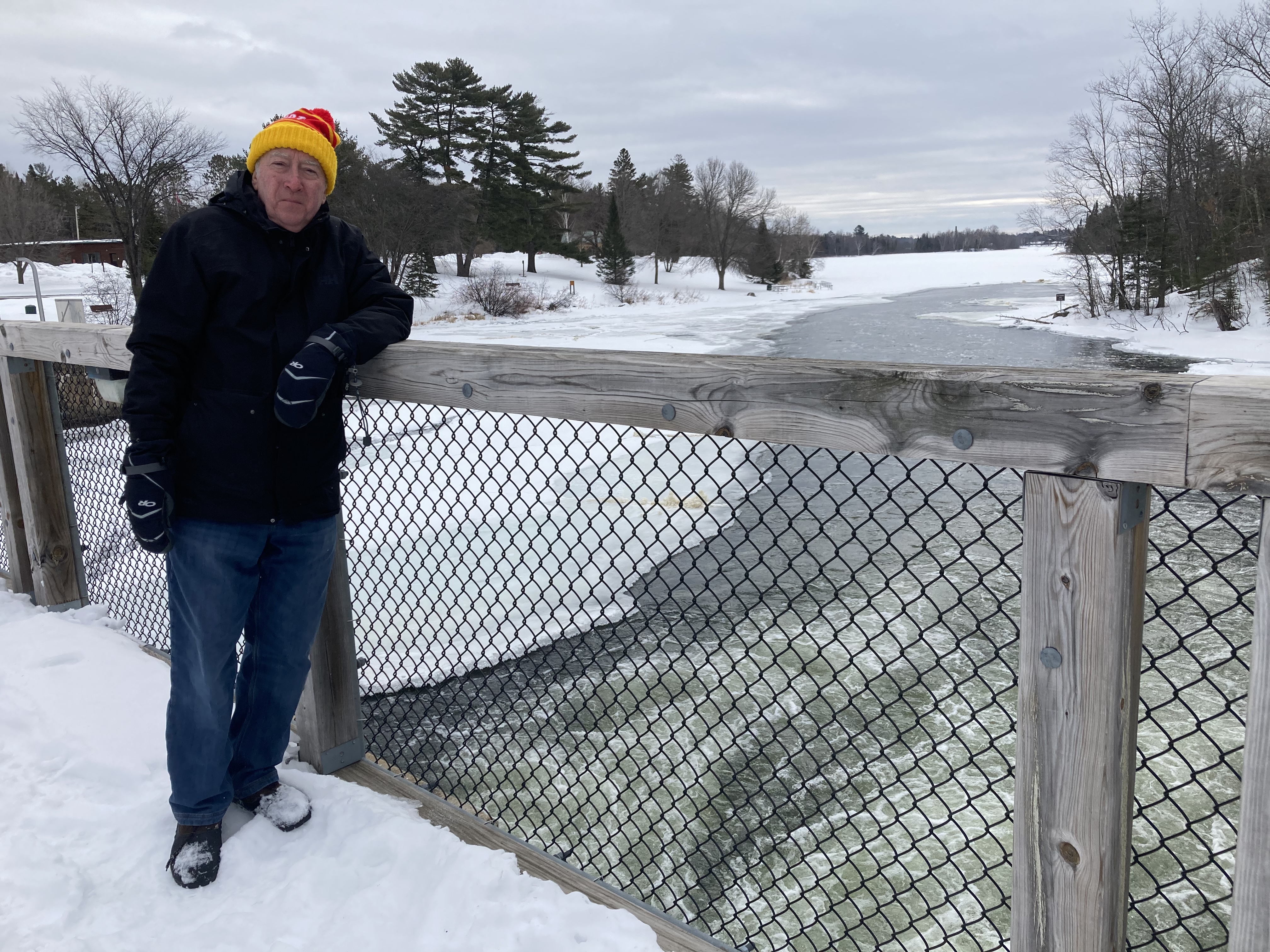
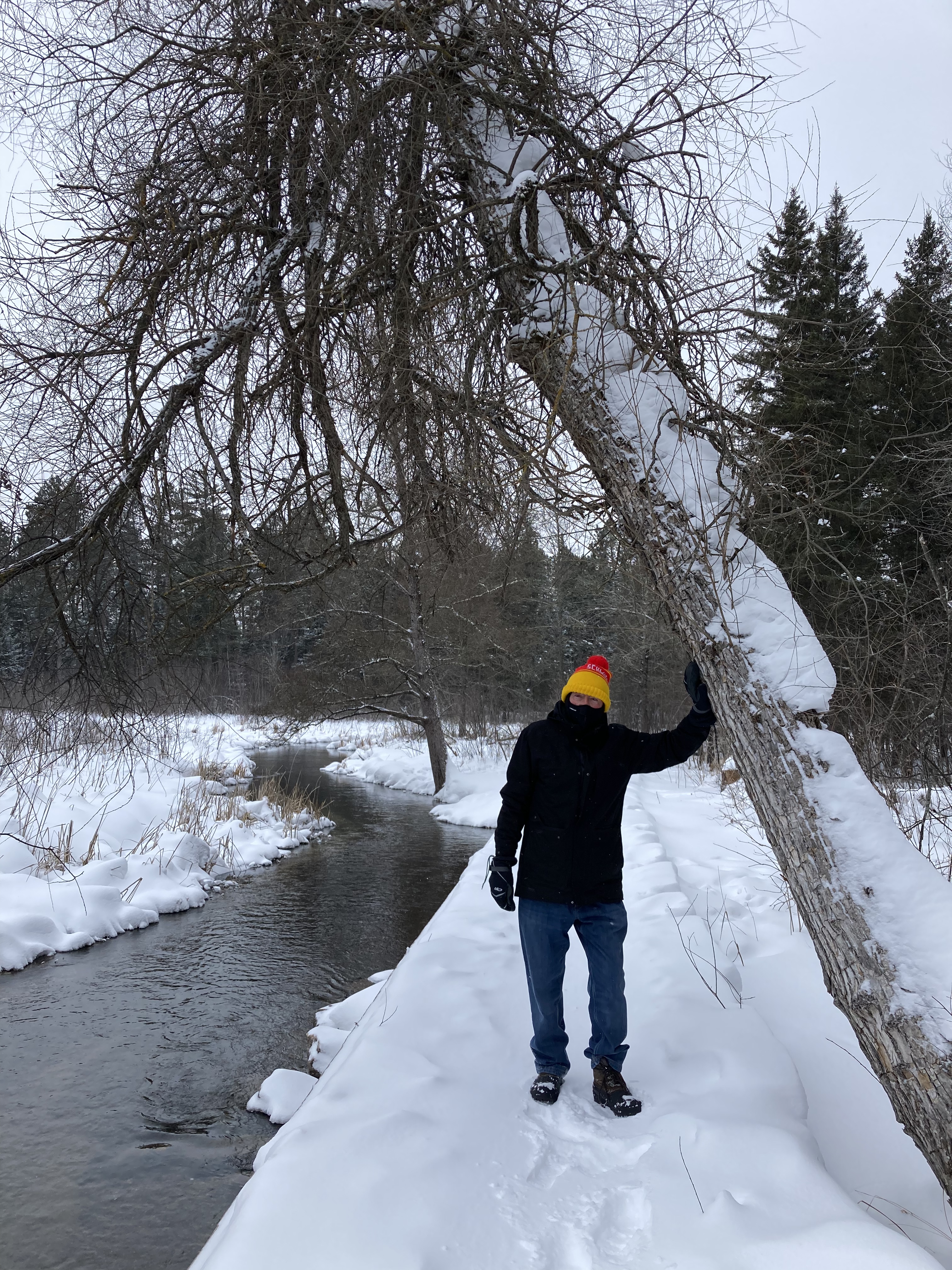
Altoona PA, Tuesday March 29, 2022

On this first major trip of 2022, we will be visiting over 30 National Park Service (NPS) units along the Eastern Shore of the U.S. By the time this 30 day trip is completed, we will have a total visitations from 278 to over 300 National Park Service sites. Most of these NPS sites are fill in, that is, we have visited other sites in these states but have not been to the ones on our current list.

While we lived in Pennsylvania for almost 30 years, it was not until after we moved back to MN that we seriously began trying to visit National Park sites. Thus, there are many sites that are worth visiting, but were not on our agenda 20-30 years ago. In addition, some NPS sites are new since 2000. Our task will be made more difficult since some sites are not open until this summer, or only open certain days of the week-which might not match our travel schedule.

Our first day starts with a drive that is one of the most frequently traveled by us, I-94 and I-90 from St. Paul to Rockford, IL. As we were driving, Chris and I figured we must have made round trips on this section of Interstate once or twice a year for over 50 years. Past Rockford, the options split between through Chicago (ugh!) or southerly towards Indianapolis.

This trip is through the southerly route. While our first major goal of this trip is visiting Deb and Rebecca in the Boston area, on day two we are stopping at Flight 93 National Memorial in southwestern Pennsylvania. Unless you were born recently, you probably know United Flight 93 was bound to San Francisco from Newark. On 9/11/2001, this flight was hijacked by four terrorists who planned to crash the plane into an unknown to us federal government building in D.C.

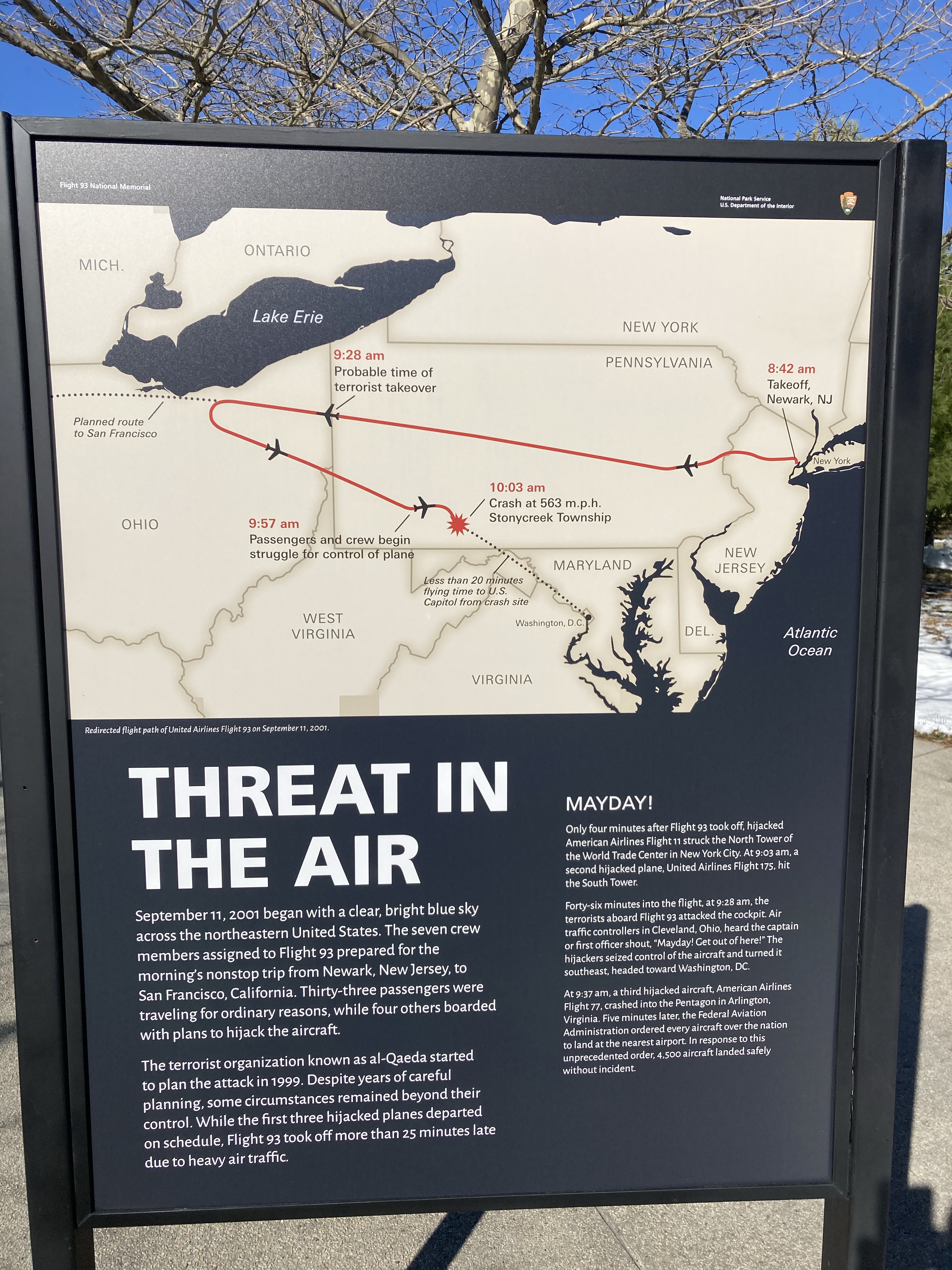
Flight 93 was the fourth flight on 9/11 that was going to be crashed into iconic U.S. buildings. The other three flights hit the World Trade Towers and the Pentagon. Flight 93 National Memorial honors the 40 passengers and crew who stormed the cockpit and forced the plane to be crashed into a field in the Allegheny Highlands of PA. Their sacrifice saved the lives of countless others who might have been in the U.S. Capitol or White House. The crash occurred but 20 minutes flying time to D.C.

Our visit started at the Visiotr Center. Exhibits re-create the day, a beautiful sunny day quickly marred by news reports out of New York City about the World Trade Towers. The crash into the Pentagon clearly makes known that the first crash was not a horrendous accident, but a planned act by terrorists. Flight 93 was delayed at departure, giving time for news of the other crashes to reach the passengers on the plane. When the plane is hijacked and turned around from its planned route, the people on board formulate plans. While the specifics are not clear, it is known they stormed the cockpit and disrupted the hijackers’ plans. The hijackers crashed the plane here in Pennsylvania, rather than in D.C. Each passenger and crew member is memorialized in the exhibit.

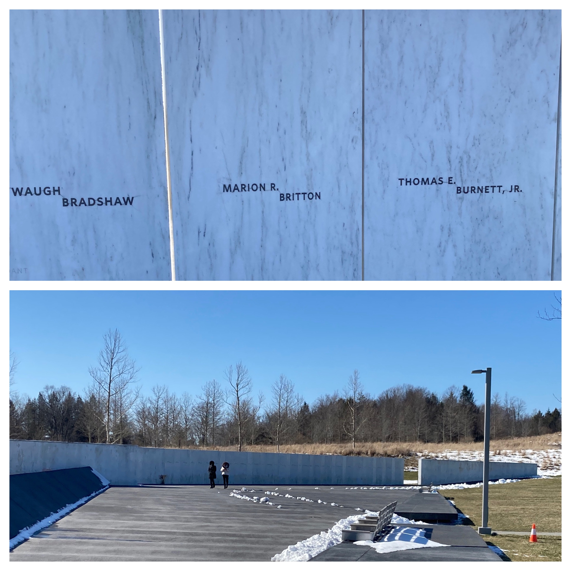
Outside, the visitor center has a walkway that simulates the flight path of the plane before its impact. The crash site itself is off limits, only family members are allowed within the gates during the month of September. The visitor center overlooks the crash site and impact zone. 40 groves of trees line a memorial drive that leads to an overlook of the crash site. At the closest public area to the crash site is a memorial wall. The wall looks solid, although it is made from 40 separate marble blocks, one for each person. The theme is of 40 people working together as one.

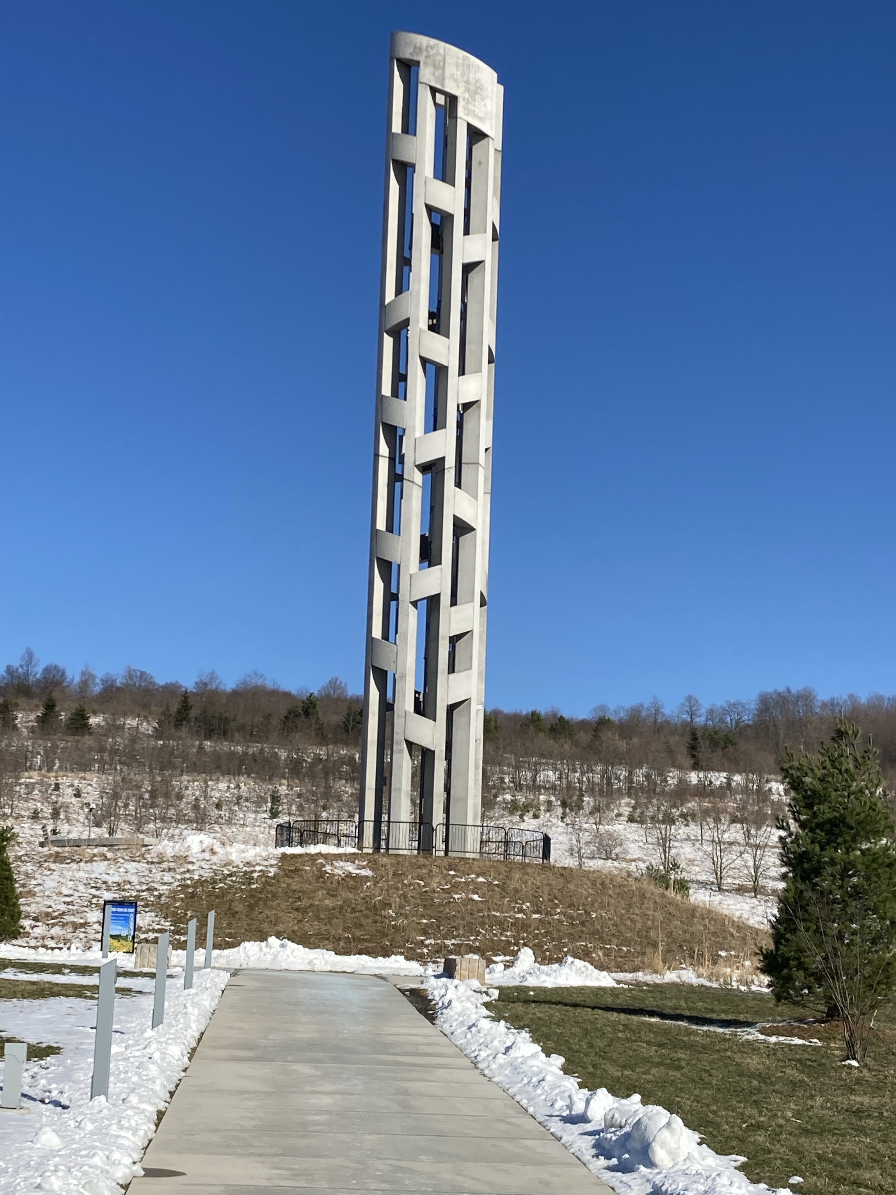
The final outdoor portion of the national memorial is the Tower of Voices. The 93 foot tall tower is a unique musical instrument, comprised of 40 chimes, each with a unique sound. Activated solely by the wind, the sounds change based on the wind patterns. (One can see wind turbines in the distance, so the musical instrument is sure to play often. We could hear it easily when we visited today.

The book store sells books about 9/11 and Flight 93. I thought it encouraging that next to books about this tragedy was a book of heart warming friendship. The book “The Day the World Came to Town” tells tales from Gander Newfoundland where 42 airline flights were forced to land on 9/11 as U.S.airspace was closed after the terrorist attacks. Chis and I both read the book and would recommend it to others.

This small town had an airport that became ignored as modern planes no longer needed to refuel here on their way to Europe. On 9/11, however, the town of 11,000 people became the emergency home for almost 6,700 people. It took days for airspace to open up and flights to be re-scheduled. The people of Gander opened their arms and their hearts. As we hear news of unspeakable horrors and tragedies, let us not forget the goodness in people also.

Ed and Chris

Altoona, PA Tuesday March 29, 2022

Categories: travel | Tags: , , , | Leave a comment

Another 2022 Winter Getaway in Northern Minnesota, March 8

Grand Rapids, MN March 8, 2022

Our hosts here at the Green Heron admitted they had to stop having breakfast with their guests or they would be gaining weight all the time. I can understand that. Our breakfast of wild rice quiche and homemade cappuccino rolls fuels us up for hiking and allows us to skip a meal later. The wild rice in the omelette was harvested by the hosts and then sent to the Fond du Lac Indian nation near Duluth for processing. Soon they will be making their own maple syrup.

One of my volunteer activities is as a National Park Service (the Mississippi National River and Recreation Area) docent at St. Anthony Falls Lock and Dam visitor center on the Mississippi River in Minneapolis. I have known that the Army Corps of Engineers constructed a series of six dams on the Mississippi River in northern Minnesota to regulate water flow for navigation between St. Paul MN and Prairie du Chen WI. The dams were built between 1884 and 1913. However, Chris and I had never observed one of these dams.

We eliminated that oversight today, visiting Pokegama Dam just upstream from Grand Rapids. The dam is not as dramatic as the dams located at most of the locks south of Minneapolis. The Corps has stated that the dams’ original purpose for water flow regulation has been less important since the Corps increased the depth of the navigation channel between St. Paul and St. Louis from 6 feet to 9 feet in the 1930s. Recreation, flood mitigation, and environmental purposes are now more important.

The dam stop was a nice adjunct to our visit in February to the headwaters of the Mississippi River. At the headwaters, the river flows out from under the ice covered lake and runs free until eventually the river has its wintry ice cover. At Pokegama Dam, the upstream river surface is frozen and then the water runs free for a short spell on the downstream side of the dam.

Our second stop was at Schoolcraft State Park. Henry Schoolcraft and his Native America guide Ozawindib are credited with making known the true source of the Mississippi River at Lake Itasca. This small state park along the Mississippi is named after him. We took a morning hike here; the two mile trail was quite clear but uneven due to the previous hikers path over the snow. Our first trip here in 2017 had been in August. No bugs this time of the year. While we did not see deer, evidence of their presence was obvious by depressions made by resting deer, tracks leading across the river, and deer scat abundant on the trail.

Our final stop of the day was at the Itasca County Historical Society. The museum had nice displays of the area with special exhibits covering topics such as local high schools, mining, logging, the river, and veterans from the area. The director checked their records and sent me a digital photo of the Pokegama Falls from the late 1800s. Then it was back to the B and B for a late afternoon snack and discussion with our hosts.

Chris and Ed, Grand Rapids MN March 9

Categories: travel | Tags: , , , , | Leave a comment

Another 2022 Northern Minnesota Getaway, March 6-7

Sunday, March 6, 2022 Grand Rapids MN

Chris wanted to ”Get out of Dodge” one more time before we leave on a 30 day trip at the end of March. We settled on Grand Rapids, MN and the Green Heron B and B. Back in 2017 we had stayed at the Green Heron and found it enjoyable and memorable, so we booked it again. It is a delightful house with only two guest rooms. Our hosts, Johnnie and Chris, have been very accommodating. Our getaway started Sunday and we will return home Wednesday afternoon.

The journey Sunday started slowly as the weather had been a mix of rain and snow Saturday evening. The roads closest to the metro area were the worst. As we went north, the roads improved since there had been less rain and snow up there. Our path was circuitous as we wanted to enjoy the trip and not just drive the almost 200 miles. Our first stop, after a McDonalds breakfast, was at the Sax Zim bog.

Sax Zim is a well known birding area about an hour west of Duluth and an hour east of Grand Rapids. Birders visit here year round, it has a welcome center with naturalists on hand. Sax Zim is a mix of public and private land, totaling over 300 square miles. We have never been here before but have heard about and read about it extensively. Not being birders, we dabble in bird watching, just enjoying what we see rather than seeking out specific species. We are also not patient enough to be true birders.

So what do we do? Well Sunday we drove a portion of the auto route. At one stop we saw our first redpolls-maybe. I say maybe because now that I saw them here, I have to recheck some of the birds that have been outside our condo recently. They might be the same species. We also saw one of the largest eagles we have ever seen. Finally, we stopped at the welcome center and met the naturalist. We did not spend time and effort trying to find great grey owls, a frequent visitor here. Then we left, thinking we might return in the future.

Just north of the Sax Zim Bog is the town of Eveleth. Eveleth is one of a series of mining towns on “The Range”. The Iron Range is, and was, home to the largest concentration of iron ore and taconite in the United States. Current operating and used up mines dot the region, one being in Eveleth. Previous blog posts have discussed and shown the mines on the Range, so I am not covering it again.

What Eveleth does have is the U.S. Hockey Hall of Fame. Hockey was big on the Range and in the early days of the Minnesota State High School Hockey Tournament, Range teams were frequent winners. Now as the population on the Range decreases and metro area high schools have more students than Range towns have population, state champions from the Range are few and far between. The Hockey Hall of Fame has been in Eveleth since 1972.

The museum showcases the history of hockey along with displays pertaining to high school, collegiate and professional teams. The 1980 ”Miracle on Ice” whereby the underdog U.S. team, comprised of collegiate players, defeated the USSR team, comprised of professional level players, on its way to winning the Olympic Gold Medal is prominently featured. The fourth Zamboni ice resurfacer ever made is on display here.

The museum is pleasant but probably more of interest to people in MN. Even though there are displays from around the country, there is no doubt there is a preponderance of items relating to MN. Of course, that may be appropriate since Minnesota is ”The State of Hockey”.

Monday morning our hosts made a fantastic breakfast with a fruit/yogurt/honey dish, multi-ingredient omelet, hash brown potatoes, thick bacon, and toast. Then we were off to Big Bog State Recreation Area, about two hours northwest of Grand Rapids. This was our second time here. We are making our second tour of all Minnesota state parks, having already been to each of them at least once. Minnesota is home to the largest peat bog (500 square miles) outside of Alaska. What is a bog? Generally speaking a bog is a wet, spongy area, poorly drained with acidic soil rich with accumulated plant material and having a specific flora.

There is not space here to cover all of this area’s interesting history. In brief, the Indian lands here were subject to various takings by which lies and broken promises were the main ingredients. The counties in the area borrowed money to drain the area to sell it to non-Indian settlers. The land did not drain and the soil is not good for farming. Since the land ended up being worthless, the counties defaulted and the State of MN bailed them out and took over ownership of the land.

Now there is a state park here with camping by the shores of Red Lake and a boardwalk at this section of the park with its concentration of peat bog. The boardwalk is a mile long and we hoped that it would be reasonable to walk on. The first half of the boardwalk was not too bad, as the center part was pretty well packed down. This section of the bog is primarily black spruce trees of varying heights. As we reached about the halfway point where the drainage ditches had been 100 years ago, the trail disappeared. We decided not to continue on and risk stepping off the boardwalk into deep snow on the side. The second half of the bog is more tall grasses and sedges.

By this time it was early afternoon and we decided to have lunch in a small town of Waskish at a local bar and fishing resort. We had eaten here five years ago and repeated our menu choices of that time; wild rice soup, cheeseburger and onion rings. Our drive home continued our pattern of circuitous driving and we enjoyed the back roads with snow covered fields and forests with a mix of coniferous and deciduous trees. Generally the roads were clear with no snow but the best views were on the roads with snow and little traffic.

Ed and Chris, Monday March 7, 2022

Categories: travel | Tags: , , , , | 1 Comment

2022 Mississippi River Headwaters-Itasca State Park

Park Rapids, MN Feb. 5, 2022

If you’ve read this blog for a while, you know that we have been at the headwaters of the Mississippi River before. It’s located in Itasca State Park in northern Minnesota. We are here for a late celebration of Chris’s January birthday. She enjoys coming to Itasca in winter time. We stay at heated lodging called the Fourseason suites at the state park. We came in Friday and will leave Monday morning.

The weather has been pretty decent, particularly considering we were told it was 42 below just 24 hours before we arrived. Temperatures for us have ranged from zero to about 18 above. This morning we got about 2 to 3 inches of fresh snow which dressed up the area very nicely. Wind was reasonable except when we were at the headwaters where there was no tree shelter from the wind.

We did three walks, ranging from half an hour to an hour. This morning we went to the headwaters and to the Schoolcraft Trail. This afternoon was the Dr. Roberts Trail and this evening was back to the headwaters where they had lanterns lighting along the trails and a bonfire.

Most of the other visitors were using snowshoes, except of course the snowmobilers. However, over time we have found snowshoes aren’t that beneficial for us. We just used our boots walking on the trails which are in good shape.

So we’re just gonna give you a sampling of pictures on a beautiful winter day at the headwaters of the Mississippi River.

Headwaters at Night and Day

Ed and Chris, February 5, 2022

Categories: travel | Tags: , , | Leave a comment

2021 Southwestern Thanksgiving, Nov. 22

Just a quick note and a few photos. We made it to Flagstaff Arizona for the Thanksgiving week. Monday was meant to be basically a straight driving day. Travel literature picked up in Silver City NM mentioned an location called ”The Catwalk”. It was just a 5 mile detour off our planned route so we decided to give it a try.

The Catwalk dates back to the mining days of the late 1800s. The geology and topography of this area of New Mexico were impacted by a caldera formed by a series of volcanic explosions. This is evident by the bowl shaped region and by the volcanic rocks along the walls of the canyon. Gold discovered in the mountains above this canyon presented difficulties in operating a mill to process the gold-a lack of water. Resolution was to construct the mill at the end of the canyon below the mines and construct a water pipeline from water sources higher in the mountains down the canyon to the mill.

The bolts used to attach the water pipeline are still evident in the sides of the canyon. The mill only lasted 10 years. In the 1930s, the CCC installed a wooden recreation trail along the canyon. In the 1960s, the U.S. Forest Service installed a metal railing and upgraded it in 2003. This is what we walked along. The brief delay and short hike were well worth the extra 40 minutes in travel time.

The rest of the trip was uneventful. Pleasant mountain and desert scenery. We passed previous travel attractions such as the NPS Petrified Forest, the town of Winslow, and Meteor Crater. We will be in Flagstaff for the next week.

Ed and Chris, Monday Nov. 23, 2021

Categories: travel | 1 Comment

2021 Southwestern Thanksgiving, Nov. 21

We are still here. A famous saying now for Native Americans. Appropriate for today’s activities, the trip up to Gila Cliff Dwellings National Monument. Actually a more accurate term, or terms, would be up, down, around, repeat. The elevation at the actual cliff dwellings is not much higher than Silver City New Mexico. It is just that the road to reach the National Monument goes over and around numerous mountain ranges.

I am not sure who is responsible for the signage on the road. I imagine the State of New Mexico since one drives NM 15 to get there. The road had been recently resurfaced and line striping had not yet been completed. But my wonderment goes to two items. First, some times, but not all of the time, maybe not even most of the time, there is a road sign warning you of a very sharp curve or need for a lower speed. How the state determines which very sharp curves deserve a warning sign and others do not is beyond me. Second, there are frequent warning signs that the road is not snow plowed at night or on weekends. Now nights I understand. Dark and dangerous for the snow plow operator. Don’t want them plunging over the cliff. But other than overtime cost, why not weekends? Nobody goes to church here? I mean it is 25 miles with many homes and businesses. Oh well, not my problem.

The drive to Gila Cliff is a scenic byway called ”Trail of the Mountain Spirits”. The road goes through the Gila National Forest and Wilderness. Forested hillsides show differing tree species at different elevations. Steep mountain cliffs and steep abysses alternate on either side of your car.

We drive over the Gila River which had more running water than the Rio Grande. Heck, even Cliff Dwellings creek had more water than the Rio Grande.

The hike to the actual cliff dwellings is only a mile loop trail. It is rocky with numerous steps, elevation gain of 200 feet. Got a little winded but quite a doable hike. This NPS site was busy for its small size. Half a dozen cars at the visitor center and maybe two dozen at the trailhead.

These cliff dwellings were only occupied for several decades, from about 1276 to about 1300. The year 1276 is carbon dated to the tree limbs used in the construction. This time period also correlates to a long period of drought in the Southwest. The springs, creek and river in the immediate area may have been able to produce enough moisture that this area was a haven for the Mogollon Puebloans who moved here.

The Chiricahua Apache lived in this area at least by the 1500s. Spanish explorers are not known to have reached as far as the cliff dwellings. It was not until prospecting in 1878 that settlers discovered the dwellings and looting of artifacts followed. The Apache were forcibly removed by 1886 and additional settlement occurred at that time in the valleys to the south and southeast of the dwellings. In 1907 the national monument was created to protect the remaining archaeological ruins.

The scenic byway took us back to Silver City by a new route. This route followed the Mimbres River, an area south and southeast of the cliff dwellers. It was occupied by a sub-group of the Mogollon called the Mimbres. They lived along the Mimbres River from 550 to 1140 C.E. predating the cliff dwellers. They are well known by a distinctive black and white pottery style.

One particular location along the Mimbres River has been studied since 1883. Our scenic byway took us to the site. Their museum was closed but visitors are still able to walk the site. Outdoor exhibits allow one to visualize how their villages would have appeared. They seem to have moved from the area by 1140 C.E.

We returned to Bear Mountain Lodge by 4 PM, a seven hour round trip day. Dinner was again at the lodge and was equally tasty as Saturday night.

Ed and Chris, Silver City NM November 21, 2021

Categories: travel | Tags: , , , | Leave a comment

2021 Southwestern Thanksgiving,Nov. 20

Saturday was a time to leave the beaten path behind and explore history and beauty along a scenic byway. It ended up being a relaxing day filled with pleasant, unplanned surprises. The end goal was to reach Silver City, NM, about a two to three hour drive depending on which route we take. Silver City will be our lodging for two nights. Sunday we head up to Gila Cliffs National Monument. The road to Gila Cliffs is twisty and mountainous and we have been advised to plan for two hours to reach it from Silver City. So, two hours to reach it, two hours to visit it, and two hours to get back again. In effect, a full day experience.

But first we had to reach Silver City. The Lake Valley Back Country Byway is sponsored by the Bureau of Land Management (BLM). It runs through ranching territory, old and new mining areas, mountainous forests, and an abandoned town. At the start of the byway, we passed wind turbines and solar farms. Those gave way to pecan farms and cattle ranches. Soon we reached Lake Valley, a once thriving mining town. In much of this area, a silver boom in the late 1800s collapsed when silver was devalued in 1893. Overnight, the economics of silver mining changed. Lake Valley became deserted.

BLM sponsors a museum at Lake Valley that was open. However, the volunteer docent was nowhere in sight although it seemed their RV housing right behind the museum was occupied. In any event, we were able to view the museum and walk around the few buildings that were still here. Despite the museum and signs, it was hard to imagine this area as a silver mining hotspot. The ranches that proliferate here among low lying hills appeared to be the normal way of life.

As we left Lake Valley, we passed through land where Apaches and outlaw bands roamed. The stage coach and railroad spur to the mines had to be protected by the U.S. Army. We reached Hillsboro, a community of 184 people that dates back to those days. Luckily for Hillsboro, its mining was more than silver and though Hillsboro may not have prospered, it survived. There was a small farmers market here and we stopped to read a historical marker. Across the street from the marker was the Black Range Museum. It was open. We stopped in.

One of the docents gave us a wonderful tour. The museum building once housed Sadie Orchards Ocean Grove Hotel and Tom Ying’s restaurant. Both of them were fascinating characters. Sadie was a strong woman, of whom it was once said: ”For a bad woman, Sadie was one of the best.” Sadie drove a stage coach, ran the hotel, operated a brothel and was a prostitute, among other occupations. Tom Ying was Chinese and immigrated prior to the Chinese Exclusion Act. He operated the restaurant in Sadie’s hotel for decades. Pictured above are the refrigerator and stove he used. The refrigerator was the first electric refrigerator in Hillsboro and came with an ice maker.

After the tour, and a short stop at the farmers market, we drove on to Silver City. This 58 mile drive took us two hours as the hairpin turns, mountainous ascents and descents, and sharp curves required a slower travel speed. At Emory Pass, 8700 feet, we stopped for a quick lunch and numerous photos. The wind was so powerful we passed on sitting at the picnic table with a great view to eat in the car. We did not want to get blown over the side of the cliff.

Emory Pass is on the southern edge of the Gila National Forest and Wilderness area. For ecology folks, this was the first wilderness area in the United States. This wilderness area was created in 1924 primarily through the work of Aldo Leopold.

Leaving Emory Pass, we drove by another one of those huge mining sites we seem to frequent. The Santa RIta mine operates 24 hours a day, 365 days per year. Grant County, where the Santa RIta is located, has been the most important metal producing county in New Mexico. Native Americans were mining copper here before the Spaniards arrived. In 1853 the Gadsden Purchase transferred control of this area along with a swath of land over through Arizona to the United States from Mexico. This land transfer gave the U.S. huge mineral deposits and a path for a southern route for a transcontinental railroad. The Santa RIta was one of the first open pit copper mines in the U.S. It is huge. Similar to some other mines, as the ores were extracted, the new veins of ore extended underneath the city of Santa Rita. Eventually the town was bought out and disappeared.

Silver City also had mining back in the 1800s but today tourism, higher education, and servicing the surrounding areas keeps the town functioning. There is a thriving arts community here. We are helping the tourism sector survive. Our lodging is at the Bear Mountain Lodge, an establishment that dates back 90 years. The lodge has comfortable rooms, great food (our dinner tonight was excellent) and 180 acres of land on the edge of the Gila National Forest.

Ed and Chris, Silver City NM, November 20

Categories: travel | Tags: , , , , , , | Leave a comment

2021 Southwestern Thanksgiving, Nov. 19, 2021

White Sands National Park exceeded our expectations. Previously we have been to Great Sand Dunes National Park, Imperial Sand Dunes Recreation Area, Sleeping Bear Sand Dunes National Lakeshore, and Oregon Dunes National Recreation Area. Were these New Mexico dunes really going to be any different? We would vote yes.

As always, we stopped at the visitors center (right as it opened), saw the movie, looked at displays, picked up the park brochure, and used the restrooms with running water. Walking in deep, soft sand is taxing. No need to come home with aching legs so our pre-planning had three short hikes on our list to experience the park. Walking on a raised boardwalk was an easy decision. It gave us an overview of the terrain while showcasing some of the plants that are able to live in the sand.

As we drove further into the park, off the paved road and on to the hard packed sand road, I had flashbacks to driving on frozen lakes in Minnesota. ”Snow” was piled up on all sides, the sun glared on the brilliant white, and a grader was clearing the road. Except the ”snow” was sand. The sand at White Sand Dunes is gypsum, laid down millions of years ago when an inland sea covered this area. Over eons, the gypsum layer was uplifted by mountains and then eroded down into this basin which has no direct water outlet. Wind and water repeat the process, making sure the gypsum crystals are broken down into small and smooth grains. Strong southwest winds produce dazzling white sand dunes.

As in all deserts, animals and plants adapt to the harsh conditions. While some dunes are completely clear of vegetation, other dunes have a variety of plants and shrubs that survive. These micro oases will harbor the animal life that normally comes out at night.

Before taking hikes two and three, we drove further into the park. Stopping several times, we climbed a number of dunes to observe the varied dune shapes, background vistas, and plants. The whiteness was stunning. On a day with beautiful blue skies, the combination was spectacular. In many directions, the surrounding mountains added extra dimensions. The wind was light, so there was no sand blowing in your face. The temperature was in the 40s and 50s, so the sun felt warming while the light breeze kept you cool. Why would someone climb these dunes in summer when the temperature can be over 100 degrees?

Hike number two took us to a playa, a shallow basin that holds water for a portion of the year-an ephemeral lake. Water run-off from the mountains stays in the basin, frequently only a few inches to a few feet below the surface. This high water table is a factor in plant growth and sand stabilization.

Hike number three was a mile long and took us up and down several dunes. This hike created greater opportunities to scrutinize plants. Of particular note was one plant whose roots go down deep and by some process I forget, hardens the sand to create its own mound. Yucca plants that grow a tall flowering stem to protect itself from increasing sand dunes falls apart when the drifting sand moves on leaving the tall plant unable to support itself.

We wrapped up our time at White Sand Dunes by having lunch at a picnic table sheltered by an innovative shield to block winds. Still, with the white sand dunes all around us, we felt we were eating in the middle of a snow field.

Unfortunately, our second stop of the day was a let-down. The New Mexico Museum of Space History was chosen due to the history of missile and space endeavors in New Mexico. It is located on the campus of New Mexico State University-Alamogordo. We knew it was undergoing some renovations and interactive displays were inactive. However, our dismay was due more to outdated exhibits, some exhibits way too technical for us, and overall it was a pale image of other space and aeronautic museums we have visited. Oh well, nothing ventured, nothing gained.

Ed and Chris, Las Cruces NM, Friday November 19, 2021

Categories: travel | Tags: , | Leave a comment

2021 Southwestern Thanksgiving, Nov. 18

In the space of 10 hours, we went from areas almost deserted of people to extremely dense communities. It was a day of contrasts. Leaving the Fairfield Inn of Carlsbad, we drove to Guadalupe Mountains National Park. In western Texas, just below the border with New Mexico, the Guadalupe Mountains, rising steeply from the plains, are the remains of an ancient marine reef, uplifted over time. 47,000 acres or half of this park is wilderness. There is no scenic drive or criss-crossing the park on paved roads. Given its location away from major interstates, even the non-wilderness areas are not crowded. The park visitor center had a limit of 6 people at a time. Was not a problem when we arrived.

Since we are past the point of even considering back packing into the wilderness, we undertook two morning hikes that would give us a flavor of the park. The hikes presented some history of the area and a view of the varied plants that exist in this arid, mountainous land. We kept our hikes to the area around the visitor center. The park visitor center is at 5700 feet although Guadalupe Peak at 8751 feet is the highest point in Texas. The temperature was 40 degrees but the wind was gusting so hard, even the birds were not flying around. Flowering shrubs and plants were still evident, despite the lateness of the season.

Nde, or Mescalero Apache, were living in this area in the 1800s and fought the U.S. Army from about 1850 to 1880 to retain their homelands. They lost. Cattle ranches generally took over their land. The Mescalero have a reservation northeast of Alamogordo.

The first overland mail route from St. Louis to San Francisco went through this area. The Butterfield Overland Mail was the first successful attempt to deliver the mail across the country. Previously mail went by ship around the tip of South America. This 2700 mile overland route was competed in 25 days with coaches being driven night and day by rotating shifts of drivers and mules. The Butterfield only lasted 11 months (Sept. 1858 to August 1859) on this route before being shifted farther south and then curtailed due to the Civil War. A small ruin (see photos above) still exists on park property.

Driving to our next stop in El Paso took us to lower elevations and warmer weather. First, though, we had to drive along the edges of the mountains and through scrubland and salt flats. El Paso, at just under 700,000 people is the 23rd largest city in the United States. It pops up quickly, to our eyes there was not a lot of urban sprawl. While trees, shrubs, and grass exist, there is no canopy of tall trees projecting a cover of green. Homes, businesses, concrete, and yards of dirt and stone are the images that remain in ones mind. But obviously people are comfortable here. A town does not reach a population of 700,000 people without positive attributes.

We were here not to evaluate El Paso but to visit Chamizal National Memorial. Chamizal celebrates history and cross-cultural artistic endeavors. Due to Covid-19, the art aspect has been curtailed. We were left with the history portion, which provided a rich lesson in U.S.-Mexican relations. This will not be a long history lesson but several salient points need to be made.

Over time, the U.S. has absorbed or taken one-half of Mexico’s original land mass. One half! Imagine if it was the reverse, and one-half of the U.S. was now part of Mexico or Canada. California, Nevada, Utah, Arizona, New Mexico, Texas and part of Colorado all were originally part of Mexico. For the most part, borders have been surveyed and agreed upon. Disputes have arisen and resolved although not always quickly.

Some of the borders are along rivers. As discussed earlier in this trip, rivers can move due to floods and other weather phenomena. We have seen portions of Iowa and Nebraska end up on the ”wrong” side of the Missouri River. There are two understandings about border changes due to river changes. Accretion is the process of a river changing slowly due to erosion of one bank and the addition of land on the opposite bank. In this case, the boundary moves with the river’s deepest channel. Avulsion is the process where a river changes suddenly, leaving its river bed and adopting a new one. Under this process, the boundary remained in the old river bed. Over the history of river changes by the Rio Grande and Colorado Rivers, border issues have had to be addressed frequently. (The photo above with different river paths marked by various colors demonstrates easily how land can shift from one side of the border to the other.)

One case remained unique. Without going into great detail, a section of land called Chamizal was caught in a tug of war between El Paso in the U.S. and Ciudad Juarez in Mexico. Shifting boundaries created a flash point that began in 1866 and went to formal dispute resolution in 1895. It took personal involvement of the two Presidents to resolve the dispute in 1963! Resolution of the dispute meant the purchase of hundreds of homes and rebuilding of public facilities. People and communities were uprooted due to the long delay in resolving the dispute. Through displays and videos, Chamizal National Memorial commemorates this peaceful, although delayed, difficult dispute resolution.

El Paso was left behind as we drove back into New Mexico. Our plan is to visit two more national park units before reaching Flagstaff. Las Cruces, a community of 100,000 will be our base for the next two days. The town grew through farming and the railroad, enhanced by the establishment of New Mexico State University here. Now, it is a space hub. White Sands Missile Range and Test Facility are here. Spaceport America and Virgin Galactic have their headquarters in the Las Cruces area.

The Bureau of Land Management administers the Dripping Springs Natural Area of the Organ Mountains-Desert Peaks National Monument east of Las Cruces. The Dripping Springs section has a colorful history. Unfortunately, we arrived too late to spend extensive time here. We managed to get in a hike before the national monument gates were closed. The national monument has several sections worth investigating that are on our potentials list for the next few days.

Ed and Chris, Las Cruces New Mexico Thursday Nov. 18, 2021

Categories: travel | Tags: , , , , , | Leave a comment

2021 Southwestern Thanksgiving, Nov. 17, 2021

Carlsbad Caverns. One of the largest caves in the United States, Carlsbad has been a National Park Service site since 1923 when it was designated a national monument. It became a national park in 1930. Caves are usually ranked by number of miles of caverns. Carlsbad is 15th with 39 miles. In the U.S., the top four are Mammoth Cave with 420 miles, Jewel Cave with 208 miles, Wind Cave with 154 miles, and Lechuguilla Cave with 150 miles. Lechuguilla is actually located on Carlsbad National Park property. . In 1986, cave explorers received permission to explore another area on Carlsbad Park property where they discovered what is now known as Lechugilla Cave. Lechuguilla is off limits to the public as scientists use it for research. Chris and I have been to Mammoth, Jewel and Wind Cave previously.

Carlsbad is best known for the Big Room, the largest chamber in North America, and for an evening bat flight from early spring through October where gigantic swarms leave the cave seeking food. So we missed the bat flight but saw the Big Room. Well, actually saw some of it. The cave is very humid, masks are required, and Chris had difficulty with her glasses fogging up frequently. Her viewing of the cave suffered because of that.

With Covid-19, ranger led tours are no longer offered. Instead visitors sign up for a limited time entry block and undertake a self-guided tour. Frnakly, I was just as happy with that. Tours at other caves frequently try to get cutesy and assign descriptive names to formations that vaguely, at best, resemble the name the formation has been assigned. With this method, you go at your own pace. I don’t know what constitutes normal visitation numbers but we had no difficulty getting around without being blocked or slowed down by other visitors.

The paths are smooth, no stairs and almost no areas in which one has to duck their head or squeeze through a narrow opening. Railings line the entire route and the low lighting is more than adequate to observe various formations. The first third and last third of the route are more interesting. The middle third is relatively humdrum.

Before Carlsbad was made a national monument, and even after, mining of bat guano and the taking of souvenirs destroyed numerous formations. However, there are still a vast number of formations to view. Stalagmites, stalactites, soda straws, draperies, flowstone, columns, popcorn, and others amaze your eyes.

Past pictures taken in caves never seem to properly portray the dimension of the experience. We have inserted a few photos just because.

Carlsbad was pretty much a full day for us. The drive from Roswell was two hours, we spent 90 minutes exploring the cave, and additional time with the park video and displays. After lunch at a picnic table in the parking lot, we explored a portion of the wilderness area that is part of the park. The 9.5 mile scenic drive takes you past canyons, rock formations, and desert foliage. Chris spotted several mule deer on the scenic drive and we stopped to watch them for a while. She had spotted Barbary sheep on the drive in to the park but the narrow road did not allow for any photo opportunities.

Ed and Chris, Carlsbad New Mexico, Wednesday Nov. 17.

Categories: travel | Tags: | 1 Comment

Blog at WordPress.com.