road trip

2016 Trip Seven, The Berkshires, Sept 18-19

Hancock, MA. Sept. 19

The Big Round Barn at Hancock Shaker Village

The Big Round Barn at Hancock Shaker Village

“Hands to work, hearts to God”. This was one of the more famous sayings of the Shakers, a small religious movement in the 1800s and 1900s. Numbering less than 7000 souls at its peak, the Shakers were more formally titled The United Society of Believers in Christ’s Second Coming and began in England. The Shakers were celibate and believed in pacifism and equality of the sexes. There were about 18 Shaker communities in the United States and were well-known for the quality of their furniture and textiles. Unlike the Amish, the Shakers embraced new technology and methods of production. The Shakers practiced a form of worship that included singing and vibrant dancing, frequently making the floors of the worship room shake; hence the term “Shakers”.

An example of Shaker furniture

An example of Shaker furniture

There is only one active Shaker community in the U.S.now, in Maine. Today, Monday the 19th, we visited a restored 750 acre Shaker Village in Hancock, Massachusetts. This locale did have as many as 300 residents at its peak in the early 1900s. They farmed, grew and sold seeds and farm produce, and manufactured wood furniture. The community closed down in 1960 and the village is maintained by a local non-profit educational organization.

The round stone barn on the property was notable for several reasons. At the time, it was likely the largest barn in New England. The round shape facilitated a unique dairying process, with hay stored in the center (which also provided heat in the winter), a basement level that allowed manure to be easily gathered and removed from the barn, and a second level that allowed hay wagons to drive in and unload (and to store hay on wagons when it was raining outside). The cows were attached to stanchions and easily milked by a person moving onto usually along the circular path. The Shakers believed in straight lines so the construction of a round barn needed special approval from the elders to be built.

Brick house residence for Shakers

Brick house residence for Shakers

The Shakers seemed to embrace their lifestyle. Music was a part of their daily life, with songs for play and for differing forms of work. They were proud of the work they did, it was essential but it was also an opportunity to demonstrate quality and workmanship. Yet, they were humble, not allowing anyone to get a big head, and kept the products basic but well-made.

Yesterday, Sunday, our major touring event was a visit to the Norman Rockwell Museum 30 miles south of Hancock in Stockbridge, MA. Sunday started easy with breakfast at the unit and then the four of us went to church in Pittsfield. We had brunch at the restaurant “Eat on North”, part of the “Hotel on North”. Hotel on North is in an old furniture and retail store in downtown Pittsfield that has been beautifully restored and has been open for about two years. Between the four, we had three different brunch entrees and all were excellent.

Norman Rockwell was an American icon to my generation and those earlier. Born in 1894, he began a career as an illustrator while still in his teens. His first regular job was as the art director for Boy’s Life, the magazine for the Boy Scouts. By age 22, he had sold his first illustrations for the “Saturday Evening Post”. (Brief history may be needed for some. The Saturday Evening Post was a national weekly magazine that for decades was one of three magazines (Life, Look and Post) that set the standards and the news for Americans. Having your art work on the cover of the Saturday Evening Post was big, big stuff. Over his career, Rockwell illustrated 321 covers for the Post.

Rockwell started his career primarily drawing young people, an outgrowth of this work with Boy’s Life. His work usually reflected small-town American life. A perfectionist in his work, Rockwell drew numerous sketches, hired live models, and used photographs of the pose and details he wanted to include in this final illustration. The painting below demonstrates some of his attention to detail. Note some items that indicate the marriage license was being taken out late Friday afternoon: the quantity of discarded cigarette butts, the calendar with today’s page already being torn off in favor of tomorrow-Saturday, and the U.S. flag has been taken down for the day.

The Marriage License by Norman Rockwell

The Marriage License by Norman Rockwell

During WWII, Rockwell did a series of four paintings that portrayed Franklin Roosevelt’s 1940 State of the Union speech listing the four freedoms all citizens of the world should be able to enjoy: the freedom of speech, the freedom of worship, the freedom from fear, and the freedom from want. It took Rockwell two years to get the paintings done the way he wanted them. The U.S. Treasury took the four paintings on tour around the country and they helped raise $130,000,000 in war bonds.

The Four Freedoms by Norman Rockwell

The Four Freedoms by Norman Rockwell

The Post was a controlling organization. For instance, Rockwell and other illustrators were not allowed to show African-Americans in other than service level jobs. In 1963, he left the Post and began putting his illustrations in Look magazine. During his Look period, his work more broadly reflect America and its problems of the day. During his career, he drew illustrations for commercial ventures like Coke and Pepsi, playing cards and calendars for Brown and Bigelow, paintings of famous people like Eisenhower and Kennedy as well as illustrations for books.

The studio where Rockwell did much of his later work

The studio where Rockwell did much of his later work

Rockwell died in 1978, living the last 25 years of his life in Stockbridge. Serous art critics downplayed his work as simplistic but recently his work has been more highly regarded. Whether art critics are listened to or not, the people of America call him one of their own. The museum does an excellent job of showing and describing a selection of his original work. Included on the grounds is the studio where he worked during the latter years of his life.

Chris, Rebecca and Deb and the board game Alhambra

Chris, Rebecca and Deb and the board game Alhambra

The evening finished up with Deb, Rebecca, Chris and Ed playing a board game. Deb won but we continued it Monday morning and ended with everyone winning but Ed.

Ed and Chris

Categories: road trip, travel | Tags: , , , , | Leave a comment

2016 Trip Seven, The Berkshires, Sept. 16-17

Hancock, MA. Sept. 18

Friday dawned clear and warm and Chris and I had a few hours before Deb and Rebecca arrived from Boston. We drove to North Adams. Like many New England towns, North Adams was a manufacturing center, helped by water power. By the 1980s, the last large employer had left town, leaving a major manufacturing site vacant. Through the efforts of many, the Massachusetts Museum of Contemporary Art (MassMOCA) opened on its grounds and is a major attraction. However, we did not go to see it. The museum was hosting a major Blue Grass Festival and our goal was the Western Gateway Heritage State Park.

This park in the city of North Adams was previously a railroad yard. The primary exhibit relates to the building of the Hoosac Tunnel. This 4.75 mile long tunnel was to be Boston’s answer to shipping goods to the Midwest. The Erie Canal was making New York a better port. Boston wanted to build a railroad to Troy NY but the Hoosac Mountains stood in the way. A five-mile barrier, made of hard rock, it took from 1851 to 1875 to complete the tunnel. It was a landmark feat in the use of hard rock tunneling.

One major difficulty was the skill needed to make sure that the two tunnel shafts being built, one on the east and one on the west, met precisely when they joined somewhere in the middle of the tunnel. The engineers set up a series of transits that aligned with scoping towers outside the work area and then lined up those with internal test marks as the work progressed.

Second, the rock was composed of schist and granite quartz that resisted drilling and blasting. A newer version of nitroglycerin and new drilling machines were used, but even those improvements still made for a long, slow slog. The state of Massachusetts provided funding but the project defaulted on the bonds. Owners of a southern Massachusetts railroad succeeded in stopping more funding. Defaulting on the bonds led to the state assuming responsibility for its eventual completion. At one time, this project assumed the majority of all the indebtedness of the state of Massachusetts.

The tunnel was completed successfully and is still in operation today. When first completed, 100 trains per day went through the tunnel. Today less than 15 trains per day go through the Hoosac Tunnel. The construction methods used and advanced here led to improvements used in later tunnel building. Towns in northern Massachusetts experienced growth spurts and the tunnel, by carrying 60% of the goods exported through the port of Boston, enhanced the Boston port’s viability. Unfortunately, the tunnel’s western entrance is deep in the forests and not readily accessible for viewing.

Chris and docent at North Adams Historical Society

Chris and docent at North Adams Historical Society

The North Adams Historical Society has a museum next to the state park and the docent was most helpful. He provided us with a narration about the model railroad he constructed for the historical society. Lunch was at a pub in the old railroad yards and dinner at a local restaurant just down the hill from the Wyndham Bentley Brook. Dessert was strawberry shortcake back in the unit.

Plane crash debris on Rounds Rock Trail on Mount Greylock

Plane crash debris on Rounds Rock Trail on Mount Greylock

Saturday got off to a relaxing start and then the four of us went to Mount Greylock. Mount Greylock is the highest point in Massachusetts at 3,491 feet. After a stop at the visitor center, we hiked Rounds Rock trail. The trail led to two overlooks and one site of a crashed plane. The plane crash occurred in 1948 as a twin-engine Cessna used to deliver late editions of the New York Daily Mirror to Albany. The crash site was in rugged territory and not found for four months.

Panoramic view from Mount Greylock

Panoramic view from Mount Greylock

The summit of Mount Greylock is reachable by car. The monument at the top is currently under construction but we were still able to enjoy the view that the summit provides of the surrounding states. There were probably 30-40 people lounging on the grass and enjoying the weather and the views. Bascom Lodge at the summit provides meals and lodging. We tested out their lunch menu and were satisfied.

The four of us on the Alpine Slide at Jiminy Peak

The four of us on the Alpine Slide at Jiminy Peak

After resting back at Bentley Brook, we spent 2.5 hours at the ski resort, Jiminy Peak. During the summer season, Jiminy Peak offers a summer adventure park with zip lines, elevated rope climbing courses, mountain slides on a rail or a luge type course, etc. Even Chris participated and enjoyed it. All four of us rode the chairlift close to the top of the mountain and rode the sleds down. Since you can set your own speed, Deb was usually the fastest. Chris and Rebecca tended to bring up the rear; I think Chris had a few sledders backed up behind her.

Deb climbing the aerial ropes

Deb climbing the aerial ropes

Deb climbing the aerial ropes

Deb climbing the aerial ropes

The ropes course in the air was a new event for us. Chris volunteered to take photos while the three of us tackled the course-the basic version. We got our harnesses on, had a very brief training session and were set loose. A participant has two carabiners that attach to the safety ropes; I of course took the longest to figure out how to attach them correctly. One time the two eight year olds behind us helped me. Another time I had to have one of the staff climb up and show me how to do it properly. But, by the end, it was working fine. We were glad we took the easiest course and the one closest to the ground for our first time. We only did the one; the alpine slides were more fun and easier to do so they were repeated several times.

Deb and Chris on the Soaring Eagle

Deb and Chris on the Soaring Eagle

Ed on the not-so-tall zip line on basic course

Ed on the not-so-tall zip line on basic course

Ed and Chris

Categories: road trip, travel | Tags: , , , , , | Leave a comment

2016 Trip Seven, The Berkshires, Sept. 14-15

Hancock, MA Friday Sept. 16

Generally when traveling, I try to write this post daily at the end of each day. Sometimes, when too tired or when maybe there has not been much to write about, the post is done every other day. Every now and then though, the mood just does not strike me, usually because the activities were not all that interesting. The last two days were more in that vein,and if you pass on this post, I will understand.

Not to say that the ride was unpleasant. In fact, we commented frequently on the beauty of green. The mountains and deserts of the western U.S.have a majesty and grandeur but after a while, the rocks get boring. It is pleasant to see lush green land on a regular basis. As we moved into central and eastern Ohio, the land has more depth as hills and low mountains start to predominate. The flat prairies give way to smaller fields and huge vistas of forests. A recent, pleasant addition is the planting of wild flowers along highways which provides even more color and interest.

And the houses are colorful. New suburban developments back home have such a sameness with the earth-tone, neutral colors of beige, sand, gray, etc. seemingly the new standard. Here the homes, particularly in the cities, often are rich and vibrant hues representing the spectrum of the rainbow. Towns have a history; some of them have re-made themselves after their first, or second, economic purpose died out. Other towns are struggling, with downtowns lacking economic purpose and sidewalks devoid of any activity.

One of the lodging options for summer Chautauqua

One of the lodging options for summer Chautauqua

On Wednesday, we left Dayton (after a sumptuous breakfast at the Inn at Brandywine Falls) around 10:30 and drove to Chautauqua, New York. Chautauqua is home to the Chautauqua Institution, a “community that comes alive on the shores of Chautauqua Lake in southwestern New York State each summer with a mix of lectures, fine and performing arts, interfaith worship and recreational activities.” Chautauqua started in 1874 as a means to educate Sunday School teachers and has been in almost continuous operation since then. In its early years, it spawned related programs around the country. Today similar functions are run by schools, libraries, public television, TED talks, etc. but without the concentrated effort and social gathering that occur during the weekly summer programs at Chautauqua.

At one point in her career, Chris had run a short summer program at the University of St. Catherine in St. Paul that mimicked Chautauqua and she wanted to observe the original site. There were no programs in operation as we toured the grounds. Chris reviewed the literature; there seemed to be one low-cost option but, in general, attending a week of Chautauqua seems to be a pricey option. For instance, Road Scholar offers a week package for $2,085 per person for six nights and all meals, with additional cost for attendance at Opera or Theater performances.

One of the numerous vineyards in the Finger Lakes region

One of the numerous vineyards in the Finger Lakes region

The drive ended Tuesday night in Seneca Falls. The journey between Chautauqua and Seneca Falls traverses hills and valleys and then enters into the Finger Lakes region. The Finger Lakes area is home to numerous vineyards and wineries, with tasting rooms a continual presence along the back roads. We did not stop at any but did enjoy the views. The whole Finger Lakes region and central New York may be a place we return to in the future. In has been decades since we were last traveling through the area.

We spent the night at the Barrister Bed and Breakfast in Seneca Falls. It is located in the downtown area and we were able to walk to a nice local pub for dinner. Breakfast Wednesday was another three course breakfast. The inn was full so there were ten of us enjoying the meal and sharing travel tips.

Seneca Falls was the model town for Bedford Falls in the movie “It’s a Wonderful Life”, now a classic Christmas movie. Seneca Falls is on a connecting canal to the Erie Canal. The Erie Canal was an engineering marvel built in 1817-1825 for 363 miles connecting the Great Lakes with the Atlantic Seaboard. The canal was a major impetus for development of the Mid-West and made New York a prime seaport. The connecting canal to Seneca Falls via Cayuga and Seneca Lakes brought prosperity to Seneca Falls.

The reconstructed church where the First Women's RIghts Conference was held in Senca Falls, New York

The reconstructed church where the First Women’s RIghts Conference was held in Senca Falls, New York

It is also home to the Women’s Rights National Historical Park run by the National Park Service. Several of the homes of the women responsible for the First Women’s Rights Conference in 1848 were not open but the visitor center was open. The church where the first meeting was held has been re-constructed. It was never preserved and only two of the original walls were still standing when reconstruction began.

This NPS site was just so-so. Clean and new and bright but still just so-so. A lot of display boards but not a lot seemed new to us. They tried to make the introductory film relevant to children and, for us, it made the film less interesting. All in all, not the best NPS site we have been to.

Harriet Tubman house in Auburn, New York. Pictures not allowed inside but most furnishings are from Tubman family

Harriet Tubman house in Auburn, New York. Pictures not allowed inside but most furnishings are from Tubman family

After Women’s Rights, we drove twenty miles to Auburn NY, the site of the Harriet Tubman National Park. Technically, while President Obama signed this legislation in December of 2014, not all of the paperwork has been signed yet. When the paperwork is completed, her home, the home for the aging she established here, and the AME Zion church where she worshipped and which supported her efforts will become part of the park. Pictures are not allowed inside the home but many of the furnishings are from the Tubman family.

In case you are out of touch, Harriet Tubman was born a slave in 1822 in Maryland. She gained her freedom in 1849 by escaping to the North. Over the next ten years, she helped numerous other slaves escape to the North through use of the Underground Railroad and her sense of direction. She assisted the Union Army during the Civil War through roles as nurse, spy, scout, and hospital cook. Just before the Civil War, former Secretary of State William Seward, who lived in Auburn, sold her a home and property for a nominal sum-which was illegal at the time. After the war, she gained additional land and ran a home for the poor aged of the community. She died in 1913 and was buried with full military rites in a local cemetery.

Fort Stanwix, Rome New York

Fort Stanwix, Rome New York

We were not done with the day yet. We continued our drive to the Berkshire Mountains of Massachusetts through Rome NY. In Rome is the site of Fort Stanwix, another National Park Service site. The fort was declared a national monument in the 1930s, but it wasn’t really until the 1970s that the reconstruction was completed. Part of downtown Rome had to be razed to conduct architectural studies to find the exact location. Frankly, from the “before” pictures, Rome was probably quite happy to have those buildings knocked down. We are not covering the history of Rome itself since that was not a focus of this stop. It probably deserves more attention on a future trip.

Interior of Fort Stanwix

Interior of Fort Stanwix

Fort Stanwix began as a British fort against the French and their Indian allies. When the French and Indian War ended in 1863 with the defeat of the French, the fort fell into disrepair. It was rebuilt by the U.S.rebels to act as a protective outpost in the Mohawk Valley during the Revolutionary War. The unsuccessful siege of Fort Stanwix by the British in 1777, along with the British surrender at Saratoga, protected the middle of the U.S.and led to France and the Netherlands joining the U.S.against the British.

But the fort represents more than a moment in the Revolutionary War. This location served as a trade route for the Native Americans in the area. It was a “carrying point” or portage, from the Mohawk River to Wood Creek. The tribes in this area had resolved their own differences and created a long-lived peace among the tribes (the Six Nation Confederacy), although not necessarily with their Indian neighbors. However, the battles between the French and the British, then the Revolutionary War, and finally the American’s desire for more land drove the various tribes into competing factions and worthless treaties with the new settlers. Their desire for neutrality in these wars was unable to be sustained.

The reconstructed fort is quite well-done and the exhibits substantial. However, I found the timeline and story difficult to keep straight. Possibly being the third NPS stop of the day made us less sharp than usual.

We drove the remaining miles to Hancock, through the Berkshire Mountains, a mountainous highlands with small towns and curvy two lane roads. Our lodging for the next five nights will be the Wyndham Bentley Brook, butting up next to a small ski resort.

Ed and Chris

Categories: road trip, travel | Tags: , , , , , , , | Leave a comment

2016 Trip Seven, The Berkshires, Sept. 12-13

Northfield OH. Monday-Tuesday Sept. 12-13. (Cuyahoga Valley National Park)

Our car "Gandalf" with the Wright Flyer sculpture in the background

Our car “Gandalf” with the Wright Flyer sculpture in the background

Dayton held our interest for a few extra hours on Monday morning. Instead of a quick exit, we visited the Inventors River Walk, part of the Riverscape Park, and then Carillon Park. Riverscape Park is along the Great Miami River, site of disastrous floods in 1913 that resulted in flood control measures that seem to leave Dayton protected from floods.

Dayton has continued its proud history of inventions beyond the Wright Brothers era. Charles Kettering is from Dayton and, after Thomas Edison, has the most patents approved by the U.S. Patent Office. Some of Kettering’s work includes the first automotive self-starter, the first electric cash register, and automotive lacquer paint. He was the head of research for General Motors and the founder of Delco (Dayton Engineering Laboratories Company).

The Inventors Walk is a segment of the Riverwalk with seven sculptures honoring local inventions. Below are four of the seven; you are being challenged to identify the invention with the sculpture. (Answers at the end of the blog for today.) (Remember, touching the picture should blow it up to a larger size for better identification.)

Sculpture A

Sculpture A

Sculpture B

Sculpture B

Sculpture C

Sculpture C

Sculpture D

Sculpture D

Carillon Park is a 65 acre park representing the history of Dayton through restored buildings and displays. We skipped the Dayton specific buildings and headed just to the other NPS site for the Dayton Aviation Heritage Park. This building houses the original Wright Brothers Flyer III that flew from Huffman Prairie and one of only five remaining Van Cleve model bicycles built by Orville and Wilbur Wright.

The actual Wright Flyer III in Carillon Park

The actual Wright Flyer III in Carillon Park

A docent, originally from St.Paul who worked for Deluxe Check company for eons and is now retired and living in Cincinnati, gave us a personalized tour. One of the new stories we heard from him was that Wilbur, Orville, and Katherine Wright (the only sister and just younger than Orville)had made a pact to never marry and to care for each other as they aged. As you know,Wilbur died relatively young. Katherine at age 52 married an old sweetheart and Orville refused to talk to her. At age 54, she contracted pneumonia and, under pressure from a younger brother, Orville finally went to her home in Kansas City as she was dying and was at her bedside when she died at age 54.

After having gotten our fill of the Wright Brothers, we departed for Akron. Akron is home to my cousin Colly and her husband Bob. We spent a wonderful afternoon and evening with them.

Inn at Brandywine Falls

Inn at Brandywine Falls

Our lodging for Monday and Tuesday nights was at the Inn at Brandywine Falls, a bed and breakfast located in Cuyahoga Valley National Park. It is the only B and B in a national park and once was the farm and home of an early settler here next to Brandywine Falls. Like most waterfalls in the early days of settlement, it was used to run mills and provide water for a prosperous farm. The old farm and barn are now a six-room inn, well-appointed and with a sumptuous breakfast.

Since breakfast begins at nine, includes several courses, and is the setting for discussions with guests and innkeepers, our daily adventures started a little later than usual. The innkeepers, Katie and George Hoy, took up the challenge to run this inn after their regular retirement. At 88 and 90, they are vigorous, sharp and protective of the historic aspect of the inn which they restored. They have a fifty year lease on the inn with National Park Service and are only halfway through the lease. The chickens on the grounds provide fresh eggs; the goat, I believe, only provides entertainment.

Brandywine Falls

Brandywine Falls

The Brandywine Falls are just a three-minute walk away. Tuesday morning I went for a walk to the falls and a mile hike along, up, and down the gorge surrounding the falls. Colors are not turning yet although leaves are falling. It was a pleasant morning for a hike, sunny skies and temps in the 60s. Later in the afternoon, Chris and I went for another, longer walk through the woods when it was warmer but still sunny. A very pleasant inn to stay at. There were numerous people hiking and biking along the paths. One option is to ride your bike and then five days per week there is an excursion train running through the park you can take back to your starting point with your bike.

Our major excursion for the day was a forty minute drive to Mentor Ohio to the James A. Garfield National Historic Site. Garfield was only an active President for less than three months before he was shot. He lingered for 80 days before dying. Even though his term was short, his life was interesting and inspiring. The last President born in a log cabin; his tale is another one of a person born in poverty, educated at a sacrifice by his mother (father died while Garfield was still young), and driven to succeed. He knew six languages, five of them well. He became a prosperous farmer, state legislator, U.S. Congressman, Union General in the Civil War, elected U.S. Senator and then at the Republican Convention in 1880, elected as the Republican candidate for President when none of the leading contenders could muster a majority through 33 ballots. His campaign in 1880 was the first when the candidate actually appeared publicly and talked to ordinary citizens and the press instead of through mouthpieces and newspaper articles. Garfield did not barnstorm the country but people arrived at his home in Mentor and Garfield would come out of the house, talk to them, shake their hands, and even invite them into the house.

James A. Garfield National Historic Site

James A. Garfield National Historic Site

Garfield was shot by a discontented office seeker on July 2, 1881 and died 80 days later in September. He lingered near death and there has been great speculation that his death could have been prevented if a more knowledgable doctor had attended him. Garfield’s assassin was upset because he had not been given a job. 1880 was still a patronage system for federal job holders and the President was expected to interview and give jobs to the “right” people. Garfield had also fought, and won, a highly political battle against a New York politician, Roscoe Conkling. Conkling wanted to appoint New York office holders, especially for the lucrative customs and port offices. Garfield appointed qualified people not beholden to Conkling.

The Garfield Presidential Library

The Garfield Presidential Library

Garfield’s widow was well provided for because an industrialist, Cyrus Field, began a national subscription for the widow after Garfield’s death. Field had seen the financial problems Lincoln’s widow had after Lincoln’s death. People all over the country contributed generously; Garfield had been well liked and his death stirred their emotions. Lucretia Garfield was provided with a sum equal in today’s dollars to about 8.5 million dollars. She expanded the house and created a library of Garfield’s papers made available to scholars. The family maintained possession of the home until 1936 when it was donated to the Western Reserve Historical Society. Today the Park Service owns and maintains the property. (Minor, quick side note. The Western Reserve stems from the fact that in early days of the U.S.colonies, Connecticut had been given land west of Pennsylvania by King George before anyone really knew the geography of America. This land was called the Western Reserve of Connecticut.)

On our return from Garfield National Historic Site, we stopped at one of the visitor centers for the Cuyahoga Valley National Park. The “hook” for the park was the Ohio and Erie Canal, a canal was dug by hand. The route was chosen by money and politics (surprise). One of the issues was the geology and geography of the area. In trying to connect the Great Lakes to the Ohio RIver, there is a continental divide about halfway through the state of Ohio necessitating additional sources of water. When that was resolved by the donations of land to have the canal run by or through one’s property, the canal digging began. Prosperity was assured, at least until the railroads changed the economics, for the land owners along the route of the canal.

After the walk mentioned above, it was dinner at a restaurant in the small town of Peninsula OH.

Answers to Sculpture Quiz: A. Pop Top cans invented. B. The metal ice cube tray that released the cubes by pulling a metal lever. C. The electric cash register. D. Lexis-Nexis-the search algorithm using and,or, not, etc.

Ed and Chris

Categories: road trip, travel | Tags: , , , , , | 1 Comment

2016 Trip Seven, The Berkshires, Sept. 11

Sunday September 11. Dayton Ohio

There really is a prairie at Huffman Prairie Flying Field

There really is a prairie at Huffman Prairie Flying Field

From the prairie testing fields to outer space, we saw the history of flight today. The National Park Service has several pieces of land that relate to the Wright Brothers. At the Huffman Prairie Interpretive Center by Wright-Patterson Air Force base, the Wright Brothers story continues. The brothers get patent protection and sell their first planes to the US Army.

A catapult was used to get the first planes into the air.

A catapult was used to get the first planes into the air.

Orville and Wilbur make a tour of Europe, demonstrating their plane and become probably the first international celebrities. Adoring crowds greet them in cities where they demonstrate their invention. Air travel had been a hot topic with many other efforts failing. Once skeptical crowds are convinced, they are known world-wide. However, two factors limit their financial success.

First, Wilbur dies in 1912 and while Orville continues, the dynamic synergy is lost. Second, WWI begins in the middle of 1914 and there is a frenzy to develop and improve upon the airplane. While Orville fights to protect the Wright Brothers patents, there is enough other inventive power at work to jump start the aviation industry. Orville sells the Wright airplane company and it later merges with the Curtiss Aviation Company. Orville spends most of the rest of his life as a consultant and inventor.

We drive two miles to Huffman Prairie Flying Field where the actual experimental flights took place. The field sits in a floodplain and the land has never been developed. A re-created hanger is here along with the catapult lifting device; they stand out against the flatness of the field. White flags on 20 foot poles mark the edges of the circular flight pattern used by the Wright brothers. All is quiet, no other visitors are in sight. After watching the films, we can visualize the funny little plane with one person flying around and around the field. Amazing.

A replica of the Wright Flyer III that was sold to the US Army

A replica of the Wright Flyer III that was sold to the US Army

Our next stop was the massive National Museum of the United States Air Force. This complex of four huge hangers is stuffed with planes on the floor and hanging from the ceiling, small video displays, and numerous written explanations of the Air Force involvement in flight from balloon observations during the Civil War to the Space Shuttle. We spend five hours here.

Just a small portion of one of the four hangers

Just a small portion of one of the four hangers

It is impossible to absorb it all. Some of the displays are of test planes; commissioned for research purposes and never put into production. There are timelines of the battles fought in WWI,WWII,Korea and Vietnam. There are personal stories of ordinary airmen and of aces.

Air Force One

Air Force One

The large plane in the middle was nicknamed Valkyrie. It was a test plane and never made it into production.

The large plane in the middle was nicknamed Valkyrie. It was a test plane and never made it into production.

We walked inside a mock-up of the Space Shuttle. We walked through Air Force One, the plane that went into service in 1962, serving eight Presidents. It was the plane that carried the casket of President Kennedy back to DC from Dallas. We walked into cargo and troop transports. We learned that Presidents and First Ladies travel on other, smaller jets besides Air Force One. We learned that Wright Patterson Air Force Base is still a major research facility for aviation. And we learned that five hours of walking is very tiring.

Our Evergreen hosts in Dayton invited us to a picnic dinner held by the Dayton Chapter of Friendship Force, a nonprofit cultural exchange organization that promotes friendship and goodwill through a program of homestay exchanges. It was a pleasant gathering of friendly people and good food and a nice way to bring the day to a close.

Chris and Ed

Categories: road trip, travel | Tags: , | Leave a comment

2016 Trip Seven, The Berkshires, Sept. 10

Saturday, September 10. Dayton Ohio

Dayton Aviation Heritage National Historical Park

Dayton Aviation Heritage National Historical Park

Clouds and corn were our companions for the drive today. As we looked up, grey clouds in wisps and in huge, piled up thunderclouds kept us commenting on their beauty as we drove through Indiana and Ohio. At eye level, acres of corn were everywhere. You probably remember that corn is native to the Americas and was brand new to the European immigrants. Did you know that corn was originally a tropical plant? It took the native Americans centuries to develop strains of corn that could survive the colder climates of the Midwest. By that time, the corn plant was no longer self seeding but had to be individually planted by the Indians who frequently put fish or other matter in the corn hills along with the seeds as a fertilizer. (The first GMO product in the U.S.?) Also, (at least in MN) less than five percent of the corn planted is used directly for food for humans. The rest is used for animal feed, biofuels, and corn syrup.

Our journey to and from the Berkshires is likely to be heavily populated with ordinary persons who, with extraordinary vision and drive, went on to change the world. From Abe Lincoln the first two days to Orville and Wilbur Wright for the next two. After that, it is the homes of three U.S. Presidents;, women who lead the U.S.in finally adopting voting rights for women; an explorer of the unknown lands bought from the French through the Louisiana Purchase; and a female abolitionist and spy during the U.S. Civil War.

After another driving day, we will be spending two nights in Dayton Ohio, home of the Wright Brothers. Today we only had time for one portion of the Dayton Aviation Heritage Park in West Dayton. This location celebrates the time leading up to the two brothers developing the first flying machine; the childhood, early days as printers and bicycle makers, and the years of effort to necessary to begin the era of flight. Dayton at the time of the Wright Brothers was a hotbed of innovation. Dayton had more patents per capita than anywhere else in the U.S.during the time the Wright Brothers were here. The Wright Brothers fit right in.

The bike shop

The bike shop

Wilbur is the elder by four years and it seems the two of them had a spectacular chemistry together. They thought, and tinkered, and argued, each feeding the other ideas and suggestions-even before graduating from high school. They invented machines to fold papers. They built and sold kites. After joining in on the new bicycling craze, they repaired bikes for friends and soon had their own business manufacturing bicycles. They opened a print shop, even building their own printing press. And, they were intrigued by the idea of flight.

In this building, the bike shop was on the ground floor and printing office on the second.

In this building, the bike shop was on the ground floor and printing office on the second.

Never having gone to college, their work and play with bicycles and kites and printing presses gave them knowledges that stood them in good stead as they built a plane. Bicycle chains were involved in manipulating rudders and wings. Kite flying and bird watching helped understand lift. By not having a college education, they avoided relying on the assumptions then prevalent with other flight inventors. Through methodical note-taking and experimentation, they were able to make minor adjustments and understand the effect (positive or negative) each adjustment had on the finished product. They had determination, vision-and each other.

Their work with gliders was the first step,taking models to Kitty Hawk, North Carolina to test it and making modification. They came back from those succesful tests at Kitty Hawk in 1903 and spent the next two years making a glider into an airplane. By 1905, hundreds of test flights produced a fragile craft of wood and fabric that could fly for 40 minutes, making frequent turns and landing softly. It transformed the world. Then they took two years to file patents and get ready to turn invention into manufacturing. That story comes tomorrow.

A replica of the Wright Flyer in the museum

A replica of the Wright Flyer in the museum

Chris and Ed

Categories: road trip, travel | Tags: , , , , | 1 Comment

2016 Trip Seven, The Berkshires, Sept. 9

Friday, Sept. 9, Springfield, IL

The Lincoln Tomb

The Lincoln Tomb

The weather forecasters were wrong again. Thankfully! Today was forecast as 70-90% chance of rain all day long. We have not seen a drop since 6 AM and even had a few rays of sunshine late this afternoon. Maybe it was Mother Nature smiling on our 44th wedding anniversary today. In any event, we enjoyed it even as we were prepared for rain.

As travelers, we make snap conclusions about communities which may not be justified, but they are made anyway. Springfield did not impress us. Oh, there are public efforts to have nice sidewalks and some street lamps with poetic and enduring statements on them. But overall, the town seemed just a tad disheveled, a bit like a seedy cousin, maybe nice if you get to know them but first impression makes you want to shy away. For a a town of 120,000; it seems very quiet. Not that we are wild party people, but there should have been more activity, more people on the streets, whatever. Chris even asked a clerk if today was some sort of holiday. Nope. Nothing strongly negative, just not much positive. The two towns of Bloomington-Normal that we passed are not much different in total population than Springfield but the area came across as much more economically vibrant.

On the drive to Springfield, we passed prosperous looking agricultural fields. One tends to forget how flat the central plains of Illinois are. Certainly when you go west, Iowa fields are flat but the northern portions of Missouri are not. One of these trips we may have to learn more about the geology of Illinois to understand what forces of nature were at work here.

But today was about the forces of man; particularly the impact of Abraham Lincoln. Lincoln lived in Springfield for 24 years before being elected President. He came here with no money and two saddlebags of personal belongings; an unmarried man seeking his future after previous jobs left him unsatisfied. He left Springfield, President-elect, married, with three living children (one died while the family lived in Springfield). Most of his adult formative years were spent in Springfield and he left the town in 1861 extremely appreciative of its citizens.

It has been stated that more books have been written about Lincoln than any other person than Jesus Christ. We are not going to try to cover his life but to comment on the five places we visited in Springfield; Lincoln’s home, the Old Depot, the Lincoln Museum, the Old State Capitol, and Lincoln’s Tomb.

The Lincoln Home in Springfield. IL. The only home Lincon ever owned.

The Lincoln Home in Springfield. IL. The only home Lincon ever owned.

Our first stop was at 8:30 AM at the Lincoln Home, a National Park site. This site is normally jammed during the summer, now just after Labor Day visitors were light. We were even able to park in the site’s parking lot all day with many open spaces still available. We made the first tour, walking through the home which still had numerous fixtures from their time here. When the Lincolns moved to Washington, they rented out the home. After his death, the home was still rented, eventually the home was given by Robert Todd Lincoln to the State of Illinois with the provisos that it always be maintained and that visitors never be charged to visit the home.

The National Park Service took over the site in 1972. Over time, the NPS purchased four blocks of surrounding properties so today’s visitors see homes from that period and walk on wooden sidewalks-although the muddy streets of Lincoln’s time have not been replicated. Two other homes are open, demonstrating the historic preservation efforts required to maintain the properties.

The Lincoln Depot

The Lincoln Depot

We left Lincoln’s home and walked to the Lincoln Depot. This had been the depot for the Great Western Railroad (later the Wabash Railroad). In those days, individual railroads had their own depots and the Great Western covered a territory from Illinois to Pennsylvania. At the Great Western Depot, Lincoln left Springfield for Washington DC to the adoration of its citizens. He returned those feelings with an impromptu emotional talk that thanked them for their support. The depot did not see good times; being abandoned, operated as a freight house, used as a warehouse, run as a museum while under ownership of the local newspaper, and suffered a fire. Finally today it has been purchased by a local law firm (yea, lawyers) who have their office on the second floor and restored the first floor as a free museum with video and displays.

Inside the Lincoln Museum-pictures generally not allowed inside exhibits

Inside the Lincoln Museum-pictures generally not allowed inside exhibits

Our third stop was a new, impressive museum. The Lincoln Presidential Library and Museum opened in 2005 and is operated by the Illinois Historic Preservation Authority. The museum uses a new, more “modern” design that is more entertaining. It is high-tech exhibits, interactive displays and multi-media programs. We spent several hours here, watching films, examining displays, and enjoying the museum. One cute display had a TV commentator explaining the 1860 election with its four different candidates. Another display ran through the Civil war in highlighted form, with a running total of the casualties experienced by the North and by the South.

IL Supreme Court Chambers. Lincoln would have been here frequently.

IL Supreme Court Chambers. Lincoln would have been here frequently.

After an anniversary lunch at the Subway on the premises of the museum, we made a quick visit to the Old State Capitol. This building was where Lincoln delivered his speech about the “House Divided”. …”A house divided against itself can not stand. I believe this government cannot endure, permanently half slave and half free.”….. This building was also the scene of the assassinated President’s final laying-in-state on May 3-4, 1865 and was replaced as Capitol in 1876.

The Lincoln Tomb

The Lincoln Tomb

Our final stop (after ice cream) was the Lincoln Tomb. The obelisk at the tomb is 117 feet high and is made out of granite. The statues were made from iron smelted from Civil War cannon. The tomb holds the caskets of Lincoln, Mary Todd Lincoln, and three of their sons. Robert Lincoln is buried at Arlington National Cemetery by decision of his wife. It is stated that the cemetery is the second most visited cemetery, after Arlington, in the US.

So that was our day in the Land of Lincoln. After our visits, we left with an impression of Lincoln as a man striving to better himself, immensely enjoying family life, suffering professional defeats and so much personal tragedy in his life and yet able to accomplish great feats for our country before making the ultimate sacrifice.

Ed and Chris

Categories: road trip, travel | Tags: , , , , , | Leave a comment

2016, Trip Seven, The Berkshires, Sept.8

Road trip to the Berkshires in western Massachusetts

Road trip to the Berkshires in western Massachusetts

Springfield IL Sept. 8

We are down in the land where Lincoln trod. Springfield IL was his primary home, although not his birth site. In order to get here, we drove today for 530 miles with two stops for local “attractions”. Today, and for most of the rest of this trip, we plan to use Interstates heavily, instead of rural two lane roads. We are also less likely to eat at small, local restaurants as we need to keep to a tight schedule. That probably means national chains with quick service.

Lunch at the largest Culver's in the world

Lunch at the largest Culver’s in the world

However, our lunch was Chris’s version of eating local. Culver’s is a home-grown Wisconsin chain that still has its headquarters in small town Wisconsin. Begun in 1984, they now have 560 stores. Lunch today was in the largest Culver’s store, in Newville, WI, along Interstate 90 in southern WI.

Castle Rock, WI

Castle Rock, WI

Before lunch though, we made two stops. The first was nostalgic, at a wayside rest in Wisconsin by Castle Rock. Chris and I remember stopping here frequently on our many drives between Pennsylvania and Minnesota, as did her parents on their drives between Connecticut and Minnesota. The rock formation juts out from the ground and geologists tell us the formation is actually the remnants of an island from glacial lakes formed thousands of years ago. I am able to view the rock when I am on Amtrak’s Empire Builder, doing narration for the National Park Service. I hope you appreciate the picture; we endured numerous mosquito bites in order to obtain them.

The second stop was at the International Crane Foundation (ICF) facility in Baraboo, WI, just south of Wisconsin Dells. ICF is the only place in the world where one can see all 15 varieties of cranes in one location. Cranes are in Asia, Europe, North America and Africa, although they are endangered in all locales. The cranes have both outdoor pens and indoor shelter; some were inside and we did not view them but we did see 11 different species of cranes. In addition to breeding cranes, ICP works around the world to provide and protect sufficient breeding and migration ground for cranes.

Whooping Crane

Whooping Crane

Wattled Crane

Wattled Crane

Blue Crane

Blue Crane

Grey Crowned Crane

Grey Crowned Crane

Trip Seven will be a two and one-half week trip, driving to the Berkshire Mountains where we will spend 4-5 days with Deb and Rebecca. To get there-and back, we will be stopping at numerous National Park sites. Lincoln’s home will be the first NPS site and we plan to be there early Friday morning when the doors open.

Chris and Ed

Categories: road trip, travel | Tags: , , , , , , | Leave a comment

2016 Trip Six, Minnesota Blufflands

St. Paul, July 24

Panoramic view of Winona MN. Wisconsin bluffs in background, then thin blue ribbon is Mississippi River, then City of Winona, then Winona lakes and finally nearest to you the Garvin Heights Bluffs

Panoramic view of Winona MN. Wisconsin bluffs in background, then thin blue ribbon is Mississippi River, then City of Winona, then Winona lakes and finally nearest to you the Garvin Heights Bluffs

Although our next major trips will be in September and October, we did take a short trip down the Mississippi River to the Bluff Country of Minnesota. Chris and her sister Kathy and I spent three nights in a cabin in Dakota, MN about halfway between Winona MN and LaCrosse WI. But I do need to write a few sentences about geology before other details. In my simplified wording, this area of Minnesota was underneath a vast sea hundreds of millions of years ago. That sea laid down layers of sediment that was smoothly eroded by wave action and over time cemented into easily eroded sandstone. Depending on the action of the seas, a less easily eroded rock type, dolomite, which is a hard limestone, was also laid down, usually over the top of the sandstone. Then during the times of the glaciers, which generally did not cover the Bluff Country, windblown dust from a glaciated area east of here, called loess, was laid down on top. Finally, when the glaciers to the north eventually melted, they formed a huge lake covering much of northern Minnesota and Ontario, with an ice dam at the southern end. Periodically the ice dam gave way releasing torrents of water that carved out the Minnesota and Mississippi River valleys. That final erosion gave us the valley we drove through with bluffs up to 600 feet high, numerous side valleys, and the bluffs in Minnesota and Wisconsin separated by up to four and a half miles. The current Minnesota and Mississippi River are just shadows of the glacial rivers.

Our drive on Thursday took us through the reservation land of the Mdewakanton Dakota Indians. This is a small reservation consisting of land re-purchased for them by the U.S. in the 1880s to replace land taken from them by treaties not adhered to. They currently have a casino here which they, on their website, call the “new buffalo” providing the basis for food and jobs similar to their dependence on the buffalo hundreds of years ago. The Dakota have not forgotten their traditions though, they have a “Buffalo Project” that consists of a new herd of buffalo (bison) that they graze on reservation land. The herd of bison is thinned periodically to provide food and materials for tribal activities.

Carousel at LARK Toy in Kellogg MN

Carousel at LARK Toy in Kellogg MN

We stopped in Kellogg, MN, home to the LARK toy store, ranked the number one toy store in MN by the viewers of a Twin Cities TV station. LARK began by making hand-made wood toys and has since expanded, incluidng an indoor carousel with hand carved animals. While we did not buy any toys, the vast array of toys was mesmerizing-and we rode the carousel.

Lock and Dam Number 5 on the Mississippi River

Lock and Dam Number 5 on the Mississippi River

We had planned to stop for a picnic lunch at John Latsch State Park. On our way there, we passed the town of Minneiska, home to the highest per capita rate of wood carvers. They have two wood carvers, and with a town population of only 111, see if you can find another place with a greater concentration of wood carvers to the general populace. We missed the turnoff to the Latsch State Park and turned around at Lock and Dam #5 which had modern restrooms, picnic tables, and a view of the lock and dam. We ate lunch here instead and watched a rented houseboat lock through on its journey upriver. When we did arrive at Latsch, we discovered no restrooms and a small picnic table next to the steps that climb to the top of the bluffs. (Most of the park is remote bluffs.) Since the temperature was 85 degrees and the humidity was at 80%, we decided to pass on the hike and continue our journey. John Latsch was a wealthy wholesale grocer. Interesting note about John Latsch though.

Looking at the bluffs in John Latsch State Park

Looking at the bluffs in John Latsch State Park

From an article in “Minnesota Trails” written in 2013:

” The June sky turned an angry thunderstorm blue bringing rain down on John A. Latsch, canoeing near Camp Glory, now Bass Camp, on the Mississippi River above his hometown of Winona.
Latsch, a wealthy, 47-year-old grocer, loved to fish, hunt and explore the byzantine backwaters of the Mississippi River in his little boat. Back in 1907, the Mississippi River bottomland was privately owned yet used by the public. Usually, landowners allowed boaters brief refuge along the shore.
Not this day. As Latsch beached his canoe to wait out the storm, an angry farmer and his dog confronted him. The farmer demanded Latsch push-off immediately.
Latsch complied but was deeply shaken. The next morning, he directed his business agent to purchase all of the land on which the incident occurred. He wanted the wild riverbanks to belong to everyone beginning a conservation career benefiting us all today.
By the time John Latsch died in 1934 at age 73, he had donated nearly 20,000 acres valued at over $2 million. He bought most of the 20 miles of bottomland from Whitman to Homer, Minnesota. He became southeastern Minnesota’s most generous conservationist, donating land to Minnesota and Wisconsin. These lands eventually became parts or all of John A. Latsch and Whitewater state parks in Minnesota and Perrot and Merrick state parks in Wisconsin.
As lavishly as he bestowed gifts to the public, John A. Latsch was personally frugal. He neither owned nor drove a car, preferring to travel in his canoe. Never married, he dressed plainly, ate sparingly and lived simply in his Winona home, occupying only a small part of the house. He was a modest man, never making a show of his generosity.
Growing up on the family farm in Trempealeau County, Wisconsin, Latsch had little time for play. When John was 7, his father moved the family to Winona and opened a grocery business.
Paddling the backwaters of the Mississippi was his refuge from the long hours and responsibilities of his business. The solitude of the bottom lands, woods and bluffs along the Mississippi became his passion. Being denied refuge on the river during the storm only steeled his resolve to preserve the untamed natural beauty surrounding him for the enjoyment of future generations.

And from the “Winona Times” in 2013:

Before his death in 1934, Latsch bought and donated more than 18,000 acres, including Aghaming Park, Gabrych Park and Westfield Golf Course in Winona; John Latsch State Park and portions of Whitewater State Park in Minnesota; and Trempealeau Mountain, John Latsch Overlook, and portions of Merrick and Perrot state parks in Wisconsin. And he funded the John C. Latsch Public Baths on Latsch Island that provided Winona with safe swimming and recreation for decades.

The example Latsch set had even more far-reaching consequences.

In the early 1920s, confronted by reclamation projects that would have destroyed thousands of acres of prime wildlife habitat along the upper Mississippi, Chicago businessman, outdoor enthusiast and friend of Latsch, Will Dilg, organized 50 wealthy and influential colleagues to lobby for federal action that would preserve and protect habitat for future generations.

As a result of their efforts, in 1924, the Congress authorized the Federal Wildlife and Fish Refuge Act which laid the basis for the federal refuge system that protects thousands of acres of prime habitat across the country.

The creek at Beaver Creek Valley State Park

The creek at Beaver Creek Valley State Park

After checking in at our cabin, we drove down to Beaver Creek Valley State Park near Caledonia, MN. Today was just about the worst day of the summer; a heat advisory in effect, and I will admit, we did very little hiking at Beaver Creek Valley. We did encounter two park interns conducting a survey of park users for the state. Well, we were their first visitors and this was close to 4 PM. We obliged them and answered the questions, inquired about the job (they spend a week at various parks and camp there), and then headed to La Crescent, a town of 4,800 for pizza and ice cream. This was a good decision; yes, the food was good but the skies opened up and a 20 minute deluge occurred while we were eating. La Crescent is supposed to be the heart of the apple growing area of MN, we did not see any orchards although we were later assured they do exist. If so, the orchards are quite unlike the many acres of neat rows of apple trees we were used to in south central Pennsylvania. We drove our share of two lane roads throughout the area, at one point driving through Rollingstone MN, a town founded by immigrants from Luxembourg. Unfortunately, it appeared that their historical museum is no longer open to visitors.

The Rollingstone MN historical museum building

The Rollingstone MN historical museum building

We spent Thursday, and the other nights, playing games, reading, watching the convention, and watching “Murdoch” movies on Acorn on our tablet computer since the cabin, while air conditioned, did not have the promised DVD player.

Friday Chris and I were up and out visiting Great River Bluffs State Park. The park is just a long baseball drive from our cabin but we had to drive a circuitous route, through the not-visible apple orchards, to the park entrance. The entrance route has been re-planted in prairie grasses which were blooming colorfully. Not many campers had arrived for the weekend yet and we were but one of a handful of hikers on this, another scorcher day. Thankfully our hikes here were in the woods to several overlooks providing a view of the Mississippi River Valley 600 feet below us. The Mississippi River Valley here is 4.5 miles wide. From the bluff top one can see the river channel clearly; as you watch the boats below go through the channel dredged by the US Army Corps of Engineers, you see the river next to the channel with ripples caused by wing dams and obstructions. It visualizes so obviously the need for barge traffic and recreational boaters to stay within the dredged channel.

Looking down from Great River Bluffs State Park to a US Army Corps of Engineers boat that dredges the river channel to a nine foot depth

Looking down from Great River Bluffs State Park to a US Army Corps of Engineers boat that dredges the river channel to a nine foot depth

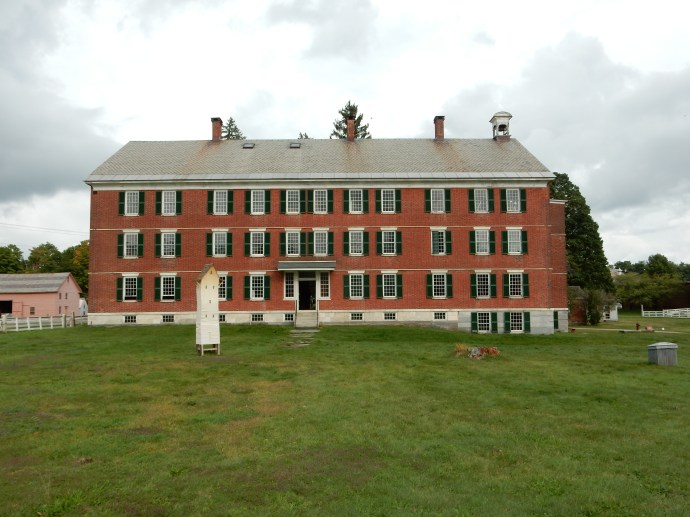
We returned to the cabin for lunch with Kathy and headed to Winona, a town of 27,000 people along the river. Founded in 1851 by a steamboat captain, the town grew prosperous early due to the milling of lumber and the shipment of grains and lumber downriver. Today it is home to three higher education institutions. One of them, Winona State University, is the only higher educational institution offering a BA in composite engineering. Composite engineering is the “how” of manufacturing products from plastics. It is the home to Wenonah Canoe and to over 20 other companies who in total employ 1200 workers making products from composites. But our visit today was to two other notables: the J.R. Watkins store and museum and the Minnesota Marine Art Museum.

At the JR Watkins museum in Winona MN

At the JR Watkins museum in Winona MN

Winona is the headquarters and site of the manufacturing facilities of the J.R. Watkins Company. The company hired notable architects to design their headquarters and production area, including a section that is ten stories tall. It has a 70 foot high rotunda dome with 24 carat gold leaf, 224 stained glass skylights and three custom Tiffany stained glass windows. Watkins = beauty products, spices, cooking products, cleaning products, was farm products and medicinal (castor oil, liniments, milk of magnesia, etc.) Watkins began in 1868 and became well-known when it’s salesmen went door to door with sample cases and in cars with company name on it. Watkins first introduced the “Trial-Mark Bottle” and America’s first money-back guarantee in 1869. Relying on door-to-door sales, Watkins gave customers a risk-free way to try his products by adding a molded “trial mark” to each bottle. Customers who used the natural products and stayed above the mark could get a full refund. This practice, while allowing customers to try a sample without worry, also gave the salesperson a reason to re-visit the home and hopefully make even more sales. At one point, they had over 15,000 salesmen. His first major product was a pain relieving liniment now 96.5% natural. The original product was primarily alcohol with some opium. If it did not cure you, I guess you no longer felt any pain.

Viewing barges on the Mississippi River from the Minnesota Marine Art Museum

Viewing barges on the Mississippi River from the Minnesota Marine Art Museum

The Minnesota Marine Art Museum was next. It is just a spectacular collection in my opinion, particularly with great marine art and Hudson River School collections. It also has Renoir, Picasso, Van Gogh, Monet, etc. It opened July 27, 2006. The painting “Washington Crossing the Delaware” by Emmanuel Leutze is here. The original was in Bremen Germany but destroyed in a 1942 British air raid. Leutze painted two other versions, both of which are still in existence. The other version is in the Metropolitan Museum of Art. This version used to hang in the West Wing of the White House. The museum is along the river and one can view the barges and tows loading and unloading. I saw three tows and over twenty barges. There are at least three elevator complexes in town. One of them, Malterup, is a one stop shop for breweries distributing malt, barley and hops.

An interior view of Winona National Bank

An interior view of Winona National Bank

Our final stop was at Winona National Bank, the bank begun by the Watkins. The same architect as was used by Watkins, George Maher of Chicago, designed this building. The downtown headquarters building of Winona National Bank just celebrated its 100th anniversary. The main office has stained glass and a collection of stuffed African animals, hunted and brought back for education in the 1920s by the Watkins and bank owners. Tiffany stained glass and marble friezes are inside the bank. It is still a locally owned bank.

Dinner was back at the cabin with crock pot chicken.

Doe and fawn leaping fence at out cabin in Dakota MN

Doe and fawn leaping fence at out cabin in Dakota MN

Saturday, our first stop was Bloedow’s Bakery, voted number one donut store in MN by viewers of WCCO TV in March of 2012. We thought the donuts were excellent, possible better than the “World’s Best Donuts” in Grand Marais MN. From Bloedow’s we went to the Polish Cultural Institute and Museum detailing the history of Polish pioneers (in the late 1800s Poles were 25% of Winona’s 20,000 people).

The Polish Museum in Winona depicts the history of Poles in Winona. The vast majority of the Winona Poles came from Kashubia in Poland. Most were recruited through the mailing of the Winona Polish language newspaper back to relatives in Kashubia. During part of this time, Poland was being controlled by Russia, Austria and Prussia. The very first Pole to arrive in Winona was named Bronk and descendants of his still live in Winona and run a garden center selling fruits and vegetables. (We did stop and purchased fruit, vegetables and flowers.)

The museum is in a former print shop and displays artifacts and family heirlooms donated by local residents of Polish descent. The museum is in the east end where most Poles live while Irish and German immigrants settled in the west end. Many of the immigrants worked on the river and in saw mills where the inability to speak English was not a major issue. Some settlers moved into the hills and valleys where small farms were possible. The hills and bluffs can continue for three to fifteen miles before the more rolling plains and fertile farmland begin.

The Solidarity banner in the Polish Cultural Institute and Museum in Winona MN

The Solidarity banner in the Polish Cultural Institute and Museum in Winona MN

One of the most striking items on exhibit is a banner that hung in the offices of Solidarity, the Polish liberation organization, in Warsaw. The banner has been signed by various notables who visited the Warsaw office including Ronald Reagan, Margaret Thatcher, George H.W. Bush, Pope John Paul II, and Mikhail Gorbachev.

Kathy and guide at the Polish Cultural  Institute and Museum, second floor

Kathy and guide at the Polish Cultural Institute and Museum, second floor

The second floor of the cavernous museum is dedicated to the history and relics of the Catholic Diocese of Winona. A number of closed churches have donated their pews, vestments, statues, and books written in Latin. Of particular note were two iron eucharistic wafer makers that made one wafer at a time by means of hand pressing the tongs, similar to a notary stamp.

After lunch at the Blue Heron Cafe we went to Winona State University Performing Arts Center and dashed through the rain to see the play “Georama”. The play is loosely based on John Banvard, the first celebrity billionaire American artist. Banvard grew up in New York City but spent time in mid-America along the Ohio and Mississippi rivers. He drew sketches of the scenes in front of him, eventually welding them into a half mile long canvas 12 feet high (georama) on a moving belt which was shown to audiences around the world. Georamas, or panoramas, were well publicized and well attended public showings, sort of a spectacle like a circus, On this canvas were painted scenery scenes representing the Mississippi; sometimes from Lake Itasca to New Orleans, sometimes just St. Louis to New Orleans. The canvas was on a roll, with a cylinder at each end. The canvas would be unrolled, and people could walk by. In other exhibitions, one panel would be unrolled at a time, and the painted scene would be explained by a narrator accompanied by music. When Banvard’s was exhibited in Boston, a ticket cost fifty cents and Banvard pulled in $50,000 in ticket sales (in 1800s money). In 1849, Banvard exhibited the Georama for Queen Victoria in London. His was the most famous traveling exhibit of its day. Over time Banvard’s Georama was cut up and sold; recently a few pieces of it were found used for insulation in the walls of a house in South Dakota.

Today only one panorama is known to survive, owned by the St. Louis Art Museum. It periodically has been loaned out; to the Metropolitan Museum of Art in NYC and to the Dallas Art Museum. This one has 27 scenes and is in fragile condition. This panorama was painted by John Egan and commissioned by a Philadelphia doctor who had visited the Upper Mississippi.

Basilica of St. Stanislaus Kostka in Winona MN

Basilica of St. Stanislaus Kostka in Winona MN

After the play, we went to Mass at the Basilica of St. Stanislaus Kostka. When America was going through the major European immigrant days, having a mass of fellow countrymen allowed you build a church and use your own language, sort of a coming rite of passage for the community. In Winona it was the construction of Saint Stanislaus Kostka Church with its great golden dome. The congregation dates back to April 2, 1871, when leaders of Winona’s Kashubian Polish community formally declared its intent to organize a parish under the patronage of St. Stanislaus Kostka. Prior to this they had been attending Mass at either the “Irish” (Saint Thomas) or the “German” (Saint Joseph) Catholic Church, but they wished to worship in their own language and to be led by a Kashubian or Polish pastor. Their church was a source of pride: In Poland only the nobility could undertake building a church, here people who had been humble villagers worked together to establish churches, frequently quite elaborate and ornate, rich in color and ornamentation. St. Stanislaus in Winona is a good example; the Poles stunned their neighbors with the huge, domed church. But that impudence was not forgotten by their neighbors. When Winona became a diocese, a smaller, non-Polish church was made the cathedral rather than the beautiful church of St. Stanislaus. Two years ago it was consecrated a basilica.

Chris and Kathy at Frontenac State Park along the Mississippi River

Chris and Kathy at Frontenac State Park along the Mississippi River

Sunday we checked out and headed back to the Cities. We did make a stop at Frontenac State Park near Red Wing. We have been here before but the views from the bluff are impressive and it was a good place to stop and finish off the brownies we brought with us for the trip.

Ed and Chris St. Paul July 24

Categories: road trip, travel | Tags: , , , , , , , , , , , , , , , , , , | 1 Comment

2016 Trip Five, North Shore of Lake Superior, June 12-17

Little Marais, MN. June 16 Thursday

Finally, clear skies. Luckily we have one full day plus our return trip to enjoy nicer weather. Not that we haven’t enjoyed our time up here, it is just better when it is sunny.

View of Lake Superior from Palisade Head near Tettegouche State Park on MN North Shore

View of Lake Superior from Palisade Head near Tettegouche State Park on MN North Shore

“Here” is the North Shore of Lake Superior, a 151 mile drive from Duluth, Minnesota to Grand Portage, Minnesota at the Ontario border.  This is called the North Shore, but the road generally goes northeast, although with curves it meanders in most directions except south, and frequently you are driving true eastward. Technically, that would mean one is on the west shore of Lake Superior, but rationality and logic don’t always win out over popular tradition. This has been called the North Shore for decades, we won’t fight it. So it is the North Shore.

Chris and Kathy at Tuesday night's bonfire at Lakeside Cottages

Chris and Kathy at Tuesday night’s bonfire at Lakeside Cottages

Our cabin at Lakeside Cottages, Little Marais MN

Our cabin at Lakeside Cottages, Little Marais MN

Chris, her sister Kathy, and I, are spending five nights and six days at Lakeside Cottages at Little Marais MN. Little it is, population 30. This is an independent, small operation, similar to the ones that used to line Highway 61 along the North Shore for decades. Many of those old-fashioned places have gone out of business in favor of newer, fancier resorts. Lakeside Cottages  suits us just fine; no TV, clean and comfortable, gracious hosts, and a picture window that looks out at the lake. Our hot spot provides Internet service and a portable boom box plays NPR and CDs. Our plans are to read, do puzzles, relax, and do some hiking and minor touristy type activities. Plus, some knitting for Kathy.

View from Shovel Point at Tettegouche State Park

View from Shovel Point at Tettegouche State Park

On the hiking side, two of the mornings, Chris and I left Kathy behind to work on her knitting, puzzling and reading while we headed off for some longer hikes. Tettegouche State Park is just 10 minutes south of Little Marais with a new visitor center and several nice hikes. Tuesday morning we drove down and made our first hike be one out to Shovel Point. There are several overlooks along the path providing great views of Lake Superior, although this day was cloudy and foggy. The path has been improved by the installation of numerous wooden steps to ease the way up, and down, the bluffs. I counted 655 such steps on the return, that makes over 1300 steps for that hike. Good exercise.

The geology of the North Shore includes ages old igneous rocks that have weathered very slowly. The Sawtooth Mountains and Superior National Forest are to the west of the lake, and the entire path of Highway 61 takes one along bluffs, green pine and deciduous trees, and blue lake water. Because of the igneous rock and mountains, numerous waterfalls line the shores and are frequently located in state parks. After the hike to Shovel Point along Lake Superior, we hiked to the High Falls of the Baptism River in Tettegouche.

Due to the rain, all of the rivers have been running strong. High Falls on the Baptism was no exception. The hike through the woods was not too bad, a few muddy spots but generally just wet and slippery. Picture taking was not the best with the clouds and with the location of the river crossing not being over the falls themselves. But we did the best conditions would allow.

Temperance River above the falls, MN North Shore

Temperance River above the falls, MN North Shore

Better pictures came on Thursday. This morning Chris and I drove about 20 minutes northeast to Temperance River State Park. We skipped the lower pools that are located between Highway 61 and Lake Superior and headed upriver. The Temperance is named because unlike the other rivers running into Lake Superior, there is no sandbar at the mouth of the river where it meets the Lake. (No bar, temperance, get it??) The trail follows the river through the gorge, then reaches the flat plains before continuing on up to Carlton Peak. Chris and I  had climbed the Peak previously and turned back after hiking out for about 45 minutes.

Temperance River on MN North Shore

Temperance River on MN North Shore

The rock formations of these rivers make for interesting cascades, waterfalls, potholes, gorges, etc. And unlike the Southwest which we just visited, there are forests of green trees surrounding the rivers. The combination of blue skies, green trees, gray and red rocks, and the blue/tan river water makes for pleasant viewing. Most of the rivers have a brownish color. This originates from the iron deposits and from decaying organic materials that create humid acid. Frequently the tumbling action of the water going over the rocks creates a foam. Unlike some other rivers, this is not pollution since there is no industrial development along these short rivers running into the lake. Most of the mining in northeastern Minnesota is located farther west in the Iron Range, not along the North Shore. ( I am trying to upload a video of the Temperance River which I think is quite good but either WordPress or my home Internet is not cooperating. Not sure if you will get to see the video or not.)

Both parks allowed us to continue our efforts to complete the MN DNR State Parks Passport Club. This is an program encouraging people to visit all of the Minnesota State Parks, stamping the name of the park in a “passport” book to prove you made it to the park. We started this in April of 2015 and the program has induced us to visit portions of Minneosta we might not otherwise visit.

Our historic/cultural activities included introducing Kathy to the Finland Historic Society and its guided tour at a recreated village outside of the town of Finland, MN. Yes, most of the founders of the town came over from Finland, taking ships that brought them to Duluth and them small ships or trails that brought them to this remote area. There were no roads connecting the North Shore to the rest of Minnesota until 1929 when Highway 61 was completed. Until that time, ships dropped off supplies to small villages along the shore and immigrants hiked further inland to claim their 160 acres of homestead land.

Logging was the major industrial activity in this area. Logging would occur in the winter; at spring time, cut logs would be sent down the rivers to the lake where they would be towed over to Ashland WI for processing. Eventually local logging railroads were built to replace the rivers and allow for year round lumbering. Most of those trees were sent to Cloquet MN for processing. Farming was not profitable, the soil was too rocky. The Finland museum had a nice exhibit. Excellent actually for a town of its size.

Dinner at Naniboujou Lodge with the fireplace and Cree Indian design in background

Dinner at Naniboujou Lodge with the fireplace and Cree Indian design in background

We spent an afternoon in Grand Marais, MN. GM is the local hub of the area farther north of Duluth. It markets itself on artistic endeavors and wilderness experiences. We traversed the floors of several galleries and stores, making a few small purchases. Dinner was at Naniboujou Lodge; an inn founded in 1929 by a group of wealthy Easterners. As you might expect, the Great Depression put an end to its grand pretensions but it continued as a hunting club and now it is a rustic inn and restaurant, just 25 miles from the Canadian border.

The interior of the dining room at Naniboujou is exquisite. There is a huge fireplace, created out of native Minnesota stone. Supposedly it is the tallest native rock fireplace in MN. The colors in the dining room are vibrant, with the decorations in the designs of Cree Indians. The walls and ceiling have not been repainted since it was first applied in the 1920s. It still looks spectacular 90 years later.

Our other meals have been created in the cabin. Our trusty Crock Pot made pork roast one night and chicken another. Leftovers filled in the other days. Homemade granola for breakfast along with eggs and toast kept us away from restaurant food and, of course, peanut butter and jelly sandwiches are always good for lunch. Dessert was pretty much brought along with us, homemade oatmeal cookies and brownies although we did stop at Betty’s Pies in Two Harbors for a slice to go for each of us on Sunday.

One afternoon we visited the Cross River Heritage Center at Schroeder MN. This small museum featured displays on the lost resorts of the North Shore and on Taconite Harbor. Taconite Harbor is now ghost town, having gone from boom to bust in 50 years. In 1950, Erie Mining created a harbor out of scratch to transport taconite pellets from its mines and processing site in Hoyt Lakes. Erie built the mine, the taconite center (which takes low-grade iron ore and through crushing, milling, heating and pelletizing, makes a high concentrate pellet of iron for use in steel mills. Erie then transported the pellets on its own railroad to Taconite Harbor, 80 miles away on the shores of Lake Superior. Erie built the company town of Taconite Harbor with its homes, ball fields, stores, etc. As steel making needs changed, the plant, the town and the harbor fell into disuse. The company sold the homes and now the former town site sits empty. (We drove by it.) The three bridges that crossed Highway 61 as the coal trains descended to the harbor still  cross the road, although unused. The coal-burning power plant which created electricity for Taconite Harbor and Hoyt Lakes continued; although now scheduled to close this fall due to  changing energy needs and generation modes. Again, for a small town, the displays are excellent, and there is a variety of local crafts for sale.

Sunset at Lake Superior with our fire Thursday night

Sunset at Lake Superior with our fire Thursday night

Relaxing might have gotten a boost from the cloudy and rainy weather. 1550 puzzle pieces were assembled. One hat knitted, second one started and likely to be finished by the end of the car ride Friday. Numerous crossword puzzles. Two books down already, another likely to be knocked off. (Your Ridley Pearson author, Jude) Soft music in the background, lapping waves watched and listened to. Well, Tuesday and Wednesday nights it was crashing waves listened to; luckily we were on dry land and not on a houseboat on the lake. Two campfires lit, one on a cloudy, crash wave night, one on a sunny, quiet wave night.

St. Louis RIver at Jay Cooke State Park Friday noon

St. Louis RIver at Jay Cooke State Park Friday noon

On the way home Friday we stopped at Jay Cooke State Park for lunch. It is located on the St. Louis River which courses from the Iron Range south to the Duluth harbor.

Chris and Ed, Friday June 17

Categories: road trip, travel | Tags: , , , , , , , , , , , , , , | Leave a comment

Blog at WordPress.com.