Follow Ed Heimel and Chris Klejbuk as we explore the USA and Canada. Trips began in 2013. See sidebar. Since Jan. 2013, over 220,000 miles traveled and 1100 days on the road. Over 700 blog posts written. 2023-We are closing in on 350th National Park unit. Photo below is Pacific Ocean by Big Sur, CA
About Ed Heimel and Chris Klejbuk, MN travel bloggers; ckeh72@comcast.net
We are a husband and wife team living in St. Paul MN. Both of us retired by the end of 2012 and decided to travel and visit areas of the U.S. and Canada that we had not seen before. Most of the time we head out for 3-7 weeks; usually by driving, first in our 2001 Saturn and then when it hit 225,000 miles we traded it in for our 2016 Subaru Legacy . This travel blog is written to help us remember the great places we have visited and people we have met as well as to inform family and friends of our whereabouts.
Contact us at ckeh72@comcast.net
In 2013 we took the following trips: Trip 1-January--2 weeks in Florida to visit Orlando, St. Augustine, Jacksonville, Amelia Island. Trip 2-February and March-4 weeks in Hawaii, visiting the four major islands. Trip 3-March and April--several weeks in New Mexico visiting family followed by traveling cross-country to VA for VA Garden week. Trip 4-May and June--6-7 weeks driving to Las Vegas, the Sierra Nevada Mtns, Yosemite, Kings Canyon, Sequoia N.P, Salt Lake City, Grand Tetons, Yellowstone, Devils Tower and home. Trip 5-June- a quick trip to Boston to visit family. Trip 6-July and August-a 6-7 week trip to Calgary, Banff, Mt. Ranier and Mt. St. Helens, Olympic N.P., North Cascades N.P., Victoria, Vancouver, Whistler, Revelstoke, Jasper, Yoho,Whitefish lake, Theodore Roosevelt N.P. Trip 7-August and September- our daughters wedding in MD and returning home through the Upper Peninsula of Michigan. Trip 8-October and November-3-4 weeks in the Ozarks, Arkansas, Missouri. Trip 9-December and January 2014-Christmas in Santa Fe and New Years in Flagstaff and points in between.
In 2014 we took the following trips: Trip 1--a week in Ely MN, most of it dog-sledding in late Feb. Trip 2--6 weeks in the Deep South including LA, MS, AL, GA and FL in March and April. Trip 3--a trip to Boston to visit family Trip 4--May and June houseboating on Lake Powell followed by Monument Valley, Arches and Canyonlands N.P, Black Canyon of the Gunnison N.P, San Juan Mtns of CO Trip 5--time spent in MN and the Midwest Trip 6--visiting Ontario, Ottawa, Montreal, Quebec, the Adirondack Mtns of NY, our daughters wedding in CT and home through Philly and Ohio, 7 weeks in September and October. Trip 7--Southern California including Joshua Tree and Mojave Desert N.P, Anza Borrego Desert State Park, and then to Flagstaff for Thanskgiving for three weeks in November.
In 2015, we took the following trips: Trip 1- 8 weeks traveling around FL in February and March, most of it on the panhandle, penninsula and Gulf Coast. Trips 2 and 4 to Boston in April and July. Trip 3 was to Isle Royale National Park in Lake Superior. Trip 5 was to southern MN. Trip 6 was to Voyageurs National Park and northwestern MN. Trip 7 was to the Great Smoky Mountains and neighboring areas.
In 2016 Trip 1 was to Chicago IL. Trip 2 was to southwestern MN. Trip 3 was to Boston. Trip 4 was to southwestern United States. Trip 5 was to Lake Superior. Trip 6 was to Winona MN. Trip 7 to western Massachusetts (the Berkshire Mountains). Trip 8 to the Rocky Mountains in Colorado. Trip 9 to Boston and Rhode Island.
In 2017, Trip 1 was to the Mississippi River Headwaters. Trip two will be a month long tour of Texas and another month traveling to and from Texas across the southern US.
Image
Serendipity. At breakfast this morning (Sunday) we sat across from a young (to us) couple. We got to talking. When they had arrived last night, we were working on the blog and greeted them. They were looking for a restaurant recommendation and were then going to crash since their travel day had started around 3AM that morning.
Sunday morning as we were chatting, it came out that the woman was from Carlisle PA where we had lived for over 20 years. Not only that, she had lived just a few blocks from us although we had left Carlisle by the time she was even in high school. It was fun chatting with the two of them and comparing Carlisle memories.
In another example of serendipity, Saturday night, again while we were working on the blog in a common area of the B and B, two other couples came in and we all got to chatting. It turns out the two husbands had played football in a Nevada high school against each other although not knowing each other 40 years earlier. There were several other coincidences between the two couples.
All of this talking delayed and confused my blog posting but it was a pleasant interlude. One of the benefits of staying at a B and B versus Airbnb.
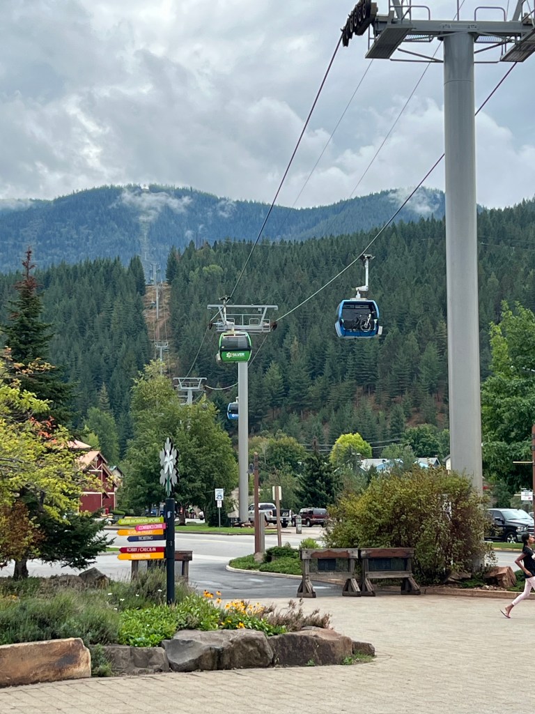
Silver Mountain gondola, it keeps going beyond…
Sunday morning, we had a three hour drive from Bonners Ferry to Kellogg ID. We are still in the narrow, northern panhandle of Idaho, just along Interstate 90 as it travels from Spokane Washington to Missoula Montana. Kellogg is another small town, population 2,500. It is an old mining town but has a ski resort that is trying to provide economic impact. For us, the ski resort was appealing because it has a 3.1 mile gondola ride that crosses several ridge lines as it reached an elevation above 5,600 feet. This is the longest gondola ride in the United States.
The full impact of the 3,000 foot elevation gain was minimized as the ride started in light showers and ended in rolling clouds. Lunch at the top was so-so. Best benefit was it gave us time to sit and gain a slight improvement in the cloud cover.
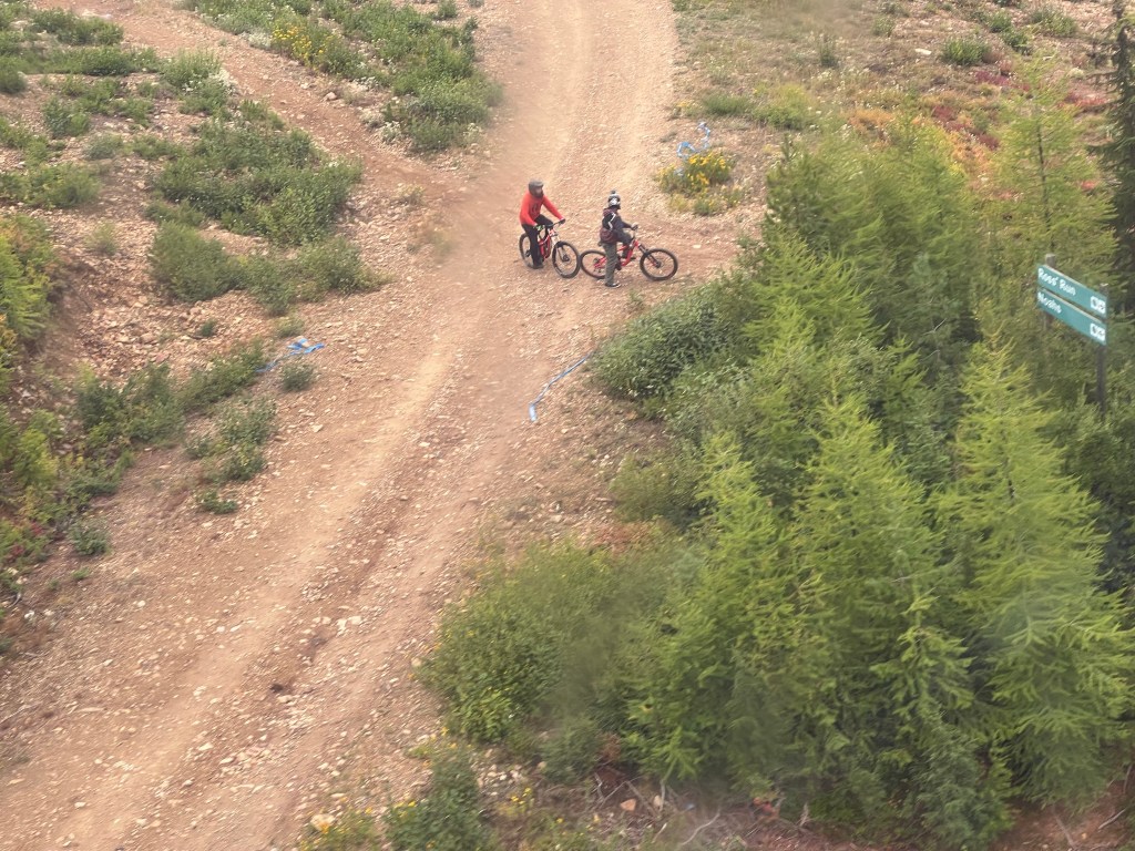
Mountain biking is very popular and we watched numerous riders head off on slopes and rides we would never consider. We overheard one rider sitting in the lunch area discussing how he had just popped his shoulder again.
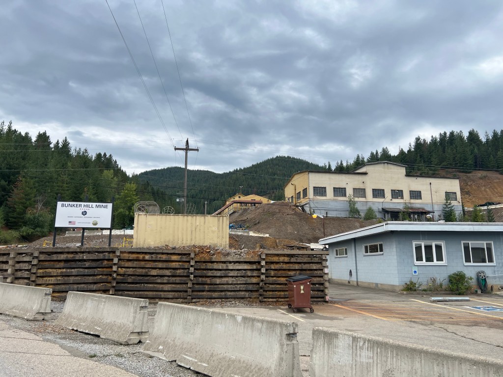
Bunker Hill Mine in Kellogg ID
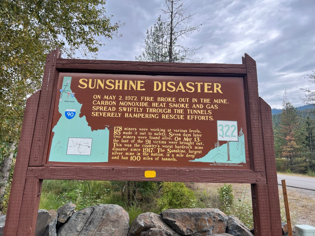
Once we returned down to earth from the clouds, we visited a mining museum in Kellogg. Starting in 1886, over time, this area of Idaho (known as the Silver Valley) has produced more silver than anywhere else in the US. Annually, it still produces the third largest quantity of silver of all states in the U.S. This area has had its share of mining problems; environmental degradation, labor-owner battles, fluctuating price of silver that affects steady production, etc. The owners of the mines and smelter in the area had a long history of indifference to health impacts to workers, residents, and downstream communities. Eventually in 1982 the smelter, largest in the world at the time, was shut down to avoid upgrading it. In 1983, the site was added to the national Superfund list.
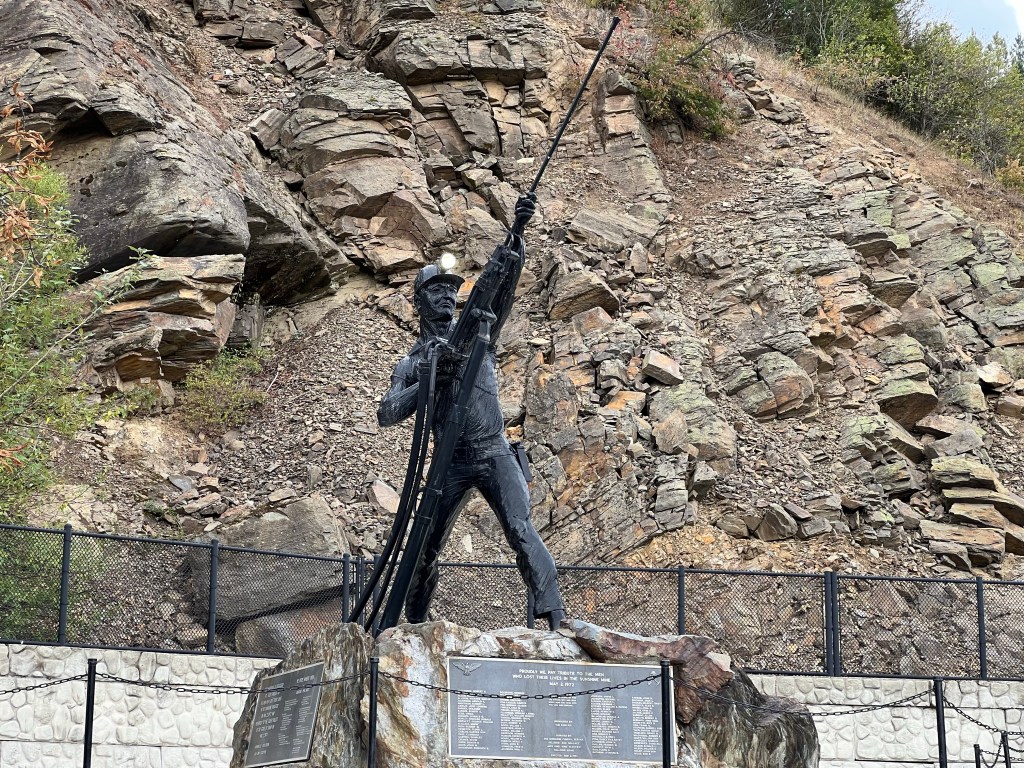
Our final bit of mining history was a surprise, sad event. Just down the road a few miles, in 1972, was the worst mining disaster in the United States. 91 miners died in the Sunshine mine disaster. You think with modern technology and safety regulations that such deadly disasters were relegated to the ash bin of past history. For those 91 workers and their families, disaster is still too real.
For dinner we stopped at the local grocery store and picked up milk, juice, salads, Tillamook ice cream (hard to choose between Tillamook and Umqua brands),and a local paper. The paper had the current prices for metals mined in the area, just like farm belt towns might have grain prices. Our ice cream was packaged in a “cold sack”, have not seen one of those in a long time.
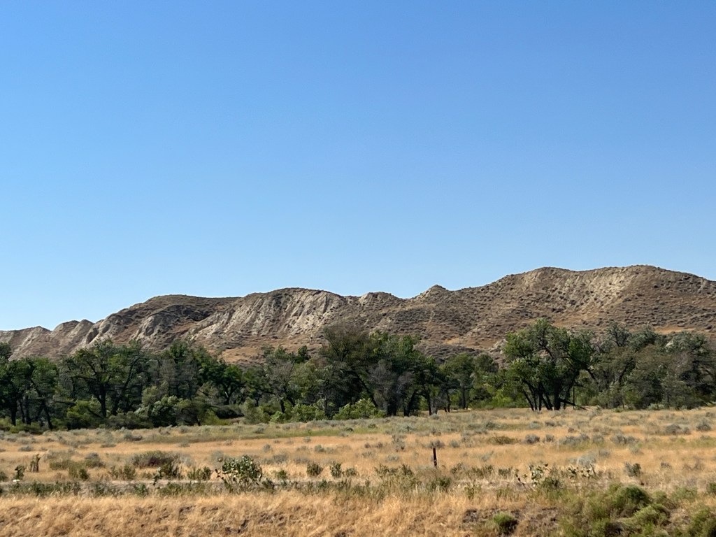
Switching from museums, we have been enjoying nature instead. Friday the first, we left Great Falls and headed north and west. Mountains became a frequent friend, watching over us from either side. No driving on narrow, curvy mountain roads yet.
Leaving Browning MT looking at the mountains of Glacier National Park
Early on in our planning for this trip, we made a conscious decision to skip two likely stops; in Browning the Museum of the Plains Indians and Glacier National Park. For Glacier, we have been there before and currently the crowds have mandated the use of a timed entry system. It added it up to probably not enjoying the trip so maybe another time. For Browning, I don’t know, we just weren’t in the mood.
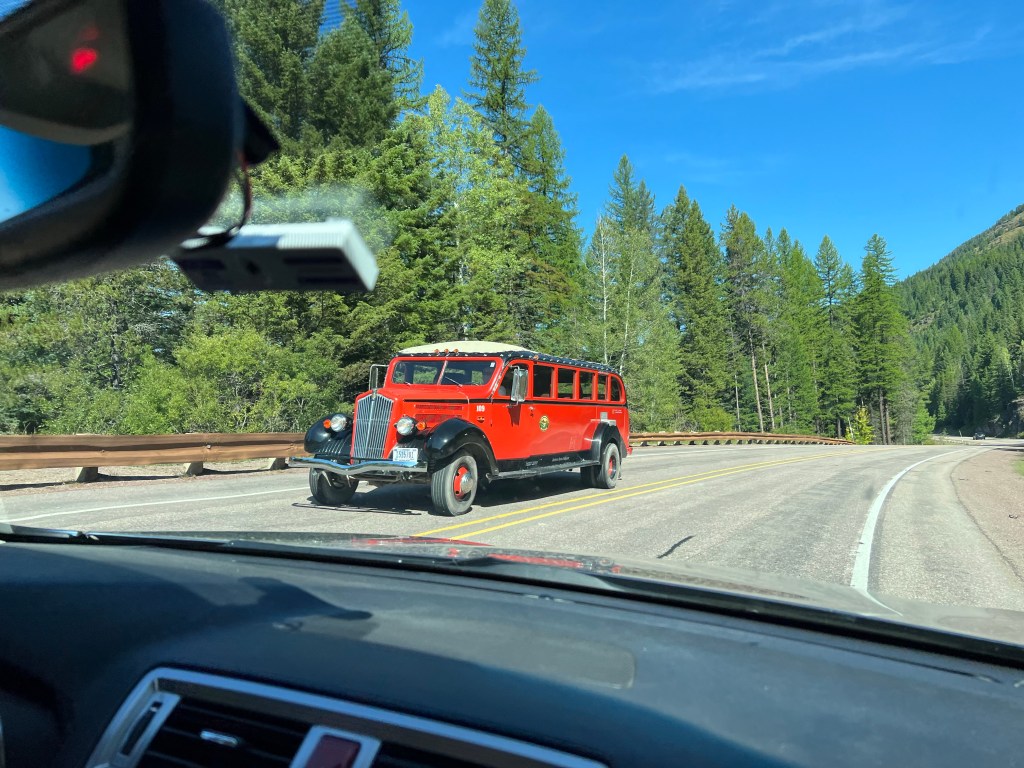
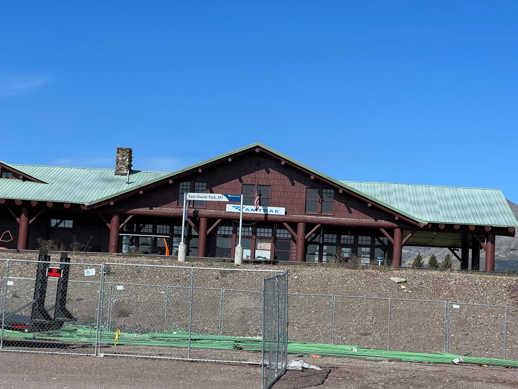
So our journey took us around the east, south, and west sides of Glacier, going through towns that the Amtrak Empire Builder stops at: East Glacier, Essex, West Glacier, Libby. No Empire Builder seen but we glimpsed several freight trains, sheds used for train protection from snow avalanches, the Libby depot, and rail crews working to maintain the tracks. We even saw two of the red shuttles used to transport people around the Glacier Park area. West of Libby we stopped at Kootenai Falls.
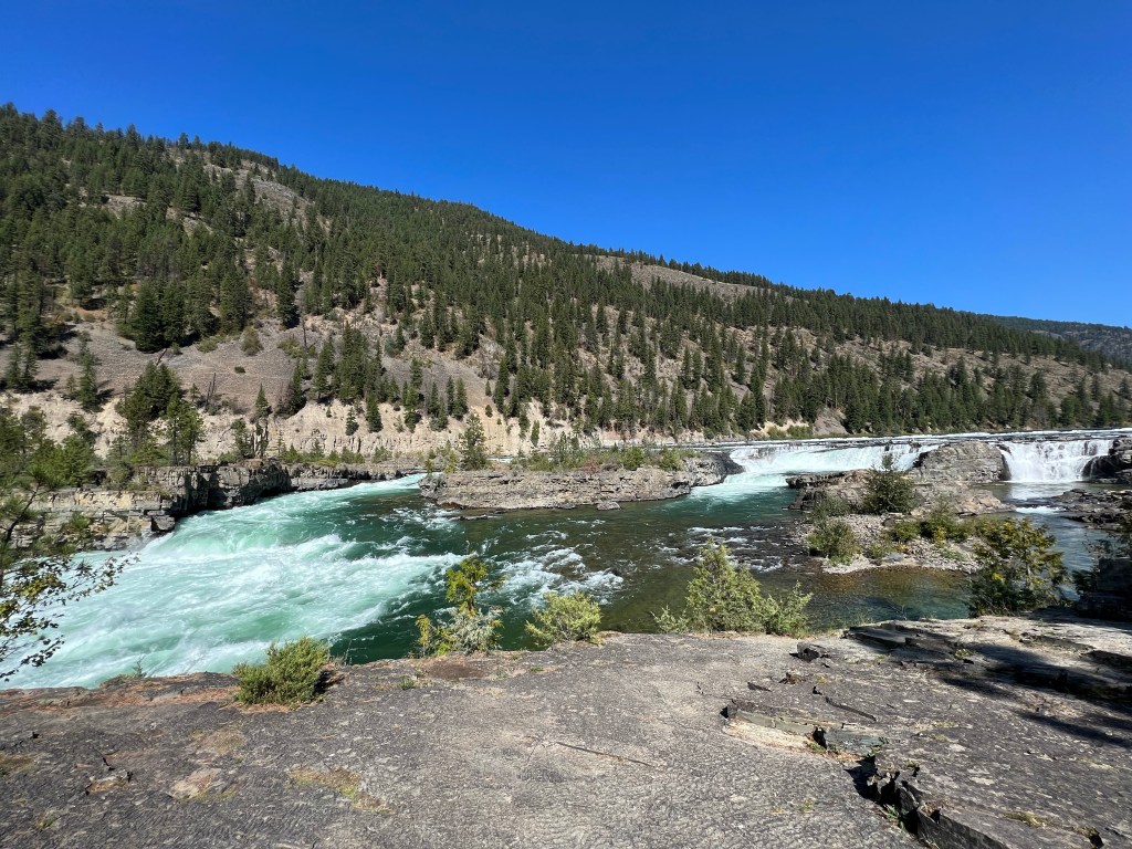
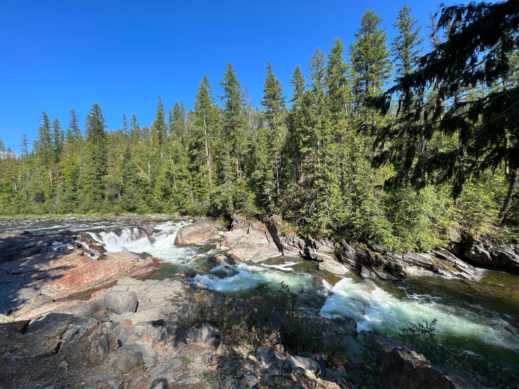
Kootenai Falls
Kootenai Falls is one of the largest free flowing falls in the Northwest since so many other rivers have been dammed for flood control and hydropower. Actually partially a falls and partially a rapids, it drops 90 feet in a distance of less than a mile. The trail to the falls is only 1/3 of a mile but involves climbing a 65 step bridge over the double tracked BNSF rail lines. The trail involves rocky terrain but the end result is quite pleasant as one gazes upon the falls.
Suspension bridge over Kootenai River
Another trail takes you to a 220 foot long suspension bridge 30-40 feet above the Kootenai River. I had no plans to go over the full length of the bridge, knowing I would get dizzy. It would likely give a different glimpse of the river so we headed that way, took our photos and returned to our car.
Yaak Falls
The Yaak falls were a minor falls not far off the route to Bonners Ferry. Nothing dramatic but a pleasant diversion that continued our weekend theme of avoiding museums and seeing natural wonders.
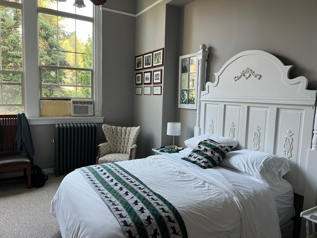
Arriving in Bonners Ferry, we checked in at Northside School B and B. As the name suggests, it is a former elementary school. We were greeted with homemade cookies (delicious) and shown to our room. The place has an in-ground swimming pool and school memorabilia throughout.
We had dinner at Mi Pueblo, another very pleasant dining experience. Entering Idaho, we had started on Pacific time and went to bed early for Pacific time but we were tired.
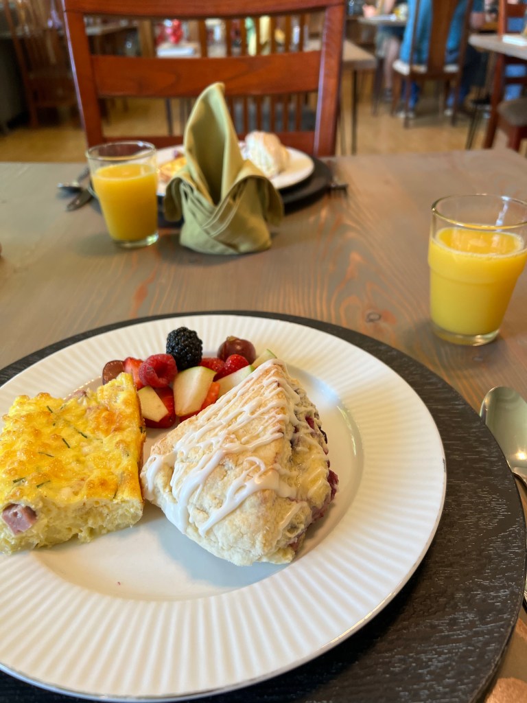
Saturday morning breakfast was exquisite, but probably typical for most B and Bs. Fresh fruit, an egg dish, and the first scone I have ever eaten that was soft and moist. (It was huckleberry.) I had two. I even had my own carafe of milk- not as large as the own in Chicago back in March but large enough.
Bonners Ferry has a Saturday morning farmers market which we visited. It did not take long and we made no purchases. From there we drove west of town to the Kootenai National Wildlife Refuge. There was one small creek but whether because of drought or because of maintenance, there was no water in the ponds and therefore practically no waterfowl.
Myrtle Falls across from Kootenai NWR
Just across the road from the wildlife refuge was a waterfall that required a hike up through the woods. The waterfall was high but in several stages and not fully visible from just one viewpoint. Pleasant, glad we saw it but no big shakes.
Instead, the highlight of the morning’s drive was gazing upon one of the biggest fields of hops under cultivation in one location. Anheuser Busch owns Elk Meadow Farms. Elk Meadow has 1750 acres of hops growing in this valley. In contrast, Minnesota statewide grows just over 100 acres while Wisconsin is about 300 acres. It was the first time I have actually seen hops under cultivation. Hops plants grow to 15 feet in height so the sight was impressive.
We stopped at a Menonnite store, again no purchases. Wandering downtown Bonners Ferry, we purchased two books. One by Nora Ephron Chris is reading now and bursts of laughter every minute or two indicates she is enjoying the book. Other than dishes of huckleberry ice cream, we came across nothing else of interest to buy so we came back and took a nap.
Surprisingly, downtown Bonners Ferry was busy for a town of 2500. A band was set up across from the farmers market location and had drawn a crowd. We noticed numerous small groups of young people having a night on the town. Most tables were occupied in our restaurant.
Tomorrow we hit the road for Wallace and Kellogg Idaho, home to a ski area where we plan to ride a three mile gondola.
The Great Falls of the Missouri River at Ryan’s Dam
Great Falls, MT August 31
Great Falls Montana was the location of one of the longest delays encountered by Lewis and Clark’s Corps of Discovery on their journey of exploration to the Pacific Ocean in 1805-1806. The Missouri River actually has five waterfalls in a short distance. Native American tribes had warned Lewis and Clark of the Great Falls, but had not mentioned the others. Lewis and Clark had planned on a portage of a day; it took them nearly a month.
Four of the falls are closer to the city of Great Falls. Great Falls, the highest waterfall, is northeast of the city and reached by back roads. There are dams and hydroelectric facilities all over the river and one today can not appreciate the majesty of what was once a free flowing 80-90 foot waterfall (Great Falls), nor the impact of five waterfalls so close together. We made our way to the Great Falls which have been topped with an extra 50 feet of concrete to produce more hydropower. Even with the concrete, we admired the rock canyon and the small stream of water coming over the dam. We could understand why the portage would have taken so long back in 1805.
There are scads of Lewis and Clark Trail interpretive centers around the U.S. The city of Great Falls is home to one of the largest, run by the U. S. Forest Service. Displays and videos here cover not only the portage around great falls, but the entirety of the total expedition. We were amazed at the amount of planning that went into this expedition and the quantity of supplies, material, and gifts to Native American tribes that they took with them. They even cached quantities of supplies to have on the return journey; hiding them so the supplies were not found by animals or Indians, yet discoverable by themselves on that return journey.
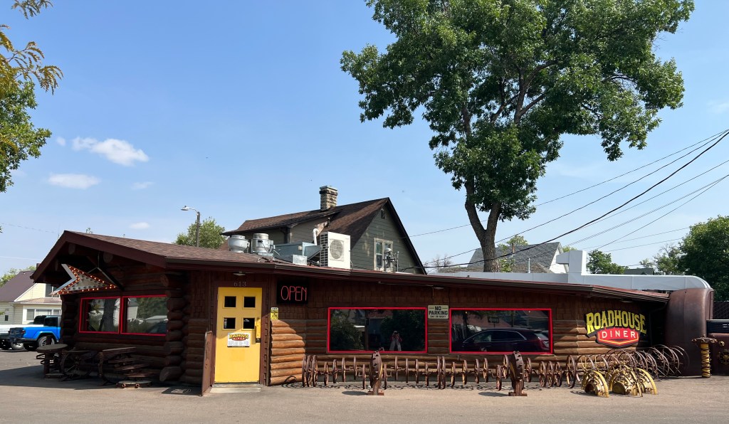
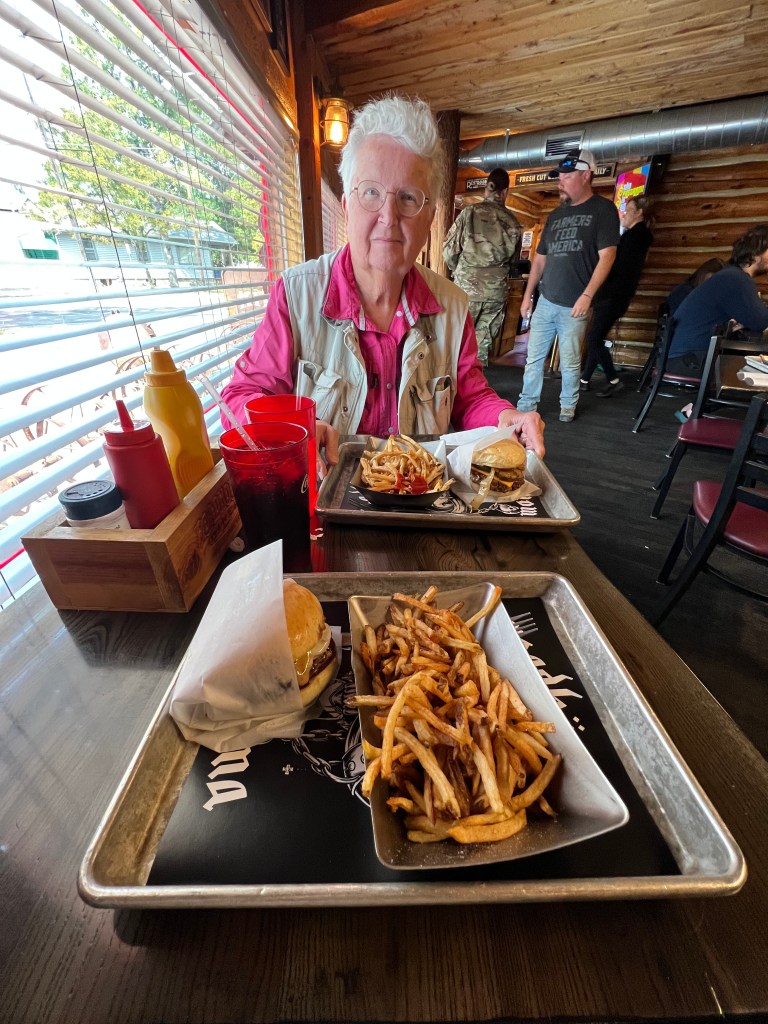
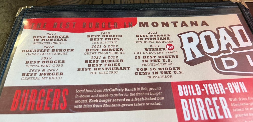
Looking for lunch, we noticed the Roadhouse Diner. Thinking it would be a typical diner with an extensive menu, we stopped there. Turns out it basically serves burgers and fries, plus a few salads and miscellaneous items. But what a burger! They were fantastic! The buns are baked especially for them every day. This place has seemingly won every burger award in the State of Montana. Sometimes you plan where you are going to eat and sometimes you just get lucky.
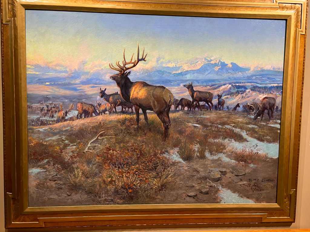
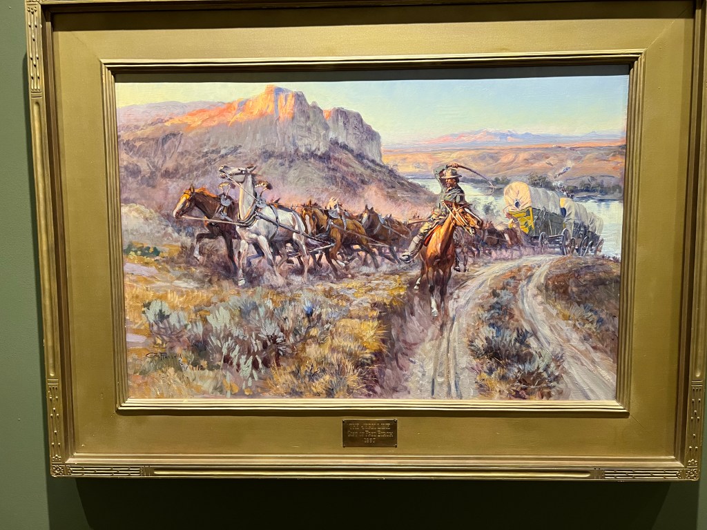
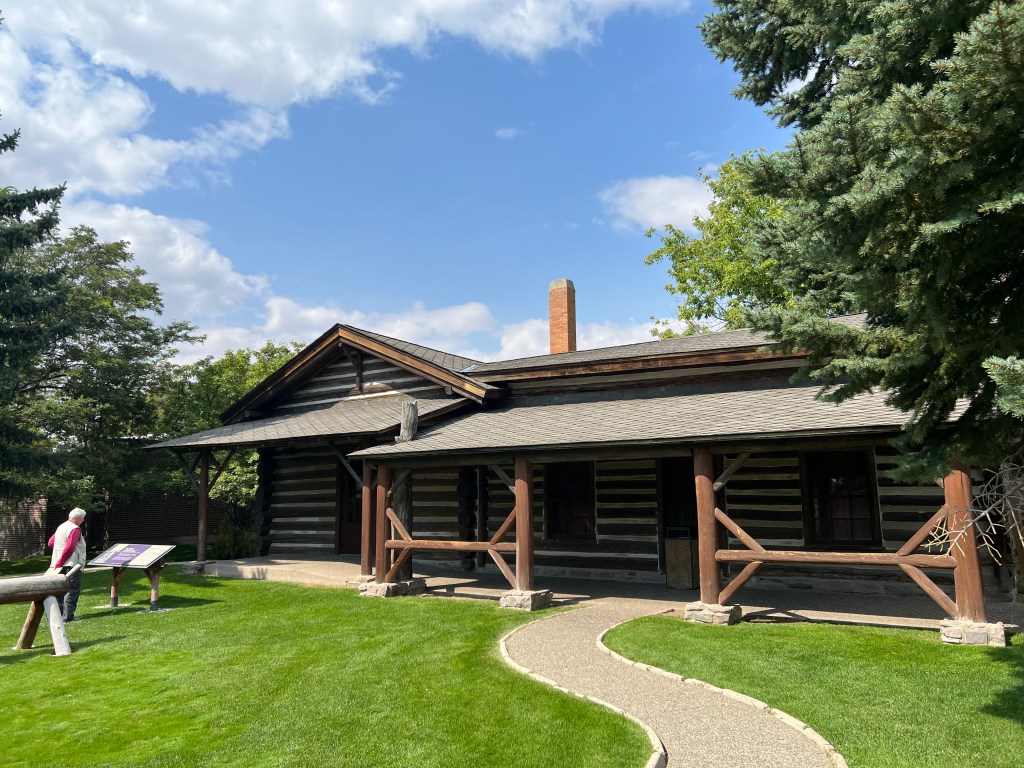
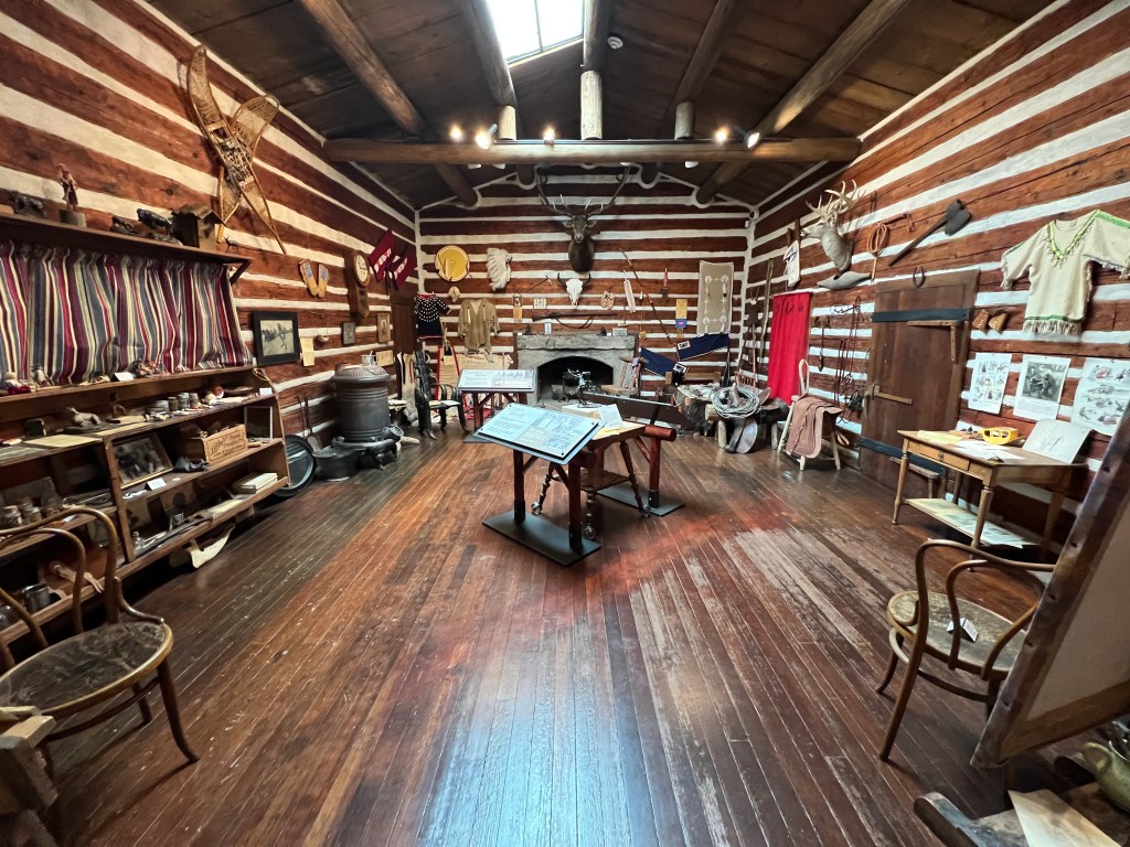
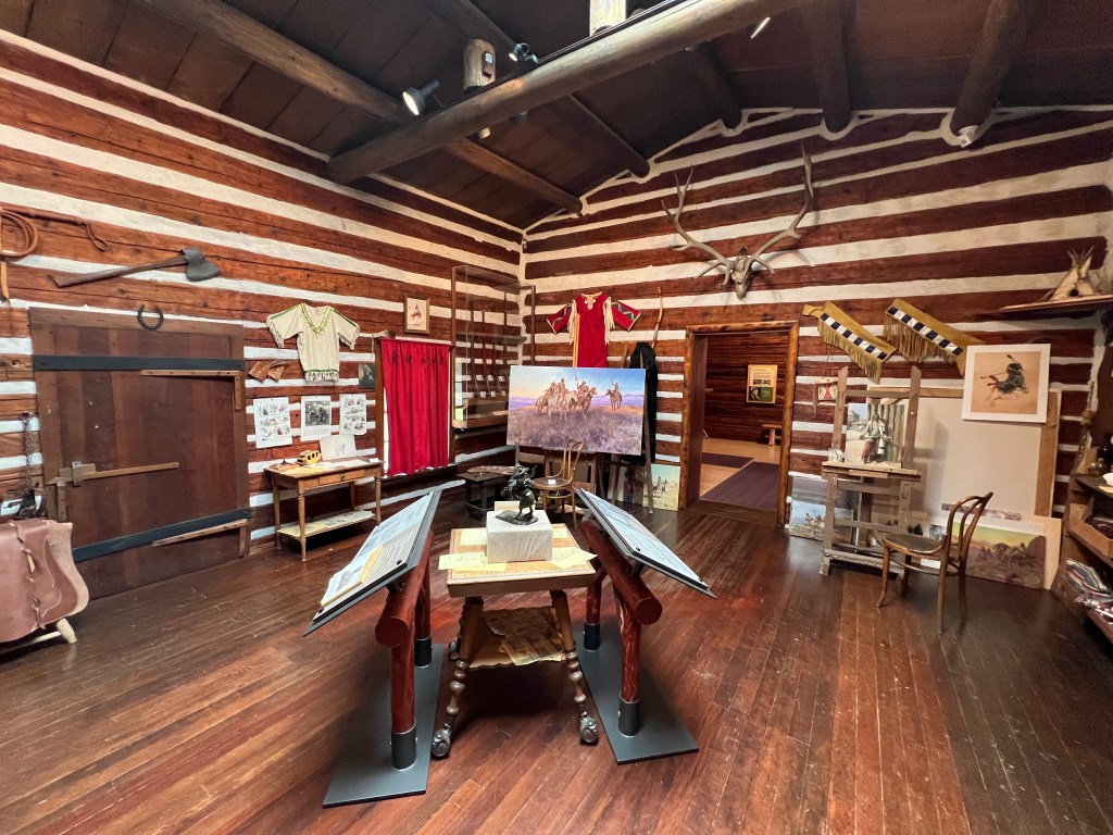
Our afternoon activity was the Charles Russell Museum.
Russell was a prolific artist specializing in paintings and sculptures of the Old West with landscapes, cowboys, bison, Native Americans, etc. The museum is a complex with multiple galleries and his home and studio. Russell was self-taught but received the praise of critics world wide. He produced over 4,000 works of art. We spent two hours here and enjoyed our time.
Above, a few of the many paintings on display. Below, this painting is set coming up the hill from Fort Benton that we drove up Thursday morning on our way to Great Falls.
Above, Russell’s studio in Great Falls Montana
Today is laundry night and Friday we head for Idaho.
It was pure serendipity. Five minutes after we walked in to the Blaine County Museum in Chinook MT, National Park Service Ranger Austin walked in. We had pretty much decided we were not going to drive down the 19 miles to the Bear Paw Battlefield and stand in an open field in 95° weather. The Blaine County Museum was supposed to have an exhibit about the Bear Paw battlefield. We thought we might settle for that.
The Bear Paw battlefield was the ending location of the Nez Perce trail. This is the 1170 mile trail followed by the Nez Perce (Nee-Me-Poo in their language) tribe. They tried to make their way from the Oregon/Idaho border to Canada and safety from the US Army. It is a long story, but in essence, the Nez Perce treaty of 1855 guaranteed them a 5000 mi.² reservation. Then gold was discovered and the US cut their reservation land by 90%. Some of the Nez Perce refused to move to the new, reduced reservation area within the 30 days mandated by the US Army. This began the 1170 mile journey with constant battles between the Nez Perce and the US Army.
Then we lucked upon Ranger Austin, who gave us a personal interpretation of the battle and the history of the Nez Perce. Combined with a 20 minute excellent video in the museum, we probably got much more from this experience at the Blaine County Museum than we would have by going down to the battlefield.
This journey of the Nez Perce in 1877 is frequently remembered by a famous saying of Chief Joseph, who is not actually the major warrior chief for the group, but who surrendered the group at the end by saying: “From where the sun now stands, I will fight no more forever. “
The Blaine County Museum also had interesting displays on the development of the area into a ranching territory, as well as some of the geological precursors to the terrain that we see now. One interesting factoid was the creation of wheat houses. There are few building materials on these plains. Prepackaged lumber for small tarpaper shacks were sold to prospective homesteaders. The enterprising farmers would create bales of wheat, which they stacked around the shack for insulation and for protection from the wind. We had never heard of this before. Sod houses yes, wheat houses no.
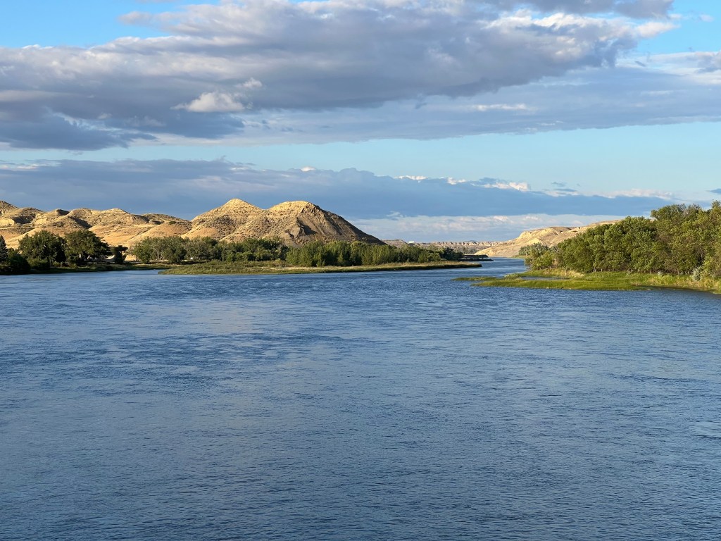
We left Chinook and continued our journey, heading for Fort Benton. Today’s travel surprise was six miles of empty railroad flat cars, the type that piggyback semi-trailers from coastal ports to inland locations. We passed Decision Point, the confluence of the Missouri and Marias Rivers. Lewis and Clark spent ten days here trying to decide which river was the true Missouri. The Marias was as muddy as the Missouri consistently had been. However, Lewis and Clark figured the Missouri must come from the mountains and that water would be cleaner. They chose the correct branch and continued the journey.
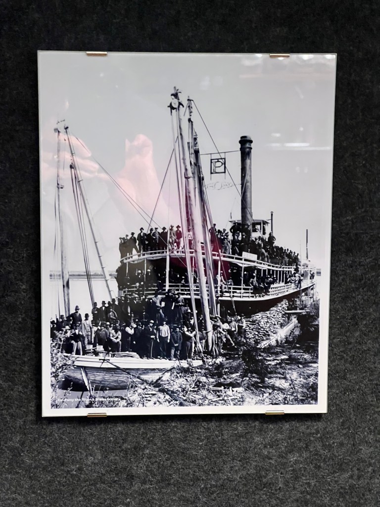
Fort Benton is a town of 1,500 and we are spending two nights here. The town proclaims itself as the Birthplace of Montana. Early traders, settlers, and miners came up the Missouri on steamboats. Fort Benton was as far as the river was navigable so they disembarked and took stage coaches, etc. to their final destination. The town continued to prosper until the railroads ended the days of river transportation for rail transportation.
But we are here due to several museums located here, a mini-museum city. We have an Airbnb close to downtown, the museums, and the river. We had sufficient time Tuesday afternoon to visit one museum and we chose The Museum of the Upper Missouri. It’s focus is on the early stages of the town’s development. The museum is right along the river and it was easy to visualize trappers and settlers coming up the Missouri and then taking various trails out to the Pacific Coast, to Canada for furs and liquor, to Helena for mining, or to St. Paul for supplies to sell. The usual tales of bad behavior and vigilante justice were displayed along the walls.
Our Airbnb is a whole house, our host has several properties and the person previously in our scheduled, smaller location wanted to extend a long rental so we got bumped. Can’t complain, this is much nicer. We wandered the downtown where a gift shop owner gave us meal recommendations and we chose the local VFW hall. Busy place and once again we had a tasty meal.
The Missouri River and the Breaks
Wednesday the weather was perfect. Sunny skies and temperatures in the 70s. So of course we spent most of the day inside museums, other than short walks to and from the museums. First off was the Missouri Breaks Interpretive Center of the Upper Missouri River Breaks National Monument operated by the U.S. Bureau of Land Management. Like us, you are probably asking: What are “breaks”? The Breaks are the rugged and remote valleys, badlands, and coulees that surround this section of the Upper Missouri. In 1976, a 149 mile stretch of the Missouri River through north central Montana was designated as wild and scenic. The Upper Missouri River Breaks National Monument was established in 2001 on both sides of the wild and scenic river although there are numerous privately owned parcels within this national monument.
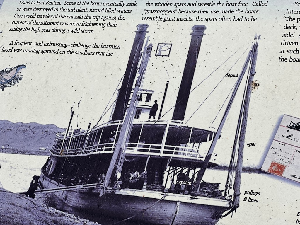
Inside the Interpretive Center, we watched a film, read about local wildlife, and listened to bird songs of the local area. Three particular items stood out. First, the rifle Chief Joseph handed over at Bear Paw Battlefield is on display. Second, the Fort Benton municipal water system was the first in the country to utilize ultraviolet light to disinfect their water supply. Third, we learned about grasshoppers. This was the term used for a series of ropes, pulleys, and tall wood spars on the front of the boat that were repeatedly driven into sandbars while the paddlewheels pushed forward; foot by foot the steamboat moved over the sandbar it had been stuck on.
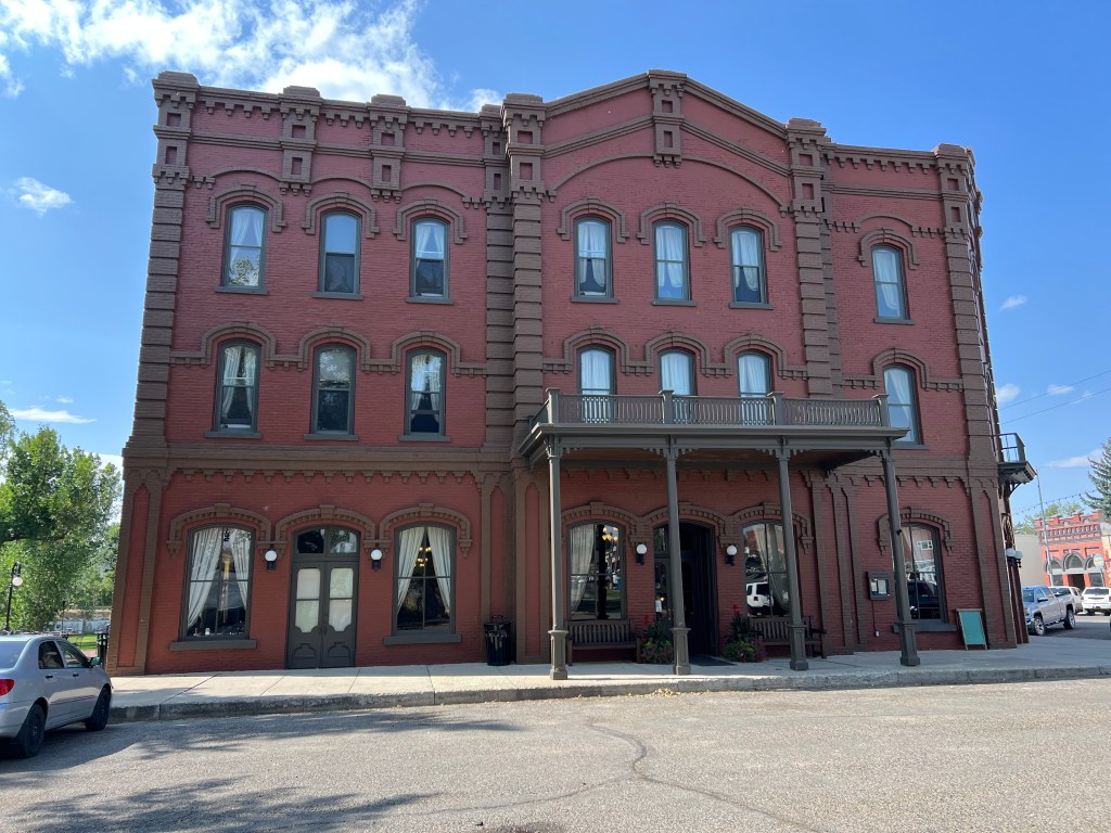
After the Interpretive Center, we had lunch at the Grand Union Hotel. Built in 1882 just prior to the economic collapse of the area due to the railroads, the hotel was a derelict for about 100 years. For the last 20 years it has regained its beauty and prominence.
During the afternoon we visited our last two museums. Old Fort Benton had been constructed for the fur trade era for about 30 years beginning in 1846. Furs for beaver hats were on the decline but buffalo skins were the new cash crop and there were plenty of those for a while. As the head of navigation for the Missouri River, the fort did a brisk business in the shipment of goods. Abandoned by 1877, the fort was purchased and restored.
In the old trading displays we discovered that blankets, like the famous Hudson’s Bay Company blankets, had clearly marked trading prices. 4.5 inch stripes were marked on the blanket with values from one to four. Each stripe was valued at one beaver pelt.
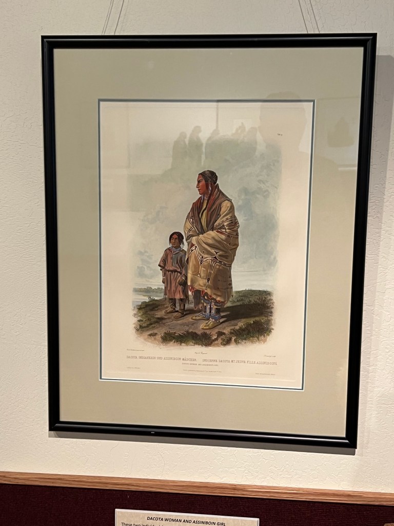
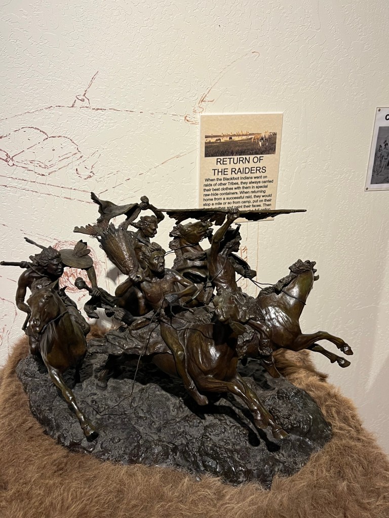
Another building was an art gallery. Remington bronzes and Charles Russell paintings were intermingled in the displays although the focus were bronze sculptures by the Blackfoot artist Robert Macfie Scriver and the paintings of Swiss artist Karl Bodmer.
The final museum was the Museum of the Great Northern Plains. (Other than the Missouri Breaks Center, the three museums are all operated by volunteers without government assistance for operations.) This museum’s focus is to document the last 100 plus years of life on Montana’s plains. Farming, ranching and small town life are on display.
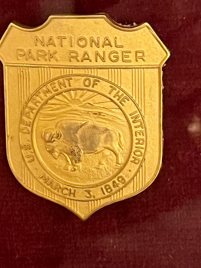
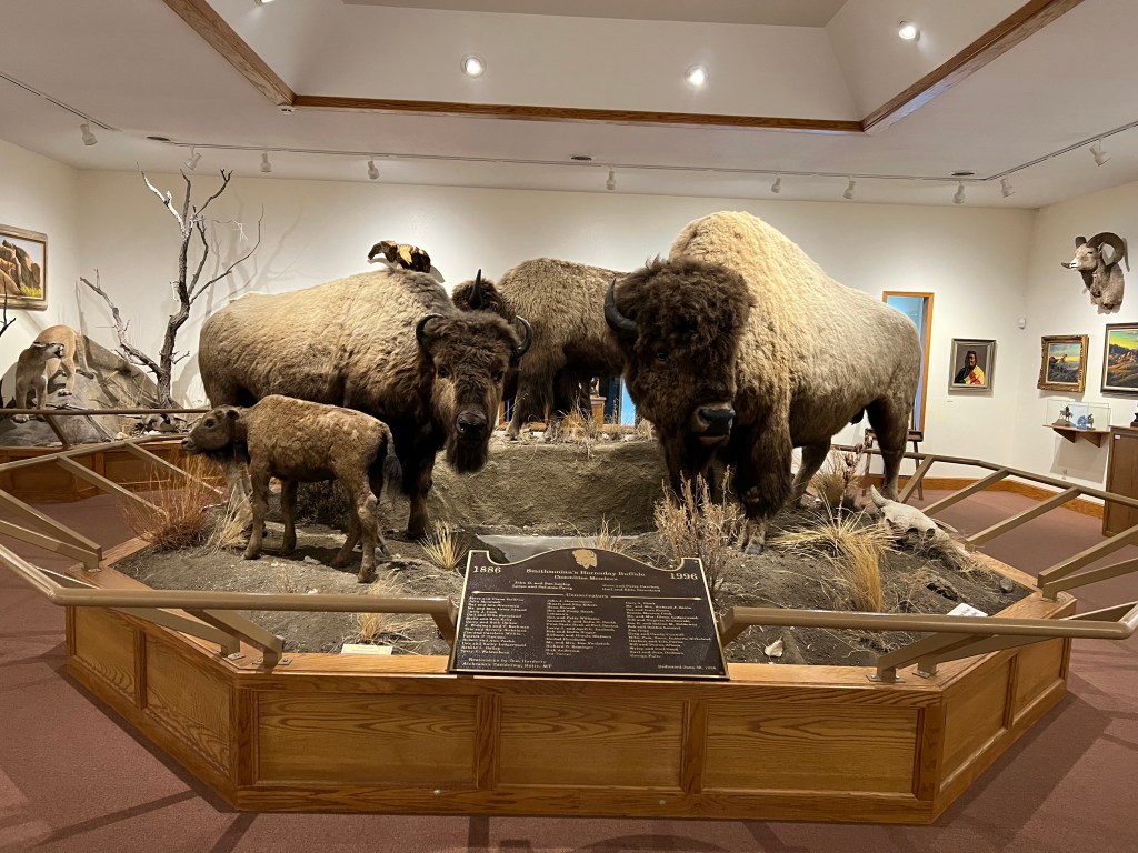
Two items were notable here. First was the Hornaday Bison. This is a group of six bison hunted in 1866 and on display at the Smithsonian for 70 years and then put in storage. They were rediscovered and restored and put on display here in Fort Benton, the last and most successful buffalo robe trading post along the upper Missouri. The bull in the display inspired the Great Seal of the Department of the Interior and the National Park Service badge bears his likeness.
The second item was a display critical of James J Hill, the founder of the Great Northern Railway. The display discussed the grandiose promises made to attract settlers along the path of Hill’s railway. The reality was flat, endless, windswept plains which had hot, dry summers and frigid winters.At its peak in 1912, 3.4 million acres were under cultivation. Less than 10 years later, in 1921, only 1.45 million acres were under cultivation. The land could not produce as the advertisements promised and 100,000 homesteaders had departed.
The day finished on a pleasant note. We walked over the old railroad bridge that is now solely for pedestrian use and got a very nice view of the river and the breaks. Dinner was at the second recommended restaurant and we drove up to a scenic overlook to try to get a view of the Supermoon rising. That effort was partially successful. We were just able to view the moon before it disappeared behind clouds for the night but the wind was so strong, holding the camera steady for an evening shot was challenging. The resulting photos were only so-so.
The Enchanted Highway was a spur of the moment diversion. We had left Bismarck and were heading west on interstate 94 when we saw small signs promoting the Enchanted Highway. Then we came upon a humongous (110 feet tall and 150 feet wide) scrap metal sculpture along one of the exits in sparsely populated western North Dakota. We pulled off the interstate to inspect the sculpture. A local artist, Gary Greff, had worked with numerous farmers in this area to create an attraction that would draw visitors to his small town of Regent North Dakota.(Population 170) The metal sculptures would utilize the welding skills so many farmers have developed.
Geese in Flight along I-94
We took a chance to follow this 30 mile, one way, diversion, hoping it was worth the time and would not make us reach Fort Peck dam and Charles Russell wildlife refuge interpretive center past its closing time of 4 PM. In the end, yes the 90 minutes or so it took us to drive to Regent and back was time well spent. Our photos of seven of the sculptures will bring back pleasant memories of this bit of quirky Americana. Greff’s goal was achieved, we gassed up in Regent and bought a memento or two. And we made it to Fort Peck at 2:45 pm.
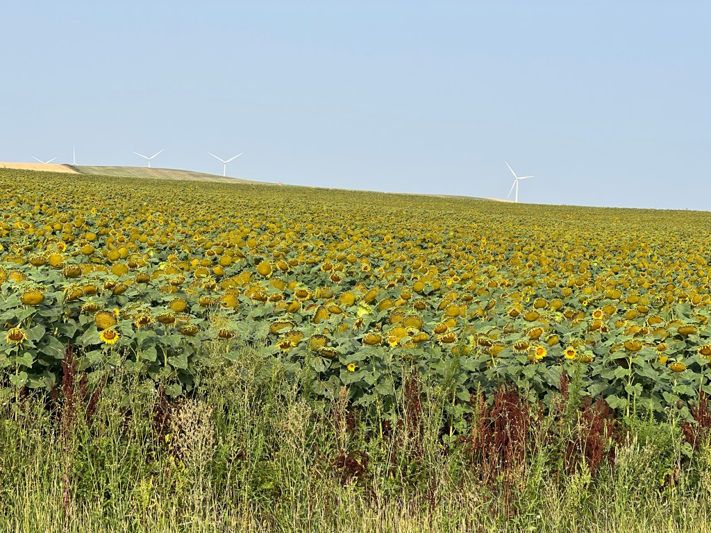
Sunflowers waking up on left, showing their blooms on right
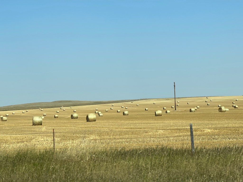
The drive to Fort Peck took us through portions of the badlands of North Dakota with its exposed rock formations, ridges and valleys. Fields of sunflowers were still curled up in the morning until unfolding later in the day as the sun brought forth the yellow flowers. Wheat fields were in the process of being harvested. Round bales of hay were lying in fields everywhere. Cattle grazed singly and in small groups on scraggly looking open pasture. Miles of empty hopper cars from BNSF Railway lined the tracks, possibly stored here until enough grains had been harvested for the cars to be useful.
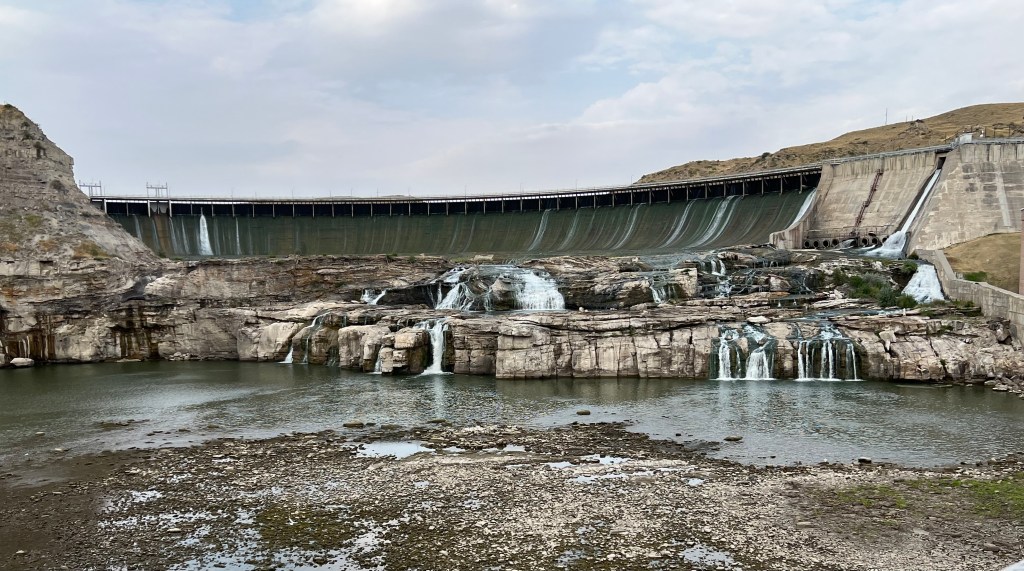
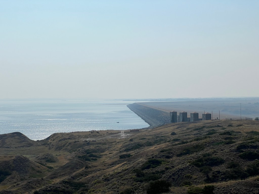
Fort Peck Dam
Our destination was the Fort Peck Interpretive Center, a joint project for the Forest Service and the Corps of Engineers. Fort Peck Dam was built during the Depression, damming the Missouri River and creating Lake Peck and later the Charles Russell National Wildlife Refuge. The dam is an earthen embankment dam, 250 feet high and just under four miles long. It took four years to build and the earth of the dam was dredged from the area, sent by a slurry pipeline to the dam site and dewatered and compacted. This is a frequent process for long dams filling a valley. Many people see the concrete spillway built to handle emergency overflows and erroneously believe that is the dam. The dam is the largest hydraulically constructed dam in the US and fifth largest reservoir in the US.
The Missouri River is frequently dammed. Six dams are in Montana and the Dakotas with two of those six creating reservoirs longer and larger than Lake Peck. The Corps of Engineers has to balance multiple and conflicting interests in managing the flows into and out of the reservoirs. Flood control, hydroelectric power, recreation, irrigation, water supply, water quality and fish and wildlife all have different constituents. It makes for a guaranteed conflict when water levels are high or low, and when the dam is built.
Lake Peck, the backed up Missouri River, is 134 miles long. The Charles Russell Wildlife Refuge dates back to 1934 and surrounds Lake Peck. Undergoing numerous changes over the years as to management, size, and designation, the refuge protects over 900,000 acres and is the second largest National Wildlife Refuge in the lower 48 states. Unfortunately for us, access is primarily by boat and we will not truly explore it. The interpretive center gave us the best feel for it that we are likely to experience.
Staff at the center were both helpful and knowledgeable. We took advantage of both of those attributes as we peppered them with questions. It took us a while to grasp the dam’s construction, how the river flows through it, and the location of the spillway versus the dam. I should have spent more time examining the fish displays. It would have helped me with my volunteer stints back at Mississippi National River and Recreation Area.
Rundle Suites, Glasgow MT
Glasgow Montana is the location of our overnight lodging. The town has 3200 people and is the largest city for 100 miles. We are staying in the Rundle Suites in downtown Glasgow. The building began its life around the time of WWI and has seen a variety of commercial and residential uses. The rooms are newly remodeled and other than a small and old fashioned elevator, the place is quite nice.
Small towns may not always have the widest variety of restaurants but over the years we have found the meals to be quite good. Glasgow did not disappoint. Eugene’s Pizza offered much more than pizza. Each dinner meal came with jo-jos; dressed up fancy potato wedges. Breakfast was at the Oasis, a small restaurant attached to a downtown casino that did not offer a lot of curbside appeal. However our breakfasts were large, tasty, and inexpensive. Plus the milk was cold and the waitress did not need to be told to bring the milk with the meal.
10 AM Sunday service at the Cathedral of the Holy Spirit was a surprise. A full house and about 40% of the attendees were children and teenagers. No special service, evidently just the usual crowd. We are more used to seeing the gray hairs vastly predominant.
The delicious caramel roll at Little Cottage Cafe
Our next surprise was breakfast at The Little Cottage Cafe. The line was out the door but we were assured the wait was worth it and the line would move quickly. All of the tables were for 2s and 4s. While waiting, we chatted a bit with two couples, one our age and one in their 20s and sat next to each other and the conversation continued. Major good advice: Order the caramel roll as an appetizer. We did and it was fantastic; sweet with extra caramel, warm, soft and fluffy, not heavy like some others are. The entire breakfast was tasty and inexpensive. Put it on your list next time you are in Bismarck.
Another bit of advice was to visit the North Dakota Heritage Center and State Museum. We had it on our secondary list in case we finished the State Capitol tour early. We decided to move it up and visit the Capitol second. Wise choice, as we got to the museum, we were informed the Capitol tours were not being held this weekend due to repairs-even though the Capitol web site had not mentioned that.
Native American drum with four colors of the medicine wheel
The Heritage Center and Museum was either new or recently renovated. The displays were well done with a nice mix of new technology and old style but new display boards. The information presented covered an extensive catalog of topics; obviously not comprehensively but reasonably thorough. The information on Native Americans was substantial.
We re-learned ND’s legacy of fighting the early domination of the state by railroads and wheat magnates out of Minneapolis. ND’s geologic history lead to several exhibits about fossils, bison, and dinosaurs. Agriculture, coal, and fracking were several hot topics also.
North Dakota is an immigrant state and the pattern of immigrants from European countries forming their own enclaves and keeping their heritage alive was discussed, although I did not observe any displays of Indian boarding schools and their negative impact on Indian cultures.
Admission to the museum is free so people are able to come back often. I find it more and more difficult to retain much of the new information I pick up at museums but I keep trying.
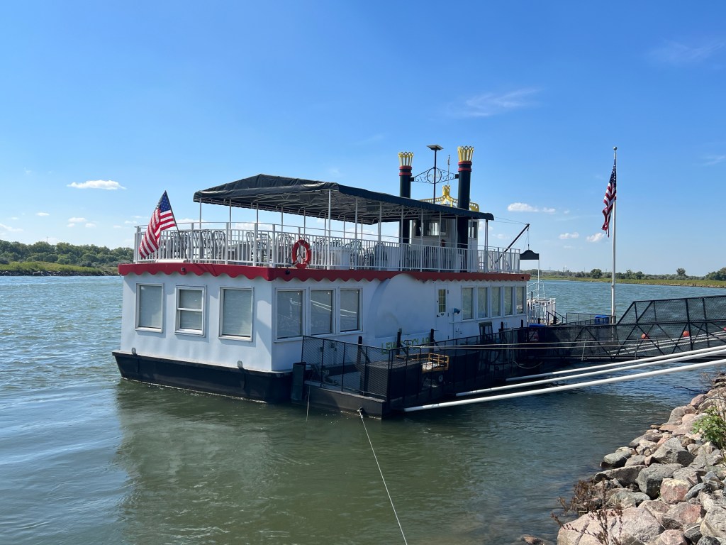
Lewis and Clark Riverboat
An afternoon cruise on the Missouri River was next on our agenda. The Missouri has been frequently dammed in ND, SD, and MT, creating water recreation opportunities. Pontoon boats were the most numerous type of vessels we observed. Our excursion boat could probably seat 150 people and was about one-half full.
This section of the Missouri River is part of the Northern Plains National Heritage Area. National Heritage Areas are created by Congress and coordinated with the National Park Service. They are not an official unit of NPS. My personal interpretation is that these are local efforts to market their communities tying into the cachet of the National Park Service. The official verbiage is: Through public-private partnerships, NHA entities support historic preservation, natural resource conservation, recreation, heritage tourism,and educational projects.
I think the people on the boat were just having a relaxing boat ride. However, there was a recorded narration on the cruise lasting about 20 minutes. If you listened to it, you heard most of the presentation expressing the Native American perspective of the dams on the Missouri. Creation of the dams led to to the destruction of the Indian villages that had been up and down the Missouri River. One statement was: “ my birthplace is 20 feet below the surface of the river”.
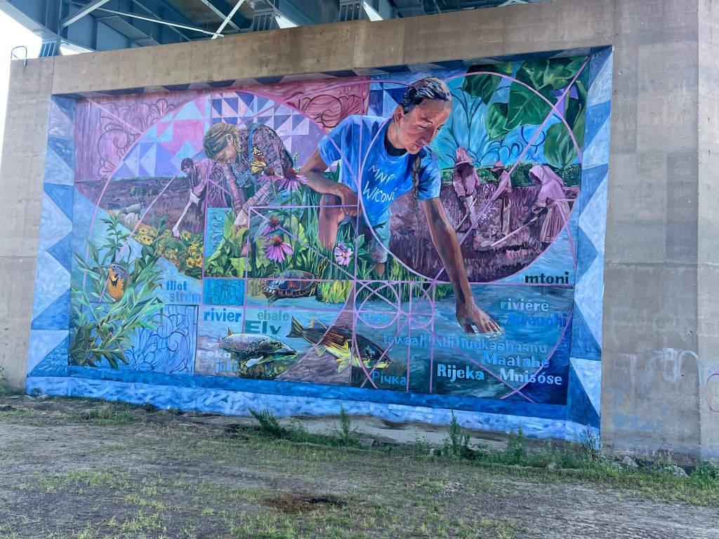
As we left the boat, we came across a large mural. It was a project just completed that had as its goal to bring together partners within the National Heritage Area to share stories about how and why the Missouri River was and continues to be meaningful. Some of the themes included the role of immigrant settler women in agriculture, the state flower (Prairie Rose) and state bird (the Meadowlark), role of cottonwood trees, the river as a source of life, and the three tribes of the area (Mandan, Arikara, and Hidatsa).
On a related note, some of the words from languages used in the area for river are: Fluss (German), Elv (Norwegian), Mnishoshe (Lakota), Joki (Finnish), and Maatahe (Mandan).
View from overlook-Chief Looking Village Park
Before dinner, we finished up the day by driving to an overlook on the bluffs overlooking the river for a beautiful view of the Missouri. Dinner was at The Lodge, a nearby restaurant recommended by our brunch companions.
We are back on the road for an extensive seven week road trip. This started out as a planned trip to Idaho, a state we have only visited minimally. As time went on, we added parts of Oregon and northern California, as well as a few more stops in Montana. If the federal government does not shut down on October 1, we will spend two nights in Yellowstone National Park and two nights in Badlands National Park. The end result is the map you see above.
Regular readers of the blog will know that we are seeking to visit most of the 420+ units of the National Park Service. Currently we are over 320 and this trip should add 15 more units that are new to us.
We had to schedule our time for this trip with sufficient days to be able to see the critical items on our list. In addition, we wanted to make sure we could get into the Minnesota State Fair before we left on our journey. That was accomplished by going to the fair on its opening day, Thursday, two days ago. I managed to fit in a volunteer stint with Mississippi National River And Recreation Area from 10 to 2. The rest of the time was spent eating and wandering the fairgrounds with Chris.
Interstate 94 to the North Dakota/Minnesota border was a routine run. Starting west from Fargo, we were back on an interstate highway we have not visited for probably eight or nine years. The terrain was similar to the North Dakota plains we passed through on our trip to Winnipeg in the middle of July, without any fields of canola. And, despite the fact that North Dakota has less than 100 dairy farms, milk is the designated state beverage. All of the cows we saw on the farms along the highway looked like beef cattle, not dairy cattle.
We decided to break up the day’s journey with a stop in Jamestown North Dakota. Jamestown is a community of about 15,000 people with a kitschy tourist attraction called Heritage Village/ National Buffalo Museum. You can tell the attraction is older, since it still uses the term of buffalo rather than bison in its name. However, within the museum itself, it utilizes space to explain the difference between the bison of North America and the water buffalo of Asia.
We picked up a few new factoids about bison. For instance, I had not remembered that there are two types of bison in North America. The plains bison are primarily found in the United States. The wood bison are primarily found in Canada and are 10 to 15% larger than bison found in the U.S. Nor did I remember that bison only require water every three or four days. I was pleased to see that the museum, while not highlighting the fact, did at least make it known that the killing of bison was also a tactic to subjugate Native Americans.
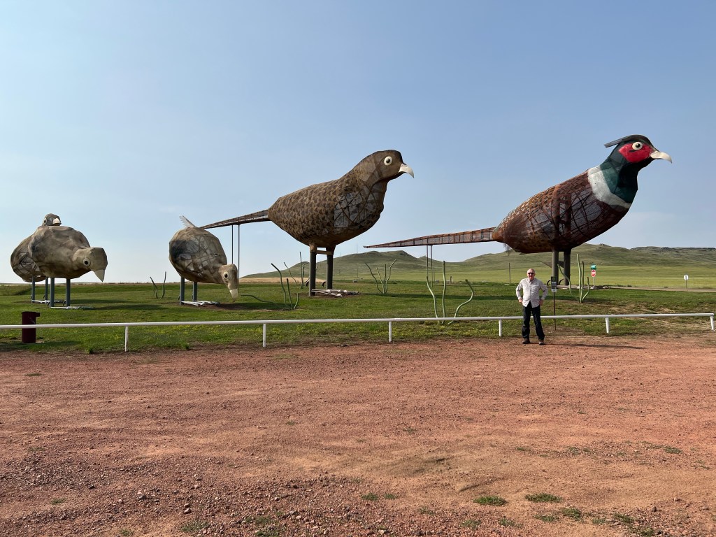
Lucky for us we have seen bison in numerous locations around the United States. The bison at the museum, according to one staff member, generally leave the area of the museum around the time visitors arrive at the door, and return from wooded areas after the visitors have left. For over fifty years, the museum has had a sculpted 26 foot tall, 60 ton bison on display outside. Of course, we got a picture of it.
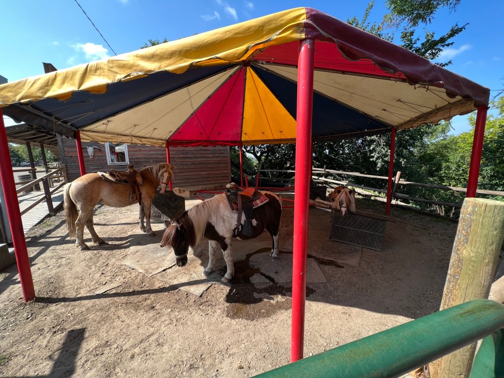
Heritage Village is a collection of pioneer day buildings, and businesses. The general store was doing a brisk business by the selling of ice cream and had a seven piece band playing on the porch outside the store. Heritage village even had a stage coach ride and pony rides for the young in age and size. I had to take a picture and send it to my sisters. We used to assist neighbors with Shetland pony rides when we kids were young.
By this time, we were ready to head out and so left the Buffalo Museum thinking to stop at a wildlife refuge prior to stopping in Bismarck. 2/3 of the way to the wildlife refuge we decided enough was enough, and just continued on to our Airbnb where we will stay in Bismarck for two nights. Dinner was takeout from a local grocery store.
Sundays are always a challenge when traveling. After you fit in time for church, many places you wish to visit are not open or have shorter hours. We lucked out today with two pleasant experiences.
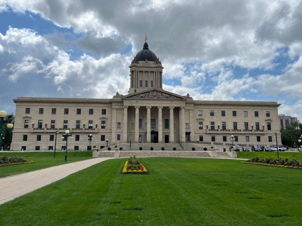
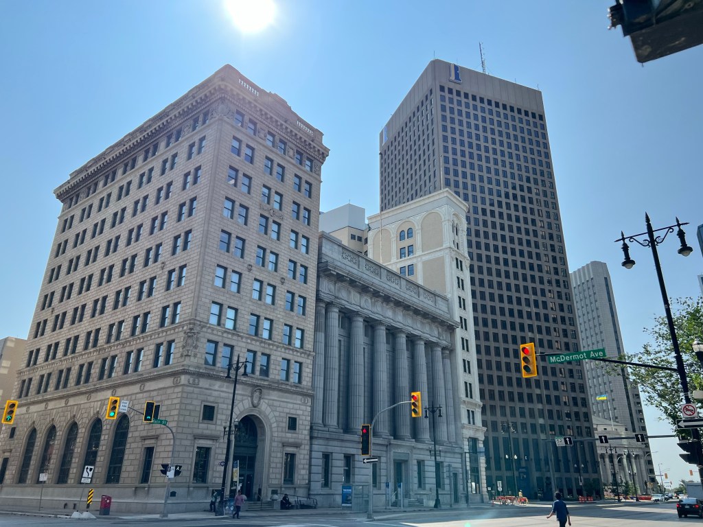
Manitoba has a unicameral legislative body and the Manitoba Legislative Building is open for tours seven days per week in the summer. There is road and sidewalk construction underway here so our first challenge, successfully completed, was to find a parking spot. Helped by a friendly neighbor out for a walk, we found free, on-street parking next to the building.
Arriving early for the 1 pm tour, we wandered the grounds and admired the statue of Louis Riel. Riel was the founder of Manitoba, and a leader of the Red River Metis (people born of a union of men of European ancestry and women of First Nation tribes) and his story is well beyond the scope of this blog.
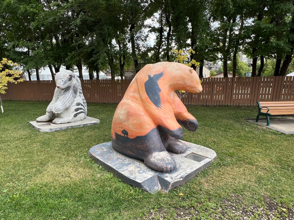
The 75th anniversary of CancerCare Manitoba was the inspiration for 62 four ton painted polar bear statues located around the city of Winnipeg in 2005. A number of the statues are still located on the grounds of the Legislative Building. It was a fitting scene as Chris has been enamored with the idea of visiting Churchill Manitoba to see polar bears, a desire not yet fulfilled and probably unlikely to be attained.
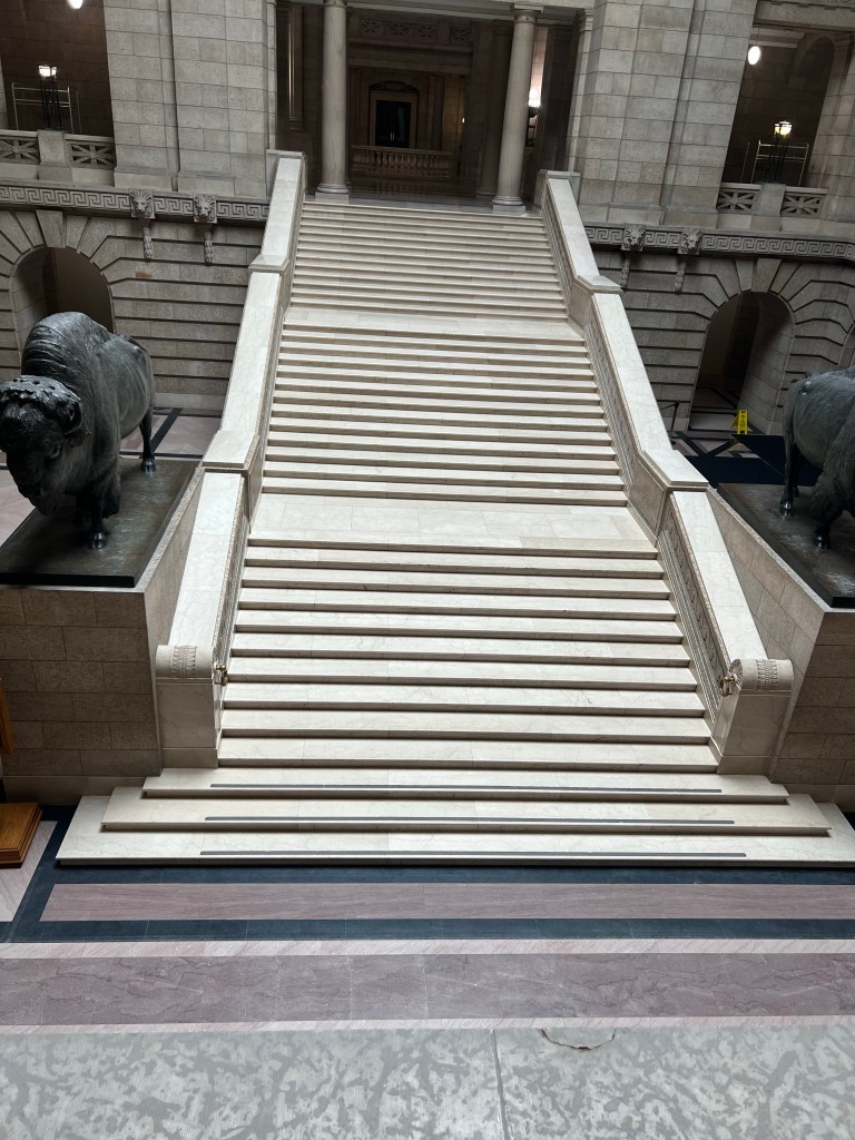
The building tour did not discuss the bears but did mention a number of other interesting details about the building. For instance, evidently the belief that the number 13 is unlucky goes back to ancient times. What we did not know was that the use of many series of 13 objects converted being unlucky to being lucky. Thus the architect has numerous style motifs which number 13 objects; decorative rosettes, stairs, light bulbs, etc.
Three sets of 13 steps, 13 geometric forms, 13 circles around the door frameGolden Boy
Another story relates to the statue on the top dome. This is “Golden Boy”, a 17 foot tall, 3640 pound bronze statue that is meant to convey the message of coming prosperity for all Manitobans. He has a lucky story too. Sculpted in France in a foundry that was bombed by the Germans during WWI, the statue was one of few that survived the bombing. It was quickly put on a ship to the New World but the ship was commandeered to ferry war supplies. The statue was stuck on the ship for several years during the war. Escaping unscathed during multiple ocean crossings, the statue eventually made it to Winnipeg.
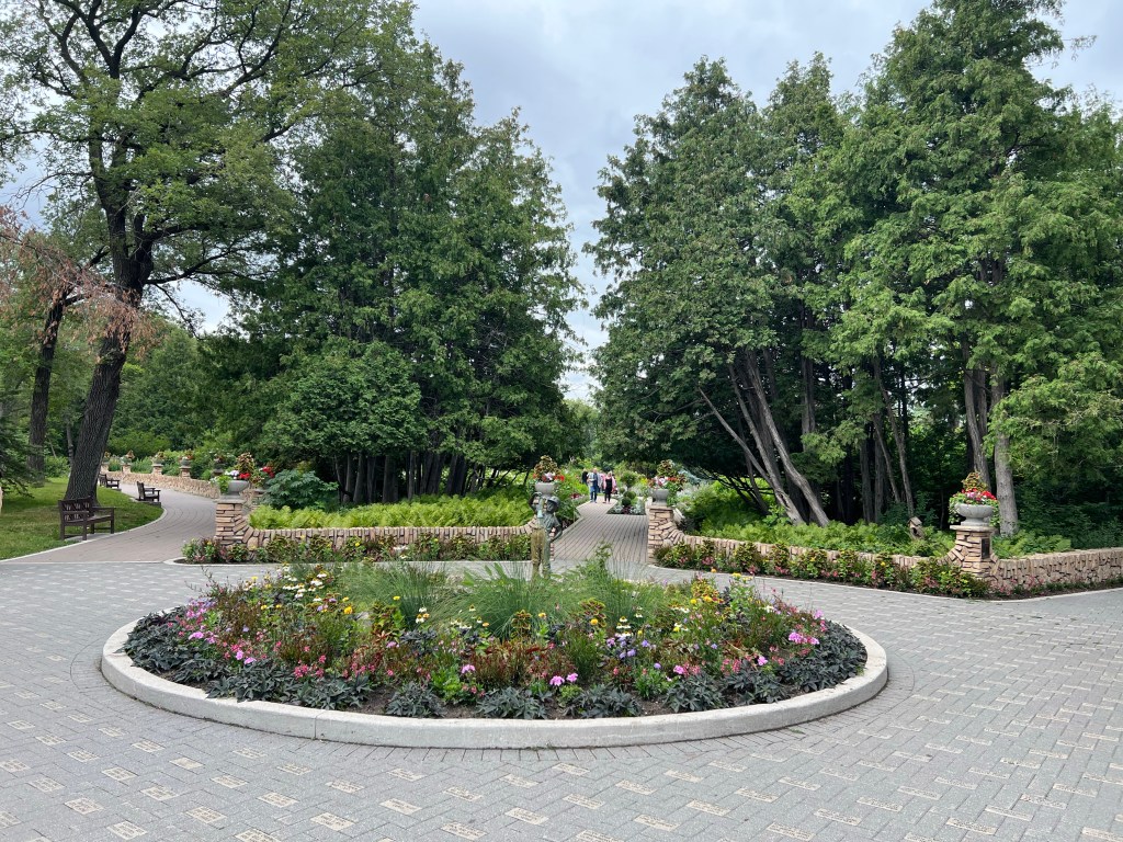
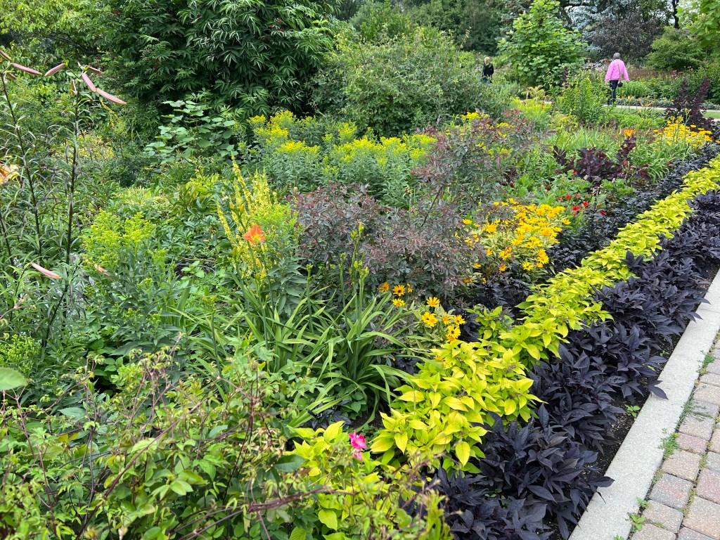
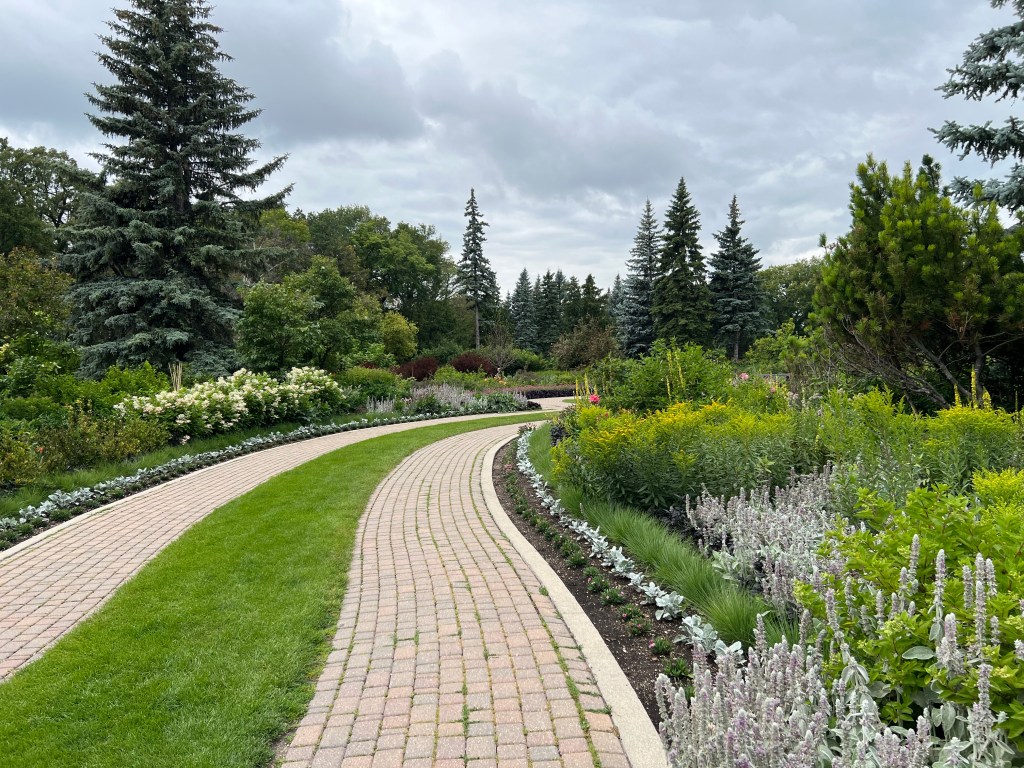
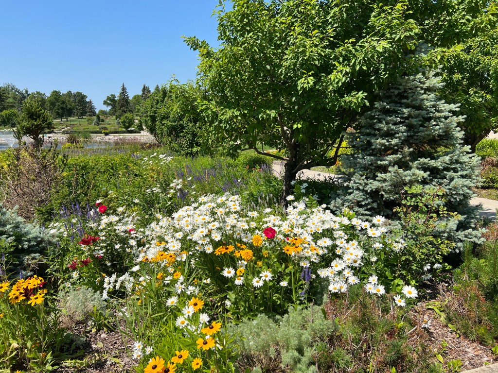
After the tour, we drove to Assiniboine Park, spending time in the English Garden and the Leo Mol sculpture park. Most English Gardens I have seen were staid and lacking in color. This one in Assiniboine Park broke the pattern. There was a profusion of color with a wide variety of flowering and non-flowering plants. It was a delight to stroll along the paths and enjoy the varying combination of plants.
The English Garden
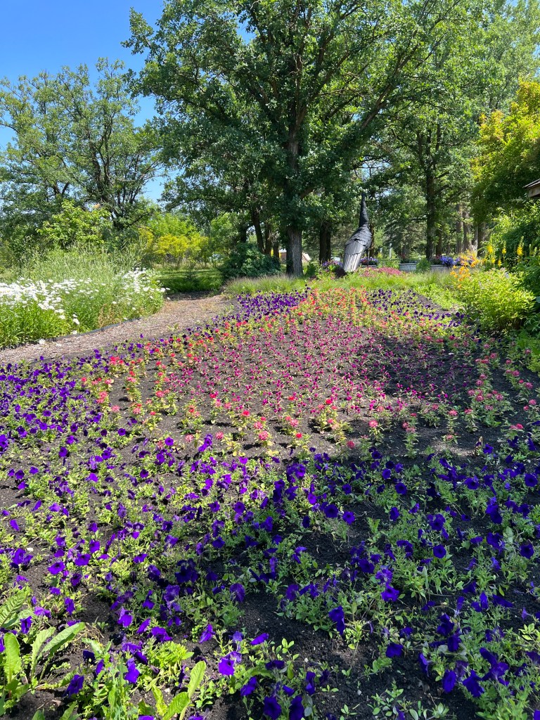
Leo Mol was a Ukrainian born Canadian who set up his shop in Winnipeg where he produced sculptures, ceramics, paintings, and stained glass windows. Outdoors, the grounds have sculptures arranged among the trees and plants while a building showcases smaller works behind protective glass.
The Lumberjacks by Leo Mol
We came back to our room at Homewood Suites where we had leftovers from an earlier Italian dinner combined with leftover steak from my birthday dinner last night at Tony Roma’s steakhouse. Friday we had stopped at Goodies Bake Shop for some treats. Mine were all gone so we had to re-visit the store to stock up on their delicious apple jacks-sort of an apple turn over only twice as large with three times the apple filling.
Tomorrow it is an all day drive home. Then it is six weeks until our next trip; six weeks touring Montana, Idaho, southern Oregon and northern California.
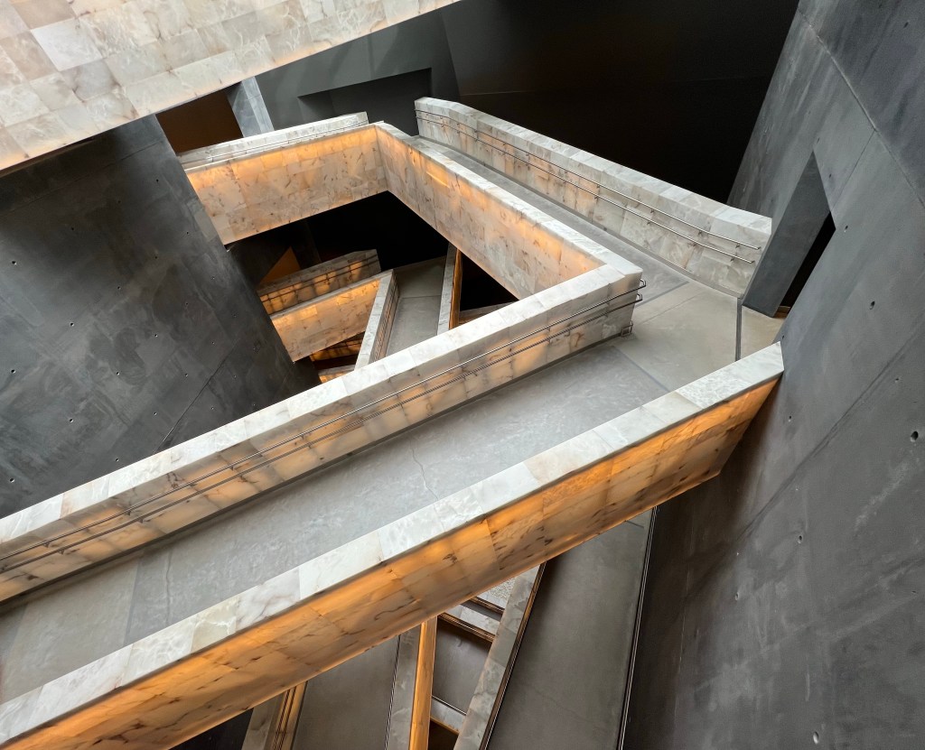
The Canadian Museum for Human Rights opened in 2014 after 3.5 years of construction and costing $350 million. It is a striking vision both as one approaches it from outside as well the internal layout of the exhibits. It is full of symbolism, used cutting edge construction techniques, and incorporated numerous methods to be environmentally and culturally sensitive.
The museum describes the building as: “Perched on the Prairie landscape at the forks of two rivers, the Museum rises from four stone “roots” that symbolize humanity’s connection to Mother Earth. The structure embodies aspects of the Canadian landscape: a craggy limestone mountain is surrounded by a glass cloud and topped with an icy peak. But look again, and the cloud becomes the wings of a dove embracing the building beneath a glowing beacon of hope. The structure’s multiple faces and changing moods also symbolize the value of diverse points of view. Once inside, visitors progress upwards from darkness to light – reflecting our hopes for human rights education.”
We spent several hours here on Saturday . One could easily double the amount of time we spent if they read and watched all displays and listened to all of the audio recordings. It is truly a space in which audio and visual displays predominate with benches and chairs to make it easier to look and listen. Of course, there is an app based tour but we chose to experience the museum the old fashioned way by walking, reading, listening, and viewing the portions of the exhibits that appealed to us.
There is a predominance of Canadian themed exhibits but as Americans we noted a symmetry with our own country’s history; segregation, maltreatment of native peoples, Japanese internment, Chinese exclusion, anti-immigrant acts, anti-Semitism, discrimination against LGBTQ and disabled people, etc. Genocide around the world is another series of displays.
Hope and positive action are not ignored. The museum is not just a “downer” of bad actors and bad actions. People, from the famous to the unknown, are shown making a difference through political action, art, music, and personal interactions. Visitors are encouraged to take their own small steps, that when combined with others, uplift all.
After walking up the seven levels of ramps that themselves are a work of art, there is an eighth level providing an expansive, 360 degree view of Winnipeg. We wrapped up the experience with lunch in their cafe.
For a museum devoted to human rights, it is not without its own controversies. First Nation peoples objected to aspects of its location and construction practices. International groups believed the genocide or discrimination they experienced wasn’t sufficiently explored. Others complained too much attention given to anti-Semitism or actions against First Nation peoples. Some wanted tours to not discuss topics they were opposed to such as same sex marriage while the self-censorship the museum practiced when giving tours to groups opposed to same sex marriage was criticized. Finally the museum itself was criticized for its internal hiring and management practices.
We put the criticisms aside and as out of town visitors found the museum well worth the time it takes to visit.
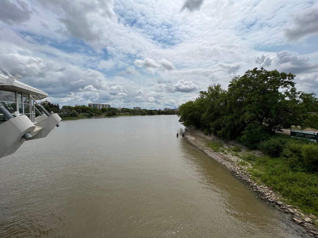
After the Human Rights Museum, we walked around “The Forks”. This is the area in Winnipeg where the Red River of the North and the Assiniboine River meet. The Forks has been the meeting place for First Nation peoples and then European traders and Red River Metis. The Red River flows northward from the States while the Assiniboine flows from the northwest. These rivers provided transit routes for First Nation peoples for 6000 years. The Red River flows up to Hudson Bay and provided access for English traders and the Hudson Bay Company to reach portions of interior Canada.
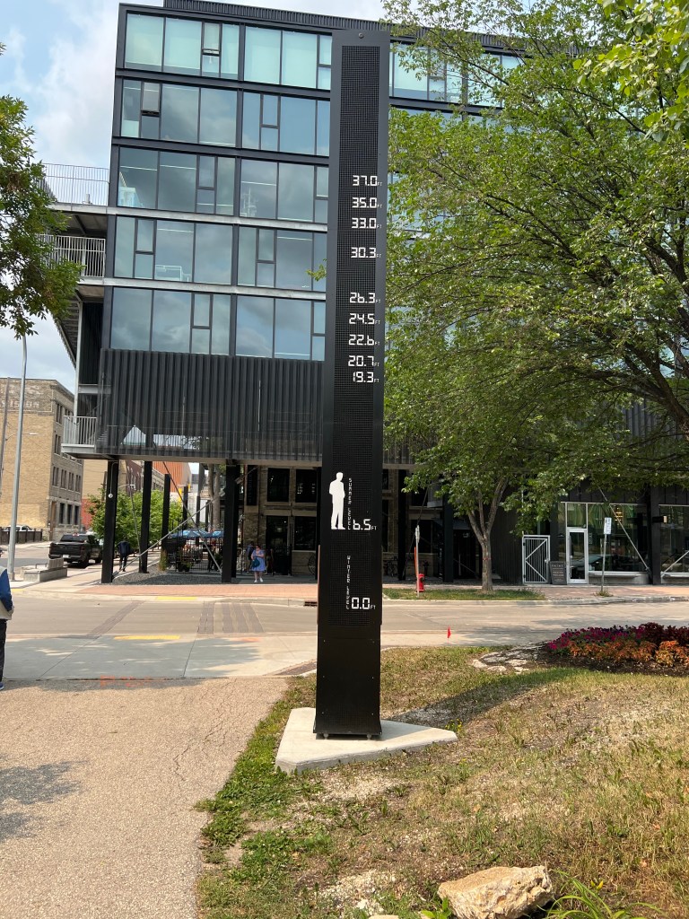
Today it is a park and home to a hotel and shopping market. There are walkways along both rivers. The flood factor here is high as the land is generally flat and northward flowing melt water runs into the frozen river in the spring.
Various flood level heights
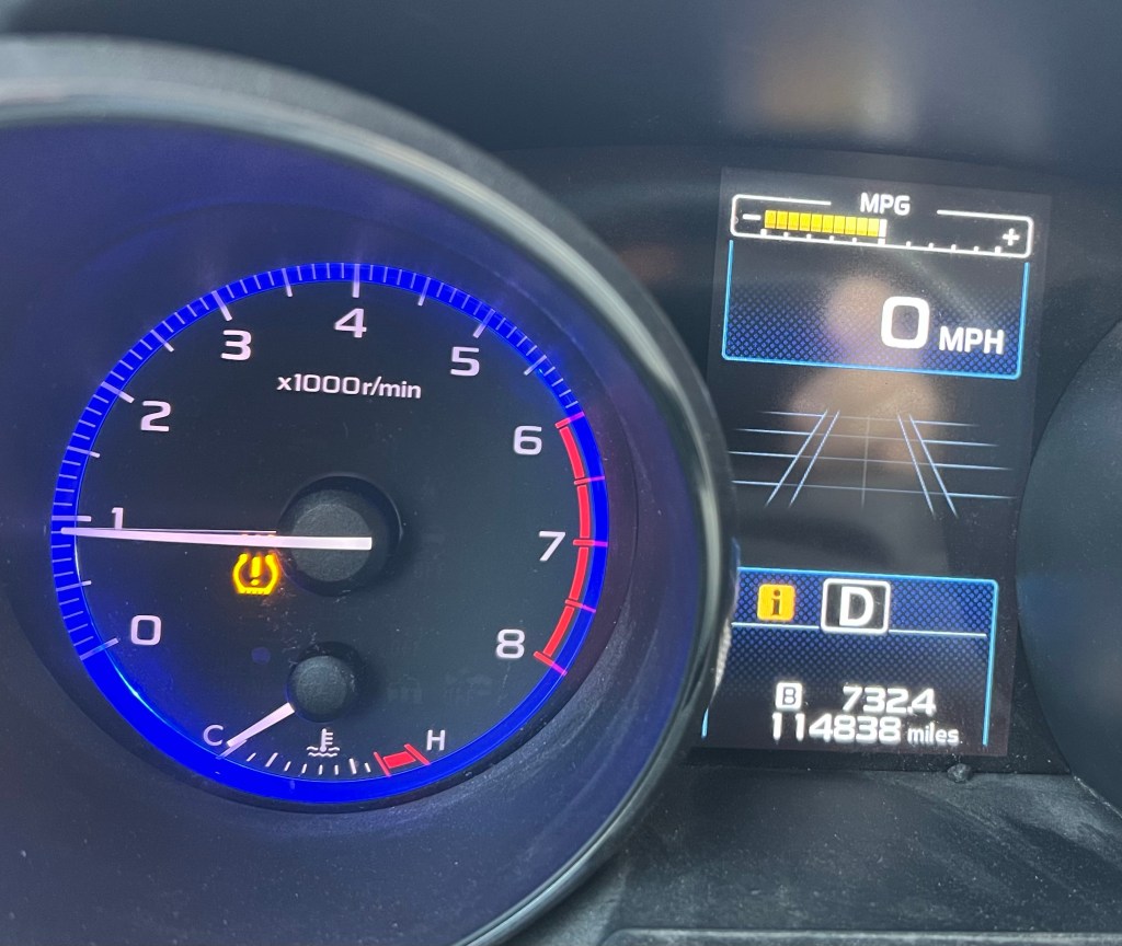
Friday started out at the local Subaru dealer. As we drove into town late Thursday afternoon, the tire pressure gauge warning light came on. It was too late to stop in Thursday so we arrived at the dealer at 7 am Friday when service opened. Their tire people did not arrive until 8 so we waited for an hour but they were able to check out the car. There was a nail in the rear passenger side tire so they pulled that and patched the tire. We were out of there in two hours, including waiting time with a $40 charge.
Tire warning
For the rest of the morning, we had a walking tour of the Exchange District. This is part of historical Winnipeg where the earliest warehouses, railroads, and commercial businesses were established. Our tour guide explained the development of the town, the history of many of the oldest buildings, and stories of interesting characters.
Three former bank buildings in the Exchange District
The story of the 1919 Winnipeg General Strike was the longest single portion of her presentation. This 6 week strike in May-June of 1919 involved 12,000 unionized strikers supported by another 20,000 workers and their families. In the end, the strikers did not achieve their short term goals. The collective power of business, Church, and government prevailed. Over a longer period of time though, some of the union goals were achieved through greater union organizing and the increased election of labor sympathetic legislators.
After the tour, Chris and I commented how the traits and failings of people seem universal. Many of today’s rivalries, jealousies and poor decisions that we complain about were repetitions of similar actions taken over a hundred years ago.
A symbol of the 1919 General Strike
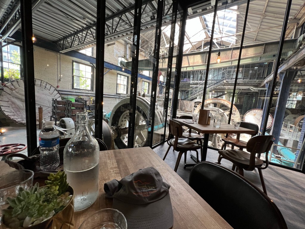
After lunch at a restaurant in an old water works building, we explored the Manitoba Museum. We were interested in the history portion of this combined history, science, and planetarium museum. It was enjoyable although we found ourselves getting tired, particularly after the walking tour and ongoing hip issues.
In 2020 I turned 70 and was planning to celebrate my July birthday with a trip to Winnipeg. As we all know, Covid happened and the planned trip never materialized. Three years later I am no longer 70 but the birthday celebration is under way.
Out trip began in a roundabout way. The International Peace Garden is on the North Dakota-Manitoba border but about 130 miles west of the route we would take from St. Paul to Winnipeg. We had frequently thought about visiting it but it was always too far out of the way to justify the effort to visit. This year we made the accommodation by leaving half a day earlier than we had planned for Winnipeg. The extra hours would allow us to make it to the peace garden without sacrificing our Winnipeg time.
We spent Wednesday night in Grand Forks ND and Thursday morning left for the International Peace Garden. Of course, we didn’t go directly to the garden, we made a stop at White Horse Hill National Game Preserve, a sort of offshoot of a National Wildlife Refuge. Our drive on U.S. 2 took us through an agricultural area with topography ranging from flat to rolling hills with numerous “prairie potholes”, small lakes, ponds, and marshes that fill depressions left over from glacial action.
Highway rest area along U.S. 2 in North Dakota
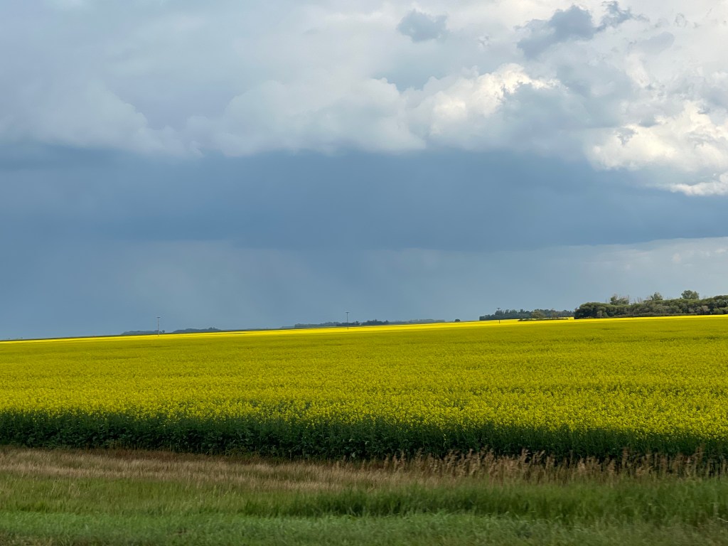
A particularly pleasant view is of the crop of canola which is hitting its peak blooming period. This time of summer is when canola flowers before the seeds are produced. The yellow canola blooms are a bright contrast to the green of many other crops. The yellow blooms continued when we journeyed into Canada as the Canadian prairies produce more canola than the U. S. North Dakota is the leading canola producer among U. S. states.
White Horse Hill is on the south side of Devil’s Lake, North Dakota’s largest natural lake. Devil’s Lake is interesting. Like the Great Salt Lake, it normally has no natural outlet. The size and depth of Devil’s Lake can vary greatly. Unlike southwestern U.S., ND has seen an increase in precipitation in the last fifty years and the lake has expanded, forcing the relocation of hundreds of homes.
White Horse Hill is at a higher elevation and not threatened by the expanding lake. Unfortunately for us, our drive through the preserve only provided glimpses of prairie dogs, none of the native elk or bison were visible.
White Horse Hill National Game Preserve
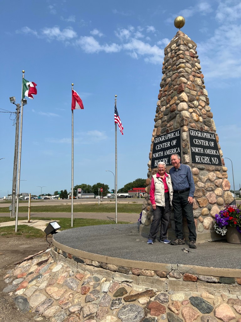
Our next stop was Rugby, North Dakota which advertises itself as the geographical center of North America. This claim goes back to the 1930s and a calculation by a National Geographic staffer.Two later efforts moved the geographic center of North America to other North Dakota cities but Rugby has longevity and better marketing behind its claim. The marker is but a stone monument in the parking lot of a Mexican restaurant but there were two other groups of people taking pictures while we were there.
From Rugby it is just a forty minute drive north to the border and the International Peace Garden (IPG). The IPG opened in 1932 as a symbol of peace and international collaboration. We had a picnic lunch here and then spent 90 minutes exploring the formal gardens. Sculptures, fountains, flowering plants, green plants, trees, and terraced hillsides made for a relaxing and colorful interlude. As a bonus, our membership to the Minnesota Arboretum waived the $25 admission fee.
International Peace Garden
Zipping through the border checkpoint and simple questions, we continued our drive through agricultural Manitoba on our way to Winnipeg. The IPG is located in the Turtle Mountains which are more like tall hills but in contrast to the surrounding flat plains, one can forgive the people of Manitoba and North Dakota in calling these mountains.
International Peace Garden
Winnipeg bursts upon you as urban sprawl is contained and you go from farmland directly to city. We are staying at a Homewood Suites outside of downtown Winnipeg. Tomorrow we begin our touring.


Recent Comments