Follow Ed Heimel and Chris Klejbuk as we explore the USA and Canada. Trips began in 2013. See sidebar. Since Jan. 2013, over 220,000 miles traveled and 1100 days on the road. Over 700 blog posts written. 2023-We are closing in on 350th National Park unit. Photo below is Pacific Ocean by Big Sur, CA
Yes, that is Chris at the lower center of the photo.
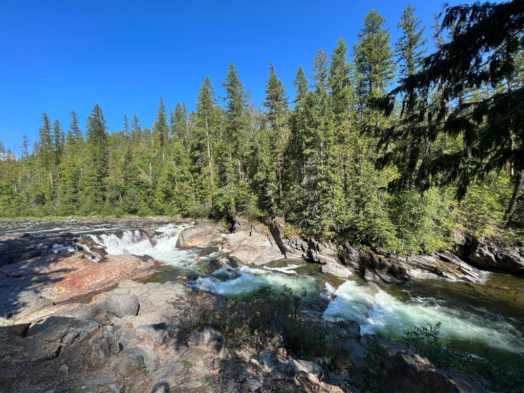
Arcata, CA Sept. 12
We woke up to a day with more smoky haze than the previous two days. The haze was more prevalent, and the odor stronger. After a hearty breakfast at the Hiouchi Café, we departed the small town of Hiouchi. It had been a pleasant interlude. We were not leaving the combined national and state redwood parks. Our goal was to move down to those parks south of the Klamath River.
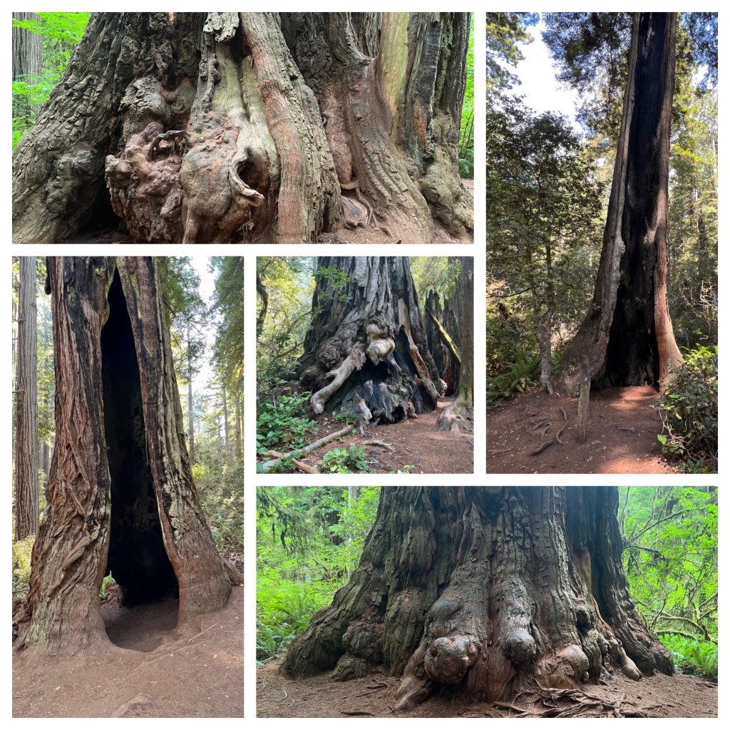
Redwood forests are not composed only of redwood trees. They have multiple layers of trees. The redwoods of course at around 300 to 375 feet are the tallest. The next layer down would be composed of Douglas fir. The third layer would be the mixed hardwoods with a fourth layer being shrubs and groundcover. It makes for constantly changing scenery.
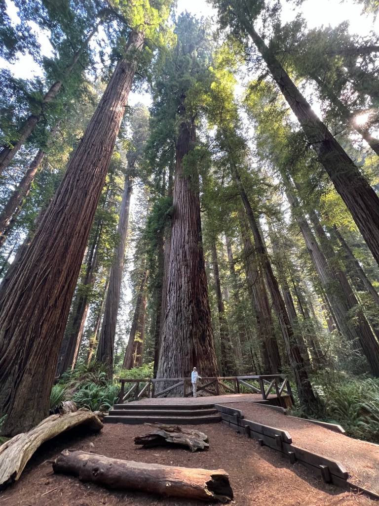
Redwood trees
An additional two hikes today provided new views. One does not tire of observing the base of trees with their lightning damage, fire scars, multiple growths at the base, and large openings. Even at higher levels, there are interesting views. You will find not just large branches, but whole trees, growing from the side of the redwood.
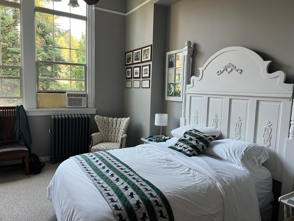
Our b and b in Arcata
After a stop for ice cream, we arrived in the town of Arcata California. Arcata is a town of about 20,000 people and home to Cal Poly Humboldt University. Previously Humboldt University, the university has an opportunity for expansion and focusing on sciences due to a recent initiative by the state. We are staying at a bed-and-breakfast here in a home dating back to the 1880s.
Arcata is just a stopover, a town that positions us more closely to reach our destination of Redding California tomorrow night. Today’s weather has been delightful, with the highs around 70 under clear skies-after we left the smoky haze behind us. Tomorrow, however, the temperatures will be in the mid 90s and maybe even 100 as we drive over the Coastal Mountains towards interior California.
Sunday and Monday have been days of scenery. No informative museums, no historical events to understand. But the drama of wildfire did impact our travel.
When we were planning this trip, people told us to make sure we kept an eye out for news about wildfires. Saturday night we went to bed, wondering if our planned route to visit Oregon Caves south of Ashland Oregon was the wisest decision. Highway 199 travels from Crescent City California up to Grants Pass Oregon. This would’ve been the most direct route from the National Park sites of Oregon Caves to Redwoods National Park in California. We debated that option or going directly west to the Oregon coast, and then south to Redwoods, skipping entirely the Oregon Caves location.
The Smith River Complex wildfires were directly across the 199 route, although not a huge fire. The fire has been going on for two months and the road was supposed to be open, although periodically with a pilot car to lead the way. We went to bed, uncertain, but when we woke up Sunday morning, decided to be cautious and go directly west, and then south along the coast. This would mean we would miss the Oregon Caves National Park site, but we have seen a lot of caves already.
When we checked into the motel Sunday afternoon, we found out our decision was wise. Route 199 was closed for a period of time completely, other times had a one hour delay in travel. In this case, the wildfires triggered a rock slide to close the road completely. When it reopened on Monday, there was still a one hour delay due to the wildfires.
In the background, 293 foot Watson Falls.
Of course, we won’t know what we missed at Oregon Caves. However, the road west from Bend over to the Oregon coast and then down Route 101 to Crescent City California was a gorgeous route. Going west, we traversed the Cascade Mountains, stopping to see a lake and two waterfalls in the Umpqua National Forest. One waterfall was the highest in southwest Oregon, the other a cute falls Chris labeled the Hobbit waterfall. Chris did a fantastic job on the curvy, mountainous roads, since my legs were acting up and she drove this entire section.
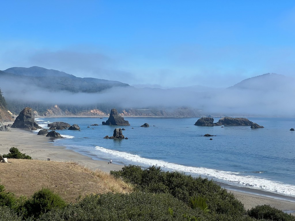
When we reached the coast of the Pacific Ocean, we stopped in Port Orford, a town we had visited and lodged at in 2010. The views were still fantastic. The fog and clouds alternately lifted and returned as we drove from Port Orford all the way down into California.
Redwoods National Park is a cooperative effort between the National Park Service, and the California Department of Parks and Recreation as the state and national parks here run together. The two park services work to inform visitors and to conserve the redwood trees along the coast of California.
Hiouchi, CA
We are spending two nights at the Hiouchi Motel in the small town of Hiouchi California, population just under 300 people. The Smith River Wildfire Complex had caused the power to be out for several hours, but was expected to be restored later that evening. We went to Crescent City, California, about 15 minutes away to have dinner instead. When we returned, power was on. It has been on ever since.
Today we went on a hike through the redwoods by ourselves, hiked down to an ocean portion of the park, and participated in a Ranger led hike in the afternoon among the redwoods.
Dinner, like breakfast, has been next-door at the Hiouchi café. The café has been here since the 1930s. Once again, good food in a very small town. Some of the other customers included firefighters and support personnel. We passed numerous pieces of fire fighting equipment, fire staging areas with tents and RVs, and signs along the roadway expressing appreciation for their work.
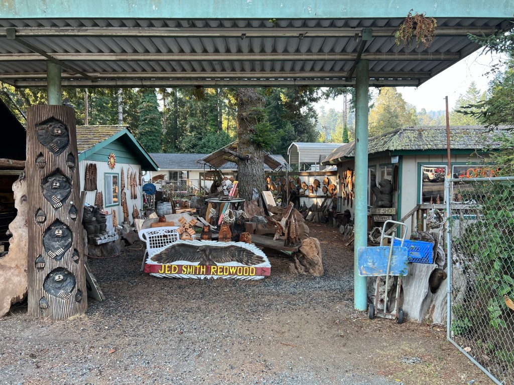
After breakfast, we stopped at a local wood carving shop next door to the motel. The business has been around for 40 years, and is finding it more difficult to get newer people interested in the skill. I will admit we did make a purchase or two.
September 9 is our wedding anniversary, 51 years. It was a day of travel; scenery that was widely and wildly different in just the space of one day.
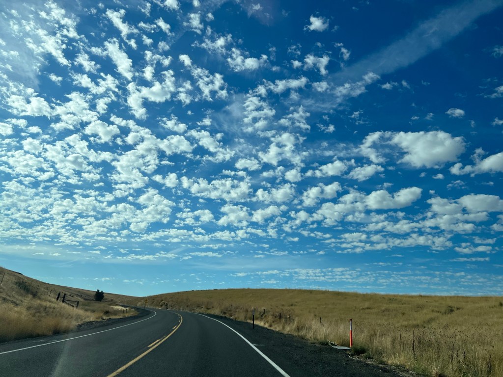
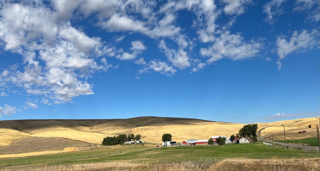
Leaving Pendleton, I thought the first part of the route would be on relatively flat agricultural land on eastern Oregon’s high desert plains. The reality was different. Agriculture yes as fields of hay and herds of cattle were evident. The road, however, while smooth as those of the entire day were, was curvy and hilly. We left Pendleton at an elevation of 1200 feet and climbed to an elevation of 4700 feet.
Even on the high plains, the terrain remained hilly and the road hugged the curvy sides of hillsides, requiring you to constantly lower your speed from the posted 55 mph. The elevation went up and down, slowly making wide changes.
Then, bang, you’re entering a forested, mountainous, without being dramatic mountains, region. The road maintained that curvy aspect, this time with steeper drop offs. Overall, the roads did not have that nerve shattering hairpin, really steep drop offs that we have experienced elsewhere.
We did two separate regions like this, with sign posts that called them a scenic byway. In a side note, we picked up a Oregon brochure listing state scenic roads and only about five percent of today’s journey was a listed scenic road-and that publication listed 29 scenic roads.
In the forested regions, that recognizable pine tree smell added to the journey. The CD player was put to use as we listened to Pete Seeger and Simon and Garfunkel. Other than the fact we were in a very lightly populated area in case something happened, it was quite pleasant.
After about three hours of this, we were deciding if we should stop and eat the bagels we packed. We had gone through two small towns, really small towns, and the local cafes were shuttered. We came to Dayville, population 133. There was a cafe, it was open, even if the sign out front said business for sale.
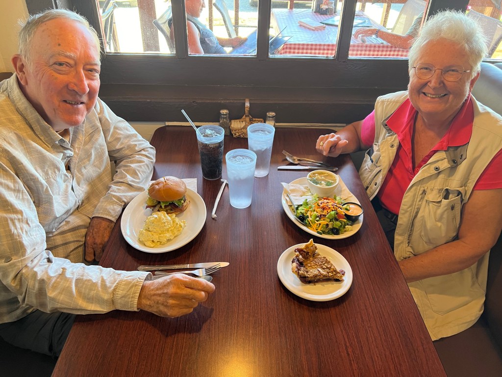
What the heck, we took a chance. The Dayville Cafe would be our big anniversary meal. It was a good stop. The clientele was a mix of travelers who like us decided to take a chance and of locals who knew each other and the staff. The food was good and the wide selection of pies were all homemade. I had rhubarb and Chris had blueberry peach. Yummy. We even considered taking an extra piece with us but finally decided not to.
On the way to John Day
On to our one site to visit for the day. John Day Fossil Beds is a National Park National Monument. Central Oregon has wide expanses of land that have been covered by a series of volcanic actions from lava flows to ash deposition. This happened over millions of years, after the age of the dinosaurs. Through a series of actions by state and federal officials, a small portion of this expense of land has been created as a national monument where further paleontology work is being done.
John Day Fossil Beds is unique. Most fossil sites around the world capture a narrow span of time. John Day Fossil Beds is more like a photo album, chronicling how life has changed over 40 million years. Fossil hunting started here in 1862. Fossils and paleontology were studied here by numerous universities and fossils from here are all over the world. Beginning in 1927, the state of Oregon was wise enough to start protecting some of the land as state parks. In 1975 the national monument was officially established, incorporating several of those state parks.
We came for the scenery and the fossil viewing. Both were gorgeous. The Park film gave a good introduction to the national monument. The exhibits in the visitor center have displays depicting life as it might’ve been at that time as well as actual fossils. The park has paleontologists on staff and during the week visitors can observe their work through a glass walled viewing area.
The scenery on the way to the visitor center is gorgeous, but the real highlight is visiting the section called Painted Hills. Here the hill sides are a combination of green, white, and red, along with the usual bits of brown. Once we finished, taking our usual, too many pictures, we continued our drive to just south of Bend Oregon to spend the night.
The final change in scenery happened south of Bend as we rolled along the highway through forested areas in the middle of lava fields. We had visited this portion of Oregon before and did not stop this time to revisit any of those lava fields.
Finally we are on the Columbia Plateau, having left Idaho, driven through Washington state, and now resting in northern Oregon. Thankfully our waitress gave us a tip last night. Gas up in Idaho, she said. Gas is more expensive in Washington. Boy, what an understatement! Gas was a dollar more per gallon in Washington. When we gassed up tonight in Oregon, it was only twenty cents more expensive than Idaho and still eighty cents less expensive than Washington. I just can’t wait to see the gas prices in California.
We leave the Snake River behind us—for now
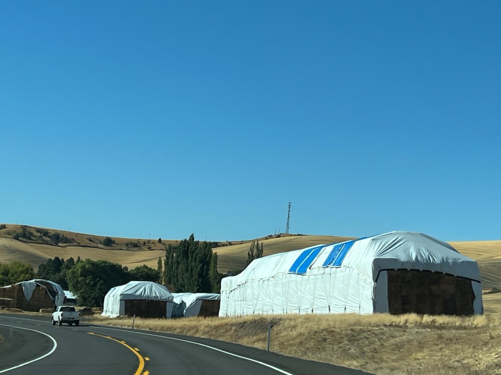
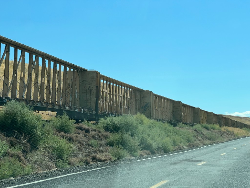
It was only 100 miles from Lewiston to Walla Walla Washington. Initially we still had the Palouse type scenery and hills but it seemed like hay/alfalfa was the only crop being grown. Farms had huge stacks of hay everywhere you looked. As is standard now, we came across another long line of empty railroad cars stacked on an unused rail line. These were center beam flat cars.
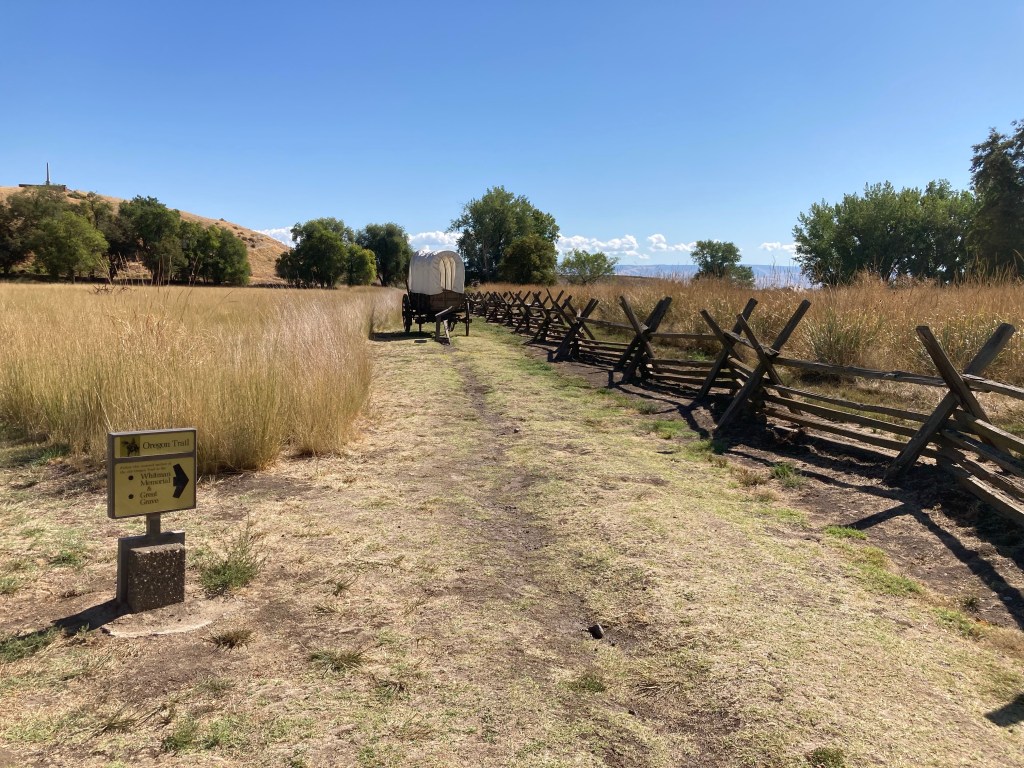
Our first stop was the Whitman Mission National Historic Site just outside Walla Walla WA. Marcus and Narcisa Whitman left New York in 1836 for Oregon with a missionary zeal to convert the heathens. They had some success but not overwhelming. As more immigrants came to Oregon, they served more of that community.
However in 1847 came a turning point. Marcus Whitman was a medical doctor. Measles struck the community extremely hard. Marcus was able to save most immigrants who came down with it. However, the Cayuse people, particularly the children, had no immunities and the majority of them that Marcus treated, died.
The Cayuse, already skeptical of the immigrants and the mission, believed Marcus was poisoning their children while saving those of the immigrants. They killed Marcus, Narcissa, and 11 others. The Cayuse War followed as the remaining Cayuse were killed or scattered. The NPS site here explores how the mission changed the way of life in this region in ways initially unimagined.
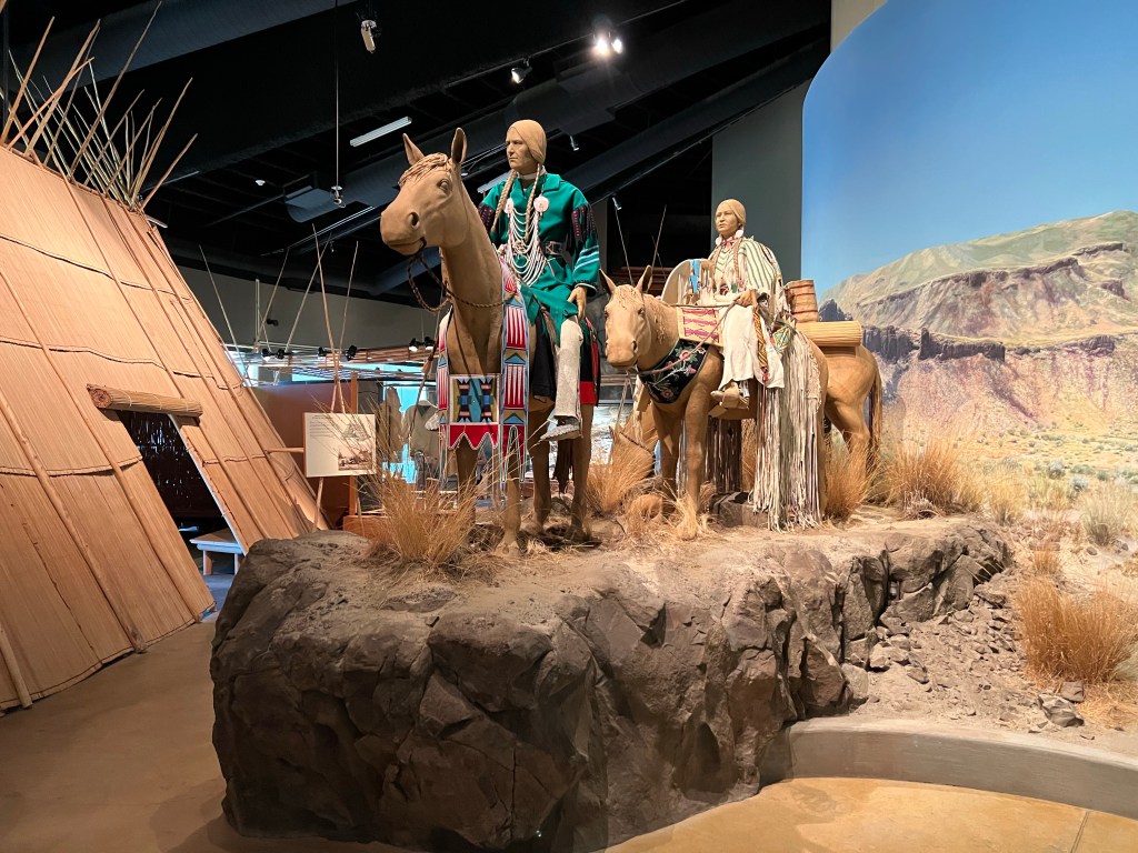
Tamastslikit
We left the Whitman Mission and drove to Pendleton Oregon. The Tamastslikt Cultural Institute is run by the Confederated Tribes of the Umatilla Indian Reservation, the Cayuse, Umatilla, and Walla Walla. The Institute is organized around the themes: We Were, We Are, We Will Be and the 16,000 year culture of the combined tribes. Perspectives look back, telling the story of westward expansion of the U.S. from a tribal viewpoint, and forward, explaining how the Tribes are leaders in salmon, lamprey, and mussel restoration and fueling the regional economy.
The history of the Oregon tribal nations is rich and complex. I doubt we will leave this trip with a deep understanding, probably just an initial and shallow one. I don’t remember even thinking about it in the two week trip we took around Oregon about a dozen years ago.
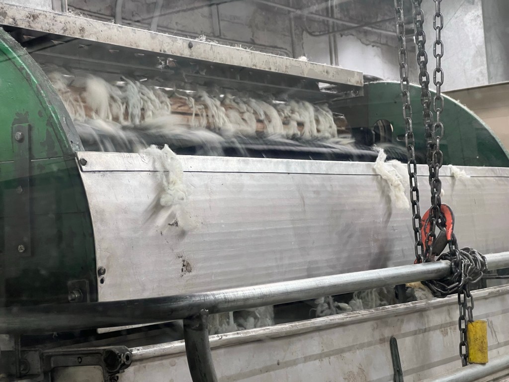
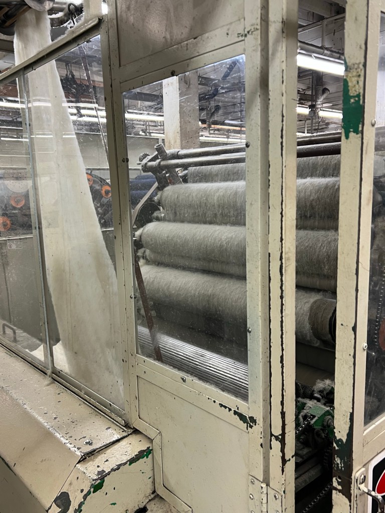
Pendleton is, of course, the home of the Pendleton woolen mills, makers of beautiful blankets and clothing.The company is still family owned and has two major mills, one here and one along the Columbia River in Washington state not far from Portland Oregon. Both offer tours and we had requested two of the eight slots available for the 3 pm tour at Pendleton. We got them.
Our tour guide has been giving tours for seven years. She explained the milling process and how the two mills complement each other. For instance, this mill takes the raw wool and works it into finished yarn but the second mill does all of the dying.
The variety of styles available in Pendleton blankets
Blankets are the specialty of this mill. The rich colors and expressive designs are all made here. Each blanket is visually inspected before it leaves the mill. The mill has been operating here since 1909. Some of the machinery is brand new, others decades old. The mill runs 24 hours a day, five days per week.
Ed and Chris Pendleton OR Sept 9 Happy 51st Anniversary to us
Center beam flat cars alongside a deserted two lane road
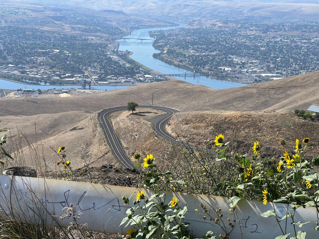
Lewiston, Idaho (upper left) at the confluence of the Snake and Clearwater rivers from Lewiston Hill
Lewiston, Idaho, Sept. 7
Wednesday the journey was the destination with two historical bookends to highlight the time. After leaving the Fairfield Inn in Missoula, we drove half an hour to the Travelers Rest State Park in Lola Montana. This state park is the only proven campsite used by Lewis and Clark and the Corps of Discovery in 1805 and 1806. They actually stopped here twice, both going out, and coming back.
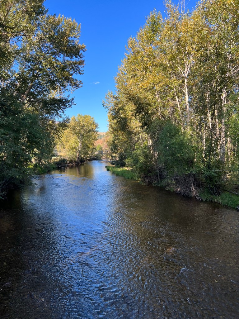
Travelers Rest creek and location of campfire
At Traveler’s Rest, archaeologists have discovered items from that time, and core samples indicate three of the trees were here in 1805. This location was a well-known resting place and trail crossing for Native Americans. Lewis and Clark‘s people communicated with the local tribes and gained food and information before heading over the steep and forbidding Bitterroot Mountains.
Leaving Travelers Rest, for the next several hours we followed, at least pretty closely, the trail used both by Lewis and Clark, and by the Nez Perce in their efforts in 1877 to avoid the US Army.
Lolo Trail and the BitterrootsLolo PassMiddle Fork Clearwater River
We stopped at several overlooks, including one at Lolo Pass, marking the easiest crossing point for a portion of the Bitterroots. The Clearwater River follows US 12 and us most of the way. Another stop was the Forest Service Ranger station at Fenn Valley, a historic building constructed by the Civilian Conservation Corps in the 1930s. This building is in the Selway River Wild and Scenic River area.
The latter portion of our drive was through the Nez Perce reservation. The National Park Service staffs an official visitor center for the Nez Perce National Historical Park. We watched the video, examined displays and talked with the rangers here, We ended the day at our Hampton Inn and had a fancy meal out at Tomato Brothers.
We had not quite realized that Washington state is right across the border from Lewiston. This was driven home as we went to dinner at Tomato Brothers and drove across the Snake river into Washington state. We also had not realized, but the town in Washington is called Clarkston. So we have Lewiston Idaho named after Meriwether Lewis across the river from Clarkston, Washington named for William Clark.
This is the area where the Corps of Discovery transferred from the horses to canoes, and traveled down the Snake and Columbia rivers to the Pacific Ocean. It was only due to the assistance of the Native Americans that the Corps of Discovery was able to make it over the Bitterroots, survive other challenges, and make it on to the Pacific Ocean. We won’t go onto the entire story, you can look that up.
The Palouse
Today, Thursday, we drove up the Lewiston Hill, the 2,000 foot elevation gain across the Clearwater River, into the region called the Palouse. The geology is unique with fields of wheat, peas, and lentils. Our destination was Moscow, Idaho. In Moscow, we visited the Appaloosa Museum. I thought this museum dedicated to the Appaloosa horse would be interesting and a worthwhile trip. It was only so-so.
Returning to the Lewiston area, we went to Hells Gate State Park. The park is located along the Snake River, and had more displays about the Lewis and Clark expedition and the Nez Perce Indians. We had lunch here along the river, took a 2 mile hike, and visited the Jack O’Connor Hunting Heritage and Education Center.
Ed and Chris, Lewiston Sept. 7
Working on the blog from the patio of the Hampton Inn, looking at the Lewiston Hills.
Tonight we were supposed to be staying in Butte, MT. Yesterday as we reviewed our upcoming plans, we made a mid course correction. Given the narrowness of the northern section of Idaho, we found it easier to drive back and forth between the two both today and again later in the trip.
The objective for today was to visit Grant-Kohrs Ranch, a NPS National Historic Site in Deer Lodge, Montana. Originally, we had planned to go to Butte to spend the night, just 40 minutes away from Deer Lodge. If we had time, there were one or two other places to visit. Then tomorrow we would drive back to Idaho over the mountains on scenic route US 12. But driving back to Missoula tonight instead would save us 90 minutes of driving time tomorrow before we even started on U.S. 12
The drive on U.S. 12 is supposed to be very scenic, curvy, slow, two lanes, with scenic overlooks, and some Nez Perce historic stops also. It was the drive most difficult to predict how long it would take. Extra time could not hurt. We canceled our Hampton Inn reservation for Butte and made one for Fairfield Inn, Missoula.
Driving to Grant Kohrs
Leaving Kellogg we were driving on I-90 with steep-sided Bitterroot Mountains on either side of us. Low hanging clouds were just slightly above our car. It took about an hour of driving until we were out of the mountains and down into the high plains of Montana. It was another 2 1/2 hours, plus an hours worth of time zone change, until we reached Grant Kohrs.
This national historic site is dedicated to the preservation and memory of the open range time in Montana. From 1860 until about 1900, the open range cattle raising system switched to the new fenced in cattle raising method. A very major factor prompting this change was the terrible winter of 1886–1887. A hard snow, a thaw, followed by another hard snow and freeze left the range covered with ice. The cattle were unable to break the snow and ice in order to reach the grass beneath. Bison, the previous grazers on the open range, did not have difficulty with these types of conditions. However, they had been pretty much exterminated by this time.
A beaverslide haystacker
Ranchers realized they needed a better knowledge of the location of their cattle and greater supplies of hay to feed them in difficult times. In order to do this, fenced in land started to sprout up along the range, reducing the open areas for cattle, and cutting off the cattle trails.
Johnny Grant was of Metis ancestry and knew the area. He realized this valley would provide a luxuriant grassy valley for winter grazing of cattle. He convinced others from a variety of backgrounds to join him and the town of Deer Lodge was begun. As times changed and new people moved in, Grant moved back to Canada.
Grant sold his land and holdings to Conrad Kohrs, a German immigrant. Kohrs, his wife, and brother worked hard, diversified their holdings, and eventually amassed ten million acres of ranch land across three states. They conquered the challenges of the great winter, as well as normal business challenges. They bred horses. They began shipping cattle directly to market in Chicago. Their heirs continued the ranch, eventually selling off the land and dedicating 1600 acres to the National Park Service, along with family furniture and mementos. The ranch is managed actively by the Park Service with cattle, horses, chickens, etc.
We were lucky enough to have an hour long tour of the home begun by Johnny Grant and expanded by Conrad Kohrs. The park ranger provided background and historical setting for the two families in greater detail than what we have discussed here. I came here, uncertain of what to expect, but walked away with greater knowledge and appreciation for the area than I had before hand.
Staying in the Silver Valley, we journeyed a full 10 miles to Wallace Idaho, population 800. Over the next several hours we learned that Wallace is the Center of the Universe, a party town, and the town that fought the feds and won. Of course we only discovered this because the day was rainy and we dumped our planned bike ride to avoid being splattered with mud. The Ride the Hiawatha trail could have been amazing under better conditions. Possibly we could have completed this 14 mile, mainly downhill ride thru tunnels on a gravel trail, but it would have been something we endured, rather than enjoyed. The trail is an abandoned railroad line.
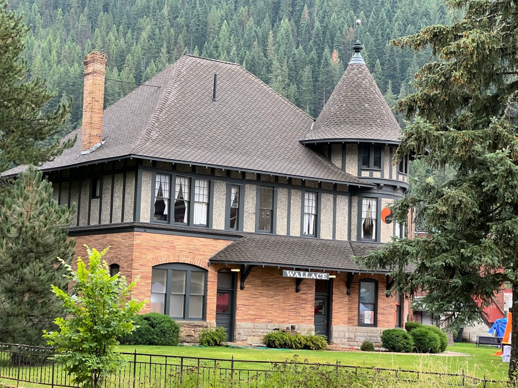
Our first stop was the Northern Pacific Railway Depot. The NP was a major player in the history of the West. The depot is now a museum with interesting displays on the Northern Pacific and life in Wallace. Several tidbits were picked up here. First, the term “closing the loop”. Telegrams for people on trains passing by, but which were not stopping in Wallace, were put on a pole with a loop on it, the train would slow down, and the message grabbed by a train employee and given to the passenger.
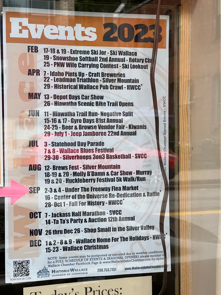
Wallace, with only 800 residents, sponsors 23 festivals and events during the year. The numerous events keeps the bars and restaurants hopping. This Labor Day weekend was one of them, The Under the Freeway Flea Market is a fund raiser for the NP Depot Foundation. Over 80 vendors were lined up underneath the Interstate 90 freeway bridge, which runs continuously for 4500 feet.
Under the Freeway Flea Market
We walked from one end of the vendor line up to the other. While we did buy a few minor items, the merchandise best reflected items from Grandma’s attic and Grandpa’s barn. Given the rainy weather, the viaduct was an appreciated protection from the elements.
The interstate highway system was authorized in 1956. Interstate 90 would run from Boston to Seattle, 3081 miles long. The initial planning for Interstate 90 through Idaho started in the 1960s. In 1970, construction was nearing both ends of Wallace. I-90 was originally planned to run right where Wallace is situated. The town would be bought out, probably not costing all that much. Residents would be relocated and most likely there would have been a nice plaque somewhere. People in Wallace were not pleased. They undertook a two pronged battle plan. First, lawsuits and injunctions were filed to give them some time to implement phase two.
Phase two was getting every single building in Wallace on the National Register of Historic Places. The Federal Highway Administration has to minimize impact to such places and the vast number of historic properties in Wallace resulted in an elevated highway that only needed one building to be moved- the Northern Pacific Depot. The people here are quite proud of that. Prior to the completion of the elevated highway in 1991, this one mile segment necessitated interstate drivers to exit the freeway, drive through town, probably stop at the only traffic signal on Interstate 90 between Boston and Seattle, and return to the interstate. That last traffic signal? It was removed in a grand ceremony involving pall bearers and a glass hearse is now on display in a local museum (which was closed today).
Wallace has two nearby ski resorts and numerous biking trails. I thought it was fascinating that one of them, the Trail of the Couer d’Alene’s, is quite clear that one should stay on the paved trail to be healthy. In their words: “Common industry practices of the time and natural processes like flooding, caused heavy metal contaminants to be spread throughout the Basin. Environmental cleanup has been ongoing for decades. … Heavy metals that pose a risk to human health are still encountered along shorelines, floodplains, and historic mine and mill sites.”
We had lunch at the Blackboard Cafe-and bakery and bookstore. Chris of course struck up a conversation with a Canadian woman who is doing some traveling after selling her home in Vancouver before settling down near her daughter in Edmonton.
Another unusual Wallace feature was the purple manhole in the intersection of two streets that is “The Center of the Universe”. In 2004, the Mayor of Wallace declared it to be the center of the universe because it can’t be proven otherwise. This little bit of whimsy is celebrated each year, In 2023 the celebration will be held Sept. 16.
Center of the Universe manhole
After lunch we drove along one short highway up into the mountains, Burke Canyon, where the reclamation process is still ongoing. The town of Burke is extremely narrow. During mining days in the late 1800s, the Tiger Hotel in Burke had to be built over the creek and a set of railroad tracks and the only highway had to be built through the hotel.
Burke Idaho
Returning to Wallace we viewed several of the wooden stairs that were constructed to allow people to reach homes built on the mountain sides where it was too narrow to construct streets. The public stairs were first constructed in 1909 and are still maintained and used today.
Serendipity. At breakfast this morning (Sunday) we sat across from a young (to us) couple. We got to talking. When they had arrived last night, we were working on the blog and greeted them. They were looking for a restaurant recommendation and were then going to crash since their travel day had started around 3AM that morning.
Sunday morning as we were chatting, it came out that the woman was from Carlisle PA where we had lived for over 20 years. Not only that, she had lived just a few blocks from us although we had left Carlisle by the time she was even in high school. It was fun chatting with the two of them and comparing Carlisle memories.
In another example of serendipity, Saturday night, again while we were working on the blog in a common area of the B and B, two other couples came in and we all got to chatting. It turns out the two husbands had played football in a Nevada high school against each other although not knowing each other 40 years earlier. There were several other coincidences between the two couples.
All of this talking delayed and confused my blog posting but it was a pleasant interlude. One of the benefits of staying at a B and B versus Airbnb.
Silver Mountain gondola, it keeps going beyond…
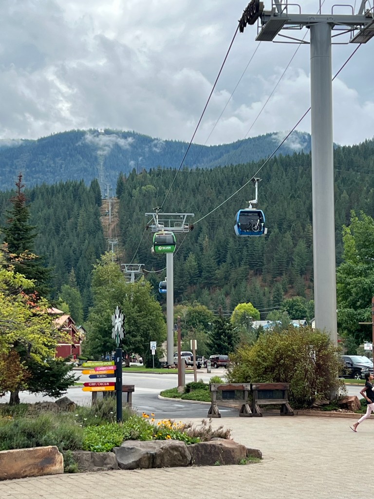
Sunday morning, we had a three hour drive from Bonners Ferry to Kellogg ID. We are still in the narrow, northern panhandle of Idaho, just along Interstate 90 as it travels from Spokane Washington to Missoula Montana. Kellogg is another small town, population 2,500. It is an old mining town but has a ski resort that is trying to provide economic impact. For us, the ski resort was appealing because it has a 3.1 mile gondola ride that crosses several ridge lines as it reached an elevation above 5,600 feet. This is the longest gondola ride in the United States.
The full impact of the 3,000 foot elevation gain was minimized as the ride started in light showers and ended in rolling clouds. Lunch at the top was so-so. Best benefit was it gave us time to sit and gain a slight improvement in the cloud cover.
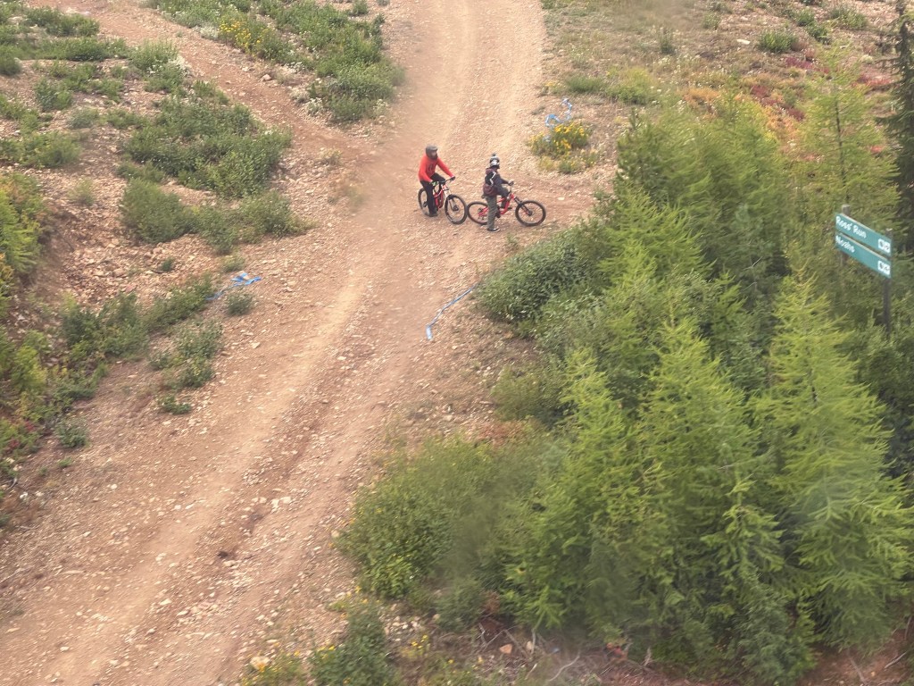
Mountain biking is very popular and we watched numerous riders head off on slopes and rides we would never consider. We overheard one rider sitting in the lunch area discussing how he had just popped his shoulder again.
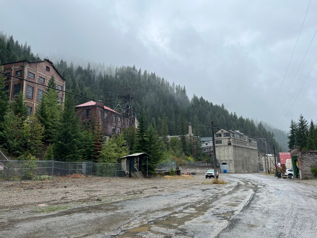
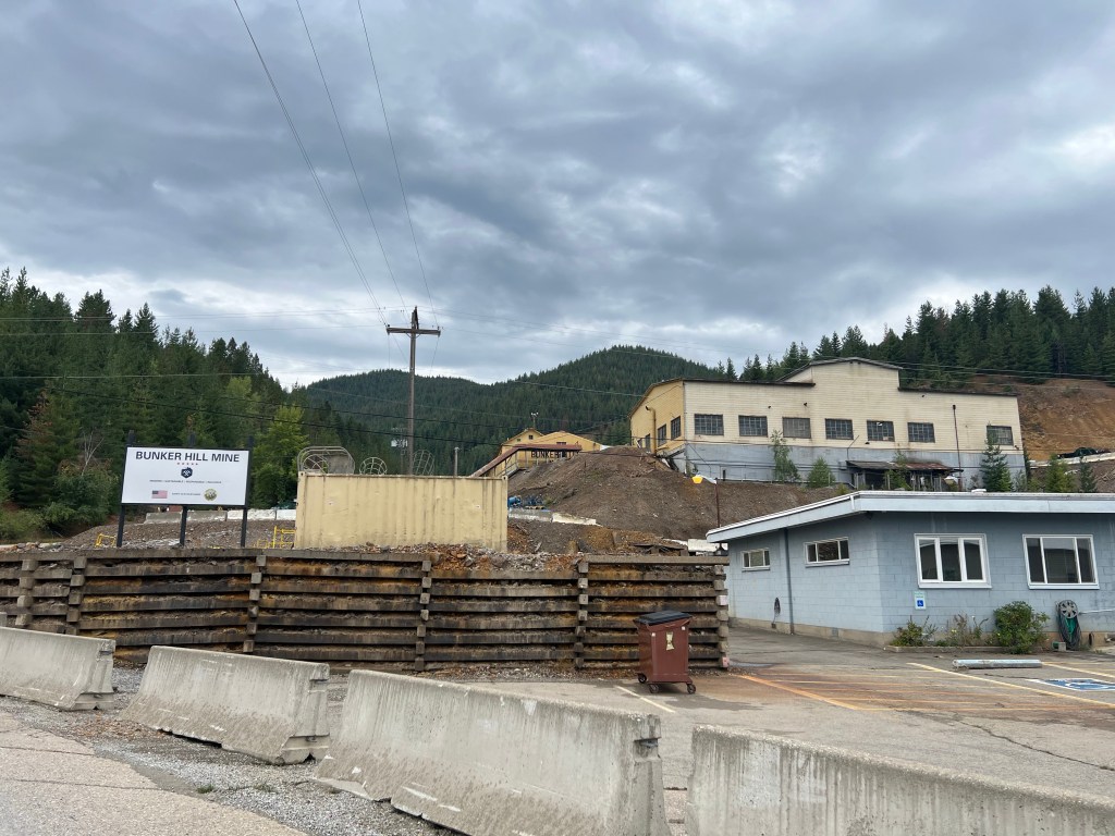
Bunker Hill Mine in Kellogg ID
Once we returned down to earth from the clouds, we visited a mining museum in Kellogg. Starting in 1886, over time, this area of Idaho (known as the Silver Valley) has produced more silver than anywhere else in the US. Annually, it still produces the third largest quantity of silver of all states in the U.S. This area has had its share of mining problems; environmental degradation, labor-owner battles, fluctuating price of silver that affects steady production, etc. The owners of the mines and smelter in the area had a long history of indifference to health impacts to workers, residents, and downstream communities. Eventually in 1982 the smelter, largest in the world at the time, was shut down to avoid upgrading it. In 1983, the site was added to the national Superfund list.
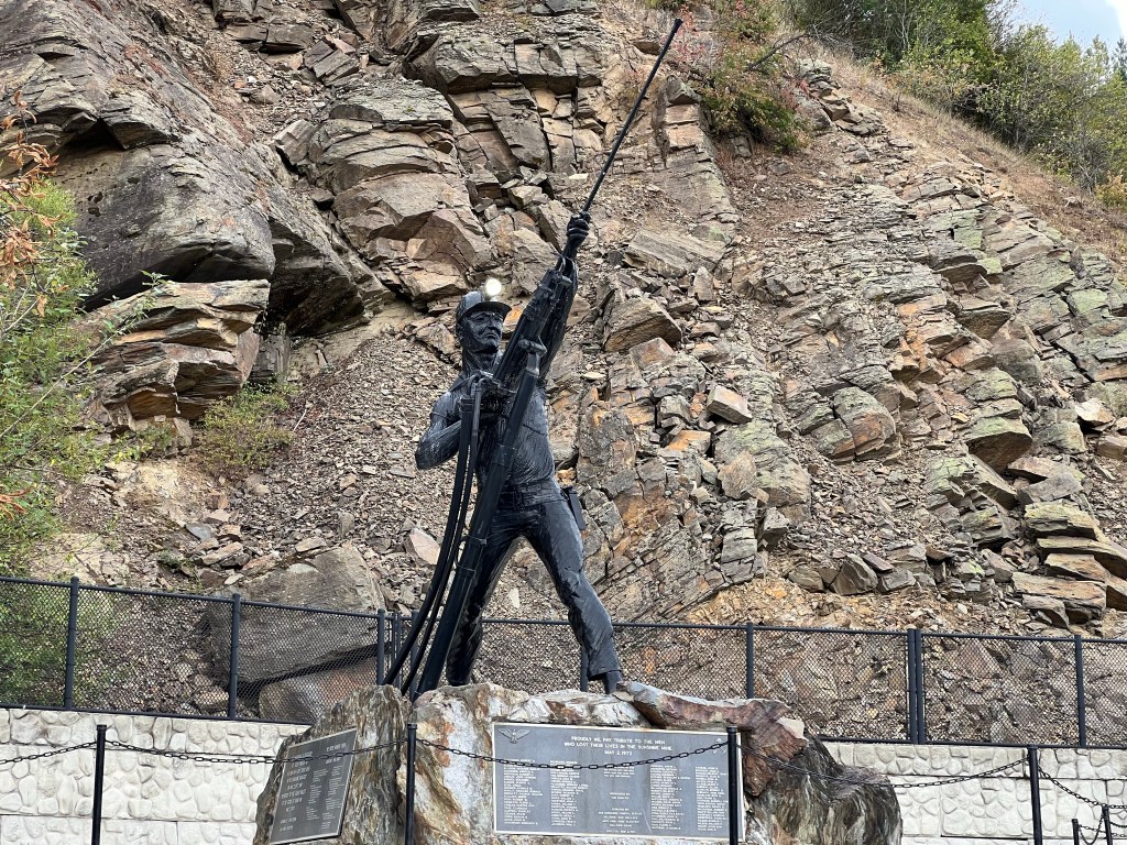
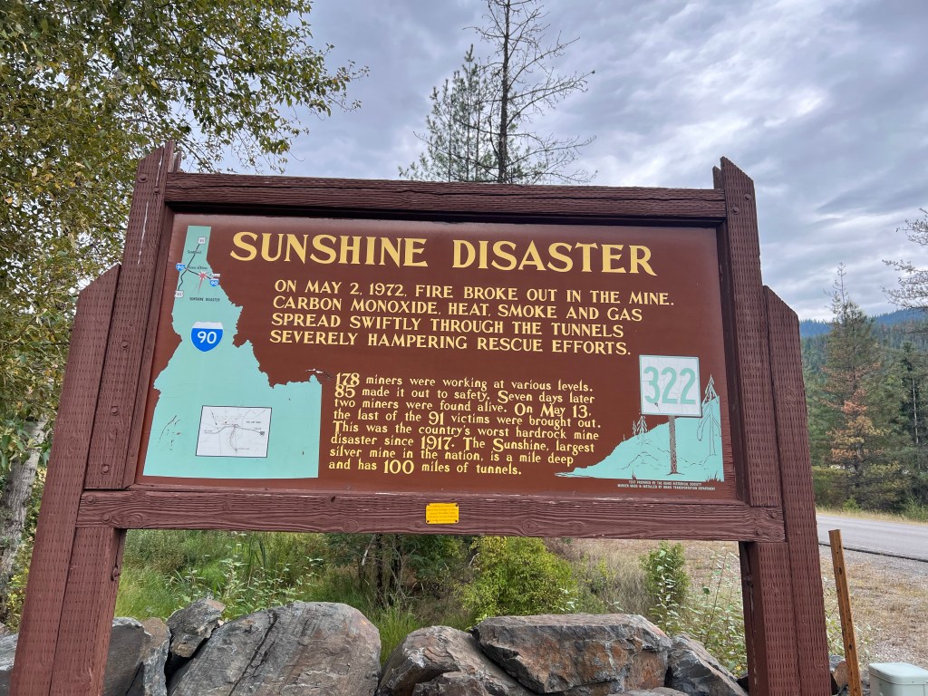
Our final bit of mining history was a surprise, sad event. Just down the road a few miles, in 1972, was the worst mining disaster in the United States. 91 miners died in the Sunshine mine disaster. You think with modern technology and safety regulations that such deadly disasters were relegated to the ash bin of past history. For those 91 workers and their families, disaster is still too real.
For dinner we stopped at the local grocery store and picked up milk, juice, salads, Tillamook ice cream (hard to choose between Tillamook and Umqua brands),and a local paper. The paper had the current prices for metals mined in the area, just like farm belt towns might have grain prices. Our ice cream was packaged in a “cold sack”, have not seen one of those in a long time.
Switching from museums, we have been enjoying nature instead. Friday the first, we left Great Falls and headed north and west. Mountains became a frequent friend, watching over us from either side. No driving on narrow, curvy mountain roads yet.
Leaving Browning MT looking at the mountains of Glacier National Park
Early on in our planning for this trip, we made a conscious decision to skip two likely stops; in Browning the Museum of the Plains Indians and Glacier National Park. For Glacier, we have been there before and currently the crowds have mandated the use of a timed entry system. It added it up to probably not enjoying the trip so maybe another time. For Browning, I don’t know, we just weren’t in the mood.
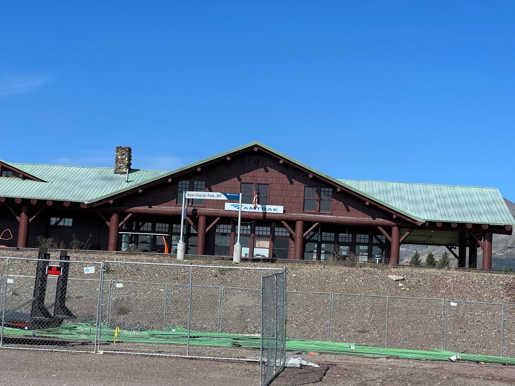
So our journey took us around the east, south, and west sides of Glacier, going through towns that the Amtrak Empire Builder stops at: East Glacier, Essex, West Glacier, Libby. No Empire Builder seen but we glimpsed several freight trains, sheds used for train protection from snow avalanches, the Libby depot, and rail crews working to maintain the tracks. We even saw two of the red shuttles used to transport people around the Glacier Park area. West of Libby we stopped at Kootenai Falls.
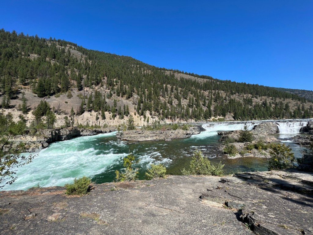
Kootenai Falls
Kootenai Falls is one of the largest free flowing falls in the Northwest since so many other rivers have been dammed for flood control and hydropower. Actually partially a falls and partially a rapids, it drops 90 feet in a distance of less than a mile. The trail to the falls is only 1/3 of a mile but involves climbing a 65 step bridge over the double tracked BNSF rail lines. The trail involves rocky terrain but the end result is quite pleasant as one gazes upon the falls.
Suspension bridge over Kootenai River
Another trail takes you to a 220 foot long suspension bridge 30-40 feet above the Kootenai River. I had no plans to go over the full length of the bridge, knowing I would get dizzy. It would likely give a different glimpse of the river so we headed that way, took our photos and returned to our car.
Yaak Falls
The Yaak falls were a minor falls not far off the route to Bonners Ferry. Nothing dramatic but a pleasant diversion that continued our weekend theme of avoiding museums and seeing natural wonders.
Arriving in Bonners Ferry, we checked in at Northside School B and B. As the name suggests, it is a former elementary school. We were greeted with homemade cookies (delicious) and shown to our room. The place has an in-ground swimming pool and school memorabilia throughout.
We had dinner at Mi Pueblo, another very pleasant dining experience. Entering Idaho, we had started on Pacific time and went to bed early for Pacific time but we were tired.
Saturday morning breakfast was exquisite, but probably typical for most B and Bs. Fresh fruit, an egg dish, and the first scone I have ever eaten that was soft and moist. (It was huckleberry.) I had two. I even had my own carafe of milk- not as large as the own in Chicago back in March but large enough.
Bonners Ferry has a Saturday morning farmers market which we visited. It did not take long and we made no purchases. From there we drove west of town to the Kootenai National Wildlife Refuge. There was one small creek but whether because of drought or because of maintenance, there was no water in the ponds and therefore practically no waterfowl.
Myrtle Falls across from Kootenai NWR
Just across the road from the wildlife refuge was a waterfall that required a hike up through the woods. The waterfall was high but in several stages and not fully visible from just one viewpoint. Pleasant, glad we saw it but no big shakes.
Instead, the highlight of the morning’s drive was gazing upon one of the biggest fields of hops under cultivation in one location. Anheuser Busch owns Elk Meadow Farms. Elk Meadow has 1750 acres of hops growing in this valley. In contrast, Minnesota statewide grows just over 100 acres while Wisconsin is about 300 acres. It was the first time I have actually seen hops under cultivation. Hops plants grow to 15 feet in height so the sight was impressive.
We stopped at a Menonnite store, again no purchases. Wandering downtown Bonners Ferry, we purchased two books. One by Nora Ephron Chris is reading now and bursts of laughter every minute or two indicates she is enjoying the book. Other than dishes of huckleberry ice cream, we came across nothing else of interest to buy so we came back and took a nap.
Surprisingly, downtown Bonners Ferry was busy for a town of 2500. A band was set up across from the farmers market location and had drawn a crowd. We noticed numerous small groups of young people having a night on the town. Most tables were occupied in our restaurant.
Tomorrow we hit the road for Wallace and Kellogg Idaho, home to a ski area where we plan to ride a three mile gondola.


Recent Comments