Monthly Archives: September 2023

2023 Trip 7: Northwest U S: Adventure and History: Sept. 29-30

Twin Falls, Idaho, September 30

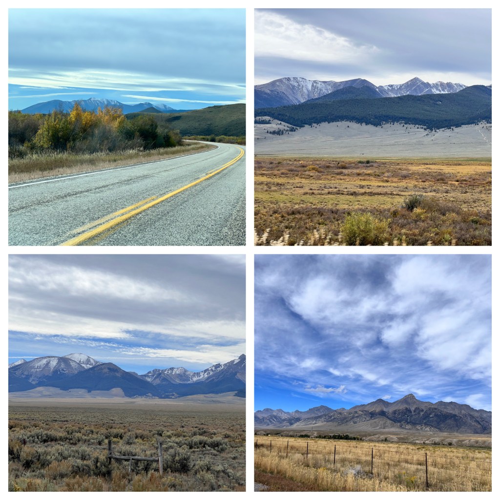
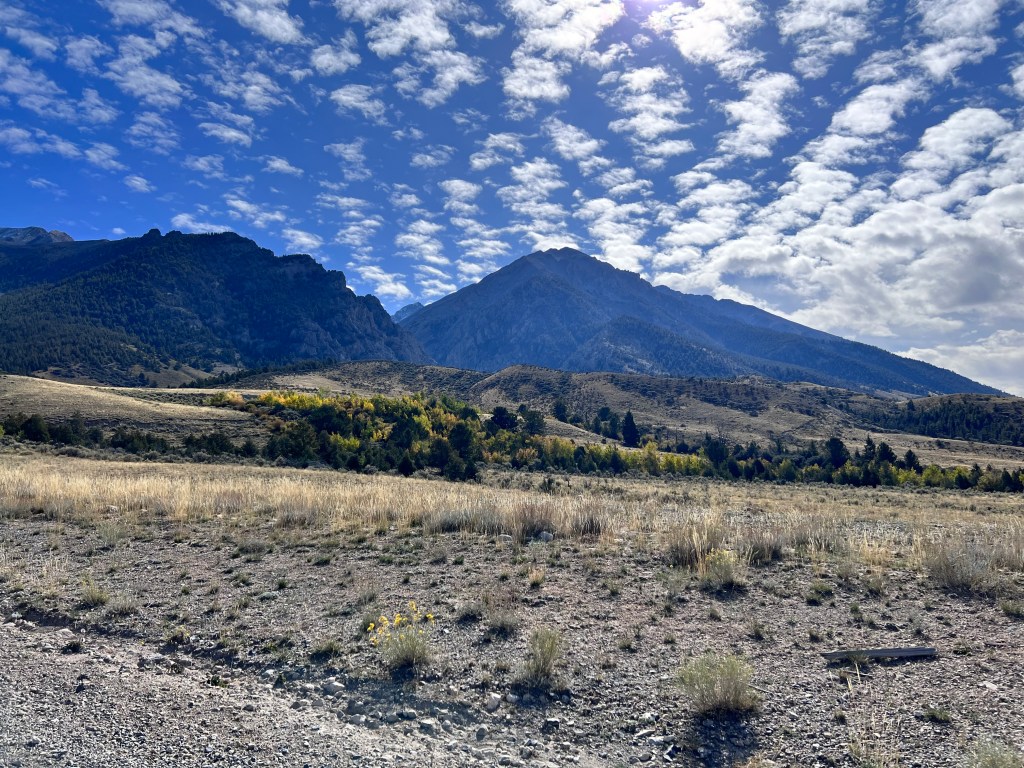
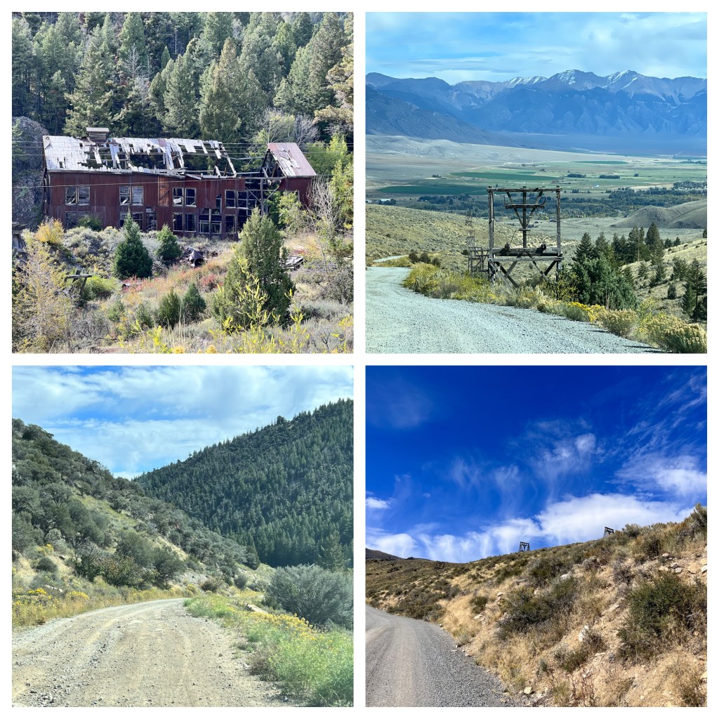
Friday and Saturday were primarily days of natural beauty with a little bit of history tossed in for good measure. We retraced our steps from Mackey, Idaho, south through Arco, Idaho, and onto our first stop at Craters of the Moon National Monument and Preserve. All of the hype we had read about this place described its similarity to the surface of the moon. Not having been to the moon, we cannot attest to the accuracy.
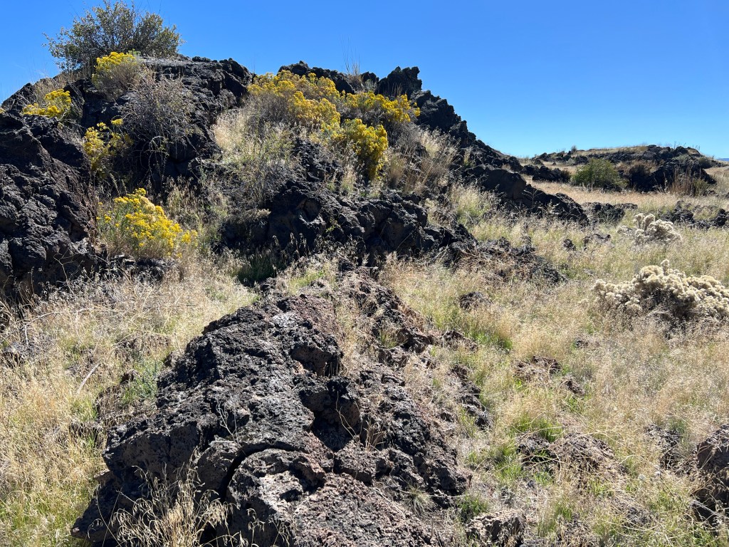

Craters of the Moon

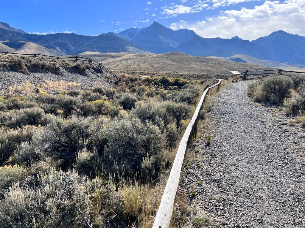
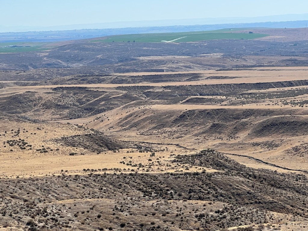
As we drove to the park, the terrain started to show evidence of lava. However, the impact increases dramatically once you enter the park’s boundary. The impact continues as you travel through the Loop Road demonstrating the impact of the lava flows over millenia. Yet we see only a portion of the park, much of it is protected as wilderness. However, the multiple types of lava were well represented in this huge park and preserve (750,000 acres). This is 30 times larger than Lava Beds National Monument in northern California, which we saw a few weeks ago.

The visitor center had a well prepared introductory video. However, I found more helpful the 3-D map in the visitor center showing the movement of the thermal hotspot underneath the earth’s crust that has moved from the south west Idaho border with Oregon to its with current location underneath Yellowstone National Park. The Snake River valley follows much of this path of the movement of the earth’s crust.

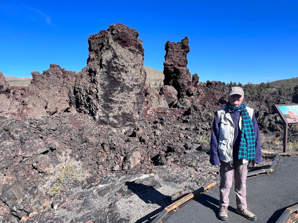
The loop road allows multiple opportunities to stop and take short hikes observing the various types of lava, its slow erosion, and the steady growth of small living plants which continue to break down the rock. Over time, enough soil is created to allow for the growth of trees and shrubs. We had our lunch surrounded by lava rocks and a few of those shade trees.

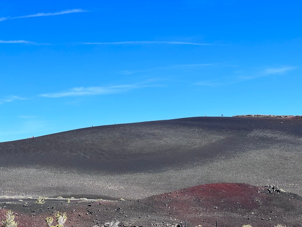
Inferno Cone, do you see the people on the hill?


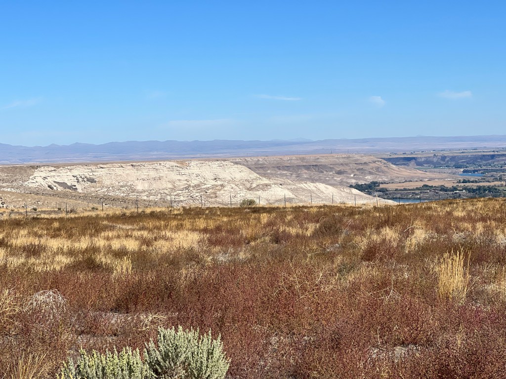
A real highlight for us was climbing Inferno Cone, which has a steep grade to its top with a wonderful view of the surrounding area. Unfortunately, by that evening, I realized that the steep climb up and down the cone had a negative impact on my left hip. The result was unsteadiness in my step, which limited our hiking on Saturday.

Leaving Craters of the Moon, we continued our journey on our usual style of two-lane roads. We stopped for a popcorn and potato chips snack at a city park in Shosone. Next stop, Minidoka National Historic Site. At Minidoka, over 13,000 of the 120,000 people with Japanese ancestry who were imprisoned during WWII were housed. The Japanese American imprisonment is a sad and disturbing story during a shameful period of our history. However, the story needs to be presented so we can discuss and learn about its implications for the future as well as the past.

On our way to Minidoka, we had railroad tracks to the right of our car. It made me realize it was probably the same tracks used by the railroad to transport the Japanese Americans from the West Coast area to this eastern side of Idaho. As compared to Tulelake in northern California, the displays and residual buildings were much better preserved and presented. The visitor center was closed, only open during summer months, but the outdoor exhibits were available to be viewed.

Saturday morning, we stopped at the Perrine bridge over the Snake River here in Twin Falls. The canyon here presents a stupendous view of the river and its power to erode the basaltic rock of this area. The bridge is well known and its impact as a visual treat was exceptional. The Perrine bridge is 1500 feet long, nearly 500 feet tall, and is the fourth tallest arched bridge in North America.

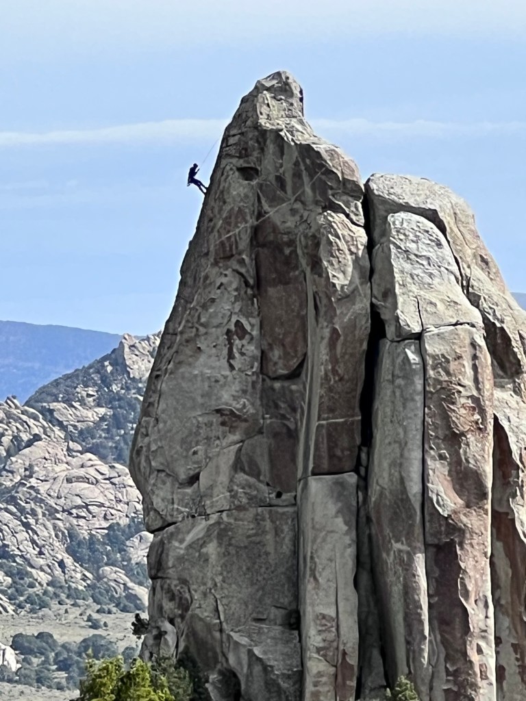
We had not realize that the Perrine bridge is one of the countries only bridges where people can do BASE jumping without obtaining a permit throughout the year. BASE is an acronym that stands for each of the categories of objects people jump from: buildings, antennae, spans, and earth, such as a cliff. A simple explanation: it’s basically strapping a parachute on your back and jumping off a bridge with hope that you land safely down below.

We discovered this as we were looking at the bridge and walking to diverse viewpoints. At one viewing point a gentleman was sitting. OK, you know the rest of the story. Chris started talking to him, and we discovered that he and his wife are from Rochester, New York. That morning, his son, who lives in Medford Oregon, had done a tandem jump from the bridge. His 64 year old wife was scheduled to do it in the next 15 minutes. A tandem jump means that a novice holds on, and is harnessed, to an experienced jumper and they go down together. Of course we had to stay to watch this. We had not seen anyone else doing it that morning nor had we come to the bridge expecting to see such a spectacle.

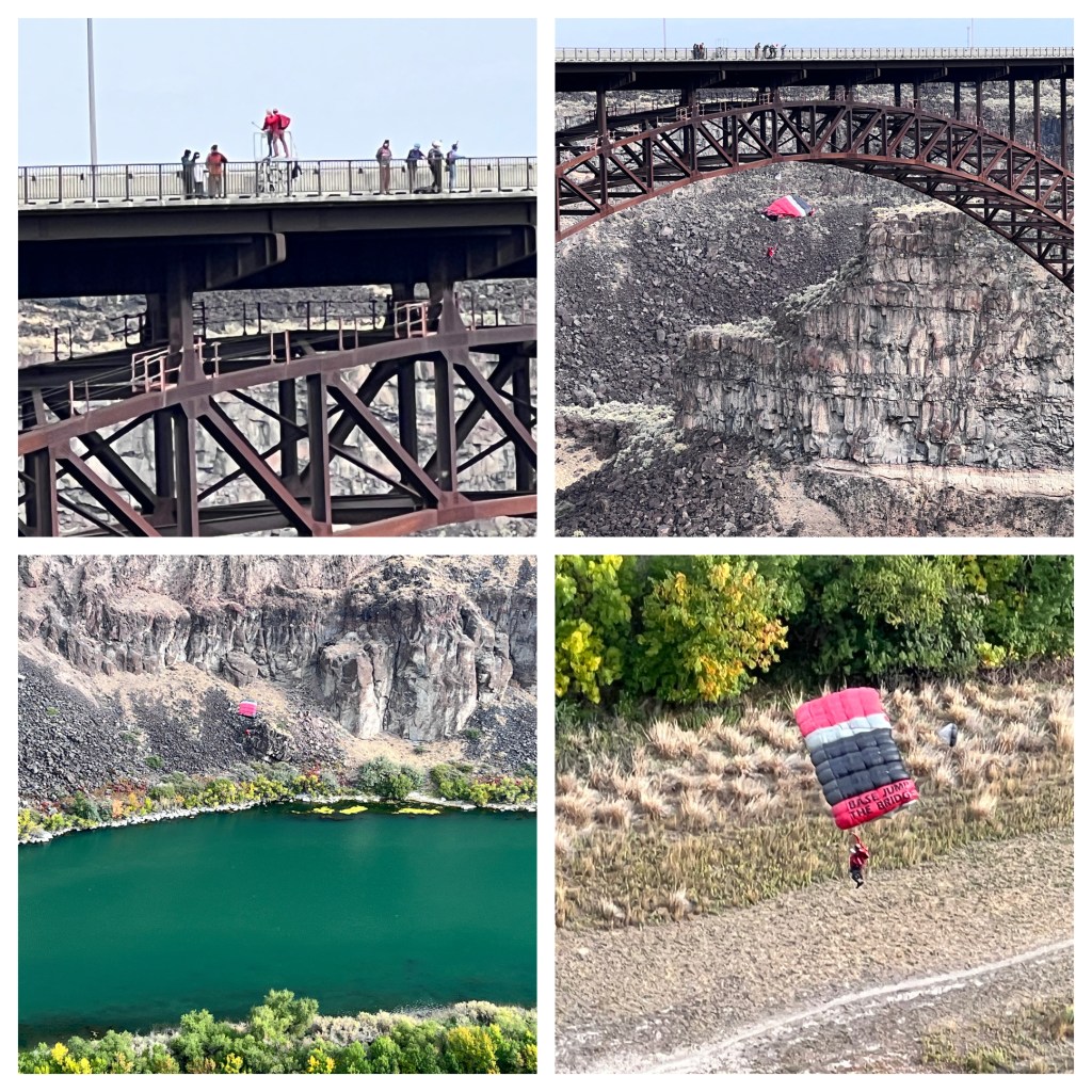
BASE jumping from Perrine Bridge

Well, the jump went great. We even took pictures for the couple since the husband’s camera was a bit shaky as he was trying to watch and not be nervous. After the wife jumped, there were four or five others making a jump, most of them as singles. They were the experienced jumpers who come here often.

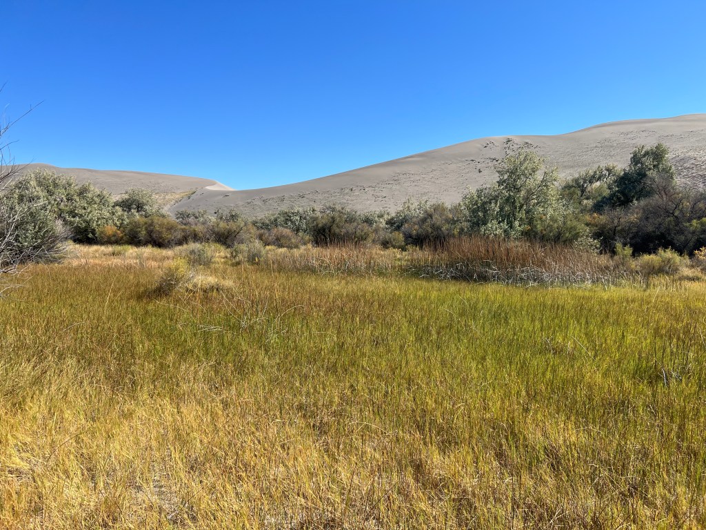
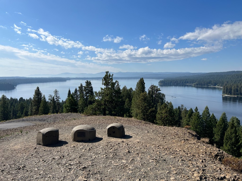
Our next scene of adventure was 90 minutes away at City of Rocks National Reserve. Today is September 30 and when we were at City of Rocks, we did not know if the federal government would go into a shut down mode for lack of a budget. City of Rocks was our last Idaho National Park Service unit to visit. If there was to be a shut down, we would’ve been able to get all of the Idaho parks visited before the October 1 shut down date.
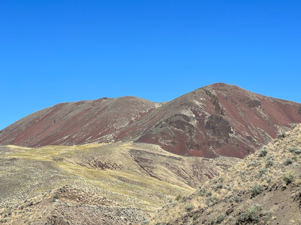
City of Rocks


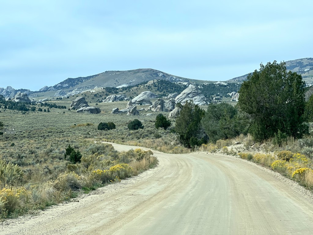
Other than rocks, we had no idea what to expect when visiting this NPS unit. We did gain 3000 feet of elevation going from Twin Falls to City of Rocks. The road was not too curvy so the ride was pleasant. One half of the journey was on Interstate 80 so we zoomed along towards our destination. Of course, the final half of the trip was through high desert plains, or very small towns. When we arrived at the visitor center, we discovered it was like Hagerman Fossil Beds, that is, co-managed with the State of Idaho and a state park. City of Rocks would have remained open, even if the federal government had gone into a shut down mode.


Driving into the park, we discovered huge granite rock monoliths littering the landscape. They stuck up like sore thumbs, with a swift transition from open fields to the rock monoliths. What we also discovered was that City of Rocks is a huge rock climbing location, even internationally renowned. Experienced rock climbers are able to tackle a large number of the rocks. There is even a training area for novices; sort of a bunny hill. As you can expect, we did not sign up for any training. There are many scattered, diverse campsites throughout the park. We observed more people camping and actively using this park than we had any of the previous parks. It is a well-known rock climbing destination among those who are interested in that. There are over 700 different climbing routes developed throughout the reserve and state park.

At lunch among the rocks and trees, we had a recurring happening. Just two picnic tables at the site and the other table had a gentleman who had grown up in Maple Grove, Minnesota. Only in this case, he approached us first once he saw the Minnesota license plate.

Our final adventure for the day was Shoshone Falls. This is hyped as a falls taller than Niagara. Well, we were disappointed. I’m sure the height is accurate. However, the falls have been so developed for hydro power and with low rainfall lately, that the view is less than impressive despite the wonderful canyon setting.


We did manage to rescue the day with sampling a new ice cream supplier- Reed’s Dairy. We tried their location in Twin Falls, although they have several in southern Idaho. The ice cream was fine, worthy of a stop, but maybe not quite up to par with our previous experiences on this trip.

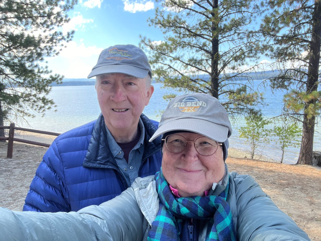
Ed and Chris, Twin Falls Sept. 30

Categories: travel | Tags: , , , , | Leave a comment

2023 Trip 7: Northwest U S: History and Adventure: Sept. 27-28

Our going away breakfast at Syringa Lodge B&B in Salmon, Idaho


Mackay, ID, Sept. 27

We will be returning to the flatter, southern portion of Idaho after this last stop in the mountainous portion. Mackay is at 6,000 feet elevation, surrounded by the high mountains in the Lost River Range. Most of Idaho’s peaks over 11,000 feet are around here. For instance, Mount Borah, the highest mountain in Idaho at 12,662 feet is just 25 miles up the road.

To get here, we had two major road options. The quicker route would have retraced some of our previous mileage over those curvy mountainous roads. The longer route would keep us primarily down in valleys between mountain ranges. We opted for the longer route.


Driving down Idaho Highway 28 in the valley between mountains.


Our air bnb host mentioned to us an Amish market less than half an hour south of Salmon. It would be too early for lunch, after all we had our second great breakfast at the Syringa Lodge B and B. A freshly made, large sandwich to go, though, fit the bill for us to pack in our cooler for lunch later on. The route we chose, primarily Idaho 28, is the Sacajawea Scenic Byway. It was a pleasure to drive 65 mph without constant curves. The mountains on either side of us had snow on their peaks, the first time we had seen snow on this trip.

Driving the Sacajawea Scenic Byway

Forest Service ranger stations are frequent in this state; we stopped at two of them to chat and pick up localized information about places to visit. At one of them, the employee had a son living in Fairmont MN and the other person looking for information was originally from Aurora MN. Unlike us, that guy was actually going to fish and camp.

At a park in Arco we had our picnic lunch. Arco’s claim to fame is that on July 17, 1955, the town was the first in the free world to be powered by energy from nuclear power. The Nuclear Reactor Testing Station located in the desert just south of Arco was the source of the power.

Chris had noticed there was supposed to be a mom and pop potato chip company located in Arco. On our first swing through town, which did not take long in a town of under 1,000 people, we could not find it. After lunch, we tried harder and came upon the Atomic Potato Chip Company. Yup, true name. We went in the building and met the owners-and sole employees. Of course, Chris got the back story about previous careers, second marriages, why they are in Arco, etc. The husband had worked in real estate in Pennsylvania, and actually knew of my law firm when I had worked in Harrisburg. Atomic Potato Chip Company had won an Idaho state innovation award and sells their product through stores. Sun Valley Resort is a big client of theirs. We went across the street to the local grocer, bought two bags, and are doing the taste test now.


An Airbnb in Mackey is our lodging. It advertises itself as a vintage style cottage. It has lots of cutesy stuff around, that’s my interpretation. It’s located on the back of a store which sells vintage clothing, housewares, and jewelry. The owner of the store also has the Airbnb. We looked around the store, but there was nothing that really met our needs enough to transport back to Minnesota. Chris, of course, had a delightful visit, chatting with the woman running the store for the owner. The store employee has moved here to be closer to her children, and she was tired of doing nothing so she runs the shop. In her spare time, she paints and makes jewelry, both of which are on sale in the store. The store owner takes bare-bones furniture, redecorating, and makes it available for sale.


Mount Borah


Today, Thursday, we had Wheaties for breakfast. It was part of our food stash we have taken with us on this trip. After breakfast, we headed up north to get a closer view of Mt. Borah and the site of a 1983 earthquake. Evidently Mount Borah is quite climbable. Many people come to the area to reach the milestone of ascending to the summit of Idaho’s highest peak. On the way there, we passed the Mackay Reservoir. They must be having dry times because this reservoir is way down.

A view of the earthquake scar from 1983


Of even more interest was the October 28, 1983 earthquake that hit this area. The earthquake measured 7.3 on the Richter scale. While the area was sparsely populated, the earthquake still caused over $12 million in damage. An area 21 miles long opened up and separated the mountain peaks from the valley. It is estimated that the mountain peaks increased in height about 1 foot while the valley area dropped over 7 feet. We were able to stand at a portion of this scar and gaze along a line where the height differential is still visible.

Mackay Mines


Returning to our lodging, we had lunch and then headed out in the afternoon to visit the Mackay Mine Hill. In operation from about 1900 to 1950, the mines in the Mackay area produced gold, silver, lead, zinc, and copper. The Mackay mines produced more copper than anywhere else in Idaho. We saw one of the dilapidated mine buildings and the remaining towers for the aerial tram that transported ore down to the smelters and supplies up to the mines. Visiting the Mackay mines was a challenge for a car, the initial portion of the gravel road not too bad, but then it became more rutted. The mine tour is actually heavily advertised as perfect for an ATV/OHV outing. We did not drive all the way to the end of the road.


Encountering a small cattle drive on the mountain pass

Driving past Mud Lake Canyon over Pass Summit


Instead, we turned around and then drove another gravel road. We were looking for a pleasant hike the Forest Service office had told us about. We never found it. Instead, we went through a ranching area, with both free range cattle and a small cattle drive complete with guys on horseback, through a narrow mountain canyon, to discover on the other side of the mountains a beautiful valley.

We had our fill of gravel roads and decided to simply return to our lodging and pack up for our departure tomorrow to Twin Falls, Idaho and several national park units.

Oh, the Lost River name? It has its name because it begins in the mountain ranges here, goes south towards the Snake River, but before reaching the Snake River goes through a high desert area where the surface of the land is porous. The river water goes underground into the aquifer. The water either travels underground for 100 miles before emerging at Thousand Springs State Parks near Hagerman or is captured by pumps and used for irrigation.

The valley on the other side of Pass Creek Summit after Mud Lake Canyon.

Ed and Chris, Mackay ID Sept. 28

Categories: travel | Tags: , , , , , | Leave a comment

2023 Trip 7: Northwest U.S.: History and Adventure: Sept. 25-26

Salmon, ID Sept.26′

Syringa Lodge

Salmon Idaho is a town of 3000 people without any major employer or large shopping store. Even the nearest Walmart is over 100 miles away. However, it has a beauty with the mountains, the Salmon River, and the valleys along the river. The town is a jumping off point for remote adventure trips in this part of Idaho.

Salmon River
The Salmon River starts down by Stanley, flows northwards, and north of Salmon the river will go west through the mountains, where it’s too narrow for any road to follow its path. That location is a big multi-day rafting trip experience. The Salmon is the only major undammed river left in Idaho, and according to some sources, the longest undammed river in the United States. It also has a canyon deeper than the Grand Canyon. That’s some river.

However our journey from Stanley to Salmon is generally along a quieter, early section of the river. That does not mean that the road has given up its curves. Of course, the road is called the Salmon River Scenic Byway. Leaving Stanley, we see a small herd of sheep, the first ones we have seen, despite the heavy connection of Idaho with the Basque sheepherders. It brought to mind two other thoughts regarding sheep. First, several days ago when we were at Hagerman Fossil Beds, we talked with a visitor who was an itinerant sheep shearer. He travels around the west doing the shearing as needed. In addition, we read an article in the local paper about the large herds of sheep starting to move down from the open ranges at the higher elevations to the lower valley area. We have not seen them ourselves yet.

When we finally arrive at Salmon, we go to the Sacajawea Interpretive Center – which was closed. Our earlier research indicated it should be open, but evidently it’s now being closed at Labor Day. This area of the Salmon River is where Sacajawea, traveling with the Lewis and Clark Corps of Discovery, met her brother. The Nez Perce were critically helpful to the explorers. All along the byway, there are signs for the Corps of Discovery Trail and the Nez Perce Trail. We are back in an area rich in history.

Lemhi county Historical Museum
The local historical museum in Salmon is called the Lemhi County Historical Museum. The Lemhi portion of the name comes from the role of the missionaries of the Church of Latter-Day Saints, exploring and settling this area. The museum has been promoted in numerous periodicals, but we were not impressed.

Our lodging for the two nights in Salmon is at the Syringa Lodge, a bed-and-breakfast. This building was built to be a bed-and-breakfast and home for the owner. The initial builder died, and a couple took it over. The husband of the couple died and it is now managed by the wife with help from her daughter and son-in-law. It is a large, custom built log building with a fantastic view towards the mountains to the east. It has six bedrooms plus living areas for the woman and the daughters individual families. We are the only guests for our two nights.

Driving along the Salmon River Scenic Byway

This morning, Tuesday, after breakfast, we drove to Big Hole National Battlefield, just over the border in Montana. Just over the border does mean an hour and a half drive through the usual mountainous terrain. Big Hole was the site of a major battle between the fleeing Nez Perce and US Army forces. The Nez Perce had camped at a valley they were acquainted with. The valley is at 6300 foot elevation but as we came down from the mountain pass at 7300 feet, the valley spreads out before you giving the impression of being at a much lower elevation.

Big Hole National Battlefield
The Nez Perce were trying to reach safety in Canada and had been doing a good job evading and/or defeating the US Army. They had 700 men, women, and children and 2000 horses but were caught by surprise by a second, unknown to them, Army unit coming from the east. 60-90 Nez Perce of all ages and sex were killed, 31 soldiers died. As the Nez Perce warriors held off the soldiers, the rest escaped. Less than two months later, just shy of the Canadian border, at the Battle of Bear Paw, the Nez Perce were finally defeated and forced to move to Oklahoma.

We returned to Salmon, after an ice cream break, rested, had dinner at a local brewery, and started packing up for our journey tomorrow to Mackay Idaho.

Ed and Chris, Salmon ID Sept. 26

Categories: travel | Tags: , , | Leave a comment

2023 Trip 7: Northwest U.S.: History and Adventure: Sept. 24

Driving to the Sawtooth Mountains
Salmon, ID Sept. 25

Sunday would be a travel day. We were going through mountainous regions of Idaho with those hilly, curvy roads and with such fantastic scenery. The distance was not far, but it would be slow going. We only had one stop planned, at Idaho City. We would be following Idaho Highway 21, also called the Ponderosa Pine Scenic Byway. Our final destination would be the city of Stanley Idaho.

Sunday morning traffic was not heavy, and we had no major tailgaters following us up the highway. It is hard to repeat, over and over again, but the road alternates between several basic types of scenery. First, is a plain with agriculture evident on both sides of the road. Usually the plain is framed with some higher terrain on either side. Second, would be a narrow gorge, usually with the river on one side, and hilly, even mountainous slopes covered with pine trees. Third, would be a more rocky, steep, high mountainous area with few trees, and sometimes with valleys opening up briefly for agricultural pursuits.


Colors would vary between the yellowish sage brush and the deep green of irrigated fields. Deep green of the pine trees was periodically, but infrequently, interrupted with a few fall colors from deciduous trees. Rock formations would intermingle brown, red, green, gray, white, and beige variations.

The road itself was always two lanes, sometimes with a reasonable shoulder, usually without. Passing lanes were very infrequent, but there were some turnout lanes where slower cars were supposed to move over for faster cars. 45 mph was a standard with a few sections of 65 mph. No matter the basic speed limit, the road was constantly interrupted with curves that needed to be taken at a speed between 20 and 40 mph. Compared to other roads, there were not a lot of really steep, several hundred feet or more, drop offs from the edge of the road side. Drop offs were for only 2 to 100 feet.

Almost the entire area is a national forest or pieces of several national forests. Periodically, land owned by the Bureau of Land Management will also be interspersed. Given the limited space between the roadway and the mountains, camping areas are frequent and close to the roadway. Recognize that there is still private land, called in-holdings, that are located within acreage owned by the Forest Service or Bureau of Land Management.

Idaho City Museum


Our one stop was to be the city of Idaho City. Idaho City now has a population of about 500 people. However, during the time of the Civil War, it was the largest city in Idaho and the site of the largest gold rush outside of California. It had a population of over 7000 with about a third of those Chinese. Today’s situation in terms of population is much different. The situation in terms of buildings is very similar. Wood buildings, with sidewalks, dirt roads, and yes, some tourists, constitute the current Idaho City situation.

We spent an hour inside the Idaho City museum with its panels and displays harkening back to the good ol’ days. For a Sunday morning, the museum was pretty busy.

Stanley is at an elevation of 6275 feet above sea level. It’s listed population is 63, but that must be year-round people, because there seem to be a few more than that running the restaurants, rafting adventures, and lodging locations. Like Idaho City, sidewalks are practically nonexistent, most roads are dirt, and the buildings are all wood or log structures. It is located in the middle of the Sawtooth Mountains. These are the mountains that Lewis and Clark saw, and wisely decided to avoid and go around. The pointed peaks of these mountains are strictly different from the rounded edges of most other mountain ranges.

Stanley Lake


Redfish Lake and Stanley Lake are two of the lakes in the region that are written up as being quite beautiful. They are alpine lakes with mountains surrounding them. We stopped at each for pictures, and at Redfish for a walk around to explore the lodge and attractions it offers. We considered a one hour boat ride on Redfish, but the temperature was dropping, the wind picking up, and we did not think we would really enjoy it. So we passed. As usual, we seem to run into Minnesota people wherever we go. This time it was people from Mendota Heights just across the Mississippi River from our house. In addition, we ran into a Nebraska Cornhusker fan who was working in the gift shop. She’s been doing that for several years now where she works for five or six months up there and takes the rest of the year off to travel around the world. She was appreciative that the current Huskers football team is doing well, although not as well as those from the Tom Osborne era.

Our lodging is at the Sawtooth Hotel, a small hotel with about a dozen rooms. We were on the second floor, no elevator, and a room that was not large, if you understand my drift. This hotel has been around since 1931. Five nights a week they have dinner served downstairs and I must admit, the food was excellent. We ate early, and then came back two hours later for dessert. They do not offer breakfast, but this morning we walked three blocks over to the Stanley Baking Company. I believe there is some inter-ownership between the two, but in any event, the baking company is well known and deservedly so. Our food was excellent and the place was quite busy at 7:30 AM. Even for a town of 63.

Ed and Chris Salmon ID Sept. 26

Categories: travel | Tags: , , , , | 1 Comment

2023, Trip 7: Northwest US: History and Adventure: Sept. 23

The dark wavy line in about the center of the photo is the Oregon Trail.


Boise, Idaho, September 23.

Hagerman fossil beds is a quick hour drive east of Boise along Interstate 84. It was actually kind of fun taking an interstate and zipping along at 80+ miles per hour. Fossil research started here in the 1920s and 1930s. A local rancher was the first to find the fossils. It is one of the best locations for fossil hunting from the period of three to four million years ago.

The cliffs that are typical of the Hagerman Fossil Bed area
The geology of this area was impacted by lava, volcanic ash, sediment from river floods, and ancient Lake Idaho. Now the Snake River crosses the southern portion of Idaho, in a basin like, high desert plains that are much distinct from the mountains and forests of the north, and in its terrain are cliffs revealing layers of fossils.

Hagerman Fossil Beds, are famous for the Hagerman horse, the initial and unique findings of the existence of horses here, many millennia ago. The Hagerman horse was unique because it most resembles the current horse with a single toed hoof. But there are fossils here of over 200 different animals, including 45 species first described here and eight not yet found elsewhere.

This is a new visitor center but the number and extent of real fossils are limited. Many of the fossils from this area were distributed to universities and the Smithsonian decades ago. The fossils in their archives have yet to be organized and arranged once new cabinets and display cases are prepared. The Hagerman horse on display, for instance, is a replica.

This National Park Service national monument also includes portions of the Oregon Trail, that heavily used path taken by tens of thousands of immigrants traveling from the East out to the Northwest. We have written many times about what has happened to the Native Americans as settlers came from the East. However, let’s also recognize the tremendous hardship and determination shown by the people traveling on foot, horse, or covered wagon, thousands of miles through a strange territory with limited supplies. As we looked down on the rutted path, still visible from over 150 years ago, we were utterly amazed at their struggles, and how easy we have it in comparison.

After a picnic lunch, at an overlook by the Oregon trail, we went to Bruneau Dunes State Park. These dunes are unique in that they represent the highest single structured sand dunes in the United States. They have one dune that is 470 feet tall, towering above the desert floor. The park also has smaller dunes as well as two lakes and associated marshes.

The dunes were created during the time of the Bonneville flood about 14,500 years ago. Lake Bonneville in northern Utah spilled over resulting in the flood the followed the approximate path of the Snake River canyon. This area received a slower moving back waters of the flood which deposited large amounts of clay, silt, and sand. The arrangement of the dunes and the neighboring mountains creates winds which are relatively equivalent from all compass points throughout the year, making the sand dunes relatively stable.

We did not climb the dunes, but enjoyed watching others do so. The day ended with church and laundry and a nice barbecue meal.

Ed and Chris, Boise Idaho Sept. 23

Replica of the Hagerman horse

Categories: travel | Tags: , , | Leave a comment

2023 Trip 7: Northwest U.S.: History and Adventure: Sept. 21-22

Boise, ID Sept. 22

The blue turf at Boise state university football stadium

Thursday we traveled down the Payette River scenic byway, southerly this time as we are going to spend three days in Boise, Idaho. Our first priority was the Basque museum, as we have frequently read about the culture and influence of the Basque minority in Idaho, particularly in sheepherding.

Our first surprise was that the Basque did not arrive in the US with any history of being sheepherders. At that time, most Basque were into shipping and sailing. Raising sheep was a solitary, less desirable job that did not need English speaking workers. The Basque were used to hard work, did not speak English, and were able to step into that job without experience. Like the practice in many other European countries, the family farm or land was given to the oldest son. When there were more than one son, the others had to look for work, and went into shipping, sailing, or emigrating to other countries. America fit the bill at that time. 

Basque women followed the men, either as spouses, potential spouses, or siblings. They also were important economic components in running boardinghouses where the single males would live when the sheep had been slaughtered, or the sheep were housed at lower elevations during the winter.

We also learned that the Basque language is unique, and it does not have the standard Indo European heritage that other European languages have. In fact, it precedes them.

As time progressed, changes in sheepherding reduced the need for that job. The Basque who were here and new Basque immigrants have progressed into general, American culture and jobs, while still maintaining a vibrant Basque culture and neighborliness.

The Basque community is now dispersed, but there is still a city block that emphasizes the Basque history. The museum is on that block. We had lunch at one of the restaurants, but I will admit, we were not terribly adventurous.

After lunch, we walked a few blocks up to the Idaho State Capitol. The capitol building is composed of several types of marble, has a very nice dome, and you explore it through a video presented there, educational displays located on the lowest level, and a self guided tour booklet. Overall, the building is not pretentious, that may be the working and functional image that they wish to present. However, there were also almost no people walking around, so we’re not sure where all the state workers are.

When you are on a seven week trip, estimated to reach 8000 miles, a mid trip oil change is always a good idea. We took time out in the latter half of the afternoon to get that accomplished here in Boise. The dealer did find two of the turn signals lights had been burnt out, so we had those replaced also.

Today, Friday, we made a particular stop that might be considered out of our usual style. We made a stop at Boise State University. For those of you who watch football, you may immediately understand. This is the home of the blue colored football field. Yes, you read that right. Their field is not green, but the artificial turf is blue. The blue color goes back to 1986, and has since been trademarked to remain the only non-green football field in United States for D1 teams.

The Athletic Director recognized that a town with a unique, overriding impression would gain a home-field advantage. A blue field was chosen, as our guide said: “Why not blue?” Of course, some people call it the Smurf turf. Boise State started out as a very successful junior college but it does extremely well now as a regular Division I team. The current student population is about 26,000. In USA Today, in a readers choice survey done this summer, this field was voted the number one sports fan attraction. It beat out such attractions as Cooperstown and the Kentucky Derby museum. One complaint, they could use a better visitor parking arrangement. We could not find any so Chris went in and talked to a staff member who came out and had us park in a donor parking space, for free.

After the blue field, we visited the Idaho Botanical Garden. It is located in part of the old penitentiary, which is also a tourist attraction. We skipped the penitentiary, but enjoyed the botanical garden. While not huge, it was well done with several different areas and colorful flower arrangements. There was one smart section delineating how Idaho residents could make their homes wild fire safe in this heavily forested state. We also had our picnic lunch there.

Next stop, the Idaho Mining and Geology museum. Another small museum, it’s run by volunteers and has an excellent selection of gems from the State of Idaho. This too is located within a portion of the old penitentiary. There are several mining areas of the state we had already seen. I was not aware that Idaho has a large phosphate mining area that we will come across in the south east corner of the state.

This museum is about gems and mining; there was a another section devoted strictly to the gem collection of Henry Fujii. He immigrated after high school from Japan in 1906 and made his money from the growing of onions. He was a pioneer in large scale farming of onions. In retirement, he took up rock hounding. Fujii amassed one of the largest gem and mineral collections in the northwest United States. During his lifetime, he played in important role in the moderation of anti-Japanese laws in this area. Due to his efforts, Japanese, while still not able to own land, could lease land for five years.

Another interesting display discussed the Chinese miners who were miners in Idaho. Many of them came from the same area of China, Guangzhou, a province of south coastal China. They were used to mining and frequently had smarter techniques so that they would buy up mines that American miners thought were worthless, and make a profit off of them.

Our final stop of the day was a popcorn hunting endeavor. We chose to get some popcorn at Cracklin Gourmet Popcorn. The store is a locally owned endeavor of a husband and wife couple. Unfortunately, they were heavily hit by a local football weekend and were not carrying my preferred cheddar popcorn. They did have scads of popcorn in a wide variety of flavors. We spent a while talking to them about the popcorn store, how it’s run, and how they got into the business. The wife has a relative in Hastings Minnesota. We told them to check out Candyland popcorn in Saint Paul if they visiting in the future. We ended up buying a small bag of white cheddar popcorn, and they gave us a gratis large bag of their regular, classic theater popcorn. We enjoyed both when we got back to the hotel before we went into the hot tub.

As I was finishing the text portion of the blog post, the front desk of the Homewood Suites called. There was a package for us at the front desk. I went down and it was a boxed package of the large size of Cracklin Gourmet cheddar cheese popcorn. They had made some this afternoon, and they dropped it off for us to have, free of charge. Isn’t that the epitome of a quality small business?

Ed and Chris, Boise ID, Sept. 22

Categories: travel | Tags: , , , , , , , | 1 Comment

2023 Trip 7: Northwest U.S.: History and Adventure: Sept. 20

The Payette River in Cascade Idaho

Cascade, ID Sept. 20

Today wraps up our time in the northern and western part of Idaho, north of Boise. We are in Cascade, Idaho, and yes, it was once the site of a Boise Cascade paper mill which closed in 2001. Cascade’s population is 1000 people, is at an elevation of 4800 feet, and is surrounded by the Boise National Forest. There is a forest ranger district office right next to the hotel, and in our chat with him this morning, he was insistent that the area needs no more residents to move up here. Tell everyone we meet all of Idaho is covered by potato farms he said.

The Payette River flows through the town and the dam here in Cascade creates Lake Cascade, the fourth largest lake in Idaho. The dam was built after World War II for irrigation purposes, and a little bit of hydropower. This area is part of a recreational portion of the state, with two state parks, and the tourist hotspot of McCall Idaho. McCall is the big city with a population of 4200.

Hotel NoBo had the best continental breakfast of any of the free breakfasts provided by hotels so far. Combined with a pleasant hot tub experience, and a very spacious room, this would be a great place to come back to.

The day started with a walk along the Strand. This is a gravel path along the river highlighting several features such as an osprey nest and river rapids. McCall was our next stop, particularly Ponderosa State Park. The state park is positioned in seven mile long Payette Lake on a peninsula. The lake was created by glacial action into the basalt rock layers, with the town of McCall located on the end moraine that created the backed up lake.

Payette Lake at Ponderosa State Park, McCall Idaho

As happens to us frequently, while gazing at the lake from a scenic overlook, we talked to several different groups of adults also enjoying the view. Two of the groups had a Minnesota connection somewhere in the members of the party. We shared travel experiences and comments about the area. The northern Idaho residents that were in these groups reiterated the forest ranger’s comments: discourage any more people from moving up here and driving up home prices.

We had one final stop of the day in Donnelly, Idaho, population 260. It is located halfway between McCall and Cascade. On Wednesday afternoons they have a farmers’ market. We are not likely to purchase much at a farmers market since we can’t carry tons of fresh fruit and produce as we travel around. However, there was one booth by a local cattle rancher, selling their hamburgers and hotdogs from Angus cattle that they raise. The male partner was originally from Amboy Minnesota by Mankato. The female partner was from Doylestown, Pennsylvania, not far from Ambler. We convinced them to cook two hotdogs, burnt the way Chris likes them. Very tasty. Plus, there was free music from two musicians serenading the buyers and sellers.

Dinner tonight was at the Lakefront Inn, the same location as last night’s very tasty meal. The restaurant is situated on the lake and provides a nice view while dining.

Ed and Chris, Cascade Idaho September 20

Sunset at Cascade Lake
Categories: travel | Tags: , , , | Leave a comment

2023 Trip 7: Northwest U.S.: History and Adventure: Sept.17-19

Snake River from Hells Canyon Dam area

Cascade, ID Sept. 19

Finally, we have decent Internet. Not knocking the last locations, we chose them for the area’s scenic beauty and accessibility to planned activities. However, it did make preparing the blog practically impossible. We are now in Cascade, Idaho at a Hilton property with excellent Internet. Hotel NoBo. I believe the NoBo stands for northbound, which seems to be a marketing phrase for this area.

But the big item for recording is Monday’s activity of a jet boat ride down the Snake River. The Snake River has the deepest river gorge of any in North America at 7,993 feet. In comparison, the Grand Canyon is measured at 6093 feet. Zion Canyon at 2640 feet. The New River gorge in West Virginia is only 1600 feet. Black Canyon of the Gunnison is about 2722 feet. The Salmon River in Idaho is rated over 7000 feet.

We only had to drive 10 minutes to reach Killgore Adventures, the people running the jet boat ride. We got there early in order to sign our life away on their liability waiver form. There was an option to drive to the landing site or to take a shuttle. We chose to take the shuttle.

On the way down to the river

To reach the starting point on the Snake River, the shuttle had to go up several thousand feet in elevation on narrow, curvy roads. Then it went back down that several thousand feet plus some extra in order to reach the river. It was nice to be able to sit back and observe the scenery and not worry about driving off the cliff. It takes about 45 to 60 minutes to make the trip from the river to Killgore Adventures and vice versa.

A postcard view

This was an actual steel hulled boat, not a raft or a pontoon. Big engines allow the boat to blast up river at 32 miles an hour and down river at 40 mph. The boat starts from Pittsburg Landing, goes 30 miles up to Hells Canyon Dam. The ride back on the river is faster and splashier since the dam releases more water in the afternoon to generate more Hydro power when it’s needed. The boat ride is 30 miles one way and it goes through two sets of class four rapids and several of class three.

Our boat held about 28 people. We had 16 passengers and two crew. Plenty of room to sit. Although, there was no ability to avoid waves when they came flying over the sides of the boat. And yes, we did get soaked.

Our pictures are not dramatic. The boat ride is bumpy and there are railings for safety that interfere with the view. Plus, you really don’t want to lose your camera or phone when you hit a bump or there’s water on the floor of the boat. Safety first.

On the ride up, you make two pit stops. One is viewing a small museum along the river that’s part of a historic ranch. We learned that these river ranches were established long ago and still get mail service once a week by a mail boat out of Lewiston Idaho. There are only a few private properties left along the river as most of it was purchased to be part of the national recreation area, or were consumed by the multiple dams built along the Snake river. The Snake actually has 22 dams between its headwaters and its confluence with the Columbia.

Lunch is at the visitors center of Hells Canyon Dam. Killgore provides very nice box lunches and it was a refreshing break from the bumpy ride. The visitor center also has some exhibits and films about the dam, its construction, and the area.

It may be hard to tell, but we are soaked from the head down

As mentioned, the ride back is faster and designed to be more exciting. Oh, and wet. There are rocks in many sections of the river, and the jet boat works its way around the rocks and the rapids and the shoreline. It really was pretty thrilling. Oh, and wet. Luckily, we were wearing sandals and clothes that would dry out quickly on the way back.

Several years ago, we did a jet boat ride on the Rogue River in Oregon. On that ride, we chose a seat a little higher up and got soaked . On that trip, I lost a hat and had to get a new camera as the one we were using got completely wet and did not function. We chose a seat this time that was forward-looking, not sideways; it was supposed to be a little smoother. Didn’t make any difference, we got wet, soaked. We would do it again.

That was Monday. Sunday was basically church and a scenic drive from Ontario OR to the Steelhead Inn. We made a side journey to the Brownlee Dam and Reservoir along the Snake River. This also involves a curvy, hilly ride down to the dam, but not as bad as the one for the Hells Canyon boat ride.

Today, Tuesday, was scenic driving again along with a stop at a cultural museum that explained the heritage of this region. It was presenting information about Native Americans, European Americans, Mexican Americans, and Japanese Americans. All four groups came here under different circumstances and had varying acclimating experiences.

One specific European American group discussed was the Basque from the Pyrenees region of France and Spain. We knew the Basque were heavily involved in the sheep raising business here. However, it was not because that’s their skill set from back in Europe. The Basque were generally involved in sailing and shipping. When they arrived here, the only jobs available were in the sheep herding and raising business. So they took those jobs.

Typical drive

This northern section of Idaho is heavily forested and mountainous. The scenery is spectacular and we are getting used to small towns, curvy roads and cattle roaming on the road. There are usually creeks or rivers running alongside the roads. Given that roads are narrow and two lane, we aren’t able to stop frequently for a photo op.

Most of the towns are small with populations ranging from 150 to 3000 people. At breakfast this morning the proprietor was explaining how three restaurants in town have closed and most hotels have changed owners. There’s plenty of business, the problem is sufficient staff to keep the restaurants open. Most restaurants are closed 2 to 4 days per week.

Ed and Chris, Cascade ID Sept.19 Happy Birthday Jude.

Sidenote. We mentioned Lava Beds National Monument in an earlier post. I forgot to mention that the Antelope wildfire of 2021 also caused significant damage to Lava Beds. Thus three of the national parks we visited recently have been heavily impacted by wildfire.

Despite this photo, we have not seen a lot of wildlife
Categories: travel | Tags: , , , , , , | Leave a comment

2023 Trip 7: Northwest U. S.: History and Adventure: Sept. 15-16

Inside a lava tube cave

Ontario, Oregon September 16

Chris was not excited about visiting Lava Beds National Monument. When she heard it had lava tube caves, she was even less excited. When we left the national monument on Friday afternoon, she had reversed herself, but not because of the caves.

McDonald’s was our breakfast source Friday morning since the local motel did not serve breakfast with the room charge. We managed to walk in just before the rush began and threw the staff into a tizzy. We felt sorry for the many workers who were delayed trying to get their meal and off to work.

The drive to lava beds continued on the Volcanic Scenic Byway that we mentioned yesterday. Our road companions were frequently trucks full of hay or of huge logs, and periodically cattle crossing the road, usually very slowly. Every now and then through the trees we saw glimpses of Mount Shasta, the tallest mountain in California at 14,180 feet.

When we reached Lava Beds National Monument, Chris kept interrupting me and the Ranger to re-state she did not want to see more caves. If we were going to see caves, we had to decontaminate our shoes since we have been to other caves in the recent past. Decontamination is necessary to prevent the spread of white nose syndrome which kills bats.

What are lava tube caves? As one of the park documents describes it, “in areas of lower elevation, such as valleys, the lava moves faster, and takes longer to cool, creating a network of lava rivers and tributaries. Eventually, in much the same way that a river of water can freeze over with ice, the surfaces of these lava rivers cool and harden into rock. This rock insulates the lava that continues to flow inside. When the supply of lava stops, the tube drains, leaving behind a hollow cast known as a lava tube.“

The lit lava tube cave

I finally managed to convince Chris to visit the one lava tube cave which is lit. The others require flashlights and frequent duck walking. Ours had a smooth bottom. These caves are unique and not your normal caverns with formations. The process of lava flowing from different types of volcanoes periodically produces a tube-like chamber that one can walk or crawl through. The walk-through was satisfactorily concluded, and the educational lesson learned for both of us. No need to see more of the same thing so we moved on to other portions of the national monument.

Lava Beds National Monument is built on the site of the Medicine Lake shield volcano, which is the largest volcano by volume in the Cascade Range. Shield volcanoes are broad, gently sloping mountains that form from many dispersed, low energy eruptions of very fluid, molten rock. These liquid rock flows are able to travel great distances before hardening and result in a large low profile volcano.

Lava rock bed

Continuing around the National Monument we observed multiple examples of different types of lava. Most interesting were those conglomerations of lava boulders with their rough, sharp, edges piled high across an extended portion of the valley floor.

Part of the stronghold

Unfortunately, as one begins to expect traveling around any of these areas, the local tribes of Native Americans went through the usual decimation by guns and germs and the loss of promised reservation land. Here the broken treaties led to what is called the Modoc War. This was a six month conflict beginning in late 1872. Notably, the Battle of the Stronghold was held in a portion of Lava Beds National Monument. The Modoc warriors were able to hold out for six months, keeping at bay a much larger US Army force. The final result follows the all too familiar pattern of the Modoc people being forced to move to either Washington State or Oklahoma State, although over time, some returned to this area on their own.

From Native Americans being mistreated to Japanese Americans being mistreated, was the second stop of the day for us. Tule Lake Segregation Center is part of the WWII Valor in the Pacific National Monument. Tule Lake started as a War Relocation Center and housed 15,000 Japanese Americans who were forced on short notice to move out of their homes to a series of relocation centers. Of course, this was not required of Italian Americans, nor German Americans.

Each family relocated here occupied one room ranging in size from 16 x 20‘ to 24 x 20‘. It was furnished with a single light bulb, a coal stove and up to eight army cots. Meals were served in community mess halls. Latrines were set up military style with no dividers between toilets or shower stalls. Barbed wire fences, guard towers, tanks, etc. were all part of the security of the area.

Tule Lake was re-categorized in 1943 as a segregation center to handle disloyal individuals. This really was a problem as the one size fits all loyalty oaths could not apply to some in varying stages of citizenship. Without going into a ton of details, the camp existed until the end of World War II. Some individuals were deported to Japan. Others went out to try and reestablish their lives in the United States. The facility itself was basically torn down and today a small visitor center is all that really remains.

We spent the night in Lakeview, Oregon, a jumping off point for our trip to the eastern side of Oregon on Saturday. The lake view name seems a stretch as the nearby lake, Goose Lake, seems to suffer dramatically from contraction and expansion even to the point of disappearing for a while, depending upon precipitation.

Saturday’s drive was from southwest Oregon to east central Oregon. The terrain was familiar as we experienced valleys, rocky buttes, cattle, juniper, shrubs, and grazing land. One of the counties we went through is the largest county in the state by size as well as the lowest in population. Cell coverage was frequently nonexistent. We crossed our fingers that we would not have a problem and have to wait for someone to come along and stop. The only issue we did encounter were slow moving recreational vehicles that couldn’t keep up to the speed limit.

At our lodging in Ontario, we picked up a local paper that discussed the special festival occurring this weekend: the tater tot festival. It seems that the founders of the Ore-Ida potato company developed tater tots back in 1953 and so the little festival today is to honor that introduction. We stopped by but we could’ve missed it.

Ed & Chris, Ontario, Oregon, September 16.

Mt. Shasta, about 60 miles away
Categories: travel | Tags: , , , , | Leave a comment

2023 Trip 7: Northwest U S: History and Adventure: Sept. 13-14

Lassen Peak National Park-fire damage

Lakeview OR, Sept. 15

Fire in United States National Parks. Wednesday and Thursday we visited two national parks in California that were heavily, heavily impacted by wildfire. It was quite an eye-opening experience.

Wednesday morning started with having breakfast with our hosts at the bed and breakfast in Arcata California. Not only was the food delicious, the conversation was politically interesting and pleasant. We left around 10 AM and drove over the Coast Mountains once more. The cooling ocean breezes were left behind, and we greeted the hot, hot temperatures of interior California. Road construction and smoke from the Smith River Complex fires were our companions.

Whiskeytown was an area of California populated by Native Americans, the Wintu. Gold fever brought immigrants who through guns and germs decimated the local Indians. The small amount of gold present was mined and removed. With gold gone, most of the people left also. Eventually, only a small town remained, and that was moved and covered up by the Whiskeytown dam.

Starting with the construction of the Shasta Dam and Lake in the 1940s, part of the Trinity River water system was diverted to central California via the Sacramento River, rather than its normal endpoint of the Pacific Ocean. Whiskeytown Lake and Dam were a 1960s addition to that water movement system. The final result was hydroelectric power, a dependable water supply for central California, a flood control system, and opportunities for recreation. Whiskeytown’s official name is Whiskeytown-Shasta-Trinity National Recreation Area. Only the Whiskeytown unit is managed by the National Park Service, the Shasta and Trinity units are part of the US Forest Service.

As we drove east from the Pacific Ocean, we came across dramatic evidence of the July 2018 Carr Fire. Over 97% of the park had fire damage, much of it severe. Prescribed burns have been done in this park for three decades, and that was able to mitigate the damage in a number of areas. But in the Carr Fire, three firefighters and four civilians died. At times while fighting the fire, temperatures reached 113°. Over 1000 homes were destroyed. Part of the park has been reopened, numerous sections are still closed, however. Leaving Whiskeytown, we had a greater appreciation for the damage fire can cause.

Sundial Bridge, Redding CA

Next stop, Redding, California where we are to spend the evening. We stopped at the Sundial Bridge. This is a 2004 constructed pedestrian bridge over the Sacramento River that connects to parts of a park, museum, and botanical garden. We only looked at the bridge, walking over it and taking pictures of the river down below.

We went onto our Home 2 Suites lodging and chose not to do a blog post for this day, thinking that we would combine Wednesday and Thursday into one post. Little did we know that for the next 36 hours, we would have practically no Internet and no cell service due to the terrain we were driving through, walking through, and staying at.

Thursday was to be spent at Lassen Volcanic National Park, one of the few places in the world where all four types of volcanoes are present: plugged dome volcanoes, cinder cone volcanoes, composite volcanoes, and shield volcanoes. Lassen Peak is one of the largest plugged dome volcanoes in the world. Its last eruptions were between 1914 and 1921.

Miles before we reached the park, we could see cinder cone volcanoes and lava rocks throughout the rolling plains, leading up to the park itself.

As one enters the park, it becomes more mountainous and more forested. Then you come across burnt areas. Yes, Lassen was also subject to a tremendous California wildfire.

The 2021 Dixie fire, started on July 13, became the largest single fire in California history. Despite spending 30 years on fuel reduction, the park still suffered traumatic loss. Recovery efforts will continue throughout 2023. We hiked over 4 miles here even though Lassen Park has a high elevation and mountainous terrain. We did not walk to the top of Lassen Peak, 10,463 feet. There’s a limit.

Manzanita Lake at Lassen
Rock strewn trail at Lassen
Lassen has mud pots

Lassen does not have glaciers, but there is still snow at some locations year around. There are meadows, lakes, creeks, forests, and of course, lots of rocks and mountainsides. The park road reaches a high elevation of 8500 feet and is part of 500 mile Volcanic Legacy Scenic Byway, connecting Lassen and Crater Lake National Parks. It is only one of 42 designated All American roads. We will end up driving a good portion of this scenic byway as we go to Lava Beds National Monument on Friday.

We spent the evening in a mom and pop hotel in the small town of Burney California, population 3000. We had a 20 minute delay getting into town due to road construction. Road construction blocked off access to many restaurants so we walked next-door to a small Chinese place. Neither the Chinese restaurant or the hotel were fantastic but they did in a pinch. Internet service was so slow it might as well not been offered. Cell coverage was nonexistent in the park and elsewhere while it too was practically nonexistent in the town. No blog post this night either.

Ed and Chris, Lakeview Sept 15

Lassen Peak
Categories: travel | Tags: , , , , , , , | Leave a comment

Blog at WordPress.com.