Monthly Archives: April 2022

2022 Trip 1: Searching for our 300th National Park Site: April 9

Glenarden, MD Saturday April 9

Pleasant surprises awaited us today, particularly at Thomas Stone National Historic Site. We left the Hampton Inn around 8:30 for a day of NPS sites to the southeast of D.C. in Maryland. In less than an hour, we left densely built up towns with crowded roads, speeders, and long waits at traffic lights. We drove through suburbia with nice homes and yards. We entered into exurbia, that mix of some new housing developments, old stone houses dating back over a hundred years, hobby farms, modular homes and large, new mansions. We arrived at Thomas Stone National Historic Site before the gates were open.

Thomas Stone National Historic Site is situated along a creek leading to an arm of the Potomac River. The old town of Port Tobacco is nearby. Named after Native American terms, not the tobacco of smoking, the town was once a thriving port and the county seat. Today the town is basically deserted. Thomas Stone was born in 1743 near Port Tobacco and he settled nearby. His house was both a country home and a country plantation. The crops and animals were simple: hogs, sheep, cattle, flax, cotton and fruit trees. The soil was too depleted to be used for tobacco growing. So why do we care, why is this location a National Park site?

Well, certainly Stone was wealthy. He was a lawyer, his plantation grew from 442 acres to over 1,000 acres, and he owned slaves. His family spent generations in service to government and their community. But, more importantly, Stone was a member of the Second Continental Congress. Stone was a moderate, not a fire breathing radical hungry to leave England far in the distance. Stone spoke little at the congress, instead listening and writing. He began as a representative hoping for a rapprochement with England. He ended up agreeing to form a new country and signed the Declaration of Independence. This NPS site speaks to the uncertainty in the 13 colonies as to which path was best for the future. Maryland, for instance, was economically well off. Why throw off this certainty for a new, unproven arrangement?

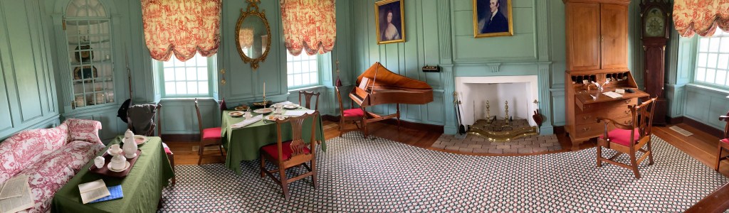
Thomas Stone NHS is staffed by only one ranger, indicative of the NPS underfunding. But Ranger Dave gave us and others a wonderfully evocative portrayal of Stone, his life, and the colonial times in which he lived. He has to close down the visitor center while he leads tours of the Stone home and interprets those times for us. I don’t intend to repeat his stories; it would do you well to visit here and learn more about our early era for yourself.

We left the Revolutionary time period and moved to the War of 1812 and the Civil War. Fort Washington Park preserves Fort Washington, the site of the first fort built to protect the capital city of this fledging country. In 1808 construction was begun on Fort Washington, initially Fort Warburton, on the Potomac River to the south of Washington D.C. The fort did little to stop the British and was blown up by our troops in 1814 to prevent if from falling into British hands.

It seems decision making was as muddled then as it is now. Progress on rebuilding Fort Washington had its ups and downs depending on federal budgets and prognostications about the need for defense. During the Civil War, it was the first fort protecting the Potomac River and a linchpin in the ring of forts built around Washington DC to protect the city from Confederate forces. After the Civil War, changes in the technology of warfare and budgetary issues kept the fort in operation and then decommissioned several times. Eventually in 1946, Fort Washington was turned over to the Department of the Interior and has been a public park ever since. It serves as a recreational area but also a public park to commemorate the long history of coastal fortifications.

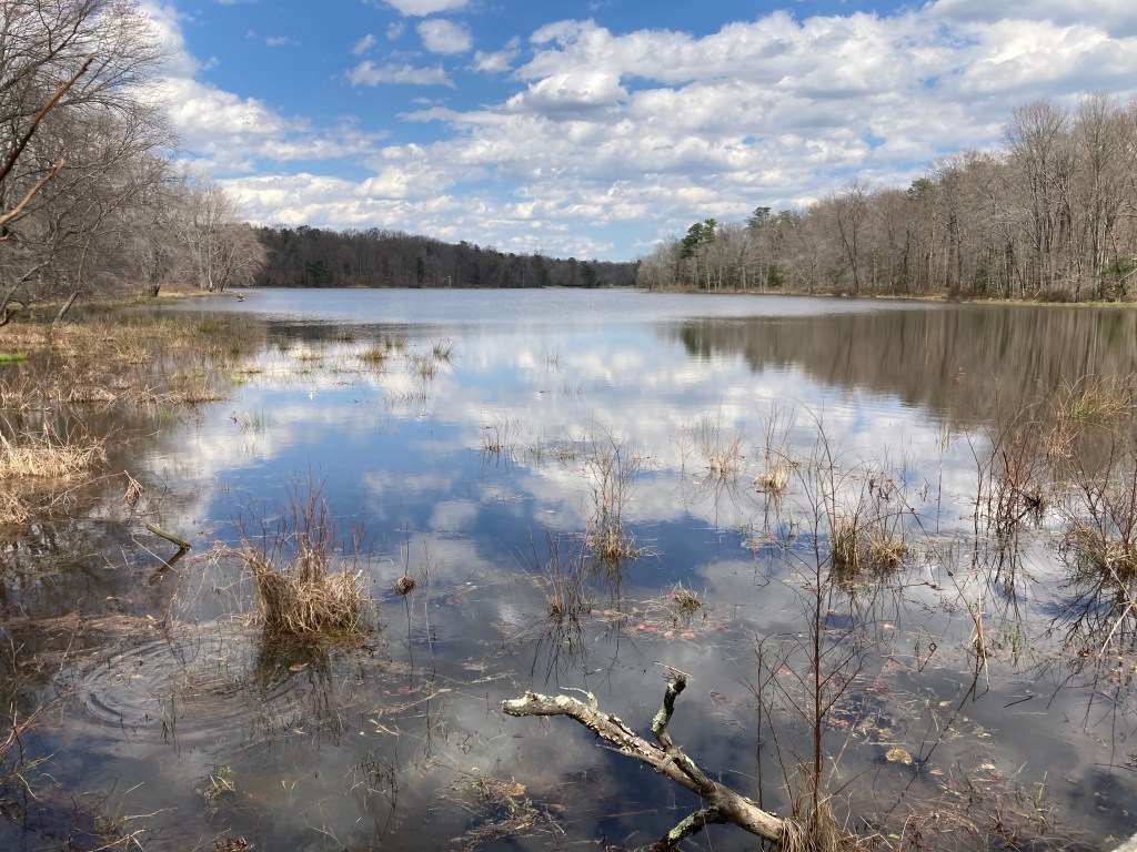
We departed Fort Washington Park and made our way up the road a few miles to Piscataway Park and the National Colonial Farm. Piscataway Park is directly across the Potomac from Mount Vernon, the home of George Washington. Concerned citizens wanted to make sure that this area did not fall prey to suburban development and wanted it kept in the same natural state as when George Washington was living at Mount Vernon and looking east across the Potomac to this site. Those concerned citizens, the National Park Service, and several foundations along with local and state agencies worked to obtain the park’s 5000 acres stretching for 6 miles along the river.

One of the features at Piscataway Park is the National Colonial Farm. This reconstructed farmstead from the late 1700s presents the view of what life was like for typical southern Maryland tobacco planters. This was not a plantation of wealthy owners; but more average to slightly above average farmers of the time. The farm uses historically accurate varieties of field crops and livestock. They practice rotational grazing by the livestock and allow students to experience farm work first hand.

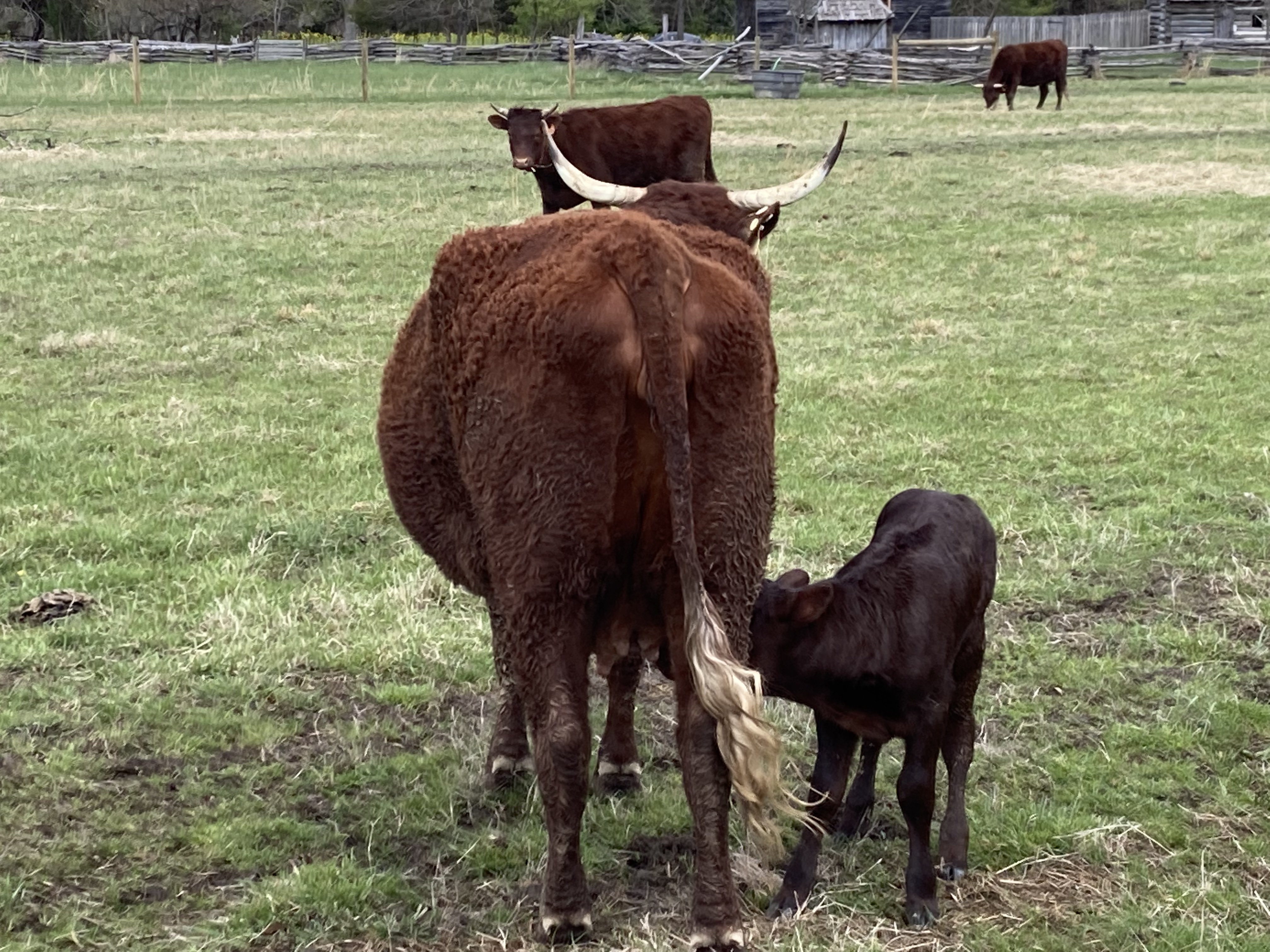
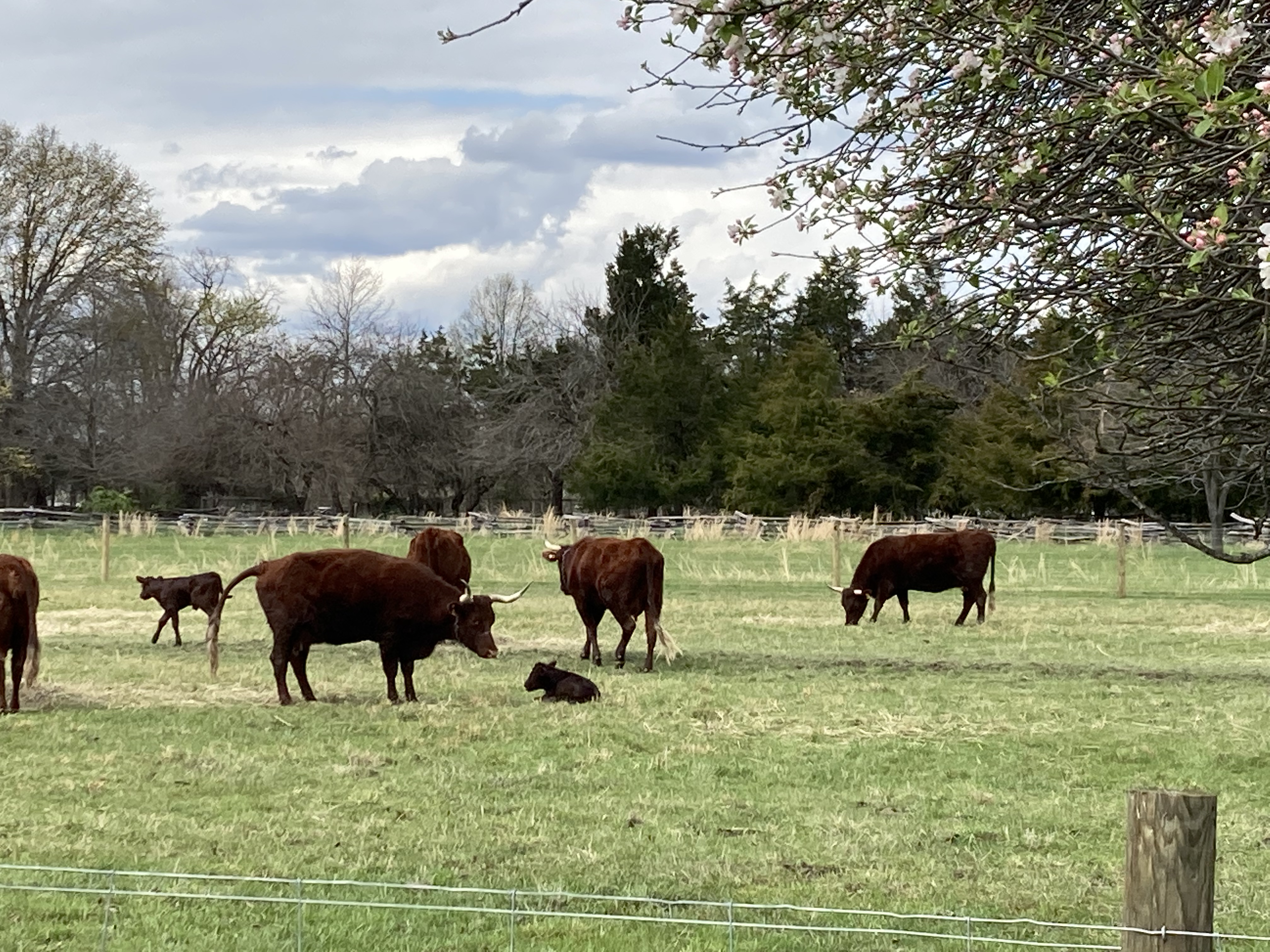
While we are not farmers, this type of exhibit is not unknown to us. We did enjoy observing the newly born lambs and calves as we walked around the farm. Other than that, we didn’t spend an extraordinary amount of time here. We also made a quick stop at Fort Foote, another of the ring of Civil War defense forts around Washington DC. A lack of parking was a determining factor in deciding not to do a major walk here.

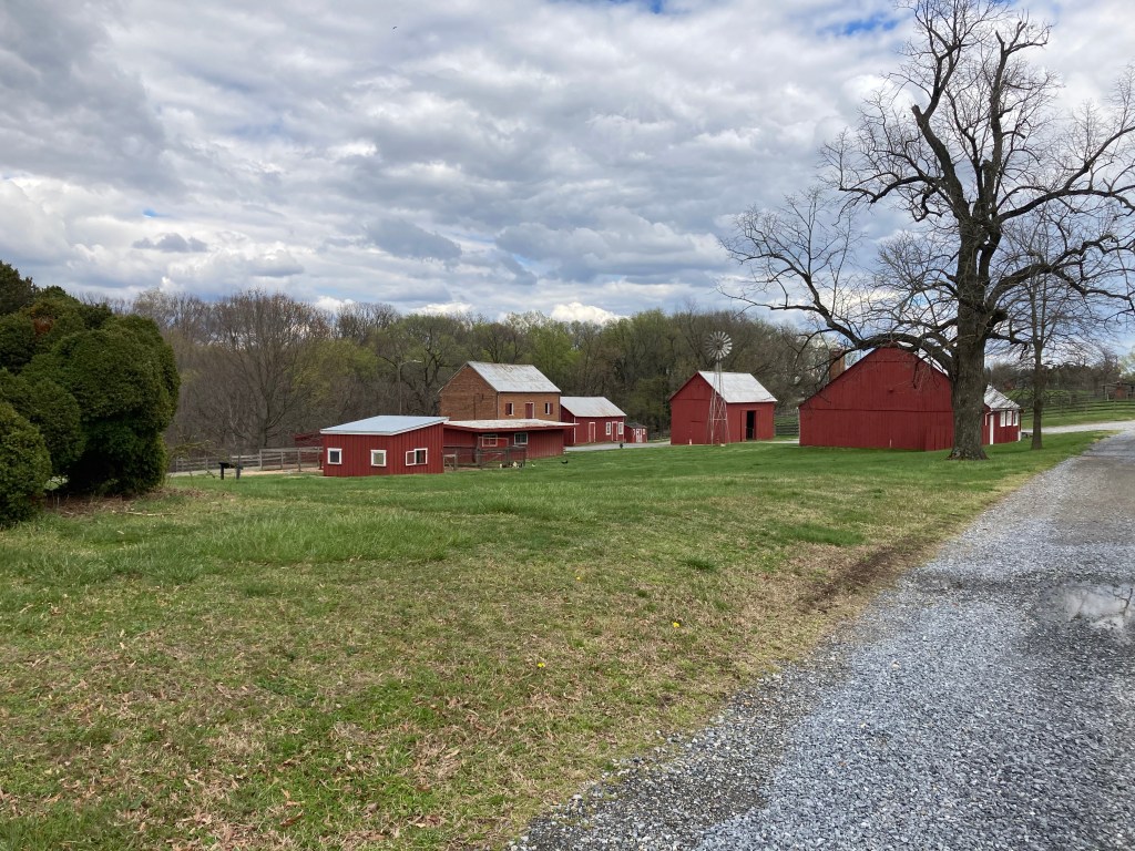
Our final stop of the day was at Oxon Hill Farm. This site is part of the Capital Parks East grouping of parks around the District of Columbia. Oxon Hill Farm represents farming in the early 1900s in comparison to Colonial Farm’s 1770s. Oxon Hill was used to raise cattle, wheat, corn, and fruit by private farmers until 1891 when the US government acquired the land. It established a farm for patients at Saint Elizabeth Hospital in DC. Saint Elizabeth’s Hospital was established as, and still is, the only national public health service hospital solely concerned with the recovery of the mentally ill. In the mid-1960s, the farm was entrusted to the National Park Service. Now it represents a working farm from the early 1900s when horses moved farm implements.

Dinner was the second half of the fish fry dinner purchased last night at the Wegman’s grocery store across the parking lot. Tomorrow we head for five nights in downtown D.C.

Ed and Chris, Glenarden MD, Saturday April 9

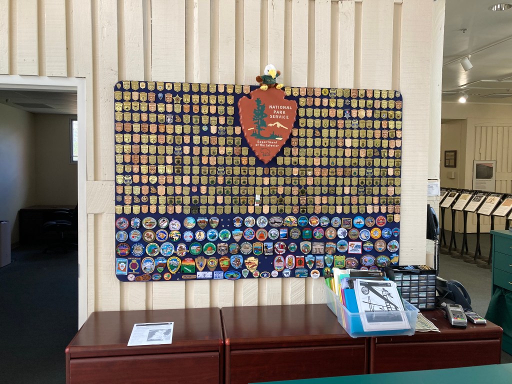
Current total of National Park Service sites visited: 290

Categories: travel | Tags: , , , , , | Leave a comment

2022 Trip 1: Searching for our 300th National Park site. April 7-8

Glenarden, MD April 8

Thursday, April 7 was a rainy day in Harpers Ferry. Fortunately we have been to the National Historical Park before so we didn’t spend time walking in the rain. Instead we drove down 50 miles to a new NPS site, Cedar Creek and Belle Grove National Historical Park. Cedar Creek and Belle Grove are in the Shenandoah Valley of Virginia, a major battleground during the Civil War. Control of the territory passed between the two frequently.

In late summer of 1864, the Union adopted a new policy of burning the buildings, crops, and animals that were supplying the Confederate troops here in the Shenandoah Valley. The battle of Cedar Creek was fought on October 19, 1864. Early Confederate success came from surprising the sleeping Union soldiers. However, the Union troops were rallied and returned to the battlefield to defeat the Confederates. Helped by the Cedar Creek victory and with Sherman‘s victories in the south, Lincoln was reelected that November.

Belle Grove was founded by the Hite family. Isaac Hite Junior married Nelly Madison, sister of President James Madison Jr.. Isaac Hite, Jr received 483 acres from his father. He expanded the farm to encompass 7500 acres at one time. Belle Grove became the heart of their plantation. Belle Grove grew a wide variety of crops, raised cattle and other animals, and operated as its own little town with various mills, smokehouses, quarries and blacksmithing.

Belle Grove is combined with Cedar Creek as one National Historical Park. That combination is because much of the battle was fought around the Belle Grove mansion and its farm land. Despite the proximity to the battle, Belle Grove was not destroyed and only suffered multiple bullet “wounds” to the building.

We received an excellent tour by a volunteer docent. Details of the home, its construction, its furnishings, and its historical ties to the area were all covered extremely well. As is finally occurring with many other historical properties, Belle Grove is coming forward and detailing its ties to slavery. Isaac and Nelly Hite began their married life with a gift of 15 slaves from her parents, James Madison,Sr.. Over the duration of the plantation, over 200 enslaved people were here.

A new feature we had not seen elsewhere was a collection of biographies of enslaved people. Each person receives about two pages of information detailing what was known about them. The task was obviously difficult since most enslaved people did not receive a second name, slaves were not allowed to be married and thus fathers were frequently not listed, and multiple enslaved people had the same first name. The attempt, however, is important and the stories presented helped to create an understanding of life for enslaved people.

Since it rained Thursday, Friday morning we returned to Harpers Ferry Historic District. Harpers Ferry is situated at the confluence of the Potomac and Shenandoah rivers. It is a narrow pass through the high hills surrounding it. Early canal and railroads traversed the gorge on their way to the Ohio River. George Washington established an armory and arsenal here. That combination of transportation and munitions made Harpers Ferry a strategic location during the Civil War. The town changed hands eight times during the war. The constant battles and threat of battles decreased the population from 3000 prior to the Civil War to less than 200 at its conclusion. The armory was gutted during the Civil War. Afterwards it was torn down and the railroads, as they did so often around the country, took the land and incorporated it into their rail yards.

Views of historic Harpers Ferry-above

The other major historical activity for which Harpers Ferry is well known is the raid by John Brown in 1859. John Brown was an famous (even in those days) abolitionist who calculated on breaking in to the arsenal and stealing arms. The weapons would be used to ignite a revolt by slaves-he hoped. His rebellion lasted over three days and by the end, 10 of his men were killed while seven were captured, tried and executed, and five escaped. This incident was broadcast by telegraph around the country to huge headlines. It was later tagged as a precursor to the Civil War.

We left Harpers Ferry to go to Nirvana. Slight joke, but also somewhat true. In our quest to obtain national park stamps, we go to those locations and they have a stamp to use in your passport book. However, around the District of Columbia, there are a number of parks which don’t really have visitor centers. I have not researched it but I’m not really sure why these parks are part of the National Park Service and not just a county or state park. For whatever reason, they are part of the National Park Service. We will be visiting them over the next week.

Chris did some research and found out that there are a few locations which have a collection of stamps for those parks that don’t have a visitor center. One central location was the headquarters for the George Washington Memorial Parkway. This office is for administrative services but there was a table in the front lobby with multiple stamps. Chris had a field day, parking herself on the chair in front of the multiple stamps and applying them to the correct pages. The George Washington Parkway is a 7,600 acre national park area protecting the landscape and native habitat of the Potomac shoreline. Within the park are over 25 sites associated with George Washington’s life and the life of the nation he helped establish. It extends from Great Falls MD to Mount Vernon.

As you probably know, Washington DC is a magnet for memorials to various people, causes, and events. Some memorials rank high enough to become an official National Park Service site. President Lyndon Johnson’s memorial is one of these. It is a grove of trees on an island not far from the Pentagon. There is a large stone monument that marks the location where he and his wife, Lady Bird, would frequent and gaze over at Washington DC. You can see the Washington Monument, Lincoln Memorial, and Thomas Jefferson Memorial from this location. The LBJ Memorial is not ostentatious nor highly visited but we could see why the view would be comforting.

Patuxent Wildlife Refuge and Research Station

Our final stop for the day was at the Patuxent Wildlife Refuge and Research Station. This is one of the 560 wildlife refugees around the country. Among wildlife refuges, it has the largest exhibit display area—Minnesota Valley National Wildlife Refuge is the next largest. Notable research has been completed here. Their efforts were critical to the saving of Whooping Cranes well as the discovery of DDT as the primary cause for the near extinction of bald eagles. DDT caused the thinning of eagle egg shells. When the parents were warming and incubating the eggs, their weight was too great and the eggs cracked. Since DDT was banned, the bald eagle population has soared.

We learned this and more from a knowledgeable volunteer at the front desk. Patuxent has a wall dedicated to volunteers. Their names and plaques line the wall listing the total hours worked. Their totals put my efforts at the Mississippi National River and Recreation Area to shame-there are numerous plaques with 5,000, 10,000, 15,000 hours volunteered by one person. Amazing. Of course, part of the reason their effort is critical is the shortfall in funds for staffing many Department of Interior programs.

We finished the afternoon with a hike along one of the many trails offered at this large refuge in the middle of a major metropolitan area. No rain and pleasant temperatures created a nice ending to a good travel day.

Ed and Chris, Glenarden MD Friday April 8

Categories: travel | Tags: , , | Leave a comment

2022 Trip 1: Searching for our 300th National Park Service site: April 6

Harpers Ferry, WV Wednesday April 6

Stops at four National Park Service sites today only produced one new and additional National Park for our total collection. The other three national parks were places we visited 20 or more years ago, well before we had purchased the National Park Service passport book. So, we made additional stops in order to add a few more stamps to the passport book. The additional stops were not a hassle since they are all conveniently close to each other.

We left Wilmington Delaware in the rain. The drive to Gettysburg National Military Park was on two lane back roads. Google maps had us taking about 2 to 3 dozen different roads as they went over curvy and hilly terrain between Wilmington and Gettysburg. Speed limits were rarely over 45 mph but the fields were green and flowering trees were in abundance along the roadways. Antique stores are frequent in the small towns and crossroads we drove through

We moved from Pennsylvania to Minnesota in 2003. In 2008, a new visitor center was completed at Gettysburg. We had not been here since then. I had to take an hour and a half training session for the National Park Service today and while I was doing that, Chris enjoyed the new film, exhibits, and cyclorama.

Gettysburg National Military Park was not a destination but a way station. For all of the many, many times we have been to Gettysburg, we have never visited Eisenhower National Historic site. This site is the home and farm of former President Dwight and First Lady Mamie Eisenhower. They purchased this property after his military career. It was their first and only home that they owned. While president, Eisenhower would bring numerous dignitaries to Camp David in the Catoctin Mountains and then also bring them up to his home and farm. It is only 20 miles between the two locations. At the farm, the Eisenhowers raised Angus cattle which won championships at the Pennsylvania Farm Show.

The home they originally selected was red brick and in some disrepair. The architect hired to oversee the renovations found a decaying 200 year old log cabin beneath the brick. The house could not be saved. Mamie Eisenhower told the contractors to save as many pieces of brick and other materials that they could. Those pieces were then incorporated into the new home. We were only able to see and walk around the outside of the home. The inside of the home is still closed due to Covid and lack of staffing reasons. However we were able to talk to the park ranger responsible for the property and gather information from him. Unlike some recent presidents, the Eisenhowers were down to earth and the interior furnishings reflect a very simple and common decor and furnishings.

Leaving Gettysburg, we drove to Catoctin Mountain Park. The purpose was to obtain a passport stamp since we had been here previously. Catoctin Mountain Park traces its roots to the Great Depression and a program called Recreational Demonstration Areas. 46 of these RDAs were created in 24 states, most eventually became state or national parks. Catoctin was built on 10,000 acres and Civilian Conservation Corps crews helped to restore the eastern hardwood forests. The forest had been depleted through decades of tree cutting for charcoal making, tannin, heating, and buildings. The plan was to give the finished park to Maryland.

Before this occurred, President Franklin D Roosevelt chose part of the property as a presidential retreat. The retreat was later named Camp David. Since it would not be appropriate or legal for the federal government to control state parkland, the Catoctin Recreational Demonstration Area was cut into two pieces. The northern portion is Catoctin Mountain Park and the home of the presidential retreat and the national park unit. The southern portion became Maryland’s Cunningham Falls State Park. In Catoctin, Camp Greentop is the oldest camp in the U.S. for children with disabilities. Greentop was built by the WPA and is still operating today.

In the process of obtaining the Junior Ranger booklet from the Ranger at the visitor center, she made us aware that another ranger stationed here had worked in the early 2000s at the Mississippi National River And Recreation Area (MISS). Ranger Carrie Andresen-Strawn came out and chatted with us and we shared information about the people we and she knew at MISS.

Our last park service stop was tonight‘s overnight location at Harpers Ferry, West Virginia. We made it to Harpers Ferry National Historical Park in time to have the passport book stamped. We have been here previously so no cheating was involved. Wednesday morning we hope to visit another NPS site farther south in Virginia. We will return to Harpers Ferry in the afternoon and re-acquaint ourselves with it. The forecast is for rain all day so we might cut down on our outside walking around.

Lodging for two nights is at an Airbnb. No fancy meals today, we had plenty of delicious meals over the last several days.

Ed and Chris, Harpers Ferry, West Virginia Wednesday April 6

Categories: travel | Tags: , , | Leave a comment

2022 Trip 1: Searching for our 300th National Park Site: March 31-April 5

Wilmington DE Tuesday, April 5

Well we are back on the road after five wonderful days in Framingham MA visiting family. Obviously part of the time with them is just being together, cooking, eating, talking, playing games. We do manage to squeeze in some activities, though.

We took Deb down to Springfield to introduce her to a childhood friend-Dr. Seuss. Springfield has a museum quad with five different museums. Ted Geisel was born in Springfield and his life here directly impacted his imaginative books. Chris and I have been here before but the chance to share the Dr. Seuss museum with Deb was too great of an opportunity to pass by. Chris goes kind of nuts remembering various Dr. Seuss characters and books. At one stop, a Smart Board was set up for children, and not so young children, to doodle. Chris had a senior moment figuring out how to use it. A mother sitting nearby offered her eight year old daughter as a tutor. The daughter did a great job and Chris had a chance to enjoy her moment of creativity.

After some yard work Saturday, the four of us visited an Audubon sanctuary, the Broad Meadow Brook Conservation Center. Part of the trails were a little muddy but we managed to spot some skunk cabbage, an early blooming spring ephemeral. Spring ephemerals need to pop up quickly before trees leaf out and block the sunlight. Skunk cabbage are usually one of the first to be spotted in spring.

Sunday after church we visited the Mapparium which is part of the Christian Science complex in Boston. The Mapparium is a three story walk through globe built in 1935 showing nations as they existed at that time. I found it less interesting than I expected, even causing a little dizziness from looking up at the globe countries. Instead, I would recommend the map library at the Central Boston Public Library if maps interest you.

Deb was able to take Monday off from work so we visited the Commonwealth Museum. This is a MA state museum attached to the state Archives. The exhibit area is quite well done even though the quantity of the exhibits is small. The focus is on MA history and given Massachusetts’ role in establishing the United States, it includes national history. I found the exhibits even handed in their handling of state history. For instance, the Puritans had a positive impact on the development of democratic institutions even as their religious intolerance still has an impact on today’s society.

There was an educational chart contrasting Native American living and farming methods with those of the European colonists. It has taken 300+ years for us to acknowledge that many of the native agricultural practices are so less destructive on the land. Maybe if we spent more time trying to scale up their practices, we could have caused less damage to the land while still feeding many more people. One final note. Hopefully you recall that untold hundreds of thousands of Native Americans died from being exposed to European sicknesses for which the Native Americans had not developed any immunity. Many Indians converted to Christianity, believing that the Christian god must be better since the Europeans did not die of these diseases.

Massachusetts complicated history with slavery was covered. First, slavery was allowed, then prohibited. Shippers participated in the slavery trade. MA was a hotbed for abolitionists while the textile mills profited from Southern cotton grown with slave labor. Free blacks were accepted and integrated into the state militia before the Revolutionary War-but not after the Revolutionary War in the country which proclaimed: ”all men are created equal.”

In the afternoon, the three of us went hiking at Callahan State Park, not far from the Airbnb Chris and I were staying at. While the trails were easy to follow, there were no maps available. We managed to get in an hour hike without getting lost and made it safely back before dinner time. Dinner was take out from Bella Costa Ristorante Italian restaurant and dessert from Dulce D Leche Gelato Cafe.

Tuesday, today, we went back on the road where we will be for the next three weeks plus. Paterson Great Falls National Historic Site is a National Park Service site in progress. In other words, it still leaves a lot to be desired. The Great Falls on the Passaic River are impressive at 77 feet high. The Great Falls are the location of America’s first manufacturing center.

In 1792, Alexander Hamilton founded Paterson and for 150 years Paterson fulfilled Hamilton’s dream to wean America from foreign goods. When Paterson was created, England sold America its manufacturing goods. Even though we were an independent country, lack of a manufacturing base made us dependent on England. Paterson mills used the water power, and later hydropower, from the Great Falls of the Passaic River to manufacture textiles including cotton, flax, silk, and rayon, to build aircraft engines and railroad locomotives, and make paper.

Immigrants flocked to the city, creating a diverse culture and melting pot, and cheap labor. But in the early 20th century, workers realized they were getting a raw deal. They banded together and a six month strike eventually produced better working conditions, shorter hours, and higher pay.

The view today around the falls is of a city struggling to reclaim its lost grandeur. Some of the mills have been rehabilitated and are economically productive once again. But across the street from one of those will be a mill with broken windows and fallen in roof. Trash and litter line several of the once mighty raceways that brought water power to the mills. The contrast between the Great Falls of the Passaic and St. Anthony Falls in Minneapolis (Mississippi National River and Recreation Area) is striking. Minneapolis is the clear winner with parklands lining the river, residential complexes created from rehabbed mills and newly built high rises. Offices and entertainment options create a vibrant community. Lets hope Paterson’s vision can be reached.

As for the national park, Paterson Great Falls National Historical Park does not have a functioning visitor center although a viewing overlook has been created. We had to knock on the locked door of the admin center to get our passport stamp. It works, but not so much that one wants to brag about it to others.

Tuesday night we ate hot dogs at a Wilmington DE landmark institution, Deerhead Hot Dogs. A special sauce is their signature dish. The sauce and restaurant date back to 1935. A local car club was having their monthly meeting while we were there. They took up 18 of the 24 seats in the restaurant.

Ed and Chris, Wilmington DE Tuesday April 5, 2022

Categories: travel | Tags: , , , , | Leave a comment

Blog at WordPress.com.