Monthly Archives: April 2022

2022 Trip 1: Searching for our 300th National Park site: April 26-28

Pipestem WV April 26

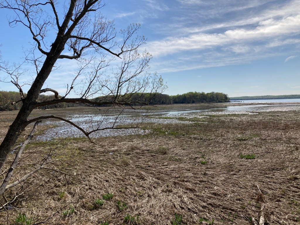
Before we left West Virginia, we made one more visit to the New River. Sandstone Falls on the New River is 30 minutes north of Pipestem Resort State Park. The waterfalls are mentioned frequently and positively in travel literature about West Virginia and in NPS brochures. The falls extend across the New River, punctuated by rock outcroppings. The rock outcroppings have trapped fallen tree trunks on top of the rocks, waiting for the next high water level to push the tree trunks downstream to the next catch point.

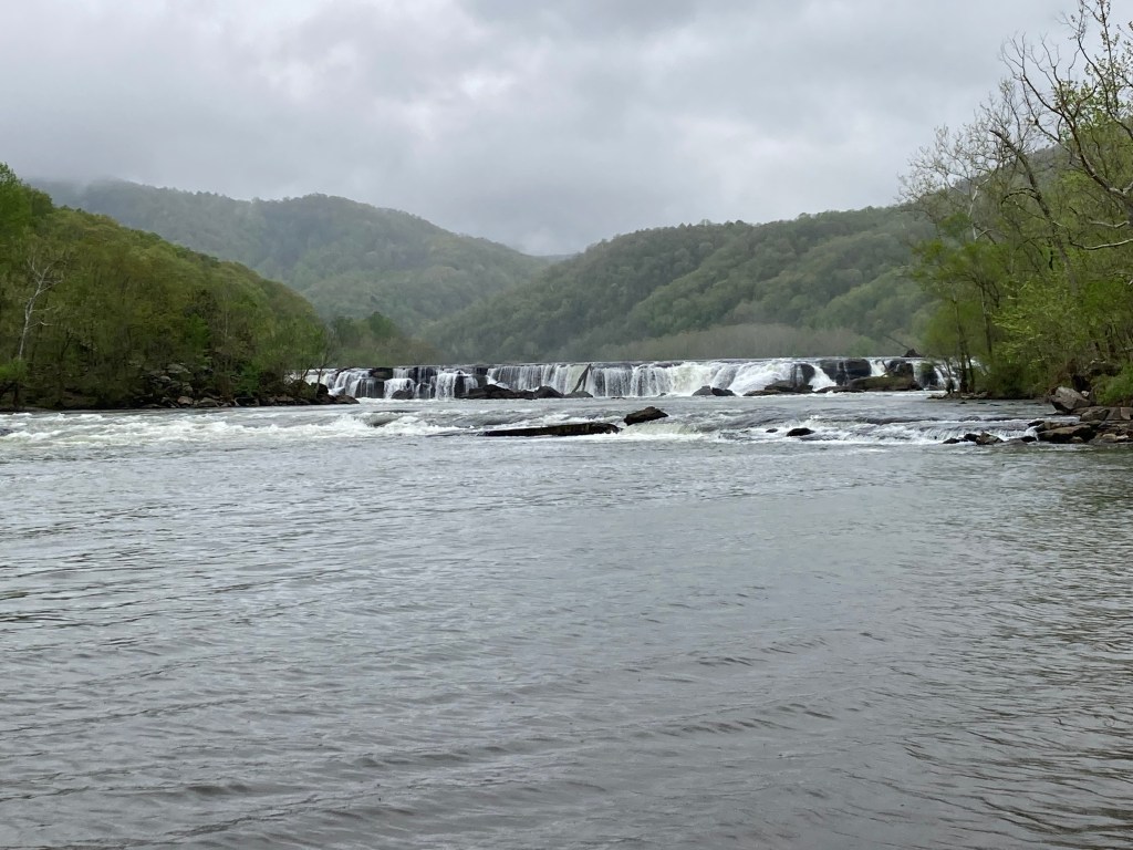
The literature indicates the height of the falls ranges from 10-25 feet. Not stunning in height, but the full river width of the falls lends to a greater majesty. The New River is one of the unusual rivers that flows from south to north. Here at Sandstone Falls, the river becomes more narrow, entering a gorge phase. The river drops 750 feet in the next 55 miles.

The day was rainy when we were at the falls, sunshine and reflections in the water would have made for a more impressive photo. Several people were out walking, taking photographs, fishing, etc. We had previously viewed the falls from above, this location places you at river level, at an island in the middle of the river just downstream of the falls. The river seemed shallow but with a fast current. As the signs advise, drownings are a major cause of death along the New River. The current can trap a person, even in very shallow water.

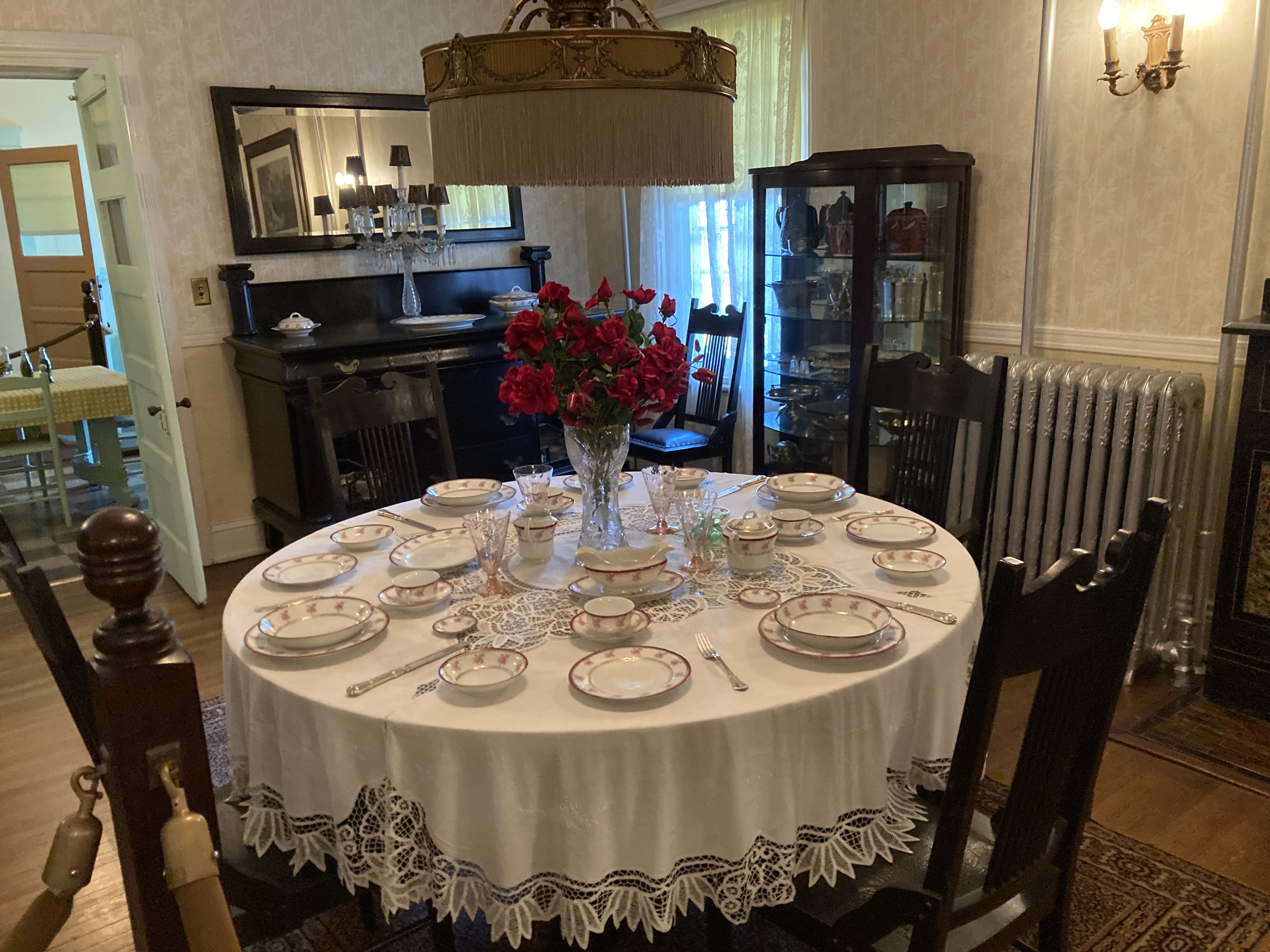
Dinner was back at Pipestem Resort State Park dining room. The menu is limited but the food has been quite good. Even the trashed food must be tasty as we saw raccoons each night who evidently go dumpster diving on a regular basis.

Wednesday morning we were gone by 7 AM; a real sacrifice since the dining room does not open until 7. The day would be longer than usual, over 600 driving miles plus a stop at our last NPS site for this trip. An early, long section of the road was along I-77 and I-64, the West Virginia Turnpike. The road was mountainous and curvy; the tolls on this road were 20% of the tolls we paid for the entire trip. Thankfully EZ Pass eliminates the old stop and pay method of gone by years.

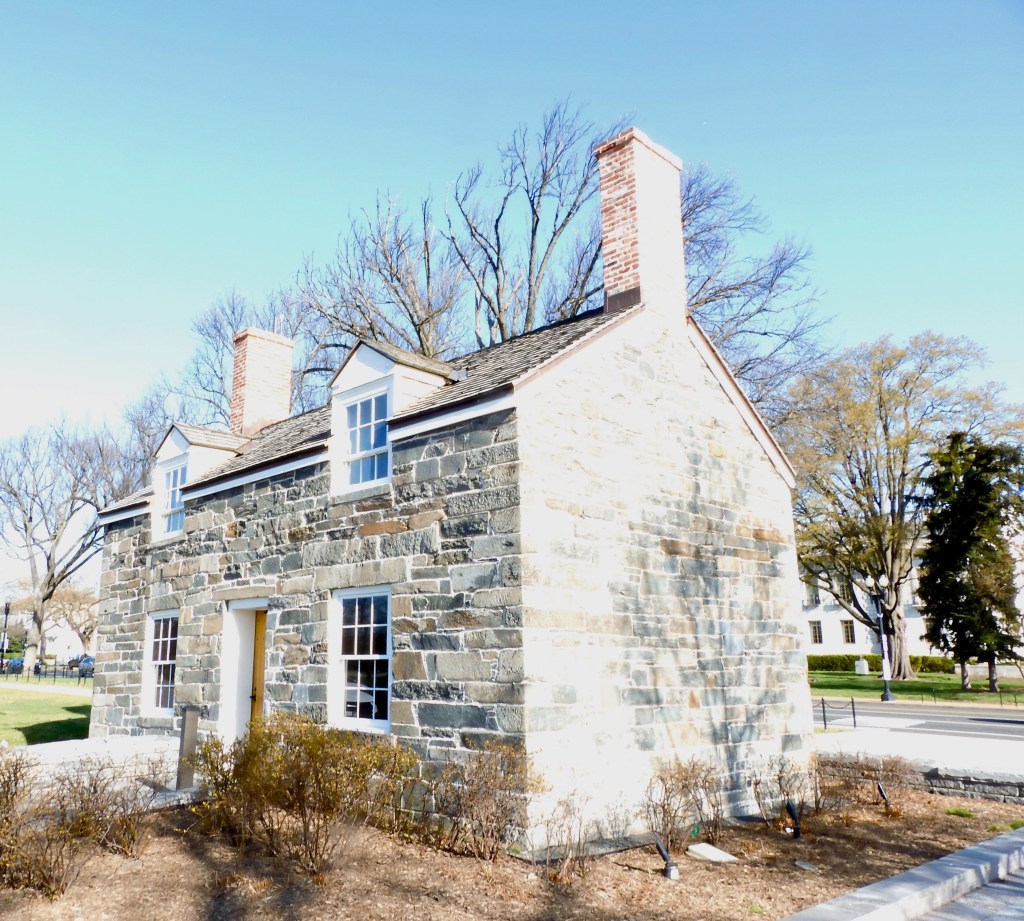
Lincoln’s Boyhood National Memorial in Lincoln City Indiana was well done. It surprised us, not sure what exactly we were expecting. The site is a memorial to Abraham Lincoln’s formative years, from ages 7-21. This is where he matured, reading books, splitting rails, arguing politics, learning how to be a farmer and learning that was not the life he wanted in the future. His mother died after two years here from an illness frequent on the frontier, milk sickness. Cows eat the white snakeroot plant native to this area; it is toxic to them and to humans who drink its milk or eat its meat. Rarely a problem today, this disease claimed Nancy Hanks Lincoln’s life as well as many others in the little community here. The cause of the disease was not known at the time. She was buried on a knoll not far from the Lincoln farm.

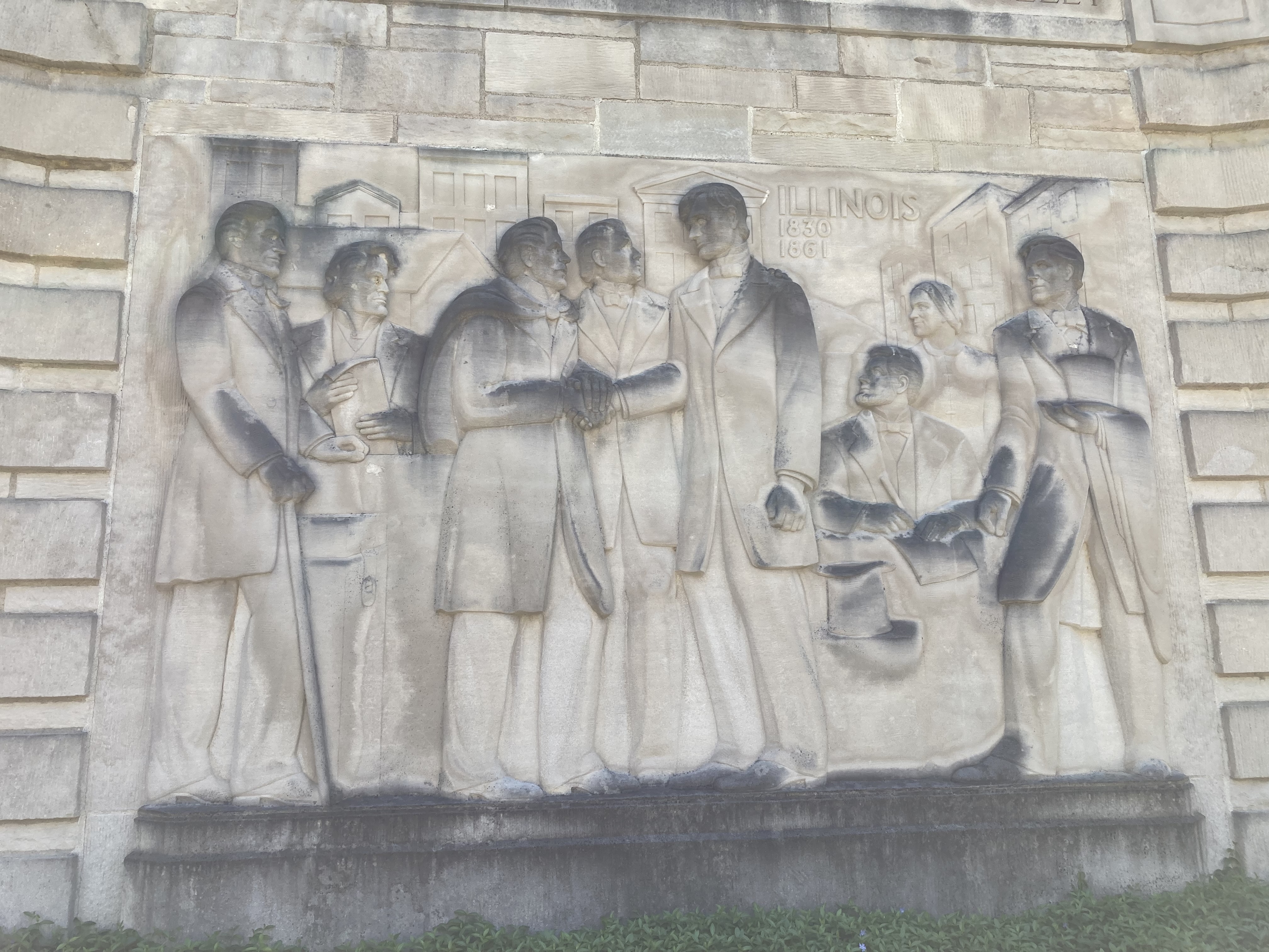
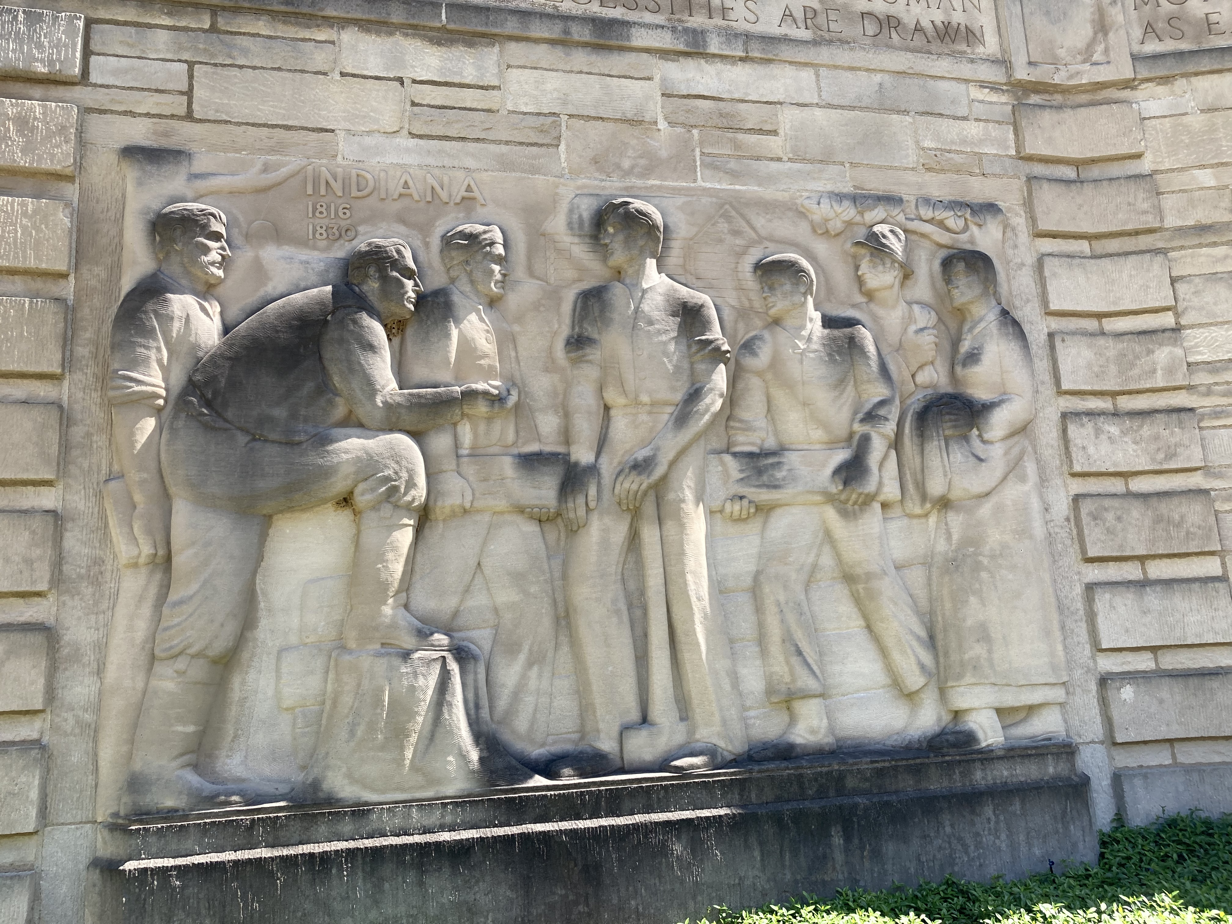
In 1943, the state of Indiana constructed the Lincoln Memorial Building to honor Lincoln and his mother. Materials are all native to Indiana. It was transferred to the National Park Service in 1962. The memorial building is a semi-circle with two large auditoriums at either end. One is dedicated to Abraham Lincoln, one to his mother, Nancy Hanks Lincoln. Between the two auditoriums are exhibits about his life in Indiana and his family while he was growing up. On the outside of the building are five sculptured panels of significant periods of his life: Kentucky childhood years, Indiana boyhood days, Illinois political ascendancy, Washington DC presidential years, and the central panel reflecting his place in history.

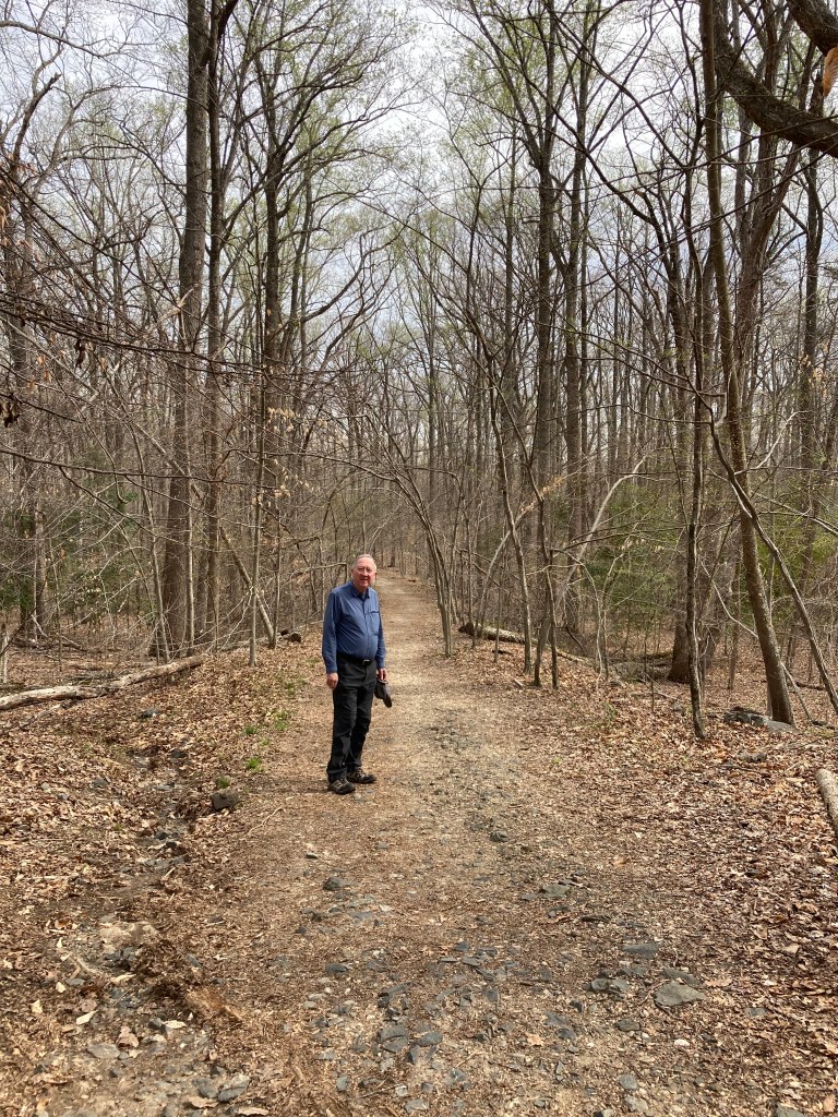
Besides the memorials for Lincoln and his mother, a living history farm is included on the land where the Lincoln farm was located. Foundation stones have been excavated and marked out while a split log fence and a reconstructed cabin indicate the type of home Lincoln would have experienced. Mary Hanks Lincoln’s actual grave site is not known precisely, but the approximate location is marked and memorialized.

Once again, our visit was enhanced by a friendly and knowledgeable guide, this time a volunteer rather than a park ranger. The rangers were busy getting ready for a huge throng of first graders who would be visiting on Monday. Today’s crowd was about a dozen people while we were there. Enough people to keep the volunteers busy answering questions but light enough to give a visitor personal attention.

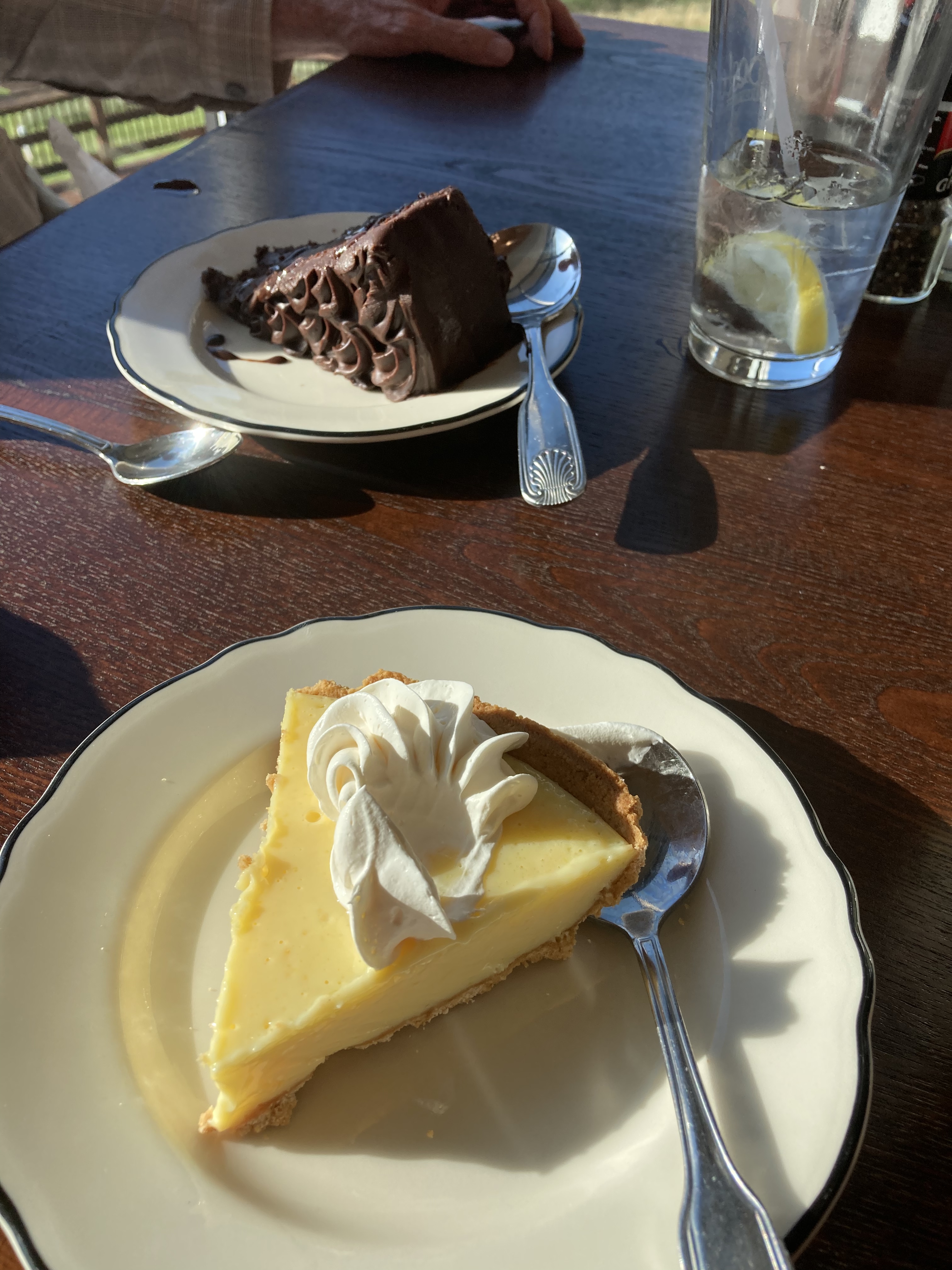
We left southern Indiana for the Champaign-Urbana area of central Illinois, a drive of over 200 miles only partly on Interstates. Lodging was our final Hampton Inn of the trip with a Perkins across the parking lot. We managed to force ourselves to have a piece of pie each for dessert.

Thursday-last leg of the trip. 500 miles with rain for the first several hours. Construction continued being frequent but as was normal for the rest of the trip, usually only bridge work. Thus construction areas were short. Our final meal on the road was in the largest Culvers restaurant in Edgerton WI, just south of Madison. As we journeyed north and west, the trees no longer had their leaves and buds visible to us on the road. Probably another week will be necessary for this section to green up. Spring is a little later this year than last, at this time in 2021 the trees were in full leaf.

Last night we reflected on the highs and lows of the trip. The historical units we visited were most frequently the highs. The sites were well done and our knowledge of U.S. history enhanced. Certainly other interesting places could have been visited but our goal of the trip was to reach 300 National Park Service sites. Accomplished.

Ed and Chris, Saint Paul, MN April 30, 2022

Categories: travel | Tags: , , , , , , , | Leave a comment

2022 Trip 1: Searching for our 300th National Park Site: April 25-26

Pipestem, WV April 25

In a short stretch of southcentral West Virginia sit three national parks: New River Gorge National Park and Preserve, Gauley River National Recreation Area, and Bluestone National Scenic River. Previously we had visited New River, so Gauley and Bluestone were our targets for this trip. We are using McKeever Lodge at Pipestem Resort State Park as our headquarters, staying here for three nights.

Our route from Appomattox was about 200 miles through valleys and up and down mountains. Part of the route was on two lane, curvy, twisty, narrow roads. The other part was on I-64, 4 lanes and faster but still hilly. Greenery has increased mightily with redbud and dogwood providing variety of color. Before arriving at our lodging, we stopped at the National Park Service’s Sandstone Visitor Center for New River, gathering brochures and tips from the park ranger-who was quite familiar with Minnesota and the Twin Cities.

We arrived Sunday night in time for dinner at the Lodge’s restaurant. Our lodging rate is very reasonable, cheap even, but we do need to pay for our meals, Even so, with the cost of breakfast tossed in, it is still less expensive than our usual motel type. Food is excellent. View of the Bluestone River canyon is great. Monday weather was great, Tuesday is rainy so we are staying in, watching the clouds over the mountains, and working on miscellaneous tasks. Last evening Chris watched the sunset from our patio. During the night I watched the stars from our patio.

Monday was spent traveling to and visiting Gauley and Bluestone. Both of these NPS sites are geared toward recreation. Gauley was established in 1988 and includes 25 miles along the Gauley River and five miles of Meadow River. Gauley’s claim to fame is whitewater rafting. But, Gauley’s waters are regulated by the U.S. Army Corps of Engineers Summersville Dam. The dam’s primary purpose is flood control. This results in periods of low flows on the Gauley and then great whitewater rapids in the fall.

The river falls 668 feet through its run here with boulders, rapids, and huge waves bringing crowds of whitewater enthusiasts. The river includes many Class IV and V rapids, well above our level. Names of the rapids include pure screaming hell rapids, heaven help you rapids, and lost paddle rapids. Much of the year, like now, the river is low and the crowds non-existent. A few campers, hikers and people fishing were wandering around.

We did not ignore the New River. The historic town of Thurmond along the New River is under restoration by the NPS. Most of it is open during the summer but we visited anyway. The New River is actually one of the oldest rivers in the world, beginning near Blowing Rock in North Carolina’s Blue Ridge Parkway. On its journey through West Virgina, the New River connected over 80 coal mines and towns to industries along the river and around the nation. Railroads, primarily the Chesapeake and Ohio, followed the river on both banks.

Thurmond was the bustling center of activity in the early 1900s. It was the rare widening in the river that allowed for company stores, railroad repair shops, steam locomotive refueling, etc. Thurmond was the major money maker for the C & O during that time, the banks here were overflowing with cash. Passenger trains stopped here 12-15 times a day. Freight trains rumbled through every 15 minutes. It was quite the place.

Times change. Diesel replaced coal fired steam locomotives. The use of coal from other parts of the country expanded. Autos replaced trains as major people conveyors. To reach Thurmond we took a narrow and little traveled road. The last step involves traversing a bridge with one way auto traffic and one set of railroad tracks. A town that once boasted numerous coal millionaires now has housing that does not have high market values. Thurmond, and several other small WV towns, are still stops on the Cardinal line of Amtrak as a ”Flag” stop with unmanned stations.

The last stop of the day was along the banks of the Bluestone River. When the Army Corps of Engineers completed the Bluestone Dam on the New RIver in 1949, it backed up the Bluestone River also. As we were told, the Corps calculated too high about the size of the likely impoundment area. They condemned and purchased more land than they needed. The excess land, including the former town of Lilly, was transferred to the NPS as a Wild and Scenic River in 1988. It only goes for 10.5 miles. Ed

Ed and Chris Pipestem WV April 26

National Park Service sites visited: 311

Categories: travel | Tags: , , , , , , | Leave a comment

2022 Trip 1: Searching for our 300th National Park Site: April 24

Pipestem, WV Sunday April 24

Appomattox Court House, Virginia is not a Civil War battleground yet it reigns tall in Civil War sites. It was here on April 9, 1865 that General Ulysses S. Grant accepted the unconditional surrender of General Robert E. Lee and his 28,000 Confederate troops. It was not until June 2 that the last Confederate armies surrendered. But the surrender here of Lee and his forces meant the realistic end to the five year turmoil.

The exhibits and films here lay out the maneuvering of the two armies leading up to the surrender. Lee is forced out of Richmond and Petersburg. He tries desperately to meet up with other Confederate troops in the Carolinas. But Grant keeps his army between Lee’s army and North Carolina and eventually Lee realizes his options are gone.

Rather than going into great detail about Appomattox or the Civil War, we are listing a few factoids which you may or may not be familiar.

  1. In the picture above, which General had the table/desk on the left and which the table/desk on the right? (Lee who arrived half an hour before Grant-who had farther to ride to reach Appomattox-, took the table on the left.)
  2. Appomattox Court House is both the name of this little village and the name of the court house of the town.
  3. The actual surrender took place in the McLean house, not in the court house.
  4. The truce flag used by the Confederates to reach the Union lines safely for the talks was a towel. A Union officer finagled it from the Confederate officer who had it. The Union officer gave it to his superior, General William Custer. Custer gave it to his wife. His wife cut part of the towel into pieces and gave those pieces to Union officers who would write positive letters about her husband after Custer’s death at the Battle of Little Bighorn.
  5. The National Park Service has an informational handout on display here about “Slavery as a Cause of the Civil War”. For all those visitors who try to argue that the Civil War was fought over states rights, not slavery, they can read this handout. The handout has the words used by Southern legislators at the time of the preparation of the Constitution and at the time of secession. For instance: ”Our position is thoroughly identified with the institution of slavery-the greatest material interest in the world.”—Mississippi Declaration of Causes of Secession.
  6. Robert Lincoln, Abraham Lincoln’s son, was a Union officer present at the surrender.
  7. The McLean house was decided to be torn down by northern interests who wanted to reconstruct it in D.C. as a memorial. It was torn down in 1893 but the company went bankrupt and the bricks sat on the property unused. After WWII, the area was made a national monument and the bricks, many still sitting there, were used in the rebuilt McLean House. The same Niagara Falls company that dismantled the McLean House in 1893 rebuilt it after WWII.
  8. Grant’s secretary who made the formal ink copy of the letter that spelled out the terms of the surrender, was Lt. Colonel Ely Parker, a Native American and a non-citizen at that time. He was known for his fine handwriting. At the meeting, General Lee said to Parker: ”I am glad to see one real American here.”
  9. The Union Army fed the Confederates and let them keep any horses they owned before they returned to their homes. The terms of surrender and the treatment of the Confederates was seen as a major symbol of honor between the two groups.

Tonight, after driving 190 miles, we are in West Virginia where we will spend three nights at Pipestem Resort State Park. I will not miss driving in VA and NC towns where there are no traffic signs indicating which lanes turn left, right, or go straight. They only have lane markings. The lane markings get faded and don’t show up until you are on top of them. May not be a problem for locals, but for out-of-towners, it leads to many last minute lane changes.

Ed and Chris, Pipestem WV April 24

Categories: travel | Tags: , | Leave a comment

2022 Trip 1: Searching for our 300th National Park Service site: April 22-23

Salem, VA April 23, Saturday

North Carolina’s capital city was not always in Raleigh. Its first permanent colonial and state capital was in the town of New Bern, located on the tidal Neuse River. To gather more history about North Carolina and its early days, we spent most of Friday at Tryon Palace, or Governor’s Palace. Britain appointed William Tryon Royal Governor in 1764 and he served until 1771 when he was promoted to be Royal Governor of New York. One of Tryon’s official acts was to build a government house to represent the Crown and a home for his family. He was allotted 5,000 pounds to do so.

Unfortunately for the citizens of North Carolina, Tryon spent 15,000 pounds to build an opulent structure, even bringing in artisans from places like Philadelphia to work on it. The extra funds to complete the government house were to be collected from additional taxes. The government house was nicknamed Tryon’s Palace due to its opulence. The taxes were one factor that led to an uprising by local citizens in western North Carolina. Gov. Tryon put the uprising down using the state militia. He has been labeled unduly harsh by friend and foe in North Carolina and New York.

Governor Josiah Martin replaced Tryon and is notable also. He was the first Royal Governor in the colonies to give up his post and flee back to England. He sent his wife and children away first and in May 1775 Gov. Martin and his assistant left town giving false information about his plans. Martin went to New York, picked up the family and then fled to England. When the colonists realized what was happening, they emptied the palace of its furnishings and auctioned them off. After all, they had paid for them. The capital was moved to Raleigh in 1794. The Governors Palace only saw limited use until it burned in 1798.

In the 1950s, the Governor’s Palace was rebuilt using the original architectural drawings. The task was immense, removing buildings and highways and constructing a new bridge over the Trent River. We received a tour of the building and it’s replacement furnishings. There are living history demonstrations and an English garden to view. The name Tryon Palace applies to this complex with other historic buildings, the palace and outbuildings, the garden, and across the street, the North Carolina History Center.

The early afternoon was spent at the History Center, including lunch at their cafe. (Delicious brownies by the way.) The exhibit area was well done. An extensive range of topics are covered. The Pepsi Family Center deserves special recognition. This area is designed as an interactive learning experience for elementary age youth. Each of the five stations (dry goods store, kitchen, print shop, turpentine distillery, and sailing ship can accommodate eight students who have to work cooperatively on tasks common to 1835. The docent on hand gave us several in person demonstrations. We were impressed. This learning center had just re-opened a month ago after flooding by Hurricane Florence in 2018 and Covid 19.

If we were in to it, we could have spent time at the Pepsi Museum (Pepsi started in New Bern), the New Bern Fire Museum, or hunting down the signature fiberglass bears in the downtown area. Bern means bear in German and was named New Bern by the Swiss settlers who came here from Bern Switzerland in 1710. We had already spent much of the day here and it was time to drive the three hours to our lodging for the night in Burlington, NC. Thankfully the drives now reveal green trees and blooming dogwood trees and azalea bushes.

Today (Saturday) the National Park Service celebrates Junior Ranger Day. The park rangers at our first stop at Guilford Courthouse National Military Park were prepared for visitors. They had a special table set up, parking guide volunteers, and re-enactors. Guilford Courthouse even has a junior ranger book for Not So Junior Rangers. You have to understand, most junior ranger books offer kids a chance to learn about that park through questions, drawings, and similar activities. It takes some effort but is very achievable. When completed, the child obtains a badge and is sworn in as a Junior Ranger. The Not So Junior Ranger Activity Program booklet here was quite the challenge for the older child or adult. It required more time and had more difficult questions. I thought it was well done and would have required real thinking and searching out for the answers. Luckily I did not really examine it until after I had left the park so I am spared the embarrassment of not knowing numerous answers.

We did learn about Guilford, though. Friday night we watched their 30 minute explanatory video on the web. Saturday morning we watched an additional 10 minute video about the conflict and read many of the exhibits inside the visitor center. Finally we walked part of the grounds.

Some of the paintings commissioned by the NPS to reflect the Southern Campaign. The artist is Don Troiani.

Guilford was established in 1917 as the first national military historical park. Initially it was under the direction of the Army but was later transferred to the National Park Service. The only reason it was available to be preserved was due to private parties that had purchased and preserved a portion of the battlefield.

Guilford was extremely important to the successful conclusion of the Revolutionary War. Most Americans think of Boston and Valley Forge, maybe Saratoga, as the primary battles of the war. However, in 1778 the war was stalemated and the British changed tactics and went to southern colonies to fight and defeat the colonials. They had success in Georgia and South Carolina and planned to go north into Virginia.

British General Cornwallis was leading his troops but suffered setbacks at Kings Mountain (Oct. 1780) and at Cowpens (Jan. 1781). (Both of which we visited on previous trips). However, Cornwallis still outnumbered the Americans who needed reinforcements and supplies. The British troops were better trained and many of troops of the Continental Army were local militia. By March of 1781, General Nathaniel Greene of the Continental Army was better prepared and the two armies met at Guilford Courthouse. The end result was that Cornwallis won the battle but Greene won the war. The British troops lost 1/5 of their troops and 1/3 of their officers. As an English member of the House of Commons stated: “Another such victory would ruin the British Army.”

Seven months later Cornwallis surrendered at Yorktown.

For the afternoon, we drove to the birthplace of Booker T. Washington. Washington was born a slave on a Virginia tobacco plantation in 1856. In 1861, at age five, he was valued at $400 on his owner’s property inventory. He was freed after the end of the Civil War, uneducated since it was illegal to teach a slave to read and write.

Washington attended school in the evenings while working in salt and coal mines in West Virginia. At age 16 he walks and begs rides to reach the Hampton Institute, 500 miles from his WV home. He graduates from schools of higher education and after several teaching stints, is appointed the head of a new school in Tuskegee Alabama. He is 25 years old.

Booker T. Washington builds Tuskegee, brick by brick, student by student. George Washington Carver was one of the students there. As Tuskegee grows, Washington becomes better known and works tirelessly to promote education and economic prosperity for African Americans. Tuskegee today has over 2,500 students.

The birthplace site demonstrates well the harsh realities of life for slaves. The plantation at which he was enslaved was not huge and the slaves were the main value of the owners. No education, poor food despite living on a farm, and harsh, violent treatment designed to keep slaves in their place was normal. Booker’s most lasting memory of slavery was his uncle being stripped, tied to a tree, and beaten with a whip.

The ranger at this site mentioned how even now she has visitors who were taught that the Civil War was about states rights. How easily some groups have been able to twist history into a story that distorts reality. Civil War was about slavery and money. If you need proof, read the speeches of legislators from seceding states, read the declarations of secession they wrote and approved.

As we left Booker T. Washington National Monument, we stopped at a local creamery. Homestead Creamery in Burnt Chimney VA had wonderful ice cream and rocking chairs in the shade. It is a small dairy started in 2001 utilizing milk from several local dairy farms. Quote: “Each farm is dedicated to the health and happiness of the cows and the quality of the products that are produced for the consumers”. I don’t know if the cows are happy but these consumers were overwhelmingly satisfied. What better way to enjoy the afternoon.

Tonight we are Salem, VA, a suburb of Roanoke. Tomorrow it is off to Appomattox and then three nights in West Virginia before heading for home.

Ed and Chris, Salem VA April 23

Categories: travel | Tags: , , , , , , | Leave a comment

2022 Trip 1: Searching for our 300th National Park Service site: April 20-21

Kill Devil Hills, N.C. April 20, Wednesday

People tease us about going on trips so detailed that we need an Excel spreadsheet to list all the information. Yes, we always rejoinder, but we improvise when appropriate. Today and tomorrow will be an example of a reasonable improvisation. Today’s schedule had to be adjusted in order to accommodate tomorrow’s major change. Originally we were going to drive the Outer Banks Scenic Byway on Thursday. This encompasses Cape Hatteras National Seashore. Completing the byway would require two ferry rides, one of over half an hour and one of over 2 1/2 hours.

The weather has been cold and windy and for two days the ferries were completely canceled. While Thursday’s weather appears better, we decided to be cautious and skipped the ferry rides. Instead, we will drive overland to our next stop. It’s not that riding a ferry is worrisome or new. We have ridden very large ferries over Lake Michigan and Vancouver Sound. We have ridden very small ferries, almost extended pontoon boats, across Bull Shoals Lake in Arkansas and the Mississippi River between Missouri and Illinois.

In order to be able to avoid the ferries, we had to add additional activity today to see Cape Hatteras National Seashore. The change would make for a busy day. Our first stop was the Wright Brothers National Memorial in Kill Devil Hills North Carolina. It was an hour and a half drive from the hotel in Norfolk. Upon arrival, we found an NPS site with a line of cars waiting to enter and a full parking lot. It was a surprising change from most of our previous sites which had been lightly attended.

On December 17, 1903, Orville and Wilbur Wright made man’s first heavier than air powered flight. The Wright brothers are from Dayton Ohio, and we have seen the National Park Service site there previously. They came to Kill Devil Hills because of its flat land, frequent steady winds, and tree less spaces. The Wright Brothers put years of study, practice, and research into glider flight, airplane material, studies of birds in flight, and aerodynamics. It was only through all of that work that success was possible. They would return to Dayton in between testing here.

The hill here allowed for the testing of the glider flights. Research with gliders was then incorporated into airplane design. The flat land below was where the first flights occurred.

Flights 1, 2, 3, and 4 markers and the boulder marking the take-off point

The first four flights on December 17 were modest. Each brother flew two flights. The first flight lasted 12 seconds and went 120 feet. The second flight lasted 12 seconds and went 175 feet. The third flight lasted 15 seconds and went two hundred feet. The fourth flight went for 59 seconds and 852 feet. There was no fifth flight because the plane crashed after flight number four and would have to be rebuilt. But the effort was successful and they would go on to achieve even greater results.

Leaving flight behind, we went to a site of travel by 16th century sailing ship. The French and the Spanish were active explorers in North America with the Spanish settlement of St. Augustine being the first permanent settlement in North America. The first English attempted settlement was not at Jamestown or Plymouth, but here on Roanoke Island in North Carolina. Now called the ”Lost Colony”, it was funded by Sir Walter Raleigh and in 1587 it was a settlement of over 100 men, women and children.

Why is it called the Lost Colony? Well, a re-supply ship was to return the following year, 1588. Due to the increasing war between England and Spain, no English ships could be spared for a return trip. It was not until the year 1590 that a return ship came back. No settlers were to be found anywhere. Archaeological searches have found no definitive proof of where the 100 settlers went or what happened to them.

Several theories exist, of course. Were the initial English settlers killed by the native American Indians? This theory has credence because while the very first exploratory (non-settlement) visit here by English ships was amicable, serious problems had later arisen. European diseases had already killed 20% of the local population, lack of food due to a drought meant less sharing, and English militaristic efforts killed numerous Indians. Did the settlers try to go west where there were supposed to be a large group of Indians that were friendly? Did they try to go south to Hatteras Island since there was a carving on a tree indicating that?

There is no definitive proof. There is anecdotal evidence and comments passed down from several descendants of American Indian tribes that were in the area at the time. The Lost Colony remains a mystery and continues to fuel a summer stock theater production held here every year. The story of the Lost Colony of Virginia is related through a movie, exhibit, and an excellent presentation by a park ranger. And while this is called the Lost Colony of Virginia, it is in North Carolina. The original colonial charter gave huge swaths of land to Virginia but North and South Carolina developed separately and later amicably set up their own provinces and then states.

Your knowledge of the Lost Colony history probably varies on your part of the country and your teachers. The first English child, Virginia Dare, was born here shortly after the settlement began. We know this because the leader of the colony, her grandfather, was the person who returned to England for supplies. When the return ship arrived three years later and found no one and no evidence, he and the ship went back to England. His written narrative provides much of the detail of the story of the Lost Colony and Virginia Dare. It was not until 1607 that the English attempted another settlement, this one at Jamestown. Thus, Virginia Dare became a symbol taught to white Americans about the difficulties encountered by brave settlers. History books could have emphasized the initial amicable relations between the two countries and how it was destroyed.

Across the street from the Lost Colony was a regional visitor center for national wildlife refuges. It had excellent videos and information detailing the numerous refuges along the North Carolina coast. We discovered that North Carolina has a thriving population of black bears along the coast, particularly in Alligator River NWR just across the sound from Roanoke Island. It was a surprise to us.

By now it was early afternoon and time for a late lunch. We tried Carolina Bar-B-Que in Manteo. Now, after that lunch, we know Carolina barbecue is vinegar based. Not my favorite, I prefer a sweeter version. The restaurant owner told us and all how difficult it is to get help. He was short two people that day and had heavier than normal business. We did not mind waiting, the food was good despite the vinegar base. We have noticed numerous variations for dealing with fewer staff: only open part of the restaurant, only take orders online or from automated kiosks, have take-out only, make the customer wait a long time, etc. We are more tolerant of lapses that might have raised our ire in earlier days. And there do seem to be more lapses everywhere.

We were able to check in early for our airbnb and after unpacking, drove along Cape Hatteras National Seashore and the Outer Banks Scenic Byway. We stopped at Bodie Island Lighthouse. The lighthouse is not open for tours or climbing but there is a very nice boardwalk overlooking the sound. The NPS summer seasonal rangers there were just finishing up their pre-season training and the visitor center was open longer hours than advertised. Lucky for us as we might not have arrived before closing time otherwise.

We continued driving south on the Outer Banks Scenic Byway to Pea Island National Wildlife Refuge. Daylight savings time and warmer temperatures made for a pleasant early evening walk along the dunes and a boardwalk going to the sound side of Hatteras Island. We finally saw our first turtles, it had been too cold before this. It was a pleasant walk listening to waves and bird calls.

Today, Thursday the 21st, we went looking for bears but found alligators instead. Intellectually I had read that alligators can be found as far north as North Carolina but it had not really sunk in. Even knowing that this wildlife refuge has a name of Alligator River was not ringing any bells. After all, there are many rivers and cities that use the name buffalo but do not have buffalo anywhere nearby. The wildlife refuge docent talked a lot about the black bears and that was what we were hoping to see. Two birders we came across during the wildlife loop drive had seen three that morning.

Alligator River NWR is huge at over 150,000 acres. Obviously the bears knew we were visiting and decided to stay away. The alligators surprised us, just laying in the road side ditch. They must not have been hungry because nearby were many turtles sunning themselves.

After two hours in the refuge, we drove 3.5 hours to Harkness Island Visitor Center to Cape Lookout National Seashore. We made a brief stop at Pocosin Lakes National Wildlife Refuge-another well done visitor center and combined with a local tourist office. We had our first outdoor picnic lunch today along the way to Harkness Island. Chris was finally able to remove her fleece jacket.

We made it to the Cape Lookout Visitor Center in time to view their film. Cape Lookout is at the corner point of the seashore which is in the shape of an ”L”. This shape results in differing erosive action from waves and wind upon the dunes which are NE to SW versus the dunes which are NW to SE. There is a lighthouse at the point. While Cape Hatteras area has had over 600 ship wrecks, Cape Lookout has had over 200. More than enough to justify a lighthouse. The Cape Lookout lighthouse stands 163 feet high.

Unlike Cape Hatteras and Assateague Island, there are no bridges to Cape Lookout. One must take a ferry and stay on the island/dunes until a return ferry departs. We were too late to make it out and back today. We decided just to walk the park property on the shore. We have been to lighthouses and seashores before and there was not a unique reason to make a special trip out to the barrier island and dunes.

Indeed, after the walk the weather was still so pleasant we just sat on the rocking chairs outside of the visitor center and watched the waves and the birds. Wrong direction for a sunset but the lighthouse was visible in the distance.

Tonight is another Hampton Inn and dinner at a local Mexican restaurant just across the parking lot.

Ed and Chris, Havelock NC April 21, Thursday

National Park Service sites visited to date: 306

Categories: travel | Tags: , , , , , , , , , , , | Leave a comment

2022 Trip 1: Searching for our 300th National Park Site: April 18-19

Norfolk, VA April 19

Salisbury has been a good choice for us. Today (April 18) was an easy 45 minute drive to Assateague Island National Seashore. Assateague Island is home to a state park, the national seashore, and Chincoteague National Wildlife Refuge. One can not drive directly on the island between the national park and the wildlife refuge. The bridges to the national seashore and the bridge to the national wildlife refuge are over an hour apart. With rain scheduled, and arrived, for Monday afternoon, we decided just to visit the national seashore today.

It was warm in DC last week and Chris had hoped we could spread a blanket on the beach and listen to the waves. One of the signs leading to the beach even read South Beach. Unfortunately the weather was not South Beach Florida material. The temperature was 48 degrees F and the wind was 15-18 mph. Having those winter jackets and hats from the first part of our trip came in handy today.

Wild horses are one of the notable draws bringing visitors to Assateague and Chincoteague. Assateague has fewer horses and they range freely wherever they desire. Chincoteague has more horses and their range is more limited. Thus, one would expect to see the horses more at Chincoteague. Maybe the horses at Assateague knew Chris was disappointed by not being able to lay on the beach so they cooperated. We viewed 11 horses in three locations, including one new foal.

We did walk on the Assateague Island National Seashore beach-briefly, but hiked three other trails. The dune trail was the most taxing as the soft sand requires more energy. The forest walk was the most enjoyable as the trees sheltered us from the wind and moderated the chill of the air. Our thought was the hikes might bring us into closer proximity to the horses. Not so. The horses were all viewed from the car along roadsides and in a camping area. I don’t blame the horses, the grass looked greener and softer along the roadsides.

Assateague almost did not make it to being part of the National Park Service. Back in the early 1900s, it was connected to Fenwick Island, where Ocean City MD is located. A major storm in 1933 cut through Fenwick Island, creating a new channel and making one island into two islands. After WWII, in the 1950s, this new island was divided into building lots and a new coastal town called Ocean Beach was planned. Street name signs were up. On Ash Wednesday 1962, a major storm hit the island, destroying homes and structures. On one trail, we came across a fresh water pond. In 1962 there had been a home here. The 1962 storm destroyed the home, ground it into the dirt, and created the pond which still exists in that location. Pieces of the home’s foundation still lie at the bottom of the pond which is fed by rainwater. Well, that 1962 storm made it clear that building on unstable land was not a good idea. The Park Service was able to purchase all of the property.

Assateague Island National Seashore has a large and pleasant visitor center. We were greeted by a young female ranger from Stillwater MN. This was her first assignment with the National Park Service, a summer seasonal position. Assateague seems a good place to begin one’s career.

We returned in the early afternoon to the Hampton Inn. Chris spent the afternoon doing laundry and we reviewed our plans for the next few days. I had hoped we could visit Fort Monroe in Norfolk VA but their hours are still limited and closed on Mondays and Tuesdays.

Assateague Island is long and the northern section is in Maryland and the southern section is in Virginia. Tuesday morning we set out for the southern section of Assateague Island. Most of the southern section is a national wildlife refuge, Chincoteague National Wildlife Refuge. There are wild horses here also. There are differences. Virginia’s wildlife refuge has about 25% more horses, they are fenced in, have vets check them out, and have the pony round up and auction managed by the Chincoteague Volunteer Fire Department. In Maryland, the horses are free to go where they want, which is good and bad for viewing. Bad in that they are dispersed over a wide area and it is difficult to predict if you will see them. Good in that the horses can come right up to you-or to the camping area as we observed Monday. There is a fence dividing the two herds.

Today in Chincoteague, the horses were in the penned area, which is many acres. We were not long into the drive in the refuge when we saw our first horses of the day. They were easily visible from the road, but that was a long distance from the horses to the road. Luckily our camera has a wonderful zoom feature. Hoping to see more, we hiked out on a trail that overlooks the penned acres but the horses were not visible from that location.

The Assateague Lighthouse is 142 feet high and is still active. Under today’s conditions, tours are not allowed but we were able to walk to see it. The lighthouse is situated on a hilly point of the island. It too has a story. When the lighthouse was built in 1867, it stood on the south end of the island. Over the years, wind and waves have created a fish hook shaped extension of sand to the southern end of the island. Now the lighthouse looks lonely, out of place, and far removed from its functional location.

The wind and waves were strong today again. We tried walking along the beach at Chincoteague but gave up quickly. We had spent the morning here and after lunch began our two hour drive to Norfolk. The journey is over the Chesapeake Bay Bridge-Tunnel. This is a 20 mile combined bridge with two tunnels crossing the end of the Chesapeake Bay. The winds were evident as one drives over the bridge portions, which is most of the drive. It wasn’t completely white knuckle but I kept my eyes on the road and did not look out or down at the bay.

We had two options to occupy our afternoon in Norfolk. The Norfolk Botanical Garden is lovely, azaleas would probably be blooming, but we had been here once before. The Chrysler Museum of Art would be indoors and warm, and its glass exhibit made us choose it over the gardens. The Museum was setting up for a big bucks donor event tonight but the doors were still open, and free, to visitors.

The glass exhibit took the bulk of our 90 minute visit. The museum states it has one of the largest and most comprehensive collections of glass in the world. The exhibit provides a history of glass making. The exhibits showcase notable techniques and artists through the ages. We could have spent all day going just through the glass but I focused on works that struck me as more unusual or inspiring. A few of my favorites are shown below: early clear glass from Murano, Italy; a huge, red covered goblet from Germany; a blue French vase showcasing new etching techniques; a blown glass vase in varying colors from the Mount Washington Glass Company in New Bedford; and an Italian glass chess set.

Our one night in Norfolk is at a Homewood Suites south of the city. Wednesday morning our journey continues south to Cape Hatteras and the Outer Banks.

Chris and Ed, Norfolk VA April 19

Categories: travel | Tags: , , , , , , , , | Leave a comment

2022 Trip 1: Searching for our 300th National Park Service Site: April 16-17–We Hit 300!

Salisbury, MD April 17

Our two and a half hour drive to Dover DE was much more relaxing than the Friday drive. There were fewer cars early in the morning so less congestion. Still plenty of high speed dragster type speeders to be seen though.

Our NPS destination was Dover Green and the Old State House, one of the sites constituting the First State National Historical Park. Delaware has an interesting history. The Dutch and the Swedes were two major immigrant groups that set up colonies in what is now Delaware. From 1638 to 1655, Sweden had a colony centered around present day Wilmington DE. The Dutch established a colony at Lewes DE and took over the Swede’s colony in 1655. The English kicked out the Dutch in 1664 and through a land grant gave Delaware’s three counties to William Penn and Pennsylvania. The Delaware people resented the Quaker control from Pennsylvania and depending on who you believe, either broke away or were allowed to leave Pennsylvania. (If you are looking for an interesting history to read, try Russell Shorto’s “The Island at the Center of the World”. The book tells the history of the Dutch colony of New York and how the Dutch customs had a lasting influence on America.)

Delaware’s claim to being the First State is rooted in the December 7, 1787 vote by the 30 delegates elected to a state convention to consider ratification of the U.S. Constitution. The vote to ratify was taken at the Golden Fleece Tavern on the Dover Green where they were meeting. Delaware was only one of three states where the vote to approve was unanimous. Delaware’s vote to approve beat Pennsylvania by five days.

We walked around The Green, established in 1717 according to standards set by William Penn; had a tour of the Old State House; and walked by the site of the Golden Fleece. The Golden Fleece Tavern was demolished around 1830, evidently historic preservation laws did not exist then. One interesting factoid. The Old State House has two replica staves, poles with a wooden triangle at the top, one side red and one side white. When a decision was made by a court in the olden days, the staves were placed outside. If the white side was showing, the defendant was innocent. If red, guilty.

Hoping to not repeat the bust of viewing very few big birds at Mason Neck and Occoquan Bay wildlife refuges, we stopped at Bombay Hook National Wildlife Refuge. This refuge was established in 1937 and has 16,000 acres along the flyway for the Atlantic coast. The name comes from a poor translation of the Dutch “Bompies Hoeck” or little tree point. The Civilian Conservation Corps built dikes, cut timber, ran ditches for mosquito control, and generally built the first level of improvements between 1938 and 1942. Our luck improved, heron, egret and various and unidentified waterfowl were present.

Our final stop of the day was another plantation owned by a wealthy founding father. John Dickinson was a delegate to the Continental Congress, primary author of the Articles of Incorporation, and drafter and signer of the U.S. Constitution. He had homes in Wilmington and Philadelphia and his plantation in Delaware. He served in both PA and DE legislatures depending on his residency at the time. His signing of the U.S. Constitution came as a delegate from Delaware. He authored numerous tracts that helped solidify support for the Union although he abstained from signing the Declaration of Independence. He was one of the moderates who was not sure if independence’s time had come. After the Declaration of Independence passed, he joined his local PA militia and reached the rank of Brigadier General.

When we toured the house, the front door was facing an empty field. The tour guide explained that in Dickinson’s day, the St. Jones River was just outside the house. Through the passage of time, the river changed its course and is now off in the distance. The river access was important, it was the means of transport to move the crops to market. Without having taken the tour, we would have been left wondering about the placement of the house.

John Dickinson always brought a sense of pride for us. We lived for several decades in Carlisle PA where Dickinson College is located. Although Dickinson was founded by Benjamin Rush, a signer of the Declaration of Independence, he had it named after John Dickinson, a good friend of his.

For three nights we are staying at a Hampton Inn located in Salisbury MD. It offers a central location allowing us to easily journey to our next planned stops.

Today started at the Harriet Tubman Underground Railroad National Historical Park-OUR 300TH National Park Service Site. A moving story of one amazing woman. Born into slavery; watched her sisters sold away and never saw them again; married to a free Black man but left him at age 27 to escape herself being sold to another owner; personally helped 70 enslaved people reach freedom through 13 return trips over 10 years including her parents and siblings while advising hundreds of other enslaved people; served the Union Army as a nurse and spy; worked for women’s suffrage; and founded a home for the elderly and disadvantaged. Whew! And what have you, and I, done to win or protect civil rights?

Even more striking to me was not her many accomplishments against much adversity but the realization once again that enslaved people just had no rights. How horrendous to watch your children beaten or sold away never to be seen again. You had no rights, no courts, no appeal to social media, no internet funding for your problems, not even the right to strike the hand of the person doing this to you.

Our next stop was the Blackwater National Wildlife Refuge. Here once again, in an area of natural beauty, we find man’s inhumanity to man. In 1642 Maryland Governor Cecil Calvert declared war against the Nanticoke Indian tribe. For the next 26 years, it was legal for any Englishman to shoot any Indian who got in his way.

Today most of the Nanticoke are long gone but this area along the Chesapeake Bay houses a wonderful visitor center to go with its 30,000 acres of wetlands, tidal marshes, crop lands and forests. Most wintering species of birds have left the area but we spotted great blue heron, great egrets, osprey, and the biggest thrill, a red eastern screech owl in a tree cavity. Okay, another person pointed out the owl to us but still we saw it. It almost looks like a small cat in a tree.

We spent the rest of the afternoon traveling back roads to visit locations along the Harriet Tubman Underground Railroad Byway. We saw where she is believed to have been born; the general store where she was hit by a two pound weight tossed by a white man at a fleeing slave; a church which housed a free Black preacher who helped Harriet Tubman escape (he served five years in prison for owning a forbidden copy of Harriet Beecher Stowe’s novel ”Uncle Tom’s Cabin); a grist mill functioning as a networking site for free and enslaved people, and a river location on the Underground Railroad.

On the right, the red eastern screech owl, on the left the tree cavity it was sitting in at the end of the diagonal tree trunk

Ed and Chris, Salisbury MD April 17

Yes, 300 National Park Service sites!!

Categories: travel | Tags: , , , , , , , , , , | Leave a comment

2022 Trip Searching for our 300th National Park Site: April 14-15

Dahlgren, VA Friday April 15

The last two days have not been horrendous but they were certainly not great days. Nothing terrible, just numerous minor disappointments. Thursday the 14th we walked to the Mary McLeod Bethune Council House National Historic Site. This townhouse was the headquarters of the National Council of Negro Women and the last home of Mary McLeod Bethune.

Mary McLeod Bethune was the founder of what is now Bethune-Cookman University. The University is home to 2600 students and is located in Daytona Beach FL. Bethune served as an advisor to Presidents Coolidge, Hoover, Roosevelt, and Truman. She founded the National Council of Negro Women which currently reaches out to four million women through affiliate organizations.

She probably did other things too. I only know the above from doing Internet research. We were unable to gain access to this NPS site. All of the apps, etc. indicated this site should be open Thursday beginning at 9 AM. At 9:30 AM, the outside entry door was open but the inside door was locked. That door had a note telling one to ring the buzzer/entry speaker to gain access. No one answered any of the three rings. No one responded to the knocks on the door. (Lights appeared to be on inside.) Phone calls to the operator went unanswered and the voice mail box was full. Not only that, but the voice mail message mentioned how this site was one of 390 National Park Service sites. Since there are currently 424 NPS sites, this group has some serious organizational issues. We decided to add this site to our list of visitations. We were here at an appropriate time, not our fault they screwed up.

Now we had a hole in our schedule. Rain was forecast for the afternoon so we did not want to go walking great distances. We found the Chinese American museum on 16th St, not far from the Bethune Council House. It was open and greeted visitors warmly. The first floor had a movie about the experience of Chinese immigrants to the U.S. The message I walked away with was that after decades of being ignored and actively discriminated against (think the Chinese Exclusion Act of 1882 which banned the immigration into this country of all Chinese; the act was not repealed until 1943.), things are looking up. As one example, history is finally acknowledging the over whelming role of Chinese labor in building the Transcontinental Railroad. On the third floor was an exhibit about textiles, needlework, and embroidery. The fourth floor had visual art interpretations of the theme ”East meets West”.

Walking back to the hotel, Chris spotted the D.C. public school museum and archives. Named after Charles Sumner, a Massachusetts abolitionist, the museum occupies portions of four floors of the old Charles Sumner School. Built in 1872, it was one of the first public elementary school buildings for African Americans in Washington DC. It was rescued from demolition in the late 1970s, lovingly renovated, and repurposed as the official museum, archives, and repository for artifacts for DC schools. It was pleasant but there is no need for you to add it to your top list of things to see in DC.

The rain held off until we returned to the hotel. In the evening I had another St. Paul related Zoom meeting.

Friday we were off early for visits to two national wildlife refuges and one NPS site, all three well south of DC. Wisely, we chose the George Washington Memorial Parkway as our route. It was relaxing, scenic, and not crowded. As we passed Mount Vernon, we saw over 15 tour buses lined up and a long line waiting to enter Mount Vernon. We continued on to Elizabeth Hartwell Mason Neck National Wildlife Refuge. Mason Neck was established in 1969 and was the first wildlife refuge established specifically for the protection of the bald eagle. Mason Neck is the name for the peninsula and Elizabeth Hartwell’s name was added due to her activism to protect this area from development.

We hiked the Woodmarsh Trail out to an overlook with tidal marshes facing the Potomac River. We did not see any bald eagles, but that was not a problem. It just seemed appropriate to visit a place that has been a part of the resurgence of the bald eagle in the United States.

Twenty miles from Mason Neck is Occoquan Bay National Wildlife Refuge. Only a quarter as large as Mason Neck, we chose this one primarily because it has an auto drive. Our hope was we might spot migratory birds without consuming a large chunk of our time. No luck. Either we did not look closely or the migratory birds have moved on. In any event it was a bust.

On to stop three for the day. George Washington Birthplace National Monument. Before we could get there, we checked Google Maps for the best route. Surprise, there was a crash on I-95 southbound. Our shortest route to stop three was to go back north to Washington, then south through the parts of Maryland we drove Wednesday to reach Thomas Stone NHS, cross over the Potomac on a major but backlogged bridge under construction to Virginia, and then on to George Washington Birthplace National Monument. Two and a half hours.

George Washington Birthplace National Monument is located on Pope’s Creek just as it joins the Potomac River with a grand looking building and a Washington Monument replica.

We made it in time to talk to two rangers, view the video, and enjoy a half hour tour. Major surprising item learnt: The building on the site was not the home where George Washington was born. His actual birth home burned in the late 1700s. We had assumed too much by the name of the NPS site This is the family plantation where he was born-his father actually had three plantations. The exact location of the birth home on this family plantation is not known. The building erected here is typical of the times and the tour focuses heavily on the characteristics of life of a colonial plantation farmer and on Washington family history.

The exact location of the home may not be known but efforts are continuing to pinpoint it. Twice In the past, a brick foundation had been uncovered, examined, and then recovered without definitive answers. Another effort is now underway. Modern underground imaging techniques are working alongside humans with shovels. At first, the monument was placed where the house is now located but as part of the deal to give the property to the Park Service, the monument was moved and the home built in its place.

The Washingtons had been living in this area for over seventy years before George was born. While the Washingtons did well, family fortunes were aided frequently by marriages to daughters of wealthy men. George too was helped in that regard. Also, as the third son of his father, his two older brothers would have inherited the bulk of the family wealth. George was aided by the mentoring, training, and business and social connections provided by an older brother, Lawrence. It was Lawrence who deeded the future Mount Vernon to George after Lawrence, and then his wife, died.

We are staying at a Hampton Inn in Dahlgren, just south of the bridge over the Potomac. We chose it due to its proximity to George Washington’s birthplace and thinking we would be getting here late after our long drive. Now I wish we had planned to push a little farther for tonight’s lodging. Tomorrow, we drive to Dover DE, another two and a half hour drive.

Ed and Chris, Dahlgren VA Saturday April 16

Categories: travel | Tags: , , , , , , , | Leave a comment

2022 Trip 1: Searching for 300th National Park Site: April 12-13

Washington, D.C. April 13

With five days in D.C., we have sufficient time to wander around and see some old haunts. On Tuesday, we walked down to the National Mall again, enjoying the architecture in the city and observing spring flowers. Although the flowers had been planted by the landscaping companies responsible for various buildings, the colors brightened up our day. We passed by numerous memorials, people deemed important to the U.S. or to their country. No police motorcade today but several occasions of a trio of fire and rescue vehicles responding to some emergency.

We had decided to spend time in one of the Smithsonian museums that had been updated since we left Pennsylvania 20 years ago. We chose the Museum of Natural History. It might have been a mistake. Most families with children also chose that museum for the day’s outing. Given the difficulty of truly enjoying the displays, we left earlier than we had planned.

The food experts that we are, we tried a new restaurant for us. Don’t laugh. We had not been to Shake Shack before. Certainly had heard of it, but never felt a need to stop in. We were pleased; Chris enjoyed her hotdog. My malt, even though it was made with chocolate custard rather than vanilla ice cream and chocolate syrup, was pretty good.

We had to be back at the hotel in mid afternoon for another Zoom meeting which I had to attend. Dinner was downstairs in the hotel restaurant and then it was to bed early.

Today we changed up our schedule. It was originally thought we would visit another museum. Friday was going to be a long day. Friday after checking out of the hotel early we would head out, tackling three new, for us, National Park Service sites. Friday’s first site would be just south of DC, go down to Richmond, VA, and finish close to Mount Vernon. Instead we did part of Friday’s journey today.

The day started out at Prince William Forest Park. This park is 15,000 acres, located 35 miles south of DC. It was originally established as Chopawamsic Recreation Demonstration Area (RDA) in 1935. This was the first RDA in the country and was a model for other similar parks. You may recall this concept from Catoctin Park that we visited a week ago. During WWII, the military used the area. The Marine base Camp Quantico is located next to the park. The park’s visitor center is only open Friday to Monday. No passport stamp for us. All outside park brochure holders were empty so my history and description of the park are basic.

We hiked the Laurel Trail. Surprising to us, the vegetation was still primarily brown. Not much greenery on the leaves or understory. It took almost halfway through the hike before we found any significant numbers of small, early spring flowers. This park offers camping. There were numerous people utilizing the trails and picnic areas.

After hiking in the park, we continued our journey driving down to Richmond Virginia. We had visited Richmond in 2013 but this next national park site was not on our radar then. The Maggie L Walker National Historic Site has been a part of the National Park Service since 1979. You, like us, may well ask: who was Maggie L Walker? A very impressive woman. A quick, but incomplete, answer would be that she was the person who established the first chartered bank in the United States founded by a black woman.

Maggie Walker understood the multitude of problems facing black women. As a teacher, she was forced to quit her profession when she got married. She was determined to empower black women both economically and educationally. She spoke out for civil rights, equal rights and fair employment. In 1899 she took responsibility for transforming a struggling benevolent society (think insurance and medical care for blacks) and molded it into a successful financial organization.

In 1903 she began the Saint Luke Penny Savings Bank. She oversaw the bank to successfully survive the bank failures of the Great Depression and it still exists today through several mergers and bank consolidations. For 30 years she published a local black newspaper, only to see it unable to survive the Great Depression. In all of her endeavors, newspaper, banking, benevolent society, it was a point of pride for her to employ African-Americans, particularly women. In the community, she was an activist and humanitarian. For the last six years of her life, she was required to use a wheelchair due to complications from diabetes.

The national historic site preserves her home and tells the many stories of her accomplishments. We truly enjoyed the opportunity to tour her home, learn about her, and can’t understand why it didn’t come up during our trip research and planning back in 2013.

Ed and Chris, Washington DC Wednesday April 13

National Park Service sites visited: 297

Categories: travel | Tags: , , , , , , | Leave a comment

2022 Trip 1: Searching for our 300th National Park Site: April 10-11

Washington D.C. April 11

Back in the District of Columbia, one of Chris’ favorite cities. Sunday we made it through my only stress point concern of the trip, getting a parking place for our car at our DC hotel. The day started okay, cool and cloudy but not too bad. We stopped at Greenbelt Park, another National Park Service site and took an hour walk. In the 1930s, Greenbelt Maryland became the first planned community in the United States built as a federal venture in housing. It was supposed to be a complete city with homes, businesses, schools etc.

Greenbelt Park occurred as a result of the building of the Baltimore Washington Parkway. The parkway planning predates the interstate highway system. The parkway was designed to connect the two cities of Washington and Baltimore. It was built along the fall line where the piedmont and coastal plains meet. The parkway was completed in 1954 and runs for 29 miles. Greenbelt Park was part of the land purchased for the parkway and for green space for Greenbelt city. The park’s mission is to be an urban natural area and recreational oasis. The 1,100 acre park has 174 campsites just minutes from urban congestion. Other than being so near to urban settings, it’s no different than many other parks and natural areas set aside to protect wildlife and wilderness, and to offer recreation. The park ranger’s vehicle was one of those “motorcycles with a cover”-my description. See below.

We are staying at The District, basically a time-share offering of the Hilton Grand Vacations Club located on the top three floors of an Embassy Suites in downtown Washington DC. Parking for your automobile is not guaranteed to guests. We were told to arrive early and cross our fingers. Well, we arrived early, 11 AM, and were told no spots were available there or expected for the rest of the week. We were directed to use the parking garage at the Ritz Carlton, one block away. The hotel people were helpful in that they told us that by using the SpotHero app we would be able to get a lower price and In-N-Out privileges. Both of these were beneficial. The Ritz Carlton price through SpotHero was $20 a night less than the Embassy Suites charges.

In order to find this out, I had to park the car in the driveway of the Embassy Suites while Chris went inside and talked to the check-in people on the eighth floor. Parking my car in the driveway of the Embassy Suites while all around me people were using their cars to were actively check out and Uber type vehicles were picking up passengers is not my favorite activity. I felt I was misusing the space. I could have driven around the block several times. Today I put that apprehension aside. I sat there looking important and letting the other cars drive around me. It worked. AND , our room was ready and we checked in.

Sunday was a little cooler and breezy. We set ourselves up in our room, caught up on some details, and then did a little exploring. We had some recommendations for bakery/dessert type places so we checked them out. I came home from Un je ne sais Quoi with a delicious chocolate mousse and Chris had a white meringue style dessert. I guess you could call that our lunch. We shared a meal downstairs in the hotel restaurant and called it an early night.

On Monday, Chris dressed for the morning and I dressed for the afternoon. The morning temperature when we left was 40°. The afternoon temperature when we returned was 67°. This was our day to visit National Park Service sites we had not previously visited. It started with a walk, first through residential neighborhoods, and then through governmental and university neighborhoods, to Constitution Gardens.

Constitution Gardens is a part of the National Mall that had been covered with World War I temporary structures. In 1971 the area was refurbished to include lawns, trees and gardens, water features, and memorials. This section of the mall had been the Washington city canal in the mid-1800s and had been partially filled in by the Baltimore and Potomac Railroad. We visited the memorial to the 56 signers of the Declaration of Independence, including the stone for Thomas Stone. At one corner of Constitution Gardens is the lockmasters house. This is a refurbished 180 year old home and toll collection facility for the freight canal. It had been vacant and deteriorated. The house has been extensively rehabilitated and looks great, even ready to collect some more tolls.

We walked along the south side of the mall to the Dwight Eisenhower Memorial. This is a Frank Gehry designed memorial, new to the list of memorials in D.C.. There are sayings from Eisenhower‘s life along with statues of Eisenhower as a boy, a general, and as president.

After Eisenhower we went to the north side of the mall. We meandered, first going north, then going west depending on which traffic lights were being friendly. Then Chris noted a Ford’s Theater directional sign. Chris asked how close we were and if we would be stopping there. Now, there is a back story here. Of all the many times we have been to D.C., we do not recall actually being in Ford’s Theater. It is a NPS site which we are missing so it would be on our priority list.

Tickets are required to enter. I had called gone online to purchase tickets but tickets for the time period we would be in D.C. were all sold. The only option was a few tickets given out daily on a first come basis. The box office person I talked to indicated people normally started lining up for these daily tickets at 7:45 AM. The box office opens at 8:30 AM and the tickets are normally gone in minutes. It seemed better to just come back to Ford’s Theater the next time we visit. After all, there are several sites here that are under construction and not viewable on this trip.

Despite my protestations, Chris wanted to get closer and ask about the possibility of getting in. I humored her. After all, I knew the drill and there wouldn’t be any tickets available. As we got closer, Chris saw a sign outside showing tickets available for afternoon entrance times of every half hour. I still had my doubts. We went into the box office area where the person standing there said oh, yes, we have plenty of tickets today. What time do you want? Well it’s about 11:35 and they had tickets available for noon so we took them. We went outside, got in line with the other people waiting for the 12 o’clock entrance and then, at noon, entered Ford’s Theatre.

Ford’s theater is still active and showing plays in the evening. Our ticket got us into a basement exhibit area where we read various exhibit about Lincoln and the Civil War. After a period of time, you were able to go upstairs and sit in the theater. A park ranger was inside the theater and held a question and answer session rather than a specific presentation. The box were Lincoln sat when he was assassinated was clearly marked and obviously no one was allowed in it.

After we had our fill of discussion time, we went across the street to the Petersen house. This is the boarding house where Lincoln was brought while doctor‘s tried to save his life. You can see the room where he died and there were several floors with more displays. In the Peterson house, the displays cover the aftermath of the assassination and the pursuit of John Wilkes Booth and his co-conspirators.

Leaving Ford’s Theater, we had lunch at Au Bon Pain. On our way to our next NPS site, the World War I Memorial, we stopped by the Treasury Department Building and watched a police escorted motorcade arrive. We figured it was probably the assistant to the clerk to the administrator to the under secretary of the office for purchasing.

The World War I Memorial is located on the site of, and incorporates, the Pershing memorial. The WWI Memorial opened in 2021. While it looks finished, currently there is artwork depicting the sculpture which is being cast now and will be installed in 2024. The sculpture will depict the journey of one solder who leaves his family, goes through war experiences, and then returns home to his family. It reminds me of the visual experience of the Korean War Memorial with its collection of soldiers moving through a battlefield .

We walked through Lafayette Square, sitting for a while to experience the vision of the White House. Then it was up Connecticut Avenue to buy two brownies for Ed from a different bakery before returning to the hotel. I had a evening Zoom meeting for our condo board to attend. According to Google maps, we put it over 6 miles of walking. We could feel it.

Ed and Chris, Washington DC April 12 Tuesday

National Park Service total sites visited: 295

Categories: travel | Tags: , , , , , , , , | Leave a comment

Blog at WordPress.com.