Monthly Archives: June 2021

2021 Southwest Circle Tour-June 4

Great Kiva at Lowry Pueblo, Canyons of the Ancients

Cortez, CO June 4, 2021

Tomorrow we will tour Mesa Verde National Park. Due to Covid, tours have been re-structured and limited. Tickets are required and limited. Very limited. Ticketing opens up two weeks before the date you wish to take a tour. Long House and Cliff Palace are the only two options for people like us who do not want to hike in the back country. Our itinerary only allowed Saturday June 5 as an option. Trying for a tour on today, Friday June 4, would have been risky given the travel time and route to get here.

Saturday May 22nd was the first day possible to order tour tickets. Having reviewed the ticketing portal in advance, it seemed that every day sold out the first day ticketing opened up. At 9 AM on Saturday, May 22, when the ticketing portal opened for the day, I tried for the first tour at 9:30 AM. Sold Out. Retried for 10:30 AM. Success!!. Out of curiosity, after I had completed my purchase, I tried to buy tickets for later in the day. The entire day was sold out. Good thing I did not dawdle or sleep in!

Recognize that a visitor can still walk around and take hikes. There is one other cliff dwelling where a visitor does not need tickets but since we came this far, lets get the full experience. Tomorrow’s post will detail the experience. I just wanted to provide a little background and warning for others who might wish to take a tour.

Driving to Cortez

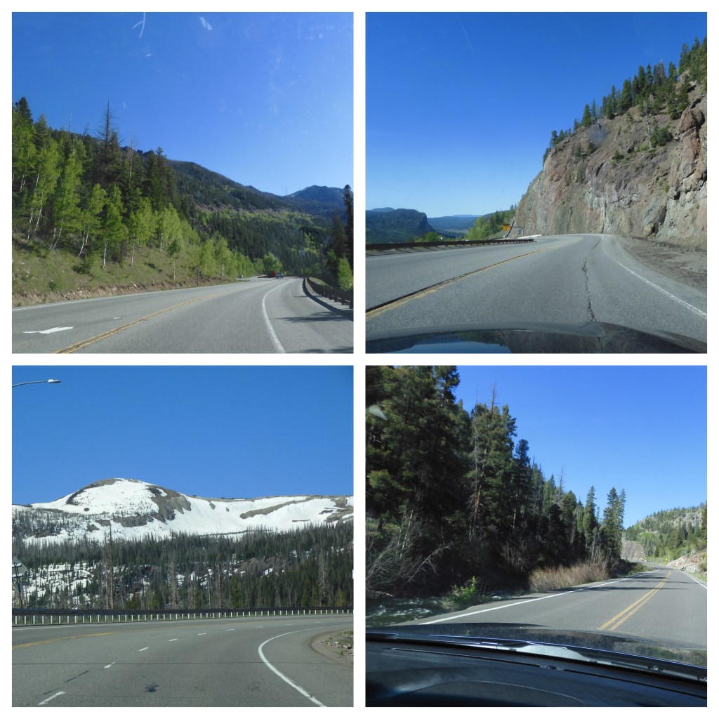
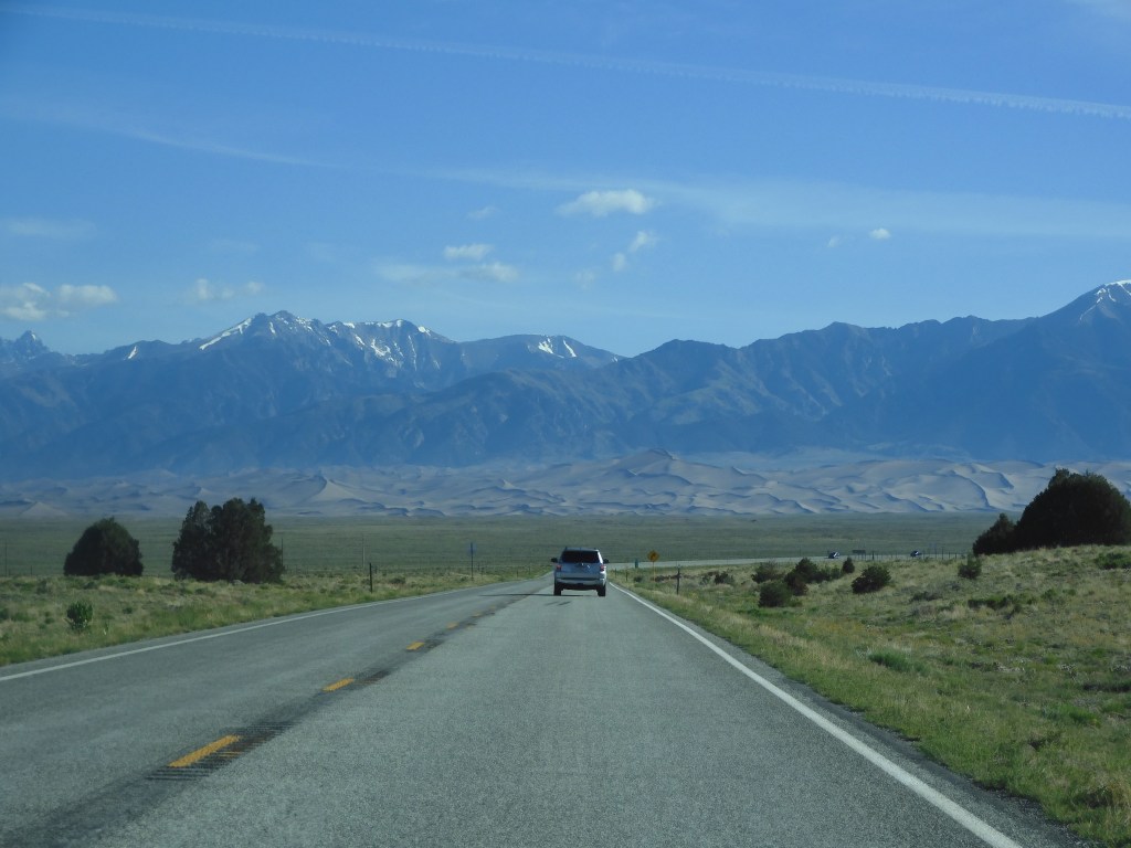
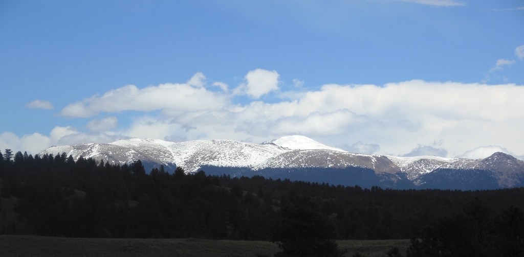
Today’s drive from Alamosa to Cortez was on a US highway. Sometimes it was two lanes, sometimes four. The route includes high mountain valleys, some rushing creeks, forests, rocky mountainsides, and tall mountains. The highest elevation was 10,856 feet above sea level. At Chimney Rock, more later, traffic stopped for construction. We pulled out from a side road and got into traffic behind a semi. I figured we would be stuck behind him for miles. Instead, we worked to keep up with him for over an hour. He led us along the highway no matter how steep the road became. Finally turned onto a different road. Forty years ago as we drove the Pennsylvania Turnpike, whose mountains were nowhere near as high, a car would zip past semis as they labored up hills. Then the semi would reverse the process and zip past the car on the downslope. Today’s trucks are much better engineered and manufactured.

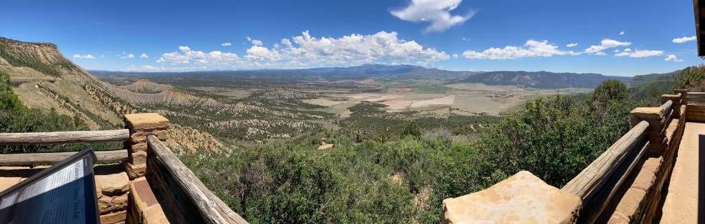
Mesa Verde National Park was created as a national park in 1906 to preserve the archeological heritage of the Ancestral Pueblo people both atop the mesas and in the cliff dwelling below. The park includes over 4,500 archaeological sites, only 600 are cliff dwellings. (NPS brochure) This area of Colorado, and parts of the neighboring states of New Mexico, Utah and Arizona are rich in Native American history. It is said that 24 tribes trace their heritage back to this four corners area.

Lunch included this view from Mesa Verde

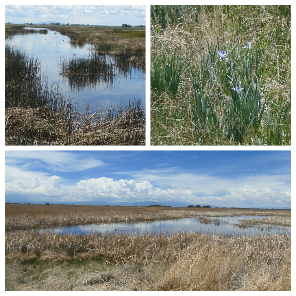
In the afternoon we explored the visitor center for Canyons of the Ancients. This is a national monument also, one administered by the Bureau of Land Management. The U.S. has 129 national monuments with the overwhelming majority administered by the National Park Service. BLM has 29 and the Forest Service is next with 13. The NPS managed monuments seem to get the most attention and visitors. We have visited several BLM National Monuments before, such as Pompey’s Pillar, Rio Grande del Norte, Kasha Katuwe Tent Rocks, and Grand Staircase Escalante among others.

Exhibit at Visitor Center at Canyon of the Ancients

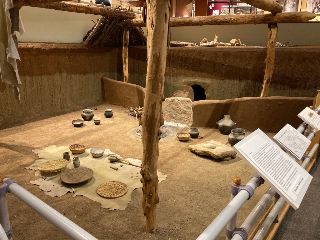
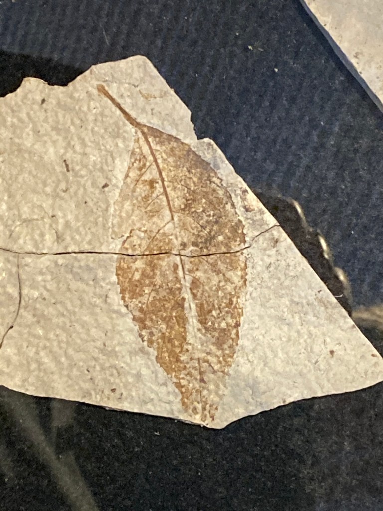
Canyons of the Ancients National Monument is more than three times larger than Mesa Verde National Park. The national monument has thousands of archaeological sites. This high desert area or Great Sage Plains has fertile land and was home to single family farms, villages, kivas, cliff dwellings, reservoirs, etc that supported a densely populated area from AD 500 to 1300. However the national monument only receives 30,000 visitor per year compared to over 500,000 for Mesa Verde. The visitor center is the official repository of items found within the national monument, some of which came from archaeological digs at development sites, such as housing or irrigation projects. The displays are impressive and well laid out. And in these days of COVID-19, it was open.

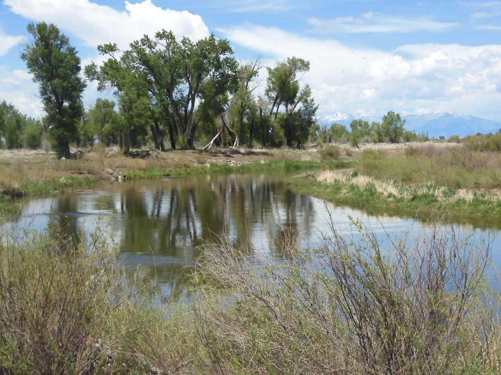
The McPhee Reservoir dams the Dolores River to provide irrigation water for much of southwest Colorado. It is the fifth largest reservoir in the state and its canal system is extensive. The drought here has brought the reservoir levels extremely low and irriagation water is in short supply.

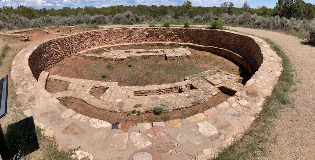
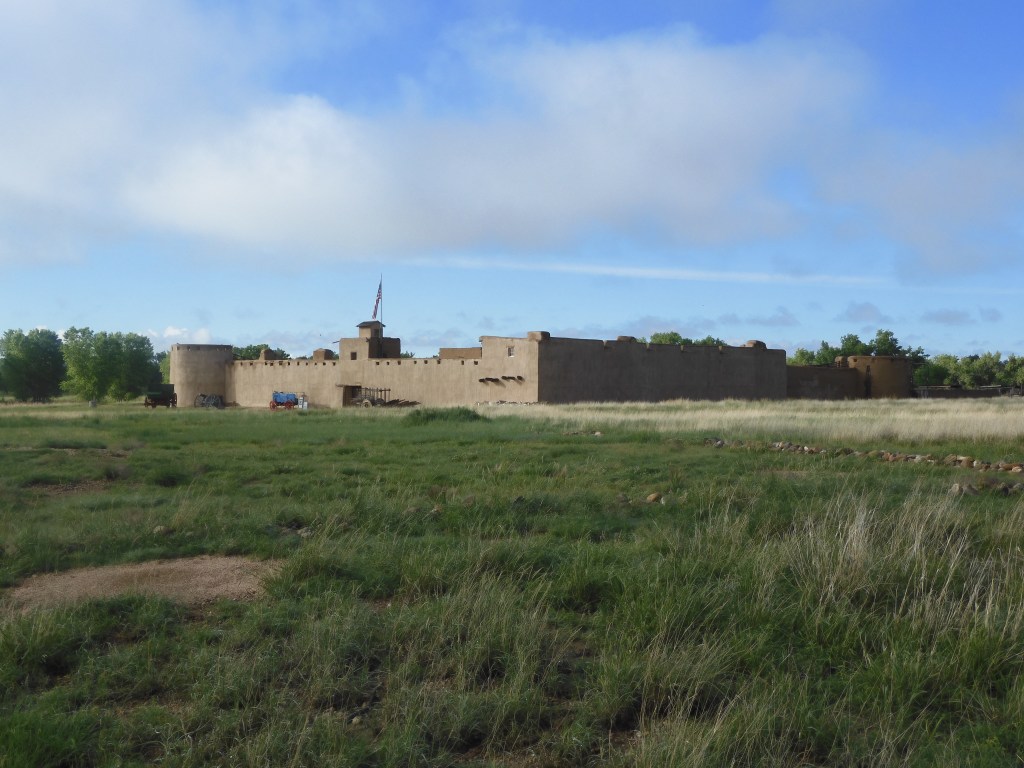
One of the excavated sites at Canyons of the Ancients is Lowry Pueblo. To get there we drove past some of those irrigation canals and observed the dramatic impact the water has. Irrigated farms have crops that are bright green and newly plowed fields are a deep brown waiting for the magic of water and seed to begin growing. It is a modern example of the impact of water and how the Ancestral Puebloans skillfully managed this scarce resource.

Lowry Pueblo is unusual within Canyons of the Ancients. The Great House and Kiva have been excavated and made available for viewing. Most of the national monument though is undeveloped, to respect and protect the items and the heritage of the Ancestral Puebloans. Between the Pueblo and the irrigated fields, Chris and I realized that life has been going on in this corner of the state for untold years and we rarely understand or respect that.

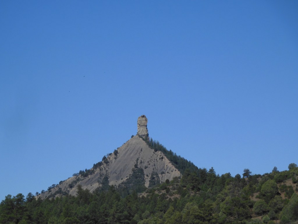
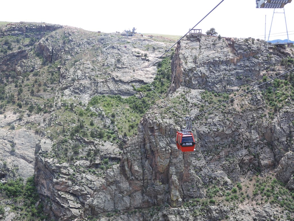
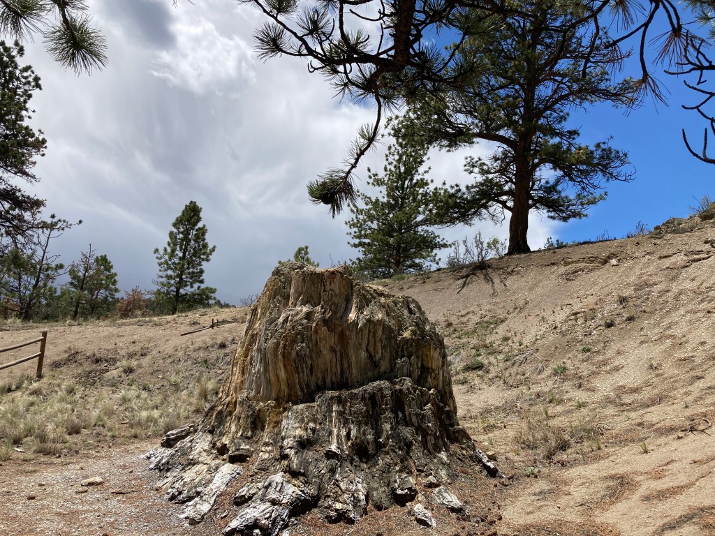
Chimney Rock. Chimney Rock National Monument was a spur of the moment action. We were not aware of this site in our planning. It is managed by the U.S. Forest Service. It too is connected to the Ancestral Puebloan culture and is considered the most remote and isolated community connected to Chaco Canyon. We were on the road west of Pagosa Springs and saw the sign. We were entering into a construction zone and were not sure we could even make the turn off. A car in front of us turned onto the road leading to Chimney Rock so we turned also.

The monument visitor center (Temporary quarters-the new one is currently under construction.) is just ten minutes off the main road. Reaching the rock pinnacle and touring the pueblo area would have required a commitment of two to three hours. We did not believe our schedule allowed it so we noted it for a future trip and headed back to the highway where we picked up the trail of the semi.

Chimney Rock

Ed Heimel, Chris Klejbuk Cortez CO June 5, 2021

Categories: travel | Tags: , , | Leave a comment

2021 Southwest Circle Tour-June 3

Approaching Great Sand Dunes National Park

Alamosa CO, June 3, 2021

No history lesson today. We spent our time visiting a national park and several wildlife refuges. Nothing high-powered, just an enjoyable day in a different part of the country. Today’s national park, Great Sand Dunes National Park and Preserve, has received a lot of hype lately as an under appreciated and less visited park. It seems many people read those comments and decided to put this park on their to visit list.

We left the Best Western hotel in Alamosa in time to reach the park for the 8:30 AM opening of the visitor center. Unfortunately, we made a mistake, not sure how that happened, since the visitor center opened at 9 AM. We took the brief nature walk by the visitor center and then got in line. The walk put us at number two in line instead of number one.

Now, despite being married for over 48 years and having hundreds of days of travel together, we can still differ on how to prioritize our day. Chris wanted to wait in line for the quick stamping of our National Park passport book. Only five people were going to be allowed in the front vestibule for the quick stamping process. I thought it was wiser to go to the back entrance to gain access to the bookstore and ranger information desk. 12 people were allowed in there but their time inside was likely to be longer.

I should have just gone back there rather than waiting with Chris. Made me grouchy, for a short while, as we waited for 9 AM to arrive and the passport book to be stamped. We did have to wait at the bookstore entrance but only for about five minutes before we entered and bought two postcards. In my defense, I was concerned about parking at the sand dune area. Big signs as we came in told everyone to anticipate Limited Parking and Heavy Traffic Expected.

Great Sand Dunes is an anomaly. At the foot of the Sangre De Christo mountains is an area of sand. Sand that one might expect at a nice ocean beach. Acres and acres of sand (30 square miles). High dunes of sand reaching 750 feet. The total park and preserve is over 232 square miles of forest and mountains but most attention is paid to the sand dunes.

Given the unique nature of the park and the heavy hype, I wanted to make sure we were at the dunes area in time for easy parking. Turns out we did fine, got a nice parking spot. My concerns were not unfounded though since from the dunes we later saw long lines of cars coming in and cars being parked way down the road leading to the parking area.

Unlike say, Sleeping Bear Dunes Lakeshore in Michigan, a visitor tromps through Medano Creek before walking through a rocky/sandy area prior to reaching the pure, soft sand of the dunes. As you can probably guess, we did not walk up 750 feet of sand to reach the top of the dunes. Walking in sand is tiring and the elevation here is 7,500 feet above sea level. We put in 45 minutes of climbing up and another 45 minutes climbing down. The weather was perfect, low 70s and practically no wind.

Most visitors were not here to hike to the top of the dunes. Great Sand Dunes replaces a day at the ocean for people in mid-continent America. Sliding down dunes or sitting alongside Medano Creek were the chosen activities. No need to over exert yourself for either of those options. Sure, some younger folks had plans to hike to the top, but they were the exception.

Medano Creek had already reached its peak depth on May 23; today it was 1-4 inches deep. Snow depth in the mountains was lower than usual this year. The creek spreads out, reaching 20-40 feet wide. Eventually the creek starts to dry up unless significant rainfall occurs in the summer.

Why are there sand dunes here? A very brief explanation is wind. Rocks erode and sand and gravel normally wash downstream. Here the mountain ranges create a wind flow that becomes almost circular, keeping the sand in this area and forming dunes.

It was a little early for lunch but we decided to stay and have lunch in a quiet, shaded area away from the dunes. It gave us a chance to continue to enjoy the day without my hyper-ventilating about parking.

Post lunch we visited Alamosa National Wildlife Refuge and Monte Vista National Wildlife Refuge. Both have auto tour routes. Both were practically deserted. Both had only a few bird types evident. Red-winged blackbirds were abundant. We heard new bird cries unfamiliar to us but the birds did not reveal themselves. During the spring and fall migration periods, sandhill cranes are abundant. The time spent did not make for a majestic time, but it was pleasant.

Before coming here, we paid no attention to the headwaters of the Rio Grande River. Probably a bit provincial for people well aware of the headwaters of the Mississippi River. As we arrived in Alamosa and saw signs at bridges noting that we were crossing the Rio Grande River, we said “the Rio Grande? Here?” Sure enough, the Rio Grande River begins in the forests and mountains 60 miles northwest of Alamosa. In our minds there is almost as much water in the Rio Grande in Alamosa as there was in the Rio Grande in Big Bend National Park when we visited in April of 2018. So much water is drawn off for irrigation and drinking as it flows through low rainfall areas that little is left by the time it reaches the Gulf of Mexico.

Rio Grande River

Friday morning we head to Cortez CO and Mesa Verde National Park. Mesa Verde we expect to be crowded and hot.

Post script. Yesterday’s blog left out two photo scenes that I had meant to include so the pics are below. The pictures are of the gondola over the Royal Gorge of the Arkansas River and of fossil samples from the Florissant Fossil Beds.

Ed Heimel, Chris Klejbuk Alamosa Thursday June 3, 2021

Categories: travel | Tags: , , | Leave a comment

2021 Southwest Circle Tour-June 2

Open pit gold mining at Cripple Creek CO

Alamosa, CO June 2, 2021

How about starting today’s blog with the story of the Golden Toothache? Our day started at the Heritage Center in Cripple Creek, Colorado. Cripple Creek is best known for its gold mining rush that began in 1890 after Bob Womack, a local prospector, found a major source of gold. Finally, 12 years of prospecting in the Pike’s Peak area ignored by others panned out. One big reason— Bob was staked to his efforts by a local dentist. Bob had a toothache, the dentist fixed it but also listened to Bob’s tale of prospecting. The dentist believed Bob’s one good lead would be successful and it did. Bob’s claim led to other prospectors prospecting in the area and Cripple Creek’s boom time had begun.

The video in the Heritage Center portrayed a series of vignettes highlighting aspects of the boom times in Cripple Creek. Fortunes were made and lost. Mining conditions led to successful union strikes followed later by successful union busting efforts. Railroads came and went. Gold production peaked, bottomed out, and has recovered again. Cripple Creek, like many other boom towns, had culture and education to put a big city to shame. Each of these vignettes, and others, could be a blog post in itself.

Today Cripple Creek still has an open pit mining operation. Dwarfed by gold mining in Nevada, the open pit mine is still productive. Regulations now require reclamation of the pits, which seems successful to our eyes. More of the Cripple Creek economy seems driven now by tourism and gambling. Gambling has led to renovation of the old brick buildings from Cripple Creek’s boom times.

Part of downtown Cripple Creek

We spent the morning in Cripple Creek, walking the downtown, viewing the mine, exploring the Heritage Center’s numerous exhibits, finishing off with a picnic lunch outdoors. Clear skies with a breeze made for a refreshing trip.

Then it was time to head out. On the outskirts of Cripple Creek was a display outlying the various road and “scenic byways” of the area. Our next destination was the Royal Gorge Bridge west of Canon City. Google Maps, remember our experience at Sand Creek?, outlined three options. The middle one seemed the most direct and quickest. All three would be scenic. The display described one route as “unpaved, rough, winding.” A second route was described as “unpaved, 4-wheel drive recommended, part of route one lane.” The third route was described as “well maintained, no vehicle restrictions.” We chose the third option.

The drive was scenic with mountains and valleys, rock formations, cattle ranches, and dotted with large and small homes in abundance. Blue skies alternated frequently with cloudy skies, brief showers, and black rain clouds which popped up in every direction but missed us.

The Royal Gorge Bridge is ranked as the highest bridge in the U.S. and in the top 20 highest bridges in the world. It is 950 feet from the bridge planks to the Arkansas River below. It was built solely as a tourist attraction in 1929 and has remained so today. It is only for walking, no cars allowed. The bridge area has added amusements ranging from play areas for kids to a theater to zip lines over the gorge.

View of Royal Gorge Bridge and Arkansas River from gondola

Chris and I chose the more sedate options of the gondola ride one way and walking back across the gorge. I thought I might get vertigo on the bridge, I have on others. I did not. I attribute that to the fact the Royal Gorge bridge is wide enough with railings ample enough to feel secure. Screams from zip liners and the train whistle of the excursion train along the edge of the river punctuated the air. Down below, rafters were challenging the rocks and rapids.

View from the Royal Gorge Bridge

From the bridge we had another drive to Alamosa Colorado. The road again showcased mountains with the Sawatch in front of us and the Sangre de Cristo on our side. The traffic was much heavier as the new roads were U.S. routes versus state and county roads. Alamosa is the closest town to the Great Sand Dunes National Park and Preserve. It will be our primary destination tomorrow.

Cripple Creek CO at an elevation of 9500 feet above seal level

Ed Heimel, Chris Klejbuk

Alamosa CO June 2, 2021

Categories: travel | Tags: | Leave a comment

Southwest Circle Tour-June 1, 2021

Bent’s Old Fort

Manitou Springs, CO June 1, 2021

Pikes Peak or bust. An old saying. Today we said, bust. We were scheduled for the 1:20 P.M. tram ride to the summit of Pikes Peak. The Broadmoor Manitou and Pikes Peak Cog Railway just reopened after a three-year rehabilitation and replacement effort. The ride would be about a three hour round trip up and down including 45 minutes at the peak. At 10:42 AM, as we were nearing Manitou Springs after driving from La Junta Colorado, we received a text saying that the Cog Railway will not go to the summit today. Due to snow, ice and high wind at the summit, they would stop at a place called Windy Point. We decided to take their offer for a full refund and reschedule for sometime in the future. The option was to go to Windy Point with a 25% reduction in the fee.

The day started out fine. Yesterday’s clouds and rain gave way to bright blue skies. Our first stop, Bent’s Old Fort National Historic Site was opening at 8 AM starting today. Previously Bents Old Fort opened at nine which would’ve been a tight fit to see it and get to Manitou Springs for our tram ride. Given all of the traffic in Manitou Springs and the parking issues, the tram people wanted you there at least an hour beforehand. So an 8 o’clock opening came in handy. As frequently happens with us, we were the first people there. In fact, we were the only people visiting during the first hour of operation.

What we visited was a reconstruction. It is unique because it is a complete reconstruction, only possible due to meticulous drawings and measurements taken by US Army Topographical Engineer Lt.James Abert and a three year archeological excavation in the 1960s. Lt. Abert was at the site in 1845 and 1846 as he recovered from illness.

For the reconstruction, a custom built machine was used to make 160,000 adobe bricks. Skilled craftsmen used cottonwood and ponderosa pine to support the roof and make doors and windowsills. Blacksmiths had to fashion hardware throughout the fort. The reconstruction was a two year effort completed in 1976, in time for the U.S. bicentennial and Colorado centennial.

Interior of the fort

Ben’s Old Fort was located at the junction, la Junta in Spanish, of the Arkansas River and the Santa Fe Trail. For those of you weak on your US history, the Arkansas River used to be the border between the US and Mexico. Many people believe the Louisiana purchase gave the United States the territory between the Mississippi and the Pacific. Not so. Mexico used to claim the entire territory of New Mexico, Arizona, California, Utah, Nevada and part of Colorado. Oh yeah, and Texas.

The fort was located at the cross road of cultures. English, French, Spanish, and numerous Indian dialects were spoken here. William and Charles Bent and their partner Ceran Saint Vrain build the fort as a trading post at this juncture in 1833. They had been successful traders. The fort increased their presence; partially enhanced by Williams’s embracing the frequent practice of western traders to marry Native American women. William married four Native American women, several at the same time. Marriage gave traders credibility and entre into the practices of the Native Americans. Charles was appointed Territorial Governor in New Mexico and killed during the uprising there in 1847.

In 1846, the military used the fort as a staging area to enter and take over parts of Mexico. Military usage and the growing stream of settlers and gold seekers disrupted the long and friendly trading practices between the Bents and Native Americans. Bison were killed off and settlers used up most of the little quantity of wood. The economic value of the fort plummeted. St. Vrain sold out to William Bent. In 1849, the fort burnt to the ground. Cause of the fire is not known with many unproven explanations.

During its 16 year run, Bent’s Old Fort was the most imposing and richly maintained edifice on the prairie. It’s adobe construction required over 100 Mexican artisans from New Mexico. Not only an economic engine, the fort served as a peacemaking and neutral meeting ground. William Bent continued to play a role in the area after the fort burnt as well did his children.

Since Pikes Peak was a bust, we continued our journey to Florissant Fossil Beds National Monument, about 20 miles past Pikes Peak. Due to Covid, the interior exhibits were closed. There were a few fossils outside at a table with a volunteer. Over 50,000 fossil specimens have been distributed to scientists and museums around the world. The fossils were discovered in the late 1800s. Several notable scientists made their reputations doing archaeological excavations here. Untold numbers of fossils were hunted and sold by private citizens for decades. Other fossils probably exist beneath the ground. Today, the main fossil visible attraction is the remnants of petrified redwood trees that existed in the area before being chipped away by scavengers.

One of the petrified redwood trees with blue skies on the right and incoming clouds on the left

The National Park Service obtained the location in the 1970s from private owners who had marketed the location as a recreation and fossil hunting area. It was facing the possibility of being developed for housing. Today it protects an area which over eons has experienced marked shifts in climate, topography, and flora and fauna. Lava flows from numerous volcanic eruptions 34 million years ago preserved the flora and fauna that the volcanoes were killing. Because of the lava, the Florissant Fossil Beds are home to one of the best known and richest paleontological resources in the world. Fossil viewing here is not spectacular. Florissant is a unit of the NPS because one of the missions of the Park Service is to preserve and protect natural and cultural resources.

Covid Update. During this trip we will stay one night at a Country Inn & Suites, a Days Inn, and a Springhill Suites; four nights at Best Westerns; two nights at Air BnBs; and six nights at Hampton Inns. We thought you might find value in travelers’ impressions So far, each hotel has had a plexiglass barrier at the front desk. Two hotels gave you clean pens. Two hotels had pools open although with some restrictions. Each claim to have enhanced cleaning which also usually means no maid service if you stay for longer than one day. Hampton Inns place a seal on the door after the room has been inspected after cleaning. Hot breakfast food is starting to come back but normally dished up for you as you wait at a table next to the kitchen. Hampton Inn has bagged breakfast to go that is hearty and tasty.

The morning breakfast bag from Hampton Inn

Dinner tonight was at Rudy’s Bar B Q . You place your order and pick your seat at one of the long tables. The food was good although the beans were a bit spicy for us. We would come back.

Mask wearing is a bit confusing right now in Colorado. Local option rules. Last night’s county was in a good place so no masks were necessary. In Manitou Springs they are required in all buildings. At Florissant Fossil Beds, the county did require a mask. Just keep one in your pocket and read the signs.

Pike’s Peak from Florissant Fossil Beds-the peak with the most snow

Ed Heimel, Chris Klejbuk, Manitou Springs, CO

June 1, 2021

Categories: travel | Tags: , , , , | Leave a comment

Blog at WordPress.com.