Monthly Archives: May 2021

2021 Southwest Circle Tour, May 31

Advertising Peony Festival in Stockton KS for Saturday May 29

La Junta CO May 31, 2021

National parks. Yellowstone, Everglades, Yosemite, Acadia, Glacier. That’s what you think of when we say national parks, correct? Yet there are over 420 national park units. Today we visited two of them, distinctly not like those mentioned above.

The mission of the National Park Service encompasses natural and cultural resources. That is why national battlefields, Independence Hall, and the Herbert Hoover National Historic site (among many others) are units of the National Park Service along with great scenic parks one normally associates with the NPS. Today’s sites were Nicodemus National Historic Site in Kansas and the Sand Creek Massacre National Historic Site in Colorado. We will be able to touch on each site only briefly; hopefully you will be interested enough to pursue further information on your own later.

Founded in 1877 by a white developer and local black minister, and assisted by five black ministers from back East, Nicodemus was created as a town built by and for black settlers. Kentucky and Tennessee sent the largest number of settlers, most of them newly freed slaves. It was an opportunity to own land and make decisions for themselves. The town grew and prospered with general stores, bank, lawyers, newspapers, blacksmith, etc. Yet like many other towns in America, Nicodemus’ prosperity was damaged when the railroad chose a route south of Nicodemus. Many settlers moved to seek greater prosperity elsewhere, and the double whammy of the dust bowl and Great Depression led the town to wither to almost nothing.

Upper left the old hotel, upper right one of two schools, lower left the AME church, lower right the Town Hall and current NPS Visitor Center.

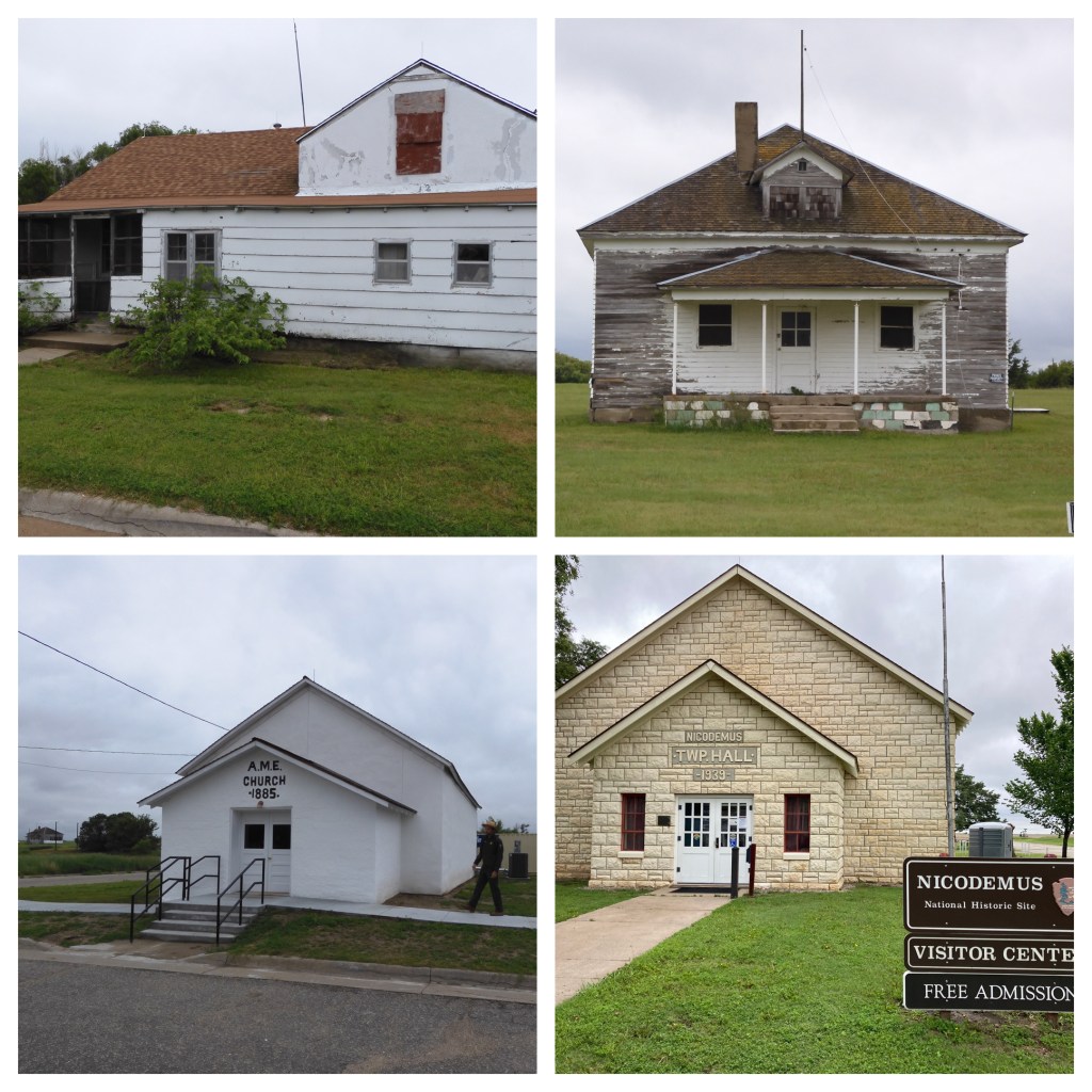
Yet the historic site tells an important story of the American post-Civil War period and the efforts to fight the Jim Crow society developing in the South. There are five remaining buildings from the period. Every summer for over 130 years, hundreds of the descendants of the original settlers return to celebrate their roots. Even while we were there, a person stopped in because a co-worker in Denver with roots here told him to visit. One of the two park rangers we talked with traces her roots to the town.

The other park ranger gave us a personal walking tour of the community, interlacing history with stories from the oral history of residents and other descendants. The tour brought the town alive for us, and coupled with the park videos, one leaves Nicodemus with a greater appreciation of the richness of U.S. history and the multitude of ways blacks fought to shake the personal harm done to them by slavery. Why not take a few minutes and check out the Nicodemus videos available on the web?

Views from along the journey

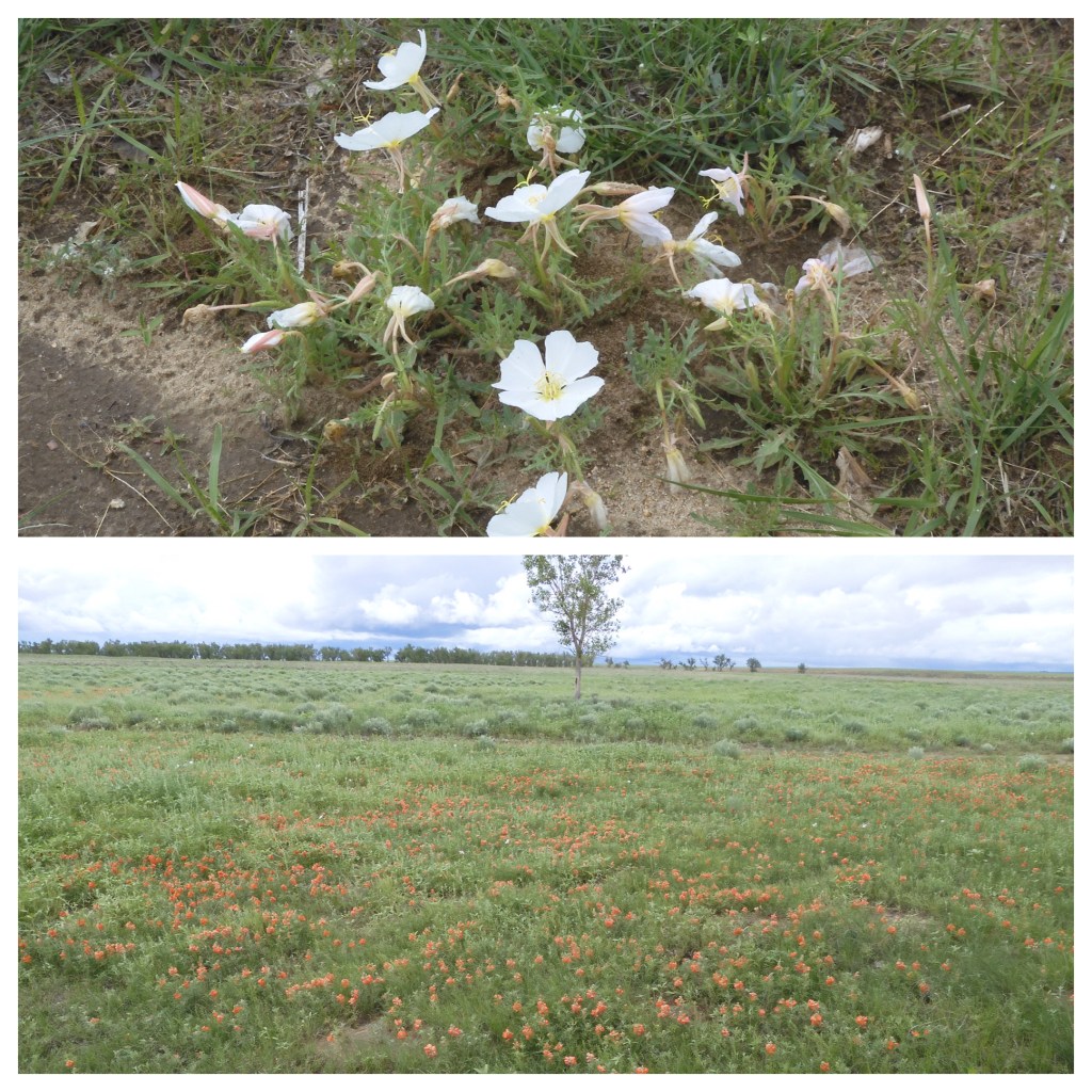
While Nicodemus is located off the major interstates and tourist trap routes, the roads to get there are well paved. Traveling back roads provides an opportunity to notice little details and points of information. One teeny town had its own brewery and tap room; a second was holding its annual peony weekend with life sized dolls; Kansas has 24 major reservoirs impounding water for flood control, irrigation and recreation (we passed several of them); topography changes from flat land to rolling hills to bluffs; and you can enjoy a up close and personal view of those crop circles you see from planes traveling over “fly-over country” as the huge, wheeled irrigation systems drain the aquifer but provide the food that feeds you. We even passed probably close to 200 empty train cars designed specifically to transfer automobiles from manufacturing plants to dealers. They were sitting on sidings in western Kansas waiting for car manufacturers to ramp up their production once computer chips become more plentiful.

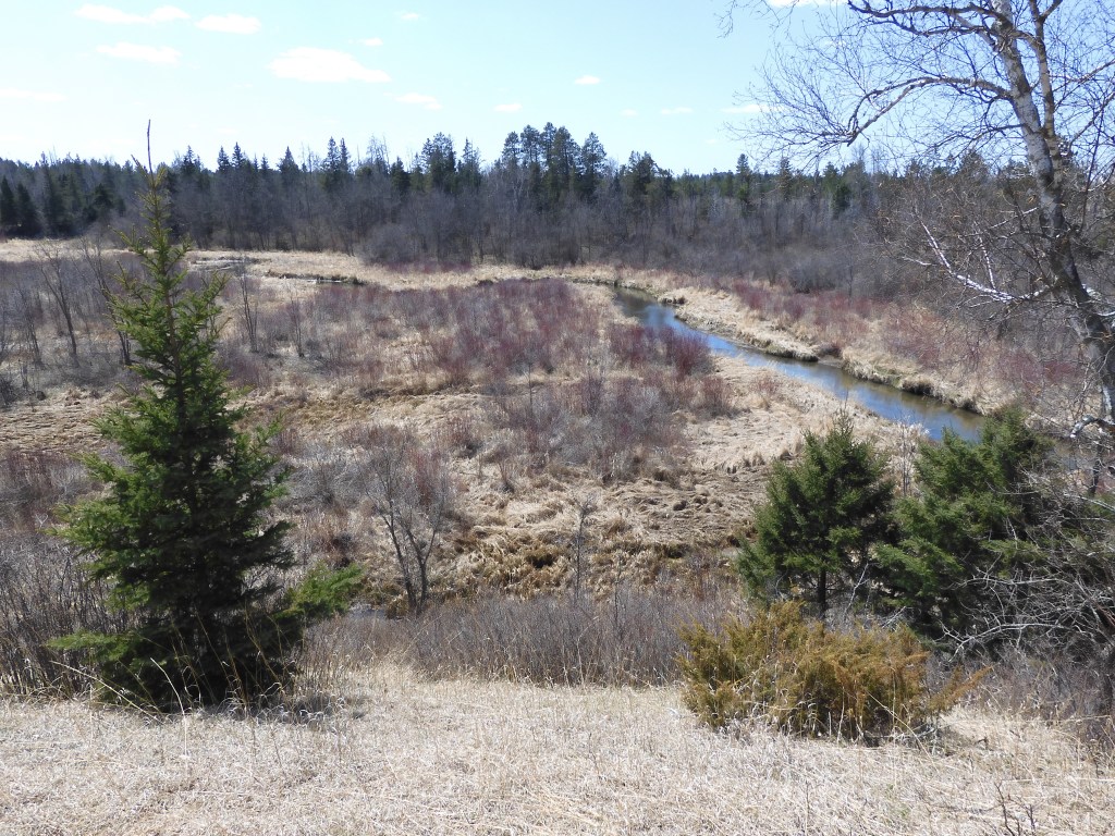
Our second NPS unit, Sand Creek Massacre Site, presented an American tragedy. Hopefully you have not gone into the myth of the cowboys and Indian themes so prevalent in America. Hopefully you understand that Native Americans, after being decimated by illnesses new to them, were kicked out of their homeland, promised much and delivered nothing, and had their traditions and children stolen from them.

Even if you are a person that believes Native American warriors massacred individual settler families without any provocation whatsoever, you should truly also believe that innocent men, women, and children should not be slaughtered in cold blood by anyone. In a nutshell, this is what happened at Sand Creek Colorado. While we had prepared ourselves by reading and watching videos, we were fortunate to just make the 2 o’clock presentation by another extremely knowledgeable park ranger. Her one hour description of the backdrop of Indian-settler relations in the West during the Civil War and the actual timeline of events was sobering and disturbing.

Native Americans had their own disagreements about how best to deal with a continual loss of their homeland and broken treaties by the United States. Many of them realized that despite the broken promises, the Indians had little chance against the massive numbers of settlers and United States Army. Many tribes and subsets of the tribes, under their own individual chiefs, surrendered to the military and civilian authorities with the promise of safety and relocation to new homelands. Here at Sand Creek, in 1864, members of the Cheyenne and Arapahoe tribes had already come to agreement with the governor of Colorado and the military commander of US forces, Col. John Chivington.

The Sand Creek Massacre site; the actual site is considered sacred burial grounds and not accessible by visitors.

Colonel John Chivington, the top US military commander in Colorado, had told the peace seeking members of the tribe to lay down any arms and turn themselves in to Fort Lyon. They did. For weeks the Native Americans had gathered just north of the fort at Sand Creek. Present were about 700 men, women, children and elders. None of them were warriors. For some reason, unknown to this day, Chivington brought his Colorado regiment down from the Denver area. With some troops from Fort Lyon, Chivington went after the peaceful tribes people.

Chivington had four cannon and about 675 soldiers. The Indians didn’t have a chance, despite trying to flee in every direction. When the firing ended, 165 to 200 Cheyenne and Arapaho people were killed, 2/3 of them women, children, and elderly. Another 200 were wounded or maimed. More appalling, is that the next day some of the soldiers came back and looted, scalped, and mutilated the dead. They didn’t even bury the corpses.

Colonel Chivington and his troops talked up their bravery in this great battle. Slowly the details came out, some from soldiers who had refused to partake in the massacre. The governor was forced to resign although Chivington gave up his commission and was never punished. From 1909 to 2002, the state of Colorado had a monument on its grounds commemorating the great battle of Sand Creek as a Civil War battle. When modifications were made, the change only said the earlier monument designers had mis-characterized Sand Creek as a battle.

The Sand Creek massacre had massive implications as Native Americans who were against a peaceful rapprochement with the US had enhanced standing and increased leadership roles due to the death of many peace loving chiefs at Sand Creek. What Indian chief could promote a peaceful settlement when US troops had massacred so many people who were following the rules laid down for a peaceful resolution? For the Cheyenne and Arapaho people, their traditions, family providers, and lands died also at Sand Creek.

The stories that belong to our journeys are not just the locations that we visit. Part of the stories are the journeys themselves. Today’s journey had a particularly interesting but brief experience. The Sand Creek Massacre site has its major entrance from the south. This was the entrance described in the website. We were approaching Sand Creek from the north and east. Google maps gave us an alternate route that would be shorter than circling around to the south. We chose it. Mistake.

The alternate route had us going down a dirt County road. Now as faithful readers know, we have taken many dirt and back roads around the United States. The vast majority of the time this is fine. Today’s road joins the smaller list of memorable but horrendous roads. This road made the list because the road bed was wet sand turned into slippery mud. Little to no gravel to give support to the road surface. We made it maybe a football field’s length before the car’s sliding and poor road conditions seemed likely to put us into the ditch. Recognize once again, this is not a populated area, on a lonely road, with poor cell service. Even executing a K-turn was out of the question. We needed all of the Subaru’s all wheel drive to slowly back up the way we came. Frequently we stopped and pulled forward a bit to gain a few more feet of road away from the ditch. Of course, it was raining so looking out the back window, the side mirrors, and the rear view camera were not sufficient. Chris and I both had our doors open to get a better sense of where on the road we were and how poor was the traction.

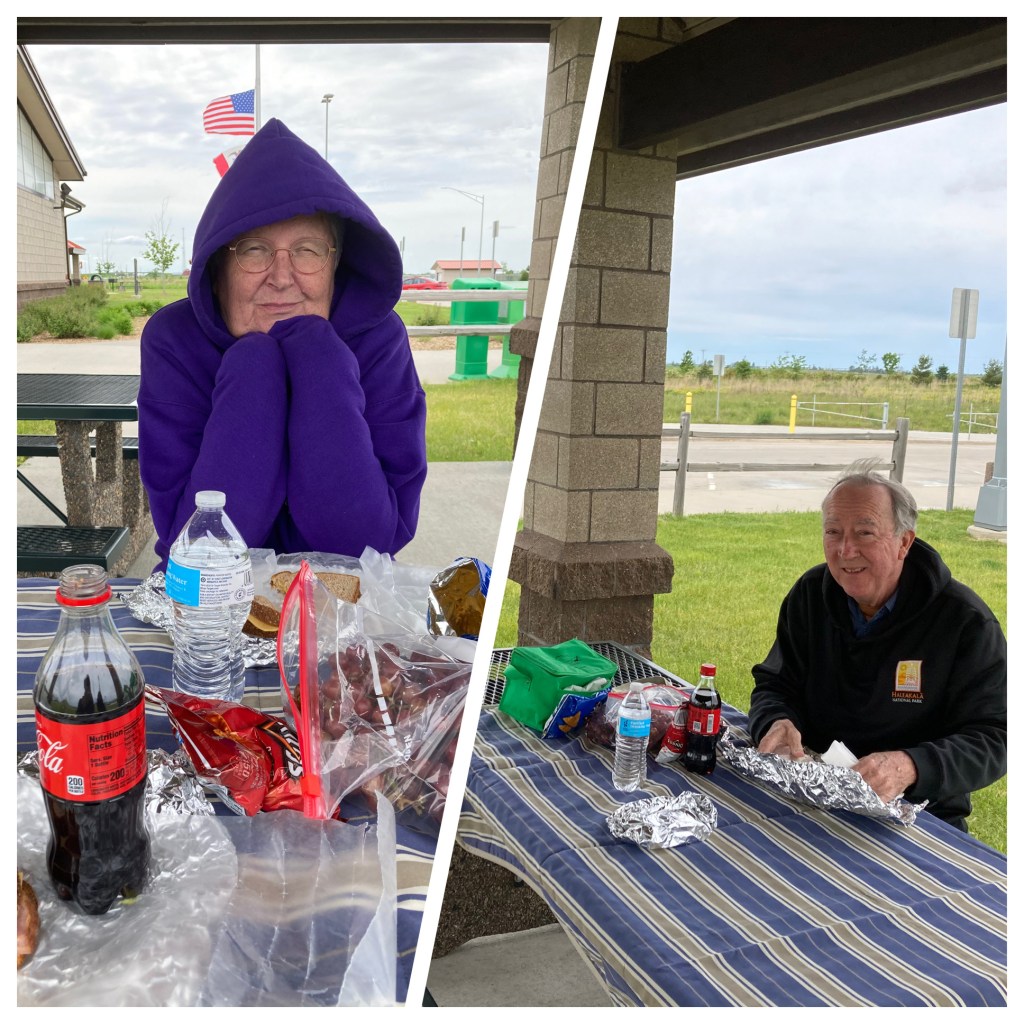
Then we come to La Junta, our locale for tonight’s lodging. Chris has read about how La Junta is a “gem”. Sometimes first impressions are incorrect, maybe La Junta is a gem. But we arrived in town by way of the large and smelly cattle feedlot; drove through streets that were muddy from recent rains that must not have just flooded roads but brought all of the dirt from surrounding properties onto the street; and had a hard time finding a gas station that did not seem sketchy. The strip with the major hotels is across from the rail yards. Even the McDonalds looked deserted. We bought sandwiches at Subway and ate in our room.

Some prairie wildflowers from Sand Creek to end the day on a bright note.

Ed Heimel, Chris Klejbuk

La Junta CO May 31, 2021

Categories: travel | Tags: , , , | Leave a comment

2021 SOUTHWEST CIRCLE TOUR—May 30-31

Kearney, NE May 30, 2021

Map of 2021 Southwest Circle tour to Flagstaff and back

Day one was a chance to see if we have remembered how to travel. This trip will take us to Flagstaff Arizona through Kansas and Colorado and returning home through Utah and Wyoming. The car is not overstuffed; of course the top of Pikes Peak will probably be as cold as we get for the next 19 days. So there is no need for winter clothing.

No major problems today. We had packed ham and cheese sandwiches and ate those north of Des Moines Iowa. We were looking forward to a nice juicy hamburger and handmade shake in Kearney Nebraska but forgot this is Sunday and Angus Burgers and Shakes closes at 4 PM. Our fallback location was Runza. This is a Nebraska chain selling burgers and their own handmade sandwiches. But their sandwiches remind us of the pasties from the UP of Michigan. Fresh dough like a soft grinder roll filled with ground beef and vegetables and spices. We have had it before and enjoyed them.

Lunch at Iowa rest stop

The travel route so far was south on interstate 35 and west on interstate 80. A route frequently used before. I even remembered which rest stop had the wind turbine display and the town with the windmill museum and the Museum of Danish America. You leave the flat farmlands of northern Iowa and enter the rolling hills of western Iowa. Yes, western Iowa does have some hills. They’re called the Loess Hills. Loess comes from the term meaning wind blown sand and drift from glaciers.

Originally we thought about taking some extra time and exploring the Loess Hills scenic byway and a little bit of time in Omaha Nebraska but the locations we wished to visit were not yet open. We will have to push them back for another trip. The last two times I was in Omaha was for the funerals of my aunt and uncle. Not exactly a sightseeing type of visit. Today was rainy, cool, and cloudy. Tomorrow is expected to be similar. A full day of driving in that type of weather is not a problem, much better than hiking in it.

We rotated driving duties taking frequent breaks. They were so frequent that some of the trucks we passed four or five times as we went past them and then stopped at a rest stop and then caught up to them again. Into our past repertoire of CDs, talking, and silence we added listening to podcasts. Something new for us, probably normal for most of you, but brought to us by our daughters.

It was probably just the luck of the draw but in Iowa we noticed numerous farms that were using buffers of grass to catch and prevent erosion and run-off while we did not see that at any farms in Nebraska. On Monday we will be driving primarily on back roads of Nebraska and Kansas which should provide a better framework for making a comment.

There was some trepidation about driving on Memorial Day weekend. So far it has been a breeze. In fact, it might be even better since road construction was evident on interstate 80 but had been stopped for the holiday weekend. All lanes were open for traffic. It appeared that at some locations, for a number of miles, it might otherwise have been single lane traffic while road crews did repaving.

Ed Heimel and Chris Klejbuk

Kearney NE May 30, 2021

Categories: travel | Tags: , , | 1 Comment

Back on the road again-Finally #3

Itasca State Park, MN May 13, 2021

We have truly lucked out with the weather. Most of the day was sunny with a temperature in the 60s. It became a little cloudy in the afternoon with about a 10 minute brief shower after 4 PM. All of our walks today were within Itasca State Park. The park is over 32,000 acres in size with over 100 lakes. There is plenty of area to experience. We chose a variety of trails today. The first trail is part of the hiking club trail system within Minnesota state parks.

Previous readers of this blog will recall that in our travels around Minnesota, we obtain a stamp from each park to verify we have visited the park. We are currently in our second time through the list of state parks and we have been to 27 of the 75 state parks and recreation areas. Each park has had signs indicating a trail with the words Hiking Club. In our first go around, we were unaware of the “Hiking Club” and assumed it was a membership type group.

Later we discovered the Hiking Club is simply one recommended trail at each park to hike. There is a separate Hiking Club booklet where you enter the date you made the hike and you are rewarded with patches, etc. Well, the patches are not our motivation but since we plan to visit each park, we decided this time to walk the Hiking Club trail as we visit each park. To make sure one does not cheat, there is a password associated with each hike. Of course, you find the password at about the halfway mark of each designated trail. As we take the hike, Chris and I have been guessing what the password might be. It is usually related in some way to the park or the trail. Today’s password was Omushkos.

Omushkos is the Ojibwe word for Elk Lake which was the Ojibwe name for Lake Itasca. Itasca was given as its new name by Henry Schoolcraft who “discovered” the lake and named it for the Latin words for truth (veritas ITAS) and head (caput CA ). Of course, Schoolcraft only “discovered” the lake because a Native American leader named Ozaawindib guided him here.

The trail today for the Hiking Club was 3.5 miles and traversed the Deer Park path, a crossover path, and the Ozaawindib path. In this part of Minnesota, glaciers did not leave the flat agricultural lands one finds to the south and west. Instead there is a series of hills, valleys, and indentations that created a hike of ascents and descents over terrain that varies between sand and rocks and tree roots.

Luckily, we were able to be delighted by the vistas. Tall pines, new growth aspen and birch, blue lakes and skies, marshes and lovely wildflowers. The wind was loud but seemed to only blow at the level of the tree tops. We could hear it but rarely felt it. On the trails we took, the wildflowers were usually small and just starting to have fully emerged. White, yellow and blue blooms were abundant but no pink or red were to be seen.

After lunch of tuna salad and crackers back at our cabin, we tackled several smaller hikes located along the Wilderness Drive. Wilderness Drive makes a circle through part of the park and road can be used by cars and bikes. Each of the shorter hikes has a theme: trees blown down by wind, areas replanted by the CCC, etc. Frankly, the Hiking Club trail was more interesting and delightful; even if more tiring.

For dinner we ate at McDonalds as we returned to Park Rapids to upload photos. Just because I bought more data time did not mean the Internet speed out here at the park increased.

Tomorrow we return home with an intermediate stop at Charles Lindbergh State Park in Little Falls, MN. Our blog post from 2014 Trip Five, Aug. 14 discussed the Lindbergh home historic site. The state park is separate.

Ed Heimel, Chris Klejbuk May 13, 2021

Categories: travel | Tags: , , , , | Leave a comment

Back on the Road Again-Finally #2

Itasca State Park, MN May 12, 2021

As one drives around this area with its mix of forests, water, agricultural land and small towns, you might think all is well with the world. Unfortunately, not so much. Enbridge Energy is constructing a replacement oil pipeline from Canada across Minnesota to Superior WI called Line 3. The line has been hotly debated and evidence of the construction is evident frequently as we drive through this area.

The most visible evidence we observe are the proliferation of yard signs saying: Minnesotans for Line 3. They are in yards throughout the area and along the many locations where the pipeline crosses roads or where access roads for construction have been built. The lure of jobs and a replacement oil transmission line that is promised to lessen the chances of an oil spill has them supporting the replacement line. We have passed numerous swaths of land with cleared land where the pipeline has already been built or staging areas with various construction materials stored.

Not as visible but vocal and with legal challenges outstanding are the concerns of the Ojibwe tribes of northern Minnesota. Remembering many lifetimes of broken treaties, land theft and failure of corporations to address environmental disasters and potential disasters, they believe this latest intrusion on their native lands threatens the environment and their traditional way of life. Pipeline oil spills could wreck havoc on the many marshes, streams, and lakes throughout the region.

It seems likely the Line 3 replacement will be going forward. In the years to come, we will find out if environmental damage occurs, and if so, how extensive the damage was and how well the clean up controlled environmental damage.

On a happier note, our lodgings at Itasca are sweet. The two pods of six year round cabins with heat, indoor plumbing, kitchen and linens for $105 per night are a great get away option. These units are newer. More traditional log style cabins, many without kitchens, are located around us and along the lake shore. The primary focus for lodging and eating at Itasca State Park is Douglas Lodge. (See picture at top. I have not yet figured out how to add captions to photos.) Douglas Lodge is seasonal and not yet open. Cleanup work is still going on of the grounds close to the lodge so everything will be looking immaculate for Memorial Day opening.

Some of the cabins here, the headwaters rock crossing, and many of the trees were planted by the CCC-recall that the loggers cut down most of the trees in the park back after Mary GIbbs was replaced as superintendent.). Itasca State Park is but one of many monuments to the work done by the Civilian Conservation Corps in the 1930s. Amazing how many of their structures are being used almost 100 years later and they are still in great shape. We have seen them in numerous parks throughout the state and throughout the country. Our state and national parks would be so much less well endowed with the facilities that enable us to enjoy the outdoors without the CCC.

Last night Chris and I walked down to the lake shore and just sat and listened to the silence. Periodically we would hear the call of a loon or other birds that we could not identify. https://loon.org/the-call-of-the-loon/ Hearing loon calls lets us know that we are truly Up North. Otherwise the silence was golden. It is not yet busy here, although I expect we will have more company as we get closer to the weekend. After the pandemic hit, we really cut back on talking to people walking along various trails we took in the Twin Cities. Thus it was refreshing to accept the offer to take the photo of the only other people walking along the headwaters of the Mississippi. After Chris took their photo, it turned the couple was from Red Wing MN. He works for an agency in Saint Paul and one of his co-workers lives in our condo. She just retired from a suburban government from a town where I lived as a child. Small world.

Today’s major outing was a drive over to Tamarac National Wildlife Refuge; it is about an hour west of Itasca. As we drove west, we left the forested areas and rejoined the richer agricultural farm lands of Minnesota. The soil is a rich dark color but irrigation was still obvious throughout the drive.

Minnesota has four biomes, or environmental regions of varying characteristics. The four are the Laurentian Mixed Forest, the Eastern Broadleaf Forest, the Prairie Parkland, and the Tallgrass Aspen Parkland. In this part of the state, the first three come together and you can come drive from one to the other without fully realizing it. (There are no boundary signs!!) Even the Tallgrass Aspen Parkland is just a short drive north of here.

Generally speaking, the Laurentian Mixed forest is in the northeast part of the state, the portion we call the arrowhead region, along Lake Superior. Here the forests are thicker, the coniferous trees are abundant, the ground is rocky and waterfalls and rivers are more abundant. The eastern broadleaf forest runs in a narrow band up near the north west corner of the state in a narrow swath until it widens at the south east corner of the state. The Prairie Parkland is wide at the southern and southwest corner of the state and narrows as it moves northward. The Tallgrass Aspen Parkland is a small rectangle near the northwest corner of MN but inland a bit from the North Dakota border.

Chris and I learned all this through a 12 week course that says we are now a Minnesota Master Naturalist. Believe me, the title has not gone to our heads. There is a lot to know and we have just started to scratch the surface. Our course only covered the eastern broadleaf forest, the area around the Twin Cities and NW and SE of them. This Zoom held course was one of the activities that we picked up during the pandemic. Sometimes the technology of handling the Zoom class and related breakout sessions was more challenging than we desired. However, we persevered.

Now when we walk and drive through a natural area, such as Tamarac National Wildlife Refuge, it takes a lot longer. We used to have to watch our footing so we would not trip on tree roots and stones as well as enjoying the vista in front of us. Now besides those, we have to listen and look for birds, look for the plants and wildflowers at our feet, as well as trying to guess what types of trees we are passing. We have given up for now trying to worry about what types of rocks and geology we are going through. We will save that for hikes with Chris’s brother.

We saw a few new birds at Tamarac; we are still hoping other users of iNaturalist will come through and confirm their identities. (Thursday morning-iNaturalist people came through and identified several different types of swallows.) Otherwise old familiar friends such as Canada geese and Redwing blackbirds were abundant. For lunch we returned to our old standby of peanut butter and jelly sandwiches but were able to enjoy the view of the water and birds under blue skies and temperatures in the mid 60s. Visitor centers here at the park and at Tamarac were not open yet but we’re hopeful more will be as we undertake our driving journey to Arizona during June.

Dinner was hot dogs, baked beans, cole slaw and root beer. Great meal for being in the woods and traveling. After dinner it was back to the lake and listening to silence and watching the sunset. (Although we did meet and talk to one other person-back to post vaccination behavior.)

{break in time} So the new WordPress editor lost my first three paragraphs which were simply sublime. Under the old system, I knew how to find earlier versions. Then it would not let me enter pictures.{break in time} Okay so now I know where to find earlier drafts and have my first three paragraphs back but still no pics. Oops, there goes my Coke all over my papers, the counter top, and the floor. **&%)!**. {break in time} Now, since the free Internet is so slow, (we already stopped in Park Rapids to upload pictures from the camera knowing about the slowness) Verizon says I am about to run out of data. BUT, I can’t stay connected to the Internet to increase my data plan. **&%#!!**. {Overnight break in time} So, now refreshed, with more data and a sunny day ahead, lets try for pictures. Sometime I wonder why I bother with this blog. Anyway, here goes, you will know the results. Ed

Ed Heimel, Chris Klejbuk May 13, 2021

Categories: travel | Tags: , , , , , | Leave a comment

Back on the Road Again-Finally

Itasca State Park, Tuesday May 11, 2021

Well, it has been 15 months since our last post. This is a travel blog, so I don’t intend to relive our pandemic experience. We each have our own stories. Luckily for us, healthwise and moneywise, our families have done OK during this time period. During the course of the next blog posts, I’m sure I will squeeze in some various experiences and comments about the last 15 months, but they are simply an embellishment, not the storyline.

This trip will be to put our toes in the water and get used to travel again. It’s only three nights, spending time at Itasca State Park in Minnesota, the headwaters of the Mississippi river. On Sunday, May 30, we begin an almost 3 week trip down to Arizona in which we will stop at about a dozen units of the National Park system.

We left Saint Paul at 9 AM for the 4 hour drive to Itasca State Park. The city center blends into the suburbs which blend into the exurbs and finally to agricultural land. North of the cities, agriculture is large scale crop growing with big farm houses, barns, silos and related buildings. As we get farther north, the land is less rich. Pasturelands and grazing for cattle and dairy cows are inter-mixed with timbering operations. Farm houses and barns are smaller and less well-maintained.

Back in the Twin Cities, grass is green, most trees are in full leaf, and wildflowers are growing. As we reach the Itasca State Park area, the trees are just starting to bud and the only flowers are the early, small ephemeral wildflowers. It’s like we went back in time about four weeks.

The temperature was in the low 60s and sunny so we had our picnic lunch outside the visitors center at Itasca State Park. Then we headed to LaSalle Lake State recreation area. This area was established in 2011 around the deepest fully contained lake in Minnesota at 213 feet. A secondary purpose was to protect the rare plants and cultural resources in the forest and wetlands of the glacial valley. However, just after it was established, a heavy wind experience took a devastating toll on the area of old growth jack pine. There are very few remaining stands of old growth jack pine in Minnesota so the damage was particularly ruinous. After discussion and reflection, the Department of Natural Resources decided to replant the jack pine with the seeds from the fallen trees. A portion of the land was enclosed with 10 foot tall heavy duty fence to keep out deer and other animals that would eat the newly planted trees.

As we took our hike, we could see that the trees planted within the enclosure were doing much better than those outside the fence. Outside the fence, the aspen trees, which grow quickly in disturbed areas such as occurred here, have already created a dense area of young growth. While there are young jack pine trees, they are vastly outnumbered and look like they will soon be losing the battle for sufficient sunlight to thrive.

The hike was an out and back so at the turnaround point, one can look down on the Mississippi River. The mighty Mississippi is mighty minimal at this point. It is only a few miles from its headwaters-which was our next stop.

We have been here before, most frequently, but not only, in winter time. we have not told you the story of Mary Gibbs in previous blog post. For those who are younger and more hip, this is not the Mary Gibbs who asked for Disney programming. Or Mary Gibbs was born in 1879 and her father was the first superintendent of Itasca State Park, the first state park created in Minnesota. Mary gives work for her father as a secretary and he died when she was just 24 years old. She was appointed the park superintendent to replace him.

The logging industry was important and influential in the area. One of the logging companies attempted to lower the water level in the park area in order to facilitate its cutting of lumber. At a head to head confrontation at the dam involved, Mary Gibbs ordered the loggers to cease-and-desist and was successful. Briefly. Back in Saint Paul, The Minnesota State Attorney General reversed Mary’s order. Mary was demoted and a new park superintendent appointed, one friendly to the logging industry. Timber was cut in the park area until the supply was no longer financially viable. Mary left the state and moved to Canada where she raised a family and died at age 104 in 1983. There is even a You Tube short video about her.

Since our last posts in 2020, WordPress has instituted a new method of composing and editing. The learning process has grasped the basics and hopes to advance a bit more as time goes on. Maybe eventually the blog can have more graphics and include more creativity in design.

Ed and Chris, Itasca State Park, MN May 11, 2011

Categories: travel | Tags: , , , | Leave a comment

Blog at WordPress.com.