Monthly Archives: November 2014

2014 Trip 7, Nov. 15, So. Cal and Thanksgiving in Flagstaff

Escondido CA Saturday Nov. 15

Driving to the rim of the world scenic byway

Driving to the rim of the world scenic byway

The cloud banks start to roll in on us

The cloud banks start to roll in on us

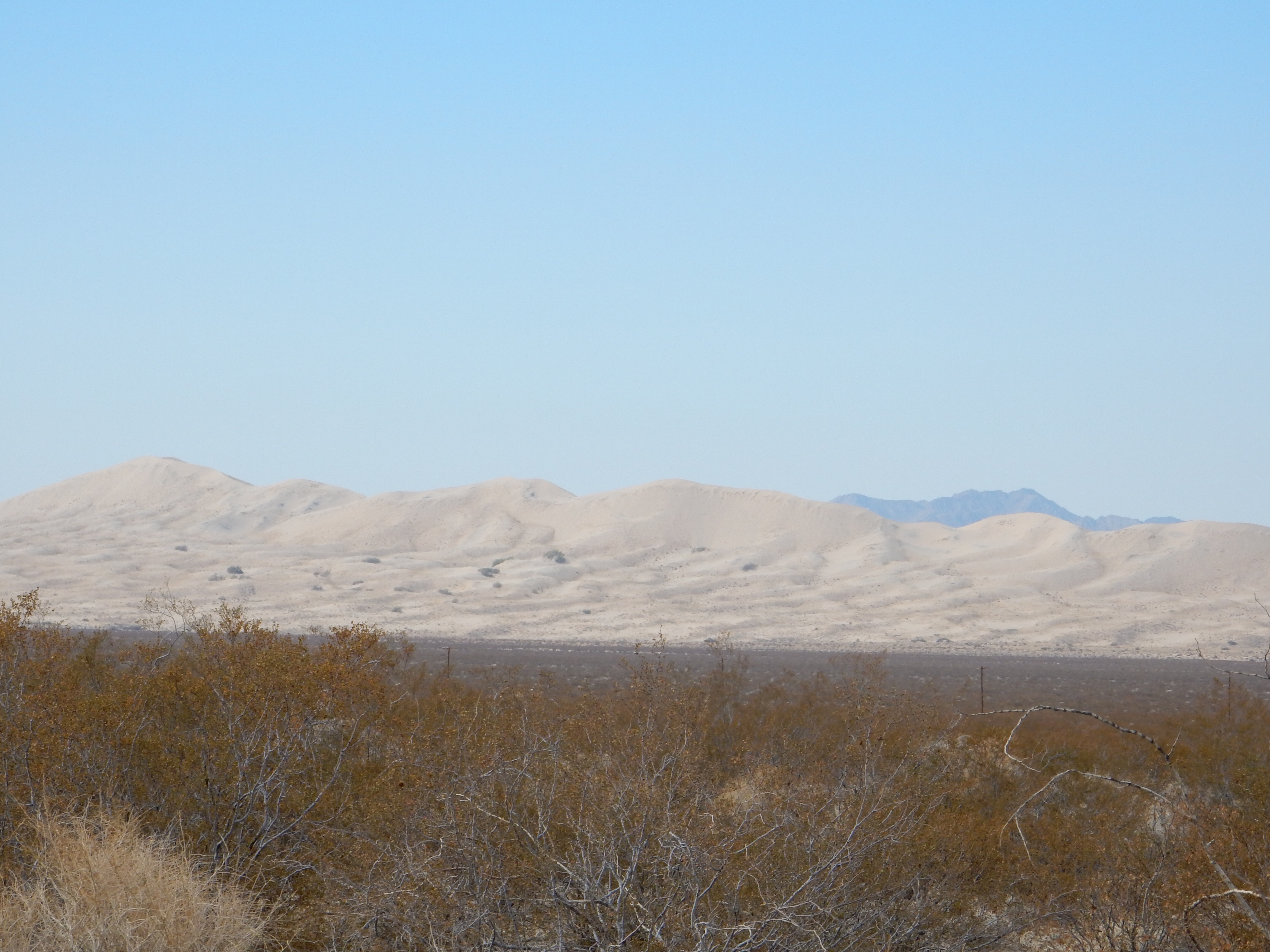
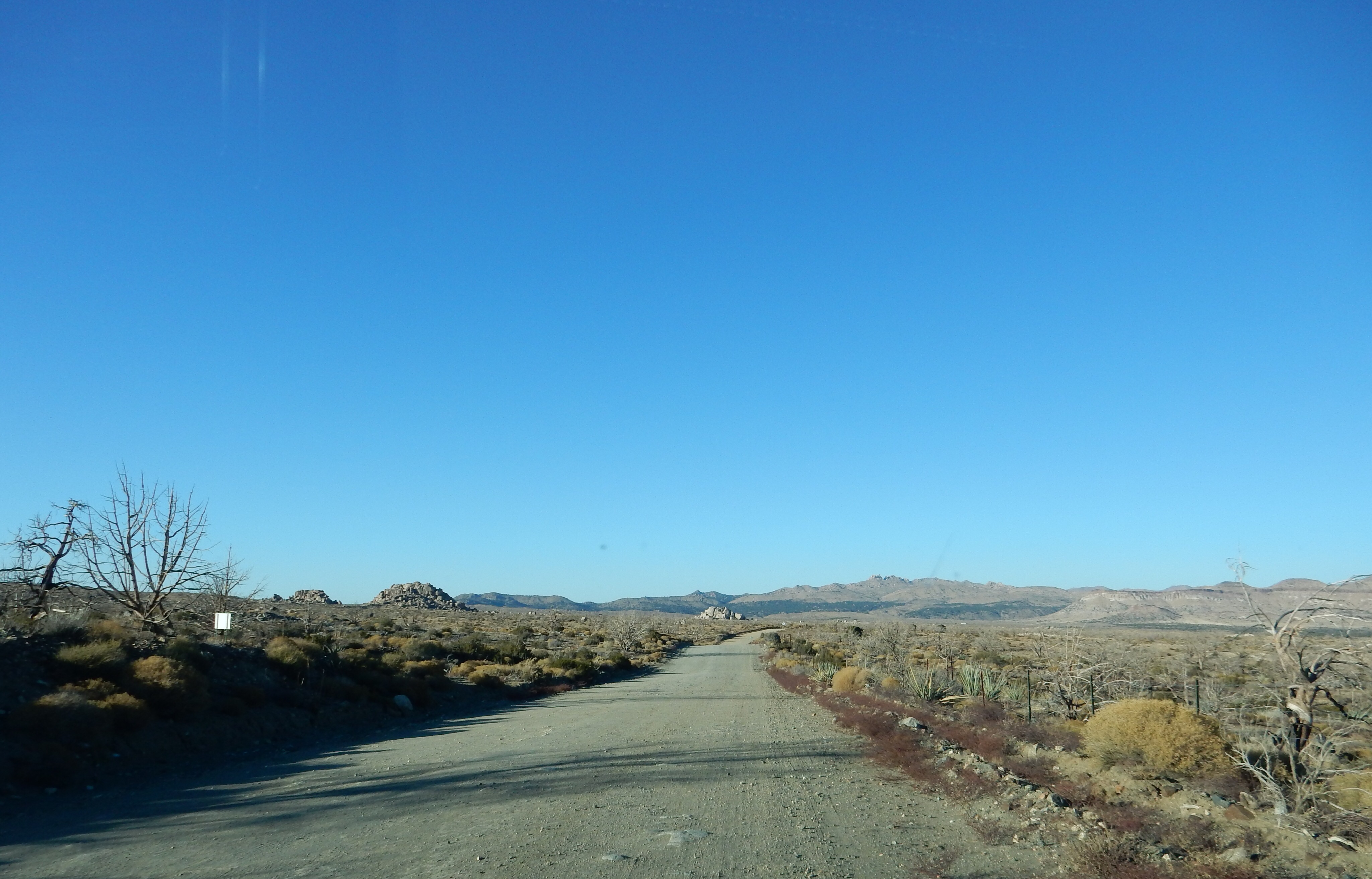
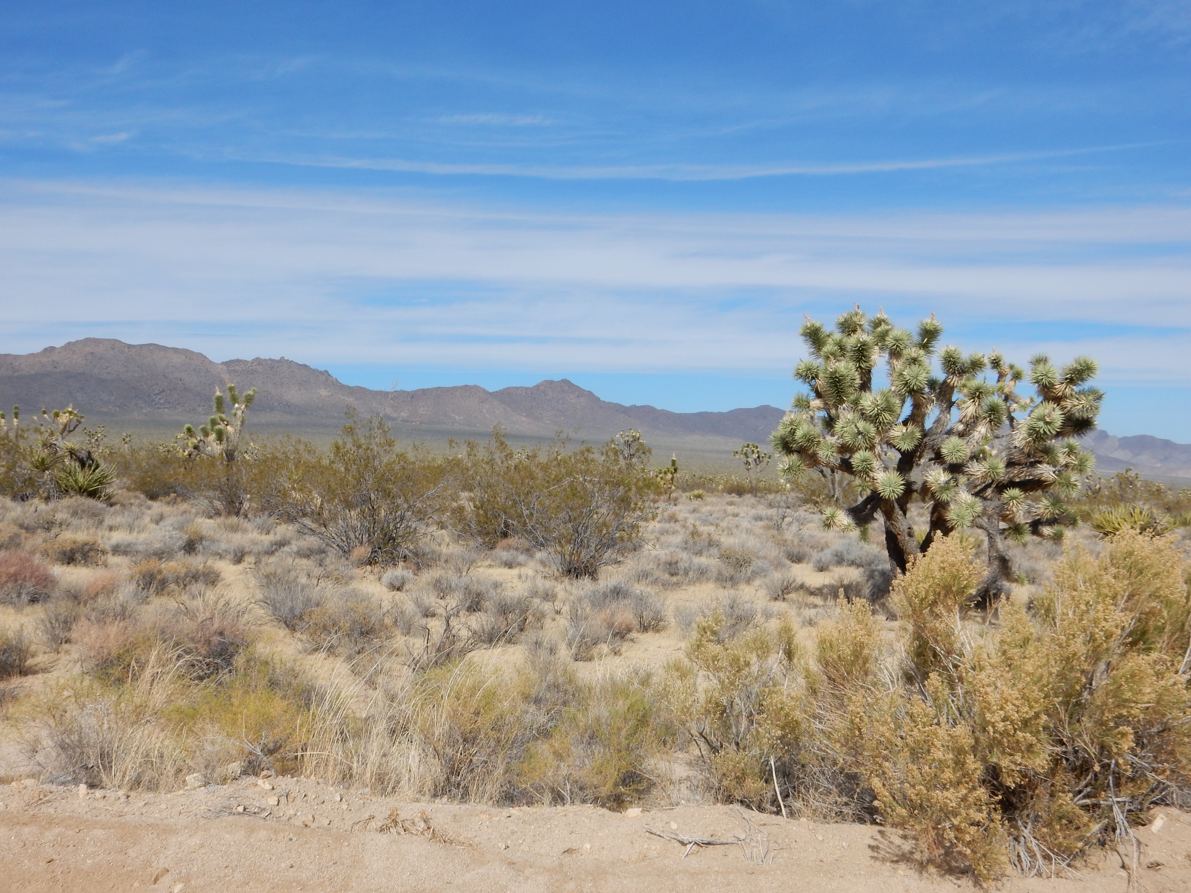
How variable weather can be. Friday was the heat and dryness of the Mojave Desert. Saturday we drove to our week’s lodging in Escondido. We left Barstow CA in sun and warmth. The Interstate goes through a series of ups and downs but primarily up. The weather change starts to make itself known as a bank of clouds gather in front of you. At Cajon Pass, elevation 3,776, we are enveloped in the clouds. We start descending and take the first exit after the pass and continue our route to Escondido along the Rim of the World Scenic Byway. This 100 mile scenic route goes through the San Bernadino Mountains, west of Los Angeles.

The Cajon Pass is similar to other mountain passes in that both trains and roads share the pass. Train spotters frequently gather along here to watch the trains work their way up the ascent and to slowly and carefully make the descent. In fact, in 1996 a BNSF train jumped the rails going downhill and two trainmen were killed.
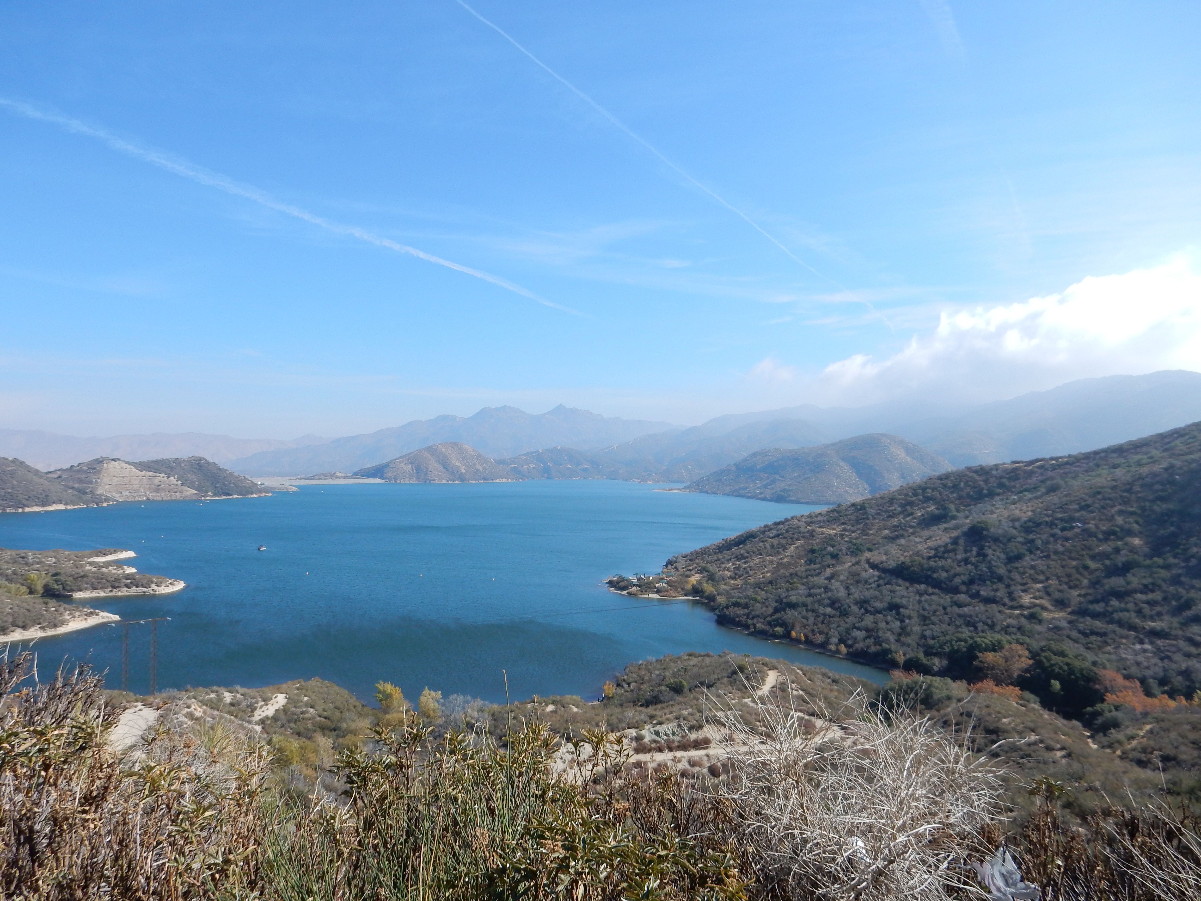
Silverwood Lake

Silverwood Lake

We passed on the train watching and began ascending again, stopping at the Silverwood Lake overlook for some scenery time and picture-taking. The lake was formed by a dam, it is not naturally occurring. After Silverwood Lake, the road narrows, ascends more steeply, and the switchbacks become numerous. Over time, we will reach 8700 feet elevation; surprising to us given the nearness to such major population centers.

Mountain driving

Mountain driving

During the next few hours we will pass by two other lakes created by dams, Arrowhead and Big Bear. There is a large resort community up here, and traffic is constant. There are multiple turnouts and even given our experience in mountain road driving, I pull over frequently to allow faster cars (speeders) to pass by and get off our rear bumper.

Mountain driving

Mountain driving

When we are on the west side of the mountains, we are in clouds and cold temperatures. As we pass over to the east side as the road meanders around the mountain, the sun is out and it is warm. At 8000 feet, we stop at Heaps Peak Arboretum, a pleasant forest walk, but one that requires hats and jackets to stay warm.

Heaps Peak Arboretum

Heaps Peak Arboretum

Sequoia trees at Heaps Peak Arboretum

Sequoia trees at Heaps Peak Arboretum

Lunch is at a pleasant, small cafe in Fawnskin, on the north side of Big Bear Lake. A little further past the cafe, we stop at Big Bear Discovery Center, a wonderful center run by the US Forest Service and its non-profit local support group. We arrived in time for the 2 pm volunteer led trail walk; but had to cut it short as our time was running low to get out of the mountains before sunset. We had already made one or two wrong turns which were easily corrected in daylight, not so sure we could have done it in the dark.

Big Bear Lake

Big Bear Lake

We did learn that the lake was created by a dam to provide water to growers in the valley below, there was only a creek here originally. When the European settlers arrived, the area was rife with grizzly bears-hence the name. The area became the first mountain recreation area in Southern California. Water from the lake is used to create snow for two ski resorts along the lake’s mountains.

View from overlook of Rim of the World Scenic Byway

View from overlook of Rim of the World Scenic Byway

Once down from the mountaintop, we finished off the drive on CA freeways; the traffic at 6 pm on a Saturday was not too bad. Our lodging is the Welk (Lawrence) timeshare resort north of Escondido; once we have time during the daylight we will check it out further.

Ed and Chris Sunday 11/16 8 pm

Categories: road trip, travel | Tags: , , , , | Leave a comment

2014 Trip 7, Nov. 14, So. Cal and Thanksgiving in Flagstaff

Barstow, CA Friday Nov. 14

Kelso Dunes in Mojave National Preserve

Kelso Dunes in Mojave National Preserve

Hate to say it but gotta say it. The temperature was about 40-50 degrees warmer than St. Paul in the Mojave Desert today. Yes we enjoy MN and winter. But it is nice to periodically leave the cold.

Our flight last night to Vegas was a full flight; I have not been on anything else in several years. The flight left from MSP’s G concourse, the premier Delta concourse so it is full of upscale bars and restaurants that we ignored. The people on the flight were in a jovial mood; it seemed there were several groups of friends going to Vegas. I hope they are able to retain that good feeling when they leave Vegas. Oh, and to the woman who sat behind me and coughed throughout the flight, rest assured you were successful in giving me your cold.

Our rental car had a defective driver side mirror so we were able to experiment with returning a rental car and exchanging it for another. The woman at the Hertz Gold Counter was very helpful, even staying after her 11 pm departure time when she had already clocked out. Thanks, ma’am.

This morning we made a stop at Target to pick up a few items we could not bring on the plane like a flat of water and a large tube of sunscreen. Then it was on to the Mojave National Preserve in southeastern CA. This Preserve comprises only a part of the vast Mojave Desert. The desert stretches from Zion National Park in Utah to the suburbs of Los Angeles and includes Las Vegas, Death Valley, Edwards Air Force Base, the Mojave Preserve and other areas.

Mojave National Preserve started when conservation efforts in the 1960s and 1970s led to the creation of the East Mojave National Scenic Area managed by the Bureau of Land Management which still allowed for many different types of uses. Conservationists wanted more restrictions and many years of wrangling and politics finally resulted in the addition of this piece of land coming under the direction of the National Park Service. The designation of the area as a preserve and not a park placed Mojave in a realm of less protection than a national park but more than BLM’s control would allow. Mojave National Preserve is 1.6 million acres and is the third largest NPS unit in the 48 contiguous states-only Death Valley and Yellowstone are larger. Alaska has many larger NPS units.

Part of the road system at Mojave

Part of the road system at Mojave

We were able to observe many of the varying climates and topography of Mojave. Elevations range from 880 feet to almost 8,000 feet above sea level. We criss crossed the area, starting our drive in the NE quadrant, going to the southwest and then starting again in the southcentral and driving to the north central section. The paved roads were under a reduced speed limit; heavy rains (how ironic) a while back caused damage. It was nice to have a rental car and not worry about our car getting its suspension damaged. I must admit the rental did provide a smoother ride.

Driving along the valley with a Joshua tree to the right

Driving along the valley with a Joshua tree to the right

Joshua trees

Joshua trees

At Cima, we drove along the valley between two mountain ranges, eventually passing over Cima Dome, a large uplifted land mass along which are located the largest collection of Joshua trees. The Joshua trees here are shorter and a different sub species from those we will observe next week at Joshua Tree National Park.

Kelso Depot

Kelso Depot

Kelso was once a major Union Pacific train staging area in the days when trains needed water for steam. Additional engines were placed on the trains, helping them get over the higher elevations to the east. Technology changes made the staging area less necessary and the depot in the area was closed. It is now re-used as the main visitor center for the preserve. Local residents were essential in preserving the building from its planned demolition by the UP.

our trail at Kelso Dunes

our trail at Kelso Dunes

Walking to the dunes

Walking to the dunes

In the southwest section of the preserve lie the Kelso Dunes, 600+ foot high sand dunes. These dunes are notable for their size and for the low frequency “booming” noise generated when people walk across the top of the dunes. We did hear the booming noise generated by others who had hiked to the top.
We spent an hour walking on the dunes but did not make it to the top-that would have taken another 2-3 hours. Walking in the loose sand was hard work, we made it our major exercise of the day.

A Joshua tree at sunset

A Joshua tree at sunset

Sunset comes early, at 4:39 p.m.officially so our last drive back up from the south central area only included one other 30 minute hike in the higher reaches of the park among the Joshua trees. We left the park as darkness was descending.

Rock formations at Mojave

Rock formations at Mojave

Rock formations at Mojave

Rock formations at Mojave

Ed and Chris Saturday 11/15 7:15 AM

Categories: road trip, travel | Tags: , , , | 1 Comment

2014 Trip Seven, CA Deserts/Mtns and Flagstaff Thanksgiving

Thursday Nov. 13 Saint Paul MN

Bellagio fountains from 2013 Trip Four

Bellagio fountains from 2013 Trip Four

A trip to Flagstaff for Thanksgiving just has to include some other sights. For this trip, we will fly to Vegas and rent a car. We will visit southern California, enjoying Mojave National Preserve, Joshua Tree National Park, spend a week in Escondido touring mountains and desert and Cabrillo National Monument before heading to Flagstaff through the Imperial Desert, Yuma, and Lake Havasu. After 5 days in Flagstaff we fly out of Las Vegas, but after spending three nights there.

The combination of desert heat, mountain coolness, and just using carry on luggage will give our packing skills a good test.

Map of Trip Seven 2014

Map of Trip Seven 2014

Ed and Chris Saint Paul MN Thursday Nov. 13th.

Categories: road trip, travel | Tags: | Leave a comment

Blog at WordPress.com.